
Search for another town





Free U.S. delivery 7 to 10 days after you order
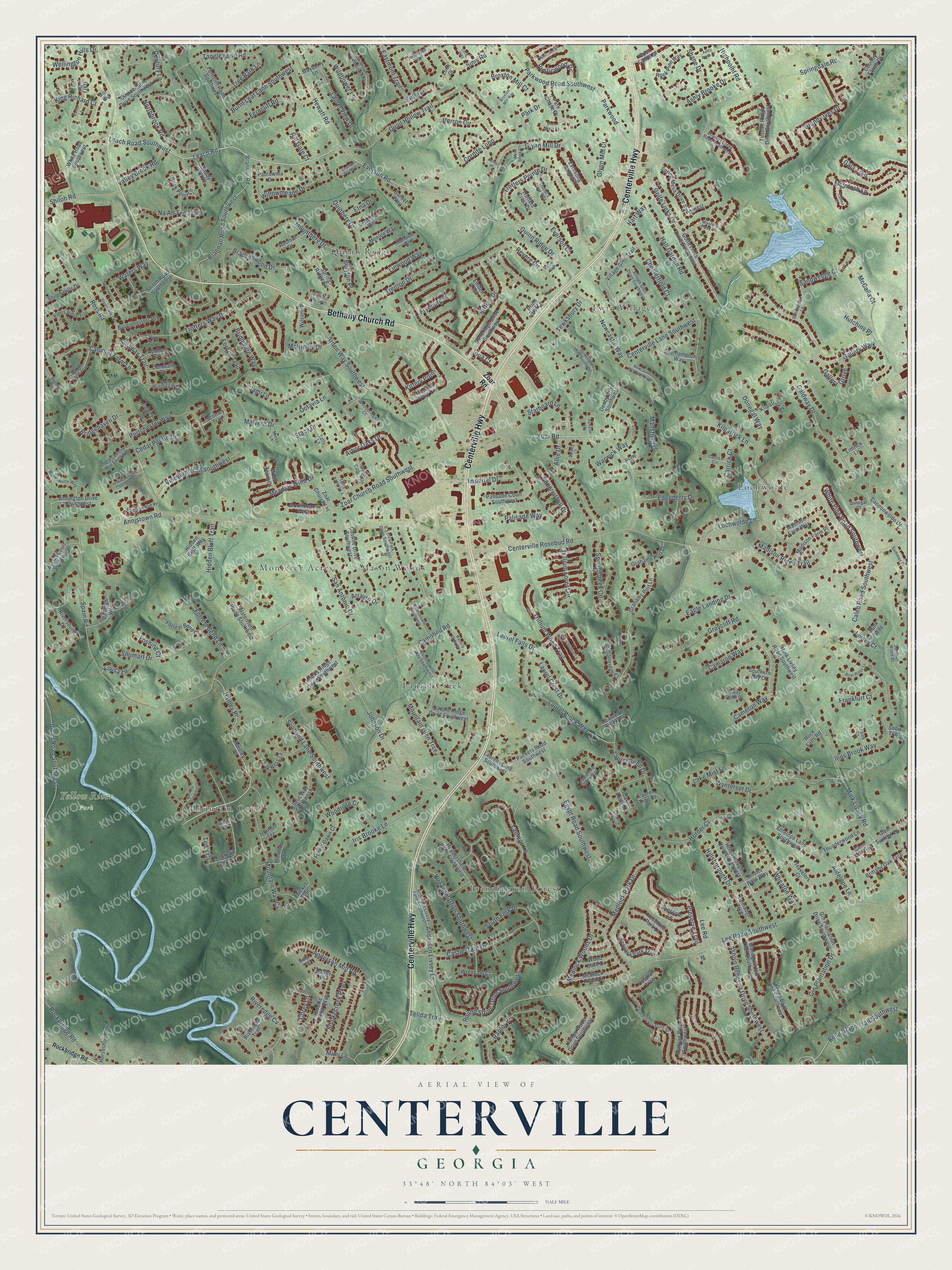
Centerville, Gwinnett County, Georgia Map Art
Building by building, with labeled streets and shaded relief.
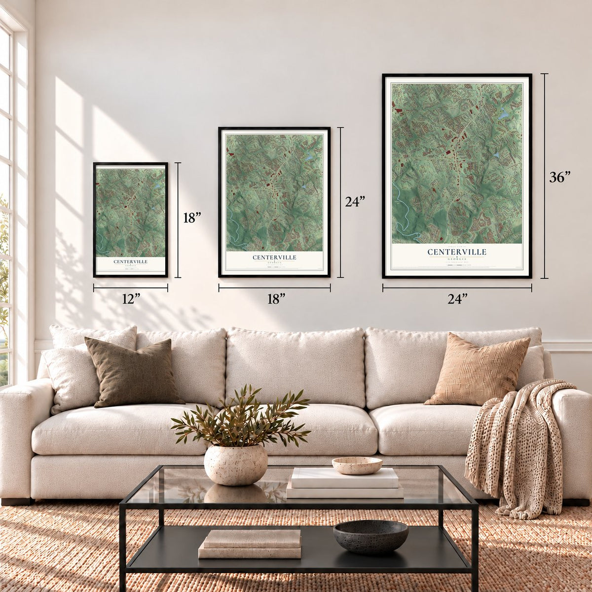
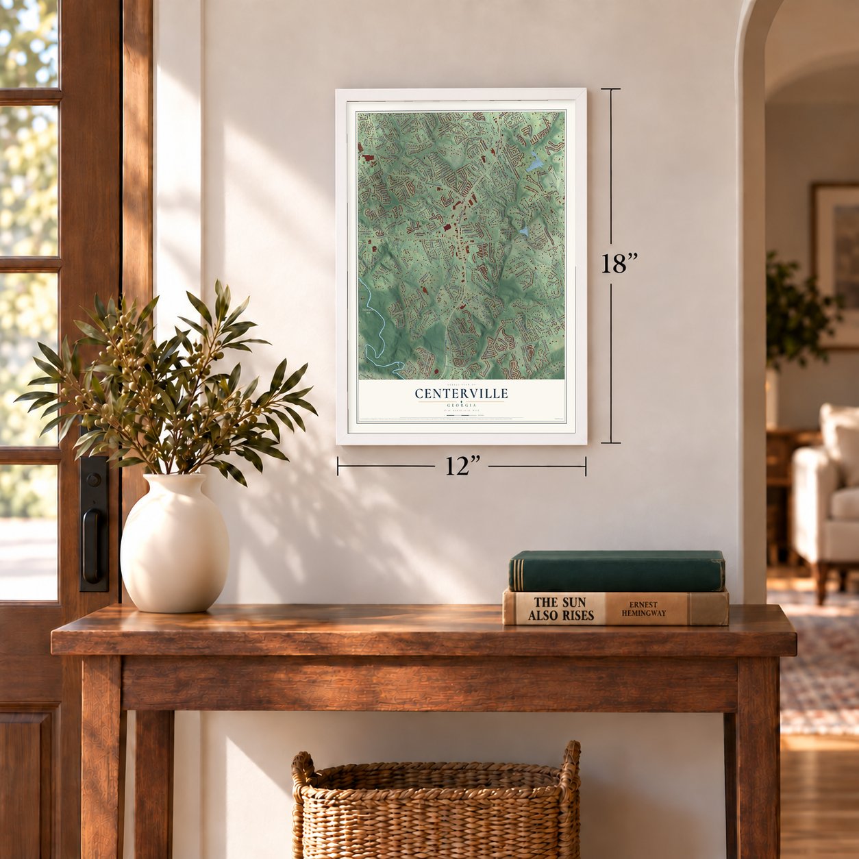
12" x 18" Archival Matte Print
A Map of Home. A Work of Art.
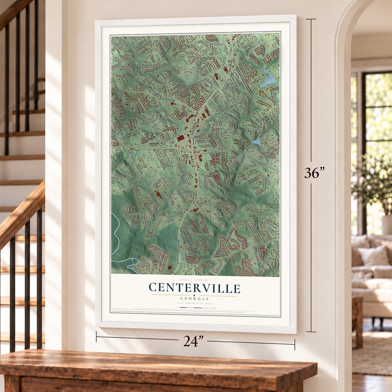
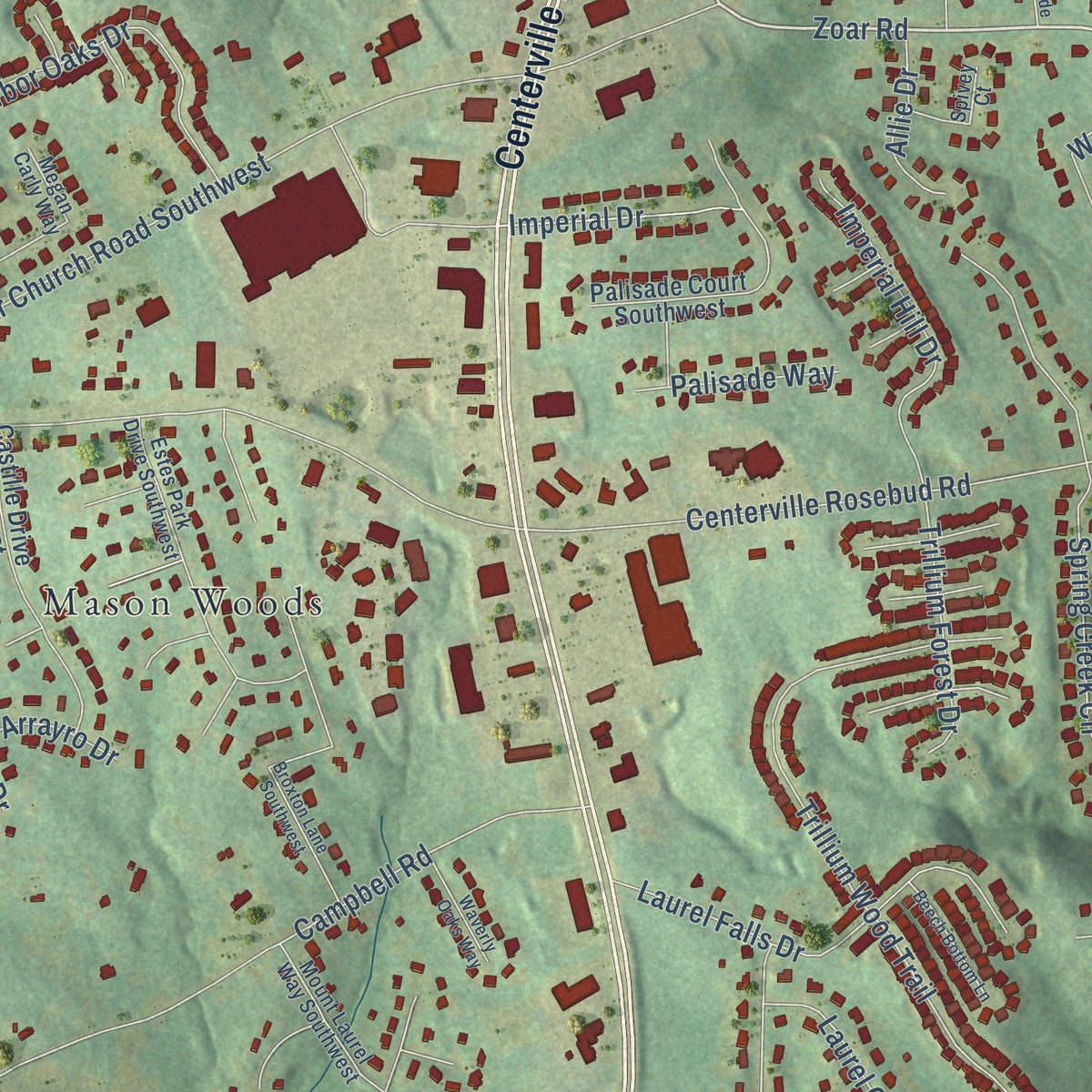
Explore Centerville, Georgia from a whole new perspective. Created using aerial imagery and detailed geographic data, this map captures Centerville building by building, with labeled streets, familiar landmarks, and shaded topographical relief that highlights the natural contours of the landscape.
Combining modern data with the timeless character of a vintage atlas, this map is just as interesting up close as it is beautiful on the wall. Whether you grew up in Centerville, spent memorable years there, or call it home today, this unique map is a great way to celebrate a place that means something to you. Zoom in on the preview to look for your street, and then order a print to put your memories on the wall.
Three ways to hang it
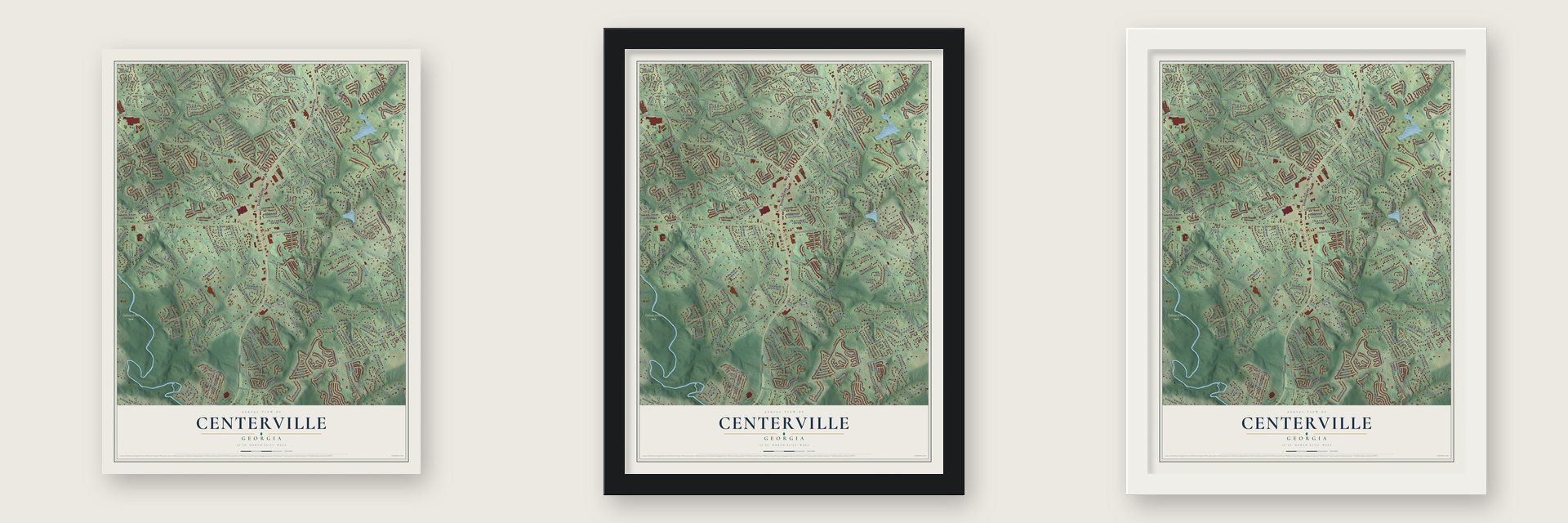
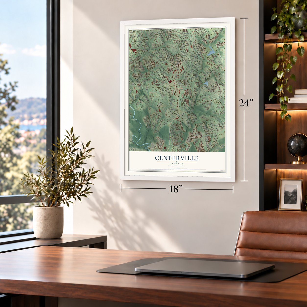
Unframed archival matte, a black wood frame or a white wood frame.
Up close
Geography Worth Displaying
This map was created using accurate cartographic data and authoritative geographic sources, including the U.S. Geological Survey and the Census Bureau. The map brings together terrain, waterways, roads, and building detail. The majority of the streets are labeled, houses are accurately depicted, and the topography is derived from government sources. Combining local data with carefully composed color and shading leads to this beautifully detailed Centerville artwork for your wall.
Rather than simply showing street outlines, we’ve included as many of the street names as we could reasonably fit on the map while keeping their names legible. Zoom in on the high resolution preview to see exactly what’s on the map. We truly set out to create a statement piece for anyone who loves Centerville. So whether it’s for you, or a gift for someone you love, we hope this map of Centerville brings back fond memories.
Read the story behind this map: Detailed Map of Centerville, Gwinnett County, Georgia.

Find your street
Names on the Centerville map
Every name below is printed on this map. Look for your street, your school, the park where you played, or the pond down the road.
Places and landmarks9
- Yellow River Park
- Quinn Ridge
- Laurel Creek
- Lochwolde
- Brandington Forest
- Twin Village
- Mason Woods
- Mountain Cove
- Monterey Acres
Streets and roads336
- Centerville Highway
- Bethany Church Road
- Campbell Road
- Everson Road
- Golfe Links Drive
- Leach Road
- Leach Road Southwest
- Zoar Road
- Cameron Way
- Camaron Way
- Belle Glade Trail Southwest
- Antelope Lane
- Lee Road Southwest
- Centerville Rosebud Road
- Annistown Road
- Spain Road
- Mink Livsey Road
- Johnson Drive
- Zoar Church Road Southwest
- Ross Road
- Springdale Road
- Brannan Road Southwest
- Kittery Drive
- Egypt Road Southwest
- Chesterfield Court
- Revere Circle
- Tanglewood Road
- Anderson Livsey Lane
- Quail Hollow Trail
- Parkwood
Show all 336 streets
- Parkwood Road Southwest
- Inns Brook Way
- Anderson Mill Road
- Trillium Wood Trail
- Medlock Park Drive
- Valley Brook Road
- Donegal Way
- Ferncliff Road
- Mansfield Lane
- Caleb Road Southwest
- Juhan Road Southwest
- Laurel Brook Way
- Wynterset Drive
- Spring Creek Circle
- Arden Way Southwest
- Trotters Way Drive
- Wildflower Lane
- Newcastle Way
- Glynn Mill Drive
- Mountain Way Cv
- Castle Gate Drive
- Ashlyn Rebecca Drive Southwest
- Quinbery Drive
- Trotters Pointe Drive
- Riveredge Cv
- Smokecreek Parkway
- Warwick Way
- Brackenwood Drive
- Willowmeade Drive
- Wrexham Drive Southwest
- Telida Trail
- Galdway Drive
- Hillsborough Drive
- Mountbery Drive
- Gin Plantation Drive
- Horder Court
- Hewatt Road
- Jami Lane
- Lochwolde Lane
- Iris Brooke Lane
- Laurel Falls Drive
- Round Stone Drive Southwest
- Kittery Point
- Grundy Ives Drive
- Raptor Place
- Medlock Woods Drive
- Gallery Grove
- Portchester Way
- Preserve Trail
- Ashly Brooke Drive
- Octavia Lane
- Mountain Glen Trce
- Vineyard Trail Southwest
- San Antonio Drive
- Graycliff Road
- Laurel Bend Drive
- Waters Way
- Cordite Loop
- Calumet Farm Lane
- Centerville Lane Southwest
- McIntosh Lane
- Lee Road
- Arbor Oaks Drive
- Imperial Hill Drive
- South Fork Drive
- Trenton Drive
- Bridlegate Way
- Gallery Walk
- Rusticwood Drive
- Burnt Leaf Lane Southwest
- Northbrook Road
- Hall Garden Road
- Quinn Ridge Drive
- Shiloh Road
- White Pine Road Southwest
- Hutchins Place
- Scotland Lane Southwest
- Erdly Lane
- Sims Road
- Forrest Bend Lane
- Forbes Trail
- Madison Ridge Trail
- Kilpatrick Lane
- Park Drive
- Hadley Place
- Gala Trail
- Na Ah Tee Trail
- McCalla Court
- Herron Circle
- Eagle Landing Drive
- Starboard Lane
- Shumart Drive
- Woodrose Court
- Laurel View Drive
- Laurens Lane
- Meadow Wind Drive
- Bridgehaven Drive
- Linwood Way
- Trillium Forest Drive
- Hidden Bluff Trail
- Stacy Drive
- Laurel Crest Drive
- Eastmont Trail
- Edenderry Drive
- Tree Bark Lane
- Broxton Mill Court
- Sandwedge Court
- Wellington Hills Drive
- Highpoint Road
- Imperial Drive
- Shiaway Trail
- King Richard Court
- Corey Lane
- Frankfurt Court
- Rockbridge Road
- Shane Drive
- Beryton Place
- Wheaton Way
- Glynn Mill Court
- Cedar Pointe Drive
- Palisade Way
- Kousa Lane
- Allie Drive
- McKinley Drive
- Century Lane
- Malvern Drive
- Carrick Court
- Mimi Lane
- Tewksbury Drive
- Lake Mist Lane
- Arrayro Drive
- Fryeburg Place
- Everson Court
- Hill Gate Court
- Livsey Court
- Etna Drive
- Yoshing Court
- Hart Way
- Ted's Cv
- Iona Court
- Mink Livsey Road Southwest
- Golfe Links Drive Southwest
- Smoke Creek Parkway
- Hardley Place
- Grahams Port Lane
- Ferncliff Road Southwest
- Brannan Road
- Riversound Drive
- Tuscan Ridge Drive Southwest
- Arabian Way Southwest
- Cannonwolde Drive
- Mountain Cove Road
- Village Glen Trail
- Valley Bluff Lane Southwest
- Spring Mesa Drive Southwest
- Saddle Ridge Drive Southwest
- Spring Ridge Circle
- Sunbridge Drive Southwest
- Laurens Lane Southwest
- James Wade Drive Southwest
- Palisade Court Southwest
- Castille Drive Southwest
- Huddersfield Drive Southwest
- Gaelic Way Southwest
- Yosemite Park Lane
- Brittany Oak Trce
- Thicket Trail
- Forest Dawn Court
- Madison Farm Way
- Medlock River Court
- Madison Farm Place
- White Road Southwest
- Antelope Lane Southwest
- Woodgate Hill Trail Southwest
- Denby Drive Southwest
- Travelers Court
- Knotts Pass Way
- Thunderwood Lane
- Holland Drive
- Sequoia Park Trail
- Zoar Church Lane
- Park Chase Drive
- Ashington Drive Southwest
- Cumberland Drive Southwest
- Forrest Bend Court
- Hillsborough Drive Southwest
- Grahamridge Court
- Puckets Road Southwest
- Rock Pine Way
- Calleigh Way
- Waterfront Place Southwest
- Gin Plantation Drive Southwest
- Weldon Drive
- Southampton Way
- Horseshoe Bend
- Aycliff Court Southwest
- Grahams Port Drive
- Preserve Lane
- Parks Ridge Drive Southwest
- Moonbeam Way
- Shiloh Road Southwest
- Eversong Ridge Court
- Shiloh Hills Drive
- Menloe Way
- Burgomeister Place
- Glen Summit Lane
- Garnet Way
- Open Fields Drive
- Lock Ness Lane
- Kilpatrick Court
- Wood Cove Drive
- Rock Point Lane
- Riverroad Trail
- Ciji Circle
- Wilsone Place
- Country Farms Drive
- Hidden Bluff Way
- Shady Hill Court
- Paulownia Drive
- Emden Trail
- Wrexham Court
- Rocmar Drive
- Caspian Trce
- Mayberry Lane
- Trotters Crest Drive
- Trumble Terrace
- Laurel Tree Court
- Southern Bay Court
- Scotney Trail
- Talmadge Trce
- Moon Beam Court
- Donerail Drive
- David Austin Court
- Drum Roll Lane
- Limrick Lane
- Laurel Brook Lane
- Apollo Court
- Mink Way
- Rock Falls Road
- Gary Circle
- Jeffrey Place
- Snow Trail
- Loch Court
- Anderson Livesy Lane Southwest
- Village Glen Drive Southwest
- Estes Park Drive Southwest
- Summer Place
- Riders Ridge Trail
- Boulder Creek Road Southwest
- Kessock Ridge Trail
- Ravenwolfe Way
- Timberloch Trail
- Saddle Bend Trail
- Sandwedge Lane
- Megan Carly Way
- Mount Laurel Way Southwest
- Terry Ashley Lane
- Masters Pass Lane
- Old Country Way Southwest
- Madison Run Place
- Summer Wood Drive
- Windy Shore Drive
- Royal Mustang Way
- Trotters View Way
- September Way
- Woodbridge Court
- Glenn Summit Lane
- Spivey Court
- Cadbury Court
- Jonathan Glen Way
- Dundee Court
- Donegal Court
- Azalea Court
- Carrick Circle
- Taffy Lane
- Missy Lane
- Benji Trail
- Royal Court
- Tim's Place
- Bridle Point Parkway Southwest
- Wildflower Lane Southwest
- Newcastle Way Southwest
- Sunderland Drive Southwest
- Broxton Lane Southwest
- Shoemaker Lane
- Jasmine Cove Lane
- Fenton Place
- Broxton Mill Way
- Beech Bottom Lane
- Connick Way
- Ross Estates Court Southwest
- Ashly Pines Drive
- Waverly Oaks Way
- Rusticwood Court
- Briar Ridge Lane
- Capot Court
- Cameo Court
- Loch Way
- Chandler Pointe Court
- Shiloh Way
- Bethany Woods Court
- Patriot Walk
- Karen Lane
- Glynn Creek Court
- Portside Lane
- Deer Chase Court
Names are listed as they appear on the printed map. Zoom into the product photos to find them.
Keep exploring Georgia
Centerville is one of 1,042 Georgia towns we've mapped. Every dot on the map is a print of its own.
The search covers every state, Georgia first.
Near Centerville
Order 2 or more town maps and save 10%. Shown in the size and finish you picked above, so they hang as a set.
- Rock Chapel 12" x 18" / Archival Matte Print $39.99
- Rosebud 12" x 18" / Archival Matte Print $39.99
- Snellville 12" x 18" / Archival Matte Print $39.99


More maps nearby: Five Forks, Lakeview Estates, Lithonia, Stone Mountain and Grayson.
The art of mapping a place
How This Map Was Made
Real places. Remarkable detail. Discover the layers that turn geographic data into a map of home.

The view from above
Aerial imagery reveals the character of the land: woodland, open fields, and the patterns of a place.

The shape of the land
Elevation data brings hills, valleys, and subtle changes in the landscape into view.

The details of home
Roads, waterways, and building footprints come together to make the map feel unmistakably local.

Geography becomes art
Considered color, shading, and typography bring the layers together in a map made for your wall.


Process illustrated with Mendon, Massachusetts. Aerial imagery: USDA NAIP. Terrain: USGS 3D Elevation Program. Map details and finished artwork: KNOWOL.
The Details
About This Print
Choose an archival matte print, or a black or white Ayous wood frame. The archival matte print is unframed.
Select your size and finish above to see the matching product image and price.
Materials & Craftsmanship
A contemporary map with the character of a classic atlas, printed on archival matte paper. Optional frames are made from Ayous wood.
Your printed map does not include the watermark shown in the full-map preview.
Shipping & Delivery
Free shipping within the United States. Every print is made to order in the USA.
Buying a gift? Add a note in your cart and we'll include it. We never put prices in the package.
Prints ship within 2 to 3 business days. Allow 7 to 10 days total from ordering for delivery. Timing may vary during holidays or periods of high order volume.
Read our shipping policy.
Returns and damaged prints
Each print is made to order. Change-of-mind refunds are not available after production.
If your print arrives damaged, misprinted or incorrect, contact support@knowol.com within 30 days of receiving it. Include your order number, photos and a description of the issue.
Read our full refund and replacement policy. For questions about your order, email support@knowol.com.