


Search for another town





Free U.S. delivery 7 to 10 days after you order
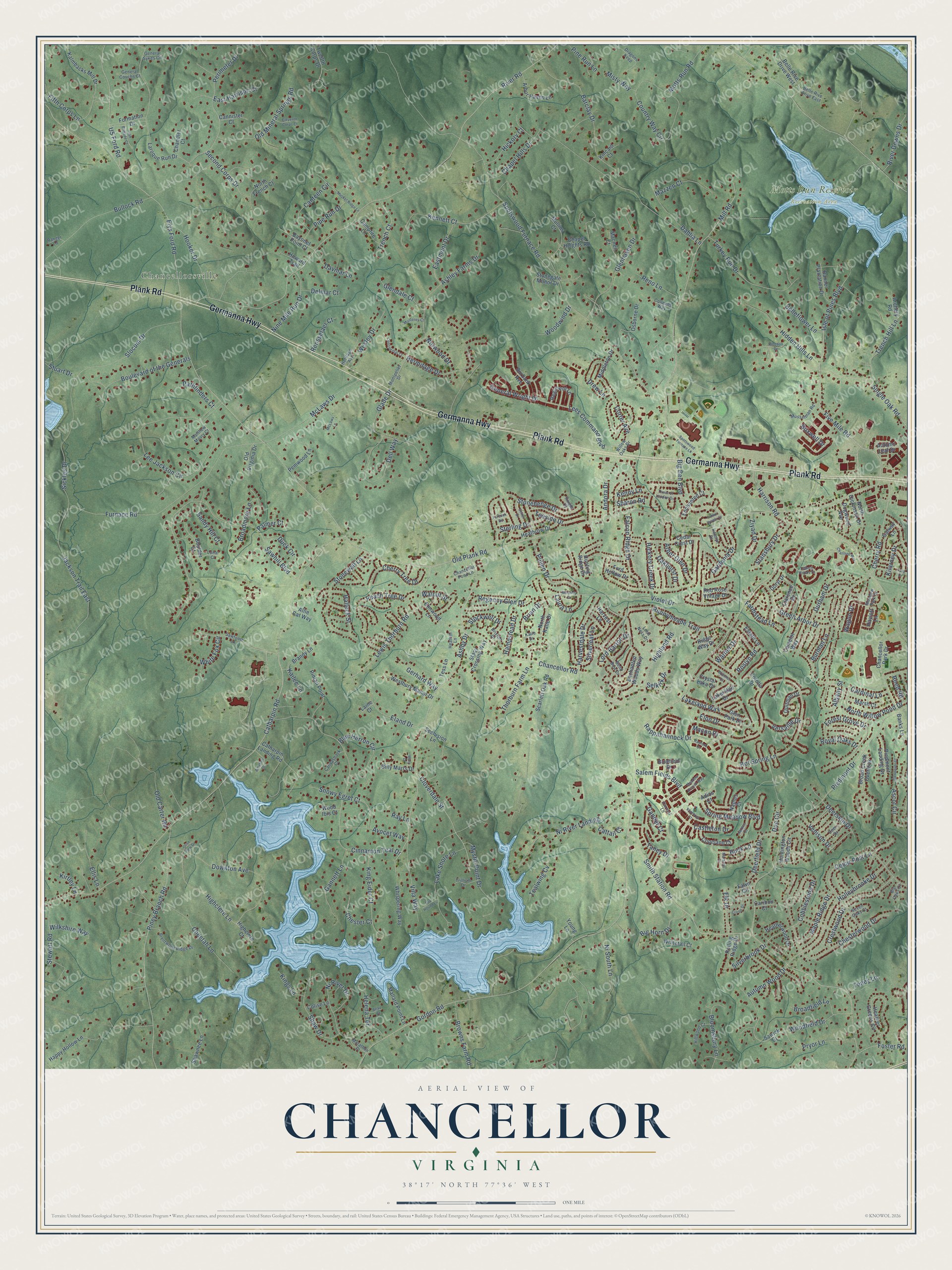
Chancellor, Virginia Map Art
Building by building, with labeled streets and shaded relief.
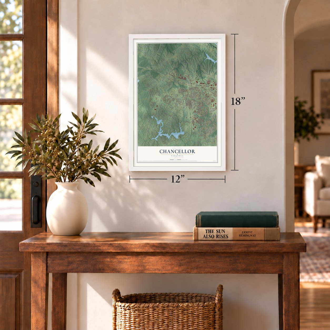
12" x 18" Archival Matte Print
A Map of Home. A Work of Art.
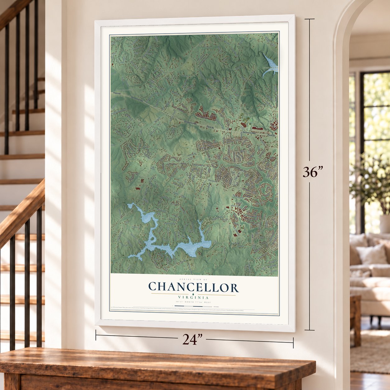
Explore Chancellor, Virginia from a whole new perspective. Created using aerial imagery and detailed geographic data, this map captures Chancellor building by building, with labeled streets, familiar landmarks, and shaded topographical relief that highlights the natural contours of the landscape.
Combining modern data with the timeless character of a vintage atlas, this map is just as interesting up close as it is beautiful on the wall. Whether you grew up in Chancellor, spent memorable years there, or call it home today, this unique map is a great way to celebrate a place that means something to you. Zoom in on the preview to look for your street, and then order a print to put your memories on the wall.
Three ways to hang it

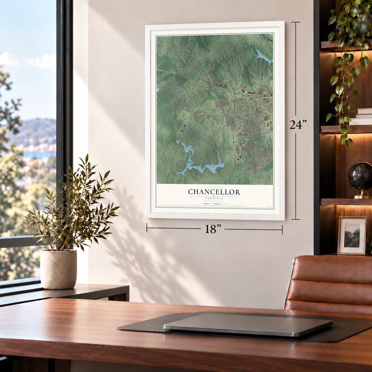
Unframed archival matte, a black wood frame or a white wood frame.
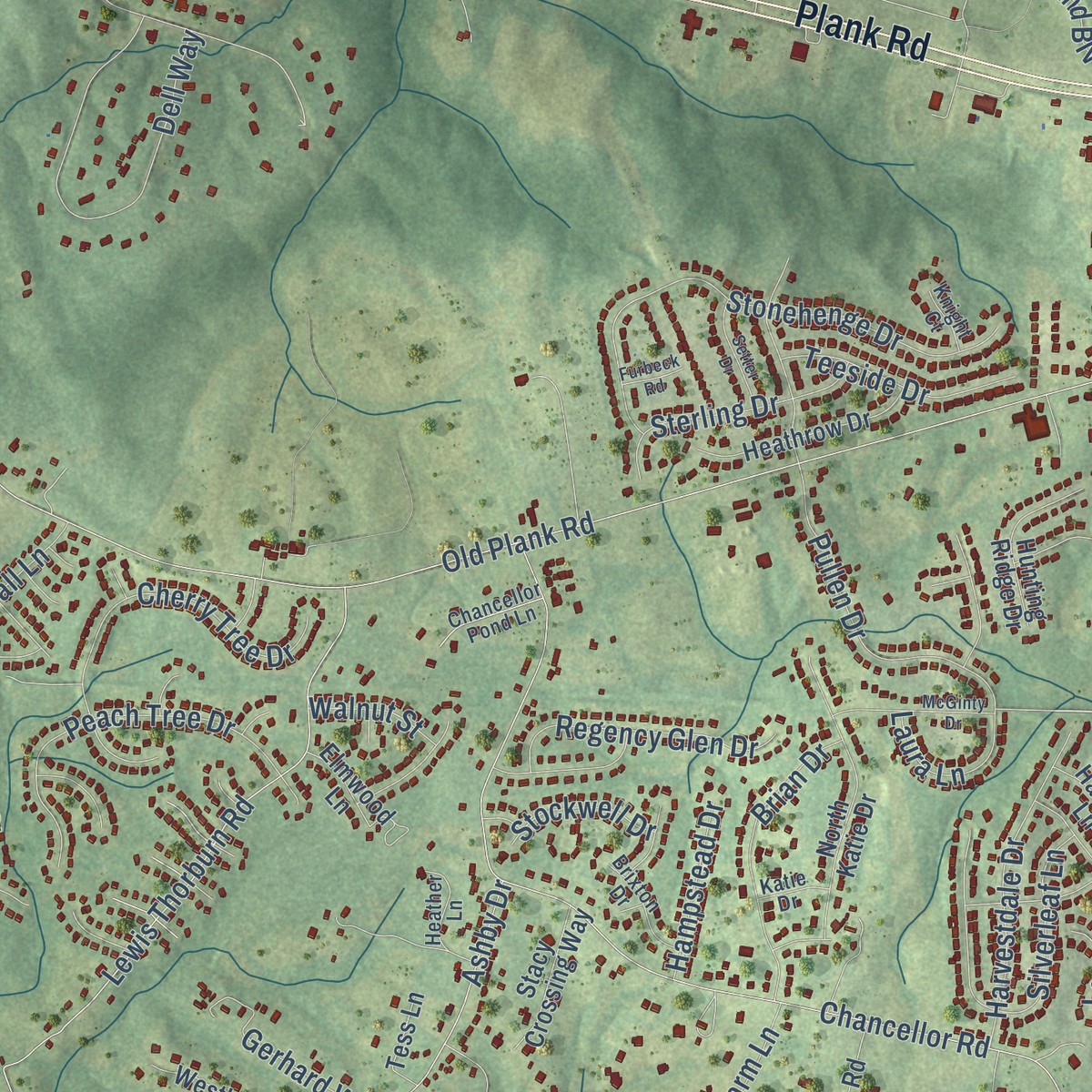
Up close
Geography Worth Displaying
This map was created using accurate cartographic data and authoritative geographic sources, including the U.S. Geological Survey and the Census Bureau. The map brings together terrain, waterways, roads, and building detail. The majority of the streets are labeled, houses are accurately depicted, and the topography is derived from government sources. Combining local data with carefully composed color and shading leads to this beautifully detailed Chancellor artwork for your wall.
Rather than simply showing street outlines, we’ve included as many of the street names as we could reasonably fit on the map while keeping their names legible. Zoom in on the high resolution preview to see exactly what’s on the map. We truly set out to create a statement piece for anyone who loves Chancellor. So whether it’s for you, or a gift for someone you love, we hope this map of Chancellor brings back fond memories.
Read the story behind this map: Detailed Map of Chancellor, Virginia.

Find your street
Names on the Chancellor map
Every name below is printed on this map. Look for your street, your school, the park where you played, or the pond down the road.
Places and landmarks2
- Chancellorsville
- Motts Run Reservoir Recreation Area
Streets and roads340
- Germanna Highway
- Plank Road
- Woodfield Drive
- Spring Meadow Boulevard
- Five Mile Road
- Macon Drive
- Old Plank Road
- Gordon Road
- River Road
- Catharpin Road
- Spotswood Furnace Road
- Smith Station Road
- Chancellor Road
- Piedmont Drive
- Hot Spring Lane
- Elys Ford Road
- Cinnamon Teal Drive
- Harrison Road
- Piney Branch Road
- Mill Road
- Ashby Drive
- Rappahannock Drive
- Furnace Road
- Lee Jackson Circle
- Sawhill Boulevard
- Chesterwood Drive
- Jackson Trail East
- Cedar Post Lane
- Downton Avenue
- Albany Street
Show all 340 streets
- Green Arbor Drive
- Country Way Circle
- Ni River Drive
- Runnymeade Trail
- Holleybrooke Drive
- Lees Command Boulevard
- Lewis Thorburn Road
- Barclay Drive
- Ni River Landing
- Perimeter Drive
- Kennett Court
- Violet Drive
- Sickles Drive
- Cobblestone Drive
- Slocum Drive
- Bullock Road
- US Ford Road
- Stonehenge Drive
- Forest Grove Drive
- McLaws Drive
- Stonewall Lane
- Ashley Farms Drive
- Turkey Run Drive
- Cloverdale Street
- Durham Drive
- Single Oak Road
- Browns Farm Road
- Dell Way
- Fifth Corps Lane
- Crestwood Drive
- Cheetah Lane
- Glade Drive
- Old Mineral Springs Road
- Boulevard of the Generals
- Highclere Lane
- Corter Avenue
- Cherry Road
- Silverleaf Lane
- Big Ben Boulevard
- Mystic Point Drive
- Shaw Drive
- Lake Shore Lane
- Peach Tree Drive
- Hermitage Drive
- King Eider Court
- Hidden Hills Lane
- Gannett Lane
- Lakeland Way
- Trench Hill Lane
- North Willow Pond Drive
- Hooker Drive
- Cherry Tree Drive
- Snowy Egret Court
- Pullen Drive
- Villa Way
- Tealwing Cv
- Falcon Ridge Drive
- Blue Herron Circle
- Bloomsbury Lane
- Harvestdale Drive
- Dahlia Lane
- Chapel Hills Drive
- Deerfield Drive
- Nine Mile Run Drive
- Brian Drive
- Halleck Street
- Stewart Road
- Gardenia Drive
- Reno Lane
- Eland Drive
- Avocet Way
- Eastmont Drive
- Highland Road
- Big Horn Drive
- Andora Drive
- Ascot Circle
- Ni South Lane
- Wesley Drive
- Regency Glen Drive
- Salem Fields Boulevard
- Arbor Glen Drive
- Maple Ridge Drive
- Second Corps Drive
- Wagon Drive
- Canteen Circle
- Mazzen Court
- Ellis Lane
- Sterling Drive
- Pipe Run Drive
- Castleton Drive
- River Downs Drive
- Glenhaven Drive
- Motts Run Road
- Gander Court
- Broadmore Lane
- Drew Lane
- Isle of Pines Boulevard
- Trench Court
- Pryor Lane
- Teeside Drive
- Thorburn Farm Lane
- Stansbury Drive
- Venison Drive
- Hickory Creek Drive
- Glendale Court
- Duck Circle
- Oakhurst Drive
- Broadfield Lane
- Norwood Drive
- Hickory Court
- General Wright Drive
- Foster Road
- Autumn Wood Drive
- White Fox Circle
- Deerskin Drive
- Davmar Lane
- Belleflower Lane
- Sandy Hill Court
- Pathfinders Court
- Old Carter Road
- Helena Terrace
- Royal Oaks Drive
- Taney Drive
- Chester Court
- Farmstead Lane
- Silverbrook Drive
- Elon Drive
- Woodwind Drive
- East Harrison Court
- Wilkshire Way
- Kilarney Drive
- Elk Drive
- Versaille Drive
- Toney Lane
- Rensselaer Court
- Gerhard Way
- Lord Barton Drive
- Kailee Lane
- Hampstead Drive
- Pine Run Lane
- Laura Lane
- Burman Lane
- Ziyad Drive
- Cardinal Lane
- Buck Lane
- Cattail Court
- Roslyn Road
- Delmar Court
- Kings Lane
- Stockwell Drive
- Stuart Drive
- Warner Drive
- Misty Way
- Walnut Street
- Sharon Road
- Boxwell Drive
- Kenny Lane
- Reed Road
- Doe Circle
- Kirtley Lane
- Selkirk Drive
- Palmer Court
- Ray Lane
- Bayonet Point Court
- Enchanted Woods Way
- Laroque Run Drive
- Scarlett Oak Road
- Heather Greens Circle
- Broad Creek Overlook
- Chapel Heights Road
- Chancellor Park Drive
- Heatherwood Drive
- Osborne Drive
- Formation Drive
- Huntington Woods Circle
- Glen Park Drive
- Pemwood Lane
- Harvest Lane
- Kalmbacks Mill Drive
- Happy Hollow Lane
- Whispering Way
- North Dickinson Drive
- Catharpin Landing Road
- Shawnee Lane
- North Katie Drive
- Camelot Way
- Pintail Point
- Piedmont Landing Drive
- Westbury Manor Drive
- Heathrow Drive
- Stonegate Manor Drive
- Burbank Avenue
- Cedar Crest Drive
- Arbor Haven Lane
- Regiment Lane
- Red Rose Village Drive
- Mallard Point Lane
- Twelfth Corps Drive
- Banner Plantation Drive
- Middleton Drive
- Rolling Ridge Drive
- Sawick Court
- Dogwood Avenue
- Hunting Ridge Drive
- Autumn Leaf Drive
- Copeland Court
- Marsh Court
- Campfire Lane
- Billy Marrs Drive
- Belle Rive Drive West
- Whitetail Court
- Seclusion Lane
- Enchanted Court
- Stacy Crossing Way
- Hayloft Lane
- Brandy Lane
- Macneil Court
- Galway Lane
- Chandler Court
- North French Court
- Banks Lane
- Archery Road
- Elmwood Lane
- Clarence Drive
- Crystal Lake Drive
- Cannister Court
- Old Virginia Drive
- Quitman Drive
- Mullins Court
- Boulder Court
- Ford Hollow Drive
- Howard Trail
- Lakeridge Drive
- Naples Court
- Young Lane
- Bluefield Drive
- Allie Cat Way
- Highclere Court
- Estate Lane
- Tess Lane
- Colise Lane
- Kincaid Court
- Ridge Way Drive
- Corolla Drive
- Doryl Drive
- Caribou Court
- Wood Ibis Court
- Fawn Circle
- Adios Court
- Laine Court
- Montpelier Drive
- Brentwood Ridge Drive
- Sawtooth Lane
- Willow Oaks Drive
- Dragons Keep
- Musselman Road
- Bend Bow Drive
- Heritage Avenue
- Heather Lane
- Loch Ness Drive
- Canvasback Court
- Hillwood Court
- Deer Drive
- Brixton Drive
- Chancellor Pond Lane
- Trillium Drive
- Meadow Park Drive
- General Couchs Court
- Marathon Place
- Belle Rive Drive East
- Matthew Maury Court
- Jarvis Court
- Lunar Court
- Carmel Lane
- General Sykes Circle
- Colleens Way
- Ranger Lane
- Katelyn Drive
- Big Oaks Court
- Seven Oaks Court
- Katie Drive
- Knight Court
- Legacy Woods Drive
- Musket Ridge Lane
- Charmed Way
- McGinty Drive
- McLaws Lane
- Tara Drive
- Spotswood Furnace Lane
- Continental Court
- Amabell Drive
- Winthrop Court
- Setter Drive
- Wendover Court
- Weedon Drive
- Cropp Drive
- Meadow Branch Way
- Radford Drive
- Tower of London Drive
- Eleventh Corps Court
- Monterey Court
- Willcher Court
- Irish Brigade Court
- Crown Jewels Court
- Fox Hound Lane
- Beau Court
- Maranda Court
- Furbeck Road
- Mary Drive
- Olive View Drive
Names are listed as they appear on the printed map. Zoom into the product photos to find them.
About Chancellor, Virginia
Chancellor began around 1878 as Screamersville, a small railroad whistle stop. Local historian Catherine Hilldrup Stanley said children shrieking whenever a train pulled in gave the stop its name. Residents later asked for a gentler one. The post office switched to Chancellor in 1919, and the railroad made the change about 1927.
In 1889 a group of Adventists camped near Screamersville made national news. They had foretold that the world would end on October 23 of that year. Elder R.C. Brown led roughly 50 of them through the watch. Believers kept using their camp meeting ground until at least 1907.
Keep exploring Virginia
Chancellor is one of 862 Virginia towns we've mapped. Every dot on the map is a print of its own.
The search covers every state, Virginia first.
Near Chancellor
Order 2 or more town maps and save 10%. Shown in the size and finish you picked above, so they hang as a set.
- Spotsylvania Courthouse 12" x 18" / Archival Matte Print $39.99
- Stafford Lakes Village 12" x 18" / Archival Matte Print $39.99
- Fredericksburg 12" x 18" / Archival Matte Print $39.99


More maps nearby: Lake Wilderness, England Run, Falls Run, Chatham Heights and Falmouth.
The art of mapping a place
How This Map Was Made
Real places. Remarkable detail. Discover the layers that turn geographic data into a map of home.

The view from above
Aerial imagery reveals the character of the land: woodland, open fields, and the patterns of a place.

The shape of the land
Elevation data brings hills, valleys, and subtle changes in the landscape into view.

The details of home
Roads, waterways, and building footprints come together to make the map feel unmistakably local.

Geography becomes art
Considered color, shading, and typography bring the layers together in a map made for your wall.


Process illustrated with Mendon, Massachusetts. Aerial imagery: USDA NAIP. Terrain: USGS 3D Elevation Program. Map details and finished artwork: KNOWOL.
The Details
About This Print
Choose an archival matte print, or a black or white Ayous wood frame. The archival matte print is unframed.
Select your size and finish above to see the matching product image and price.
Materials & Craftsmanship
A contemporary map with the character of a classic atlas, printed on archival matte paper. Optional frames are made from Ayous wood.
Your printed map does not include the watermark shown in the full-map preview.
Shipping & Delivery
Free shipping within the United States. Every print is made to order in the USA.
Buying a gift? Add a note in your cart and we'll include it. We never put prices in the package.
Prints ship within 2 to 3 business days. Allow 7 to 10 days total from ordering for delivery. Timing may vary during holidays or periods of high order volume.
Read our shipping policy.
Returns and damaged prints
Each print is made to order. Change-of-mind refunds are not available after production.
If your print arrives damaged, misprinted or incorrect, contact support@knowol.com within 30 days of receiving it. Include your order number, photos and a description of the issue.
Read our full refund and replacement policy. For questions about your order, email support@knowol.com.