
Search for another town





Free U.S. delivery 7 to 10 days after you order
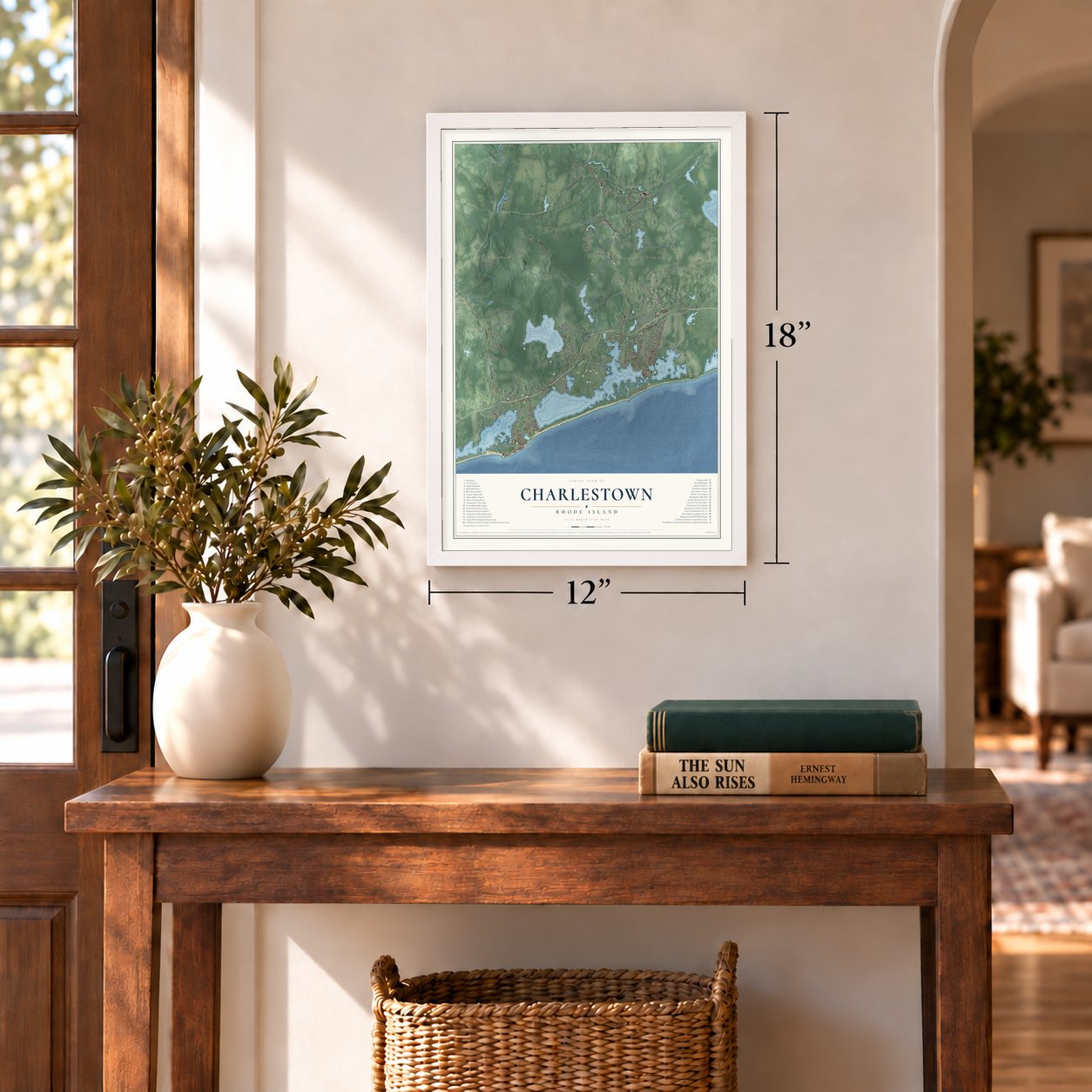
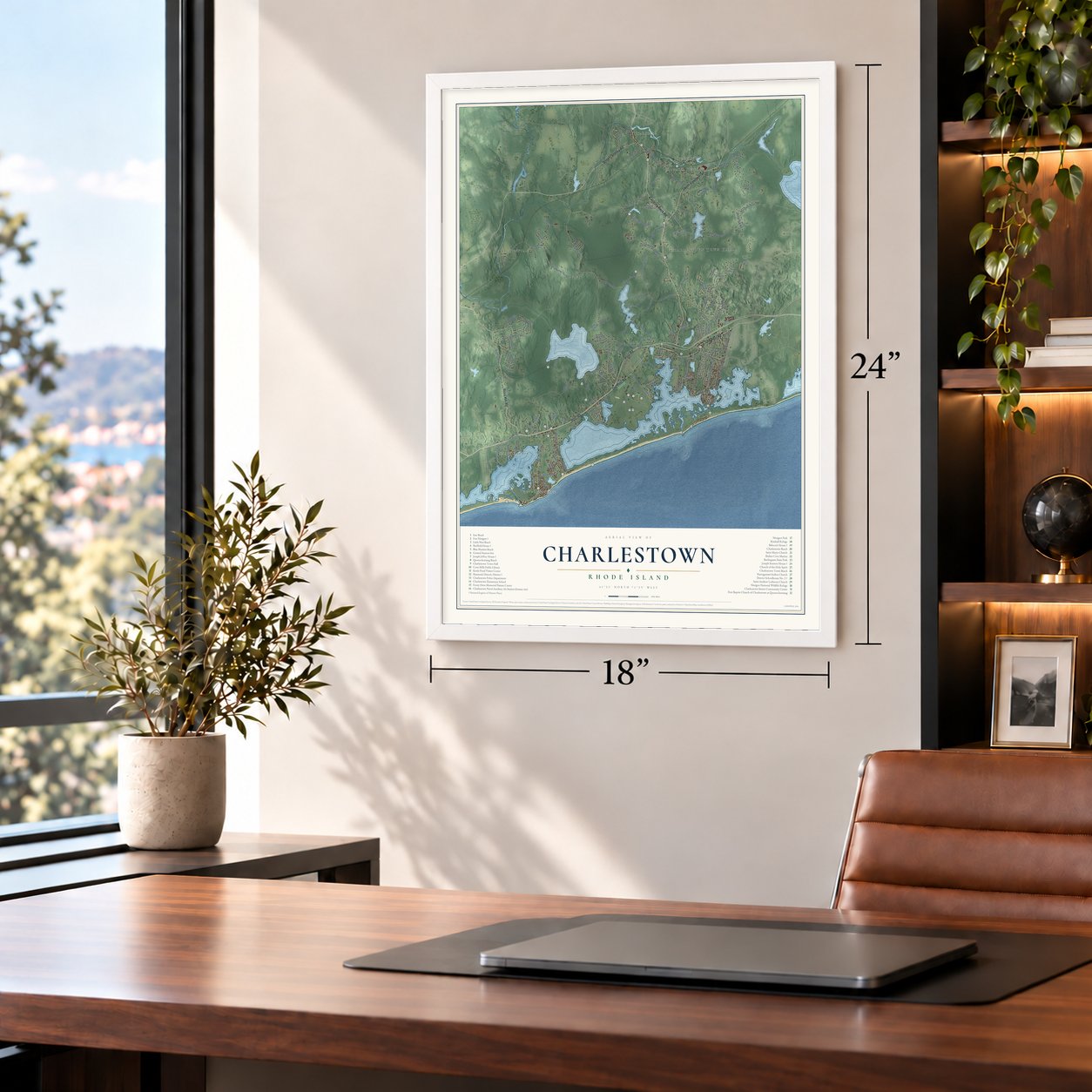
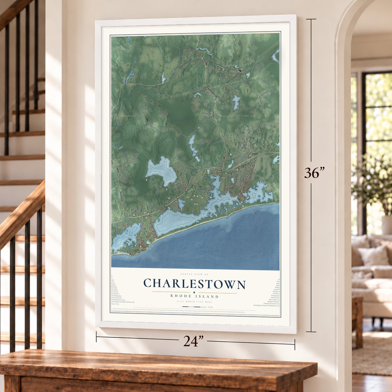
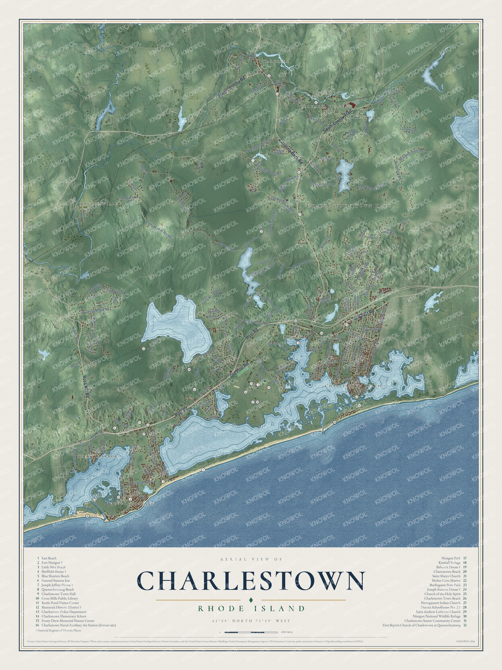
Charlestown, Rhode Island Map Art
Building by building, with labeled streets and shaded relief.
12" x 18" Archival Matte Print
A Map of Home. A Work of Art.
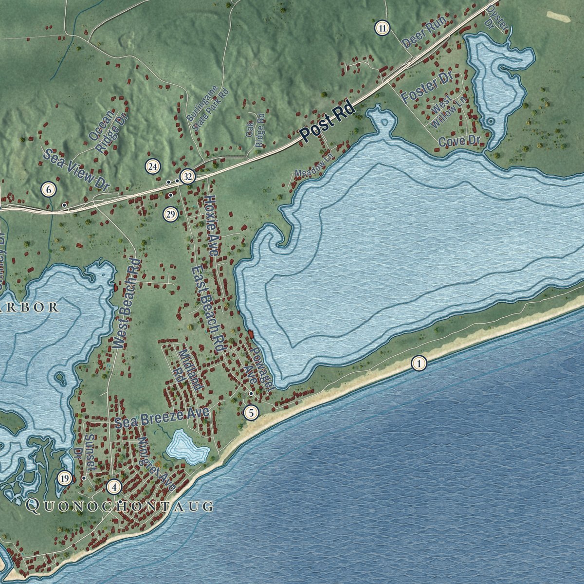
Explore Charlestown, Rhode Island from a whole new perspective. Created using aerial imagery and detailed geographic data, this map captures Charlestown building by building, with labeled streets, familiar landmarks, and shaded topographical relief that highlights the natural contours of the landscape.
Combining modern data with the timeless character of a vintage atlas, this map is just as interesting up close as it is beautiful on the wall. Whether you grew up in Charlestown, spent memorable years there, or call it home today, this unique map is a great way to celebrate a place that means something to you. Zoom in on the preview to look for your street, and then order a print to put your memories on the wall.
Three ways to hang it
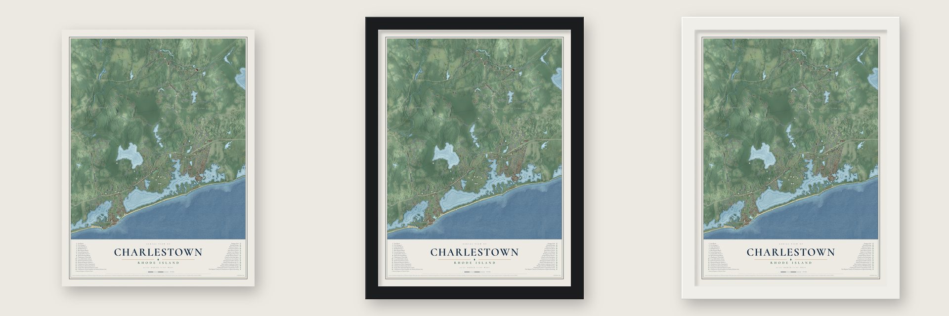
Unframed archival matte, a black wood frame or a white wood frame.
Up close
Geography Worth Displaying
This map was created using accurate cartographic data and authoritative geographic sources, including the U.S. Geological Survey (USGS) and FEMA. The map brings together terrain, waterways, roads, and building detail. The majority of the streets are labeled, houses are accurately depicted, and the topography is derived from government sources. Combining local data with carefully composed color and shading leads to this beautifully detailed Charlestown artwork for your wall.
Rather than simply showing street outlines, we’ve included as many of the street names as we could reasonably fit on the map while keeping their names legible. Zoom in on the high resolution preview to see exactly what’s on the map. We truly set out to create a statement piece for anyone who loves Charlestown. So whether it’s for you, or a gift for someone you love, we hope this map of Charlestown brings back fond memories.
Explore the full map of Charlestown, Rhode Island and read about the local places it shows.
Find your street
Names on the Charlestown map
Every name below is printed on this map. Look for your street, your school, the park where you played, or the pond down the road.
Places and landmarks10
- Charlestown Town Hall
- Carolina
- Brudickville
- Charlestown Beach
- Kenyon
- Arnolda
- Shady Harbor
- Quonochontaug
- Columbia Heights
- Shannock
Streets and roads154
- Old Post Road
- Post Road
- South County Trail
- Carolina Back Road
- Ross Hill Road
- Alton Carolina Road
- West Beach Road
- Indian Church Road
- Arnolda Road
- Kings Factory Road
- BIA Route 411
- Shannock Road
- Buckeye Brook Road
- Klondike Road
- Old Coach Road
- Narragansett Trail
- Shumankanuc Hill Road
- Charlestown Beach Road
- Narrow Lane
- Park Lane
- Old Mill Road
- School House Pond Road
- Biscuit City Road
- BIA Route 402
- Prosser Trail
- Pasquisett Trail
- East Beach Road
- Sanctuary Road
- East Pasquiset Trail
- Sand Plain Road
Show all 154 streets
- Old Shannock Road
- BIA Route 401.2
- Botka Drive
- Tockwotten Cove Road
- Auburn Drive
- Ram Island Road
- Wordens Pond Road
- BIA Route 309
- Shirley Drive
- North Niantic Drive
- Southern Way
- Country Drive
- Edwards Lane
- Hoxie Avenue
- Sea Breeze Avenue
- Hill Top Drive
- Timber Ridge Road
- Rose Court
- Stillwater Road
- Ridgewood Road
- BIA Route 303
- Lauri Drive
- Warren Road
- Quail Lane
- Sea View Drive
- Pequot Drive
- Niantic Highway
- Foster Drive
- Attuk Road
- Old Road
- BIA Route 406
- Shore Drive
- Potter Hoxie Trail
- Burdickville Road
- Fish Camp Road
- South Arnolda Road
- Peckham Hollow Road
- Cedar Road
- Duhamel Avenue
- General Stanton Lane
- Black Pond Road
- Laurel Road
- Mohawk Trail
- Midland Road
- Burlingame Park Road
- Liisa Drive
- Watchaug Lane
- Arnolda Round Road
- Scapa Flow Road
- Crosspatch Road
- Lady Slipper Drive
- Sunset Drive
- Montauk Road
- Camp Davis Road
- East Quail Run
- Charles Avenue
- BIA Route 409
- Ninigret Avenue
- Cherokee Bend
- BIA Route 311
- Ocean Ridge Drive
- BIA Route 301
- King Tom Drive
- Starrett Drive
- Cool Spring Road
- Colony Road
- Walsh Road
- Mosena Drive
- Sand Hill Road
- Clarkin Pond Road
- Wiitala Drive
- Cedar Meadows
- Elizabeth Cooper Drive
- Indian Trail
- Powaget Avenue
- BIA Route 408
- Maize Drive
- Butter Lane
- Deer Run
- Keith Drive
- Cove Drive
- Yew Road
- Tunoopa Trail
- Arbutus Trail
- Maple Lake Farm Road
- New Biscuit City Road
- Shady Harbor Drive
- Burlingame Drive
- Driftwood Drive
- West Willow Lane
- Castlerock Drive
- Pietila Road
- Arches Road
- Pine Tree Road
- Gardner Road
- Crossland Street
- Railroad Avenue
- Botka Woods Drive
- Genwood Road
- Grays Point Road
- Oyster Drive
- First Street
- Fifth Avenue
- Matunuck School House Road
- Cove Point Road West
- Deep Pond Access Road
- Cedar Swamp Path
- Meadow Lane
- Lakeside Drive
- Riidam Way
- White Pines Trail
- Kickapoo Run
- Burlingame State Park Road
- Blue Ridge Drive
- Oak Ridge Road
- Pond Meadow Road
- Healey Brook Drive
- Essex Drive
- Town Dock Road
- Old Farm Way
- Fawn Circle
- Noka Lane
- Foxtrot Drive
- Lynn Road
Names are listed as they appear on the printed map. Zoom into the product photos to find them.
About Charlestown, Rhode Island
Charlestown is a town of 7,997 people in Washington County, on the Block Island Sound shore, with Westerly to the west and South Kingstown to the east. Around 1620 many Niantic people, relatives and allies of the larger Narragansett tribe, settled on Fort Neck to plant corn, make wampum and do business with Dutch and English traders. By the 1630s their sachem was Ninigret, and his name now belongs to a fort, a salt pond and a wildlife refuge.
In 1660 a company formed in Newport bought the tract called Misquamicut, which covered today's Westerly, Charlestown, Richmond and Hopkinton, and in 1669 it became the Town of Westerly. After years of debate, Charlestown broke away and was incorporated in 1738, taking its name from King Charles II. Richmond split off along the Pawcatuck River in 1747. The Narragansett regained federal recognition as a tribe in 1983, and Charlestown is now the tribe's headquarters, with 1,800 acres of reservation trust land.
- A fort built before 1637At its 1883 dedication, Commissioner George Carmichael Jr. called the monument "the oldest military post on the Atlantic coast." The state, guided by Narragansett tribal commissioners, then rebuilt its earthworks, added evergreens and an iron fence. A European sword and cannon surfaced nearby in the early 1920s; the fort joined the National Register in 1970.
- The oldest house in townIn 1753 the farm passed to Nathaniel Sheffield, the husband of Rebecca Stanton. Little about the house has changed over the centuries. Local tradition calls it Charlestown's oldest home, and it was added to the National Register in 1976.
- Carolina, named for CarolineIn 1802 a wooden dam and gristmill rose on the Pawcatuck at a place then called Nichols Bridge. A cotton mill followed, and some of its workers lived in houses on the Charlestown side. North of the village, John W. Hoxie started one of America's first trout farms on White Brook in 1877.
- Edison's black-sand ironIn the 1880s Thomas Edison backed a mining venture at Quonochontaug that used magnets to draw iron out of the black sand on the beach. The business failed after cheaper sources of iron were found.
- First to ban wind turbinesCharlestown banned electricity-generating wind turbines of every size and type in 2011, from big commercial machines down to small ones at homes. No other municipality in the United States had passed such a ban before.
Keep exploring Rhode Island
Charlestown is one of 86 Rhode Island towns we've mapped. Every dot on the map is a print of its own.
The search covers every state, Rhode Island first.
Near Charlestown
Order 2 or more town maps and save 10%. Shown in the size and finish you picked above, so they hang as a set.
- Quonochontaug 12" x 18" / Archival Matte Print $39.99
- Bradford 12" x 18" / Archival Matte Print $39.99
- Weekapaug 12" x 18" / Archival Matte Print $39.99


More maps nearby: Matunuck, Carolina, South Kingstown, Ashaway and New Shoreham.
The art of mapping a place
How This Map Was Made
Real places. Remarkable detail. Discover the layers that turn geographic data into a map of home.

The view from above
Aerial imagery reveals the character of the land: woodland, open fields, and the patterns of a place.

The shape of the land
Elevation data brings hills, valleys, and subtle changes in the landscape into view.

The details of home
Roads, waterways, and building footprints come together to make the map feel unmistakably local.

Geography becomes art
Considered color, shading, and typography bring the layers together in a map made for your wall.


Process illustrated with Mendon, Massachusetts. Aerial imagery: USDA NAIP. Terrain: USGS 3D Elevation Program. Map details and finished artwork: KNOWOL.
The Details
About This Print
Choose an archival matte print, or a black or white Ayous wood frame. The archival matte print is unframed.
Select your size and finish above to see the matching product image and price.
Materials & Craftsmanship
A contemporary map with the character of a classic atlas, printed on archival matte paper. Optional frames are made from Ayous wood.
Your printed map does not include the watermark shown in the full-map preview.
Shipping & Delivery
Free shipping within the United States. Every print is made to order in the USA.
Buying a gift? Add a note in your cart and we'll include it. We never put prices in the package.
Prints ship within 2 to 3 business days. Allow 7 to 10 days total from ordering for delivery. Timing may vary during holidays or periods of high order volume.
Read our shipping policy.
Returns and damaged prints
Each print is made to order. Change-of-mind refunds are not available after production.
If your print arrives damaged, misprinted or incorrect, contact support@knowol.com within 30 days of receiving it. Include your order number, photos and a description of the issue.
Read our full refund and replacement policy. For questions about your order, email support@knowol.com.