
Search for another town





Free U.S. delivery 7 to 10 days after you order
Chester, Virginia Map Art
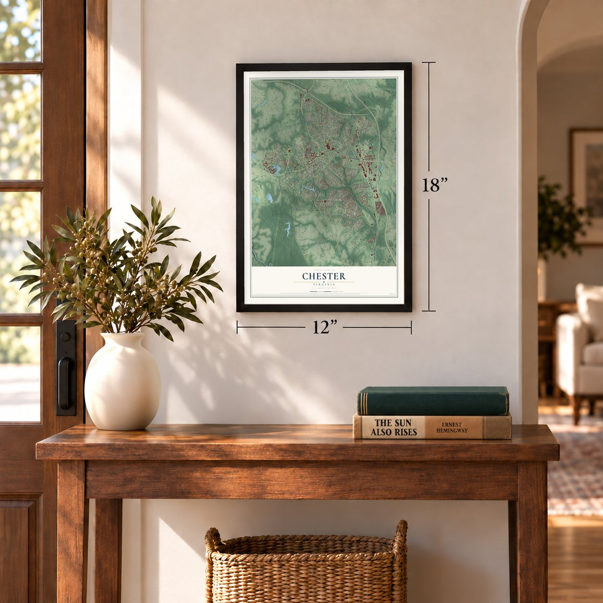
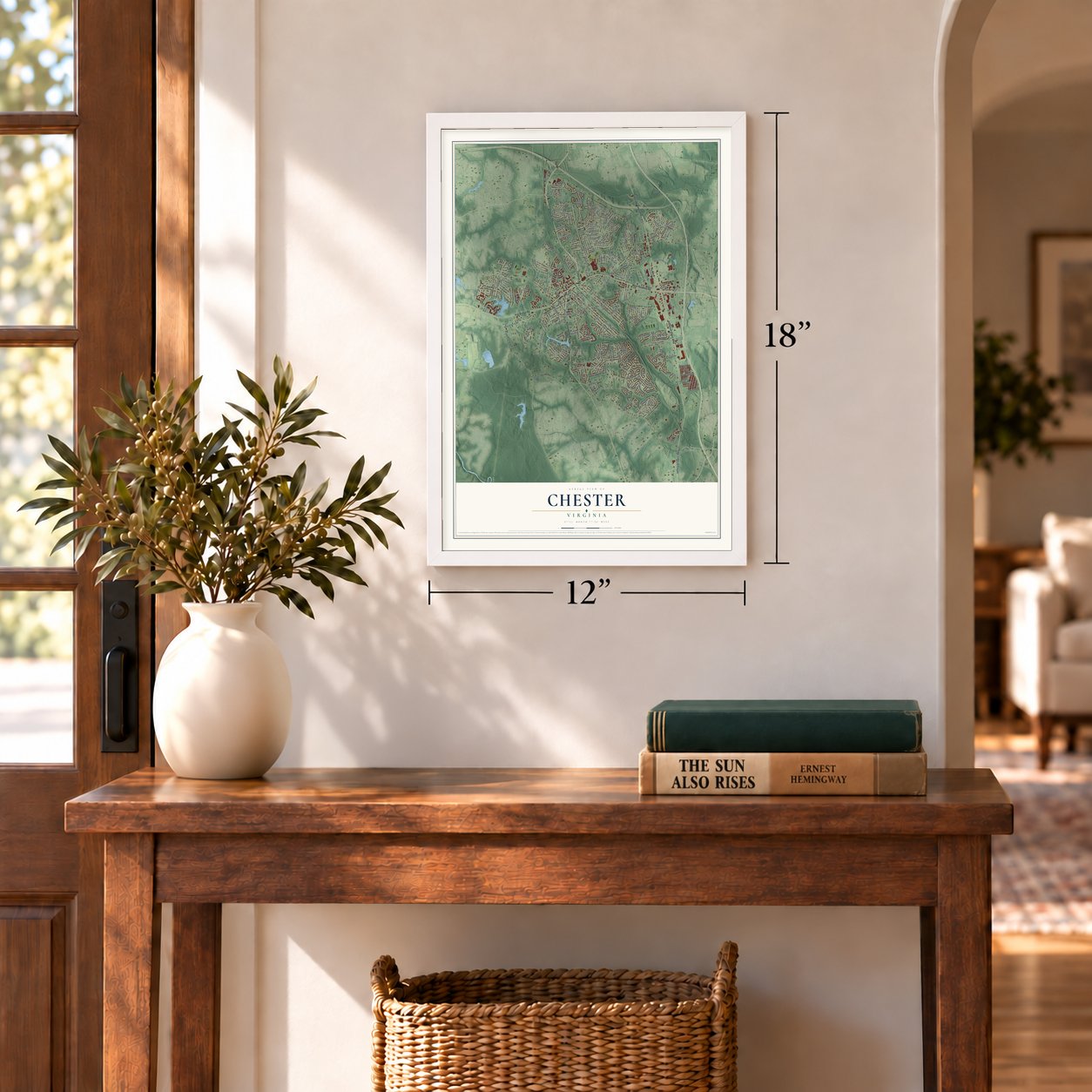
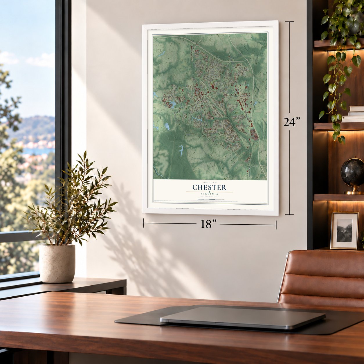
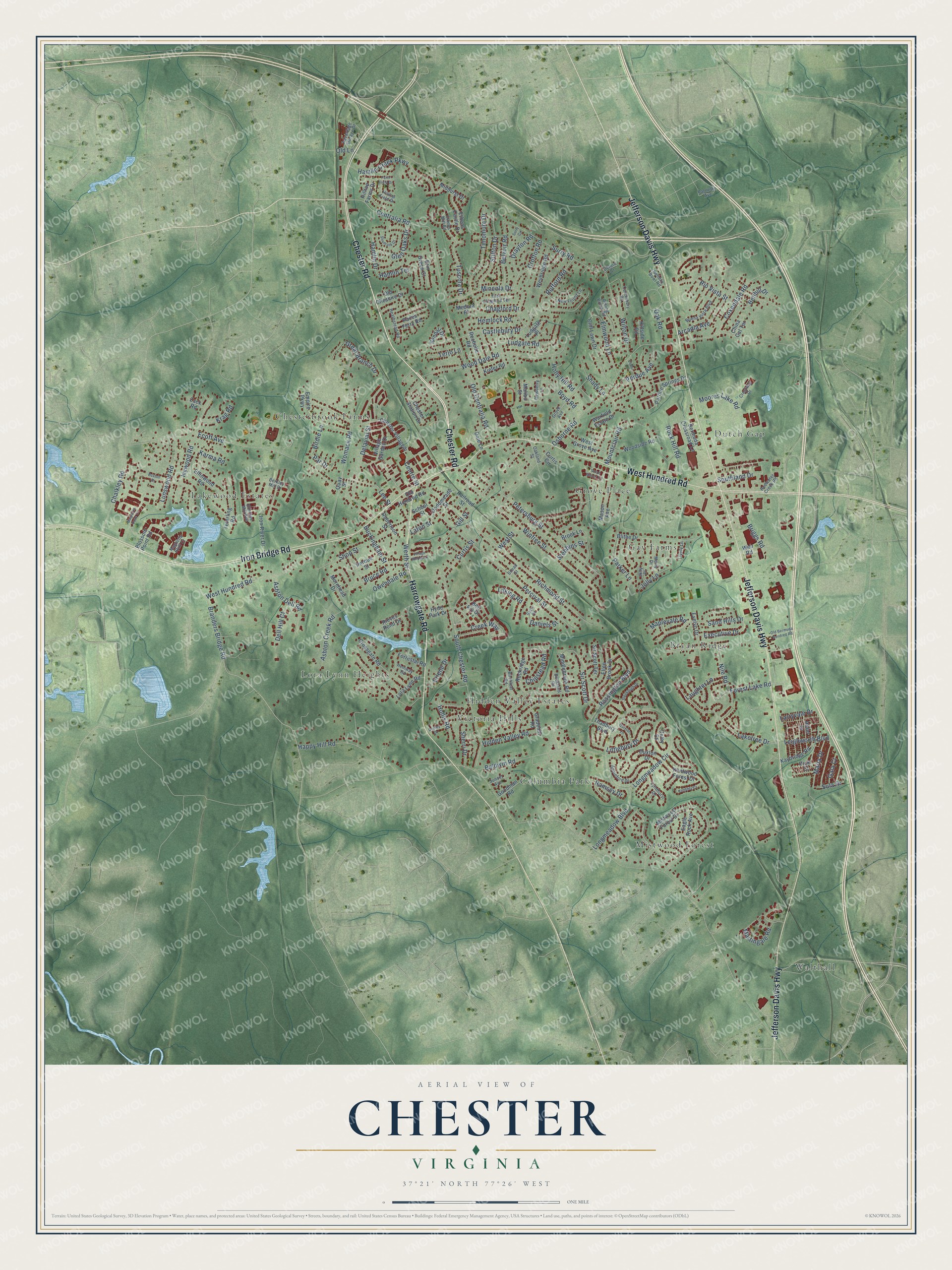
A new map of Chester, Virginia, made in 2026 and printed to order on thick archival matte paper.
12" x 18" Archival Matte Print
A Map of Home. A Work of Art.
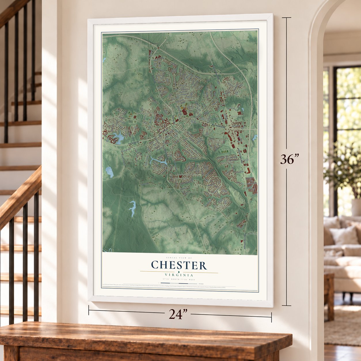
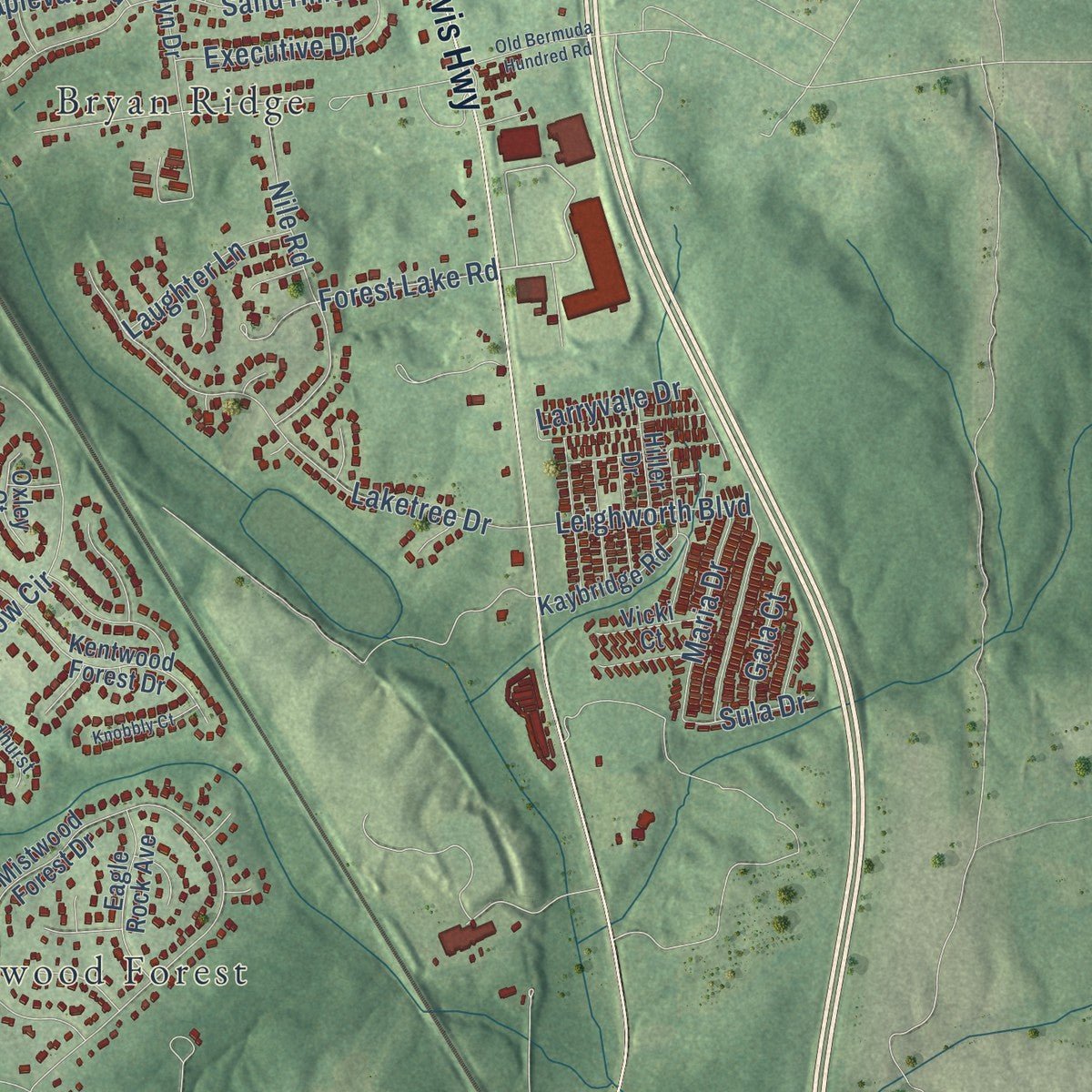
Explore Chester, Virginia from a whole new perspective. Created using aerial imagery and detailed geographic data, this map captures Chester building by building, with labeled streets, familiar landmarks, and shaded topographical relief that highlights the natural contours of the landscape.
Combining modern data with the timeless character of a vintage atlas, this map is just as interesting up close as it is beautiful on the wall. Whether you grew up in Chester, spent memorable years there, or call it home today, this unique map is a great way to celebrate a place that means something to you. Zoom in on the preview to look for your street, and then order a print to put your memories on the wall.
Three ways to hang it
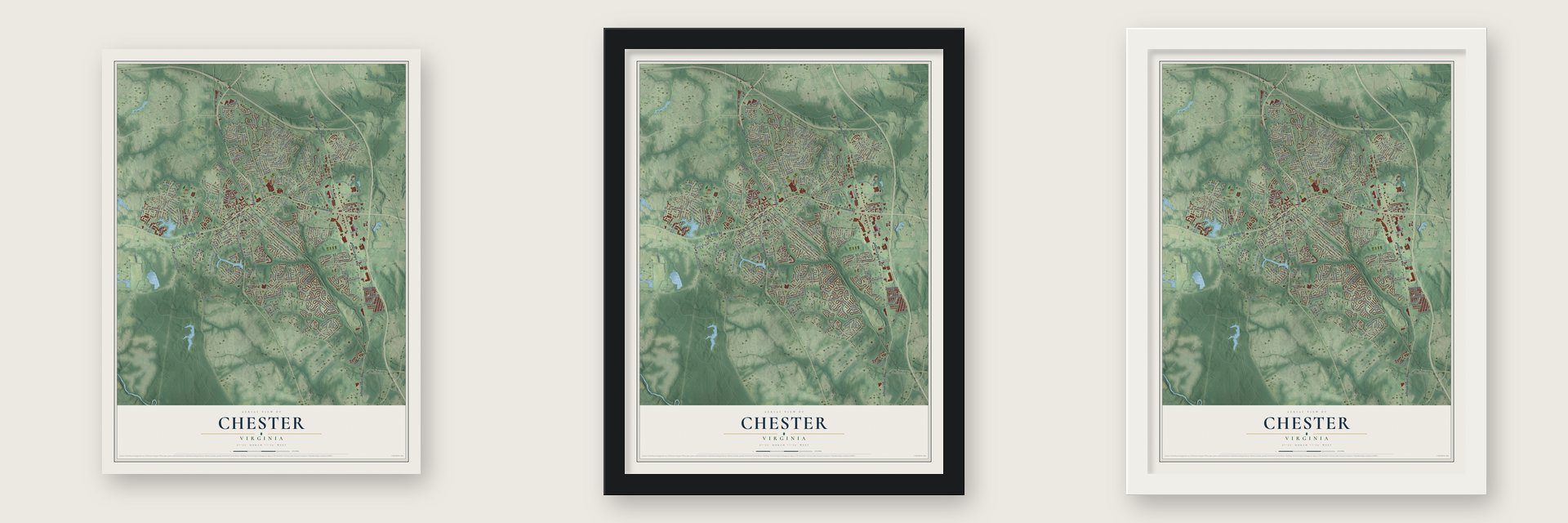
Unframed archival matte, a black wood frame or a white wood frame.
Up close
Geography Worth Displaying
This map was created using accurate cartographic data and authoritative geographic sources, including the U.S. Geological Survey and the Census Bureau. The map brings together terrain, waterways, roads, and building detail. The majority of the streets are labeled, houses are accurately depicted, and the topography is derived from government sources. Combining local data with carefully composed color and shading leads to this beautifully detailed Chester artwork for your wall.
Rather than simply showing street outlines, we’ve included as many of the street names as we could reasonably fit on the map while keeping their names legible. Zoom in on the high resolution preview to see exactly what’s on the map. We truly set out to create a statement piece for anyone who loves Chester. So whether it’s for you, or a gift for someone you love, we hope this map of Chester brings back fond memories.
Read the story behind this map of Chester, Virginia from 2026.

About Chester, Virginia
Chester is a community of 23,414 people in Chesterfield County, in the Richmond and Petersburg area. Its first downtown was a stop where two railroads crossed. The Richmond and Petersburg line ran north and south, and the Clover Hill Railroad ran east and west. The Clover Hill road was later renamed the Brighthope Railway, and after that the Farmville and Powhatan Railroad.
In 1900 the Richmond and Petersburg joined the Atlantic Coast Line. That same year the Seaboard Air Line built a second north and south route through Chester, and in 1905 the old east and west line became the Tidewater and Western Railroad. The Seaboard's path is now Chester Linear Park. Many people who live in Chester now work elsewhere, and new shops have gone up where State Route 10 meets U.S. Route 1 near Interstate 95.
“George Washington visited Osbornes in 1791 during a national tour designed to afford citizens the opportunity to see their first national hero.”
- Arnold's raid in 1781In April 1781, during the American Revolution, General Benedict Arnold struck at Osborne's Landing, now part of Chester. In the Action at Osborne's he wrecked much of Virginia's navy.
- Battle of Chester StationIn May 1864 the railroad stop at Chester Station became a battlefield. The fighting there was part of the Bermuda Hundred Campaign of the Civil War.
- A college of 13,000Brightpoint Community College is in Chester. It was first called John Tyler Community College, and in the 2020-21 school year it served nearly 13,000 students.
Find your street
Names on the Chester map
Every name below is printed on this map. Look for your street, your school, the park where you played, or the pond down the road.
Places and landmarks12
- Bryan Ridge
- Chesterbrook Farms
- Columbia Park
- Dutch Gap
- Gay Farms
- Grove Place
- Hidden Valley Estates
- Lakewood Estates
- Lora Lynn Heights
- Mistwood Forest
- Victoria Hills
- Walthall
Streets and roads217
- Chester Road
- West Hundred Road
- Jefferson Davis Highway
- Iron Bridge Road
- Harrowgate Road
- Winfree Street
- Gill Street
- Centralia Road
- Forest Lake Road
- Chalkley Road
- Happy Hill Road
- Osborne Road
- Ecoff Avenue
- Longmeadow Circle
- Branders Bridge Road
- Old Centralia Road
- Richmond Street
- Percival Street
- Curtis Street
- South Chester Road
- Castlebury Drive
- Wood Dale Road
- Petersburg Street
- Surry Road
- Womack Road
- Baldwin Road
- Moores Lake Road
- Laketree Drive
- Parker Lane
- Ivywood Road
Show all 217 streets
- Shop Street
- Sand Hills Drive
- Hamlin Creek Parkway
- Coxendale Road
- Delavial Street
- Rossington Boulevard
- Mineola Drive
- Timonium Drive
- Mountclair Road
- Nile Road
- Stebbins Street
- Creek Way
- Martingale Road
- Ludgate Road
- Stilton Drive
- Ashton Creek Road
- Rio Vista Street
- Boyd Road
- Werth Street
- Longmeadow Boulevard
- Lunswood Road
- Hamlin Drive
- Ashton Dell Road
- Arcadia Avenue
- Elmwood Lane
- Holly Hill Road
- Belvoir Road
- Larryvale Drive
- Great Branch Drive
- Chipstead Road
- Buckingham Street
- Tuscola Drive
- Rock Hill Road
- Daniels Street
- Hemlock Road
- Bruce Road
- Glen Oaks Drive
- Rufford Road
- Lee Street
- Executive Drive
- Crofton Road
- Hidden Valley Road
- Chagford Drive
- Southland Drive
- Leighworth Boulevard
- Littlebury Drive
- Perdue Avenue
- Birdie Lane
- Maria Drive
- Drayton Road
- Sir Scott Drive
- Hamlin Terrace
- Laughter Lane
- Hollis Road
- West Street
- Shady Lane
- Benhill Drive
- Dell Hill Court
- Owendale Road
- Wilton Drive
- Maplevale Road
- Jolly Lane
- Sherri Drive
- Krag Road
- Centre Street
- Karma Road
- Erlene Drive
- Ramsey Drive
- Oak Road
- Briggs Road
- Terjo Lane
- Gala Court
- Sula Drive
- Lilking Road
- Lafon Street
- Par Drive
- Old Lane
- Mistwood Forest Drive
- Elfinwood Road
- Iron River Drive
- Blithe Drive
- Empire Parkway
- Hyde Park Drive
- Evelyn Drive
- Middlebrook Road
- Crossgate Road
- Cliff Lawn Drive
- Ellen Brook Drive
- Brook Lane
- Bermuda Crossroad Lane
- Mason Avenue
- Paces Ferry Road
- Teterling Road
- Dodomeade Street
- Chester Villagedr
- Kentwood Forest Drive
- Rockridge Road
- Chester Station Drive
- Rochelle Road
- Warfield Estate Drive
- Rieves Pond Drive
- Purdue Springs Drive
- Old Hundred Road
- Railroad Street
- Village Garden Drive
- Woodside Road
- West Grove Avenue
- Weybridge Road
- Kaybridge Road
- Eagle Rock Avenue
- Blossom Point Road
- Ethens Castle Drive
- Robertson Street
- Lora Lynn Road
- Hiller Drive
- Goodman Road
- Sir Scott Terrace
- Ben Fry Drive
- Erin Green Court
- Duxton Drive
- Ludgate Place
- Old Cheshire Drive
- Forrestal Road
- Randall Drive
- Malibu Street
- Midhurst Drive
- Thadbury Boulevard
- Perdue Street
- Gladehill Road
- Morehead Drive
- Hillside Road
- Kiefer Road
- Vicki Court
- Oxley Court
- Medora Place
- Hilltop Farms Drive
- Weir Road
- China Cat Terrace
- Curtis Circle
- School Street
- Dale Lane
- Quay Street
- Zack Road
- Holiday Bowl Road
- Crestway Drive
- Grove Avenue
- Buena Vista Boulevard
- Appleford Drive
- Rolling Brook Road
- New Found Lane
- Birchleaf Road
- Dewberry Lane
- Merry Drive
- Heathstead Road
- East Chagford Terrace
- Lyndhurst Drive
- Berkley Mill Drive
- Ethens Mill Road
- Canterbury Road
- Advantage Storage Drive
- Hilltop Field Drive
- Snead Street
- Redwater Creek Road
- Ellerbee Mill Avenue
- Sunset Avenue
- Hemway Road
- Magnolia Bluff Court
- Buckland Road
- Palmetto Avenue
- Lively Lane
- Oakland Street
- Jolly Place
- Deford Court
- Stone Manor Circle
- Magnolia Cove Circle
- Stockleigh Drive
- Buxton Drive
- Old Bermuda Hundred Road
- Farm Field Drive
- Shumark Drive
- Quixton Lane
- Knobbly Court
- Gayle Road
- Village Woods Lane
- Dudley Drive
- Cedar Lane
- Surry Circle
Names are listed as they appear on the printed map. Zoom into the product photos to find them.
The art of mapping a place
How This Map Was Made
Real places. Remarkable detail. Discover the layers that turn geographic data into a map of home.

The view from above
Aerial imagery reveals the character of the land: woodland, open fields, and the patterns of a place.

The shape of the land
Elevation data brings hills, valleys, and subtle changes in the landscape into view.

The details of home
Roads, waterways, and building footprints come together to make the map feel unmistakably local.

Geography becomes art
Considered color, shading, and typography bring the layers together in a map made for your wall.


Process illustrated with Mendon, Massachusetts. Aerial imagery: USDA NAIP. Terrain: USGS 3D Elevation Program. Map details and finished artwork: KNOWOL.
The Details
About This Print
Choose an archival matte print, or a black or white Ayous wood frame. The archival matte print is unframed.
Select your size and finish above to see the matching product image and price.
Materials & Craftsmanship
A contemporary map with the character of a classic atlas, printed on archival matte paper. Optional frames are made from Ayous wood.
Your printed map does not include the watermark shown in the full-map preview.
Shipping & Delivery
Free shipping within the United States. Every print is made to order in the USA.
Buying a gift? Add a note in your cart and we'll include it. We never put prices in the package.
Prints ship within 2 to 3 business days. Allow 7 to 10 days total from ordering for delivery. Timing may vary during holidays or periods of high order volume.
Read our shipping policy.
Returns and damaged prints
Each print is made to order. Change-of-mind refunds are not available after production.
If your print arrives damaged, misprinted or incorrect, contact support@knowol.com within 30 days of receiving it. Include your order number, photos and a description of the issue.
Read our full refund and replacement policy. For questions about your order, email support@knowol.com.
Find your town
Looking for another city?
Find a map of home in our Virginia collection, or any town in the country.
Nearby
Maps of towns near Chester
Know someone from one of these towns? Their map makes a great gift.
 Bellwood
, Virginia
From $39.99See the map
 Meadowbrook
, Virginia
From $39.99See the map
 Colonial Heights
, Virginia
From $39.99See the map
More maps nearby: Enon, Bensley, Ettrick, Matoaca and Hopewell.