
Search for another town




Free U.S. delivery 7 to 10 days after you order
Colonial Heights, Virginia Map Art
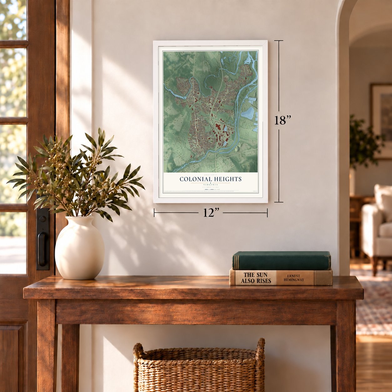
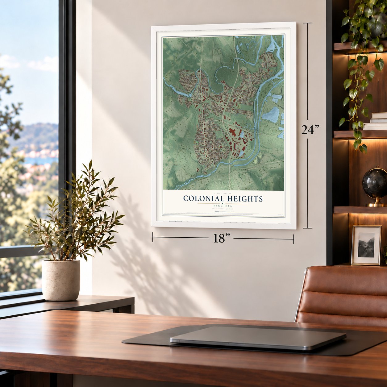
A new map of Colonial Heights, Virginia, made in 2026 and printed to order on thick archival matte paper.
12" x 18" Archival Matte Print
A Map of Home. A Work of Art.
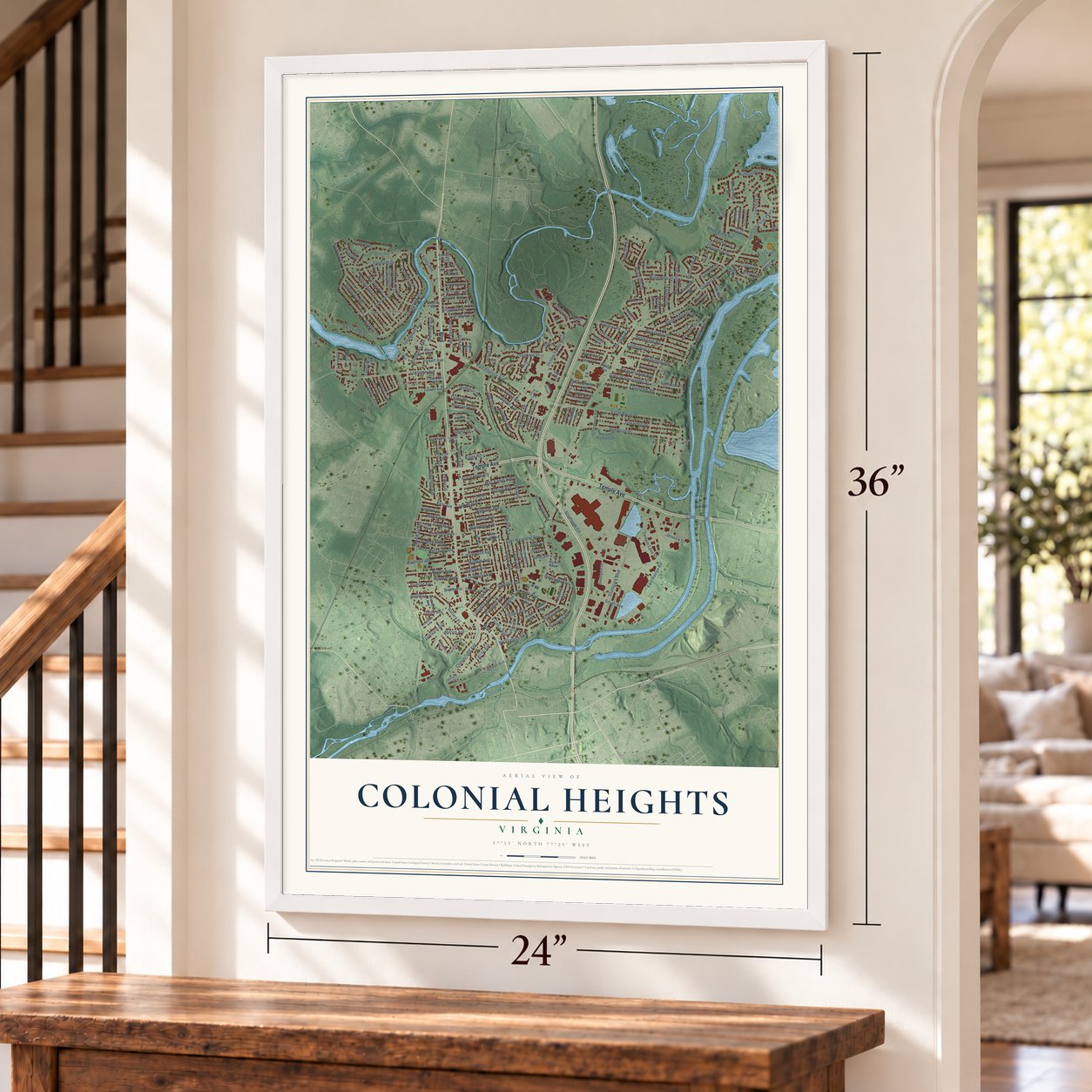
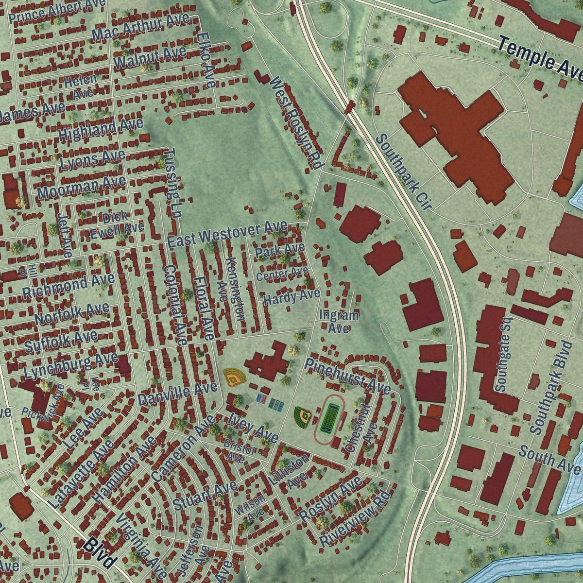
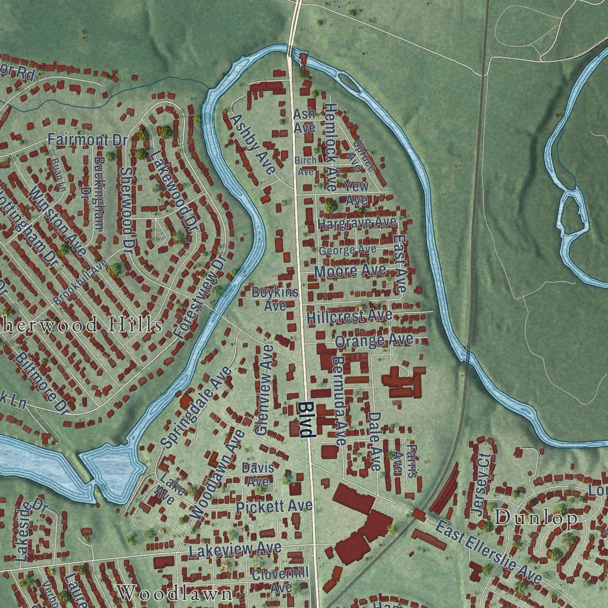
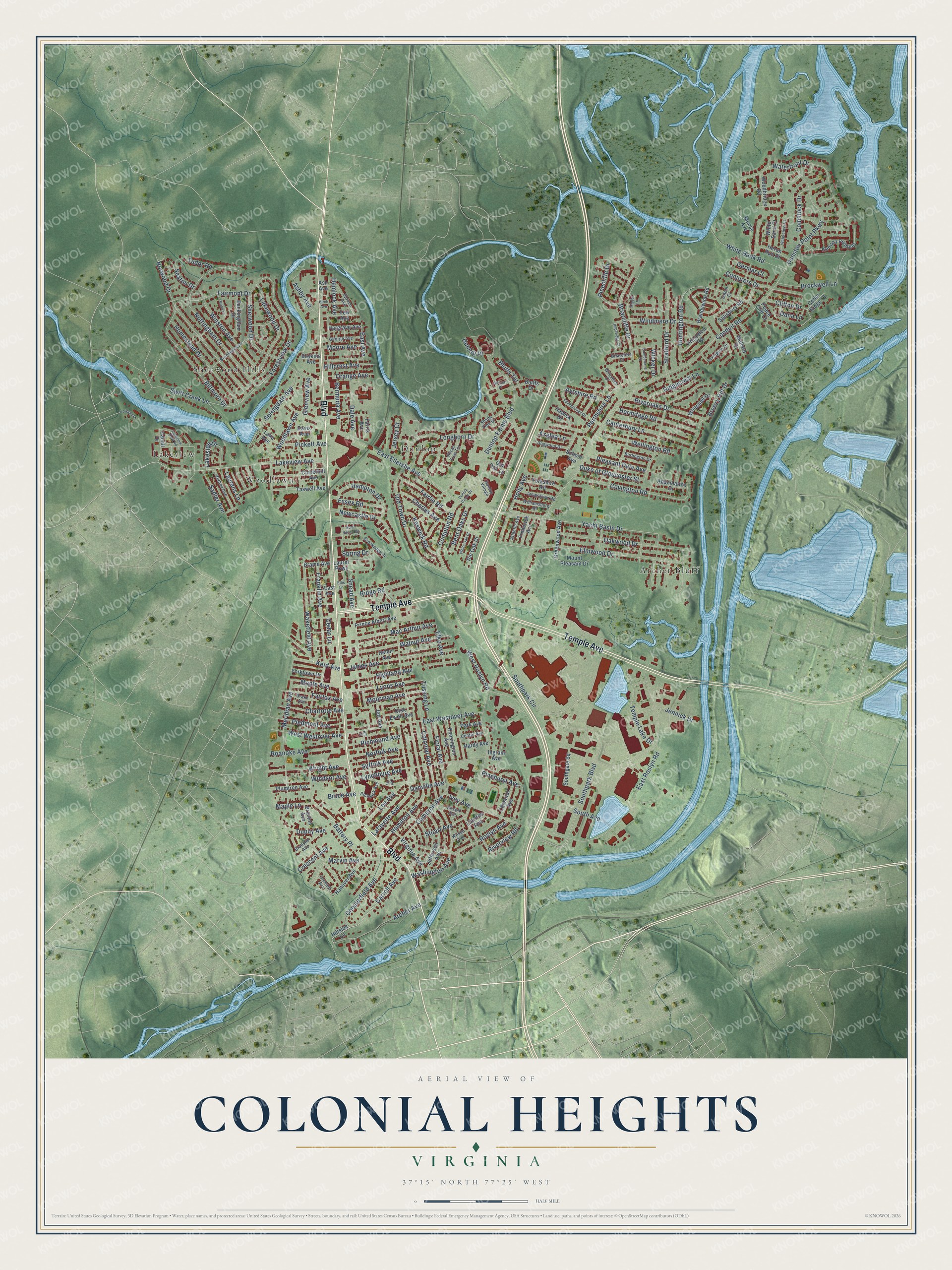
Explore Colonial Heights, Virginia from a whole new perspective. Created using aerial imagery and detailed geographic data, this map captures Colonial Heights building by building, with labeled streets, familiar landmarks, and shaded topographical relief that highlights the natural contours of the landscape.
Combining modern data with the timeless character of a vintage atlas, this map is just as interesting up close as it is beautiful on the wall. Whether you grew up in Colonial Heights, spent memorable years there, or call it home today, this unique map is a great way to celebrate a place that means something to you. Zoom in on the preview to look for your street, and then order a print to put your memories on the wall.
Three ways to hang it
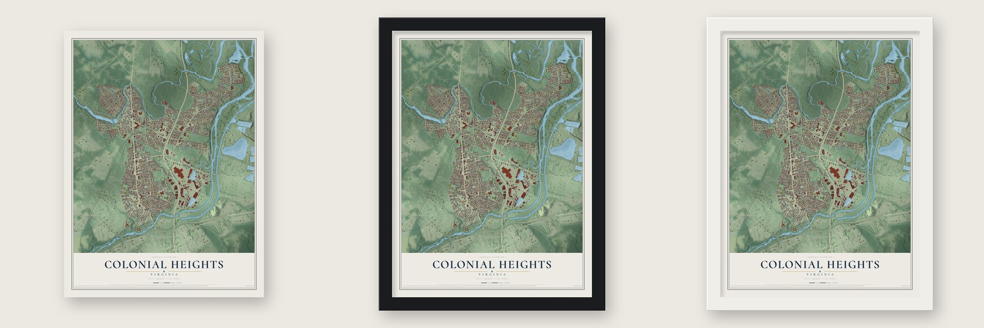
Unframed archival matte, a black wood frame or a white wood frame.
Up close
Geography Worth Displaying
This map was created using accurate cartographic data and authoritative geographic sources, including the U.S. Geological Survey and the Census Bureau. The map brings together terrain, waterways, roads, and building detail. The majority of the streets are labeled, houses are accurately depicted, and the topography is derived from government sources. Combining local data with carefully composed color and shading leads to this beautifully detailed Colonial Heights artwork for your wall.
Rather than simply showing street outlines, we’ve included as many of the street names as we could reasonably fit on the map while keeping their names legible. Zoom in on the high resolution preview to see exactly what’s on the map. We truly set out to create a statement piece for anyone who loves Colonial Heights. So whether it’s for you, or a gift for someone you love, we hope this map of Colonial Heights brings back fond memories.
Read the story behind this map of Colonial Heights, Virginia from 2026.
About Colonial Heights, Virginia
Colonial Heights is an independent city of 18,170 people on the Appomattox River, just north of Petersburg. Captain John Smith's early map shows the main town of the Appamattuck people here, under their leader Coquonasum and his sister Oppussoquionuske. In 1620 a small party of English colonists sailed up the Appomattox in search of cleared land. They settled where Swift Creek joins the river and called the spot Conjurer's Neck, after a Native healer who was believed to cast spells over the water.
The land became part of Chesterfield County in 1749 and stayed in it for almost 200 years. Colonial Heights did not join Petersburg. A judge's ruling made it an incorporated town in Chesterfield in 1926, and in 1948 it became a city and left the county. Between 1960 and 1970 its population grew from 9,587 to 15,097.
“Look! There are the Colonials, up on the Heights!”
- Named for Lafayette's gunsIn May 1781 Continental troops under Lafayette marched south from Richmond. They set cannon behind a boxwood hedge on the lawn of Oak Hill, on Carroll Avenue, and shelled Petersburg across the river, which British troops held. The British commander, Major-General William Phillips, died of typhoid during the bombardment. Legend says a British soldier gave the place its name when he spotted the troops, and in 1906 the name went to a subdivision of the Oak Hill tract.
- The Brick HouseRichard Kennon was a Bermuda Hundred merchant who represented Henrico County in the House of Burgesses. He built a plantation house here between 1677 and 1685. Later known as the Brick House, it served for years as a landmark for boats on the river and is thought to be the oldest permanent structure in the city. A fire in 1879 left one wall standing, and the rest was rebuilt.
- Lee's headquarters in 1864During the Siege of Petersburg, General Robert E. Lee ran his command from Violet Bank, staying there from June until September of 1864. Violet Bank is listed on the National Register of Historic Places.
- The F4 tornado of 1993On August 6, 1993, an F4 tornado tore through Colonial Heights. It badly damaged Southpark Mall and brought down the roof of a Wal-Mart store. Across the Tri-Cities it killed four people, three of them inside the Wal-Mart. It also injured 246 people, and the damage to property was estimated at $50 million.
Find your street
Names on the Colonial Heights map
Every name below is printed on this map. Look for your street, your school, the park where you played, or the pond down the road.
Places and landmarks5
- Archer Bluff
- Dunlop
- Lakeview
- Sherwood Hills
- Woodlawn
Streets and roads228
- Boulevard
- Temple Avenue
- Carroll Avenue
- Marvin Avenue
- Forestview Drive
- Charles Avenue
- East Avenue
- Yacht Basin Drive
- Kent Avenue
- East Ellerslie Avenue
- Swift Creek Lane
- Dale Avenue
- Bluffs Terrace
- Conduit Road
- Southpark Boulevard
- Hamilton Avenue
- West Roslyn Road
- Duke of Gloucester Street
- Chesterfield Avenue
- Nottingham Drive
- Waterfront Drive
- Lakeview Avenue
- Norwood Drive
- Southpark Circle
- Dunlop Farms Boulevard
- Huntington Road
- Elmwood Drive
- East Roslyn Road
- Meridian Avenue
- Sherwood Drive
Show all 228 streets
- East Westover Avenue
- Old Town Drive
- Lynchburg Avenue
- Covington Road
- Cedar Lane
- Oakwood Drive
- Dunston Point Parkway
- Lafayette Avenue
- Franklin Avenue
- Biltmore Drive
- James Avenue
- Snead Avenue
- Windmere Drive
- Longhorn Drive
- Battery Place
- Lakewood Drive
- Ridge Road
- Homestead Drive
- Washington Avenue
- Perthshire Lane
- Holly Avenue
- Archer Avenue
- Woodlawn Avenue
- Briarcliffe Drive
- Fairmont Drive
- Walnut Avenue
- Wakefield Avenue
- Elko Avenue
- Winston Avenue
- Canterbury Lane
- White Bank Road
- Cameron Avenue
- Compton Road
- Hermitage Road
- Stratford Drive
- Newcastle Drive
- Danville Avenue
- Colonial Avenue
- Dupuy Avenue
- Dunlop Place
- Wright Avenue
- Ivey Avenue
- Conjurers Drive
- Mac Arthur Avenue
- Riveroaks Drive
- Temple Lake Drive
- Breezy Hill Drive
- Pinehurst Avenue
- Lyons Avenue
- Wellington Road
- Hampton Drive
- Brockwell Lane
- Roanoke Avenue
- Highland Avenue
- West Westover Avenue
- Comstock Drive
- Springdale Avenue
- Floral Avenue
- Piedmont Avenue
- Clifton Drive
- South Avenue
- Jennick Drive
- Fairlie Road
- Charlotte Avenue
- Pleasant Dale Avenue
- Roslyn Avenue
- Fairfax Avenue
- Lakeside Drive
- Keswick Road
- Ridgecrest Lane
- Moorman Avenue
- Pinecliffe Drive
- Lee Avenue
- Bermuda Avenue
- Norfolk Avenue
- Suffolk Avenue
- Richmond Avenue
- Maple Avenue
- Hillcrest Avenue
- Essex Road
- Virginia Avenue
- Riverview Road
- Ashby Avenue
- Orange Avenue
- Bent Oaks Drive
- Sadler Avenue
- Pickett Avenue
- Ayrshire Road
- Tussing Lane
- Bruce Avenue
- Stuart Avenue
- Dana Lane
- Moore Avenue
- Crescent Avenue
- Windsor Avenue
- Hemlock Avenue
- Glenview Avenue
- Maple Lane
- Laurens Lane
- Spring Drive
- Azalea Lane
- Wicker Drive
- Tudor Road
- Germar Court
- Seaton Drive
- Jersey Court
- Hillside Lane
- Lake Avenue
- Helen Avenue
- Southgate Square
- Mount Pleasant Drive
- Kennon Pointedr
- Jefferson Avenue
- Cloverhill Avenue
- Taswell Avenue
- Buckingham Drive
- School Avenue
- Kensington Avenue
- Salisbury Road
- Prince Albert Avenue
- Hanover Avenue
- Moose Avenue
- Yorkshire Road
- Jett Avenue
- Greenwood Avenue
- Plumtree Avenue
- Yew Avenue
- Brandywine Road
- Peace Cliff Court
- Whitehall Drive
- Heron Run Drive
- Chestnut Avenue
- Princeton Road
- Hargrave Avenue
- Woodbridge Road
- Cabell Drive
- Laurel Parkway
- Yorktown Drive
- Frederick Avenue
- Appomattox Drive
- Mallard Drive
- White Sand Court
- Braxton Avenue
- Pin Oak Court
- Dick Ewell Avenue
- Brame Avenue
- Hardy Avenue
- Hawick Drive
- Bluffs Drive
- Old Oak Lane
- Cedar Ridge Court
- Park Avenue
- Davis Avenue
- Lilliston Avenue
- Boykins Avenue
- Farris Avenue
- Ingram Avenue
- Ash Avenue
- Bristol Avenue
- Brookhill Avenue
- Verbov Avenue
- Jamestown Road
- Lexington Drive
- Spruce Avenue
- Williamsburg Road
- Bradsher Avenue
- Dogwood Drive
- Pickwick Avenue
- George Avenue
- Shade Tree Drive
- Brookedge Drive
- Atlantic Avenue
- Dunlop Village
- Orchard Avenue
- Burlington Drive
- Pecan Tree Terrace
- Center Avenue
- Drake Avenue
- Briarclifte Court
- Wilkshire Court
- Wilson Avenue
- Salem Court
- Taylor Lane
- Lakeview Park Road
- Brian Lane
- Edinborough Drive
- Hill Place
- Lee Place
- Watercress Court
- Cumberland Drive
- Hoperidge Court
- North Valley Road
- Birch Avenue
- White Oak Court
- Pondola Lane
- Gilcreff Place
- Dunlop Circle Drive
- Ellis Lane
Names are listed as they appear on the printed map. Zoom into the product photos to find them.
The art of mapping a place
How This Map Was Made
Real places. Remarkable detail. Discover the layers that turn geographic data into a map of home.

The view from above
Aerial imagery reveals the character of the land: woodland, open fields, and the patterns of a place.

The shape of the land
Elevation data brings hills, valleys, and subtle changes in the landscape into view.

The details of home
Roads, waterways, and building footprints come together to make the map feel unmistakably local.

Geography becomes art
Considered color, shading, and typography bring the layers together in a map made for your wall.


Process illustrated with Mendon, Massachusetts. Aerial imagery: USDA NAIP. Terrain: USGS 3D Elevation Program. Map details and finished artwork: KNOWOL.
The Details
About This Print
Choose an archival matte print, or a black or white Ayous wood frame. The archival matte print is unframed.
Select your size and finish above to see the matching product image and price.
Materials & Craftsmanship
A contemporary map with the character of a classic atlas, printed on archival matte paper. Optional frames are made from Ayous wood.
Your printed map does not include the watermark shown in the full-map preview.
Shipping & Delivery
Free shipping within the United States. Every print is made to order in the USA.
Buying a gift? Add a note in your cart and we'll include it. We never put prices in the package.
Prints ship within 2 to 3 business days. Allow 7 to 10 days total from ordering for delivery. Timing may vary during holidays or periods of high order volume.
Read our shipping policy.
Returns and damaged prints
Each print is made to order. Change-of-mind refunds are not available after production.
If your print arrives damaged, misprinted or incorrect, contact support@knowol.com within 30 days of receiving it. Include your order number, photos and a description of the issue.
Read our full refund and replacement policy. For questions about your order, email support@knowol.com.
Find your town
Looking for another city?
Find a map of home in our Virginia collection, or any town in the country.
Nearby
Maps of towns near Colonial Heights
Know someone from one of these towns? Their map makes a great gift.
 Ettrick
, Virginia
From $39.99See the map
 Petersburg
, Virginia
From $39.99See the map
 Fort Lee
, Virginia
From $39.99See the map
More maps nearby: Matoaca, Hopewell, Enon, Chester and Prince George.