
Search for another town




Free U.S. delivery 7 to 10 days after you order
Chico, California Map Art
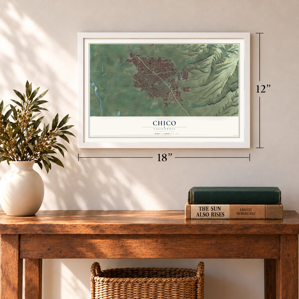
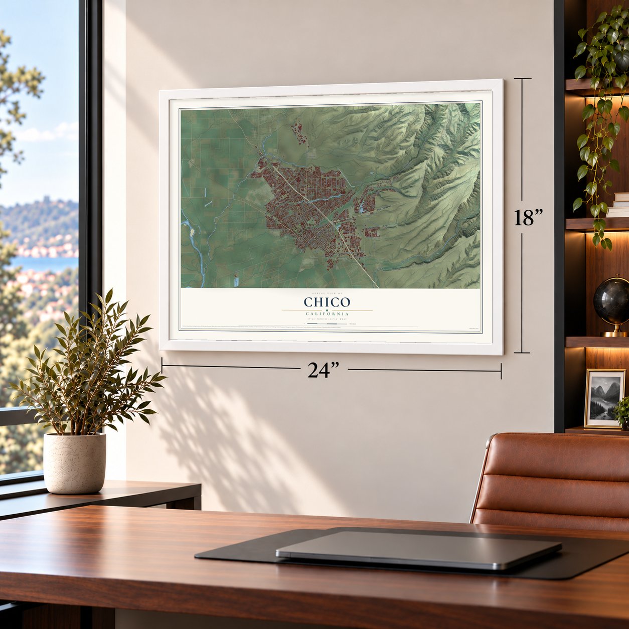
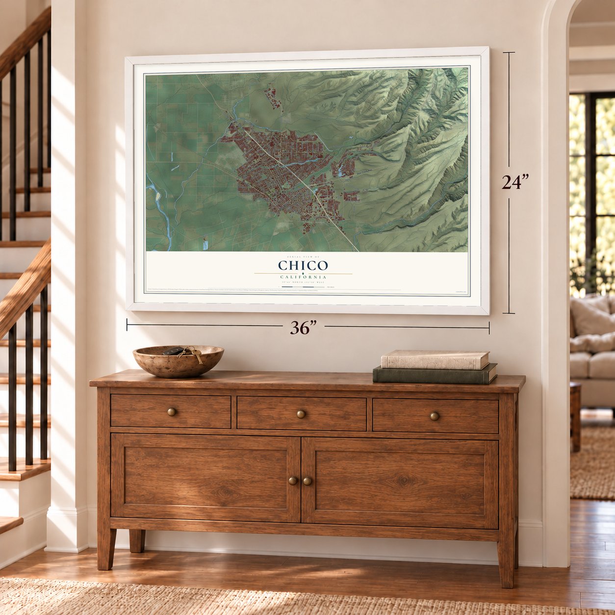
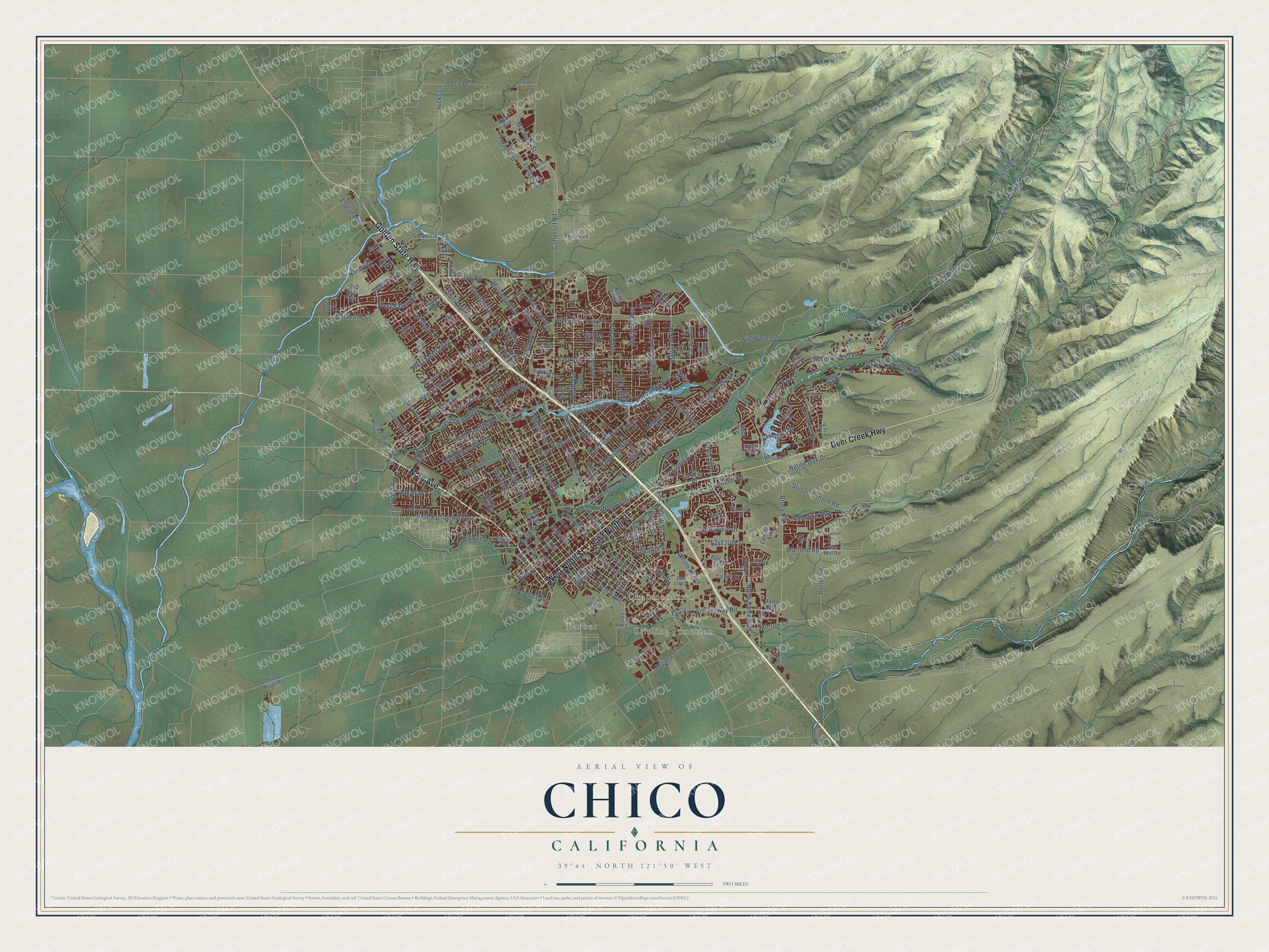
A new map of Chico, California, made in 2026 and printed to order on thick archival matte paper.
12" x 18" Archival Matte Print
A Map of Home. A Work of Art.
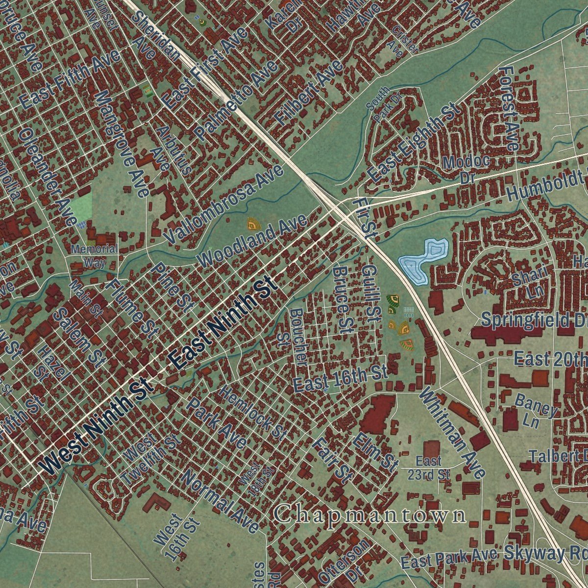
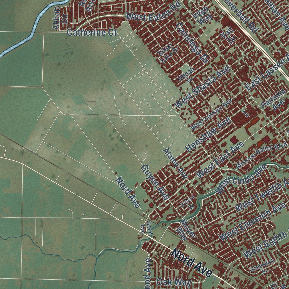
Explore Chico, California from a whole new perspective. Created using aerial imagery and detailed geographic data, this map captures Chico building by building, with labeled streets, familiar landmarks, and shaded topographical relief that highlights the natural contours of the landscape.
Combining modern data with the timeless character of a vintage atlas, this map is just as interesting up close as it is beautiful on the wall. Whether you grew up in Chico, spent memorable years there, or call it home today, this unique map is a great way to celebrate a place that means something to you. Zoom in on the preview to look for your street, and then order a print to put your memories on the wall.
Three ways to hang it
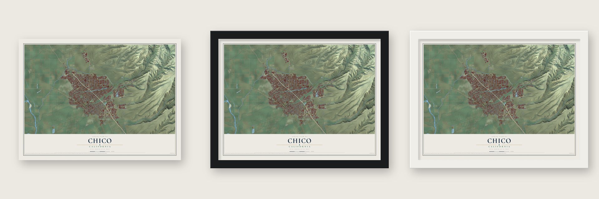
Unframed archival matte, a black wood frame or a white wood frame.
Up close
Geography Worth Displaying
This map was created using accurate cartographic data and authoritative geographic sources, including the U.S. Geological Survey and the Census Bureau. The map brings together terrain, waterways, roads, and building detail. The majority of the streets are labeled, houses are accurately depicted, and the topography is derived from government sources. Combining local data with carefully composed color and shading leads to this beautifully detailed Chico artwork for your wall.
Rather than simply showing street outlines, we’ve included as many of the street names as we could reasonably fit on the map while keeping their names legible. Zoom in on the high resolution preview to see exactly what’s on the map. We truly set out to create a statement piece for anyone who loves Chico. So whether it’s for you, or a gift for someone you love, we hope this map of Chico brings back fond memories.
Read the story behind this map of Chico, California from 2026.

About Chico, California
Chico is a city of 101,475 people in Butte County, at the northeast edge of the Sacramento Valley. The Mechoopda Maidu lived here first. Old records give the name of one of their villages, inside today's city limits, as Bah-hahp'-ke, which means "straight tree." John Bidwell had come to California in 1843 with one of the first wagon trains. He settled here in 1850, and in 1860 he laid out the town and named it Chico, a Spanish word for "little."
During the Civil War, Lt. Col. A. E. Hooker set up Camp Bidwell a mile from town on August 26, 1863, with one cavalry company and two of infantry. By early 1865 people called it Camp Chico, because a new Camp Bidwell had opened in the state's far northeast. The California and Oregon Railroad reached Chico in 1870, and the city was incorporated on January 8, 1872. In February 1886 arsonists burned Chico's Chinatown and drove its Chinese American residents out of town.
- A college since 1887In 1887 the state opened the Northern Branch of the State Normal School in Chico. The school grew into California State University, Chico, and Chico State now drives much of the city's economy. Historian W.H. "Old Hutch" Hutchinson counted its founding among the five events that shaped Chico most.
- Bidwell Mansion, 1868John and Annie Bidwell made their home in a Victorian house finished in 1868. It later became a California State Historical Park and a museum. Arson destroyed the building on December 11, 2024.
- Dr. Stansbury's housePhysician Oscar Stansbury finished his house in 1883. It joined the National Register in 1975 and is now a museum of life in the 19th century.
- Sierra Nevada since 1979Sierra Nevada Brewing Company was founded in Chico in 1979. It became a leading brewery nationwide and the biggest craft brewer in the U.S., and the company is still based here.
Find your street
Names on the Chico map
Every name below is printed on this map. Look for your street, your school, the park where you played, or the pond down the road.
Places and landmarks3
- Stirling Junction
- Barber
- Chapmantown
Streets and roads206
- Golden State Highway
- Nord Avenue
- East Ninth Street
- West Ninth Street
- Deer Creek Highway
- Eaton Road
- East Avenue
- Bruce Road
- East First Avenue
- West Lindo Avenue
- East Lindo Avenue
- West East Avenue
- East Fifth Avenue
- Glenwood Avenue
- West Eaton Road
- East Eighth Street
- Wildwood Avenue
- Marigold Avenue
- California Park Drive
- Chico Canyon Road
- Shallow Springs Terrace
- Canyon Oaks Terrace
- Citrus Avenue
- East 16th Street
- Fir Street
- Fenced Road
- Esplanade
- Cohasset Road
- Upper Park Road
- Humboldt Road
Show all 206 streets
- Manzanita Avenue
- Vallombrosa Avenue
- East 20th Street
- Forest Avenue
- East Lassen Avenue
- Notre Dame Boulevard
- West Sacramento Avenue
- Ceres Avenue
- Filbert Avenue
- Park Avenue
- Floral Avenue
- West Eighth Avenue
- Fair Street
- Skyway Road
- Hicks Lane
- Normal Avenue
- Mangrove Avenue
- Henshaw Avenue
- Salem Street
- Springfield Drive
- Mariposa Avenue
- Ceanothus Avenue
- Potter Road
- White Avenue
- Ivy Street
- Oleander Avenue
- North Avenue
- Yosemite Drive
- Hooker Oak Avenue
- West Twelfth Avenue
- West Eleventh Avenue
- Marauder Street
- Bidwell Avenue
- Palmetto Avenue
- West Fifth Street
- Fortress Street
- Whitman Avenue
- Warner Street
- Spruce Avenue
- Madrone Avenue
- Native Oak Drive
- Picholine Way
- Burnap Avenue
- Stilson Canyon Road
- Woodland Avenue
- Godman Avenue
- Invader Street
- Rio Lindo Avenue
- Hegan Lane
- Silverbell Road
- Pine Street
- Lupin Avenue
- Lakewest Drive
- Elm Street
- West Shasta Avenue
- Guynn Avenue
- Degarmo Drive
- Oak Way
- Shadowtree Lane
- Morseman Avenue
- Morrow Lane
- Nord Highway
- Catherine Court
- Cactus Avenue
- Pomona Avenue
- Flume Street
- Oasis Drive
- Warfield Road
- Calistoga Drive
- Guill Street
- Aztec Drive
- Bruce Street
- Old Chico Canyon Road
- Sheridan Avenue
- Arbutus Avenue
- Arcadian Avenue
- Pillsbury Road
- Hazel Street
- Magnolia Avenue
- Otterson Drive
- Alamo Avenue
- West 16th Street
- Rogue River Drive
- Ryan Avenue
- El Paso Way
- Oak Street
- Hawthorne Avenue
- Modoc Drive
- Sycamore Drive
- Abbott Circle
- West Twelfth Street
- Hemlock Street
- East Park Avenue
- Karen Drive
- Thorntree Drive
- Panama Avenue
- Lucy Way
- Boucher Street
- Moyer Way
- Talbert Drive
- Hartford Drive
- North Cedar Street
- Tom Polk Avenue
- Ruth Lane
- Shari Lane
- Valley Forge Drive
- Chico River Road
- Bridle Lane
- Concord Avenue
- Lorinda Lane
- Baney Lane
- Legion Avenue
- Ellene Avenue
- Raley Boulevard
- Calla Lane
- Doe Mill Road
- Keri Lane
- Garden Park Drive
- Tulip Drive
- Kettle Creek
- Josie Court
- Dale Way
- Todd Court
- Risa Way
- Husa Lane
- Vail Drive
- Estes Road
- Noyo Court
- Vega Way
- Levi Lane
- Shady Brook Lane
- Shadybrook Lane
- Idyllwild Circle
- Sierra Sunrise Terrace
- West Lassen Avenue
- Main Street
- Delaney Drive
- Mission Ranch Boulevard
- East 23rd Street
- Sunset Avenue
- Peterson Memorial Way
- Silver Lake Drive
- Denali Drive
- Stewart Avenue
- Oak Drive
- Longwood Drive
- Dog Leg Drive
- Cohasset Lane
- Sterling Oaks Drive
- Jasper Drive
- Roth Street
- South Park Drive
- Greenwich Drive
- Orange Street
- Arch Way
- Whitewood Way
- Gallatin Gtwy
- Golf Course Road
- Bar Triangle Street
- Garner Lane
- Boeing Avenue
- Tonea Way
- Almendia Drive
- Cramer Lane
- West 18th Street
- Lazy South Lane
- Quista Drive
- Patricia Drive
- Crister Avenue
- Grumman Avenue
- Memorial Way
- Zanella Way
- Sparrow Hawk Lane
- Diablo Avenue
- Grant Avenue
- Mort Drive
Names are listed as they appear on the printed map. Zoom into the product photos to find them.
The art of mapping a place
How This Map Was Made
Real places. Remarkable detail. Discover the layers that turn geographic data into a map of home.

The view from above
Aerial imagery reveals the character of the land: woodland, open fields, and the patterns of a place.

The shape of the land
Elevation data brings hills, valleys, and subtle changes in the landscape into view.

The details of home
Roads, waterways, and building footprints come together to make the map feel unmistakably local.

Geography becomes art
Considered color, shading, and typography bring the layers together in a map made for your wall.


Process illustrated with Mendon, Massachusetts. Aerial imagery: USDA NAIP. Terrain: USGS 3D Elevation Program. Map details and finished artwork: KNOWOL.
The Details
About This Print
Choose an archival matte print, or a black or white Ayous wood frame. The archival matte print is unframed.
Select your size and finish above to see the matching product image and price.
Materials & Craftsmanship
A contemporary map with the character of a classic atlas, printed on archival matte paper. Optional frames are made from Ayous wood.
Your printed map does not include the watermark shown in the full-map preview.
Shipping & Delivery
Free shipping within the United States. Every print is made to order in the USA.
Buying a gift? Add a note in your cart and we'll include it. We never put prices in the package.
Prints ship within 2 to 3 business days. Allow 7 to 10 days total from ordering for delivery. Timing may vary during holidays or periods of high order volume.
Read our shipping policy.
Returns and damaged prints
Each print is made to order. Change-of-mind refunds are not available after production.
If your print arrives damaged, misprinted or incorrect, contact support@knowol.com within 30 days of receiving it. Include your order number, photos and a description of the issue.
Read our full refund and replacement policy. For questions about your order, email support@knowol.com.
Find your town
Looking for another city?
Find a map of home in our California collection, or any town in the country.
Nearby
Maps of towns near Chico
Know someone from one of these towns? Their map makes a great gift.
 Butte Creek Canyon
, California
From $39.99See the map
 Nord
Nord, California
From $39.99See the map
 Durham
, California
From $39.99See the map
More maps nearby: Hamilton City, Cohasset, Butte Valley, Paradise and Magalia.