
Search for another town




Free U.S. delivery 7 to 10 days after you order
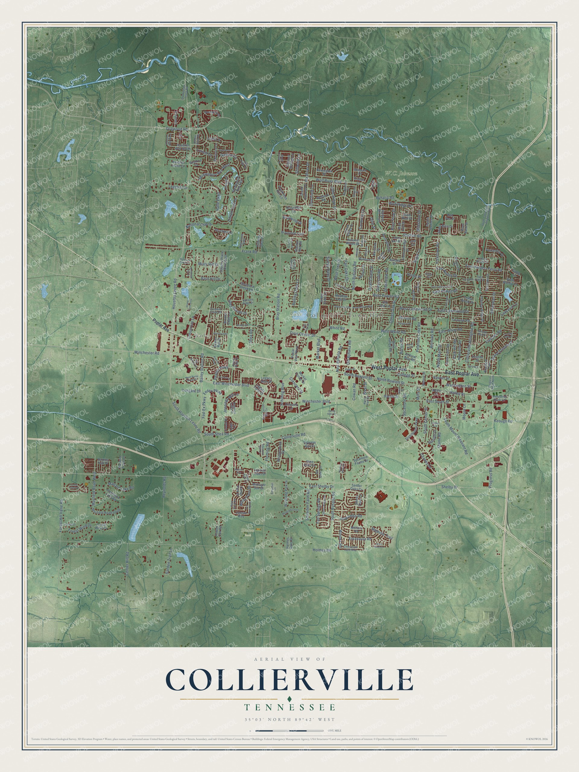
Collierville, Tennessee Map Art
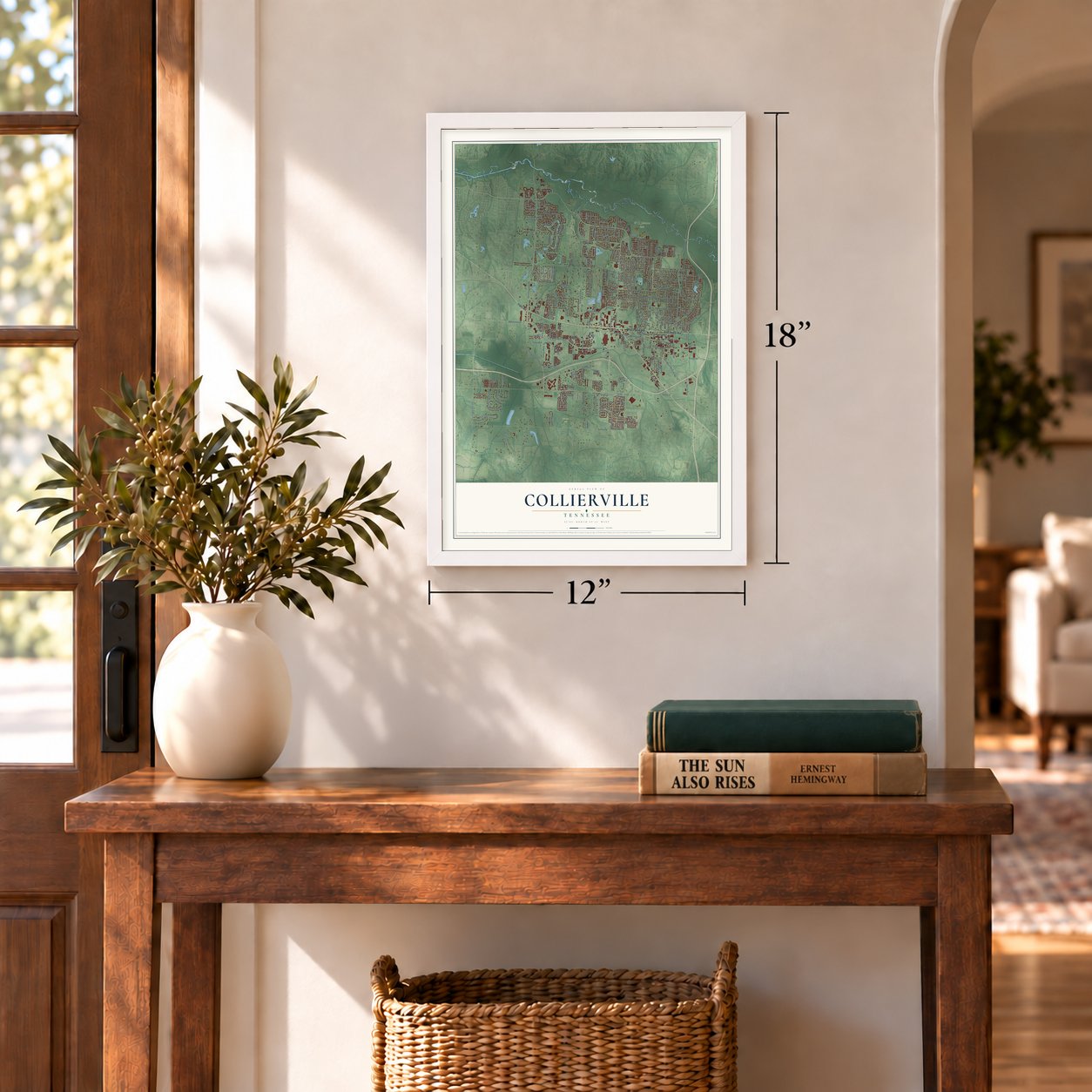
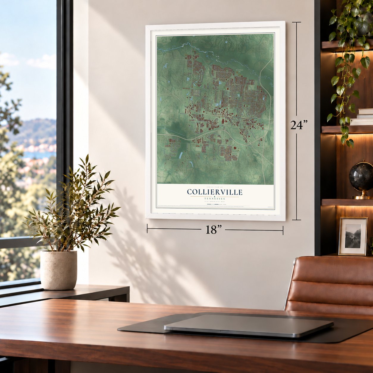
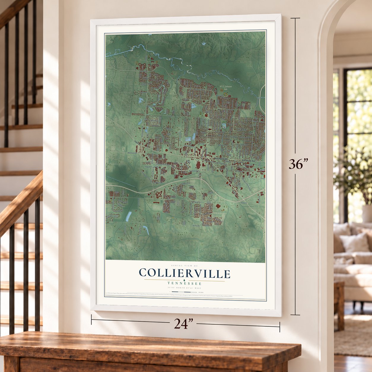
A new map of Collierville, Tennessee, made in 2026 and printed to order on thick archival matte paper.
12" x 18" Archival Matte Print
A Map of Home. A Work of Art.
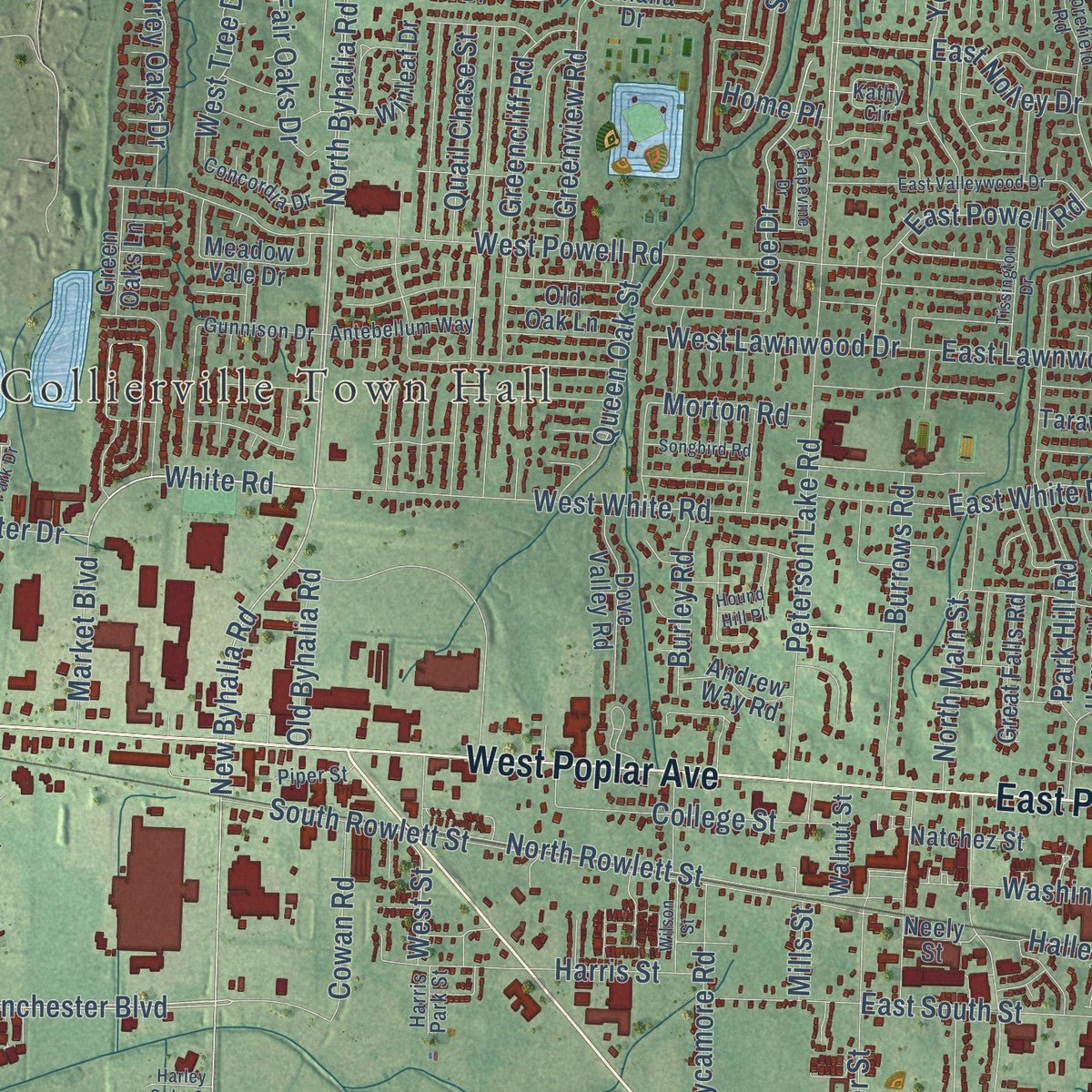
Explore Collierville, Tennessee from a whole new perspective. Created using aerial imagery and detailed geographic data, this map captures Collierville building by building, with labeled streets, familiar landmarks, and shaded topographical relief that highlights the natural contours of the landscape.
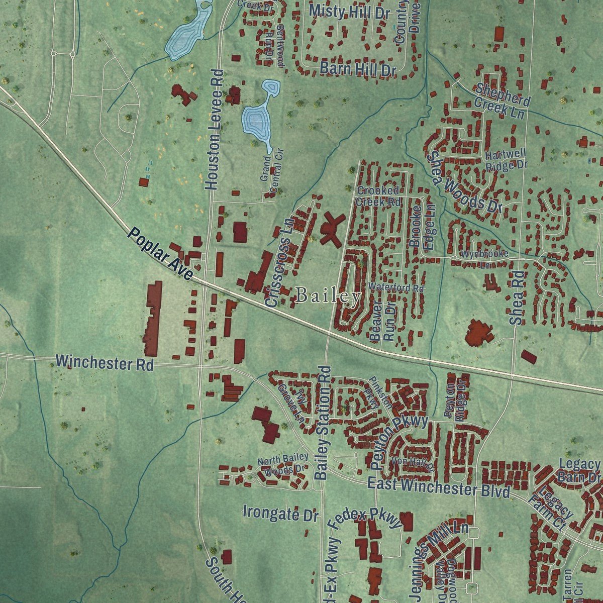
Combining modern data with the timeless character of a vintage atlas, this map is just as interesting up close as it is beautiful on the wall. Whether you grew up in Collierville, spent memorable years there, or call it home today, this unique map is a great way to celebrate a place that means something to you. Zoom in on the preview to look for your street, and then order a print to put your memories on the wall.
Three ways to hang it
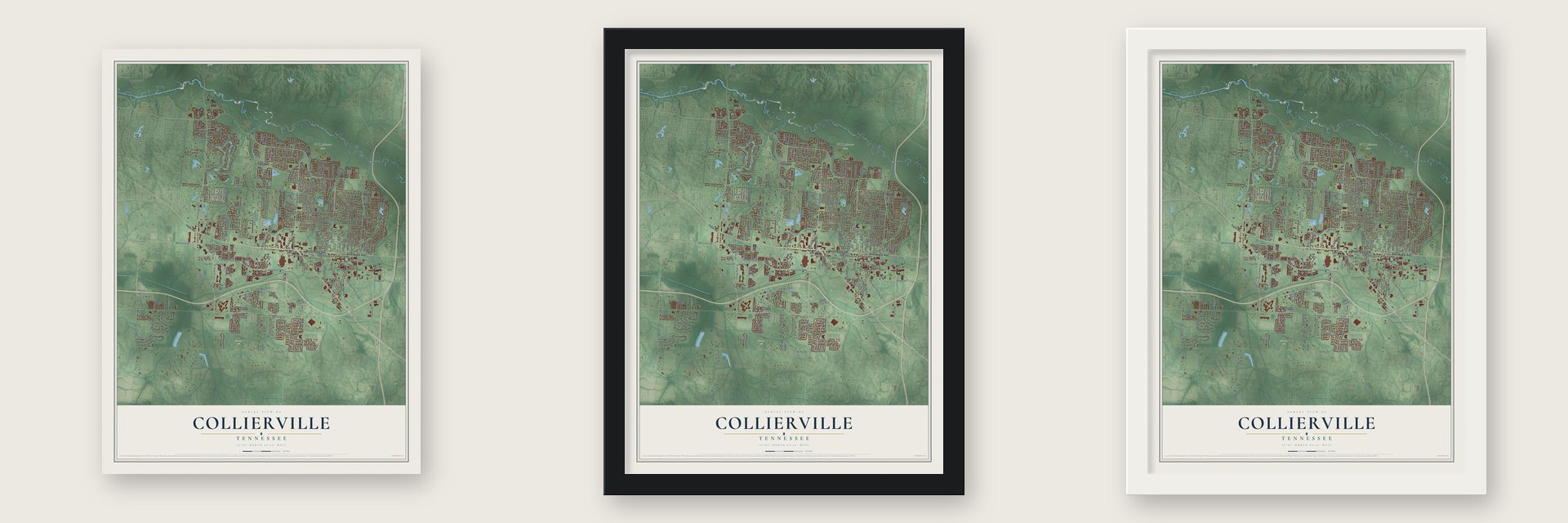
Unframed archival matte, a black wood frame or a white wood frame.
Up close
Geography Worth Displaying
This map was created using accurate cartographic data and authoritative geographic sources, including the U.S. Geological Survey and the Census Bureau. The map brings together terrain, waterways, roads, and building detail. The majority of the streets are labeled, houses are accurately depicted, and the topography is derived from government sources. Combining local data with carefully composed color and shading leads to this beautifully detailed Collierville artwork for your wall.
Rather than simply showing street outlines, we’ve included as many of the street names as we could reasonably fit on the map while keeping their names legible. Zoom in on the high resolution preview to see exactly what’s on the map. We truly set out to create a statement piece for anyone who loves Collierville. So whether it’s for you, or a gift for someone you love, we hope this map of Collierville brings back fond memories.
Read the story behind this map of Collierville, Tennessee from 2026.

About Collierville, Tennessee
Collierville is a town of 51,324 people in Shelby County, a suburb of Memphis. Jesse R. Collier, a businessman, bought land here in 1836, laid out a town and promoted it under the name "The Town of Collier." Its first charter came in 1850, while Richard Ramsey was mayor.
Union and Confederate troops fought over the town's railroad twice in 1863, and the war wiped out the original settlement. Collierville was chartered again in 1870, under Mayor James B. Abington. It grew back on cotton, dairy farming and manufacturing.
“Collierville is a very handsome town in the southeast corner of the county, on the Memphis and Charleston Railroad, and is the second in rank in Shelby county.”
- Two battles in 1863On October 11, 1863, Confederate Brigadier General James Chalmers rode in with 3,000 cavalrymen to strike the Union troops guarding the Memphis and Charleston Railroad. Major General William T. Sherman was there, and the garrison drove them off. Chalmers tried again on November 3, 1863, lost to Colonel Edward Hatch and pulled back to North Mississippi, so the line stayed open to Tuscumbia, Alabama. Colliersville appears among the battles on Sherman's monument in Washington, D.C.
- Fair on the Square since 1976Every May the town holds the Fair on the Square, which has run each year since 1976, along with Symphony in the Rose Garden. In 2014 Parade picked Collierville's historic town square as the "Best Main Street" in America.
- A town library since 1956The town opened its first library in 1956, stocked with three thousand books, but even with additions the building could not hold the growing collection. In March 2001 a new Burch Library, named for Lucius E. and Elsie C. Burch Jr., opened beside the town hall.
Find your street
Names on the Collierville map
Every name below is printed on this map. Look for your street, your school, the park where you played, or the pond down the road.
Places and landmarks5
- Collierville Town Hall
- Bailey
- Halle Park
- Hinton Park
- W.C. Johnson Park
Streets and roads280
- West Poplar Avenue
- East Poplar Avenue
- Wolf River Boulevard
- East Winchester Boulevard
- South Shea Road
- Dogwood Road
- White Road
- South Houston Levee Road
- Shea Road
- Market Boulevard
- River Pine Drive
- North Byhalia Road
- Stillwind Lane
- Houston Levee Road
- East Harpers Ferry Road
- Civic Center Drive
- Joe Drive
- Winchester Boulevard
- New Byhalia Road
- Irongate Drive
- South Byhalia Road
- Peterson Lake Road
- East Shelby Drive
- Winchester Road
- Holmes Road
- Bailey Station Road
- Frank Road
- Shelton Road
- Bray Station Road
- Sycamore Road
Show all 280 streets
- Halle Parkway
- South Mount Pleasant Road
- Fleming Road
- Collierville Arlington Road
- Collierville Road
- Quinn Road
- Forest Hill Irene Road
- West Powell Road
- Progress Road
- Fletcher Road
- South Rowlett Street
- Keough Road
- Fedex Parkway
- Peyton Parkway
- West White Road
- Byhalia Road
- Fed-Ex Parkway
- Reynolds Road
- North Rowlett Street
- East South Street
- Greenview Road
- East Lawnwood Drive
- South Center Street
- Washington Street
- North Main Street
- Burrows Road
- Yorktown Road
- John Ridge Drive
- Lancelot Lane
- Grand Steeple Drive
- Wolf Ridge Drive
- Center Hill Road
- Estanaula Road
- Schilling Boulevard
- Forest Wind Drive
- Rolling Oaks Lane
- Shrewsbury Run West
- Dibrell Trail Drive
- East Powell Road
- East Nolley Drive
- Mayfield Road West
- Harris Street
- Itawamba Road
- Legends Drive
- Winoka Road
- Sugar Lane
- Gallina Circle
- College Street
- East White Road
- Silverman Drive
- Shea Woods Drive
- Queen Oak Street
- National Club Drive
- Snowden Farm Road
- Shelby Drive
- Greencliff Road
- West Lawnwood Drive
- Jennings Mill Lane
- Chaney Drive
- Fall Springs Road
- Halley Street
- Garden Trail Lane
- Majestic Trail
- Surrey Oaks Drive
- White Pass Drive
- Quail Chase Street
- Crisscross Lane
- Park Hill Road
- Cowan Road
- Crescent Street
- Old Byhalia Road
- Mallard Lake Road
- Misty Hill Drive
- Milestone Drive
- Burley Road
- Fair Oaks Drive
- West Tree Drive
- Barn Hill Drive
- Courtfield Lane
- Morton Road
- Lonhill Drive
- Braywind Drive
- Carmony Cv
- Elk River Drive
- West Street
- Ollie Street
- Home Place
- Liles Lane
- Moore Lane
- Mills Street
- Poplar Avenue
- Belle Watley Lane
- Poplar View Parkway
- Gable Lane
- Denali Park Drive
- Brooke Edge Lane
- Planters Ridge Drive
- Midnight Sun Drive
- Shrewsbury Run East
- Windsong Park Drive
- Green Oaks Lane
- Beaver Run Drive
- Laurel Lane
- Verlington Drive
- Mayfield Road South
- Preakness Run Lane
- Plantation Lake Road
- Country Place Drive East
- Simmonsridge Drive
- Market Center Drive
- Dove Valley Road
- Starlight Drive
- Distribution Parkway
- Deloach Lane
- Planters Trace Lane
- Grand Cypress Drive
- Braystone Trail
- Alexandria Drive
- Whisperwood Drive
- Cypress Springs Lane
- Squire Dudney Drive
- Autumn Winds Drive
- Houston Way South
- Ten Oaks Drive
- Sycamore Farms Drive
- Sweet Rain Drive
- Tender Oaks Cv
- Hunters Mill Trail
- Cedar Brook Drive
- Great Falls Road
- Creek Valley Drive
- Taraview Road
- Brado Drive
- Rowen Oak Road
- Winleaf Drive
- Homeville Road
- Winford Drive
- Houston Levee Cv
- Wincreek Drive
- Swynford Lane
- Shepherd Creek Lane
- Fairway Glen Drive
- River Bank Drive
- Stratfield Drive
- Bradford Trail
- Penhurst Drive
- Welbeck Road
- Holmes Oaks Drive
- Juneau Way
- Newington Street
- Andrew Way Road
- Nine Oaks Lane
- Stanton Hall Road
- Old Oak Lane
- Laura Ann Drive
- Natchez Street
- Duscoe Street
- Industrial Park Lane
- Ashana Drive
- Walnut Street
- Winburn Drive
- Brayridge Cv
- Silver Wolf Drive
- Forest Wind Cv
- Meadow Vale Drive
- Bushrod Cv
- Six Oaks Lane
- Fossil Place
- Cypress Run Drive
- Smoky Oaks Lane
- Legacy Farm Court
- Harvest Oaks Drive
- Military Road
- Red Sea Drive
- Barkley Hall Drive
- Briston Lane
- Legacy Barn Drive
- Wolf Lair Drive
- Tartan Lane
- Neely Street
- Lago Lane
- Joel Cv
- Brooks Bend Road
- Ivy Grove Lane
- Concordia Drive
- Crooked Creek Road
- Moorefield Road
- Lake Page Drive
- Linkenholt Drive
- Old Houston Levee Road
- West Tarren Mill Circle
- Center Ridge Road
- South Collierville Arlington Road
- Shoal Creek Lane
- Antebellum Way
- Autumn Oaks Circle
- Pilot Rock Road
- Winrose Drive
- Gunnison Drive
- Chickasaw Land Way
- Houston Way West
- Chestnut Hill Drive
- Dogwood Valley Drive
- West Levee Oaks
- Fox Springs Drive
- Progress Road North
- Autumn Run Drive
- Beckenhall Street
- Piper Street
- Ashton Woods Court
- Tara Oaks Drive
- Mintmere Drive
- Hartwell Ridge Drive
- Carousel Lane
- Peyton Ridge Drive
- Kathy Circle
- Grayson Street
- Jasper Park Lane
- Harris Park Street
- Wynbrooke Lane
- East Valleywood Drive
- Pinkston Parkway
- Meadowbirch Lane
- Landing Party Lane
- Tissington Drive
- Crosswinds Way
- Herbers Drive
- Von Hall Drive
- Southern Home Road
- Bentwood Creek Drive
- Dymoke Drive
- Songbird Road
- North Bailey Woods Drive
- Waterford Road
- Hound Hill Place
- Grapevine Drive
- Forest Island Drive
- Wilson Street
- Fairwoods Drive
- Grand Central Circle
- Sterling Drive
- Bentwood Run Drive
- Halle Park Drive
- East Lake Pointe Drive
- Amber Waves Lane
- Winsail Drive
- Aniston Way
- Harley Oaks Cv
- Cannon Avenue
- Blair Circle
Names are listed as they appear on the printed map. Zoom into the product photos to find them.
The art of mapping a place
How This Map Was Made
Real places. Remarkable detail. Discover the layers that turn geographic data into a map of home.

The view from above
Aerial imagery reveals the character of the land: woodland, open fields, and the patterns of a place.

The shape of the land
Elevation data brings hills, valleys, and subtle changes in the landscape into view.

The details of home
Roads, waterways, and building footprints come together to make the map feel unmistakably local.

Geography becomes art
Considered color, shading, and typography bring the layers together in a map made for your wall.


Process illustrated with Mendon, Massachusetts. Aerial imagery: USDA NAIP. Terrain: USGS 3D Elevation Program. Map details and finished artwork: KNOWOL.
The Details
About This Print
Choose an archival matte print, or a black or white Ayous wood frame. The archival matte print is unframed.
Select your size and finish above to see the matching product image and price.
Materials & Craftsmanship
A contemporary map with the character of a classic atlas, printed on archival matte paper. Optional frames are made from Ayous wood.
Your printed map does not include the watermark shown in the full-map preview.
Shipping & Delivery
Free shipping within the United States. Every print is made to order in the USA.
Buying a gift? Add a note in your cart and we'll include it. We never put prices in the package.
Prints ship within 2 to 3 business days. Allow 7 to 10 days total from ordering for delivery. Timing may vary during holidays or periods of high order volume.
Read our shipping policy.
Returns and damaged prints
Each print is made to order. Change-of-mind refunds are not available after production.
If your print arrives damaged, misprinted or incorrect, contact support@knowol.com within 30 days of receiving it. Include your order number, photos and a description of the issue.
Read our full refund and replacement policy. For questions about your order, email support@knowol.com.
Find your town
Looking for another city?
Find a map of home in our Tennessee collection, or any town in the country.
Nearby
Maps of towns near Collierville
Know someone from one of these towns? Their map makes a great gift.
 Piperton
, Tennessee
From $39.99See the map
 Germantown
, Tennessee
From $39.99See the map
 Rossville
, Tennessee
From $39.99See the map
More maps nearby: Arlington, Bartlett, Lakeland, Oakland and Memphis.