
Search for another town


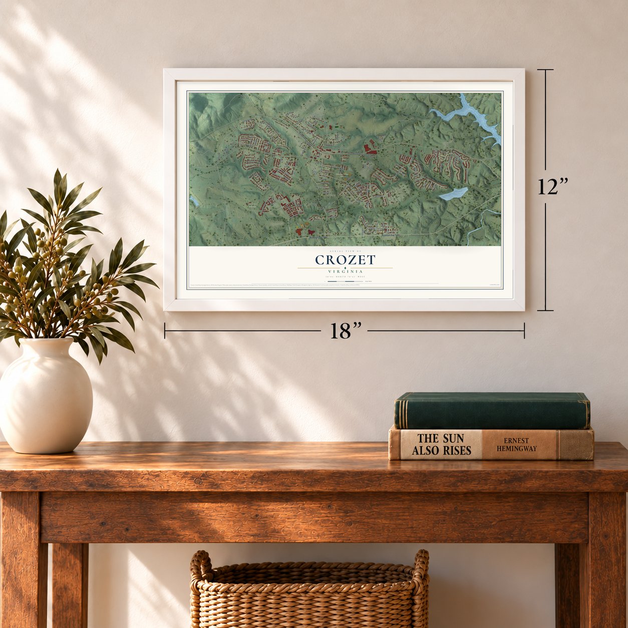

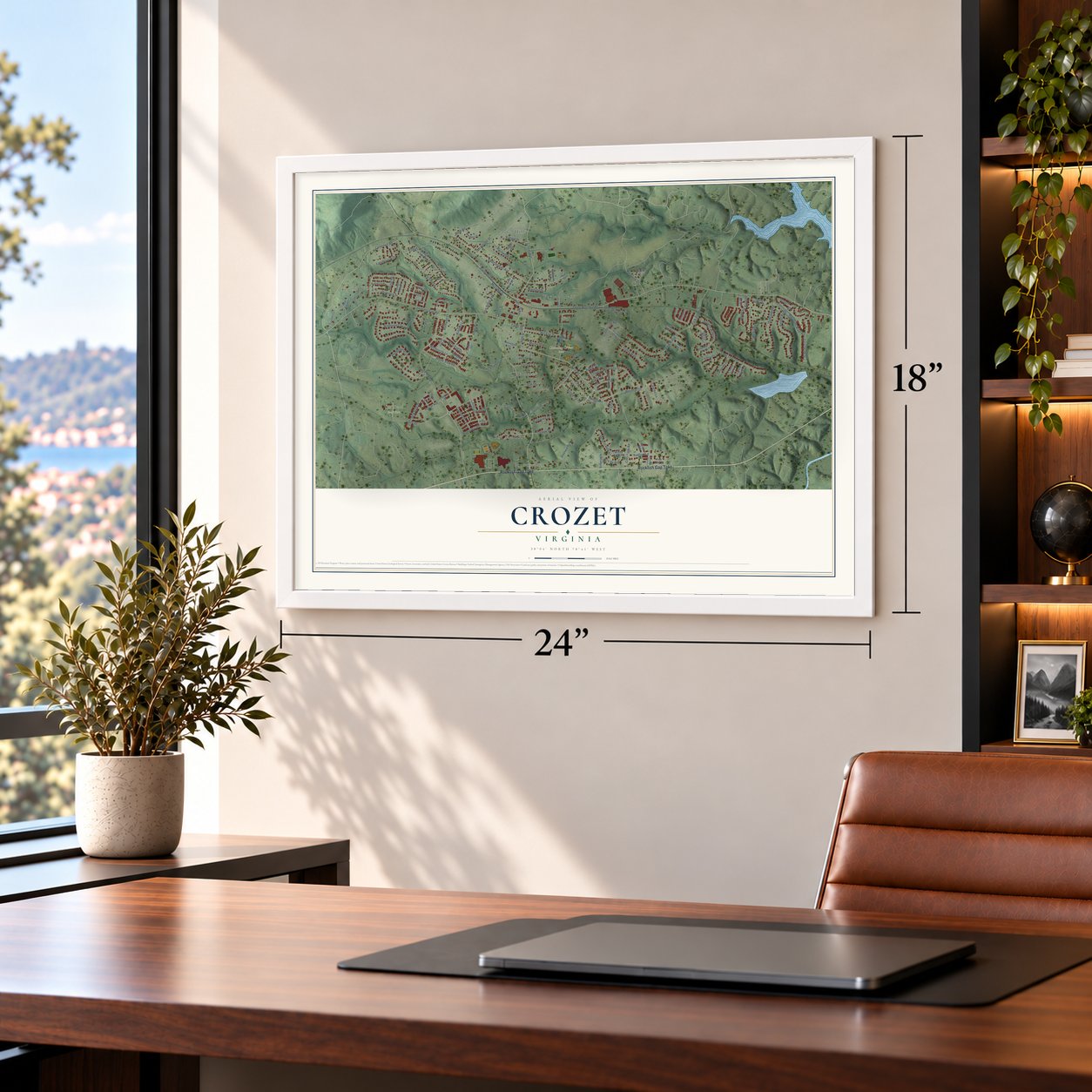

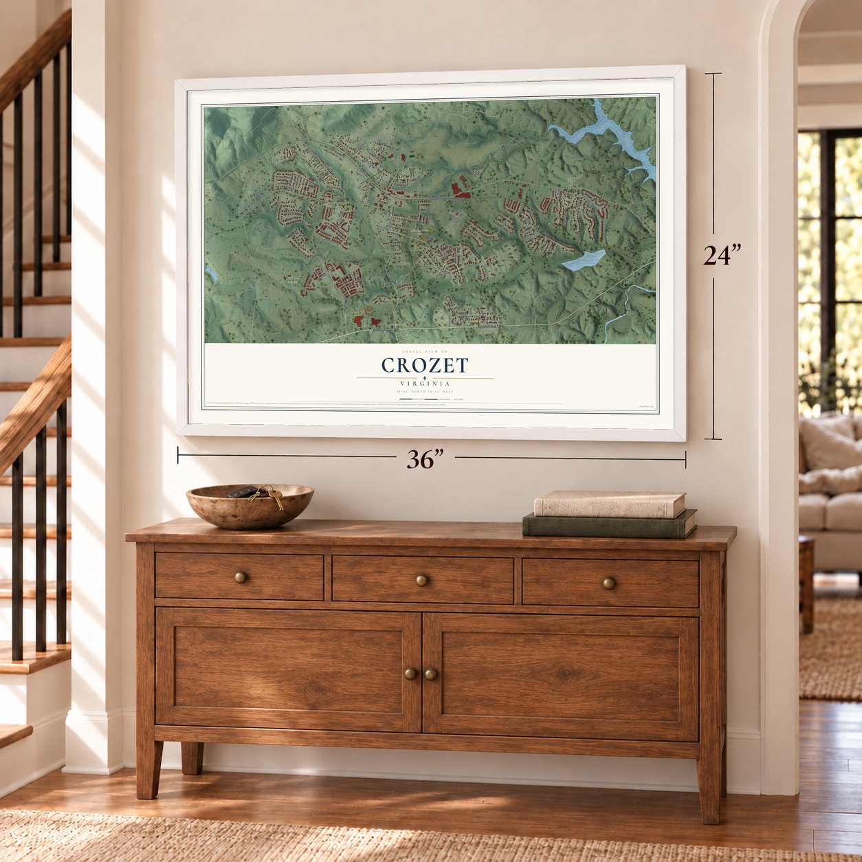

Free U.S. delivery 7 to 10 days after you order
Crozet, Virginia Map Art
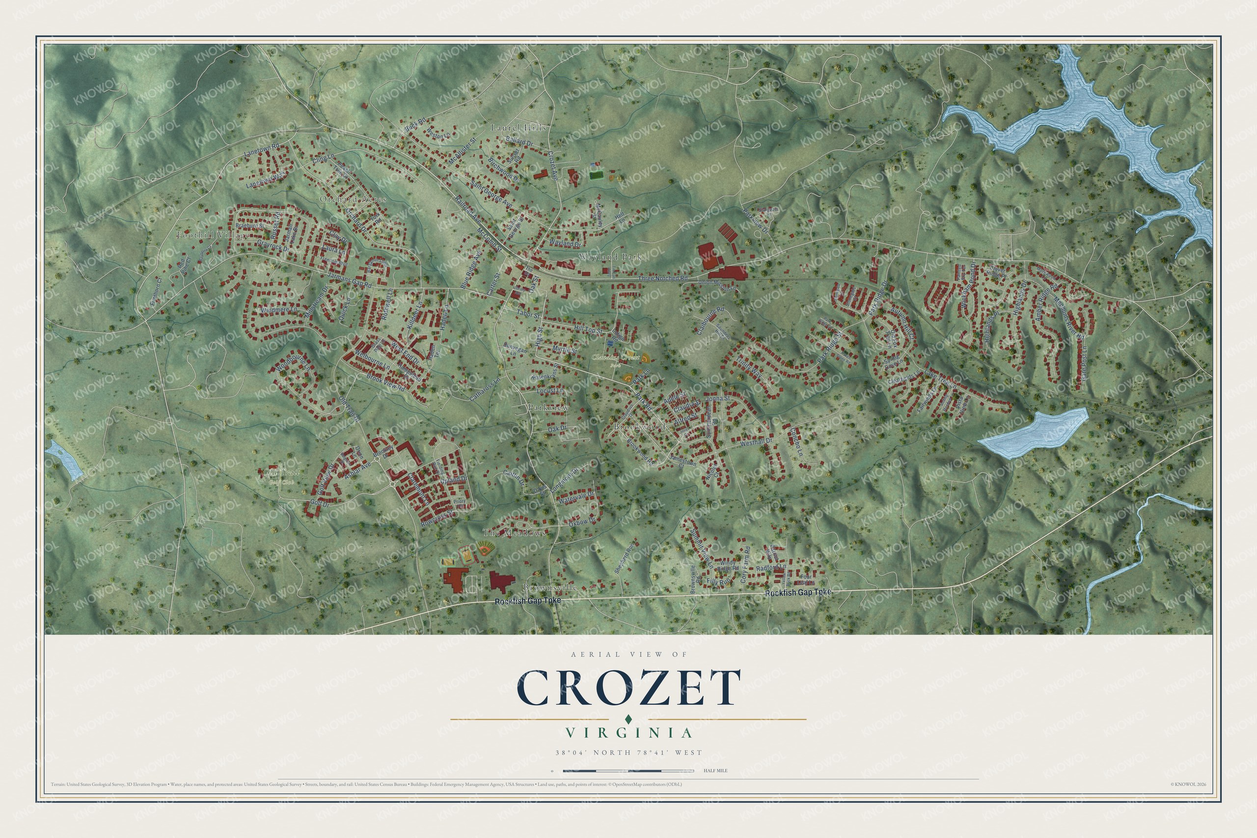
A new map of Crozet, Virginia, made in 2026 and printed to order on thick archival matte paper.
12" x 18" Archival Matte Print
A Map of Home. A Work of Art.
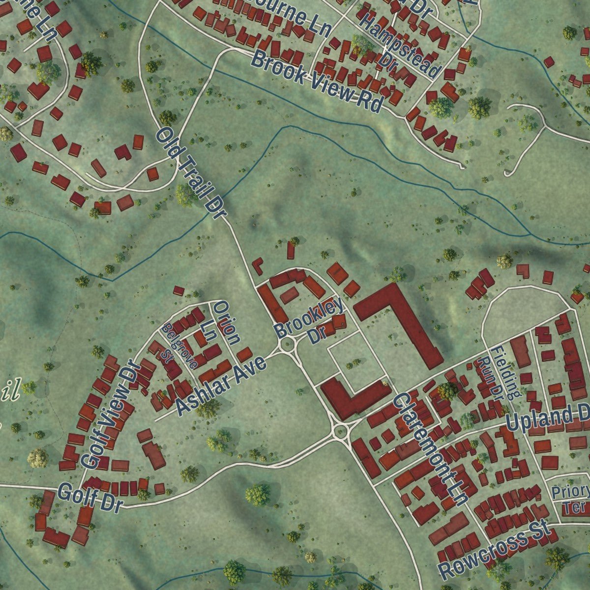
Explore Crozet, Virginia from a whole new perspective. Created using aerial imagery and detailed geographic data, this map captures Crozet building by building, with labeled streets, familiar landmarks, and shaded topographical relief that highlights the natural contours of the landscape.
Combining modern data with the timeless character of a vintage atlas, this map is just as interesting up close as it is beautiful on the wall. Whether you grew up in Crozet, spent memorable years there, or call it home today, this unique map is a great way to celebrate a place that means something to you. Zoom in on the preview to look for your street, and then order a print to put your memories on the wall.
Three ways to hang it
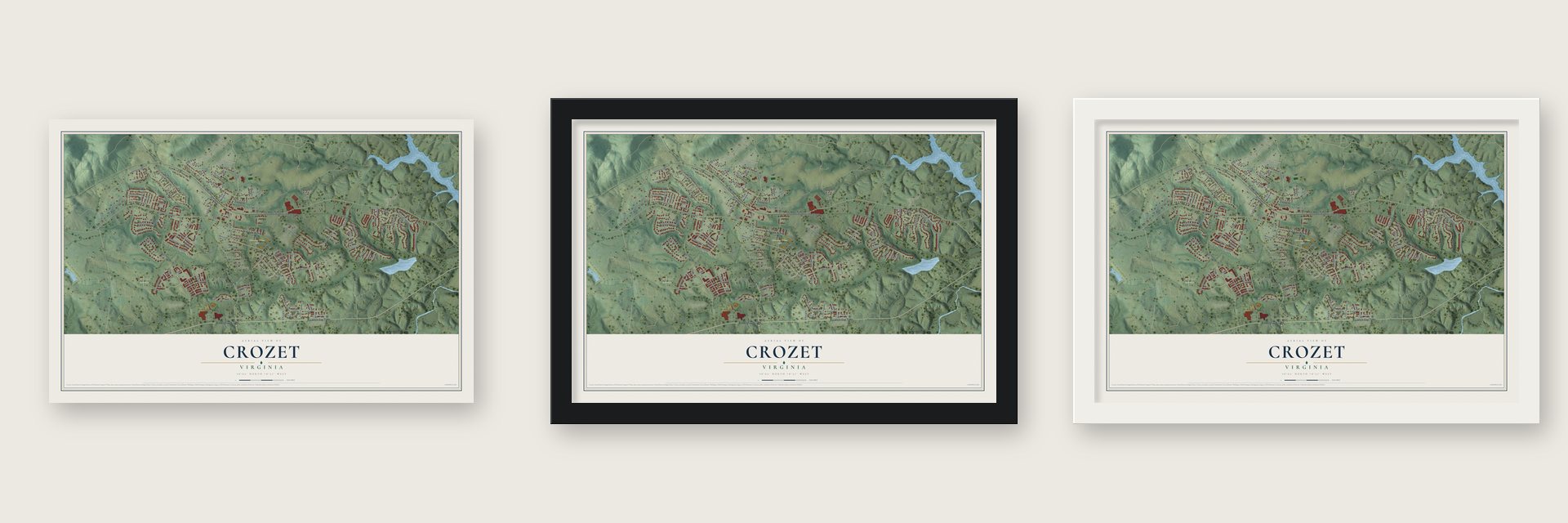
Unframed archival matte, a black wood frame or a white wood frame.
Up close
Geography Worth Displaying
This map was created using accurate cartographic data and authoritative geographic sources, including the U.S. Geological Survey and the Census Bureau. The map brings together terrain, waterways, roads, and building detail. The majority of the streets are labeled, houses are accurately depicted, and the topography is derived from government sources. Combining local data with carefully composed color and shading leads to this beautifully detailed Crozet artwork for your wall.
Rather than simply showing street outlines, we’ve included as many of the street names as we could reasonably fit on the map while keeping their names legible. Zoom in on the high resolution preview to see exactly what’s on the map. We truly set out to create a statement piece for anyone who loves Crozet. So whether it’s for you, or a gift for someone you love, we hope this map of Crozet brings back fond memories.
Read the story behind this map of Crozet, Virginia from 2026.

About Crozet, Virginia
Crozet is a community of 9,224 people in Albemarle County, about 12 miles west of Charlottesville. It began as a railroad stop called Wayland's Crossing, a few yards from Pleasant Green, the Ficklin-Wayland Farm. In 1870 the stop took the name of Colonel Claudius Crozet, the French-born engineer who led the building of the Blue Ridge Tunnel. He is said to have stayed at Pleasant Green while he surveyed this land.
The town grew into a depot where growers shipped the apples and peaches from the surrounding orchards. In 1953 Morton Frozen Foods opened its flagship plant in Crozet, and it stayed until the late 1990s. ConAgra Foods, which owned the brand, shut the plant in 2000, and more than 600 workers lost their jobs. New tenants later filled the building, including Starr Hill Brewery, which moved over from Charlottesville in 2006.
- A growth plan in 2001Albemarle County kept 95% of its land rural but chose Crozet as a place for new housing. In 2001 the Board of Supervisors adopted the Crozet Master Plan, which let a town of about 3,000 grow past 12,000 by the 2020s. More than a thousand residents signed a petition asking the county to plan fewer homes. Growth came anyway: Crozet passed 7,000 people in 2007, and the 2020 census counted 9,224.
- Noah's ark in 2007Parts of the comedy Evan Almighty were filmed in Crozet. The crew built the film's ark and the set for Evan's neighborhood on land across from Western Albemarle High School. After filming ended, that ground became Old Trail, now a popular housing subdivision.
- A library in the depotThe Chesapeake and Ohio Railway built a depot in Crozet in 1923, and years later the old station became home to the Crozet Library. The library has since moved into a newer building, the Crozet/Western Albemarle Library.
- Mrs. Murphy's hometownThe author and activist Rita Mae Brown set her mystery novels, known as the Mrs. Murphy series, in Crozet, so readers across the country know the town by name.
Find your street
Names on the Crozet map
Every name below is printed on this map. Look for your street, your school, the park where you played, or the pond down the road.
Places and landmarks10
- Foothill Village
- Orchard Acres
- Claudius Crozet Park
- Old Trail Golf Club
- Brookwood
- Brownsville
- Laurel Hills
- Parkview
- The Meadows
- Wayland Park
Streets and roads133
- Rockfish Gap Turnpike
- Park Road
- High Street
- Railroad Avenue
- Old Trail Drive
- Grayrock Drive
- Radford Lane
- Golf Drive
- Crozet Avenue
- Lanetown Road
- Hill Top Street
- Three Notched Road
- Jarmans Gap Road
- Saint George Avenue
- Orchard Drive
- Lake Tree Lane
- Westhall Drive
- Woodbourne Lane
- Rowcross Street
- Amber Ridge Road
- Welbourne Lane
- Mechums River Road
- Cling Lane
- Jonna Street
- Claremont Lane
- Highlands Drive
- Brook View Road
- Killdeer Lane
- Park Ridge Street
- Haden Lane
Show all 133 streets
- Park Ridge Drive
- Gate Post Lane
- Wickham Pond Drive
- Oxbow Drive
- West End Drive
- Golf View Drive
- Oak Drive
- McComb Street
- Upland Drive
- Lanetown Way
- Cathaross Lane
- Summit View Lane
- Claibourne Road
- Autumn Hill Court
- Blue Ridge Avenue
- Parkview Drive
- Highlands Place
- Quick Lane
- Caitlin Drive
- Wayland Drive
- Buck Road
- McAllister Street
- Longmont Drive
- Carter Street
- Trinity Way
- Ballard Drive
- Millstream Drive
- Birchwood Drive
- Cory Farm Road
- Concho Lane
- Windmere Lane
- Rothwell Lane
- Clay Drive
- Ashlar Avenue
- Locust Lane
- Watervale Drive
- Laura Lane
- Alfred Street
- Tabor Street
- Myrtle Street
- Adele Street
- Filly Run
- Claudia Street
- Russet Road
- Park Lane
- Oak Street
- Brookwood Road
- Peach Tree Drive
- Brownsville Road
- Union Mission Lane
- Shepherd Run
- Hampstead Drive
- Summerdean Road
- Fairwinds Lane
- Braeburn Street
- Saint George Street
- Firethorn Court
- Rosenkrans Street
- Red Pine Court
- Sunset Road
- Weston Lane
- Jarman Lake Drive
- Clearfields Lane
- Spring Cove Lane
- Windy Ridge Road
- Old Fox Trail Lane
- Jamestown Court
- Four Leaf Lane
- Clover Ridge Place
- Dunvegan Lane
- McCauley Street
- Haden Terrace
- Vista View Lane
- Brookley Drive
- Orion Lane
- York Road
- Indigo Road
- Patriot Way
- Nicolet Court
- Davis Street
- Helt Lane
- Fielding Run Drive
- Claudius Drive
- Bargamin Loop
- Saunders Hill Drive
- Freedom Boulevard
- Morewood Lane
- Grass Dale Lane
- Stonegate Court
- Stargazer Lane
- Priory Terrace
- Painted Sky Terrace
- The Square
- Stonegate Lane
- Yellow Brick Road
- Raven Stone Road
- Bayberry Court
- Park Ridge Court
- Tin Can Alley
- Rolling Meadow Lane
- Belgrove Street
- Library Avenue
- Joliet Court
Names are listed as they appear on the printed map. Zoom into the product photos to find them.
The art of mapping a place
How This Map Was Made
Real places. Remarkable detail. Discover the layers that turn geographic data into a map of home.

The view from above
Aerial imagery reveals the character of the land: woodland, open fields, and the patterns of a place.

The shape of the land
Elevation data brings hills, valleys, and subtle changes in the landscape into view.

The details of home
Roads, waterways, and building footprints come together to make the map feel unmistakably local.

Geography becomes art
Considered color, shading, and typography bring the layers together in a map made for your wall.


Process illustrated with Mendon, Massachusetts. Aerial imagery: USDA NAIP. Terrain: USGS 3D Elevation Program. Map details and finished artwork: KNOWOL.
The Details
About This Print
Choose an archival matte print, or a black or white Ayous wood frame. The archival matte print is unframed.
Select your size and finish above to see the matching product image and price.
Materials & Craftsmanship
A contemporary map with the character of a classic atlas, printed on archival matte paper. Optional frames are made from Ayous wood.
Your printed map does not include the watermark shown in the full-map preview.
Shipping & Delivery
Free shipping within the United States. Every print is made to order in the USA.
Buying a gift? Add a note in your cart and we'll include it. We never put prices in the package.
Prints ship within 2 to 3 business days. Allow 7 to 10 days total from ordering for delivery. Timing may vary during holidays or periods of high order volume.
Read our shipping policy.
Returns and damaged prints
Each print is made to order. Change-of-mind refunds are not available after production.
If your print arrives damaged, misprinted or incorrect, contact support@knowol.com within 30 days of receiving it. Include your order number, photos and a description of the issue.
Read our full refund and replacement policy. For questions about your order, email support@knowol.com.
Find your town
Looking for another city?
Find a map of home in our Virginia collection, or any town in the country.
Nearby
Maps of towns near Crozet
Know someone from one of these towns? Their map makes a great gift.
 Ivy
Ivy, Virginia
From $39.99See the map
 North Garden
, Virginia
From $39.99See the map
 Afton
Afton, Virginia
From $39.99See the map
More maps nearby: Dooms, Free Union, University of Virginia, Crimora and Waynesboro.