
Search for another town





Free U.S. delivery 7 to 10 days after you order
Cypress, California Map Art
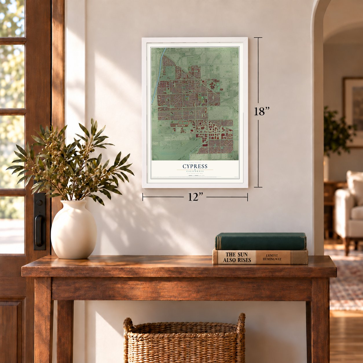
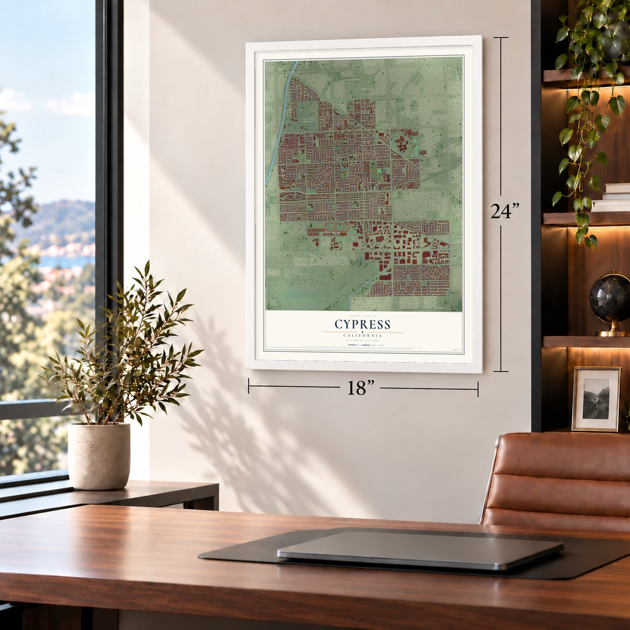
A new map of Cypress, California, made in 2026 and printed to order on thick archival matte paper.
12" x 18" Archival Matte Print
A Map of Home. A Work of Art.
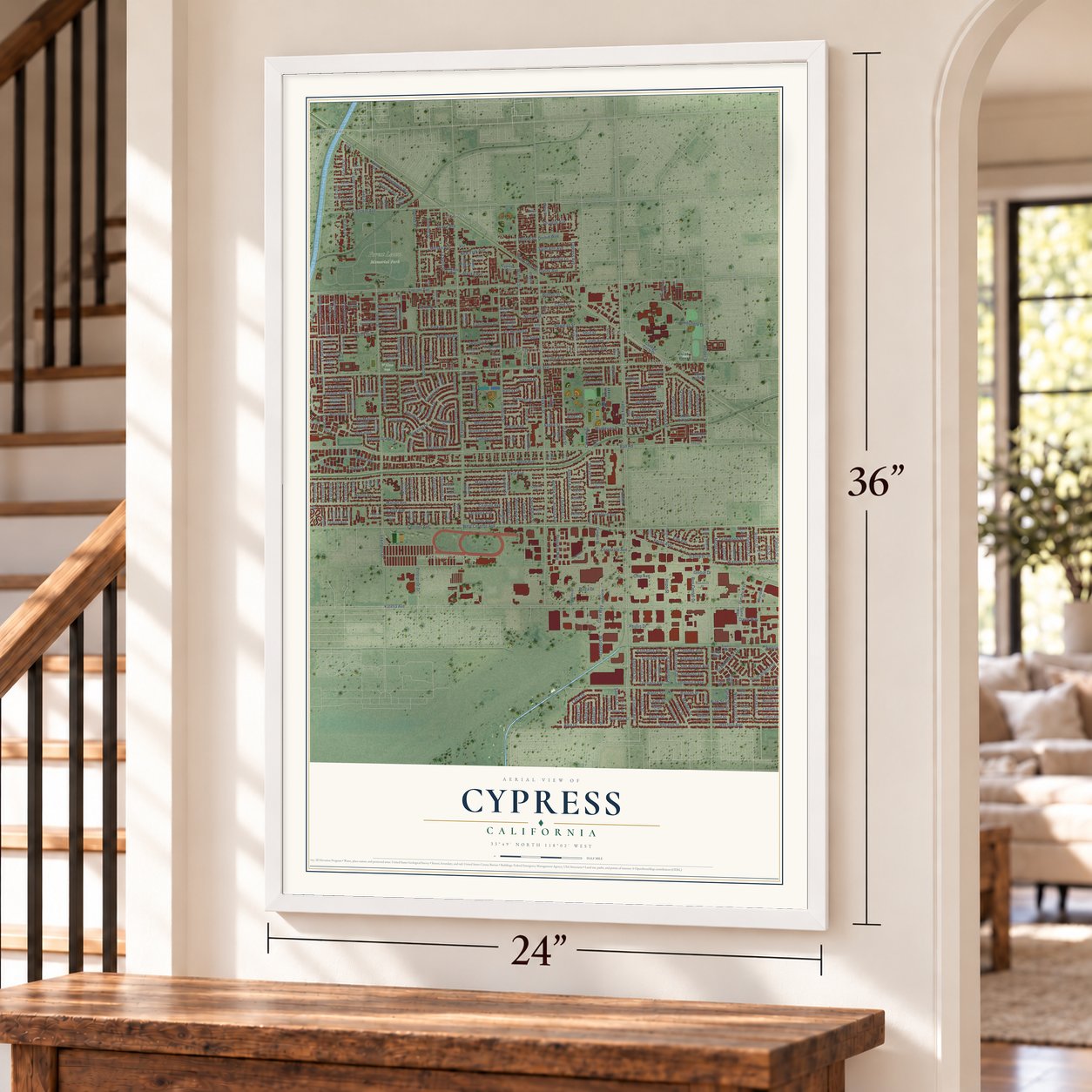
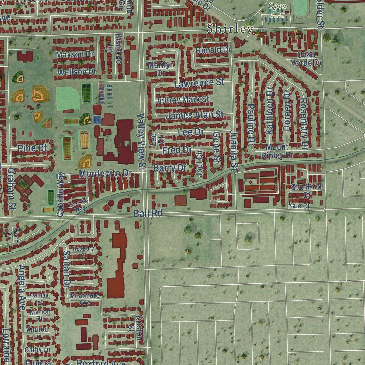
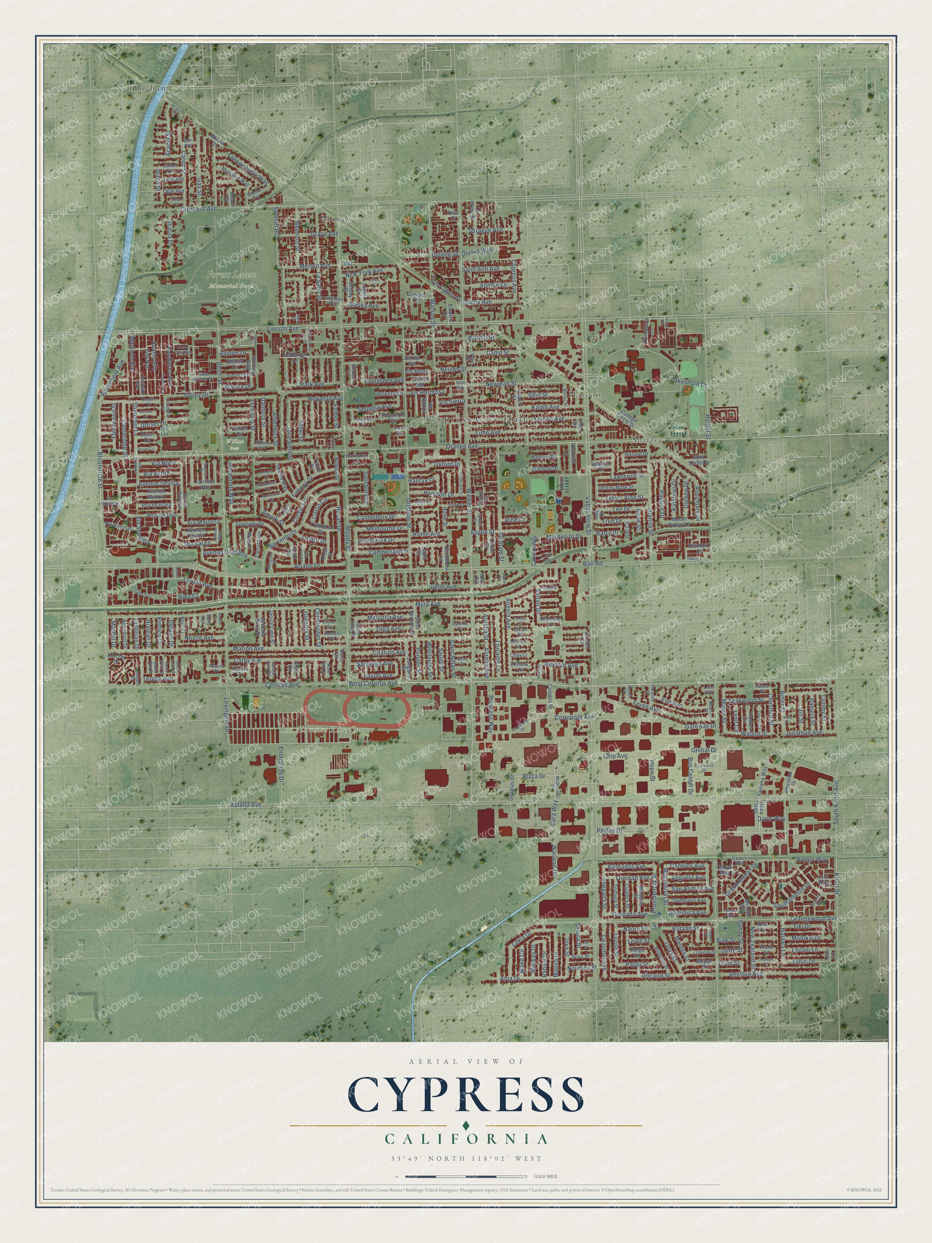
Explore Cypress, California from a whole new perspective. Created using aerial imagery and detailed geographic data, this map captures Cypress building by building, with labeled streets, familiar landmarks, and shaded topographical relief that highlights the natural contours of the landscape.
Combining modern data with the timeless character of a vintage atlas, this map is just as interesting up close as it is beautiful on the wall. Whether you grew up in Cypress, spent memorable years there, or call it home today, this unique map is a great way to celebrate a place that means something to you. Zoom in on the preview to look for your street, and then order a print to put your memories on the wall.
Three ways to hang it
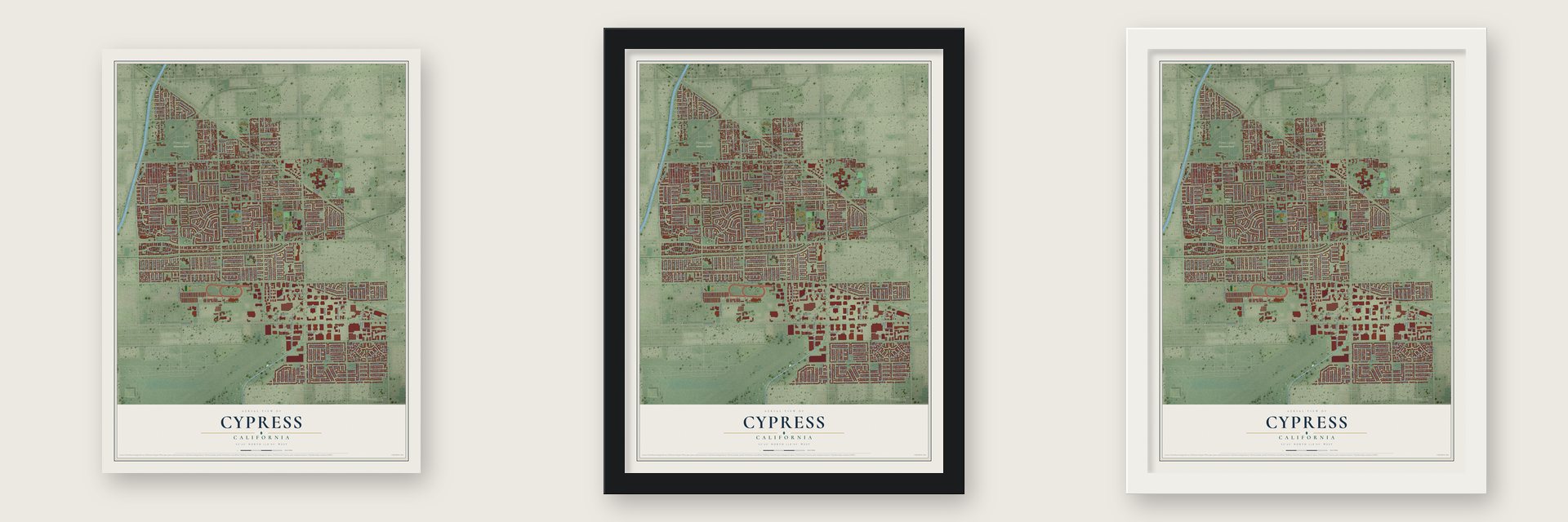
Unframed archival matte, a black wood frame or a white wood frame.
Up close
Geography Worth Displaying
This map was created using accurate cartographic data and authoritative geographic sources, including the U.S. Geological Survey and the Census Bureau. The map brings together terrain, waterways, roads, and building detail. The majority of the streets are labeled, houses are accurately depicted, and the topography is derived from government sources. Combining local data with carefully composed color and shading leads to this beautifully detailed Cypress artwork for your wall.
Rather than simply showing street outlines, we’ve included as many of the street names as we could reasonably fit on the map while keeping their names legible. Zoom in on the high resolution preview to see exactly what’s on the map. We truly set out to create a statement piece for anyone who loves Cypress. So whether it’s for you, or a gift for someone you love, we hope this map of Cypress brings back fond memories.
Read the story behind this map of Cypress, California from 2026.
About Cypress, California
Cypress is a city of 50,151 people in northwestern Orange County. So many artesian wells flowed here that the area was first nicknamed Waterville. In 1956 the local dairy farmers incorporated it as Dairy City, hoping that city status would hold off developers and save their dairies. Neighboring farmers tried the same thing in Cerritos, with Dairy Valley, and in La Palma, with Dairyland.
A year later, in 1957, residents voted to rename the city Cypress. After World War II the land had grown too valuable to farm, and through the 1960s the dairies sold out one by one to housing builders. By the 1970s none were left, and many of the dairymen had moved their herds to Chino.
“Berryfield, Benedict and Cypress are way stations on the Pacific Electric Railway northwest of Garden Grove in the order named going toward Los Angeles. Besides accommodating the local travel they form shipping points for the products of the surrounding farms, gardens and poultry yards.”
- Named for a schoolhouseCypress Elementary School went up in 1895, and cypress trees were planted around it to shield the building from the Santa Ana winds. When the Pacific Electric Railway finished its Santa Ana Line in 1906, the new station on Walker Street at Lincoln Avenue took the school's name, because Waterville was already in use elsewhere on the line. In 1957 the city took the same name.
- A birthday party since 1981In 1981 the city began throwing itself a yearly birthday celebration, the Cypress Community Festival. It now fills Oak Knoll Park, beside the Cypress Community Center on Orange Avenue, on the fourth Saturday of every July, and it may be the biggest one-day event of its kind in Orange County.
- Los Alamitos Race CourseThe racetrack known as Los Alamitos Race Course actually stands inside Cypress, even though it carries the name of the neighboring city of Los Alamitos.
Find your street
Names on the Cypress map
Every name below is printed on this map. Look for your street, your school, the park where you played, or the pond down the road.
Places and landmarks9
- Cypress City Hall
- Forest Lawn Memorial Park
- Los Alamitos Race Course
- Open Field
- Willow Park
- Bingham
- Halcon
- Moody
- Shirley
Streets and roads389
- West Cerritos Avenue
- Camp Street
- Walnut Street
- Maple Street
- Bloomfield Street
- Plaza Drive
- Chestnut Street
- Orange Avenue
- Corsica Drive
- Phyllis Drive
- Valley View Street
- Ball Road
- Lincoln Avenue
- Katella Avenue
- Cerritos Avenue
- Walker Street
- Holder Street
- Moody Street
- Myra Avenue
- Denni Street
- Marion Avenue
- Orangewood Avenue
- Crescent Avenue
- Grindlay Street
- Larwin Avenue
- Belle Avenue
- Lakeshore Drive
- South Knott Avenue
- Warland Drive
- Grand Manan Drive
Show all 389 streets
- Watson Street
- Graham Street
- Sorrento Drive
- Lime Avenue
- Cathy Avenue
- Bishop Street
- Lemon Avenue
- Julie Beth Street
- Gateway Drive
- Juanita Street
- Karen Avenue
- Sumner Place
- Christopher Street
- Rosemary Drive
- Ferne Avenue
- Reefton Avenue
- Ethel Street
- Newman Avenue
- Knott Street
- Marcella Avenue
- Elm Avenue
- Orchid Way
- Pitcairn Street
- Newman Street
- Jonathan Avenue
- Cumberland Drive
- La Salle Street
- Gregory Street
- Southampton Drive
- Hope Street
- Lakia Drive
- Pso de Oro
- Corporate Avenue
- Via Largo
- Canterbury Drive
- Bloomfield Avenue
- Belmont Street
- Gay Street
- Carob Street
- Apia Drive
- Angela Avenue
- Saint Alban Street
- Nelson Street
- Oxford Drive
- New York Avenue
- Avenue Sevilla
- Fontainbleau Way
- Ariano Drive
- Aurelia Avenue
- Aurelia Street
- Lorraine Lane
- Alaska Avenue
- Avenue Granada
- Merten Avenue
- Grace Avenue
- Evergreen Avenue
- Hanover Drive
- Cypress Avenue
- Pauline Drive
- Rome Avenue
- Saint Ann Avenue
- Delong Street
- Adams Avenue
- Ravari Drive
- Madison Avenue
- Van Buren Avenue
- Acacia Drive
- Olga Avenue
- Lexington Drive
- Citation Avenue
- Enterprise Drive
- Park Avenue
- Alderbury Street
- Cambridge Street
- Somerset Lane
- Aspen Street
- Leilani Lane
- Surrey Drive
- Firenza Drive
- Esther Street
- Sprague Avenue
- Kathleen Drive
- Providencia Street
- New Zealand Street
- Sequoia Avenue
- Brunswick Drive
- Midway Drive
- Melbourne Drive
- Lawrence Street
- Acacia Street
- Vonnie Lane
- James Alan Street
- Tuscani Drive
- Montecito Drive
- Danny Avenue
- Progress Way
- Tiki Drive
- Lee Drive
- Trinidad Avenue
- Cozumel Avenue
- Dominica Avenue
- San Andres Avenue
- Onyx Street
- Barbados Avenue
- Shirl Street
- Ritter Street
- Danbury Street
- Fernbury Street
- Fred Drive
- Normandy Way
- Teakwood Street
- Molokai Drive
- Bataan Street
- Doreen Drive
- Saratoga Avenue
- Bus Center Drive
- Grenada Avenue
- Montserrat Street
- Anegada Street
- Tahiti Drive
- Via Verde
- Luzon Street
- Nestle Avenue
- Linaro Drive
- Halawa Lane
- Rexford Avenue
- Via Sonoma
- Twin Lakes Drive
- Via Norte
- Fleetwood Street
- Anguilla Avenue
- Via Majorca
- Chip Avenue
- Saltair Drive
- Vis Hermosa
- Tammy Street
- Dina Court
- Sande Street
- Jill Street
- Pamela Street
- Java Street
- Malden Street
- Cantiles Avenue
- Darin Way
- Whirlaway Street
- Noumea Street
- Ponder Street
- Palau Street
- Breton Way
- Manila Drive
- Corso Circle
- Salisbury Lane
- Dorset Drive
- Birch Street
- Samoa Street
- Vis Real
- Teresa Avenue
- Tanforan Drive
- Hialeah Drive
- Pimlico Drive
- Delano Drive
- Mardel Drive
- Laurel Avenue
- Rainier Drive
- Blanca Drive
- Nauru Street
- Halifax Drive
- Cara Way
- Amalfi Street
- Wake Circle
- Panay Street
- Vis Sierra
- Rabaul Drive
- Global Drive
- Vnr
- Barry Drive
- Leyte Street
- Pine Court
- Biak Street
- Jaluit Street
- Lynn Circle
- Ulithi Street
- Gene Street
- Dana Way
- Fieldbrook Lane
- Douglas Drive
- Meridian Drive
- College Circle Drive
- Barbara Anne Street
- Walker Court
- Peach Street
- Polk Avenue
- Camden Drive
- Seville Way
- Mount Ripley Drive
- Jackson Avenue
- La Homa Street
- Longden Street
- Sombrero Avenue
- Cedar Court
- Janice Lynn Street
- Cabrillo Way
- Jeffrey Mark Street
- Madeira Street
- Culebra Street
- Tortuga Street
- Monique Way
- Saint Bernard Street
- Via Encinas
- Trevi Street
- Saipan Street
- Whitney Way
- Aqueduct Drive
- Tremezzo Drive
- Avenue Carmel
- Pso de Plata
- Avenue Madrid
- Yamaha Way
- Lanett Street
- Fairfield Way
- Fonte Road
- Opal Avenue
- Jade Avenue
- Carrara Circle
- Belday Street
- Miscou Way
- Hickory Circle
- Maxson Drive
- Peartree Lane
- Shasta Circle
- Wellson Drive
- Cypress Street
- Primavera Lane
- Barcelona Lane
- Rome Street
- Thomas Circle
- Lime Circle
- Edgemont Circle
- Stanford Court
- Vis del Mar
- Ronald Drive
- Harmony Lane
- Novara Lane
- Casa Verde Drive
- Lemon Circle
- Naples Drive
- Marilyn Drive
- Saint Joan Street
- Kristen Street
- Electric Street
- Cary Circle
- Vis Bonita
- Suva Street
- Willow Drive
- Noel Street
- Doris Circle
- Kiwi Circle
- Tivoli Circle
- Kent Way
- Joel Circle
- Dover Circle
- Vis del Sol
- Barclay Drive
- Elinora Lane
- Capri Circle
- Ethel Circle
- Beach Circle
- Tonga Circle
- Jekyll Way
- Riva Court
- Luau Lane
- Alice Circle
- Lee Street
- McDonnell Drive
- Forest Street
- Avenue Monterey
- Taylor Avenue
- Ashbury Avenue
- Elizabeth Court
- Mindanao Street
- Tokelau Street
- Spruce Court
- Garnet Avenue
- Florence Street
- Casa Grande Circle
- Via Entrada
- Everest Circle
- Santorini Drive
- Cynthia Circle
- Capers Way
- Simone Way
- Portofino Circle
- Nancy Street
- Lexington Street
- Embassy Way
- Stratmore Avenue
- Timaru Circle
- Santa Rita Street
- Colgate Drive
- Acacia Circle
- Via Ingresso
- Messina Circle
- Patricia Drive
- Marion Circle
- Windsor Circle
- Lipari Circle
- Mildred Lane
- Beatrice Street
- Cathy Lane
- Janice Lynn Circle
- Patricia Circle
- Rose Ann Circle
- Yale Court
- Hester Street
- Gem Avenue
- Arbor Lane
- Palm Court
- Villa Way
- Kalani Street
- Lincoln Plaza Way
- Yorkshire Drive
- Cheshire Drive
- Cobblestone Lane
- Glenbrook Street
- Santa Clara Street
- Charles Circle
- Cathy Circle
- Commerce Drive
- Beaver Circle
- Plumeria Lane
- Augusta Court
- Anticost Way
- La Jolla Way
- Abraham Avenue
- Chamois Circle
- Avenue Mateo
- Corporate Drive
- Santa Marta Street
- Eucalyptus Circle
- Ravenna Way
- William Avenue
- Sussex Circle
- Adagio Lane
- Cynthia Lane
- Roxbury Court
- Lolina Lane
- Devon Circle
- Tangier Way
- Rexford Drive
- Sowma Way
- Pearl Court
- Delano Lane
- Leone Way
- Talaud Street
- Grand Circle
- Topaz Court
- Adore Circle
- Fiji Street
- Ward Circle
Names are listed as they appear on the printed map. Zoom into the product photos to find them.
The art of mapping a place
How This Map Was Made
Real places. Remarkable detail. Discover the layers that turn geographic data into a map of home.

The view from above
Aerial imagery reveals the character of the land: woodland, open fields, and the patterns of a place.

The shape of the land
Elevation data brings hills, valleys, and subtle changes in the landscape into view.

The details of home
Roads, waterways, and building footprints come together to make the map feel unmistakably local.

Geography becomes art
Considered color, shading, and typography bring the layers together in a map made for your wall.


Process illustrated with Mendon, Massachusetts. Aerial imagery: USDA NAIP. Terrain: USGS 3D Elevation Program. Map details and finished artwork: KNOWOL.
The Details
About This Print
Choose an archival matte print, or a black or white Ayous wood frame. The archival matte print is unframed.
Select your size and finish above to see the matching product image and price.
Materials & Craftsmanship
A contemporary map with the character of a classic atlas, printed on archival matte paper. Optional frames are made from Ayous wood.
Your printed map does not include the watermark shown in the full-map preview.
Shipping & Delivery
Free shipping within the United States. Every print is made to order in the USA.
Buying a gift? Add a note in your cart and we'll include it. We never put prices in the package.
Prints ship within 2 to 3 business days. Allow 7 to 10 days total from ordering for delivery. Timing may vary during holidays or periods of high order volume.
Read our shipping policy.
Returns and damaged prints
Each print is made to order. Change-of-mind refunds are not available after production.
If your print arrives damaged, misprinted or incorrect, contact support@knowol.com within 30 days of receiving it. Include your order number, photos and a description of the issue.
Read our full refund and replacement policy. For questions about your order, email support@knowol.com.
Find your town
Looking for another city?
Find a map of home in our California collection, or any town in the country.
Nearby
Maps of towns near Cypress
Know someone from one of these towns? Their map makes a great gift.
 Los Alamitos
, California
From $39.99See the map
 Hawaiian Gardens
, California
From $39.99See the map
 La Palma
, California
From $39.99See the map
More maps nearby: Stanton, Rossmoor, Buena Park, Cerritos and Artesia.