
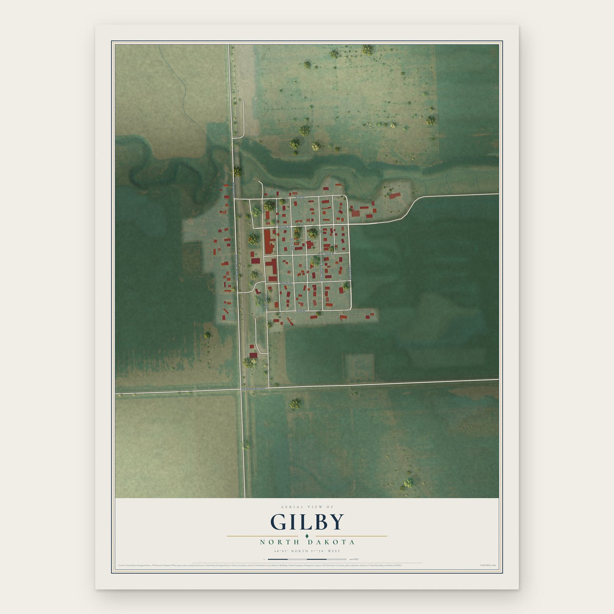


Search for another town




Free U.S. delivery 7 to 10 days after you order
Deerfield, Massachusetts Map Art
Building by building, with labeled streets and shaded relief.
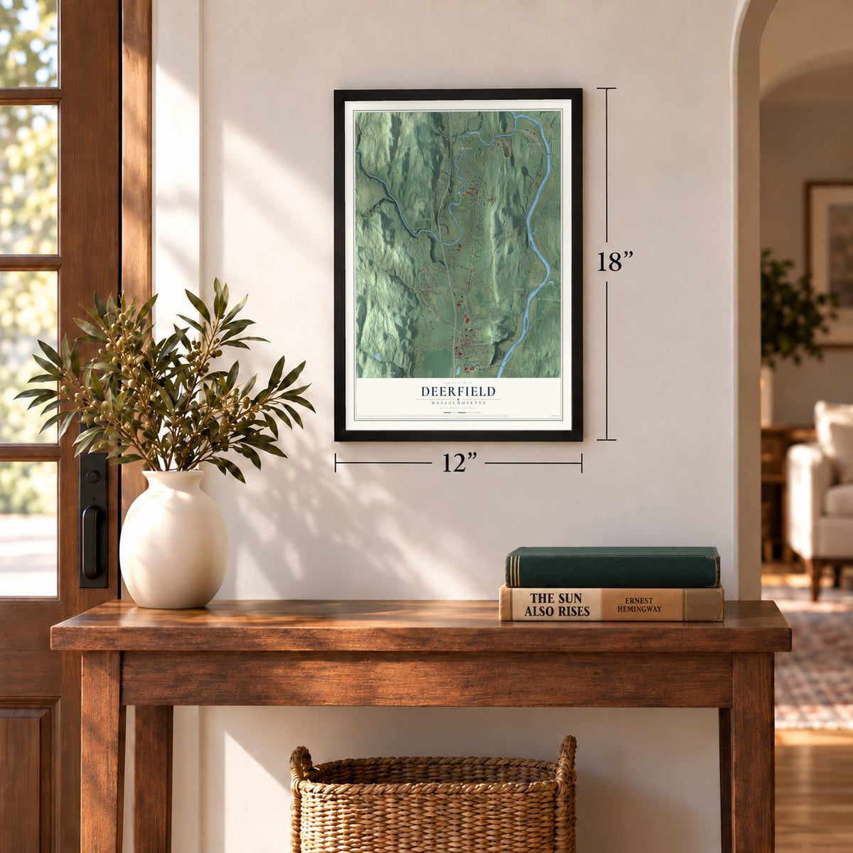
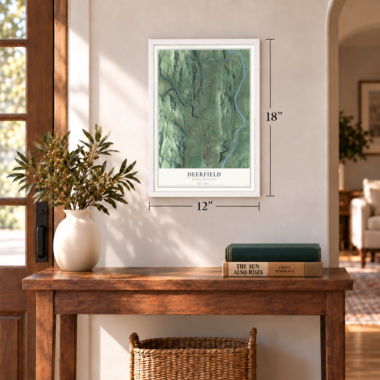
12" x 18" Archival Matte Print
A Map of Home. A Work of Art.
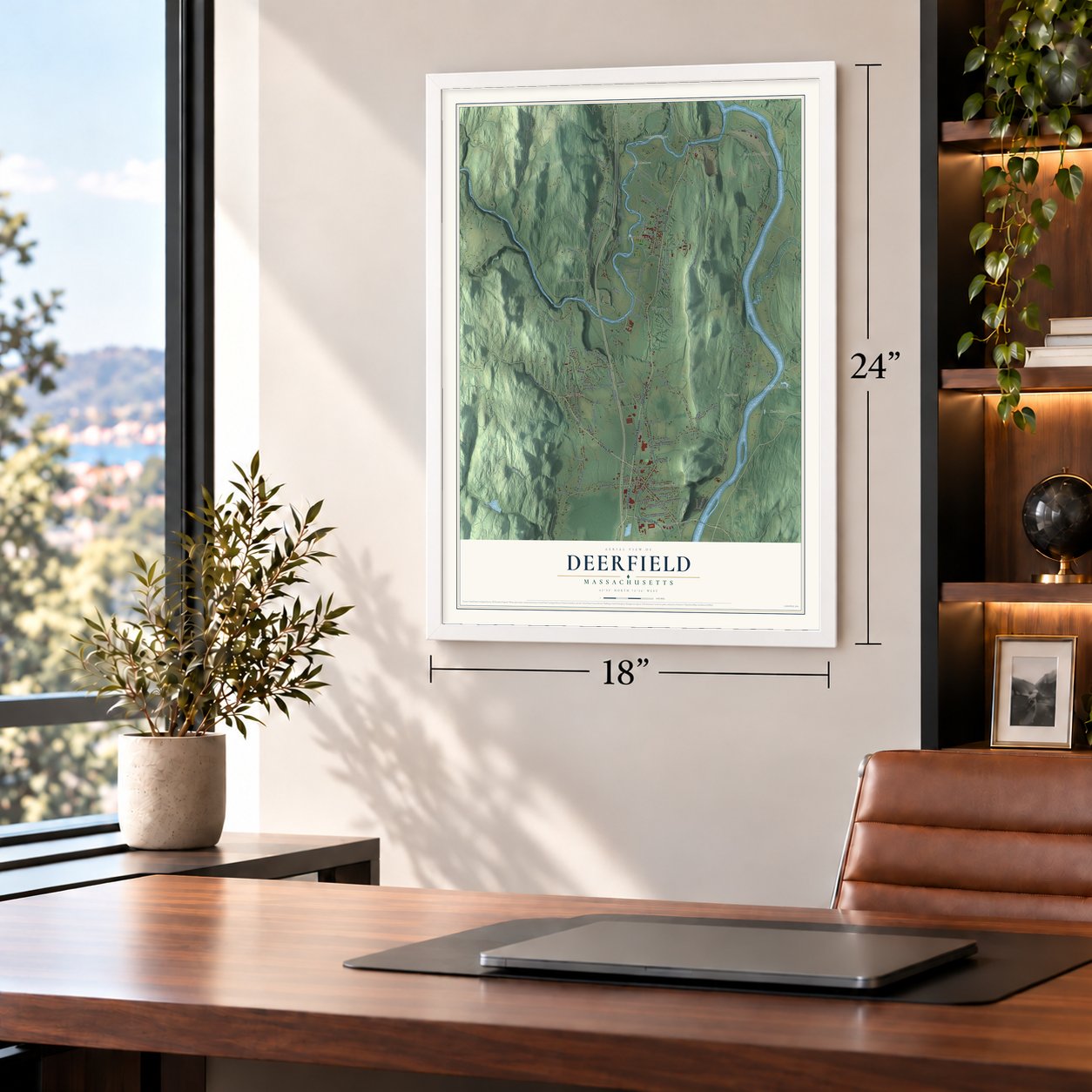
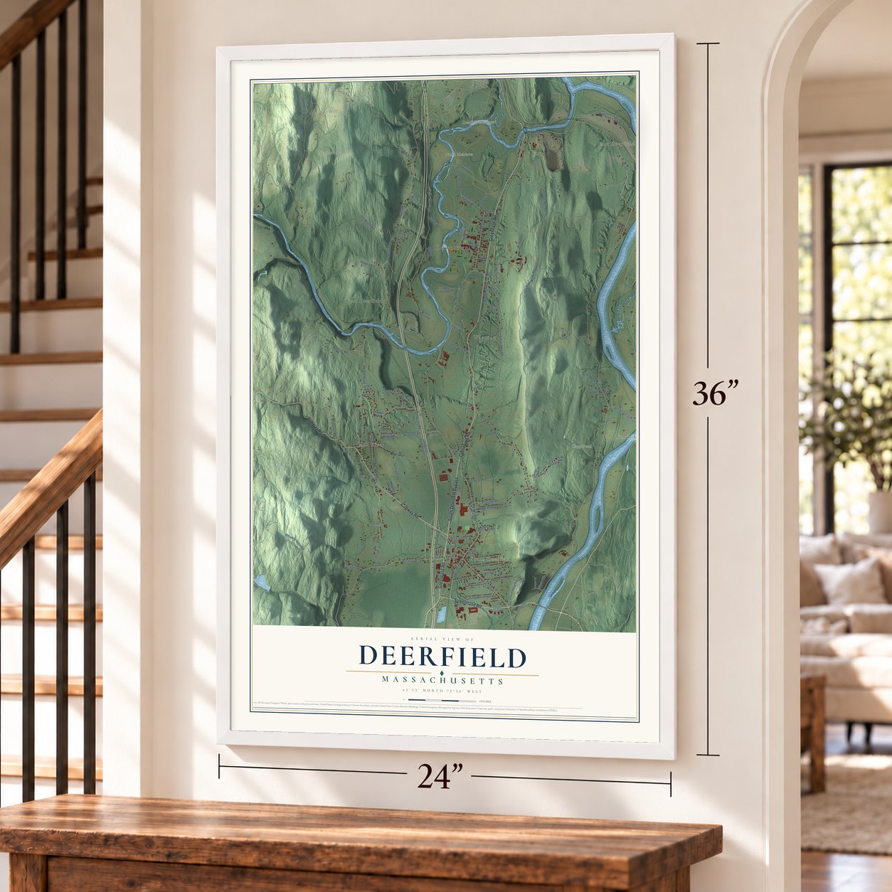
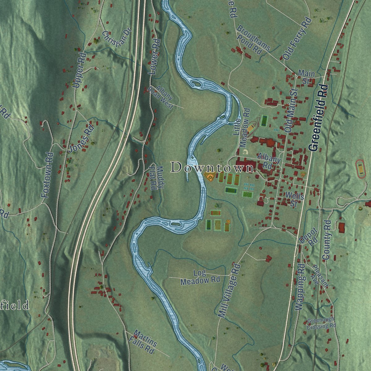
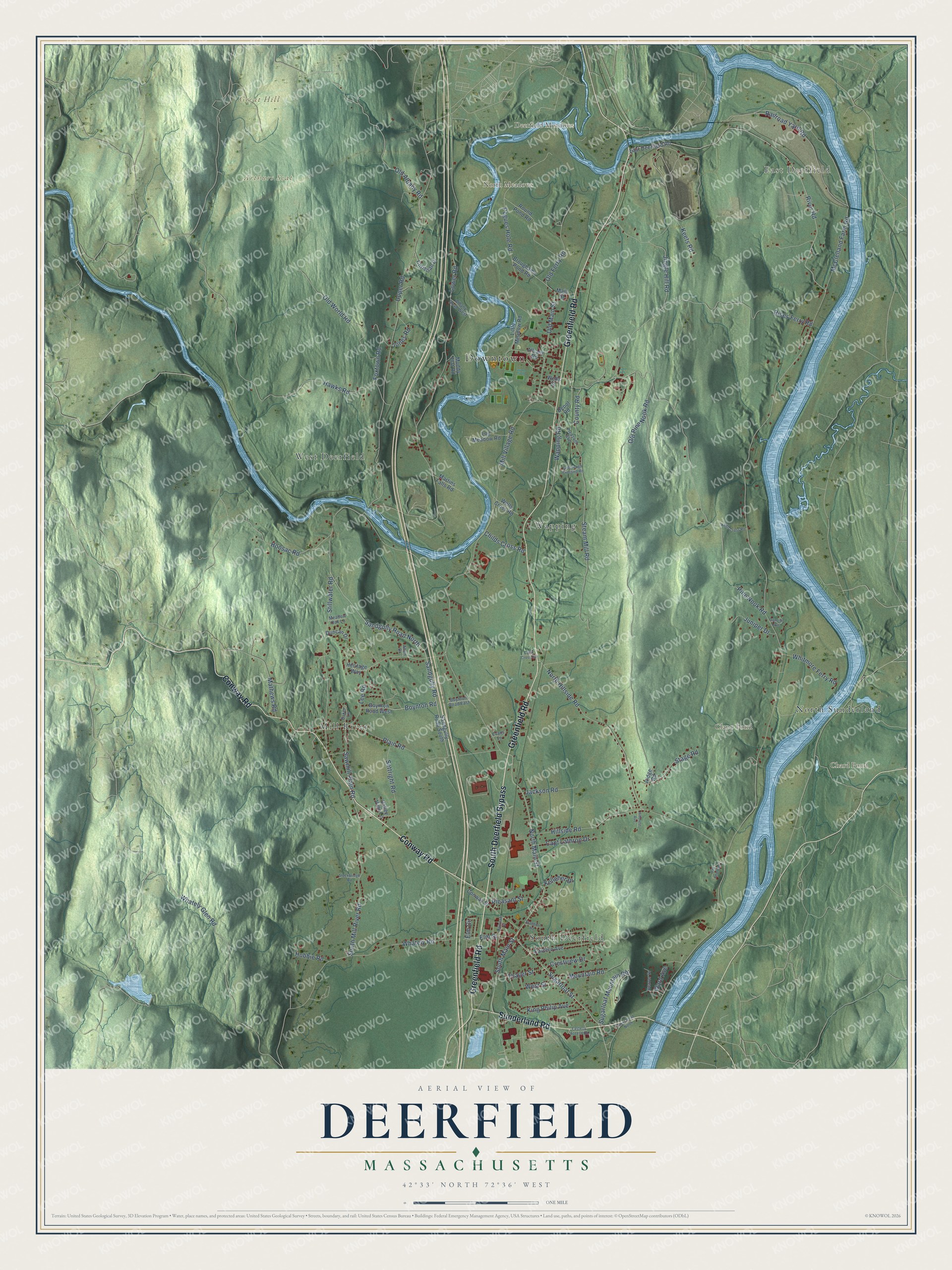
Explore Deerfield, Massachusetts from a whole new perspective. Created using aerial imagery and detailed geographic data, this map captures Deerfield building by building, with labeled streets, familiar landmarks, and shaded topographical relief that highlights the natural contours of the landscape.
Combining modern data with the timeless character of a vintage atlas, this map is just as interesting up close as it is beautiful on the wall. Whether you grew up in Deerfield, spent memorable years there, or call it home today, this unique map is a great way to celebrate a place that means something to you. Zoom in on the preview to look for your street, and then order a print to put your memories on the wall.
Three ways to hang it
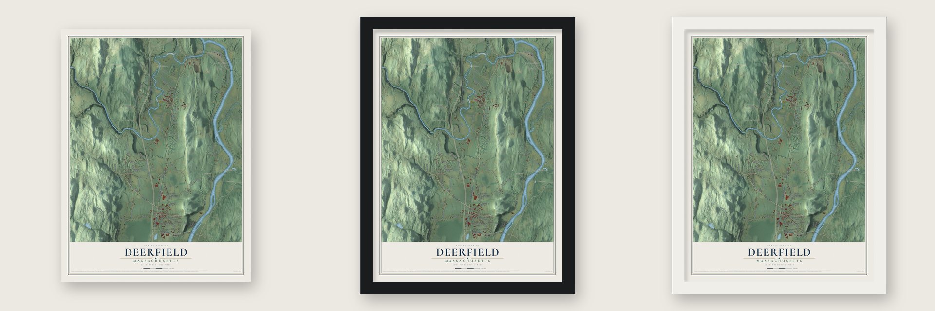
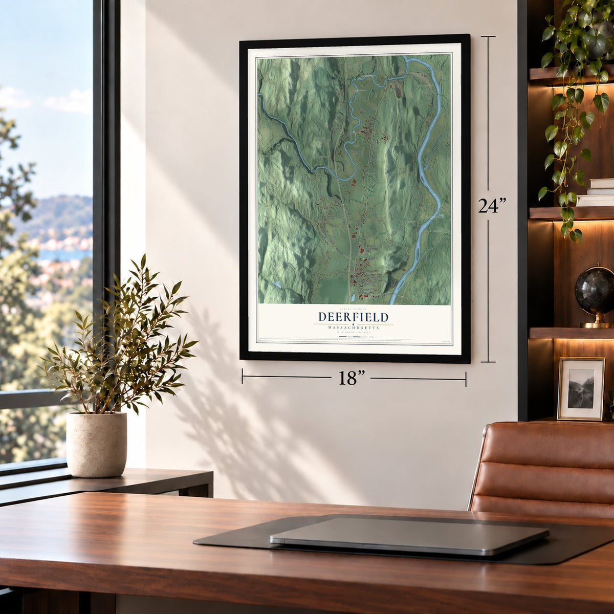
Unframed archival matte, a black wood frame or a white wood frame.
Up close
Geography Worth Displaying
This map was created using accurate cartographic data and authoritative geographic sources, including the U.S. Geological Survey (USGS) and FEMA. The map brings together terrain, waterways, roads, and building detail. The majority of the streets are labeled, houses are accurately depicted, and the topography is derived from government sources. Combining local data with carefully composed color and shading leads to this beautifully detailed Deerfield artwork for your wall.
Rather than simply showing street outlines, we’ve included as many of the street names as we could reasonably fit on the map while keeping their names legible. Zoom in on the high resolution preview to see exactly what’s on the map. We truly set out to create a statement piece for anyone who loves Deerfield. So whether it’s for you, or a gift for someone you love, we hope this map of Deerfield brings back fond memories.
Explore the full map of Deerfield, Massachusetts and read about the local places it shows.
Find your street
Names on the Deerfield map
Every name below is printed on this map. Look for your street, your school, the park where you played, or the pond down the road.
Places and landmarks13
- Downtown
- East Deerfield
- Arthurs Seat
- Deerfield Meadows
- Great Hill
- North Meadows
- Chard Pond
- Clapp Pond
- South Deerfield
- West Deerfield
- Mill River
- Wapping
Show all 13 places
- North Sunderland
Streets and roads102
- South Deerfield Bypass
- Greenfield Road
- Conway Road
- Sunderland Road
- Sugarloaf Street
- North Main Street
- South Main Street
- Mill Village Road
- Jones Road
- River Road
- Lower Road
- Upper Road
- Pine Nook Road
- Stillwater Road
- Hawks Road
- McClelland Farm Road
- Rices Ferry Road
- Sandgully Road
- Hillside Road
- Whately Road
- Steam Mill Road
- North Hillside Road
- Lee Road
- South Mill River Road
- Plain Road
- Old Albany Road
- Sugarloaf Mountain Road
- Keets Road
- Sandgully Road North
- Old World Road
Show all 102 streets
- Pogues Hole Road
- Old Main Street
- Whately Glen Road
- Old Ferry Road
- Boynton Road
- Hoosac Road
- Mathews Road
- Wapping Road
- Settright Road
- Railroad Yard Road
- Old Pine Nook Road
- Stage Road
- Foxtown Road
- Jingle Hill Road
- Sawmill Plain Road
- Pleasant Street
- King Philip Avenue
- Capt Lathrop Drive
- Jackson Road
- Whitmore Ferry Road
- Crestview Drive
- County Road
- Juniper Drive
- Mountain Road
- Elm Street
- Thayer Street
- Childs Cross Road
- Elm Circle
- Kelleher Drive
- Hobbie Road
- West Street
- Ward Avenue
- Broughams Pond Road
- Little Meadow Road
- East Deerfield Road
- Sandgully Road South
- Round Pond Road
- Eastern Avenue
- Boynton Road West
- Conway Street
- Christian Drive
- Log Meadow Road
- Duncan Drive
- Martins Falls Road
- Wells Cross Road
- Albany Road
- Depot Road
- Muddy Flat Road
- Heritage Way
- Main Street
- Valley View Lane
- Wells Street
- Ridge Road
- Beaver Drive
- Albany Road West
- Pleasant Avenue
- Boynton Road East
- Baker Lane
- Meadow Oak Lane
- Evans Lane
- Allen Drive
- Railroad Street
- River Road North
- Keith Cross Road
- Stockbridge Road
- Oak Knoll Drive
- Greenough Crossing Road
- Sunrise Avenue
- Easterly Access Road
- Braeburn Road
- Hillcrest Avenue
- Clark Cross Road
Names are listed as they appear on the printed map. Zoom into the product photos to find them.
About Deerfield, Massachusetts
Deerfield is a town of 5,090 people in Franklin County, at the point where the Deerfield River joins the Connecticut. The Pocumtuck nation lived here when English colonists came. After the General Court gave 8,000 acres to the Praying Indians at Natick, it repaid Dedham with 8,000 acres of its own choosing, and Dedham picked Pocomtuck. House lots were drawn on May 23, 1670, and on May 7, 1673, the court made Deerfield separate from Dedham.
As New England's northwesternmost outpost, the village took the brunt of frontier war. Settlers left after the Battle of Bloody Brook in 1675 and came back in 1682. Before dawn on February 29, 1704, French and Native forces under Jean-Baptiste Hertel de Rouville burned much of the village, killed 56 colonists and marched 112 captives nearly 300 miles toward Montreal. Deerfield helped raise ransom money, and most captives eventually came home, among them the minister John Williams, whose 1707 account of his captivity became well known. His daughter Eunice, taken at 8, married a Mohawk man and stayed.
“The beautiful Deerfield Street, without a rival in all New England, with its grand elms and venerable dwellings, became an historic wonderland.”
- The door that survivedEnsign John Sheldon's house outlasted the 1704 raid, its front door hacked by tomahawks. Called the Old Indian House, it stood until 1849; its door was saved. The Pocumtuck Valley Memorial Association bought it back from collector Dr. Daniel Denison Slade and displayed it in glass at the Pocumtuck House. Frank Nims led neighbors carrying it out when the hotel burned May 18, 1877. After a corner store and a corn house, it reached Memorial Hall in September 1879.
- Lucy Terry's "Bars Fight"Lucy Terry was stolen from Africa as a baby and enslaved; at about five she was brought to the Deerfield home of Ebenezer Wells. She was the author of "Bars Fight," a 1746 ballad telling of an August raid on the Deerfield meadow. It passed by memory until printed in 1854 and is counted as the earliest known African American literary work. Abijah Prince, a free Black man, bought her freedom, and they married in 1756.
- Saving its own pastUnder historian George Sheldon, residents formed the Pocumtuck Valley Memorial Association in 1870 and marked Bloody Brook and the 1704 attack with monuments. Its Memorial Hall Museum, opened in 1880, built the first permanent period room in any American museum. Returning in 1890, C. Alice Baker restored her family's Frary House with Boston's Shepley, Rutan & Coolidge. Henry and Helen Flynt, arriving in 1936, founded Historic Deerfield, whose eleven house museums include the 1734 Ashley House and 1747 Wells-Thorn House.
- An academy from 1797Deerfield Academy received its charter in 1797, under Governor Samuel Adams, and formally opened on New Year's Day in 1799, in a building Asher Benjamin had designed the year before. During the War of 1812 the school added a Professor of the Art of War. It ranks among the nation's oldest secondary schools, and its first building became Memorial Hall Museum.
- From common fields to onionsThe Rev. John Williams's 60-pound salary as minister from 1686 came in wheat, peas, Indian corn and pork. After harvest the field became common pasture. South Deerfield later grew tobacco and onions; James Campbell's Connecticut Valley Onion Company, organized there in 1908, handled four to five hundred carloads yearly by 1926.
Keep exploring Massachusetts
Deerfield is one of 470 Massachusetts towns we've mapped. Every dot on the map is a print of its own.
The search covers every state, Massachusetts first.
Near Deerfield
Order 2 or more town maps and save 10%. Shown in the size and finish you picked above, so they hang as a set.
- South Deerfield 12" x 18" / Archival Matte Print $39.99
- Conway 12" x 18" / Archival Matte Print $39.99
- Sunderland 12" x 18" / Archival Matte Print $39.99


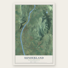
More maps nearby: Montague, Turners Falls, Whately, Greenfield and Leverett.
The art of mapping a place
How This Map Was Made
Real places. Remarkable detail. Discover the layers that turn geographic data into a map of home.

The view from above
Aerial imagery reveals the character of the land: woodland, open fields, and the patterns of a place.

The shape of the land
Elevation data brings hills, valleys, and subtle changes in the landscape into view.

The details of home
Roads, waterways, and building footprints come together to make the map feel unmistakably local.

Geography becomes art
Considered color, shading, and typography bring the layers together in a map made for your wall.


Process illustrated with Mendon, Massachusetts. Aerial imagery: USDA NAIP. Terrain: USGS 3D Elevation Program. Map details and finished artwork: KNOWOL.
The Details
About This Print
Choose an archival matte print, or a black or white Ayous wood frame. The archival matte print is unframed.
Select your size and finish above to see the matching product image and price.
Materials & Craftsmanship
A contemporary map with the character of a classic atlas, printed on archival matte paper. Optional frames are made from Ayous wood.
Your printed map does not include the watermark shown in the full-map preview.
Shipping & Delivery
Free shipping within the United States. Every print is made to order in the USA.
Buying a gift? Add a note in your cart and we'll include it. We never put prices in the package.
Prints ship within 2 to 3 business days. Allow 7 to 10 days total from ordering for delivery. Timing may vary during holidays or periods of high order volume.
Read our shipping policy.
Returns and damaged prints
Each print is made to order. Change-of-mind refunds are not available after production.
If your print arrives damaged, misprinted or incorrect, contact support@knowol.com within 30 days of receiving it. Include your order number, photos and a description of the issue.
Read our full refund and replacement policy. For questions about your order, email support@knowol.com.