
Search for another town





Free U.S. delivery 7 to 10 days after you order
DeSoto, Texas Map Art
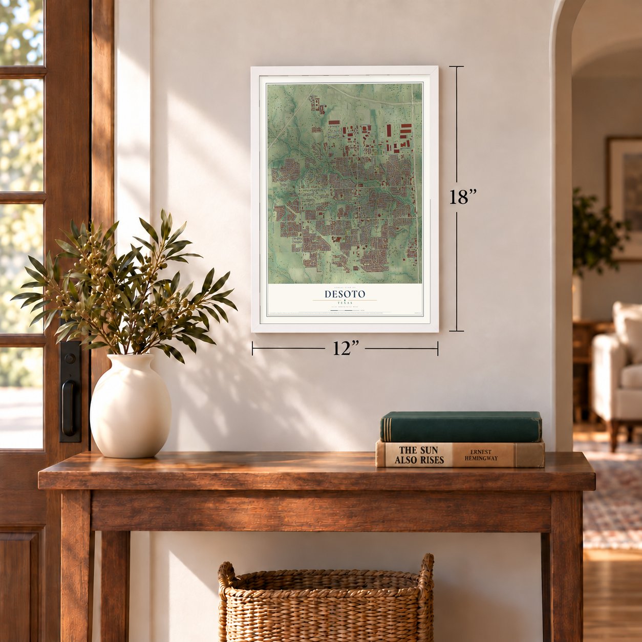
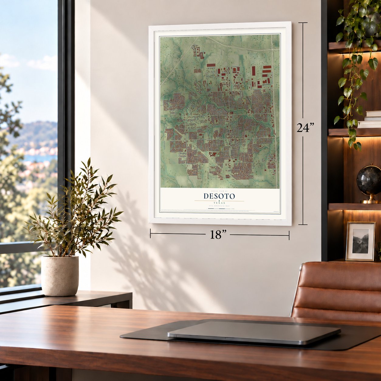
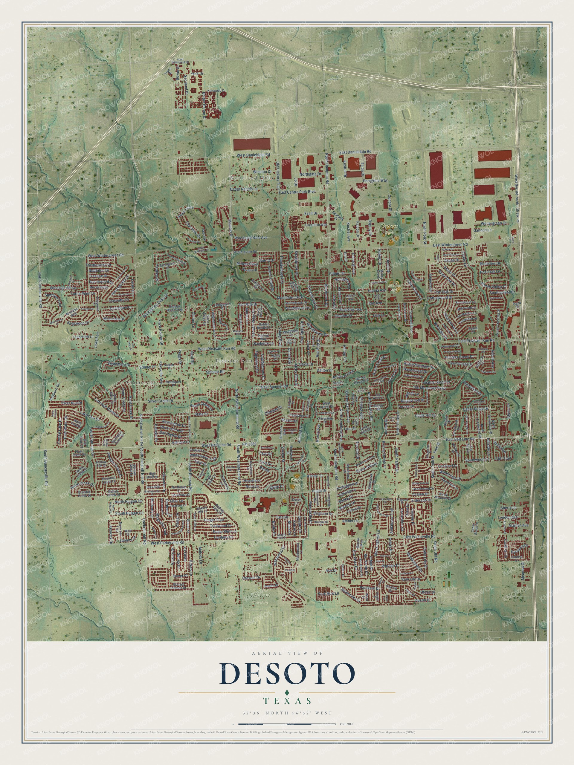
A new map of DeSoto, Texas, made in 2026 and printed to order on thick archival matte paper.
12" x 18" Archival Matte Print
A Map of Home. A Work of Art.
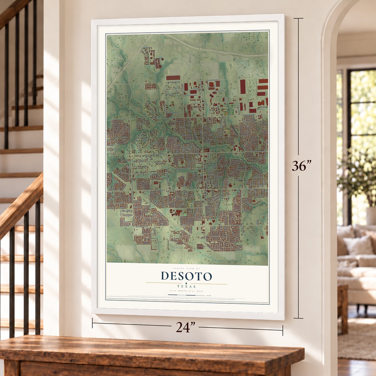
This beautifully detailed map of DeSoto, Texas was created in 2026 using aerial imagery combined with modern topographical, census, street and landmark data. It's a modern aerial view of DeSoto in Dallas County, Texas, that combines modern data with a vintage aesthetic. Zoom in on the preview and look for your block.
Three ways to hang it
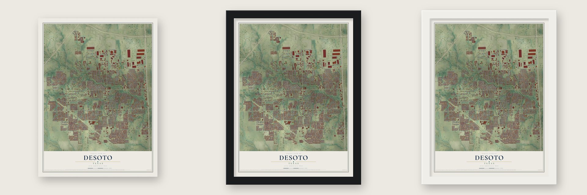
Unframed archival matte, a black wood frame or a white wood frame.
Up close
Real geography. Art worth displaying.
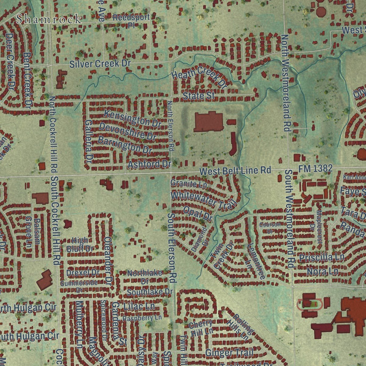
This map was created using accurate cartographic data and authoritative geographic sources, including the U.S. Geological Survey and the Census Bureau. The map brings together terrain, waterways, roads, and building detail. The majority of the streets are labeled, houses are accurately depicted, and the topography is derived from government sources. Combining local data with carefully composed color and shading leads to this beautifully detailed DeSoto artwork for your wall.
Rather than simply showing street outlines, we’ve included as many of the street names as we could reasonably fit on the map while keeping their names legible. Zoom in on the high resolution preview to see exactly what’s on the map. We truly set out to create a statement piece for anyone who loves DeSoto. So whether it’s for you, or a gift for someone you love, we hope this map of DeSoto brings back fond memories.

About DeSoto, Texas
DeSoto is a city in southern Dallas County with roots reaching to the 1840s. The community developed near early land grants and a general store at the future intersection of Belt Line and Hampton roads. Incorporated in 1949, DeSoto recorded 56,145 residents in the 2020 census.
- Early Settler FamiliesThe Parks, Cheshier, Ramsey, and Johnson families founded the community during the 1840s.
- The StoreT. J. Johnson opened DeSoto's first general store in 1848, and the surrounding place became known as the Store.
- City Since 1949DeSoto incorporated in 1949 and had about 300 residents by 1950.
- Decades of GrowthThe population rose from 1,969 in 1960 to 15,538 in 1980 as municipal services and construction expanded.
- 2020 PopulationThe U.S. Census Bureau counted 56,145 DeSoto residents in 2020.
Find your street
Names on the DeSoto map
Every name below is printed on this map. Look for your street, your school, the park where you played, or the pond down the road.
Places and landmarks7
- Shamrock
- Woodland Hills
- Pleasant Run
- Grimes Park
- Mosley Park
- Vincent Cemetery
- Zeigler Park
Streets and roads439
- North Hampton Road
- North Westmoreland Road
- East Belt Line Road
- West Belt Line Road
- South Hampton Road
- West Danieldale Road
- North Duncanville Road
- East Danieldale Road
- West Parkerville Road
- North Polk Street
- South Polk Street
- FM 1382
- Wintergreen Court
- West Svc Road
- Lyndon Avenue
- Polk Street
- East Pleasant Run Road
- Scotland Drive
- South Hulgan Circle
- Daventry Drive
- Boulder Creek Drive
- Spice Street
- West Pleasant Run Road
- East Wintergreen Road
- West Wintergreen Road
- South Cockrell Hill Road
- East Centre Park Boulevard
- Eagle Drive
- Silver Creek Drive
- The Meadows Parkway
Show all 439 streets
- East Parkerville Road
- South Westmoreland Road
- Mockingbird Lane
- Cockrell Hill Road
- Mantlebrook Drive
- Carriage Creek Drive
- Old Hickory Trail
- West Spinner Road
- Whispering Oaks Drive
- Terrace Drive
- Kestrel Avenue
- Kestrel Drive
- North Chattey Road
- South Parks Drive
- South Duncanville Road
- Rickey Canyon Avenue
- South Elerson Road
- Bolton Boone Drive
- Thunderbrook Drive
- Bluffview Drive
- Aviary Drive
- North Parks Drive
- Nora Lane
- Ginger Trail
- Honor Drive
- Deer Creek Drive
- Renee Lane
- South Uhl Road
- Melody Lane
- Woodridge Drive
- Ranch Valley Drive
- Shadywood Lane
- Young Boulevard
- Lakeview Drive
- Ten Mile Drive
- Ray Andra Drive
- Sagewood Drive
- Warbler Drive
- Shockley Avenue
- Laurel Springs Drive
- Heather Knoll Drive
- Ray Avenue
- Windmill Hill Lane
- Masters Drive
- Westlake Drive
- Shadybrook Drive
- Bluebonnet Drive
- Longmeadow Lane
- Falcon Drive
- Hanna Avenue
- Brook Hollow
- Thistlewood Drive
- Davis Drive
- Estate Lane
- Peggs Street
- Keysville Avenue
- Thorntree Drive
- Hunters Creek Drive
- Winston Drive
- Frost Hollow Drive
- Rusticwood Drive
- Essex Drive
- Hilltop Circle
- Evelyn Street
- Longleaf Drive
- Sherry Lane
- Dalton Drive
- Vince Lane
- Wentwood Drive
- Desoto Drive
- Cedar Rapids Lane
- Woodland Hills Avenue
- Priscilla Lane
- Jo Drive
- Newcastle Drive
- Alpine Drive
- Mulberry Lane
- Spinner Road
- Cottonwood Drive
- Robin Meadow Drive
- Regal Bluff Lane
- Sawsawi Trail
- Canyon Ridge Drive
- Magnolia Trail
- Valleyglen Drive
- Bob White Street
- Peregrine Way
- Surrey Drive
- Amber Lane
- Ace Drive
- Mosslake Drive
- Townsend Lane
- Stinnet Place
- Goldeneye Drive
- Misty Glen Drive
- Whitewater Trail
- Trailwood Drive
- Kittery Drive
- Cold Water Drive
- Covington Drive
- Yardley Place
- Aspen Drive
- North Lyndalyn Avenue
- Briarbrook Drive
- Rayburn Drive
- Bent Creek Drive
- Bailey Drive
- River Run Drive
- Wyndmere Drive
- Wylie Creek Drive
- Heritage Hill Drive
- Andalusia Trail
- Osprey Drive
- Jordan Drive
- Red Bud Drive
- Tate Drive
- Royal Oak Drive
- Cedar Ridge Drive
- Crystal Lake Drive
- State Street
- Kelsie Lane
- Faye Street
- Live Oak Drive
- Rio Vista Drive
- Greenbrook Drive
- Devonshire Drive
- Kensington Drive
- Barrington Drive
- Hubert Drive
- Grand Teton Drive
- Marisa Lane
- Dennis Drive
- Ashford Drive
- Cresent Drive
- Nettleton Drive
- Woodhaven Drive
- Charles Street
- Arbor Creek Drive
- Lake Grove Lane
- Southpointe Drive
- Horseshoe Court
- Jewett Lane
- Saddlebrook Drive
- Northgate Drive
- Condor Street
- Urban Drive
- North Hulgan Circle
- Wesley Drive
- Parakeet Drive
- Regalwood Drive
- Abbott Avenue
- Place Louie
- Holt Avenue
- Teresa Drive
- Calla Lilly Drive
- Cardinal Drive
- Shasta Street
- Vickery Drive
- Austin Drive
- Keats Drive
- Talon Drive
- Ezell Drive
- Beltwood
- Treeline Drive
- Deborah Avenue
- Tara Drive
- Danbury Drive
- Heath Creek Drive
- Daisy Drive
- Raintree Lane
- Angie Lane
- Sequoia Drive
- Rain Lily Drive
- Turtle Point Drive
- Oleander Drive
- Rio Verde Drive
- Brighton Drive
- Galleria Drive
- Plantation Drive
- Marilyn Avenue
- Canyon Place
- Southwood Drive
- Eldorado Drive
- Post Oak Lane
- Meadow Street
- Woodbrook Drive
- Gilbert Street
- Havencrest Drive
- Williams Avenue
- Lion Street
- Hanna Circle
- Chalk Hill Drive
- Edgewood Drive
- Lilac Lane
- York Drive
- Jefferson Avenue
- Neal Road
- Bowie Street
- Morris Avenue
- Dynamic Drive
- Keswick Drive
- Leisure Lane
- Park Row Lane
- Randa
- Mirkes Parkway
- Almond Drive
- Olympia Street
- Azalea Drive
- Sabona Drive
- Hillside Lane
- Bayberry Lane
- Gardenia Street
- David
- Gannon Lane
- Wendy Lane
- Oteca Drive
- Clifton Lane
- Opal Drive
- Abbey Lane
- Sharp Drive
- Bridle Drive
- Brees Drive
- Dover Place
- Lisa Lane
- Cliff Trail
- Sierra Drive
- Duke Drive
- North I- 35 Svc Road
- Stone Ridge Lane
- Windy Meadow Drive
- North Crestwood Road
- Twin Hills Lane
- Montrose Trail
- North Cockrell Hill Road
- Mountain Laurel Lane
- Buffalo Creek Drive
- Rickey Canyon Drive
- North Beltwoods Drive
- Twin Creek Drive
- Newpark Boulevard
- Wintergreen Road
- Seahawk Drive
- Rolling Hills Lane
- Ida Bess Avenue
- Sandy Creek Drive
- Montauk Way
- Wildwood Drive
- Reedsport Place
- Stoney Creek
- Peach Lane
- Woodlawn Drive
- Pecan Crossing Drive
- Meadowlark Lane
- Connie Drive
- Bramble Creek Drive
- Clear Springs Drive
- Highridge Drive
- Granite Lane
- Roaring Springs Drive
- Ashington Place
- Briarwood Lane
- Lemontree Lane
- Hidden Brooke Drive
- Rosewood Drive
- Tenderfoot Lane
- Derby Lane
- Executive Way
- Quick Silver Drive
- Balsam Grove Lane
- Squirebrook Drive
- Richard Pittmon Drive
- Renee Road
- Plum Creek Drive
- Larchbrook Drive
- Dutchman Creek Drive
- Laurie Avenue
- Cherry Hill Lane
- Beechwood Drive
- Birchwood Lane
- Blue Sky Drive
- Kirnwood Drive
- Rio Bravo Drive
- Cheyenne Drive
- Kathy Drive
- Graceland Drive
- Southlake Drive
- Sapling Way
- Dartbrook Drive
- Brookview Drive
- Northlake Drive
- Mossy Ridge
- Kearsarge Street
- Armstrong Drive
- Belclaire Terrace
- Wolf Drive
- Windwood Drive
- Shadow Wood Trail
- Idle Creek Lane
- Foxwood Drive
- Rockcreek Drive
- Beverly Drive
- Fern Drive
- Bridgeport Drive
- Cedar Brook Drive
- Drexel Drive
- West Lanett Drive
- White Falls Drive
- Chowning Drive
- Shavano Street
- Hollow Oak Drive
- Mai Avenue
- Martin Drive
- Sunrise Drive
- Rock Glen Street
- Starling Drive
- Wren Street
- Goffin Drive
- Wild River Court
- High Bluff Drive
- Rainier Street
- Avalon Drive
- Macaw Way
- Larry Drive
- Plaza Road
- Travis Street
- West Wheatland Road
- Millington Drive
- Brentwood Drive
- Stinnett Place
- Pine Tree Lane
- Edmonds Way
- Cambridge Drive
- Saddle Head Drive
- Honeysuckle Way
- Meadowcreek Drive
- North Elerson Road
- Franklin Street
- Trillium Lane
- Inglewood Trail
- Country Ridge Drive
- Rising Ridge Drive
- Winding Brook Drive
- Oak Meadow Lane
- Jeff Grimes Boulevard
- Spicewood Drive
- Forest Creek
- Tanglerose Drive
- Summerside Drive
- Streamside Drive
- Danny Drive
- Manor Drive
- Raspberry Lane
- Kinglet Street
- Lakeside Drive
- Fall Wheat Drive
- White Ash Road
- Campbell Street
- Joanna Avenue
- Oak Trail
- Saint Andrews Place
- Bob White Drive
- Castle Street
- Diamond Drive
- Maplecrest Drive
- Amanda Avenue
- Cypress Lane
- Tealridge Lane
- Glen Avenue
- Flagstaff Drive
- Spinner Circle
- West Hulgan Circle
- Beaverbrook Lane
- Frenchmans Drive
- Ida Bess Drive
- Brookwood Drive
- Regents Park Court
- Summertree Lane
- Cambridge Lane
- Chestnut Lane
- Mallard Drive
- Courson Drive
- Stony Creek Drive
- Wisterglen Drive
- Worthington Drive
- Buxton Drive
- Prairie Creek Drive
- Valley Ridge Drive
- Ironwood Drive
- Glenwick Drive
- Strayhorn Drive
- Foraker Street
- Canary Lane
- Crestwood Court
- Pecan Drive
- Bordeaux Avenue
- South Lyndalyn Avenue
- Kari Anne Lane
- Newberry Court
- Dove Lane
- Windmill Circle
- Kaylor Drive
- Monahan Drive
- Trail Ridge Drive
- Water Crest Drive
- Settlers Creek
- Finch Drive
- Aspen Lane
- Parrot Court
- Metro Court
Names are listed as they appear on the printed map. Zoom into the product photos to find them.
The art of mapping a place
How This Map Was Made
Real places. Remarkable detail. Discover the layers that turn geographic data into a map of home.

The view from above
Aerial imagery reveals the character of the land: woodland, open fields, and the patterns of a place.

The shape of the land
Elevation data brings hills, valleys, and subtle changes in the landscape into view.

The details of home
Roads, waterways, and building footprints come together to make the map feel unmistakably local.

Geography becomes art
Considered color, shading, and typography bring the layers together in a map made for your wall.


Process illustrated with Mendon, Massachusetts. Aerial imagery: USDA NAIP. Terrain: USGS 3D Elevation Program. Map details and finished artwork: KNOWOL.
The Details
About This Print
Choose an archival matte print, or a black or white Ayous wood frame. The archival matte print is unframed.
Select your size and finish above to see the matching product image and price.
Materials & Craftsmanship
A contemporary map with the character of a classic atlas, printed on archival matte paper. Optional frames are made from Ayous wood.
Your printed map does not include the watermark shown in the full-map preview.
Shipping & Delivery
Free shipping within the United States. Every print is made to order in the USA.
Buying a gift? Add a note in your cart and we'll include it. We never put prices in the package.
Prints ship within 2 to 3 business days. Allow 7 to 10 days total from ordering for delivery. Timing may vary during holidays or periods of high order volume.
Read our shipping policy.
Returns and damaged prints
Each print is made to order. Change-of-mind refunds are not available after production.
If your print arrives damaged, misprinted or incorrect, contact support@knowol.com within 30 days of receiving it. Include your order number, photos and a description of the issue.
Read our full refund and replacement policy. For questions about your order, email support@knowol.com.
Find your town
Looking for another city?
Find a map of home in our Texas collection.
Nearby
Maps of towns near DeSoto
Know someone from one of these towns? Their map makes a great gift.
 Glenn Heights
, Texas
From $39.99See the map
 Ovilla
, Texas
From $39.99See the map
 Duncanville
, Texas
From $39.99See the map
More maps nearby: Lancaster, Cedar Hill, Oak Leaf, Bear Creek Ranch and Red Oak.