
Search for another town





Free U.S. delivery 7 to 10 days after you order
Easton, Pennsylvania Map Art
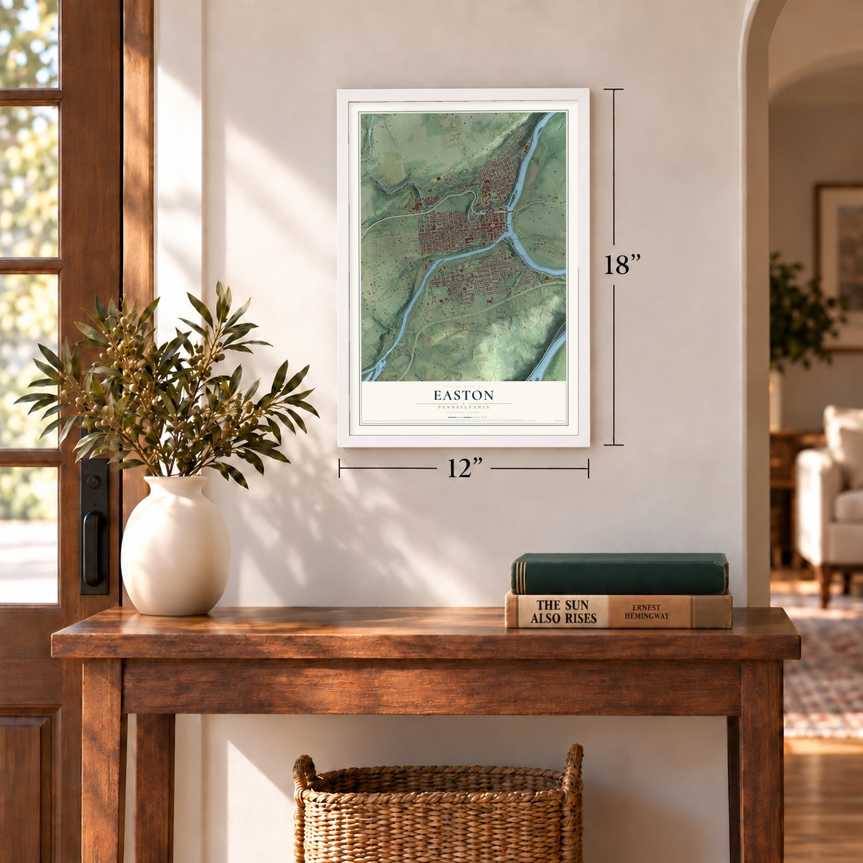
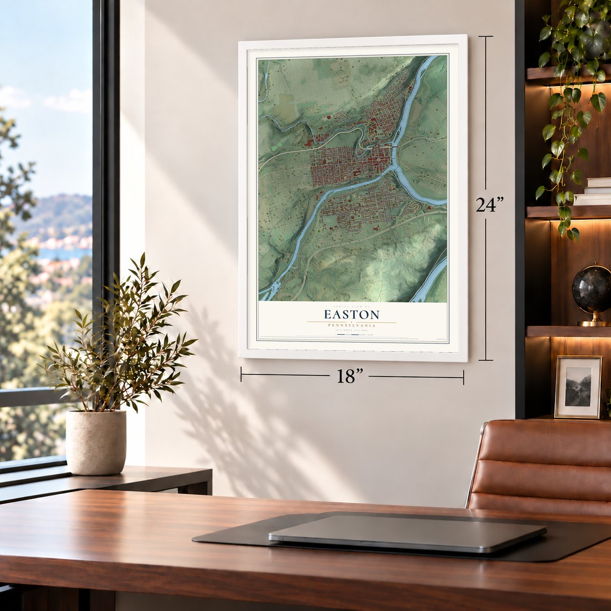
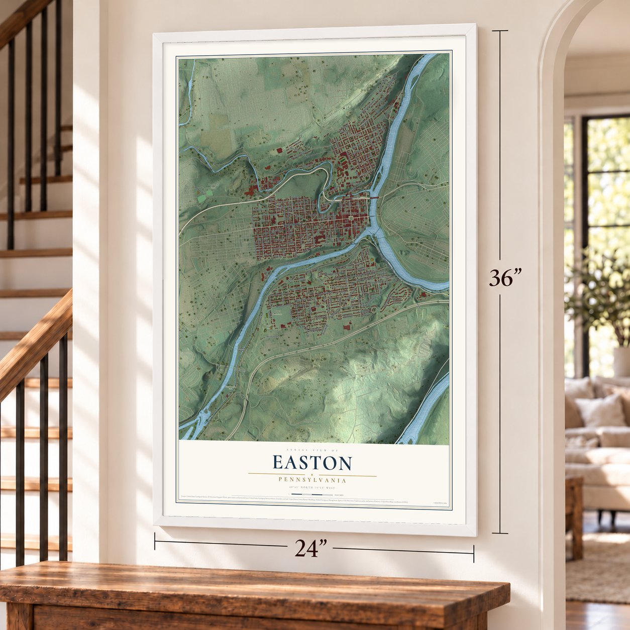
A new map of Easton, Pennsylvania, made in 2026 and printed to order on thick archival matte paper.
12" x 18" Archival Matte Print
A Map of Home. A Work of Art.
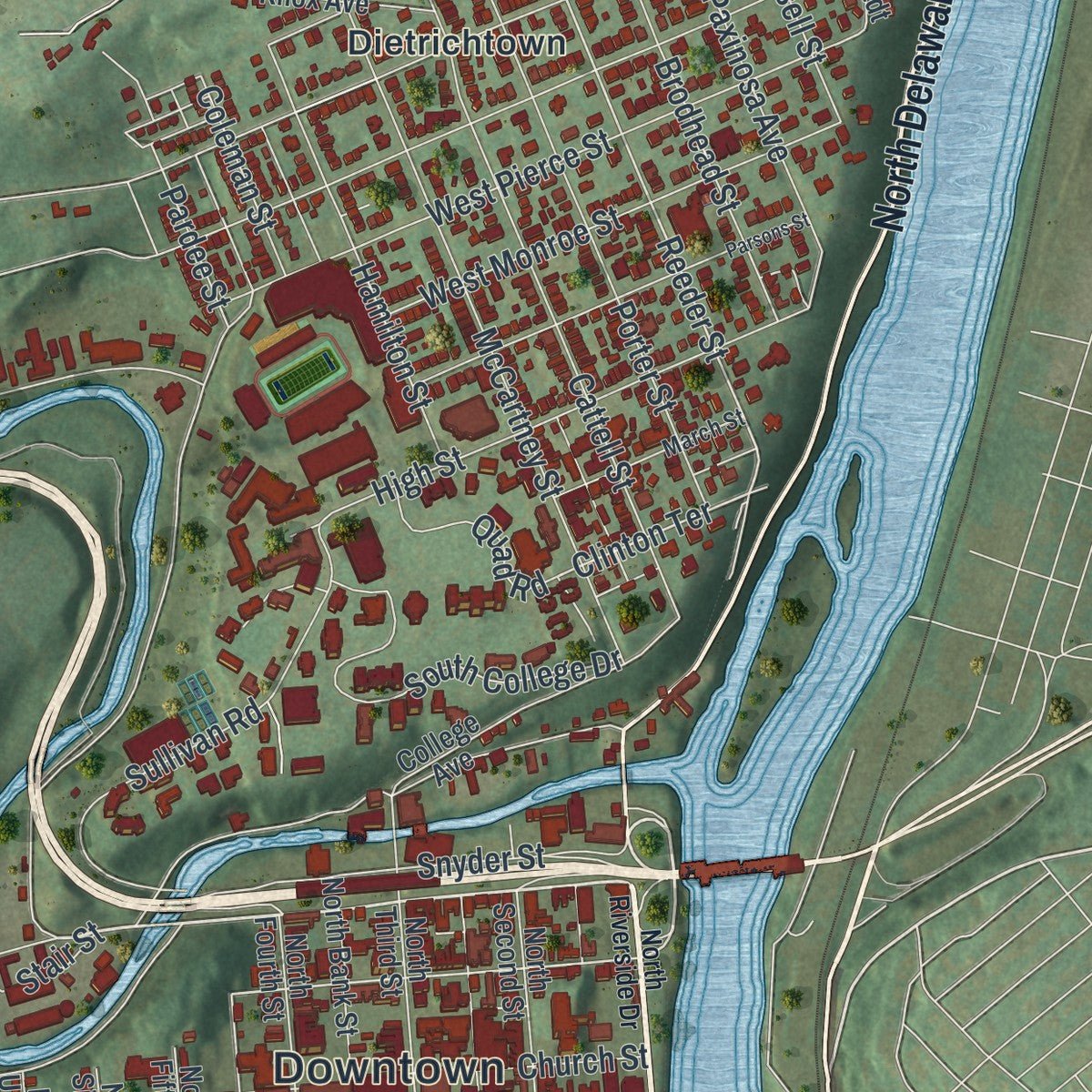
Explore Easton, Pennsylvania from a whole new perspective. Created using aerial imagery and detailed geographic data, this map captures Easton building by building, with labeled streets, familiar landmarks, and shaded topographical relief that highlights the natural contours of the landscape.
Combining modern data with the timeless character of a vintage atlas, this map is just as interesting up close as it is beautiful on the wall. Whether you grew up in Easton, spent memorable years there, or call it home today, this unique map is a great way to celebrate a place that means something to you. Zoom in on the preview to look for your street, and then order a print to put your memories on the wall.

Three ways to hang it
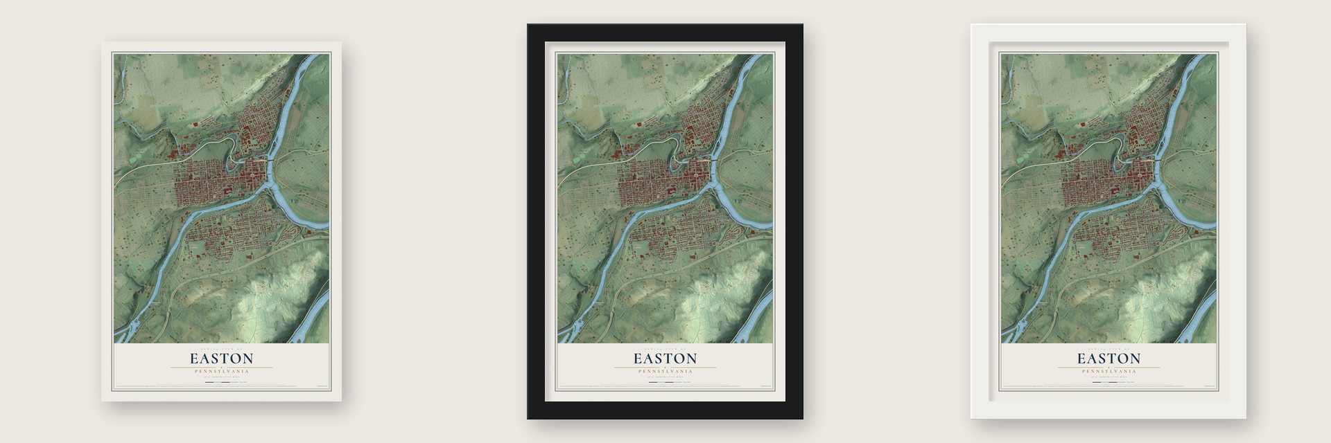
Unframed archival matte, a black wood frame or a white wood frame.
Up close
Geography Worth Displaying
This map was created using accurate cartographic data and authoritative geographic sources, including the U.S. Geological Survey and the Census Bureau. The map brings together terrain, waterways, roads, and building detail. The majority of the streets are labeled, houses are accurately depicted, and the topography is derived from government sources. Combining local data with carefully composed color and shading leads to this beautifully detailed Easton artwork for your wall.
Rather than simply showing street outlines, we’ve included as many of the street names as we could reasonably fit on the map while keeping their names legible. Zoom in on the high resolution preview to see exactly what’s on the map. We truly set out to create a statement piece for anyone who loves Easton. So whether it’s for you, or a gift for someone you love, we hope this map of Easton brings back fond memories.
Read the story behind this map of Easton, Pennsylvania from 2026.

About Easton, Pennsylvania
Easton is a city of 28,127 people and the seat of Northampton County, where the Lehigh River pours into the Delaware. The Lenape called this ground Lechauwitank, the Place at the Forks, and the Penn family took it through the Walking Purchase of 1737. Thomas Penn married Juliana Fermor in 1751, and a few weeks later he wrote to Governor James Hamilton asking that a new town at the Forks be called Easton, after her family's estate, Easton Neston. Surveyor William Parsons laid out its streets in 1752, the same year it became the county seat.
From 1756 to 1762, colonial leaders and Native nations held peace councils on the town square, and the Treaty of Easton was signed here during the French and Indian War. On July 8, 1776, at noon, the Declaration of Independence was read aloud in Easton, one of just three places, with Philadelphia and Trenton, where the public first heard it. The Easton flag flew over the reading, a militia carried it again in the War of 1812, and it is still the city's flag.
“The city is a composite of a hurried commercial present and a sedate mercantile past, leavened by a carefree college atmosphere.”
- Where the canals metThe lower Lehigh Canal opened in 1818, and the Delaware Canal followed soon after, carrying anthracite coal toward Philadelphia, New Jersey and New York City. Across the river, the Morris Canal in Phillipsburg linked Easton to the New York area, so coal from Mauch Chunk passed through here on its way to the world. When railroads replaced the canals, Easton became a hub for five of them.
- Lafayette College, 1824On December 27, 1824, local people gathered at White's Hotel near Centre Square and founded a college. James Madison Porter, one of the leaders, had just met the French general Lafayette. Lafayette first played Lehigh in football in 1884, starting the most played rivalry in college football, and Alpha Phi Omega was founded on campus on December 16, 1925.
- A Christmas tree in 1816Easton was settled largely by Germans, and a diary records that they put up a Christmas tree here in 1816, one of the earliest on the continent. A plaque in Scott Park along the Delaware marks it. Each Christmas season the city still builds the Peace Candle on top of the Soldiers' and Sailors' Monument in Centre Square.
- The split-cane fly rodFishing historians credit Samuel Phillipe, a gunsmith who worked in Easton, with making the first fly rod built from six strips of split bamboo cane, in 1845. A state historical plaque near Centre Square honors his work.
Find your street
Names on the Easton map
Every name below is printed on this map. Look for your street, your school, the park where you played, or the pond down the road.
Places and landmarks11
- Downtown
- Hackett Park
- Hays Cemetery
- Heil Park
- Hugh Moore Park
- Browntown
- Dietrichtown
- Glendon
- Paxinosa
- South Easton
- Williamsport
Streets and roads178
- South Delaware Drive
- Northampton Street
- North Delaware Drive
- Larry Holmes Drive
- Bushkill Street
- Washington Street
- Clinton Terrace
- Spring Garden Street
- Reeder Street
- Wood Avenue
- Glendon Avenue
- Seitz Street
- Old Philadelphia Road
- Philadelphia Road
- West Cooper Street
- Line Street
- West Nesquehoning Street
- Folk Street
- Canal Street
- Butler Street
- Palmer Street
- West Saint Joseph Street
- North Eighth Street
- Bushkill Drive
- Pine Street
- West Lafayette Street
- Ferry Street
- Lehigh Drive
- West Lincoln Street
- West Berwick Street
Show all 178 streets
- West Wilkes Barre Street
- Church Street
- Lehigh Street
- West Burke Street
- West Wirebach Street
- Spruce Street
- West Canal Street
- Cattell Street
- Rock Street
- West Grant Street
- Centre Street
- McCartney Street
- Davis Street
- Milton Street
- Hoyt Street
- Williams Street
- High Street
- North 13th Street
- Charles Street
- Highlands Boulevard
- Pennsylvania Avenue
- Porter Street
- Paxinosa Avenue
- Vista Drive
- Iron Street
- Walnut Street
- East Kleinhans Street
- West Pierce Street
- Jackson Street
- Coal Street
- Sullivan Road
- Elm Street
- East Wilkes Barre Street
- South Peach Street
- Valley Avenue
- Packer Street
- South College Drive
- Reynolds Street
- East Nesquehoning Street
- South 14th Street
- Sassafras Street
- Raspberry Street
- Hackett Avenue
- Brodhead Street
- Pearl Street
- Ann Street
- Hamilton Street
- West Monroe Street
- Parker Avenue
- Terry Street
- South 15th Street
- South 13th Street
- Bird Street
- Shawnee Avenue
- Juniper Street
- East Lafayette Street
- Snyder Street
- South Ninth Street
- Vine Street
- North Eleventh Street
- South Fifth Street
- Mixsell Street
- West Madison Street
- East Wayne Avenue
- South Seventh Street
- East Grant Street
- North Warren Street
- North 15th Street
- Simon Boulevard
- George Street
- Pardee Street
- James Street
- Smith Avenue
- Belmont Street
- Wolf Avenue
- Quad Road
- Liberty Street
- Stair Street
- Coleman Street
- South Union Street
- Salk Street
- Raub Street
- Lynn Street
- Reese Street
- Veile Street
- West Wayne Avenue
- Fell Street
- North Twelfth Street
- South Tenth Street
- East Cooper Street
- Burr Street
- College Avenue
- South Cherry Street
- Mauch Chunk Street
- South Fourth Street
- Taylor Avenue
- Sampson Street
- Frederick Street
- South Sixth Street
- North Third Street
- North Locust Street
- Orchard Street
- North Bank Street
- Storm Street
- Wirebach Street
- Morrison Avenue
- North Elder Street
- North Second Street
- South Warren Street
- South Sitgreaves Street
- North Fourth Street
- Fern Street
- East Saint Joseph Street
- Tanglewood Road
- Oak Street
- Sherrer Avenue
- South Eighth Street
- Knox Avenue
- Industrial Drive North
- Weygadt Drive
- Phillips Street
- Glendon Hill Road
- North Fifth Street
- North Union Street
- North Sixth Street
- Bank Street
- South Elder Street
- North Tenth Street
- Pastor Fred Davis Street
- McKeen Street
- East Madison Street
- High Point Lane
- March Street
- East Bird Street
- North Riverside Drive
- Pine Trail
- Saint John Street
- South Raspberry Street
- Parsons Street
- South Eleventh Street
- Diamond Street
- North Cherry Street
- Cedarville Road
- West Milton Street
- Howard Street
- Green Street
- Maple Street
- Winter Street
Names are listed as they appear on the printed map. Zoom into the product photos to find them.
The art of mapping a place
How This Map Was Made
Real places. Remarkable detail. Discover the layers that turn geographic data into a map of home.

The view from above
Aerial imagery reveals the character of the land: woodland, open fields, and the patterns of a place.

The shape of the land
Elevation data brings hills, valleys, and subtle changes in the landscape into view.

The details of home
Roads, waterways, and building footprints come together to make the map feel unmistakably local.

Geography becomes art
Considered color, shading, and typography bring the layers together in a map made for your wall.


Process illustrated with Mendon, Massachusetts. Aerial imagery: USDA NAIP. Terrain: USGS 3D Elevation Program. Map details and finished artwork: KNOWOL.
The Details
About This Print
Choose an archival matte print, or a black or white Ayous wood frame. The archival matte print is unframed.
Select your size and finish above to see the matching product image and price.
Materials & Craftsmanship
A contemporary map with the character of a classic atlas, printed on archival matte paper. Optional frames are made from Ayous wood.
Your printed map does not include the watermark shown in the full-map preview.
Shipping & Delivery
Free shipping within the United States. Every print is made to order in the USA.
Buying a gift? Add a note in your cart and we'll include it. We never put prices in the package.
Prints ship within 2 to 3 business days. Allow 7 to 10 days total from ordering for delivery. Timing may vary during holidays or periods of high order volume.
Read our shipping policy.
Returns and damaged prints
Each print is made to order. Change-of-mind refunds are not available after production.
If your print arrives damaged, misprinted or incorrect, contact support@knowol.com within 30 days of receiving it. Include your order number, photos and a description of the issue.
Read our full refund and replacement policy. For questions about your order, email support@knowol.com.
Find your town
Looking for another city?
Find a map of home in our Pennsylvania collection, or any town in the country.
Nearby
Maps of towns near Easton
Know someone from one of these towns? Their map makes a great gift.
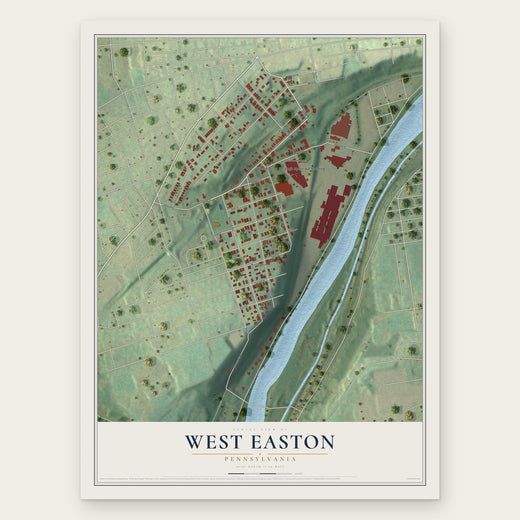 West Easton
, Pennsylvania
From $39.99See the map
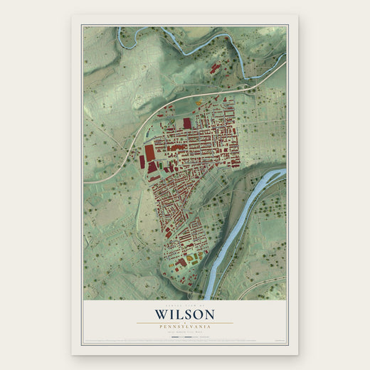 Wilson
, Pennsylvania
From $39.99See the map
 Morgan Hill
, Pennsylvania
From $39.99See the map
More maps nearby: Glendon, Palmer, Palmer Heights, Chestnut Hill and Old Orchard.