
Search for another town





Free U.S. delivery 7 to 10 days after you order
Elgin, Illinois Map Art
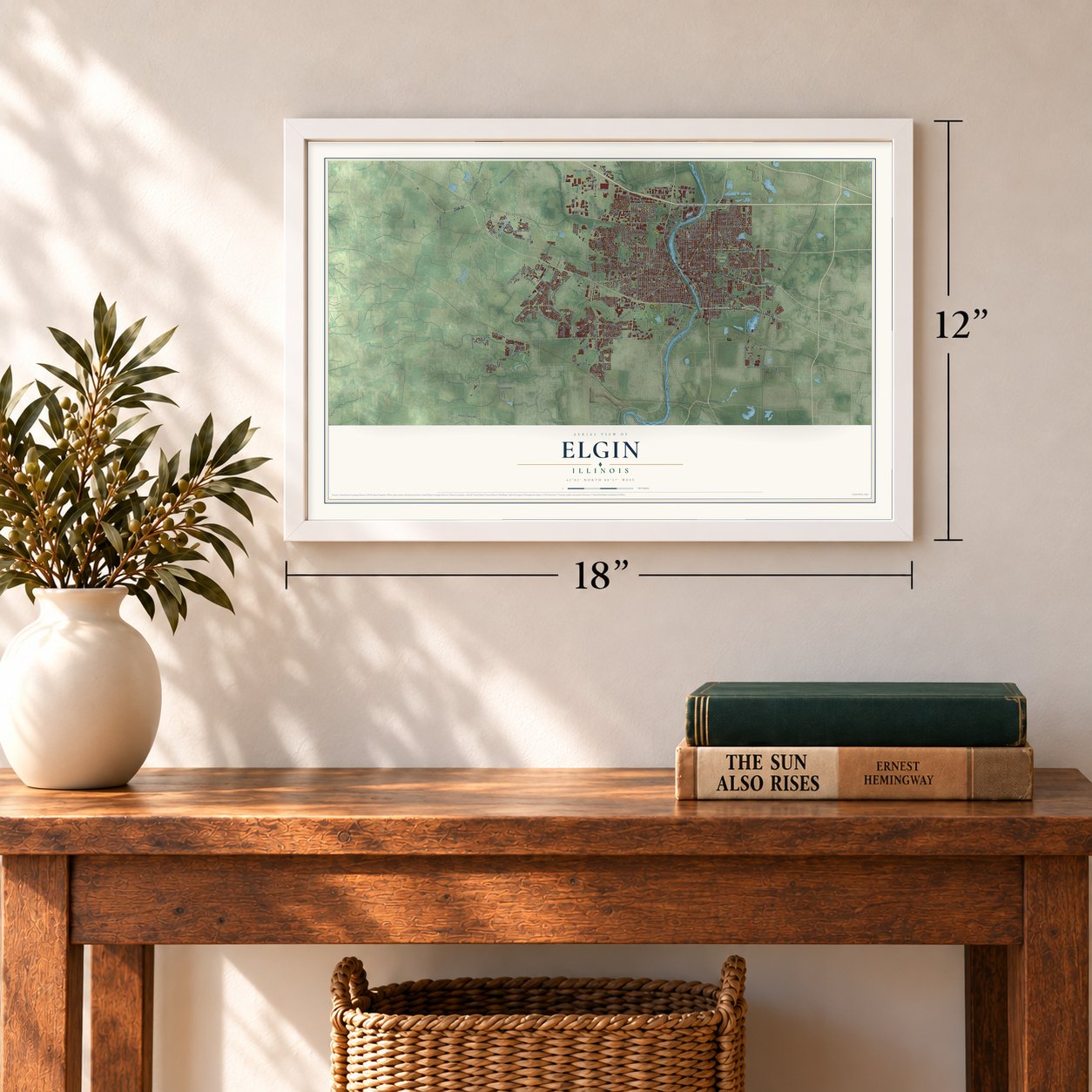
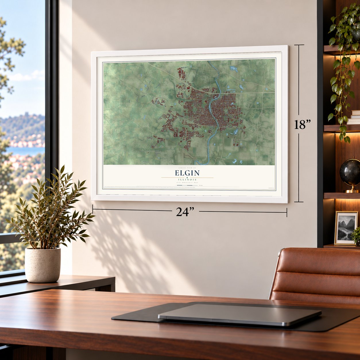
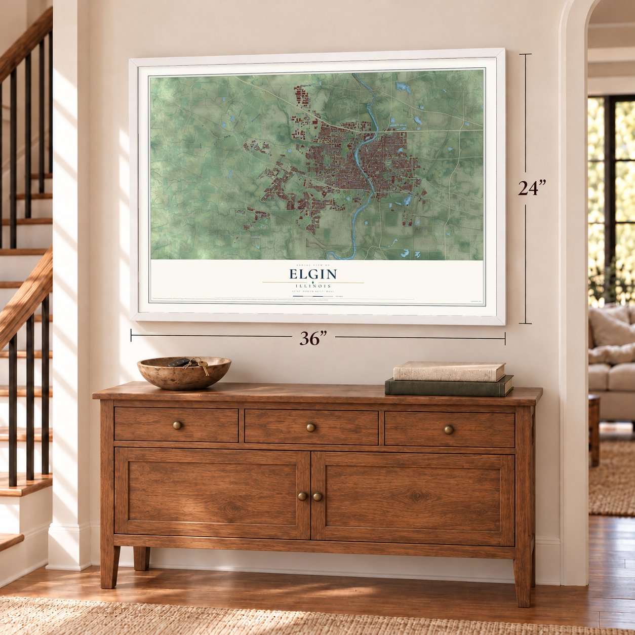
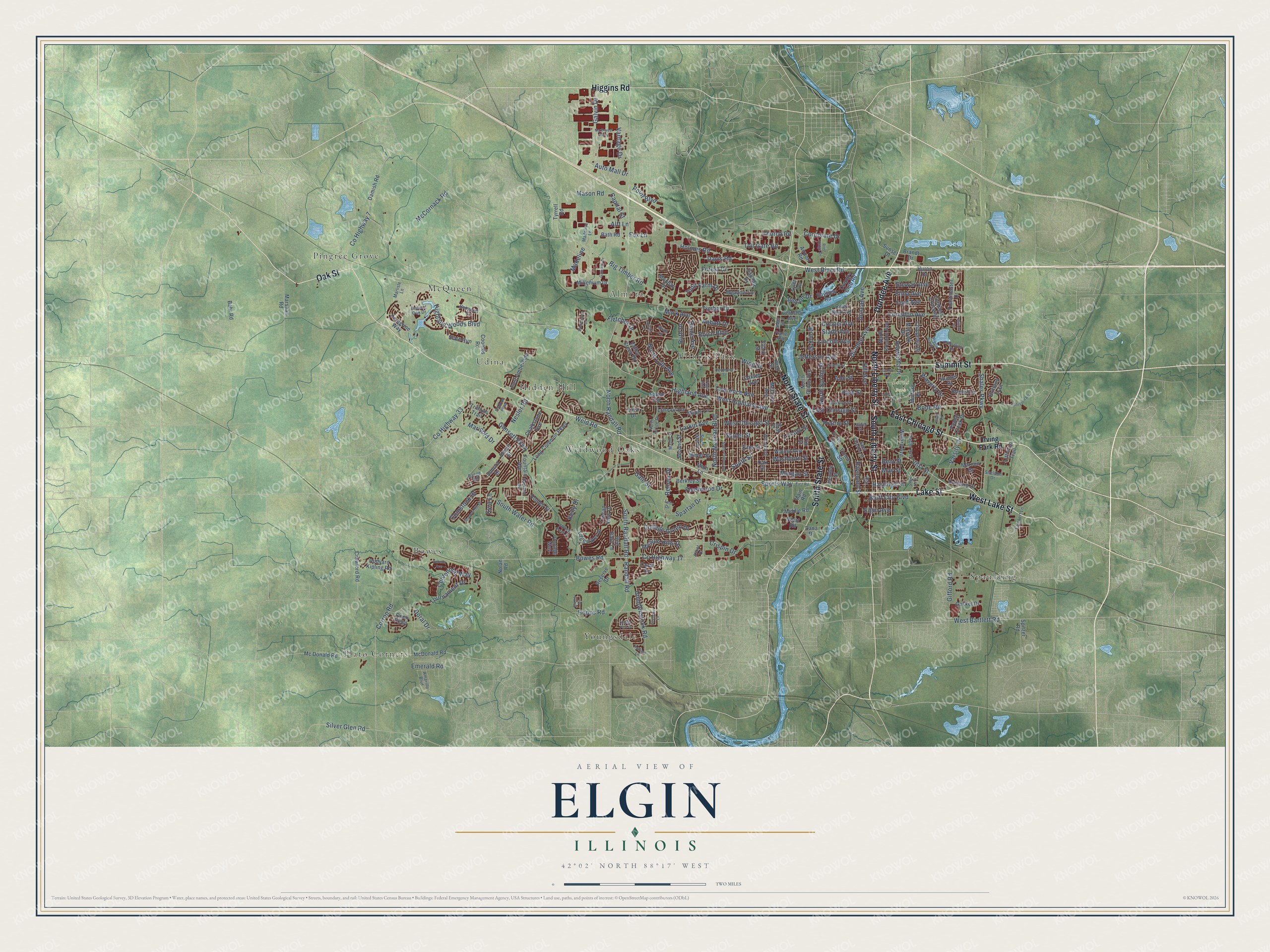
A new map of Elgin, Illinois, made in 2026 and printed to order on thick archival matte paper.
12" x 18" Archival Matte Print
A Map of Home. A Work of Art.
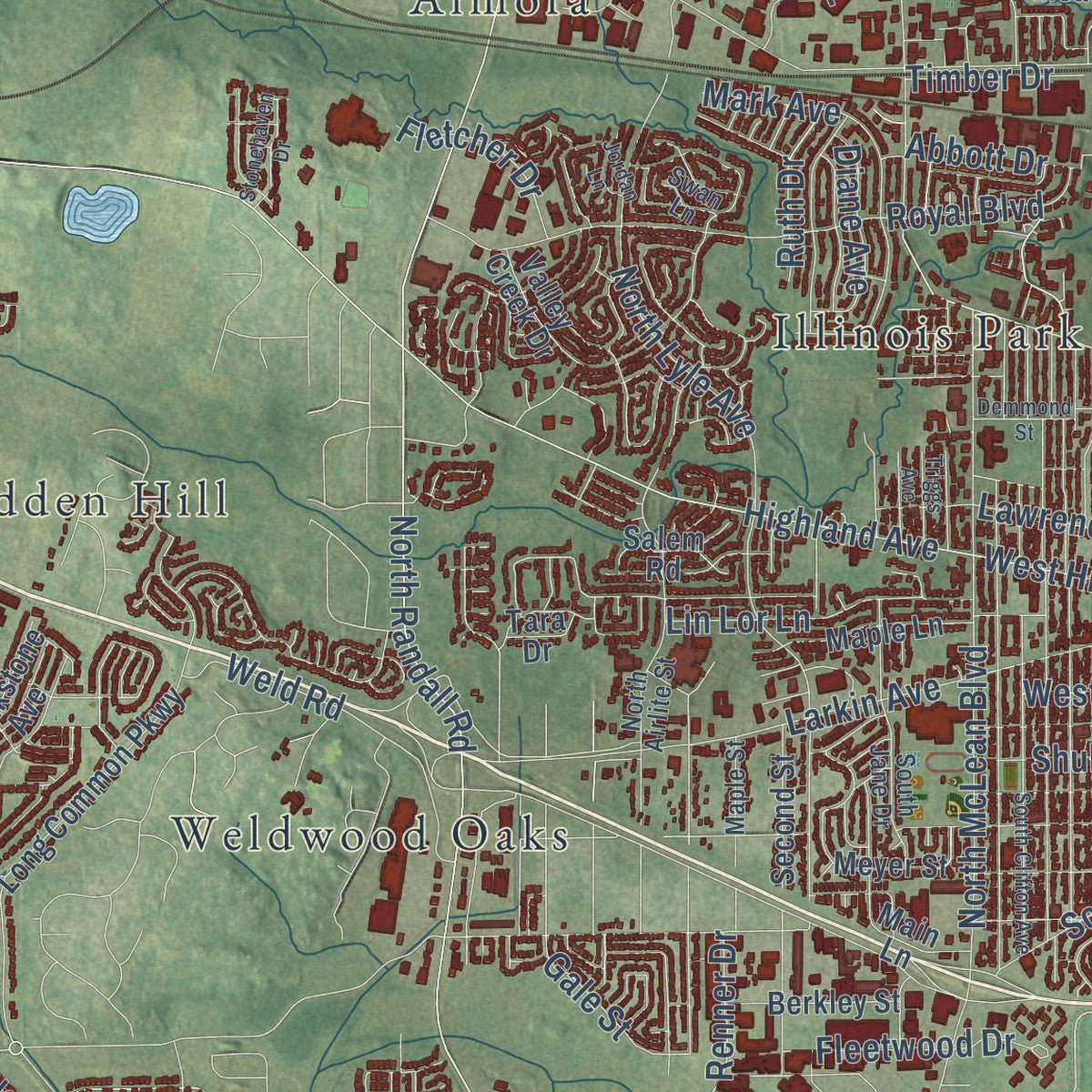
Explore Elgin, Illinois from a whole new perspective. Created using aerial imagery and detailed geographic data, this map captures Elgin building by building, with labeled streets, familiar landmarks, and shaded topographical relief that highlights the natural contours of the landscape.
Combining modern data with the timeless character of a vintage atlas, this map is just as interesting up close as it is beautiful on the wall. Whether you grew up in Elgin, spent memorable years there, or call it home today, this unique map is a great way to celebrate a place that means something to you. Zoom in on the preview to look for your street, and then order a print to put your memories on the wall.
Three ways to hang it
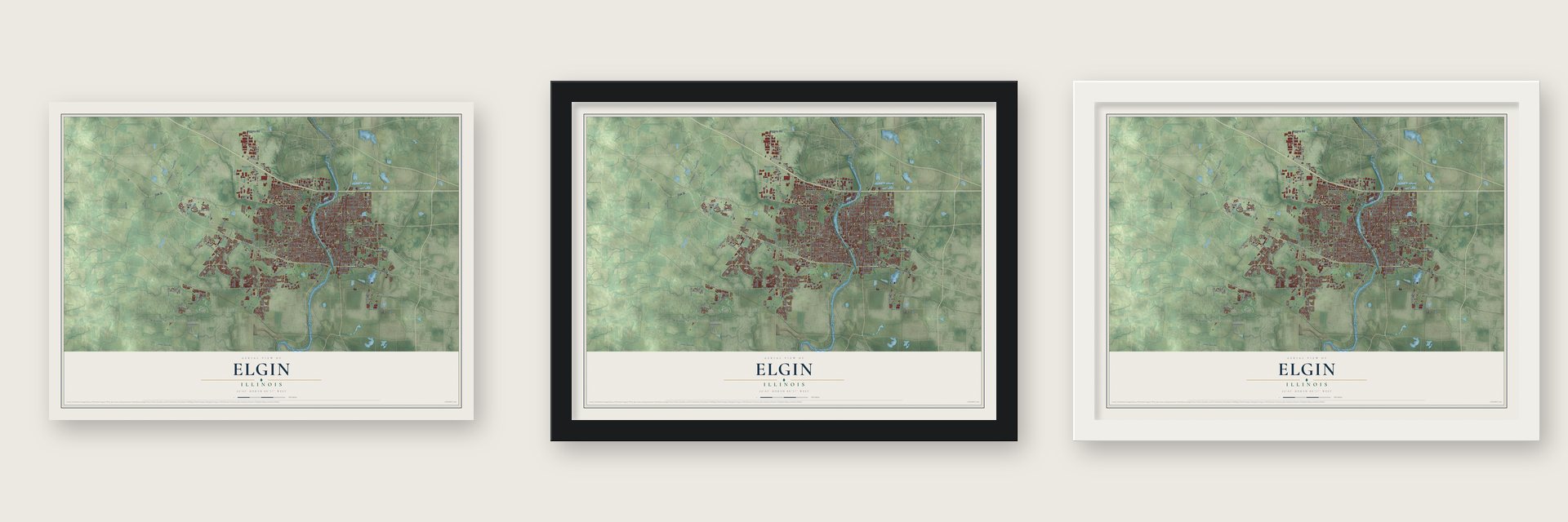
Unframed archival matte, a black wood frame or a white wood frame.
Up close
Geography Worth Displaying
This map was created using accurate cartographic data and authoritative geographic sources, including the U.S. Geological Survey and the Census Bureau. The map brings together terrain, waterways, roads, and building detail. The majority of the streets are labeled, houses are accurately depicted, and the topography is derived from government sources. Combining local data with carefully composed color and shading leads to this beautifully detailed Elgin artwork for your wall.
Rather than simply showing street outlines, we’ve included as many of the street names as we could reasonably fit on the map while keeping their names legible. Zoom in on the high resolution preview to see exactly what’s on the map. We truly set out to create a statement piece for anyone who loves Elgin. So whether it’s for you, or a gift for someone you love, we hope this map of Elgin brings back fond memories.
Read the story behind this map of Elgin, Illinois from 2026.

About Elgin, Illinois
Elgin is a city of 114,797 people in Kane County, on the Fox River 35 miles northwest of Chicago. After the Black Hawk War of 1832, soldiers who had crossed the Fox River valley carried word of its rich soil and flowing springs back east. Brothers James T. and Hezekiah Gifford heard those stories in New York and came west to find a town site on the stagecoach road between Chicago and Galena.
They chose a place where the river could be bridged, founded the town in April 1835 and named it after the Scottish tune "Elgin." Lots in what is now the Elgin Historic District, which holds the site of the founder's log cabin, were first laid out in 1842. Farms around the young town shipped butter and dairy goods to Chicago, and Gail Borden opened a condensed milk factory here in 1866. Illinois chartered Elgin as a city in 1854, and a century later it became the first city in the state to choose a council-manager government.
- Watches for three generationsThe Elgin Watch Company slowly pushed dairying aside. Three generations of Elgin families worked at the factory, and by the middle of the 20th century it was the country's largest maker of fine watches and ran the biggest watchmaking complex in the world. Production stopped in 1965, and crews demolished the factory in the summer of 1966. The clocks in Chicago's Union Station still carry the Elgin name, and the company's observatory joined the National Register in 1994.
- Road races from 1910From 1910 until 1920 the city held the Elgin National Road Races every year except during World War I. The watch company sponsored them, offering the winner $1,000 and a silver trophy, and they drew the best national racing champions and many of the big carmakers. The races did a great deal to shape the modern automobile.
- Elgin AcademyElgin Academy was the oldest college preparatory school west of the Allegheny Mountains that taught boys and girls together and had no tie to any church. It joined the National Register in 1976, and the Burhan Academy, an Islamic K-12 school, later bought its buildings.
- The tornadoes of 1920On March 28, 1920, several tornadoes tore along the Fox River. Twenty-three people died, and homes and businesses were wrecked, among them the Opera House and the Grant Theater.
- The first motorized streetsweeperJohn Murphy of Elgin invented the motorized streetsweeper in 1914. He went on to found the Elgin Sweeper Corporation to build it.
Find your street
Names on the Elgin map
Every name below is printed on this map. Look for your street, your school, the park where you played, or the pond down the road.
Places and landmarks12
- Lords Park
- Almora
- Bowes
- Hidden Hill
- Illinois Park
- McQueen
- Pingree Grove
- Plato Corners
- Spaulding
- Udina
- Weldwood Oaks
- Youngsdale
Streets and roads243
- Summit Street
- East Chicago Street
- Dundee Avenue
- Lake Street
- North Liberty Street
- West Lake Street
- South Liberty Street
- North State Street
- South State Street
- Higgins Road
- Oak Street
- Villa Street
- West Chicago Street
- West Bartlett Road
- May Street
- Sports Way
- Randall Road
- Highland Avenue
- South Street
- North McLean Boulevard
- Bowes Road
- Big Timber Road
- County Highway 17
- North Lyle Avenue
- Weld Road
- Jefferson Avenue
- West Highland Avenue
- Bluff City Boulevard
- Highland Woods Boulevard
- Nesler Road
Show all 243 streets
- Larkin Avenue
- Shales Parkway
- Royal Boulevard
- South Randall Road
- Gifford Road
- Bode Road
- Congdon Avenue
- Umbdenstock Road
- South Water Road
- Davis Road
- College Green Drive
- Hill Avenue
- North Randall Road
- Lawrence Avenue
- Gansett Parkway
- Tournament Drive
- Spartan Drive
- Duncan Avenue
- County Highway 7
- North Spring Street
- Lincoln Avenue
- Slade Avenue
- Toll Gate Road
- Erie Street
- Wing Street
- Hiawatha Drive
- Waverly Drive
- Hopps Road
- Raymond Street
- Cooper Avenue
- McCornack Road
- Corron Road
- West River Road
- Galvin Drive
- Washburn Street
- Ann Street
- Bent Street
- Todd Farm Drive
- Brook Street
- Doral Drive
- Morgan Street
- Fox Lane
- Elma Avenue
- Holmes Road
- Comstock Drive
- Forest Drive
- Alft Lane
- Capital Street
- Shuler Street
- Mason Road
- Park Street
- Varsity Drive
- Centennial Way
- Silver Glen Road
- Hastings Street
- Stewart Avenue
- Ford Avenue
- County Highway 33
- Lin Lor Lane
- Gale Street
- Renner Drive
- Fleetwood Drive
- Emerald Road
- Mission Hills Drive
- Elgin Avenue
- Madeline
- Diane Avenue
- Corporate Drive
- Fletcher Drive
- Abbott Drive
- Church Road
- Mark Avenue
- Auto Mall Drive
- Kelly Drive
- Kyra Lane
- Vantage Drive
- Crispin Drive
- Judson Drive
- Marigold Drive
- Prairie Street
- Ruth Drive
- Timber Drive
- Point Boulevard
- Locust Street
- Irving Park Road
- Main Road
- Long Common Parkway
- Mc Donald Road
- McDonald Road
- Damish Road
- River Bluff Road
- Airport Road
- Edgewater Drive
- North Grove Avenue
- North Preston Avenue
- Walnut Avenue
- Willard Avenue
- McClure Avenue
- Van Street
- Valley Creek Drive
- Slate Run
- Chalkstone Avenue
- Tuscan View Drive
- Borden Drive
- Peregrine Way
- Second Street
- Crawford Road
- Reserve Drive
- Fountain Avenue
- Meyer Street
- Maroon Drive
- Mohawk Drive
- Oakley Avenue
- Littleton Trail
- Coombs Road
- Cobblers Crossing
- East Amberside
- Middle Road
- Brittany Trail
- Maple Lane
- Elm Street
- Millenium Drive
- Clark Street
- Red Barn Lane
- Rudyard Kipling Road
- Hendee Street
- Monday Drive
- Chippewa Drive
- Hunter Drive
- Toastmaster Drive
- Sonora Drive
- Dana Drive
- Concord Drive
- Sunset Drive
- Oakdale Drive
- Poplar Creek Drive
- Trillium Trail
- Gasket Drive
- Berkley Street
- Bahr Road
- Meadow Lane
- Atwell Street
- Mulford Drive
- Country Club Road
- Salem Road
- Bayview Road
- Jerusha Avenue
- Brandt Drive
- Holden Street
- Voyage Way
- Open Parkway
- Marshall Road
- Times Square
- West Road
- Bath Road
- Huron Drive
- Main Lane
- Nolan Road
- Spitzer Road
- Tyrrell Road
- Tyler Lane
- Tara Drive
- Coral Cv
- Bird Street
- Range Road
- North Airlite Street
- Division Street
- Wilcox Avenue
- Saint Charles Street
- Jay Street
- Laurel Street
- Marlisle Lane
- South Jane Drive
- Lambert Lane
- Kirk Avenue
- Sadler Avenue
- Madeline Lane
- Amarillo Boulevard
- Hopewell Place
- Sheldon Drive
- Ancient Oak Drive
- Maple Street
- Lehr Drive
- Frazier Avenue
- Steel Street
- Grove Avenue
- Swan Lane
- Ascot Drive
- East Road
- Vahella Avenue
- Shadow Hill Drive
- South Clifton Avenue
- Stoney Creek Drive
- Demmond Street
- Rockland Avenue
- Northwest Parkway
- River Ridge Drive
- Blume Drive
- Gateway Drive
- Rohrssen Road
- Shannon Parkway
- Knotty Pine Drive
- Hatfield Lane
- Willoby Lane
- Foxmoor Lane
- Grand Avenue
- Ripple Brook Lane
- Lillie Street
- Stonehaven Drive
- Coldspring Road
- Triggs Avenue
- Jordan Lane
- Allen Drive
Names are listed as they appear on the printed map. Zoom into the product photos to find them.
The art of mapping a place
How This Map Was Made
Real places. Remarkable detail. Discover the layers that turn geographic data into a map of home.

The view from above
Aerial imagery reveals the character of the land: woodland, open fields, and the patterns of a place.

The shape of the land
Elevation data brings hills, valleys, and subtle changes in the landscape into view.

The details of home
Roads, waterways, and building footprints come together to make the map feel unmistakably local.

Geography becomes art
Considered color, shading, and typography bring the layers together in a map made for your wall.


Process illustrated with Mendon, Massachusetts. Aerial imagery: USDA NAIP. Terrain: USGS 3D Elevation Program. Map details and finished artwork: KNOWOL.
The Details
About This Print
Choose an archival matte print, or a black or white Ayous wood frame. The archival matte print is unframed.
Select your size and finish above to see the matching product image and price.
Materials & Craftsmanship
A contemporary map with the character of a classic atlas, printed on archival matte paper. Optional frames are made from Ayous wood.
Your printed map does not include the watermark shown in the full-map preview.
Shipping & Delivery
Free shipping within the United States. Every print is made to order in the USA.
Buying a gift? Add a note in your cart and we'll include it. We never put prices in the package.
Prints ship within 2 to 3 business days. Allow 7 to 10 days total from ordering for delivery. Timing may vary during holidays or periods of high order volume.
Read our shipping policy.
Returns and damaged prints
Each print is made to order. Change-of-mind refunds are not available after production.
If your print arrives damaged, misprinted or incorrect, contact support@knowol.com within 30 days of receiving it. Include your order number, photos and a description of the issue.
Read our full refund and replacement policy. For questions about your order, email support@knowol.com.
Find your town
Looking for another city?
Find a map of home in our Illinois collection, or any town in the country.
Nearby
Maps of towns near Elgin
Know someone from one of these towns? Their map makes a great gift.
 South Elgin
, Illinois
From $39.99See the map
 Sleepy Hollow
, Illinois
From $39.99See the map
 West Dundee
, Illinois
From $39.99See the map
More maps nearby: Gilberts, East Dundee, Carpentersville, Pingree Grove and Wayne.