
Search for another town





Free U.S. delivery 7 to 10 days after you order
Englewood, Colorado Map Art
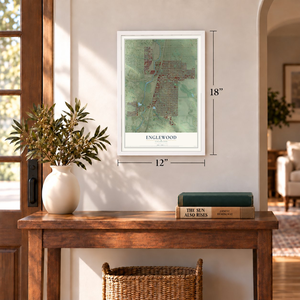
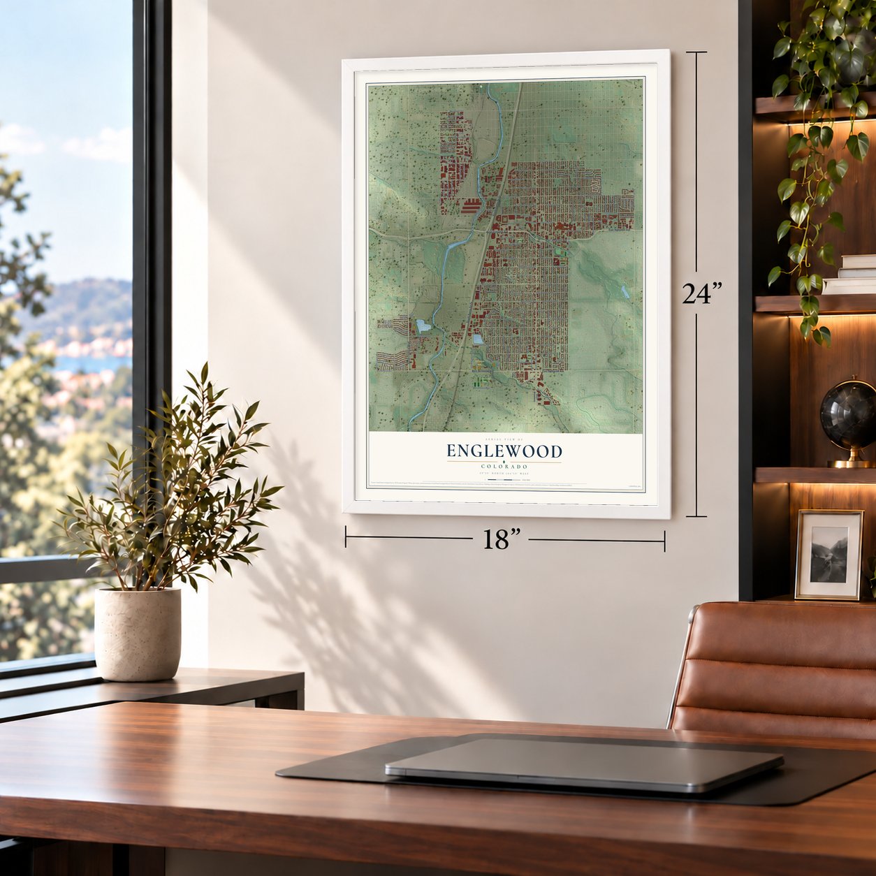
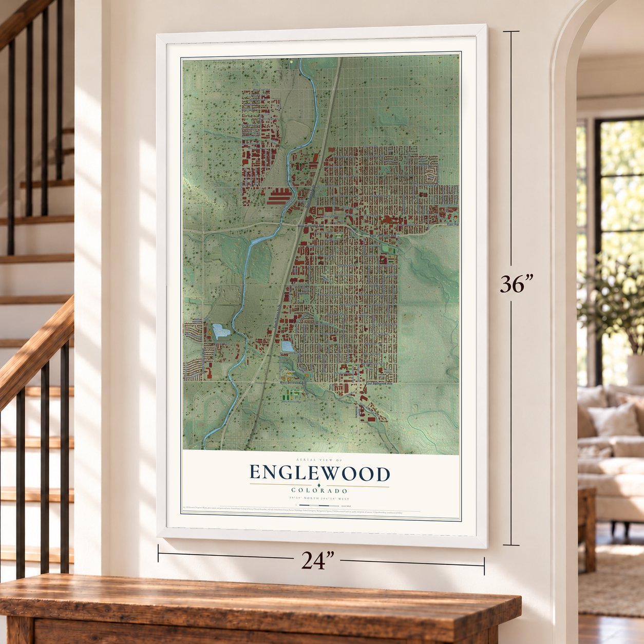
A new map of Englewood, Colorado, made in 2026 and printed to order on thick archival matte paper.
12" x 18" Archival Matte Print
A Map of Home. A Work of Art.
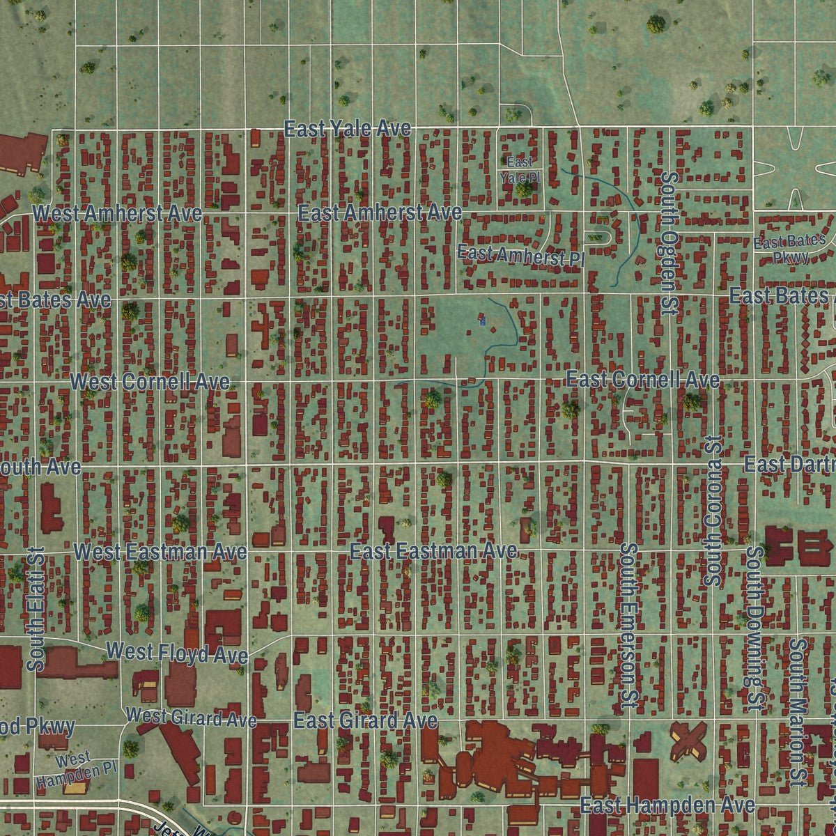
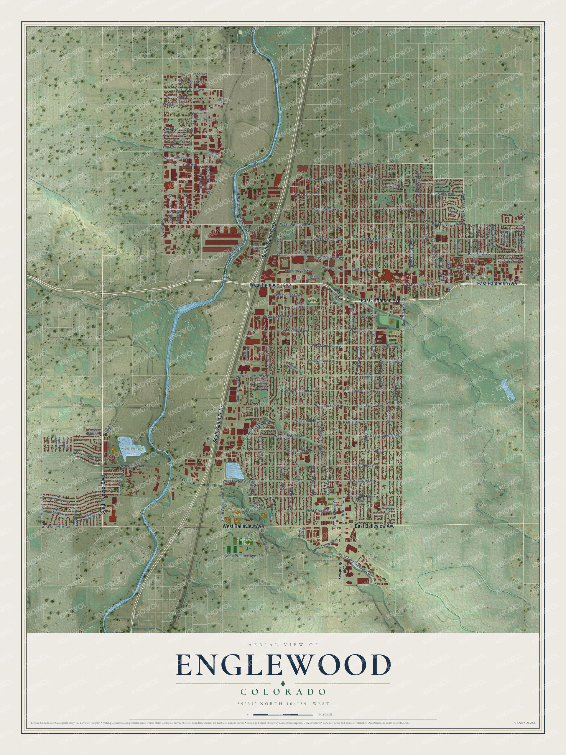
Explore Englewood, Colorado from a whole new perspective. Created using aerial imagery and detailed geographic data, this map captures Englewood building by building, with labeled streets, familiar landmarks, and shaded topographical relief that highlights the natural contours of the landscape.
Combining modern data with the timeless character of a vintage atlas, this map is just as interesting up close as it is beautiful on the wall. Whether you grew up in Englewood, spent memorable years there, or call it home today, this unique map is a great way to celebrate a place that means something to you. Zoom in on the preview to look for your street, and then order a print to put your memories on the wall.
Three ways to hang it
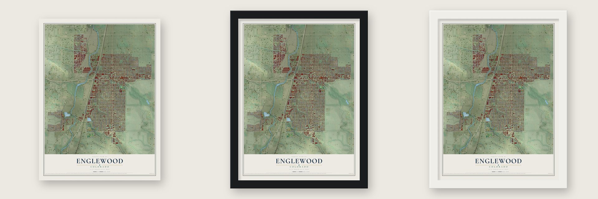
Unframed archival matte, a black wood frame or a white wood frame.
Up close
Geography Worth Displaying
This map was created using accurate cartographic data and authoritative geographic sources, including the U.S. Geological Survey and the Census Bureau. The map brings together terrain, waterways, roads, and building detail. The majority of the streets are labeled, houses are accurately depicted, and the topography is derived from government sources. Combining local data with carefully composed color and shading leads to this beautifully detailed Englewood artwork for your wall.
Rather than simply showing street outlines, we’ve included as many of the street names as we could reasonably fit on the map while keeping their names legible. Zoom in on the high resolution preview to see exactly what’s on the map. We truly set out to create a statement piece for anyone who loves Englewood. So whether it’s for you, or a gift for someone you love, we hope this map of Englewood brings back fond memories.
Read the story behind this map of Englewood, Colorado from 2026.

About Englewood, Colorado
Englewood is a city of 33,659 people in Arapahoe County, on Denver's southern edge in the valley of the South Platte River. In 1858 a Georgia prospector named William Green Russell found gold near the mouth of the stream later called Little Dry Creek. Two years later Thomas Skerritt, remembered as the city's founder, made his home here in a settlement known as Orchard Place, and four years after that he built the first road to Denver.
Residents incorporated the Town of Englewood on May 9, 1903. Skerritt ran for mayor but lost narrowly to J.C. Jones, a landowner who had once held nearly all of today's north Englewood. Pavement and street lights came in 1906, and police and fire departments followed a year later. In 1948 the city bought 2,500 acres on the Platte Canyon and built McLellan Reservoir, which freed it from relying on Denver Water. A building boom followed, and most of the city stood by 1960.
- The Cherrelyn horsecarThe Cherrelyn line was laid in 1883. A horse took the trolley car up Broadway, and then the car rolled back down on gravity alone. The odd little trolley became a symbol of the town and kept running until 1908.
- A New Deal post officeUntil the 1930s, Englewood's mail was handled through Denver's post office. Residents began asking for one of their own in 1929, and the effort gained speed after 1935, pushed by local lobbying, Denver's growth and New Deal building programs. It became Englewood's first federal building, and the only one the city got from the New Deal. The Englewood Post Office joined the National Register in 2011.
- Cinderella City, 1968In 1965 the city sold City Park for Cinderella City, which opened in 1968 as the biggest mall west of the Mississippi. The developer paid for a network of parks to replace it. About 30 years later the city tore down the failed mall. Its one surviving piece holds the Civic Center, the library, city hall and the Museum of Outdoor Arts, beside the light rail station that opened with the line in 2000.
- From sanitorium to hospital districtThe Swedish National Sanitorium was founded here in 1905 and grew into today's Swedish Medical Center. Together with Craig Hospital, a nationally ranked center for spinal cord and brain injury rehabilitation, it forms the hospital district in northeast Englewood that drives the city's economy.
Find your street
Names on the Englewood map
Every name below is printed on this map. Look for your street, your school, the park where you played, or the pond down the road.
Places and landmarks4
- Belleview Park
- Centennial Park
- Cornerstone Park
- Miller Field
Streets and roads151
- South Federal Boulevard
- East Hampden Avenue
- West Hampden Avenue
- East Jefferson Avenue
- West Belleview Avenue
- South Santa Fe Drive
- East Belleview Avenue
- West Dartmouth Avenue
- East Dartmouth Avenue
- South Downing Street
- East Amherst Avenue
- East Yale Avenue
- South Franklin Street
- West Union Avenue
- South Irving Street
- South Broadway
- South Zuni Street
- West Evans Avenue
- South Lowell Boulevard
- South Raritan Street
- South University Boulevard
- West Oxford Avenue
- West Yale Avenue
- South Clarkson Street
- West Warren Avenue
- West Iliff Avenue
- West Stanford Avenue
- South Platte River Drive East
- West Amherst Avenue
- West Eastman Avenue
Show all 151 streets
- South Logan Street
- South Sherman Street
- South Elati Street
- South Grant Street
- South Delaware Street
- South Cherokee Street
- South Acoma Street
- South Lincoln Street
- South Fox Street
- South Bannock Street
- South Galapago Street
- South Washington Street
- South Huron Street
- South Pennsylvania Street
- South Pearl Street
- South Inca Street
- South Jason Street
- South Windermere Street
- West Tufts Avenue
- East Floyd Avenue
- East Eastman Avenue
- South Lipan Street
- South Tejon Street
- West Layton Avenue
- South Kalamath Street
- South Emerson Street
- East Cornell Avenue
- South Ogden Street
- East Bates Avenue
- South Corona Street
- West Quincy Avenue
- West Grand Avenue
- East Girard Avenue
- West Radcliff Avenue
- West Floyd Avenue
- West Mansfield Avenue
- West Bates Avenue
- West Lehigh Avenue
- West Cornell Avenue
- West Kenyon Avenue
- South Lafayette Street
- South Marion Street
- South Vallejo Street
- South Shoshone Street
- South Navajo Street
- East Girard Place
- West Nassau Avenue
- Englewood Parkway
- East Stanford Avenue
- East Layton Avenue
- East Union Avenue
- West Baltic Place
- East Tufts Avenue
- East Princeton Avenue
- East Quincy Avenue
- West Princeton Avenue
- West Stanford Drive
- South Race Street
- East Chenango Avenue
- South Broadway Circle
- West Adriatic Place
- West Baker Avenue
- West Prentice Avenue
- West Ithaca Avenue
- South Gilpin Street
- South Wyandot Street
- West Lehow Avenue
- South Inca Drive
- West Pimlico Drive
- South Umatilla Street
- West Hillside Avenue
- West Vassar Avenue
- South High Street
- West College Avenue
- East Floyd Place
- South Platte River Drive West
- West Chenango Avenue
- South Decatur Street
- West Jefferson Avenue
- West Monmouth Avenue
- West Harvard Avenue
- East Mansfield Avenue
- West Wesley Avenue
- East Radcliff Avenue
- East Nassau Avenue
- East Oxford Avenue
- East Kenyon Avenue
- South Williams Street
- East Dartmouth Place
- West Bellewood Drive
- West Girard Avenue
- East Amherst Place
- Princeton Place
- South York Street
- South Lipan Drive
- Rob Roy Road
- South Vine Court
- Nassau Way
- West Radcliff Drive
- Lipan Court
- South Clay Street
- South Knox Court
- South Julian Street
- Raritan Circle
- South Platte River Drive
- East Bates Parkway
- East Lehigh Avenue
- South Hickory Street
- South Humboldt Street
- East Grand Avenue
- West Hampden Place
- South Race Court
- South Mariposa Street
- West Oxford Place
- Cornell Place
- South Elati Drive
- Pecos Street
- West Caspian Place
- Chenango Circle
- Pennwood Circle
- East Yale Place
Names are listed as they appear on the printed map. Zoom into the product photos to find them.
The art of mapping a place
How This Map Was Made
Real places. Remarkable detail. Discover the layers that turn geographic data into a map of home.

The view from above
Aerial imagery reveals the character of the land: woodland, open fields, and the patterns of a place.

The shape of the land
Elevation data brings hills, valleys, and subtle changes in the landscape into view.

The details of home
Roads, waterways, and building footprints come together to make the map feel unmistakably local.

Geography becomes art
Considered color, shading, and typography bring the layers together in a map made for your wall.


Process illustrated with Mendon, Massachusetts. Aerial imagery: USDA NAIP. Terrain: USGS 3D Elevation Program. Map details and finished artwork: KNOWOL.
The Details
About This Print
Choose an archival matte print, or a black or white Ayous wood frame. The archival matte print is unframed.
Select your size and finish above to see the matching product image and price.
Materials & Craftsmanship
A contemporary map with the character of a classic atlas, printed on archival matte paper. Optional frames are made from Ayous wood.
Your printed map does not include the watermark shown in the full-map preview.
Shipping & Delivery
Free shipping within the United States. Every print is made to order in the USA.
Buying a gift? Add a note in your cart and we'll include it. We never put prices in the package.
Prints ship within 2 to 3 business days. Allow 7 to 10 days total from ordering for delivery. Timing may vary during holidays or periods of high order volume.
Read our shipping policy.
Returns and damaged prints
Each print is made to order. Change-of-mind refunds are not available after production.
If your print arrives damaged, misprinted or incorrect, contact support@knowol.com within 30 days of receiving it. Include your order number, photos and a description of the issue.
Read our full refund and replacement policy. For questions about your order, email support@knowol.com.
Find your town
Looking for another city?
Find a map of home in our Colorado collection, or any town in the country.
Nearby
Maps of towns near Englewood
Know someone from one of these towns? Their map makes a great gift.
 Sheridan
, Colorado
From $39.99See the map
 Cherry Hills Village
, Colorado
From $39.99See the map
 Bow Mar
, Colorado
From $39.99See the map
More maps nearby: Columbine Valley, Holly Hills, Littleton, Greenwood Village and Glendale.