
Search for another town




Free U.S. delivery 7 to 10 days after you order
Englewood, New Jersey Map Art
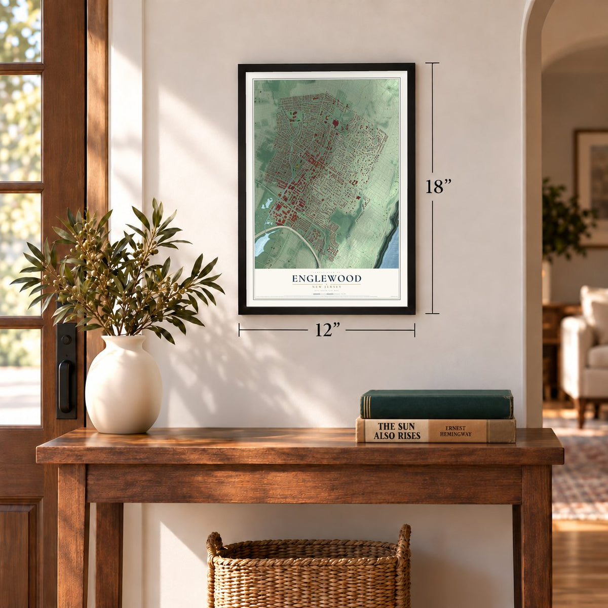
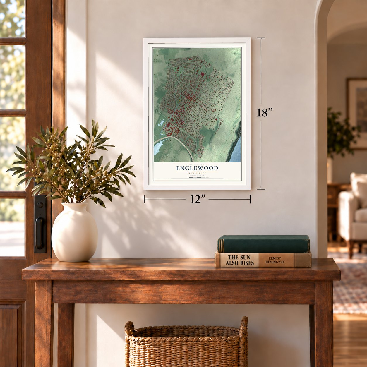
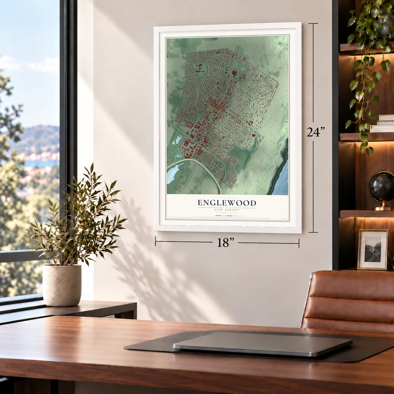
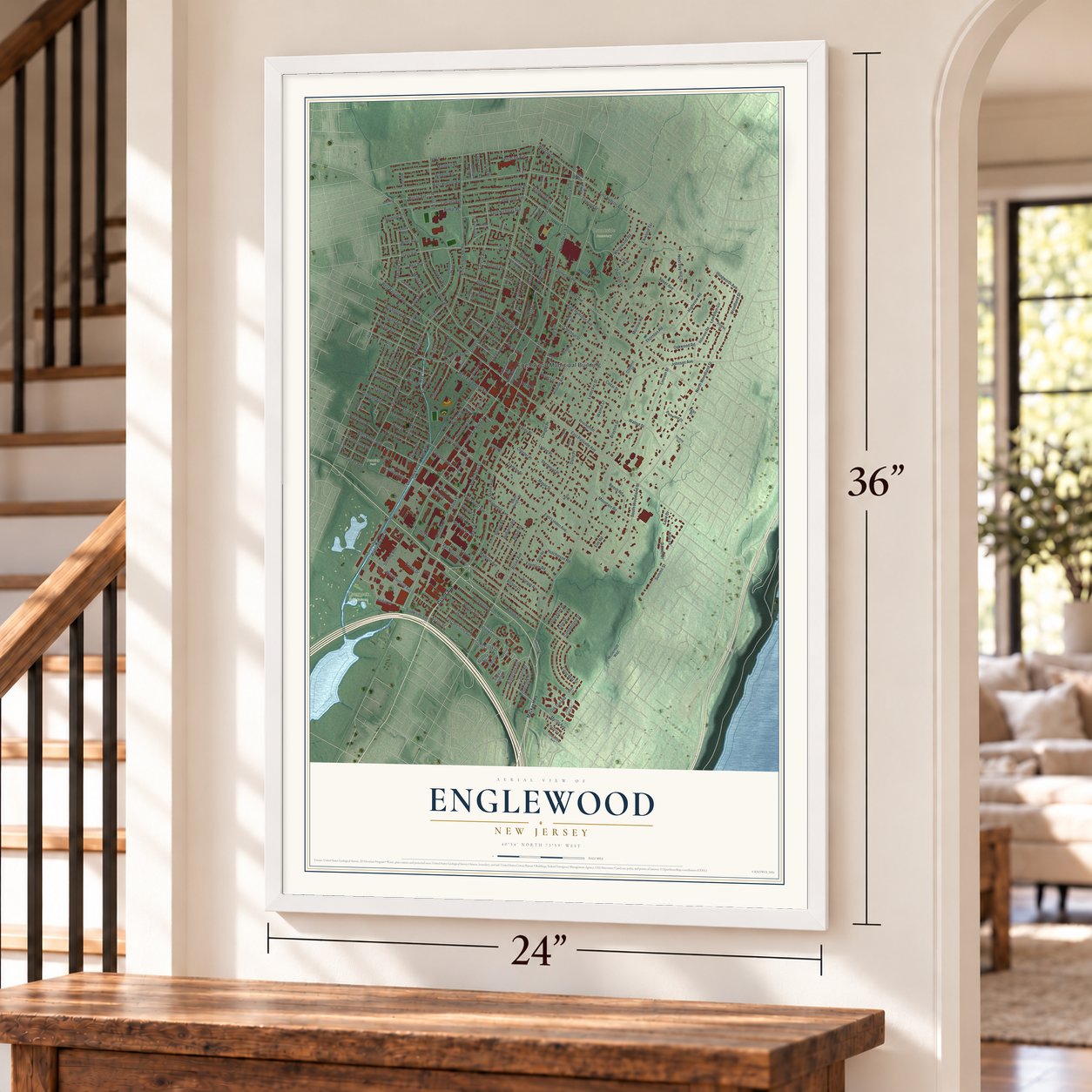
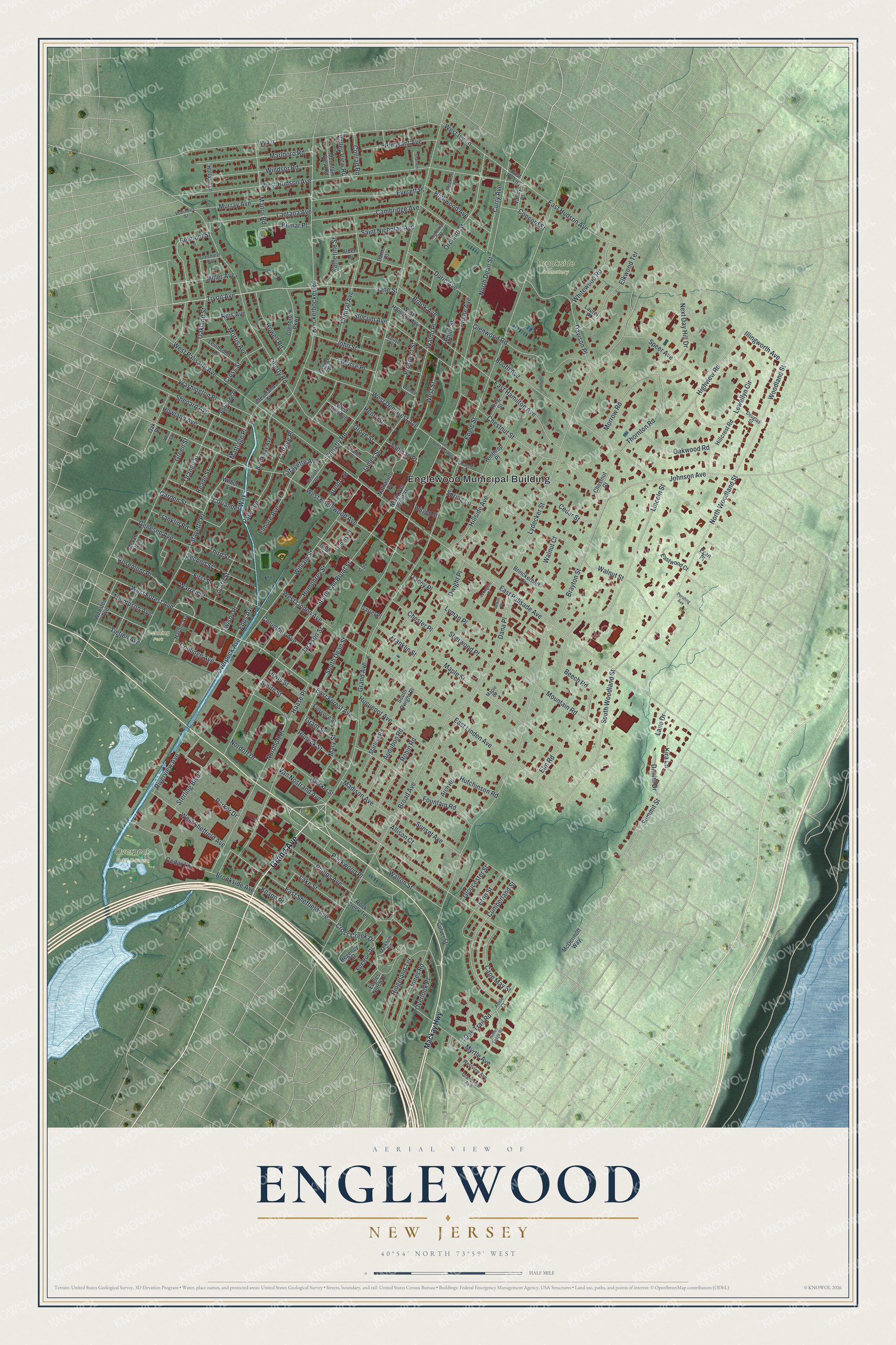
A new map of Englewood, New Jersey, made in 2026 and printed to order on thick archival matte paper.
12" x 18" Archival Matte Print
A Map of Home. A Work of Art.
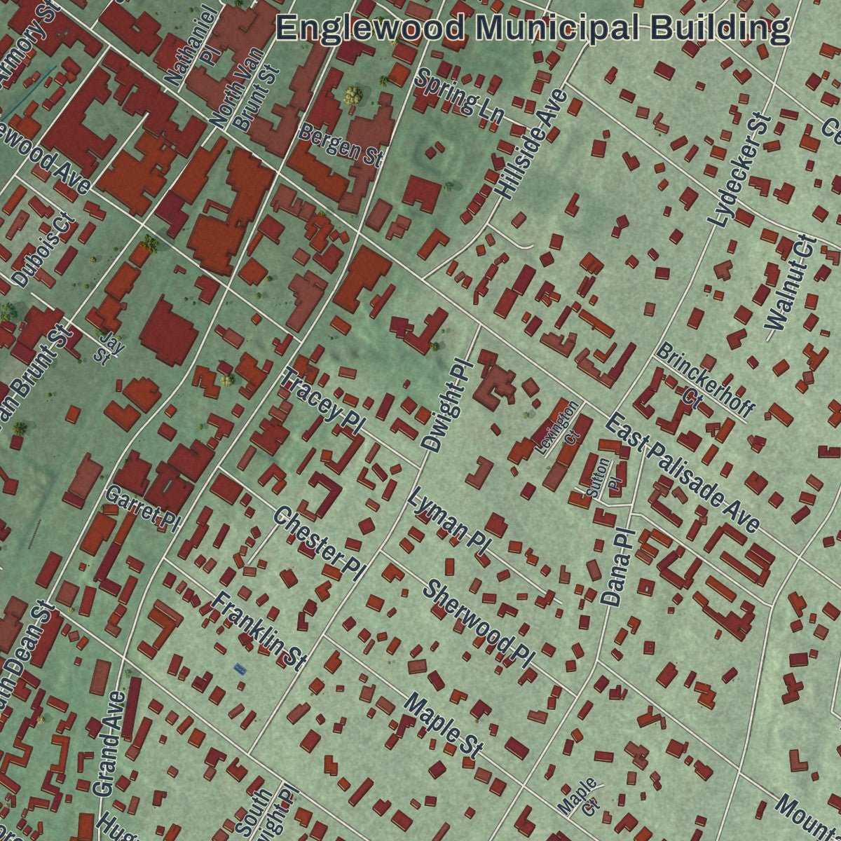
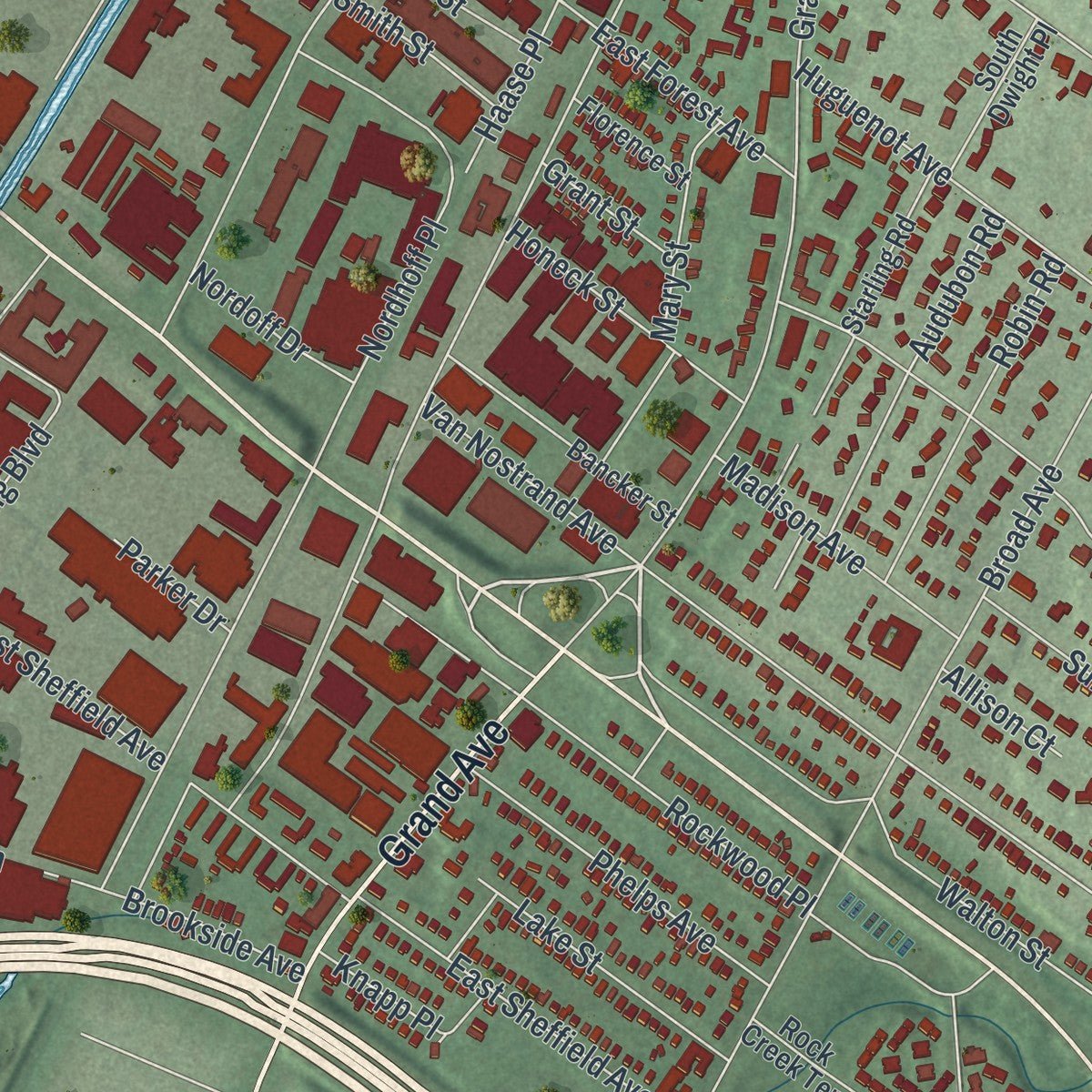
Explore Englewood, New Jersey from a whole new perspective. Created using aerial imagery and detailed geographic data, this map captures Englewood building by building, with labeled streets, familiar landmarks, and shaded topographical relief that highlights the natural contours of the landscape.
Combining modern data with the timeless character of a vintage atlas, this map is just as interesting up close as it is beautiful on the wall. Whether you grew up in Englewood, spent memorable years there, or call it home today, this unique map is a great way to celebrate a place that means something to you. Zoom in on the preview to look for your street, and then order a print to put your memories on the wall.
Three ways to hang it
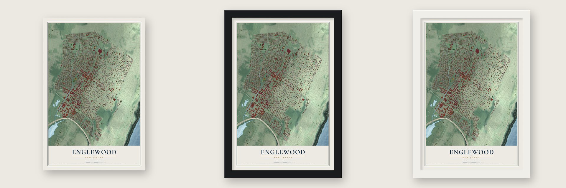
Unframed archival matte, a black wood frame or a white wood frame.
Up close
Geography Worth Displaying
This map was created using accurate cartographic data and authoritative geographic sources, including the U.S. Geological Survey (USGS) and FEMA. The map brings together terrain, waterways, roads, and building detail. The majority of the streets are labeled, houses are accurately depicted, and the topography is derived from government sources. Combining local data with carefully composed color and shading leads to this beautifully detailed Englewood artwork for your wall.
Rather than simply showing street outlines, we’ve included as many of the street names as we could reasonably fit on the map while keeping their names legible. Zoom in on the high resolution preview to see exactly what’s on the map. We truly set out to create a statement piece for anyone who loves Englewood. So whether it’s for you, or a gift for someone you love, we hope this map of Englewood brings back fond memories.
Explore the full map of Englewood, New Jersey and read about the local places it shows.

About Englewood, New Jersey
Englewood is a city of 29,308 people in Bergen County. About 2,000 Lenape of the turtle clan once lived here, but conflicts with Europeans cut their number to 50 by 1832. Once the Dutch handed New Netherland over to England in 1664, English land grants drew English, Dutch and Huguenot families, and the area came to be called the English Neighborhood.
Those first families still name the city's streets: Brinckerhoff, Van Brunt and Lydecker were Dutch, Demarest and DeMott were Huguenot, and Moore and Day were English. Englewood Township, probably named for the Engle family, took its name in 1859. When the legislature made Englewood a city on March 17, 1899, J. Wyman Jones persuaded residents to keep the name instead of choosing Brayton or Paliscena.
- The first dialed long-distance callOn November 10, 1951, Mayor M. Leslie Denning picked up the phone in Englewood and dialed Mayor Frank Osborne of Alameda, California, with no operator involved. From that day, customers whose numbers began with Englewood 3, Englewood 4 or Teaneck 7 could reach 11 cities across the country by dialing a three-digit area code before the local number.
- Upton Sinclair's Helicon Home ColonyIn 1906 the writer Upton Sinclair started the Helicon Home Colony in Englewood, a shared household run on socialist ideas. Charlotte Perkins Gilman and Sinclair Lewis were both connected with it. The experiment ended when the colony's building burned down on March 16, 1907.
- Rapper's Delight, 1979Sylvia and Joe Robinson started Sugar Hill Records in Englewood in 1979. That September the label put out the Sugarhill Gang's Rapper's Delight, which became the first hip-hop single to reach the Top 40. The label went on to record Grandmaster Flash and the Furious Five.
- From the Plaza to BergenPACThe Englewood Plaza opened as a movie theater in 1926. Half a century later, in 1976, residents led by the organist and teacher John Harms revived it as the John Harms Center, and the pianist Lazar Berman played on opening night. The hall reopened as BergenPAC in 2003, and its arts school now uses the old railway station at One Depot Square.
- A church moved stone by stoneEnglewood residents bought the land for Brookside Cemetery in 1876 and named it for the brook along its eastern edge. A pink sandstone Presbyterian church had stood on East Palisades Avenue, and in 1887 it was given to the cemetery. Workers took it apart, rebuilt it stone by stone near the cemetery entrance and turned its doorway to face a new direction.
Find your street
Names on the Englewood map
Every name below is printed on this map. Look for your street, your school, the park where you played, or the pond down the road.
Places and landmarks4
- Englewood Municipal Building
- Brookside Cemetery
- Overpeck Golf Course
- Denning Park
Streets and roads244
- Grand Avenue
- Tryon Avenue
- West Forest Avenue
- Jones Road
- South Dean Street
- North Dean Street
- East Palisade Avenue
- Tenafly Road
- Engle Street
- Lydecker Street
- West Hudson Avenue
- West Englewood Avenue
- Liberty Road
- Knickerbocker Road
- North Woodland Street
- South Van Brunt Street
- Booth Avenue
- Broad Avenue
- Van Nostrand Avenue
- West Palisade Avenue
- East Linden Avenue
- Ivy Lane
- Nordhoff Place
- Walnut Street
- Lafayette Place
- Chestnut Street
- William Street
- Lincoln Street
- Glenwood Road
- Cambridge Avenue
Show all 244 streets
- Summit Street
- Central Avenue
- Maple Street
- Rockwood Place
- Humphrey Street
- East Hudson Avenue
- South Woodland Street
- West Demarest Avenue
- Walton Street
- Cumberland Street
- Highview Road
- Johnson Avenue
- Hillside Avenue
- Brayton Street
- Belmont Street
- Dana Place
- Lewellyn Circle
- East Hamilton Avenue
- Dwight Place
- Cross Creek Drive
- Next Day Hill Drive
- Mountain Road
- East Sheffield Avenue
- Slocum Avenue
- Morrow Road
- Davison Place
- Murray Avenue
- Marlboro Road
- Everett Place
- Waldo Place
- Lantana Avenue
- Cedar Lane
- Orchard Street
- Coolidge Avenue
- Windsor Road
- Saint Nicholas Avenue
- West Street
- Elkwood Terrace
- Beech Road
- Phelps Avenue
- Oakland Street
- Speer Avenue
- First Street
- Washington Place
- Green Street
- Sterling Boulevard
- Thornton Road
- Shepard Avenue
- Audubon Road
- West Sheffield Avenue
- Huguenot Avenue
- Cedar Street
- Curry Avenue
- Hutchinson Road
- Elmore Avenue
- Jane Street
- Howland Avenue
- Whitewood Road
- Highwood Avenue
- Manor Road
- Eton Street
- Mary Street
- James Street
- Lake Street
- Robin Road
- Orange Street
- Second Street
- Cape May Street
- West Ivy Lane
- Oakwood Road
- Fountain Road
- Sunset Avenue
- Durie Avenue
- Pleasant Avenue
- Myrtle Avenue
- Pindle Avenue
- Overpeck Avenue
- Bilmar Place
- John Street
- Third Street
- Warren Street
- Sherwood Place
- Woodland Street
- Prospect Street
- Howell Road
- Ridgeland Terrace
- East Forest Avenue
- Madison Avenue
- Genesee Avenue
- Columbus Avenue
- Miller Avenue
- West Linden Avenue
- Honeck Street
- Smith Street
- Mattlage Place
- Morris Avenue
- Rosemont Place
- Park Avenue
- Jackson Street
- Riverview Avenue
- Cross Street
- Fourth Street
- Thompson Avenue
- Lyman Place
- Overlook Place
- Coriander Way
- Chester Place
- Concord Street
- Franklin Road
- Illingworth Avenue
- Franklin Street
- Lafayette Avenue
- Oak Trail Road
- Garden Street
- Brook Avenue
- Tietjen Avenue
- Morse Place
- Tracey Place
- Gloucester Street
- Cottage Place
- Reade Street
- Brookside Avenue
- Daniel Drive
- Reis Avenue
- Conrad Road
- Valley View Road
- Kira Lane
- Haase Place
- Nordoff Drive
- Lewis Street
- Katherine Street
- Tallman Place
- Twisby Place
- Epps Avenue
- Armory Street
- Spring Lane
- Grove Street
- Henry Street
- Elm Road
- Grant Street
- Knapp Place
- Parker Drive
- Allison Court
- Walnut Court
- Lane Drive
- White Street
- Mackay Highway
- East Ivy Lane
- West Hamilton Avenue
- Glenbrook Parkway
- North Van Brunt Street
- Starling Road
- Regency Circle
- Hillcrest Road
- Dubois Court
- Bancker Street
- Winthrop Place
- Brookway Avenue
- Oak Street
- Webster Avenue
- Levinsohn Place
- Harold Avenue
- Mountain View Road
- Eastwood Court
- Wilbur Street
- South Dwight Place
- Culver Street
- Cleveland Street
- Arch Road
- West End Avenue
- Fox Run Drive
- Nathaniel Place
- King Street
- Brinckerhoff Court
- Laurel Place
- Palisade Place
- McDermott Way
- Mevan Avenue
- Florence Street
- Holland Lane
- Valley Place
- Rock Creek Terrace
- Bergen Street
- Chestnut Court
- Alden Place
- Garret Place
- Eagles Notch Drive
- Ostego Place
- Tibbs Court
- Durie Court
- Egan Place
- Markham Circle
- Church Street
- Bennett Road
- Charles Street
- Jay Street
- Adele Court
- Westview Avenue
- Douglas Street
- Grandview Avenue
- Greenleaf Avenue
- Stockton Place
- Highland Street
- Voorhees Street
- Marilyn Court
- Demott Street
- Maple Court
- Hidden Ledge Road
- East Demarest Avenue
- Sutton Place
- Lexington Court
- Shannon Court
- Pershing Avenue
- Wood Street
Names are listed as they appear on the printed map. Zoom into the product photos to find them.
The art of mapping a place
How This Map Was Made
Real places. Remarkable detail. Discover the layers that turn geographic data into a map of home.

The view from above
Aerial imagery reveals the character of the land: woodland, open fields, and the patterns of a place.

The shape of the land
Elevation data brings hills, valleys, and subtle changes in the landscape into view.

The details of home
Roads, waterways, and building footprints come together to make the map feel unmistakably local.

Geography becomes art
Considered color, shading, and typography bring the layers together in a map made for your wall.


Process illustrated with Mendon, Massachusetts. Aerial imagery: USDA NAIP. Terrain: USGS 3D Elevation Program. Map details and finished artwork: KNOWOL.
The Details
About This Print
Choose an archival matte print, or a black or white Ayous wood frame. The archival matte print is unframed.
Select your size and finish above to see the matching product image and price.
Materials & Craftsmanship
A contemporary map with the character of a classic atlas, printed on archival matte paper. Optional frames are made from Ayous wood.
Your printed map does not include the watermark shown in the full-map preview.
Shipping & Delivery
Free shipping within the United States. Every print is made to order in the USA.
Buying a gift? Add a note in your cart and we'll include it. We never put prices in the package.
Prints ship within 2 to 3 business days. Allow 7 to 10 days total from ordering for delivery. Timing may vary during holidays or periods of high order volume.
Read our shipping policy.
Returns and damaged prints
Each print is made to order. Change-of-mind refunds are not available after production.
If your print arrives damaged, misprinted or incorrect, contact support@knowol.com within 30 days of receiving it. Include your order number, photos and a description of the issue.
Read our full refund and replacement policy. For questions about your order, email support@knowol.com.
Find your town
Looking for another city?
Find a map of home in our New Jersey collection, or any town in the country.
Nearby
Maps of towns near Englewood
Know someone from one of these towns? Their map makes a great gift.
 Englewood Cliffs
, New Jersey
From $39.99See the map
 Teaneck
, New Jersey
From $39.99See the map
 Leonia
, New Jersey
From $39.99See the map
More maps nearby: Tenafly, Bergenfield, Fort Lee, Bogota and Palisades Park.