
Search for another town




Free U.S. delivery 7 to 10 days after you order
Enterprise, Nevada Map Art
Building by building, with labeled streets and shaded relief.
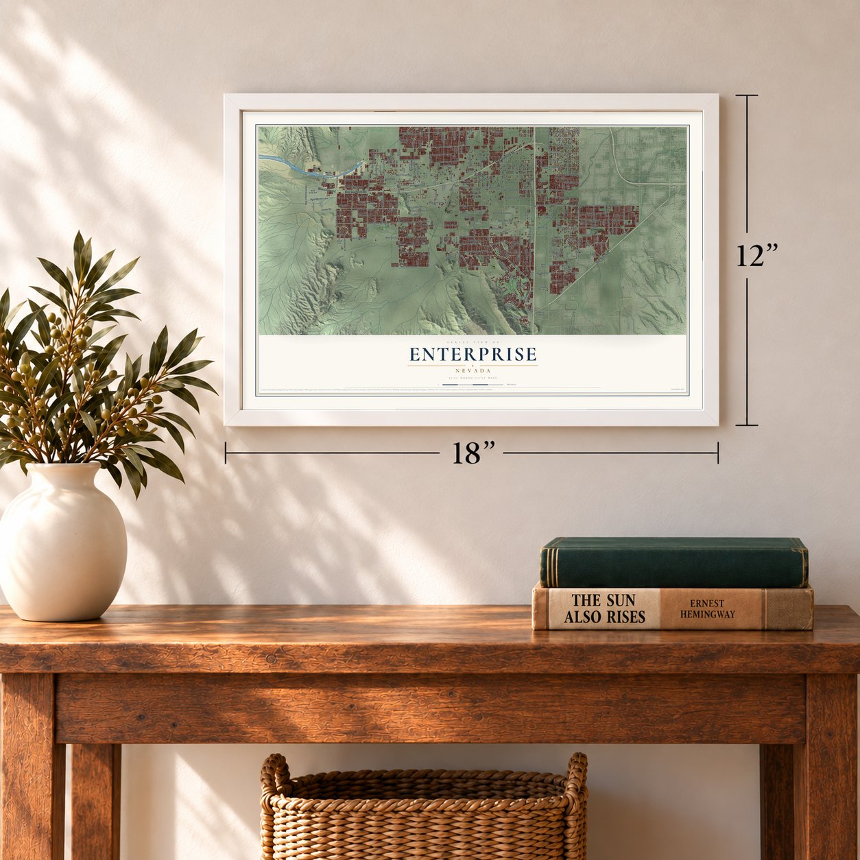
12" x 18" Archival Matte Print
A Map of Home. A Work of Art.
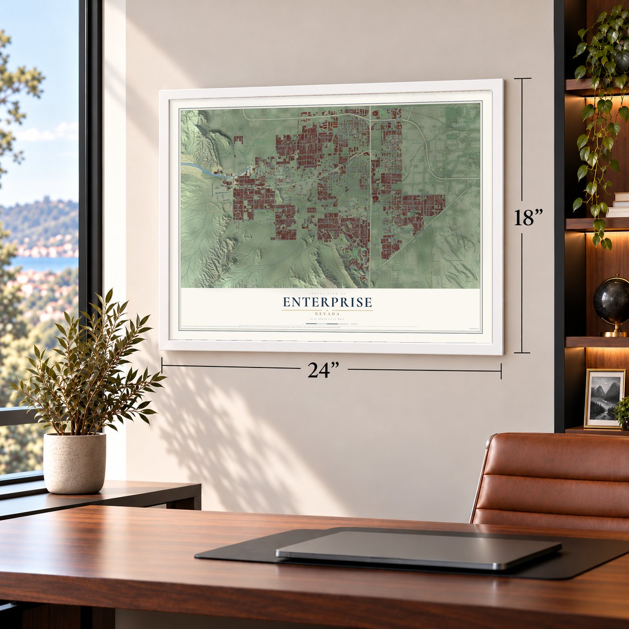
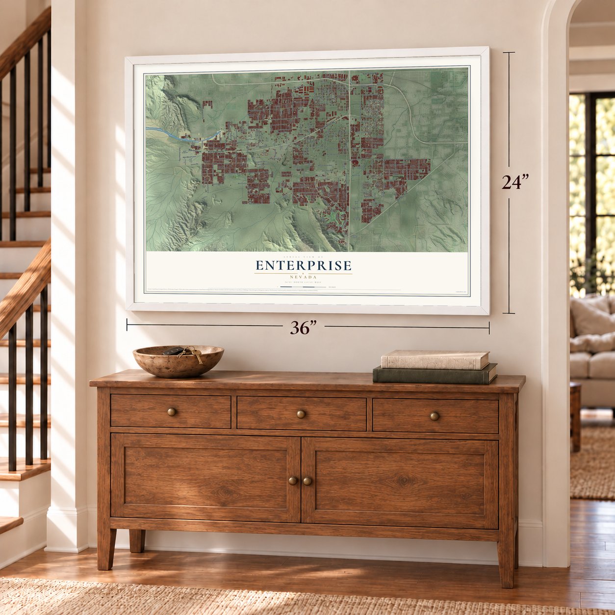
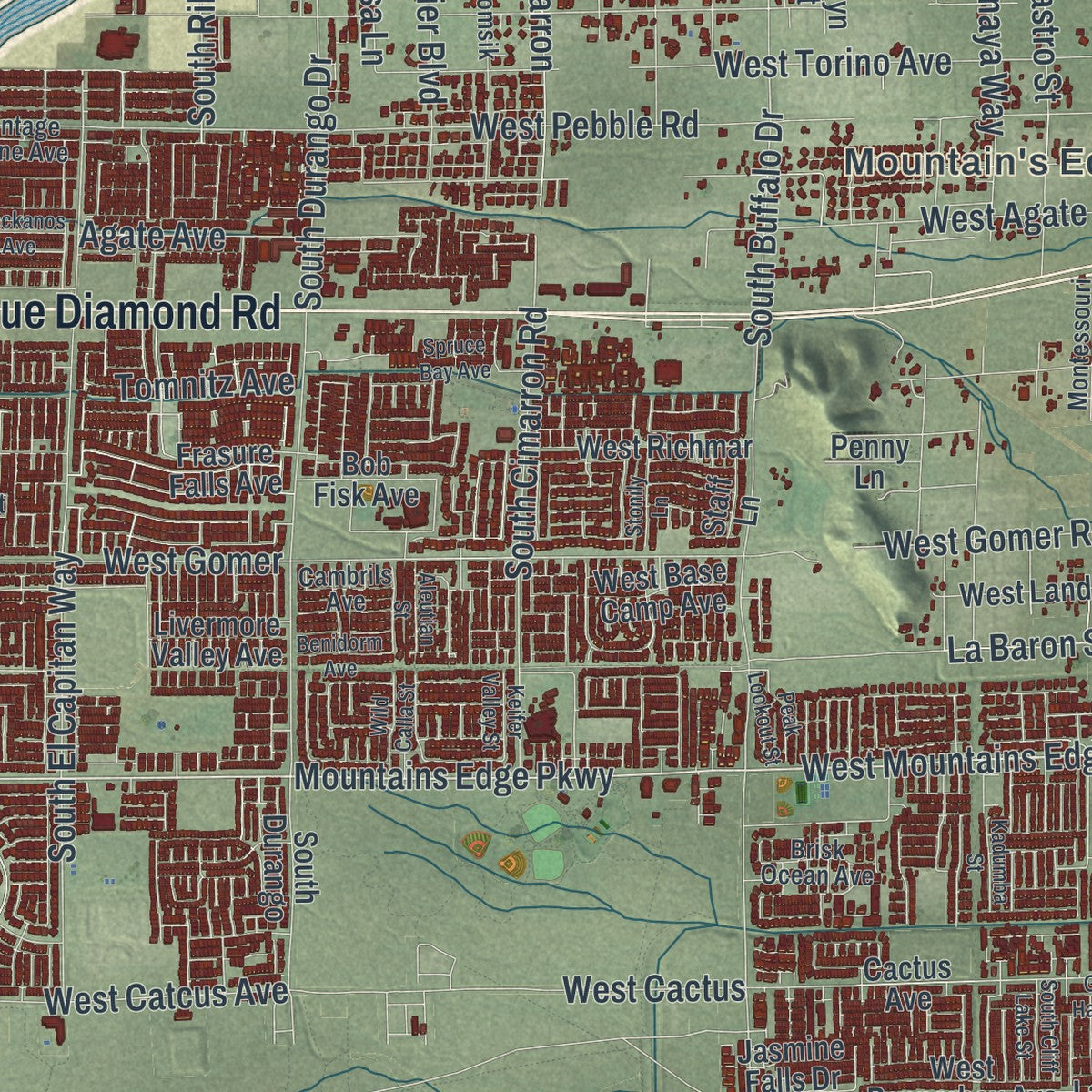
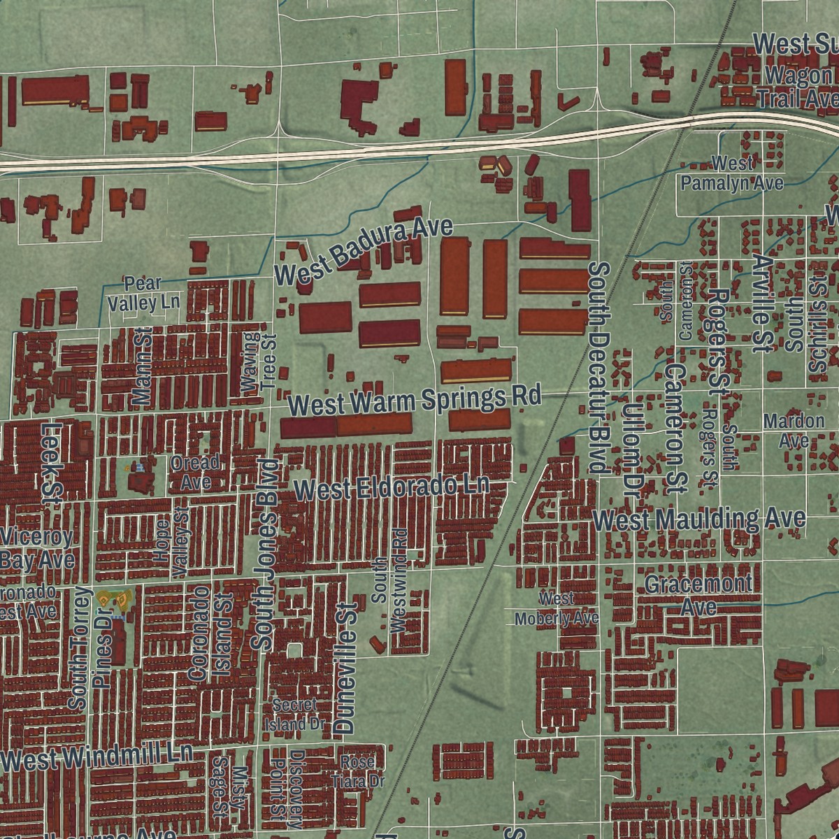
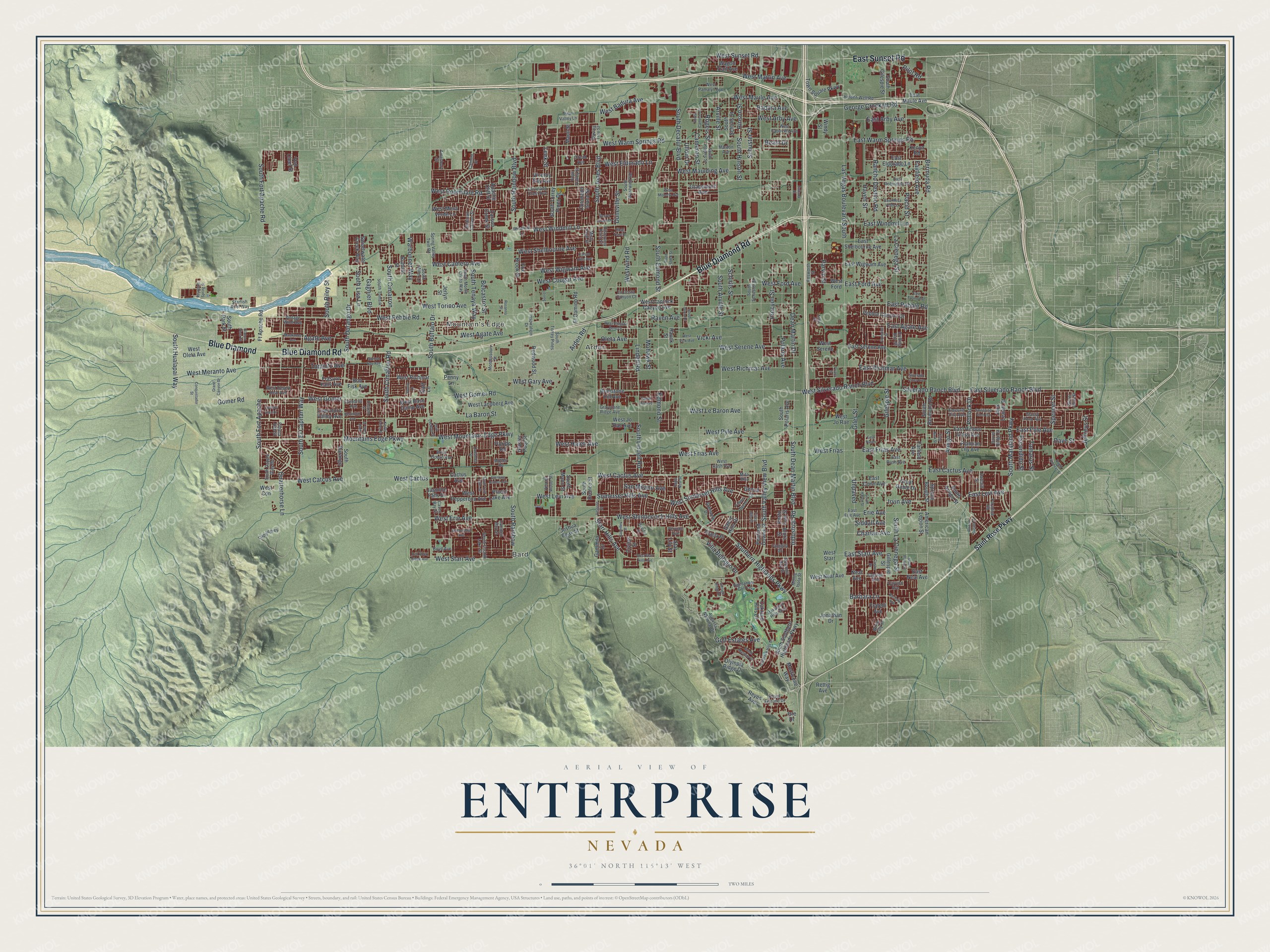
Explore Enterprise, Nevada from a whole new perspective. Created using aerial imagery and detailed geographic data, this map captures Enterprise building by building, with labeled streets, familiar landmarks, and shaded topographical relief that highlights the natural contours of the landscape.
Combining modern data with the timeless character of a vintage atlas, this map is just as interesting up close as it is beautiful on the wall. Whether you grew up in Enterprise, spent memorable years there, or call it home today, this unique map is a great way to celebrate a place that means something to you. Zoom in on the preview to look for your street, and then order a print to put your memories on the wall.
Three ways to hang it
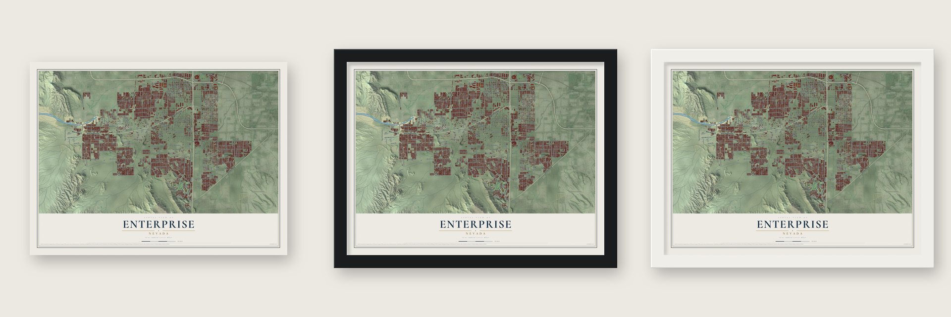
Unframed archival matte, a black wood frame or a white wood frame.
Up close
Geography Worth Displaying
This map was created using accurate cartographic data and authoritative geographic sources, including the U.S. Geological Survey and the Census Bureau. The map brings together terrain, waterways, roads, and building detail. The majority of the streets are labeled, houses are accurately depicted, and the topography is derived from government sources. Combining local data with carefully composed color and shading leads to this beautifully detailed Enterprise artwork for your wall.
Rather than simply showing street outlines, we’ve included as many of the street names as we could reasonably fit on the map while keeping their names legible. Zoom in on the high resolution preview to see exactly what’s on the map. We truly set out to create a statement piece for anyone who loves Enterprise. So whether it’s for you, or a gift for someone you love, we hope this map of Enterprise brings back fond memories.
Read the story behind this map of Enterprise, Nevada from 2026.

Find your street
Names on the Enterprise map
Every name below is printed on this map. Look for your street, your school, the park where you played, or the pond down the road.
Places and landmarks3
- Bard
- Mountain's Edge
- Arden
Streets and roads355
- Blue Diamond Road
- Blue Diamond
- East Sunset Road
- West Pebble Road
- Gilespie Street
- Bermuda Road
- West Agate Avenue
- West Mountains Edge Parkway
- Mountains Edge Parkway
- George Crockett Road
- Irvin Avenue
- Las Vegas Boulevard South
- Industrial Road
- South Valley View Boulevard
- Dean Martin Drive
- West Wigwam Avenue
- West Warm Springs Road
- South Rainbow Boulevard
- Haven Street
- West Ford Avenue
- South Decatur Boulevard
- South Jones Boulevard
- West Windmill Lane
- South Buffalo Drive
- West Richmar Avenue
- Placid Street
- Arville Street
- La Cienega Street
- West Shelbourne Avenue
- West Eldorado Lane
Show all 355 streets
- West Torino Avenue
- Raven Avenue
- West Robindale Road
- West Cactus Avenue
- West Serene Avenue
- West Le Baron Avenue
- West Sunset Road
- Giles Street
- Southern Highlands Parkway
- Rancho Destino Road
- West Silverado Ranch Boulevard
- West Meranto Avenue
- West Pyle Avenue
- West Cougar Avenue
- West Gomer Road
- Hinson Street
- South Lindell Road
- East Silverado Ranch Boulevard
- Silverado Ranch Boulevard
- Polaris Avenue
- South Arville Street
- West Camero Avenue
- Edmond Street
- South Tenaya Way
- Lindell Road
- East Pyle Avenue
- West Erie Avenue
- South Durango Drive
- East Cactus Avenue
- West Frias Avenue
- Fairfield Avenue
- West Badura Avenue
- West Arby Avenue
- South Cimarron Road
- Quarterhorse Lane
- Procyon Street
- South Hinson Street
- Somerset Hills Avenue
- West Somerset Hills Avenue
- South El Capitan Way
- West Gary Avenue
- Schuster Street
- West Haleh Avenue
- South Dean Martin Boulevard
- Starr Hills Avenue
- West Starr Avenue
- Cameron Street
- Schirlls Street
- West Maulding Avenue
- West Maule Avenue
- West Gomer
- South Maryland Parkway
- Westwind Road
- Rogers Street
- West Cactus
- Chartan Avenue
- South Fort Apache
- Amigo Street
- Belcastro Street
- South Rainbow
- South La Cienega Street
- Mohawk Street
- West Martin Avenue
- South Fort Apache Road
- West Shinnecock Hills Avenue
- Warbonnet Way
- Gomer Road
- Gagnier Boulevard
- West Levi Avenue
- Spencer Street
- Parvin Street
- West Catcus Avenue
- East Starr Avenue
- East Warm Springs Road
- East Windmill Lane
- East Ford Avenue
- East Pebble Road
- East Agate Avenue
- East Arby Avenue
- East Richmar Avenue
- East Frias Avenue
- South Edmond Street
- Vicki Avenue
- Oleta Avenue
- Ullom Drive
- Duneville Street
- South Hualapai Way
- South Cimarron
- Badura Avenue
- Agate Avenue
- Barbara Lane
- Erie Avenue
- Unpaved
- Arden Road
- Siddall Avenue
- Villa Bellagio Drive
- South Lisa Lane
- South Riley Street
- Golf Estates Avenue
- East Levi Avenue
- Jeffreys Street
- Pilot Road
- San Milano Avenue
- Escondido Street
- Tomnitz Avenue
- Pollock Drive
- La Baron Street
- Tamarus Street
- Dave Street
- West Frias
- Beam Drive
- Leek Street
- Saint Rose Parkway
- El Camino Road
- South Gilespie Street
- East Conn Avenue
- South Torrey Pines Drive
- South Southern Highlands Parkway
- West Oleta Avenue
- Redwood Street
- South Bermuda Road
- West Mesa Verde Lane
- South Polaris Avenue
- Hauck Street
- Oakland Hills Drive
- South Amigo Street
- South Bronco Street
- West Jo Rae Avenue
- South Schirlls Street
- East Maule Avenue
- East Shelbourne Avenue
- East Wigwam Avenue
- West Landberg Avenue
- Town Square Parkway
- East Eldorado Lane
- East Neal Avenue
- Mann Street
- South Mann Street
- South Park Street
- Jack Leavitt Street
- West Richmar
- South Durango
- Wagon Trail Avenue
- Pentland Downs Street
- Jerlyn Street
- West Neal Avenue
- Pebble Canyon Drive
- Ft Apache Road
- East Serene Avenue
- Joshua Peak Street
- East Ribbon Grass Avenue
- Penny Lane
- Frasure Falls Avenue
- West Base Camp Avenue
- West Caprock Canyon Avenue
- West Pepperbox Avenue
- West Serene
- Great Gable Drive
- West Ford
- West Starr
- Apache Cliff Street
- Gracemont Avenue
- West Jo Rae
- West Con
- Mosticone Way
- Olympia Ridge Drive
- Fox Brook Street
- Plantian Lily Avenue
- Sweetwater Creek Way
- Gammila Drive
- Brimstone Hill Avenue
- Coronado Island Street
- Viceroy Bay Avenue
- Bob Fisk Avenue
- Genoa Drive
- Gillespie Street
- American Legion Street
- Livermore Valley Avenue
- Jonathan Drive
- Spruce Bough Street
- Prada Place
- Reyes Avenue
- Jasmine Falls Drive
- Cactus Avenue
- Porto Foxi Street
- Placid Lake Avenue
- Van Cleef Street
- Neal Avenue
- Carson Creek Street
- Rumrill Street
- Star Lily Street
- Windy Street
- Rettig Avenue
- Civitas Street
- Glacier Pool Street
- Alora Street
- Farfield Avenue
- Gaelic Hills Drive
- Fratelli Avenue
- Florido Road
- Staff Lane
- Kenya Road
- Isle Drive
- South Monte Cristo Way
- Mardon Avenue
- South Rogers Street
- West Capovilla Avenue
- East Robindale Road
- Hidden Well Road
- Ensworth Street
- South Schuster Street
- South Torrey Pines
- South Westwind Road
- Montessouri Street
- South Dapple Gray Road
- East Erie Avenue
- West Rush Avenue
- South Miller Lane
- East Rush Avenue
- South Cochiti Lake Street
- Spring Valley Twin Road
- Dapplegrey
- South Tomsik
- Augusta National Drive
- Oakbrook Hills Way
- Highlander Golf Lane
- Radcliff Street
- La Costa Canyon Court
- Bramante Drive
- West Pamalyn Avenue
- Famiglia Drive
- Paradise Road
- West Desert Heat Avenue
- Graystone Ridge Avenue
- Royal Fortune Drive
- Mohican Canyon Street
- Inspiration Drive
- Coronado Crest Avenue
- Brisk Ocean Avenue
- Bandol Place
- Amesbury Street
- Discovery Point Street
- Verona Wood Street
- Hope Valley Street
- Vintage Wine Avenue
- Windmill Lane
- Steponia Bay Street
- Boyd Avenue
- Starfish Reef Way
- Pear Valley Lane
- Glassy Pond Avenue
- Drifting Bay Street
- Cambrils Avenue
- Barrel Ridge Street
- Capriati Avenue
- Emerald City Avenue
- Misty Sage Street
- Calvino Avenue
- Camden Bay Street
- Perrone Avenue
- Casco Bay Street
- Waving Tree Street
- Catmint Street
- White Lilly Street
- Pimera Alta Street
- Monte Isola Street
- Silver Dew Street
- Motley Road
- Oread Avenue
- Mita Way
- Rosanna Street
- Grand Canyon Drive
- South Cameron Street
- South Ullom Drive
- South Spencer Street
- East Mesa Verde Lane
- West Moberly Avenue
- Conquistador Street
- South Haven Street
- South Hauck Street
- Oakbrook Hills Drive
- West Vicki Avenue
- West Starr Hills Avenue
- African Sunset Street
- Grand Masters Drive
- South Placid Street
- Sweeping Vine Avenue
- West Alington Bend Drive
- East Torino Avenue
- Glencoe Harbor Avenue
- Salernes Street
- Benlomond Avenue
- South Cliff Lake Street
- Red Rock Ridge Avenue
- Aqueduct Street
- Palliser Bay Drive
- Mackanos Avenue
- Wild Calla Street
- Benidorm Avenue
- Peak Lookout Street
- Cowboy Rain Drive
- Silverado Pines Avenue
- Reynolds Spring Street
- Kadumba Street
- Fintry Hills Street
- Stonily Lane
- Carson Hills Avenue
- Tartan Hill Avenue
- Castor Street
- Secret Island Drive
- Keifer Valley Street
- Aleutian Street
- Barbara Avenue
- Vintage Ridge Drive
- Rose Tiara Drive
- Spruce Bay Avenue
- Tree Bark Street
- Vestone Street
- Sultana Street
- Eagle Nest Street
- Blanco Vista Street
- East Haleh
- Friant Street
- Sorrel
- Kimo Street
Names are listed as they appear on the printed map. Zoom into the product photos to find them.
About Enterprise, Nevada
Enterprise is an unincorporated town of 221,831 people in Clark County, covering the southwestern corner of the Las Vegas Valley. Paiute people lived across the valley first. The area belonged to Lincoln County until Clark County was split off in 1909. County commissioners set up an Enterprise school district in 1918, the earliest known use of the name, and one historian thinks it was picked simply because it sounded hopeful.
Residents petitioned to form a town of their own so that Henderson could not annex them and their semirural way of life. Enterprise was created on December 17, 1996. Right after that, county commissioners moved about five square miles, including Rhodes Ranch and a regional park, into Spring Valley, though residents protested that they had no say. On January 19, 1999, the county and Henderson agreed to let the city take 1,400 acres of Enterprise in sections 26 and 34, which were still empty, so it could reach an Interstate 15 exit. Section 33, where many people lived, stayed in the town.
- The 1958 midair collisionOn April 21, 1958, United Airlines Flight 736 collided with an Air Force jet over what was then empty desert scrub, and 49 people died. Shops and offices near South Decatur Boulevard and West Cactus Avenue now crowd the crash site. In 1999 the son of one victim put up a small metal cross there in memory of those who were killed.
- From 14,108 to 221,831Growth came fast once the town was formed. Enterprise had 14,108 residents in 2000 and 108,481 in 2010, and the count more than doubled to 221,831 by 2020. The planned communities of Mountain's Edge and Southern Highlands both lie inside the town.
- Home of the UFCThe Ultimate Fighting Championship opened its Performance Institute here in 2017 and named it the organization's headquarters. The UFC Apex followed across the street in June 2019, and it hosted the company's U.S. events during the COVID-19 pandemic.
Keep exploring Nevada
Enterprise is one of 150 Nevada towns we've mapped. Every dot on the map is a print of its own.
The search covers every state, Nevada first.
Near Enterprise
Order 2 or more town maps and save 10%. Shown in the size and finish you picked above, so they hang as a set.
- Sloan 12" x 18" / Archival Matte Print $39.99
- Spring Valley 12" x 18" / Archival Matte Print $39.99
- Paradise 12" x 18" / Archival Matte Print $39.99

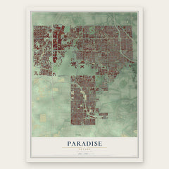
More maps nearby: The Lakes, Summerlin South, Winchester, Blue Diamond and Henderson.
The art of mapping a place
How This Map Was Made
Real places. Remarkable detail. Discover the layers that turn geographic data into a map of home.

The view from above
Aerial imagery reveals the character of the land: woodland, open fields, and the patterns of a place.

The shape of the land
Elevation data brings hills, valleys, and subtle changes in the landscape into view.

The details of home
Roads, waterways, and building footprints come together to make the map feel unmistakably local.

Geography becomes art
Considered color, shading, and typography bring the layers together in a map made for your wall.


Process illustrated with Mendon, Massachusetts. Aerial imagery: USDA NAIP. Terrain: USGS 3D Elevation Program. Map details and finished artwork: KNOWOL.
The Details
About This Print
Choose an archival matte print, or a black or white Ayous wood frame. The archival matte print is unframed.
Select your size and finish above to see the matching product image and price.
Materials & Craftsmanship
A contemporary map with the character of a classic atlas, printed on archival matte paper. Optional frames are made from Ayous wood.
Your printed map does not include the watermark shown in the full-map preview.
Shipping & Delivery
Free shipping within the United States. Every print is made to order in the USA.
Buying a gift? Add a note in your cart and we'll include it. We never put prices in the package.
Prints ship within 2 to 3 business days. Allow 7 to 10 days total from ordering for delivery. Timing may vary during holidays or periods of high order volume.
Read our shipping policy.
Returns and damaged prints
Each print is made to order. Change-of-mind refunds are not available after production.
If your print arrives damaged, misprinted or incorrect, contact support@knowol.com within 30 days of receiving it. Include your order number, photos and a description of the issue.
Read our full refund and replacement policy. For questions about your order, email support@knowol.com.