
Search for another town





Free U.S. delivery 7 to 10 days after you order
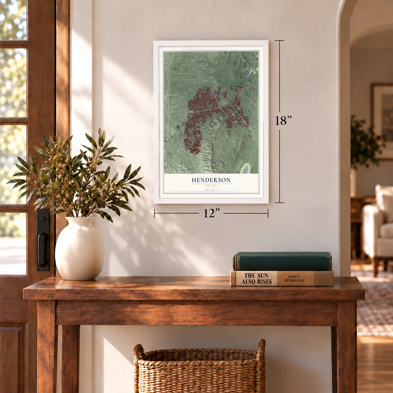
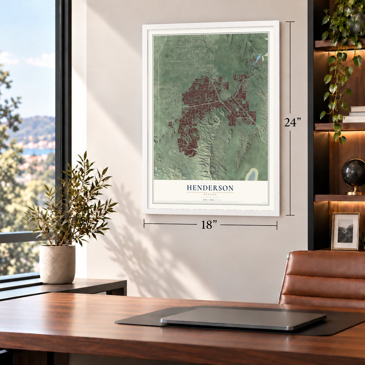
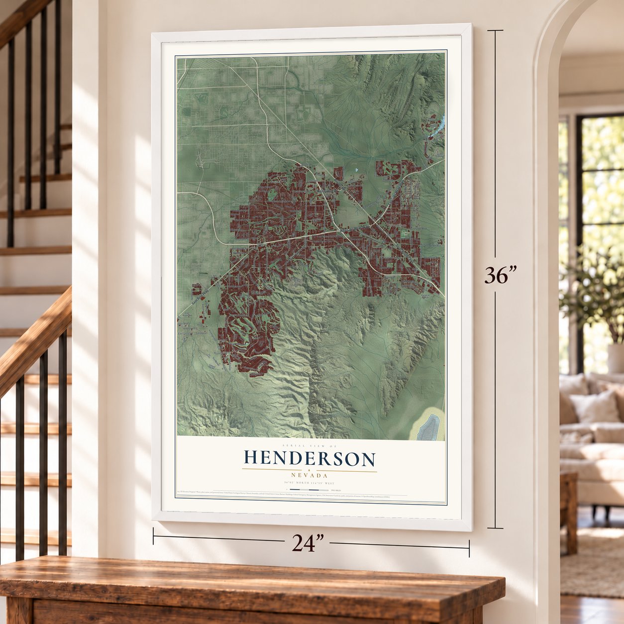
Henderson, Nevada Map Art
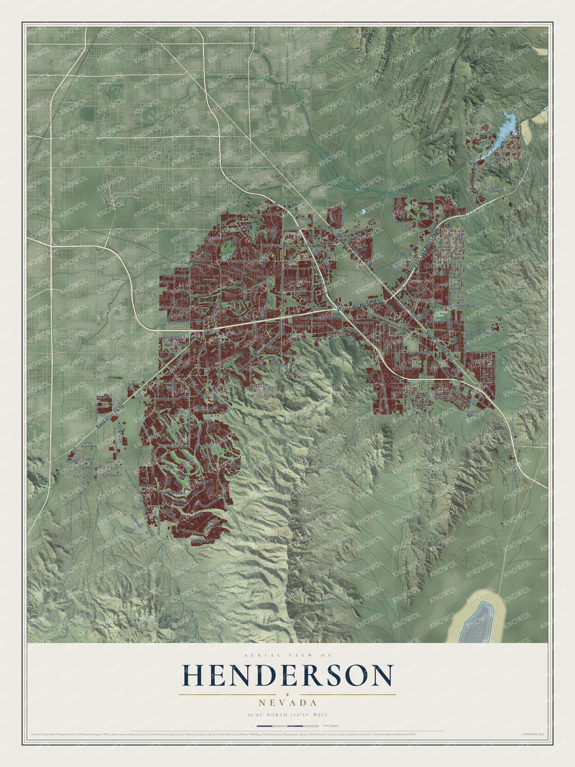
A new map of Henderson, Nevada, made in 2026 and printed to order on thick archival matte paper.
12" x 18" Archival Matte Print
A Map of Home. A Work of Art.
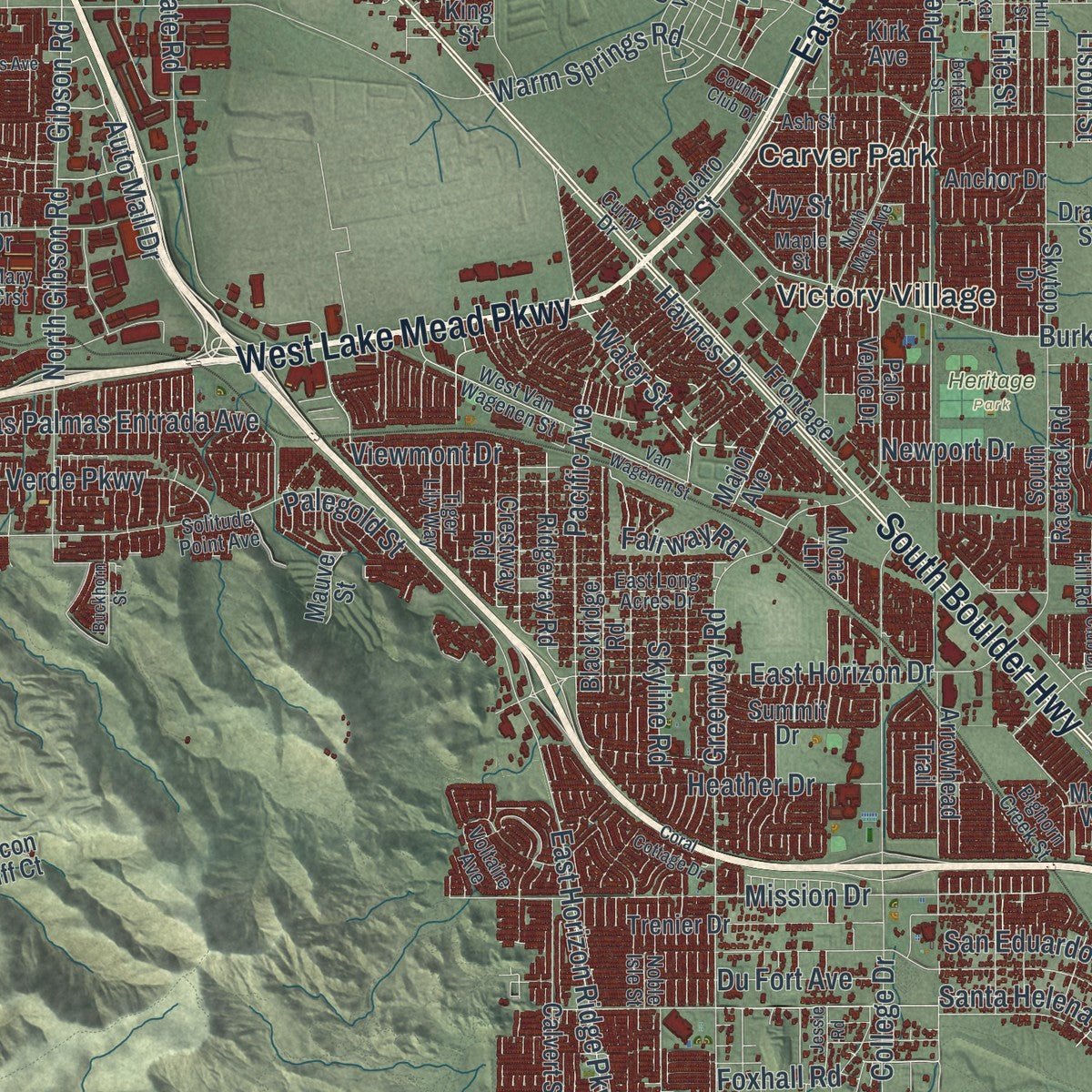
Explore Henderson, Nevada from a whole new perspective. Created using aerial imagery and detailed geographic data, this map captures Henderson building by building, with labeled streets, familiar landmarks, and shaded topographical relief that highlights the natural contours of the landscape.
Combining modern data with the timeless character of a vintage atlas, this map is just as interesting up close as it is beautiful on the wall. Whether you grew up in Henderson, spent memorable years there, or call it home today, this unique map is a great way to celebrate a place that means something to you. Zoom in on the preview to look for your street, and then order a print to put your memories on the wall.
Three ways to hang it
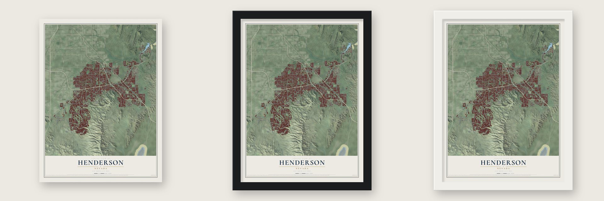
Unframed archival matte, a black wood frame or a white wood frame.
Up close
Geography Worth Displaying
This map was created using accurate cartographic data and authoritative geographic sources, including the U.S. Geological Survey and the Census Bureau. The map brings together terrain, waterways, roads, and building detail. The majority of the streets are labeled, houses are accurately depicted, and the topography is derived from government sources. Combining local data with carefully composed color and shading leads to this beautifully detailed Henderson artwork for your wall.
Rather than simply showing street outlines, we’ve included as many of the street names as we could reasonably fit on the map while keeping their names legible. Zoom in on the high resolution preview to see exactly what’s on the map. We truly set out to create a statement piece for anyone who loves Henderson. So whether it’s for you, or a gift for someone you love, we hope this map of Henderson brings back fond memories.
Read the story behind this map of Henderson, Nevada from 2026.
About Henderson, Nevada
Henderson is a city of 317,610 people in Clark County, about 16 miles southeast of Las Vegas. During World War II the federal government needed huge amounts of magnesium for airplane engines, fuselages and the casings of fire bombs. The War Department chose this stretch of desert because it lay 250 miles or more from the coast, sheltered by the McCullough Hills and the River Mountains, and close to both the railroad and the water and power of Hoover Dam. In September 1941 about 2,700 workers began building the Basic Magnesium plant. When it opened in February 1942, around 15,000 people came from across the country to work there.
At its peak the plant made 25% of the nation's magnesium, and the camp between Pittman and Midway became known as the Basic Townsite. When production stopped after the war, most of the plant's 14,000 workers left with their families. In 1946 the Nevada Legislature let the Colorado River Commission of Nevada buy the plants, and that kept the town from dying out. Henderson became a city on April 16, 1953, with 7,500 people, and Dr. Jim French was its first mayor.
- Manganese found in 1917In the fall of 1917, manganese ore and other metals turned up at the Three Kids Mine, next to today's Lake Las Vegas. Miners worked it off and on for decades until it shut down for good in 1961.
- Many camps, one nameBefore the city existed, scattered Hoovervilles dotted the area, and Pittman was the best known of them. Through incorporation, Carver Park, Victory Village and Pittman were folded into the Henderson town site and joined under a single name. Many of the old settlement names live on as neighborhoods.
- Basic High School since 1942Basic High School opened in 1942 as Henderson's first high school and the second in Clark County. It has changed locations twice, in the 1950s and in 1972. A large white B made of painted boulders still marks the side of the River Mountains.
- Green Valley in 1971In 1971 Hank Greenspun, founder of KLAS-TV and publisher of the Las Vegas Sun, bought 4,720 acres of land released by the government between Las Vegas and downtown Henderson. Critics complained about the low price, roughly $280 an acre. The land became Green Valley, the first neighborhood built outside the original downtown.
- The PEPCON blast of 1988On May 4, 1988, a fire set off huge explosions at the PEPCON chemical plant, one of only two in the country making ammonium perchlorate for solid rocket fuel. Two people died and more than 300 were hurt. The blasts measured as strongly as an earthquake of magnitude 3.5, and people up to 10 miles away felt them. PEPCON then left Henderson, and its site became shops and business parks.
Find your street
Names on the Henderson map
Every name below is printed on this map. Look for your street, your school, the park where you played, or the pond down the road.
Places and landmarks6
- Lake Las Vegas
- Heritage Park
- Carver Park
- Texas Acres
- Victory Village
- Whitney
Streets and roads296
- East Lake Mead Parkway
- West Lake Mead Parkway
- Boulder Highway
- Saint Rose Parkway
- South Boulder Highway
- West Sunset Road
- North Stephanie Street
- Water Street
- West Horizon Ridge Parkway
- Anthem Parkway
- Sun City Anthem Drive
- West Warm Springs Road
- Wigwam Parkway
- Paseo Verde Parkway
- South Eastern Avenue
- South Green Valley Parkway
- East Sunset Road
- Via Inspirada
- Via Firenze
- Seven Hills Drive
- Windmill Parkway
- Gibson Road
- North Gibson Road
- Anthem Club Drive
- Greenway Road
- Volunteer Boulevard
- College Drive
- Democracy Drive
- Eastgate Road
- Burkholder Boulevard
Show all 296 streets
- Pabco Road
- Richard Bunker Avenue
- Galleria Drive
- South Magic Way
- North Water Street
- North Pecos Road
- Carnegie Street
- Pacific Avenue
- Mission Drive
- Olivia Parkway
- North Racetrack Road
- Marks Street
- Milan Street
- High Mesa Drive
- Robindale Road
- East Horizon Drive
- East Larson Lane
- Larson Lane
- East Horizon Ridge Parkway
- Olivia Heights Avenue
- Galleria Street
- Foothills Drive
- Emden Street
- La Mesa Drive
- Equestrian Drive
- South Maryland Parkway
- Macdonald Ranch Drive
- Las Palmas Entrada Avenue
- Somersworth Drive
- Hampton Road
- Skyline Road
- Fife Street
- Siena Heights Drive
- East Russell Road
- Sandy Ridge Avenue
- Haynes Drive
- Lisbon Street
- San Eduardo Avenue
- Newport Drive
- Conestoga Way
- Colt Drive
- Heather Drive
- High View Drive
- Old US Highway 95
- Santa Helena Avenue
- Du Fort Avenue
- Warm Springs Road
- Nuevo Road
- Sebring Hills Drive
- East Serene Avenue
- Pinto Road
- Wiesner Way
- Fairway Road
- Olsen Street
- Auto Mall Drive
- Santiago Drive
- Josephine Drive
- Foxhall Road
- Jeffreys Street
- Annet Street
- Viewmont Drive
- King Mesa Drive
- Patrick Lane
- Jada Drive
- Pueblo Place
- Wellness Place
- Bensley Street
- Atchley Drive
- Ione Road
- Via Lido
- Ultra Drive
- Richmar Avenue
- Ramrod Avenue
- Palm Drive
- Tilden Way
- Panini Drive
- Palegold Street
- Via Monet
- Ivy Street
- Liege Drive
- Julia Street
- Bermuda Road
- North Green Valley Parkway
- North Valle Verde Drive
- Lake Las Vegas Parkway
- Arroyo Grande Boulevard
- Grand Mediterra Boulevard
- Reunion Drive
- South Racetrack Road
- Bicentennial Parkway
- American Pacific Drive
- Arrowhead Trail
- Whitney Ranch Drive
- Executive Airport Drive
- McCormick Road
- South Stephanie Street
- Paradise Hills Drive
- Orleans Street
- East Galleria Drive
- Palo Verde Drive
- South Valle Verde Drive
- East Pebble Road
- Trenier Drive
- Anthem Highlands Drive
- Canyon Retreat Drive
- Frontage Road
- Blackridge Road
- Coronado Center Drive
- Havre Avenue
- Ridgeway Road
- Foxtail Creek Avenue
- Calvert Street
- Navarre Lane
- Village View Drive
- Saguaro Street
- Magic Way
- Idaho Falls Drive
- Pebble Road
- East Silver Spring
- Dawson Avenue
- Contrada Fiore Drive
- Jet Stream Drive
- Pago Pago Drive
- Colvin Run Drive
- Welpman Way
- Crestway Road
- Cape Horn Drive
- Troon Drive
- South Boulder
- Ver Mundo Road
- Strada Cassano
- Summit Grove Drive
- Drake Street
- Mona Lane
- Millcroft Drive
- Via Vin Santo
- East Bruner Avenue
- Strada Tiriana
- Mauve Street
- Canyon Heights Drive
- Major Avenue
- Armillaria Street
- Del Terra Avenue
- Summit Drive
- Bluegrass Lane
- Carmel Mesa Drive
- Dawson Street
- Pavilio Drive
- Le Arta Drive
- Falcon Cliff Court
- Anchor Drive
- Skytop Drive
- Sunset Way
- Chalet Hills Terrace
- Holick Avenue
- Erie Avenue
- Frabiele Street
- Pincay Drive
- Forest Peak Street
- Laurel Avenue
- Canvas Sky Street
- Via Da Vinci
- Lyrical Road
- Valare Street
- King Street
- Kirk Avenue
- Jessup Road
- Gilespie Street
- Villa Rica Drive
- Williamsport Street
- Desert Shadow Trail
- Carnegie Drive
- Ash Street
- Quail Run Road
- West Van Wagenen Street
- Voltaire Avenue
- Dakar Street
- Cloud Chaser Boulevard
- Cadence Vista Drive
- Amador Lane
- Aspen Cliff Drive
- East Long Acres Drive
- Tiger Lily Way
- East Cactus Avenue
- Quiet River Avenue
- Myrtle Beach Drive
- Davina Street
- Mary Crst
- Reflection Cove Drive
- Desert Dawn Lane
- Alper Center Drive
- Baja Lane
- Kabuki Avenue
- Monte Vista Boulevard
- Matese Drive
- Maffie Street
- Solitude Point Avenue
- East Dale Avenue
- Bighorn Creek Street
- Sky Arc Court
- Camp Hill Road
- Curry Drive
- Roaring Brook Drive
- Cedar Pines Street
- Greens Avenue
- Via Centra
- Maple Street
- Noble Isle Street
- Jeri Drive
- Xanadu Drive
- South Pecos Road
- Mall Ring Circle
- Van Wagenen Street
- North Major Avenue
- Hull Street
- Kelso Dunes Avenue
- Scotts Valley Drive
- North Parawan Street
- Calico Ridge Drive
- Country Club Drive
- Firth Avenue
- Middlegate Road
- Weston Ridge Street
- Fox Ridge Drive
- Hartwick Pines Drive
- Clark Drive
- Pyrenees Court
- Serene Avenue
- Ping Drive
- Hillpointe Road
- Chickasaw Drive
- Mustang Drive
- Megan Drive
- Turf Drive
- Romanesca Drive
- Jessie Road
- Oslo Avenue
- Avenue Sorrento
- Coral Cottage Drive
- Via del Salvatore
- Indigo Spring
- Hidden Creek Street
- Buckhorn Street
- Harbor Avenue
- Cardelina Lane
- Colleton River Drive
- Big Bar Drive
- Bogey
- Riceville Drive
- Prairie Dog Drive
- Grosse Pointe Place
- Canyon Spirit Drive
- Jevonda Avenue
- Bowes Avenue
- Blitzen Drive
- Cotton Valley Street
- Tapatio Street
- Vegas View Drive
- Belfast Street
- Kennel Club Drive
- Seville Avenue
- Sea Holly
- Deora Way
- Via Di Como
- Manti Place
- Luca Lane
Names are listed as they appear on the printed map. Zoom into the product photos to find them.
The art of mapping a place
How This Map Was Made
Real places. Remarkable detail. Discover the layers that turn geographic data into a map of home.

The view from above
Aerial imagery reveals the character of the land: woodland, open fields, and the patterns of a place.

The shape of the land
Elevation data brings hills, valleys, and subtle changes in the landscape into view.

The details of home
Roads, waterways, and building footprints come together to make the map feel unmistakably local.

Geography becomes art
Considered color, shading, and typography bring the layers together in a map made for your wall.


Process illustrated with Mendon, Massachusetts. Aerial imagery: USDA NAIP. Terrain: USGS 3D Elevation Program. Map details and finished artwork: KNOWOL.
The Details
About This Print
Choose an archival matte print, or a black or white Ayous wood frame. The archival matte print is unframed.
Select your size and finish above to see the matching product image and price.
Materials & Craftsmanship
A contemporary map with the character of a classic atlas, printed on archival matte paper. Optional frames are made from Ayous wood.
Your printed map does not include the watermark shown in the full-map preview.
Shipping & Delivery
Free shipping within the United States. Every print is made to order in the USA.
Buying a gift? Add a note in your cart and we'll include it. We never put prices in the package.
Prints ship within 2 to 3 business days. Allow 7 to 10 days total from ordering for delivery. Timing may vary during holidays or periods of high order volume.
Read our shipping policy.
Returns and damaged prints
Each print is made to order. Change-of-mind refunds are not available after production.
If your print arrives damaged, misprinted or incorrect, contact support@knowol.com within 30 days of receiving it. Include your order number, photos and a description of the issue.
Read our full refund and replacement policy. For questions about your order, email support@knowol.com.
Find your town
Looking for another city?
Find a map of home in our Nevada collection, or any town in the country.
Nearby
Maps of towns near Henderson
Know someone from one of these towns? Their map makes a great gift.
 Whitney
, Nevada
From $39.99See the map
 Paradise
, Nevada
From $39.99See the map
 Winchester
, Nevada
From $39.99See the map
More maps nearby: Enterprise, Sunrise Manor, Boulder City, Spring Valley and Nellis AFB.