
Search for another town



Free U.S. delivery 7 to 10 days after you order
Whitney, Nevada Map Art
Building by building, with labeled streets and shaded relief.
12" x 18" Archival Matte Print
A Map of Home. A Work of Art.
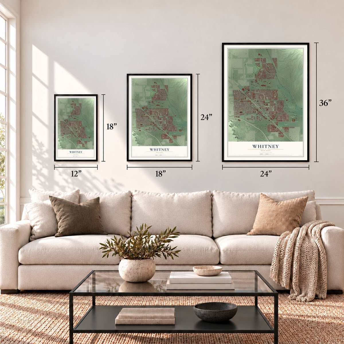
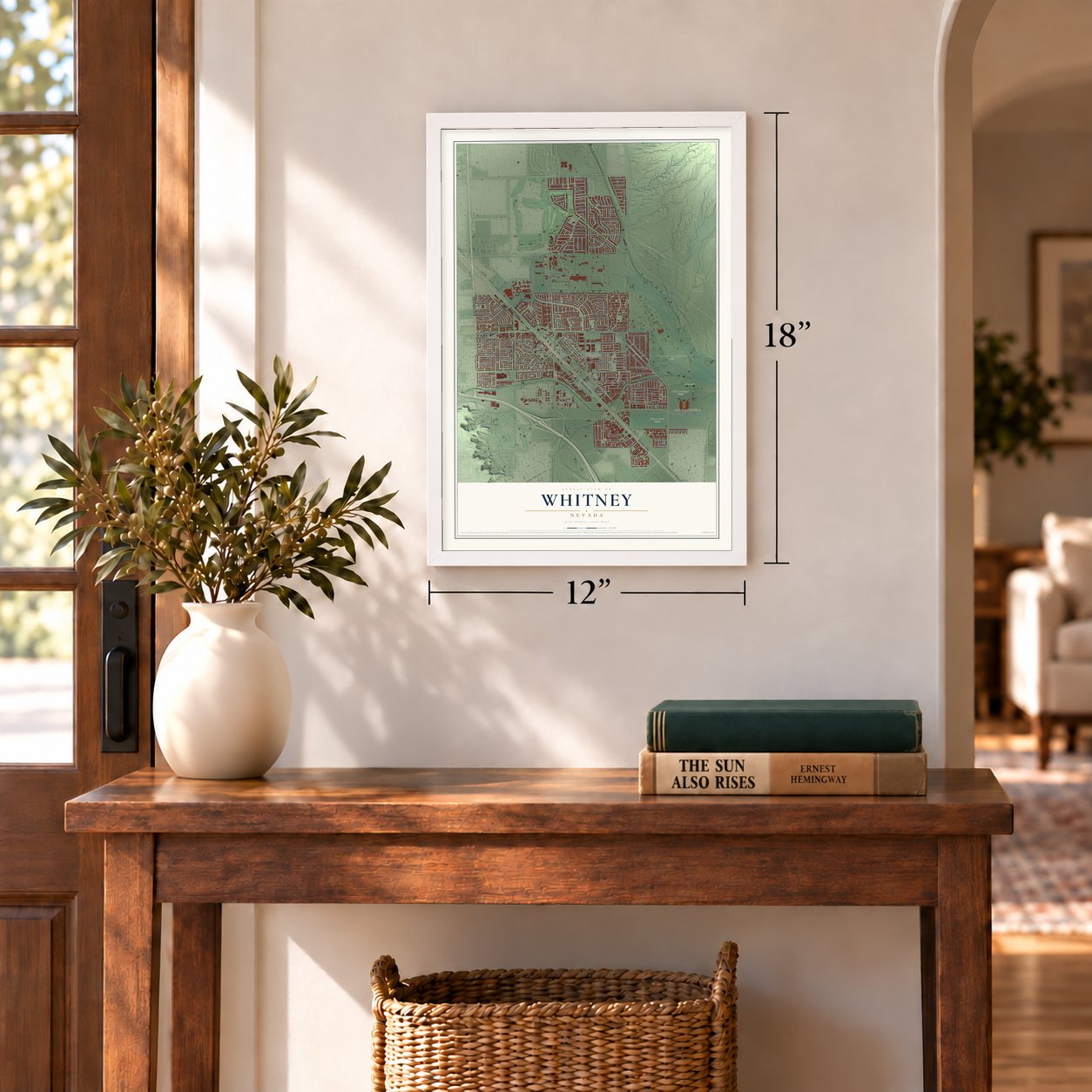
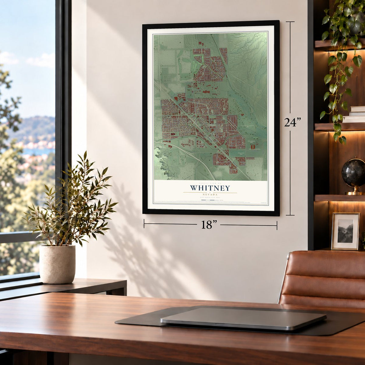
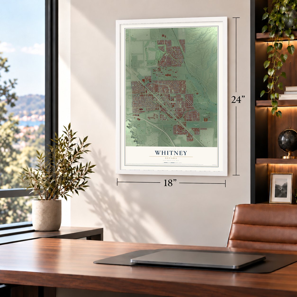
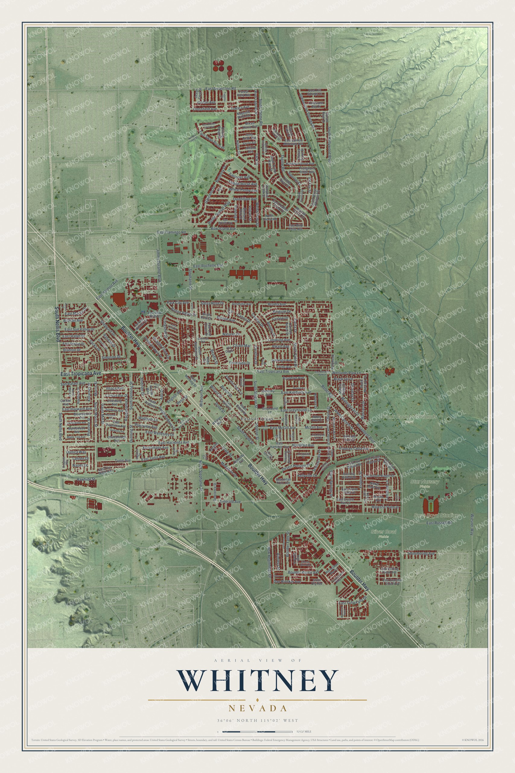
Explore Whitney, Nevada from a whole new perspective. Created using aerial imagery and detailed geographic data, this map captures Whitney building by building, with labeled streets, familiar landmarks, and shaded topographical relief that highlights the natural contours of the landscape.
Combining modern data with the timeless character of a vintage atlas, this map is just as interesting up close as it is beautiful on the wall. Whether you grew up in Whitney, spent memorable years there, or call it home today, this unique map is a great way to celebrate a place that means something to you. Zoom in on the preview to look for your street, and then order a print to put your memories on the wall.
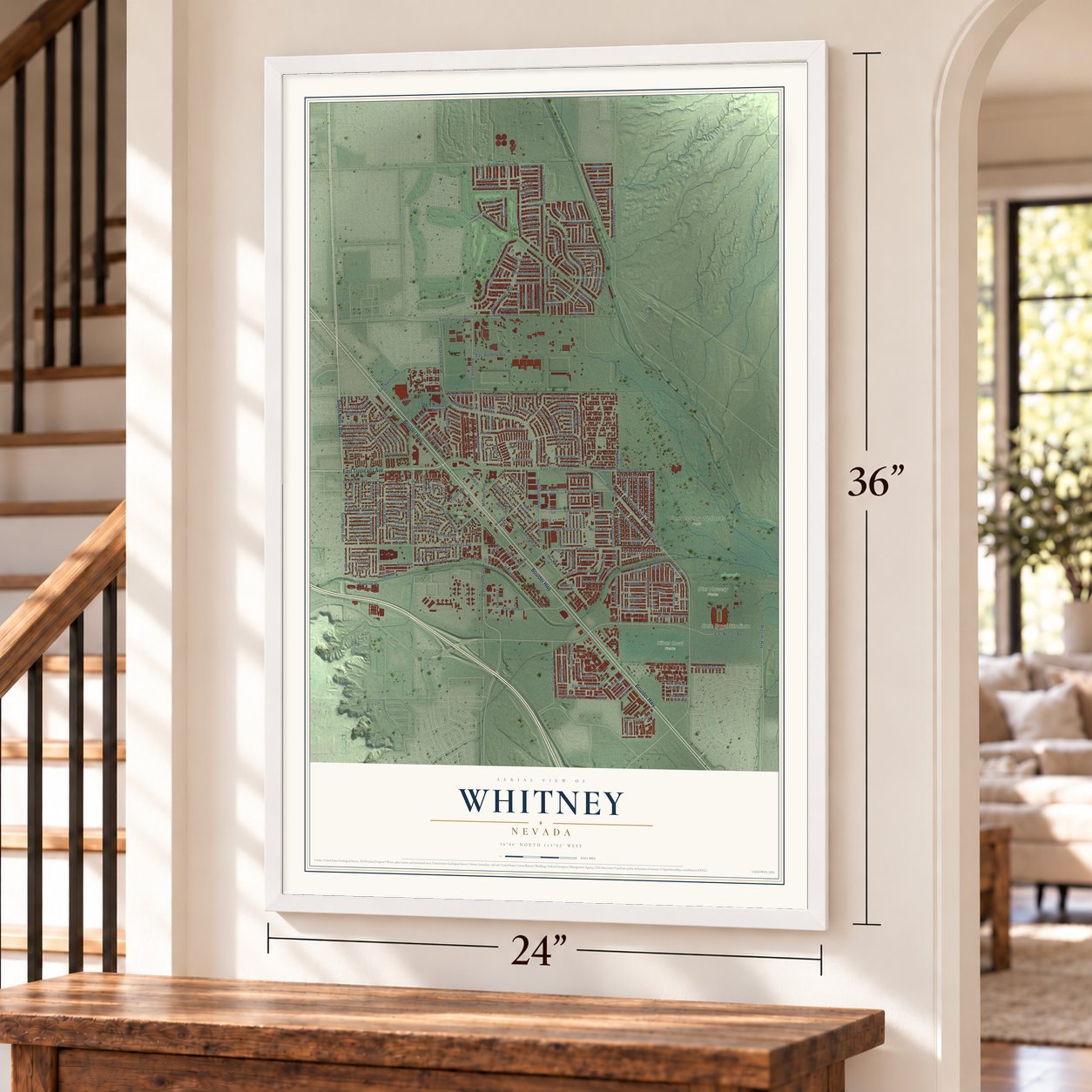
Three ways to hang it
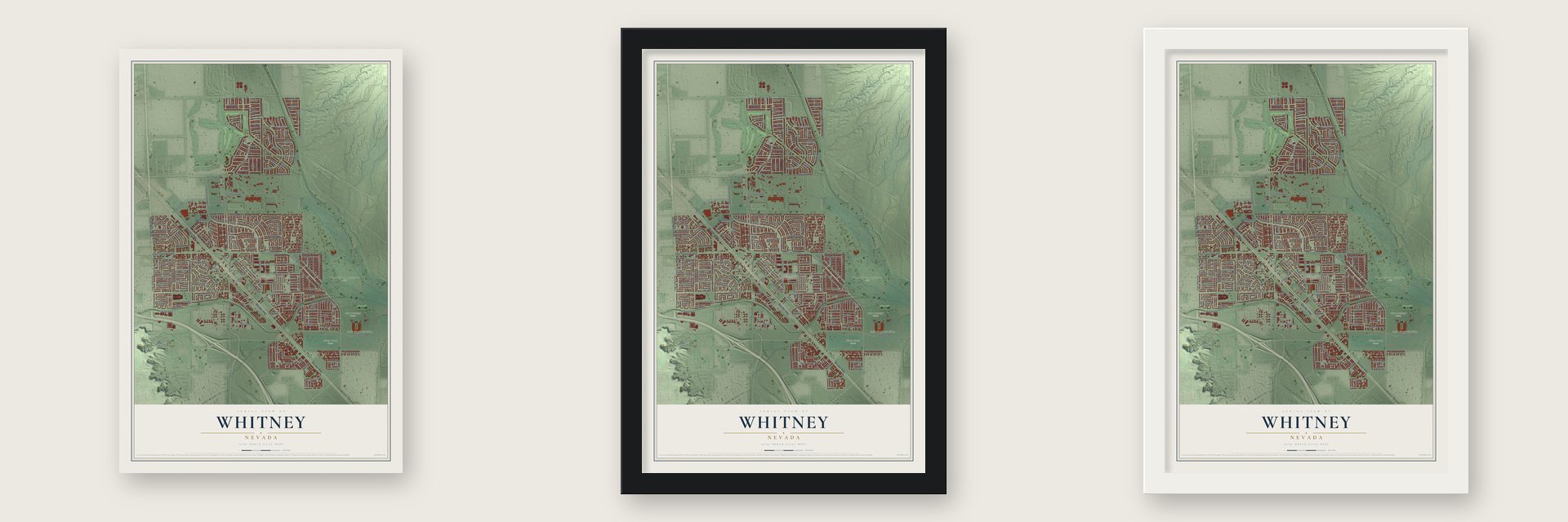
Unframed archival matte, a black wood frame or a white wood frame.
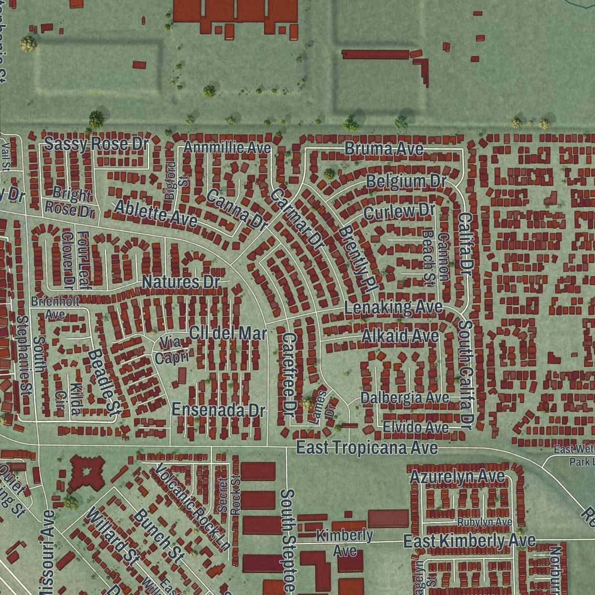
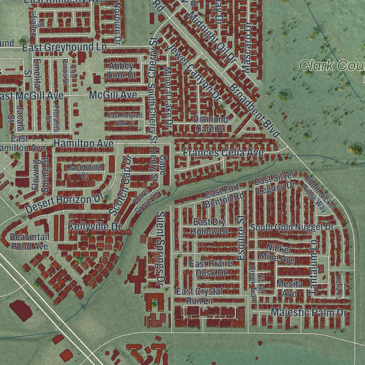
Up close
Geography Worth Displaying
This map was created using accurate cartographic data and authoritative geographic sources, including the U.S. Geological Survey and the Census Bureau. The map brings together terrain, waterways, roads, and building detail. The majority of the streets are labeled, houses are accurately depicted, and the topography is derived from government sources. Combining local data with carefully composed color and shading leads to this beautifully detailed Whitney artwork for your wall.
Rather than simply showing street outlines, we’ve included as many of the street names as we could reasonably fit on the map while keeping their names legible. Zoom in on the high resolution preview to see exactly what’s on the map. We truly set out to create a statement piece for anyone who loves Whitney. So whether it’s for you, or a gift for someone you love, we hope this map of Whitney brings back fond memories.
Read the story behind this map of Whitney, Nevada from 2026.
Find your street
Names on the Whitney map
Every name below is printed on this map. Look for your street, your school, the park where you played, or the pond down the road.
Places and landmarks6
- East Las Vegas
- Clark County Wetlands Park
- Sam Boyd Stadium
- Silver Bowl Fields
- Star Nursery Fields
- Whitney Park
Streets and roads265
- Boulder Highway
- East Tropicana Avenue
- South Nellis Boulevard
- South Morris Street
- South Andover Drive
- Gains Mill Street
- Ithaca Avenue
- Stephanie Street
- South Theme Road
- East Desert Inn Road
- Morris Street
- Killarney Street
- East Wellesley Drive
- Bruma Avenue
- Califa Drive
- South Califa Drive
- Simpson Drive
- East Tunis Avenue
- Tunis Avenue
- South Denning Street
- Beadle Street
- Waltham Lane
- East Russell Road
- Broadbent Boulevard
- Jimmy Durante Boulevard
- South Hollywood Boulevard
- Theme Road
- Rebel Road
- East Hacienda Avenue
- North Stephanie Street
Show all 265 streets
- Dodd Street
- East Harmon Avenue
- Rustic Sunset Way
- Denning Street
- Hamilton Avenue
- Halter Drive
- Emerald Avenue
- South Dodd Street
- Andover Drive
- South Steptoe Street
- Steptoe Street
- East Kimberly Avenue
- East Greyhound Lane
- McGill Avenue
- Missouri Avenue
- Canna Drive
- Desert Horizon Drive
- Sacks Drive
- Sheppard Drive
- Midnight Oil Drive
- Corbin Avenue
- East Sun Valley Drive
- Wetlands Park Lane
- Blanton Drive
- Rappahanock Street
- Cherry Street
- Boulder Ranch Avenue
- Clark Street
- New Beginnings Drive
- Willard Street
- Bunch Street
- Greenwood Springs Drive
- Plainview Avenue
- Quintillion Avenue
- Longshot Drive
- Cll del Mar
- East McGill Avenue
- Galiceno Drive
- Tack Street
- Lenaking Avenue
- Mascaro Drive
- Medallion Drive
- Wheat Penny Avenue
- Frances Celia Avenue
- Natures Drive
- Carmar Drive
- Boulder Falls Street
- Bow Island Avenue
- English Avenue
- Jewel Canyon Drive
- Saddle Horse Avenue
- East Swan Point Place
- Carefree Drive
- East Rochelle Avenue
- East Flamingo Road
- Tantalum Lane
- Squirrel Street
- Wiesner Way
- San Rafael Avenue
- Majestic Palm Drive
- East Hayward Avenue
- Rawhide Street
- Shimmering Avenue
- Aimless Street
- East Tulip Falls Drive
- Crossfield Avenue
- Bolton Valley Drive
- Brently Place
- Budenny Drive
- Black Oil Drive
- Welsh Pony Street
- Silent Springs Drive
- Belgium Drive
- Dan Blocker Avenue
- Danica Way
- Double Down Drive
- Falconer Avenue
- Tanning Street
- Straight Flush Drive
- Berchmans Avenue
- Droubay Drive
- Tokara Avenue
- Ablette Avenue
- Scotch Cap Drive
- East Hallet Drive
- Billman Avenue
- Randall Drive
- Park City Avenue
- Alkaid Avenue
- East Margo Drive
- Vulcan Street
- Sassy Rose Drive
- Tahnee Drive
- Bend Street
- Azurelyn Avenue
- Esquire Street
- Ensenada Drive
- Kellyville Drive
- Curlew Drive
- Pinetree Street
- Kit Fox Street
- Ada Drive
- Naomi Drive
- South Andover
- Chattanooga Avenue
- South Stephanie Street
- East Heather Creek Place
- Elvido Avenue
- Annmillie Avenue
- East Hamilton Avenue
- Kimberly Avenue
- Greyhound Lane
- Tundra Swan Street
- South Bunch Street
- East Plainview Avenue
- South Cherry Street
- Durant River Drive
- South Mascaro Drive
- South Winter Whitetail Street
- South Gold Nugget Drive
- Whitney Avenue
- Haystack Drive
- East Newton Drive
- Pronghorn Ridge Avenue
- Emelita Street
- Mineral Lake Drive
- East Salmon Mountain Avenue
- Brownwood Avenue
- Hamilton Grove Avenue
- River Legends Street
- Dalbergia Avenue
- Duck Hill Springs Drive
- Driving Range Street
- North Theme Road
- East Crystal Run Lane
- Beavertail Pond Avenue
- Meadow Foxtail Drive
- East Fort Benton Road
- Nickel Mine Avenue
- Volcanic Rock Lane
- Shetland Pony Street
- Jackpot Winner Lane
- Diamond Care Drive
- South Winter Wren Street
- East Wild Chive Avenue
- Mikasi Horse Avenue
- Sunbury Avenue
- Vicksburg Avenue
- Camden Avenue
- East Smiling Cloud Avenue
- Myrtlewood Avenue
- East Graceful Cloud Avenue
- Kentucky Avenue
- East Slow Bluff Street
- Arvada Way
- Cannon Beach Street
- Carmel Avenue
- Quiet Morning Street
- East Praire Dusk Drive
- Coldwater Bay Drive
- East Dry Hollow Drive
- Isola Peak Avenue
- Magestic Wind Avenue
- Forest Pony Avenue
- Horseshoe Bar Lane
- Flowing Spring Street
- Reference Street
- Chelsea Grove Street
- Jutland Avenue
- East Fire Night Avenue
- Hollywood Drive
- Glacial Lake Street
- Miners Ridge Drive
- East Silver Legacy Drive
- High Steed Street
- Ocean Crest Street
- Pumpkin Creek Street
- Stone Dry Avenue
- Norburn Drive
- Via Capri
- Four Leaf Clover Drive
- Cape Henry Street
- Mesita Avenue
- Jacala Street
- Abbey Door Court
- Bright Rose Drive
- Duralite Street
- Kilda Circle
- Tumbleweed Ridge Lane
- Brienholt Avenue
- South Squirrel Street
- Los Pinos Street
- Nickel Creek Trail
- Floralita Street
- Laurelwood Avenue
- Bridgette Way
- Maple Tree Avenue
- Everman Drive
- Secret Rock Street
- Mendocino Forest Street
- Funks Grove Lane
- Sun Appello Avenue
- Equine Avenue
- North Marin Street
- South Nickel Ridge Way
- East Willard Street
- Spotted Sandpiper Street
- Bigford Street
- Jacobville Court
- Karvel Street
- Sagtikos Street
- Sagelyn Street
- Yankee Spring Street
- Tupplev Court
- Lames Drive
- Trout Circle
- Paint Court
- Extreme Shear Avenue
- Mc Gill Avenue
- Gentleslope Street
- East Missouri Avenue
- East Pavilion Lakes Avenue
- Rubylyn Avenue
- East Wetlands Park Lane
- Wellesley Avenue
- Manassas Avenue
- Castle Kennedy Street
- Kemper Lakes Street
- Azuza Avenue
- East Holyrod Park Court
- Lucky Draw Court
- Ordaz Avenue
- Pacyna Street
- La Perla Court
- Vail Street
Names are listed as they appear on the printed map. Zoom into the product photos to find them.
About Whitney, Nevada
Whitney is an unincorporated town of 49,061 people in Clark County, on Boulder Highway between Las Vegas and Henderson. Stowell E. Whitney, a dairy farmer from Bunkerville, bought a ranch here in the 1910s. When Boulder Highway was built, he split the ranch into lots in 1931, but the Great Depression kept buyers away and few came. A post office named Whitney opened a year later.
In February 1942, businessmen of the Whitney Taxpayers Association petitioned the county to make the place a town, and that year the Clark County Commission created it and gave it official borders. That makes Whitney the oldest unincorporated town in the Las Vegas Valley. In 1958 nearly every resident signed a petition to rename it East Las Vegas, and it kept that name until it became Whitney again in 1993.
- The Bunch family post officeIn the town's early years, John and Nellie Bunch ran the Whitney post office. They owned much of the Whitney property and the land around it. The whole town then fit on three avenues running east and west, crossed by three numbered streets.
- A school in old barracksWhitney Elementary School was set up in a converted barracks. It taught first through seventh grades until the 1960s, when the seventh graders were moved to Henderson Junior High. Older students went on to Basic High School in Henderson.
- Home of the Silver BowlSam Boyd Stadium stands in Whitney. Known over the years as Las Vegas Stadium, the Las Vegas Silver Bowl and the Sam Boyd Silver Bowl, it was where the UNLV Rebels played their home football games.
- Bypassed, then rebuiltIn the early 1990s, Las Vegas and Henderson spread outward and Interstate 515, now Interstate 11, was built to go around Whitney. Local businesses suffered, but they began to recover in the 2000s, and new housing has since gone up on land that once sat empty.
Keep exploring Nevada
Whitney is one of 148 Nevada towns we've mapped. Every dot on the map is a print of its own.
The search covers every state, Nevada first.
Near Whitney
Order 2 or more town maps and save 10%. Shown in the size and finish you picked above, so they hang as a set.
- Sunrise Manor 12" x 18" / Archival Matte Print $39.99
- Paradise 12" x 18" / Archival Matte Print $39.99
- Winchester 12" x 18" / Archival Matte Print $39.99
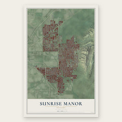
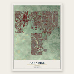

More maps nearby: Henderson, Downtown Las Vegas, West Las Vegas, Nellis AFB and Enterprise.
The art of mapping a place
How This Map Was Made
Real places. Remarkable detail. Discover the layers that turn geographic data into a map of home.

The view from above
Aerial imagery reveals the character of the land: woodland, open fields, and the patterns of a place.

The shape of the land
Elevation data brings hills, valleys, and subtle changes in the landscape into view.

The details of home
Roads, waterways, and building footprints come together to make the map feel unmistakably local.

Geography becomes art
Considered color, shading, and typography bring the layers together in a map made for your wall.


Process illustrated with Mendon, Massachusetts. Aerial imagery: USDA NAIP. Terrain: USGS 3D Elevation Program. Map details and finished artwork: KNOWOL.
The Details
About This Print
Choose an archival matte print, or a black or white Ayous wood frame. The archival matte print is unframed.
Select your size and finish above to see the matching product image and price.
Materials & Craftsmanship
A contemporary map with the character of a classic atlas, printed on archival matte paper. Optional frames are made from Ayous wood.
Your printed map does not include the watermark shown in the full-map preview.
Shipping & Delivery
Free shipping within the United States. Every print is made to order in the USA.
Buying a gift? Add a note in your cart and we'll include it. We never put prices in the package.
Prints ship within 2 to 3 business days. Allow 7 to 10 days total from ordering for delivery. Timing may vary during holidays or periods of high order volume.
Read our shipping policy.
Returns and damaged prints
Each print is made to order. Change-of-mind refunds are not available after production.
If your print arrives damaged, misprinted or incorrect, contact support@knowol.com within 30 days of receiving it. Include your order number, photos and a description of the issue.
Read our full refund and replacement policy. For questions about your order, email support@knowol.com.