
Search for another town




Free U.S. delivery 7 to 10 days after you order
Evanston, Illinois Map Art
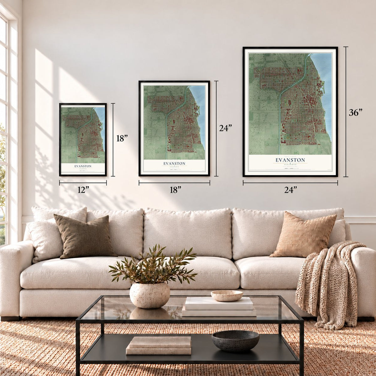
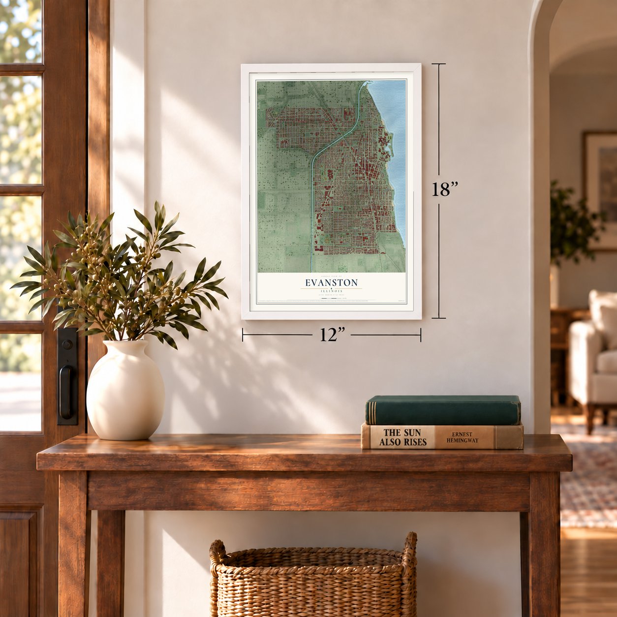
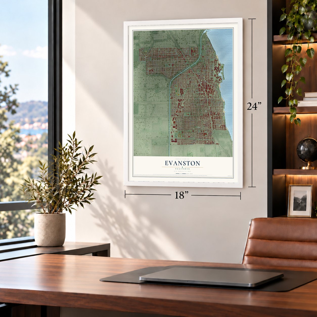
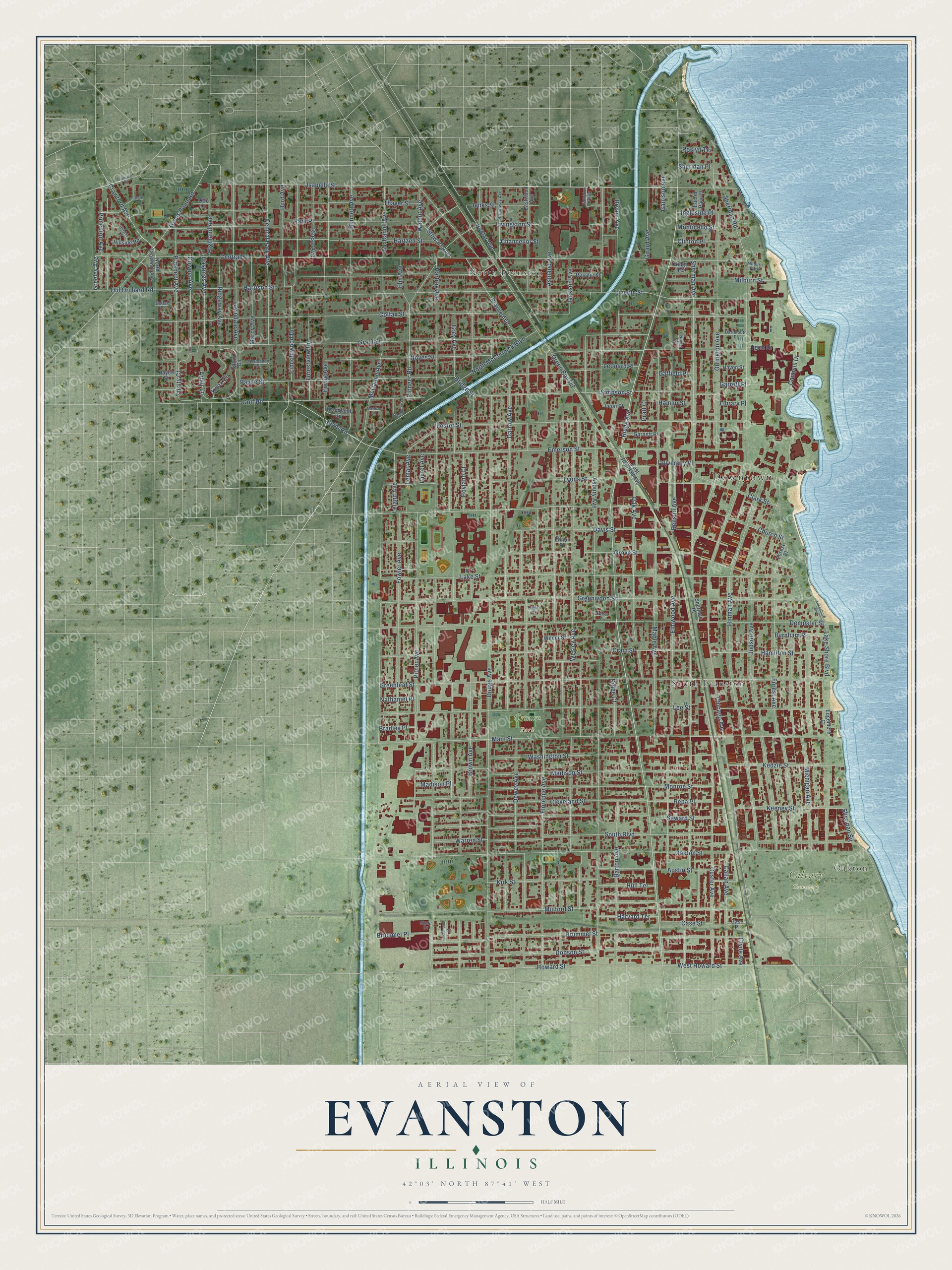
A new map of Evanston, Illinois, made in 2026 and printed to order on thick archival matte paper.
12" x 18" Archival Matte Print
A Map of Home. A Work of Art.
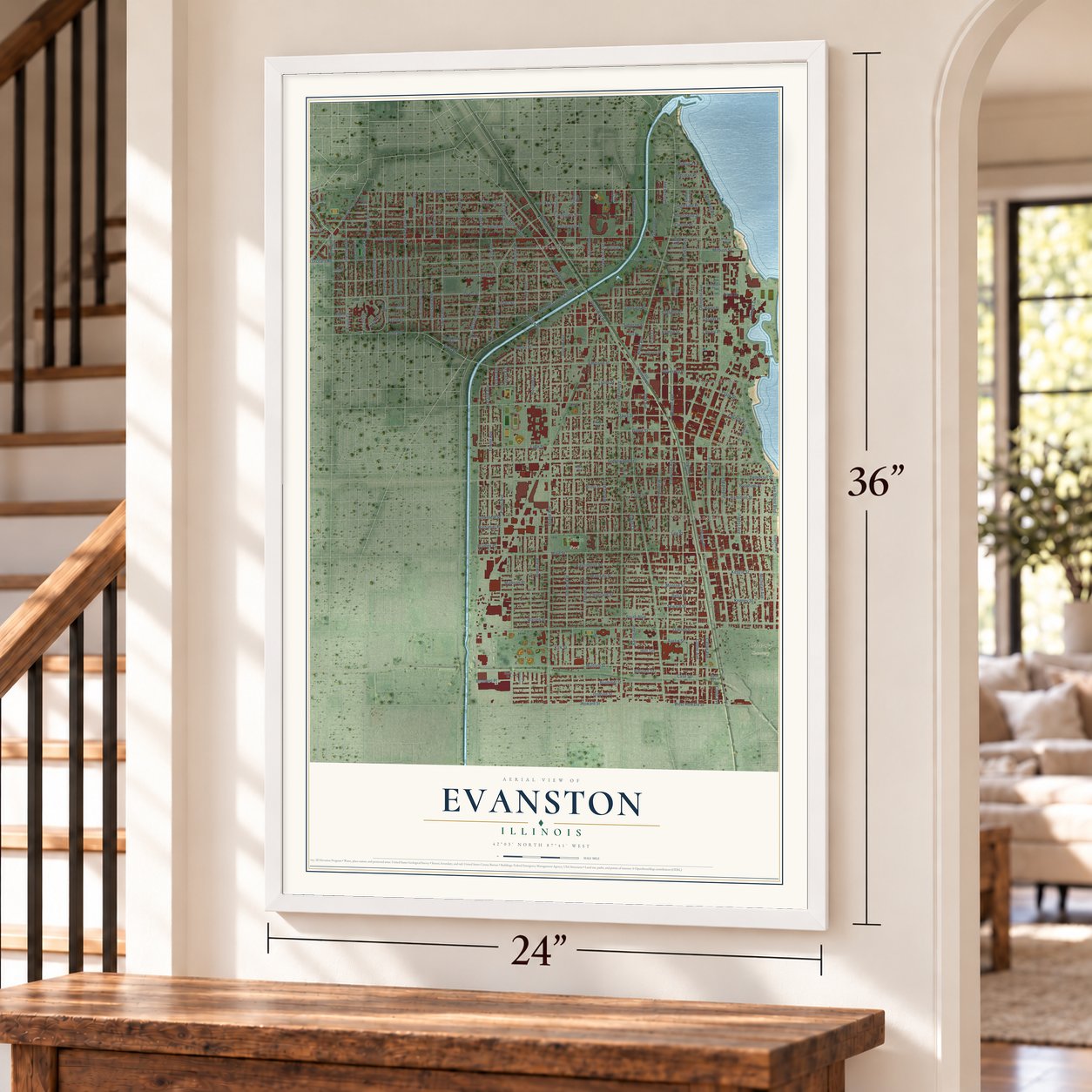
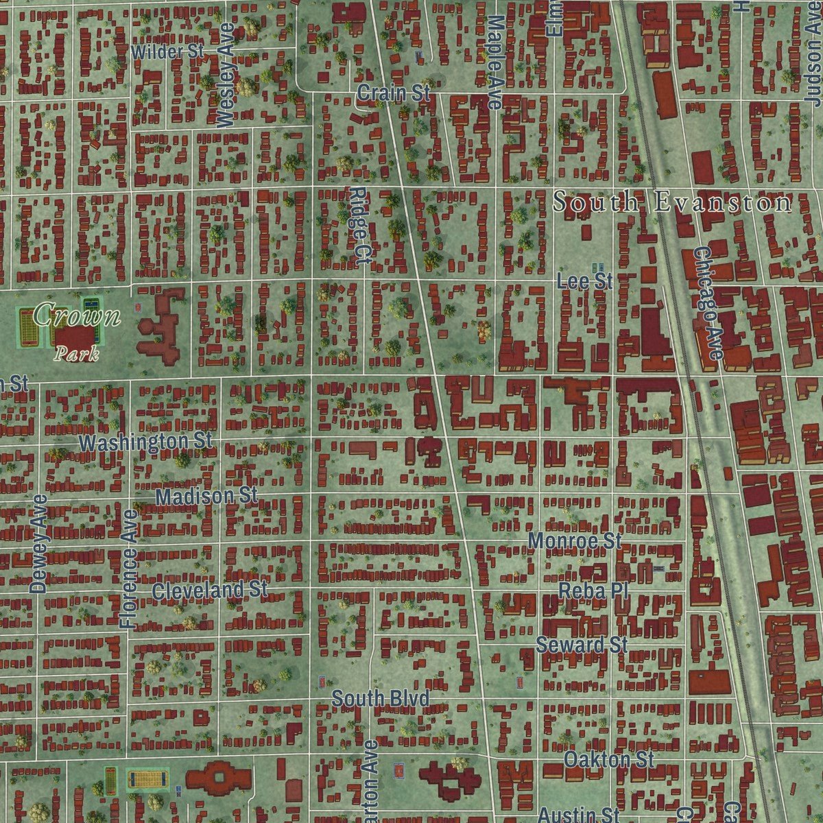
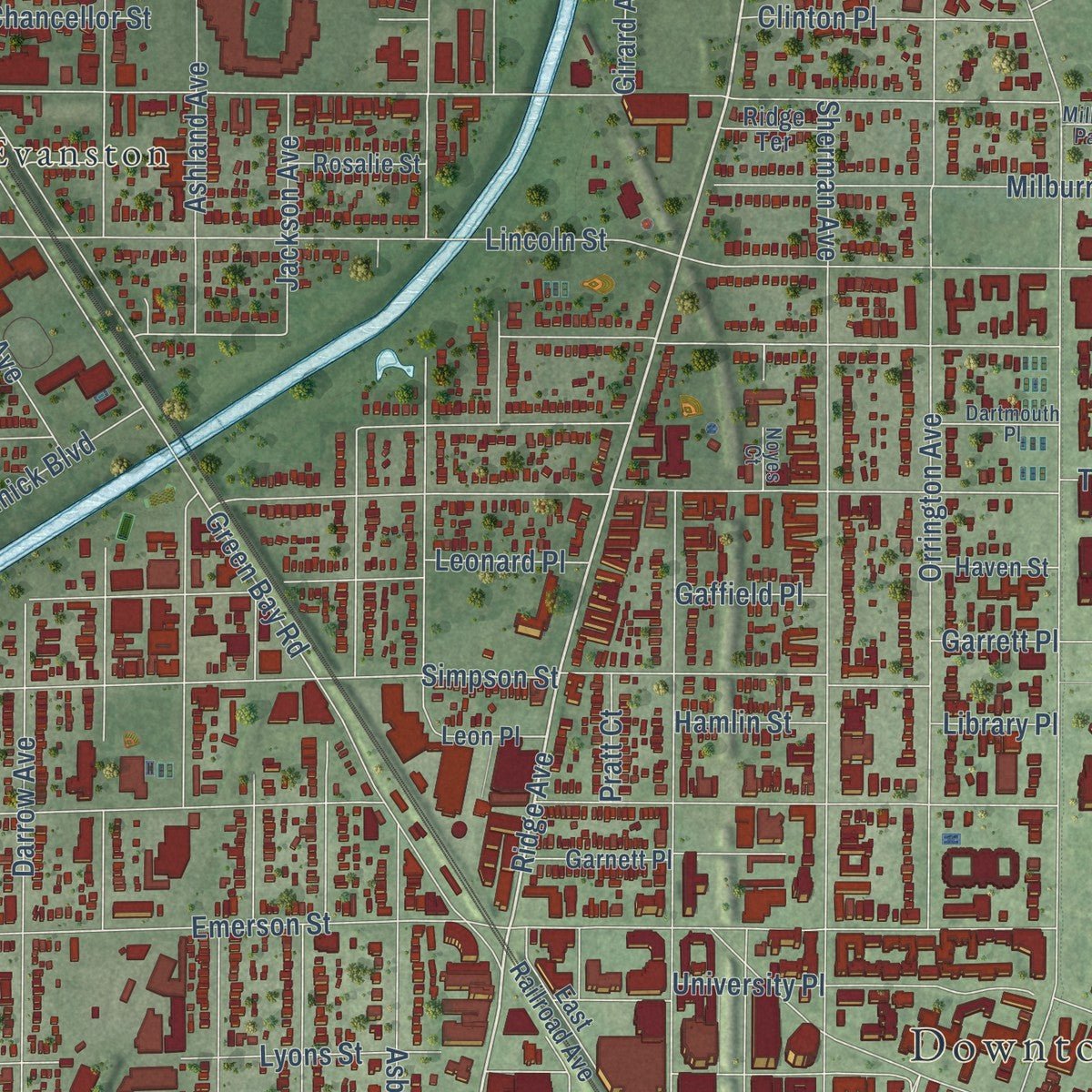
Explore Evanston, Illinois from a whole new perspective. Created using aerial imagery and detailed geographic data, this map captures Evanston building by building, with labeled streets, familiar landmarks, and shaded topographical relief that highlights the natural contours of the landscape.
Combining modern data with the timeless character of a vintage atlas, this map is just as interesting up close as it is beautiful on the wall. Whether you grew up in Evanston, spent memorable years there, or call it home today, this unique map is a great way to celebrate a place that means something to you. Zoom in on the preview to look for your street, and then order a print to put your memories on the wall.
Three ways to hang it
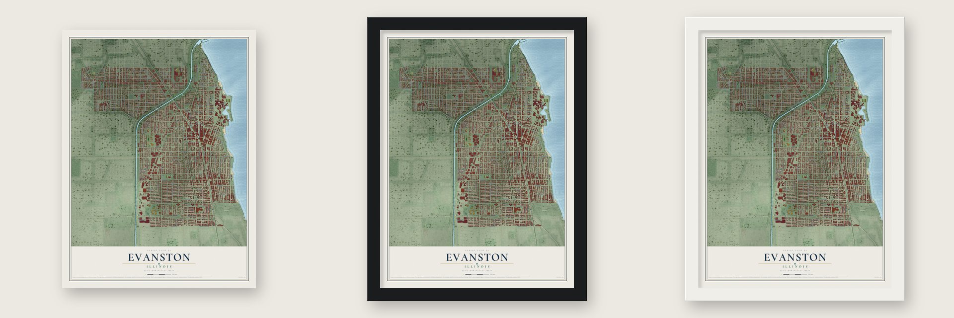
Unframed archival matte, a black wood frame or a white wood frame.
Up close
Geography Worth Displaying
This map was created using accurate cartographic data and authoritative geographic sources, including the U.S. Geological Survey and the Census Bureau. The map brings together terrain, waterways, roads, and building detail. The majority of the streets are labeled, houses are accurately depicted, and the topography is derived from government sources. Combining local data with carefully composed color and shading leads to this beautifully detailed Evanston artwork for your wall.
Rather than simply showing street outlines, we’ve included as many of the street names as we could reasonably fit on the map while keeping their names legible. Zoom in on the high resolution preview to see exactly what’s on the map. We truly set out to create a statement piece for anyone who loves Evanston. So whether it’s for you, or a gift for someone you love, we hope this map of Evanston brings back fond memories.
Read the story behind this map of Evanston, Illinois from 2026.

About Evanston, Illinois
Evanston is a city of 78,110 people in Cook County, on Lake Michigan just north of Chicago. Before the 1830s the land was mostly wetland and swampy woods, and Potawatomi people traveled the higher ridges that ran north and south through it. French explorers called the area Grosse Pointe, for a point of land reaching into the lake. After settlers came it belonged to the Gross Point voting district, and from 1850 it was part of Ridgeville Township.
In 1851 a circle of Methodist businessmen founded Northwestern University. Orrington Lunt pushed for one last look at a wooded bluff on the lake, and the founders bought several hundred acres there from John Foster of Chicago, who owned the farm. Three years later, in 1854, they asked the county judge for a town named for John Evans, one of their leaders, and the request was granted in 1857. Evanston became a town on December 29, 1863, and after it annexed South Evanston, voters chose in 1892 to organize as a city.
“no spiritous, vinous, or fermented liquors shall be sold under license, or otherwise, within four miles”
- Turned back at GlencoeSamuel Rohrer arrived in 1837 with a good deal of livestock and settled first at Rose Hill. When he decided to move north, he burned his shanty behind him for good luck. Near Glencoe, which German settlers called Ewige Quid, or Everlasting Punishment, he faced the lake, a swamp, bluffs and gullies, so he turned around and made his home in Evanston. He stayed until 1847, when he bought land in Niles.
- A claim settled with a pistolJames Carroll squatted on a tract that Edward H. Mulford had already claimed by pre-emption. When Mulford came to take it in 1838, he drove Carroll off at the point of a pistol. Mulford then opened a tavern there, and old settlers remembered that his rooms were good but his prices were very steep.
- Dry from 1858 to 1972Northwestern's charter barred the sale of liquor near the school, and Evanston stayed dry for 117 years. The Woman's Christian Temperance Union, which has its headquarters in the city, campaigned to keep the ban. In 1972 the City Council let restaurants and hotels serve drinks, and in 1984 it allowed liquor stores.
- The first NCAA finalIn 1939 Northwestern's Patten Gymnasium in Evanston hosted the first NCAA basketball championship final.
- The world's churches in 1954In August 1954 the World Council of Churches held its second assembly in Evanston. No other assembly of the council has met in the United States. President Dwight Eisenhower greeted the delegates, and the United Nations secretary-general, Dag Hammarskjöld, spoke to them in an address titled "An instrument of faith."
Find your street
Names on the Evanston map
Every name below is printed on this map. Look for your street, your school, the park where you played, or the pond down the road.
Places and landmarks7
- Downtown
- Oakton
- Calvary Cemetery
- Crown Park
- North Evanston
- South Evanston
- Milburn Park
Streets and roads182
- Ridge Avenue
- Isabella Street
- Washington Street
- Greeley Avenue
- Bridge Street
- Sheridan Road
- Asbury Avenue
- Sherman Avenue
- Central Street
- Dodge Avenue
- Wesley Avenue
- Ashland Avenue
- Hartrey Avenue
- Chicago Avenue
- Colfax Street
- Lincoln Street
- Oakton Street
- Dewey Avenue
- Dempster Street
- Greenleaf Street
- Main Street
- Greenwood Street
- Church Street
- Grant Street
- Howard Street
- Lee Street
- Harrison Street
- West Howard Street
- Lake Street
- Grey Avenue
Show all 182 streets
- Elmwood Avenue
- McDaniel Avenue
- Simpson Street
- Maple Avenue
- Noyes Street
- Hinman Avenue
- Florence Avenue
- Darrow Avenue
- Emerson Street
- Judson Avenue
- Brown Avenue
- South Boulevard
- Davis Street
- Green Bay Road
- Foster Street
- Orrington Avenue
- Pitner Avenue
- Brummel Street
- Forest Avenue
- Payne Street
- Hartzell Street
- Grove Street
- Park Place
- Dobson Street
- Crain Street
- Custer Avenue
- Seward Street
- Mulford Street
- Thayer Street
- Madison Street
- Golf Road
- Crawford Avenue
- Michigan Avenue
- Ewing Avenue
- Fowler Avenue
- Cleveland Street
- Monroe Street
- Bennett Avenue
- Lincolnwood Drive
- Central Park Avenue
- Lawndale Avenue
- North McCormick Boulevard
- Oak Avenue
- Keeney Street
- Prairie Avenue
- Prospect Avenue
- Elgin Road
- Barton Avenue
- Callan Avenue
- Poplar Avenue
- Clark Street
- Pioneer Road
- Lyons Street
- Gross Point Road
- Jenks Street
- Hamilton Street
- Livingston Street
- Campus Drive
- Austin Street
- Kedzie Street
- University Place
- Kirk Street
- Jackson Avenue
- Marcy Avenue
- Milburn Street
- Hurd Avenue
- Mc Daniel Avenue
- Cowper Avenue
- Trinity Court
- Hastings Avenue
- Ridgeway Avenue
- Lake Shore Boulevard
- Princeton Avenue
- Bryant Avenue
- Forestview Road
- Hull Terrace
- Benson Avenue
- Girard Avenue
- Highland Avenue
- Reese Avenue
- Ingleside Place
- Case Street
- Leonard Place
- Walnut Avenue
- Clinton Place
- Chancellor Street
- Reba Place
- Harvard Terrace
- Leland Avenue
- Old Orchard Road
- Hovland Court
- Ridge Court
- Brummel Place
- Sheridan Place
- Burnham Place
- Sheridan Square
- Warren Street
- Elm Avenue
- Stewart Avenue
- Monticello Street
- Knox Circle
- Lemar Avenue
- Garrison Avenue
- Nathaniel Place
- Bradley Place
- Hamlin Street
- Roslyn Terrace
- Gaffield Place
- Madison Place
- Laurel Avenue
- Pratt Court
- Garrett Place
- Library Place
- Tech Drive
- Arbor Lane
- Clyde Avenue
- North Crawford Avenue
- Calvin Circle
- Eastwood Avenue
- Garnett Place
- Wilder Street
- East Railroad Avenue
- Rosalie Street
- Hillside Road
- Haven Street
- Edgemere Court
- Woodland Road
- Leon Place
- Ridge Terrace
- Euclid Park Place
- Sherman Place
- Hayes Street
- Forest Place
- Elinor Place
- Case Place
- Otto Lane
- Broadway Avenue
- Dartmouth Place
- Normandy Place
- Noyes Court
- Hampton Parkway
- Colfax Place
- Thelin Court
- Shure Drive
- Hawthorne Lane
- Glenview Road
- Lakeshore Boulevard
- Martha Lane
- Hillside Lane
- Clifford Street
- Richmond Street
- Dryden Place
Names are listed as they appear on the printed map. Zoom into the product photos to find them.
The art of mapping a place
How This Map Was Made
Real places. Remarkable detail. Discover the layers that turn geographic data into a map of home.

The view from above
Aerial imagery reveals the character of the land: woodland, open fields, and the patterns of a place.

The shape of the land
Elevation data brings hills, valleys, and subtle changes in the landscape into view.

The details of home
Roads, waterways, and building footprints come together to make the map feel unmistakably local.

Geography becomes art
Considered color, shading, and typography bring the layers together in a map made for your wall.


Process illustrated with Mendon, Massachusetts. Aerial imagery: USDA NAIP. Terrain: USGS 3D Elevation Program. Map details and finished artwork: KNOWOL.
The Details
About This Print
Choose an archival matte print, or a black or white Ayous wood frame. The archival matte print is unframed.
Select your size and finish above to see the matching product image and price.
Materials & Craftsmanship
A contemporary map with the character of a classic atlas, printed on archival matte paper. Optional frames are made from Ayous wood.
Your printed map does not include the watermark shown in the full-map preview.
Shipping & Delivery
Free shipping within the United States. Every print is made to order in the USA.
Buying a gift? Add a note in your cart and we'll include it. We never put prices in the package.
Prints ship within 2 to 3 business days. Allow 7 to 10 days total from ordering for delivery. Timing may vary during holidays or periods of high order volume.
Read our shipping policy.
Returns and damaged prints
Each print is made to order. Change-of-mind refunds are not available after production.
If your print arrives damaged, misprinted or incorrect, contact support@knowol.com within 30 days of receiving it. Include your order number, photos and a description of the issue.
Read our full refund and replacement policy. For questions about your order, email support@knowol.com.
Find your town
Looking for another city?
Find a map of home in our Illinois collection, or any town in the country.
Nearby
Maps of towns near Evanston
Know someone from one of these towns? Their map makes a great gift.
 Skokie
, Illinois
From $39.99See the map
 Wilmette
, Illinois
From $39.99See the map
 Kenilworth
, Illinois
From $39.99See the map
More maps nearby: Lincolnwood, Golf, Winnetka, Morton Grove and Northfield.