
Search for another town





Free U.S. delivery 7 to 10 days after you order
Fairfax Station, Virginia Map Art
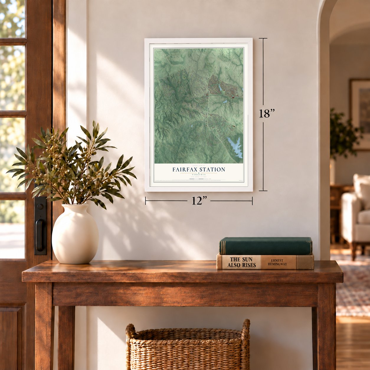
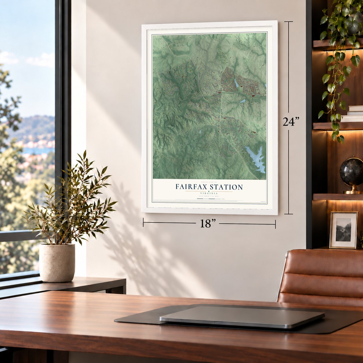
A new map of Fairfax Station, Virginia, made in 2026 and printed to order on thick archival matte paper.
12" x 18" Archival Matte Print
A Map of Home. A Work of Art.
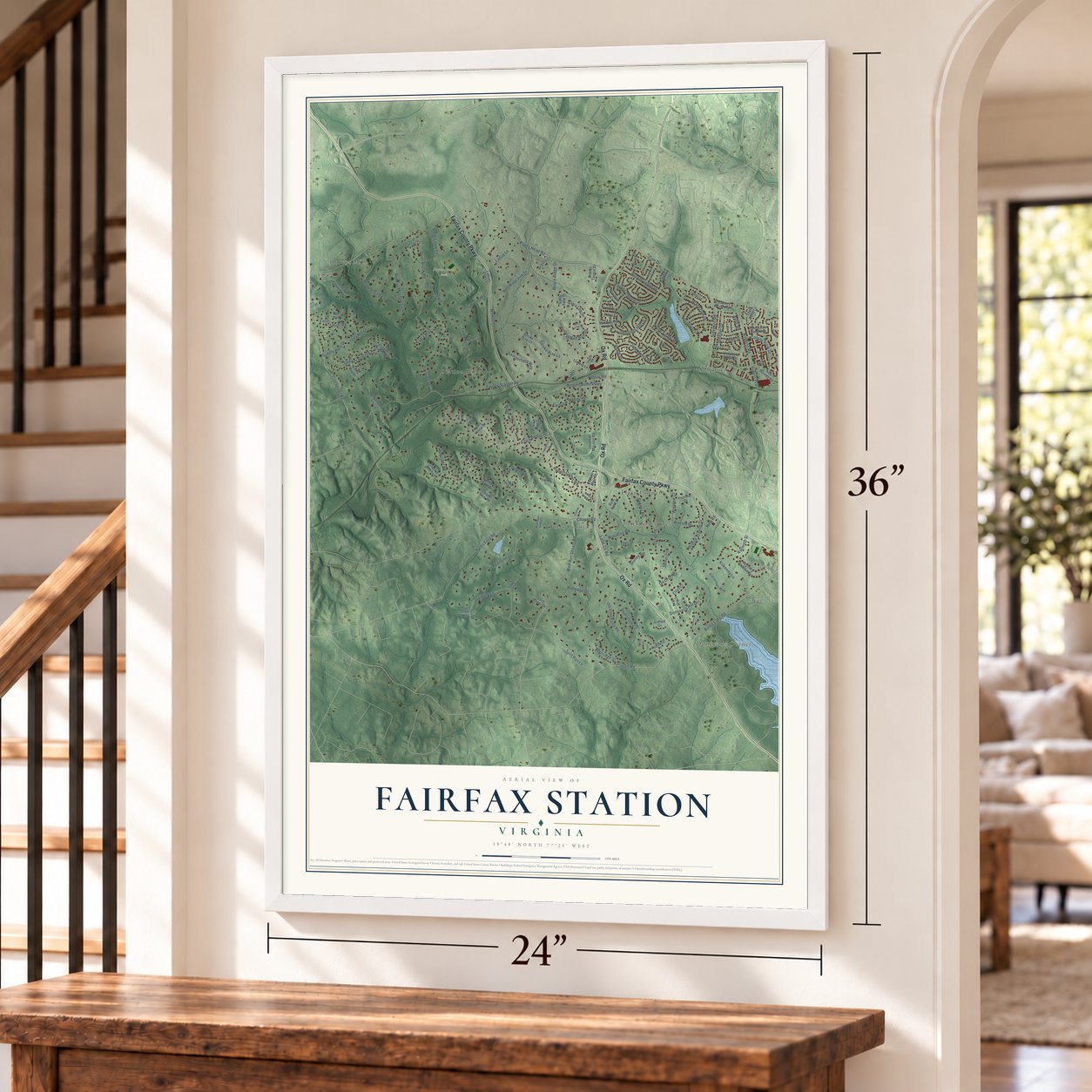
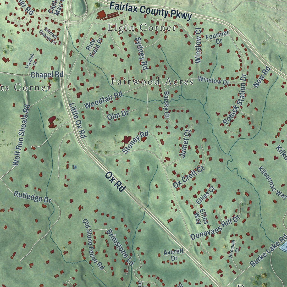
Explore Fairfax Station, Virginia from a whole new perspective. Created using aerial imagery and detailed geographic data, this map captures Fairfax Station building by building, with labeled streets, familiar landmarks, and shaded topographical relief that highlights the natural contours of the landscape.
Combining modern data with the timeless character of a vintage atlas, this map is just as interesting up close as it is beautiful on the wall. Whether you grew up in Fairfax Station, spent memorable years there, or call it home today, this unique map is a great way to celebrate a place that means something to you. Zoom in on the preview to look for your street, and then order a print to put your memories on the wall.
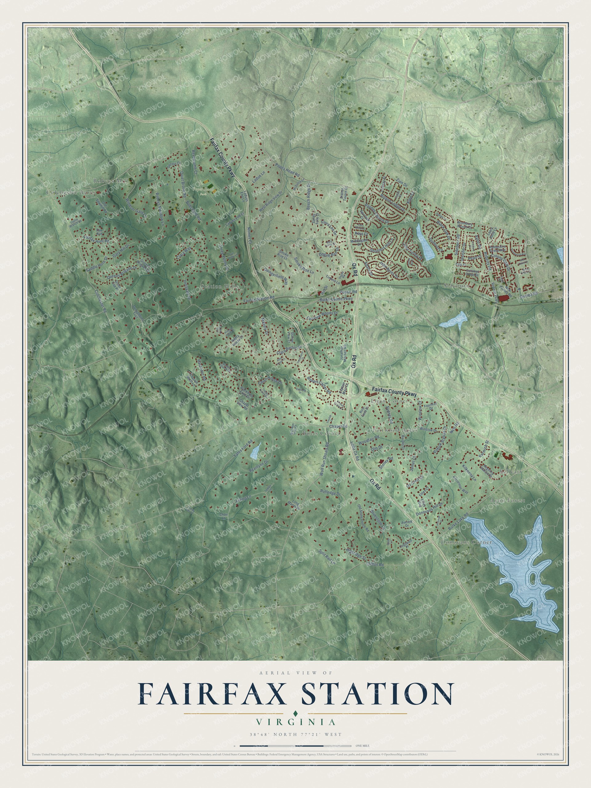
Three ways to hang it
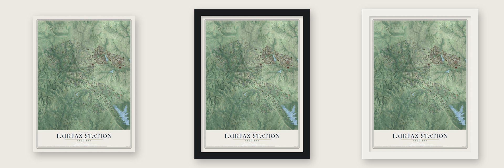
Unframed archival matte, a black wood frame or a white wood frame.
Up close
Geography Worth Displaying
This map was created using accurate cartographic data and authoritative geographic sources, including the U.S. Geological Survey and the Census Bureau. The map brings together terrain, waterways, roads, and building detail. The majority of the streets are labeled, houses are accurately depicted, and the topography is derived from government sources. Combining local data with carefully composed color and shading leads to this beautifully detailed Fairfax Station artwork for your wall.
Rather than simply showing street outlines, we’ve included as many of the street names as we could reasonably fit on the map while keeping their names legible. Zoom in on the high resolution preview to see exactly what’s on the map. We truly set out to create a statement piece for anyone who loves Fairfax Station. So whether it’s for you, or a gift for someone you love, we hope this map of Fairfax Station brings back fond memories.
Read the story behind this map of Fairfax Station, Virginia from 2026.

About Fairfax Station, Virginia
Fairfax Station is a community of 12,420 people in Fairfax County, about 22 miles southwest of Washington, D.C. It began in 1851 as a stop on the Orange and Alexandria Railroad, chosen for its closeness to the county seat at Fairfax, and for that first year people called it Lee's Station.
Many of the men who worked the railroad were Irish immigrants, and they filled the pews of St. Mary's Church, begun in 1858 as the first Catholic church in Fairfax County. The community took the name Swetnam in 1897, but in 1921 it went back to being Fairfax Station.
- Clara Barton in August 1862After the Second Battle of Bull Run in August 1862, Clara Barton cared for wounded soldiers from both the Union and Confederate sides at the station. She ran her work from St. Mary's Church nearby. Barton had been working at the U.S. Patent Office in Washington when the war began, and in 1881 she went on to found the American Red Cross.
- The county's last skirmishThe final fighting of the Civil War in Fairfax County was a small skirmish at Brimstone Hill, close to Fairfax Station.
- A Cold War Nike siteA Nike missile complex was built here to defend against Soviet air attack. Together with the sites at Great Falls and Lorton, it was one of thirteen Nike installations that ringed Washington and Baltimore.
- Ekoji Buddhist Temple, 1998Ekoji Buddhist Temple was built in Fairfax Station in 1998. The community is also home to the Fairfax Station Railroad Museum, which recalls the rail stop that gave the place its start.
Find your street
Names on the Fairfax Station map
Every name below is printed on this map. Look for your street, your school, the park where you played, or the pond down the road.
Places and landmarks11
- Avon Forest
- Popes Head Park
- Belleair
- Butts Corner
- Colchester Acres
- Donovans Corner
- Elgin Corner
- Fairwood Acres
- Robeys Mill
- Sideburn
- Station Hills
Streets and roads146
- Fairfax County Parkway
- Ox Road
- Robert Carter Road
- Popes Head Road
- Fairfax Station Road
- Colchester Road
- Zion Drive
- Little Ox Road
- Clara Barton Drive
- Lilting Lane
- Burke Centre Parkway
- Yates Ford Road
- Burke Lake Road
- Havenner Road
- Wolf Run Shoals Road
- Chapel Road
- Clifton Road
- John Ayres Drive
- Quiet Brook Road
- Fairview Woods Drive
- Smoke Rise Lane
- Robeys Meadow Lane
- Innisvale Drive
- Rutledge Drive
- Queens Brigade Drive
- Brimstone Lane
- Sydney Road
- Paynes Church Drive
- Split Rail Lane
- Revercomb Court
Show all 146 streets
- Sideburn Road
- Pohick Station Drive
- Ryanlynn Drive
- Windsor Gate Lane
- Roberts Road
- Adare Drive
- Ladue Lane
- Rippon Lodge Drive
- Kilkenny Lane
- Beech Ridge Drive
- Flora Lee Drive
- Colony View Drive
- Shooters Hill Lane
- Three Penny Drive
- Fairfax Hunt Road
- Highridge Street
- Clara Way
- Saddle Horn Drive
- Daingerfield Way
- Woodfair Road
- Makely Drive
- John Turley Place
- Aylor Road
- Black Oak Drive
- Donovans Hill Drive
- Poplar Road
- Guinea Road
- Ox Croft Court
- Gary Hill Drive
- Jennifer Drive
- Karmich Street
- Nomes Court
- Jumet Court
- Olm Drive
- Bobs Ford Road
- Chinn House Drive
- Winslow Court
- Dogue Run Drive
- Hill Street
- New Road
- Pearl Street
- Stoney Road
- Keys Court
- Kipp Court
- Roberts Parkway
- New Guinea Road
- Old Stone Fence Road
- West Ridge View Drive
- Fournier Drive
- Winslow Drive
- Old Sawmill Road
- Jonathan Mitchell Road
- Rice Field Place
- Southport Lane
- Fox Run
- Ladues End Lane
- Captain Rhett Lane
- Tinkers Lane
- Regency Station Drive
- Chapel View Road
- Barsky Court
- Kilcormac Way
- Henry House Court
- Ladues End Court
- Blackburn Ford Drive
- Decour Court
- Lindsay Street
- Long Manor Drive
- Sandy Folly Court
- Station View Court
- Queens Brigade Court
- Ellies Way
- Hampshire Green Avenue
- Sunpatterns Trail
- Middlegate Drive
- Green Cap Place
- Smoke Rise Court
- Laura Belle Lane
- Spurlock Court
- Calumet Grove Drive
- Dranes Tavern Drive
- Woodbury Woods Court
- Cogswell Place
- Fyfe Court
- Averett Drive
- Ellies Court
- Captain Marr Court
- Choir Lane
- Colton Street
- Talon Court
- McDuffie Lane
- Sudley Church Court
- Castle Branch Road
- Indigo Lane
- Wolf Run Hunt Court
- Vogue Road
- Tempo Lane
- Spout Lane
- Youngs Branch Drive
- Grovewood Way
- Ballsford Drive
- Jeremiah Court
- Emmett Guards Court
- Housatonic Court
- Four Penny Lane
- Simpson Patent Court
- Travilah Court
- Cristfield Court
- Mary Fairfax Court
- Glen Chase Court
- Clara Barton Court
- Alms House Court
- Burke Chase Court
- Twelve Oaks Drive
- Sally Ford Court
- Yellow Rail Court
Names are listed as they appear on the printed map. Zoom into the product photos to find them.
The art of mapping a place
How This Map Was Made
Real places. Remarkable detail. Discover the layers that turn geographic data into a map of home.

The view from above
Aerial imagery reveals the character of the land: woodland, open fields, and the patterns of a place.

The shape of the land
Elevation data brings hills, valleys, and subtle changes in the landscape into view.

The details of home
Roads, waterways, and building footprints come together to make the map feel unmistakably local.

Geography becomes art
Considered color, shading, and typography bring the layers together in a map made for your wall.


Process illustrated with Mendon, Massachusetts. Aerial imagery: USDA NAIP. Terrain: USGS 3D Elevation Program. Map details and finished artwork: KNOWOL.
The Details
About This Print
Choose an archival matte print, or a black or white Ayous wood frame. The archival matte print is unframed.
Select your size and finish above to see the matching product image and price.
Materials & Craftsmanship
A contemporary map with the character of a classic atlas, printed on archival matte paper. Optional frames are made from Ayous wood.
Your printed map does not include the watermark shown in the full-map preview.
Shipping & Delivery
Free shipping within the United States. Every print is made to order in the USA.
Buying a gift? Add a note in your cart and we'll include it. We never put prices in the package.
Prints ship within 2 to 3 business days. Allow 7 to 10 days total from ordering for delivery. Timing may vary during holidays or periods of high order volume.
Read our shipping policy.
Returns and damaged prints
Each print is made to order. Change-of-mind refunds are not available after production.
If your print arrives damaged, misprinted or incorrect, contact support@knowol.com within 30 days of receiving it. Include your order number, photos and a description of the issue.
Read our full refund and replacement policy. For questions about your order, email support@knowol.com.
Find your town
Looking for another city?
Find a map of home in our Virginia collection, or any town in the country.
Nearby
Maps of towns near Fairfax Station
Know someone from one of these towns? Their map makes a great gift.
 Burke Centre
, Virginia
From $39.99See the map
 Kings Park West
, Virginia
From $39.99See the map
 Union Mill
, Virginia
From $39.99See the map
More maps nearby: Clifton, Braddock, George Mason, Burke and Long Branch.