
Search for another town




Free U.S. delivery 7 to 10 days after you order
Franklin, Tennessee Map Art
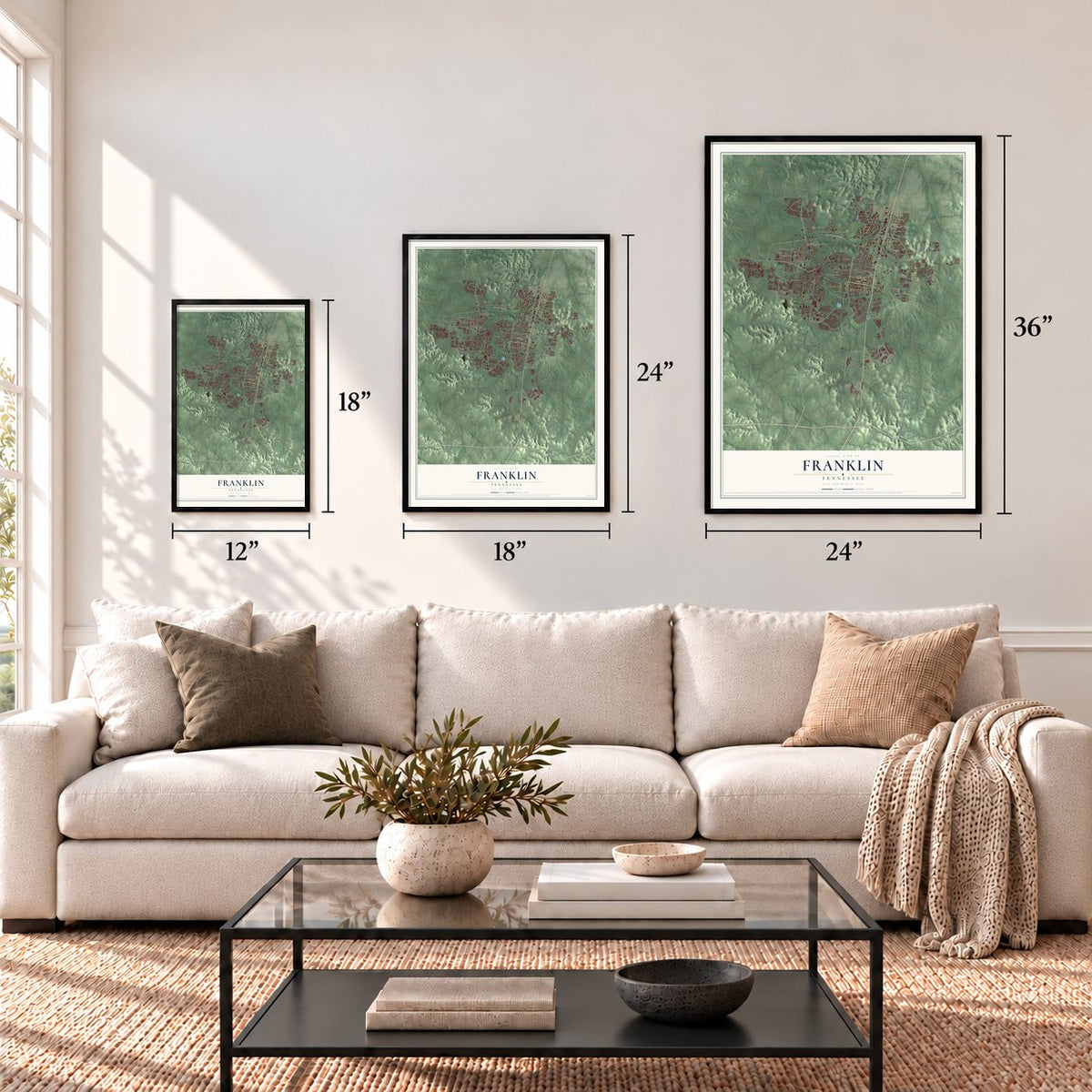
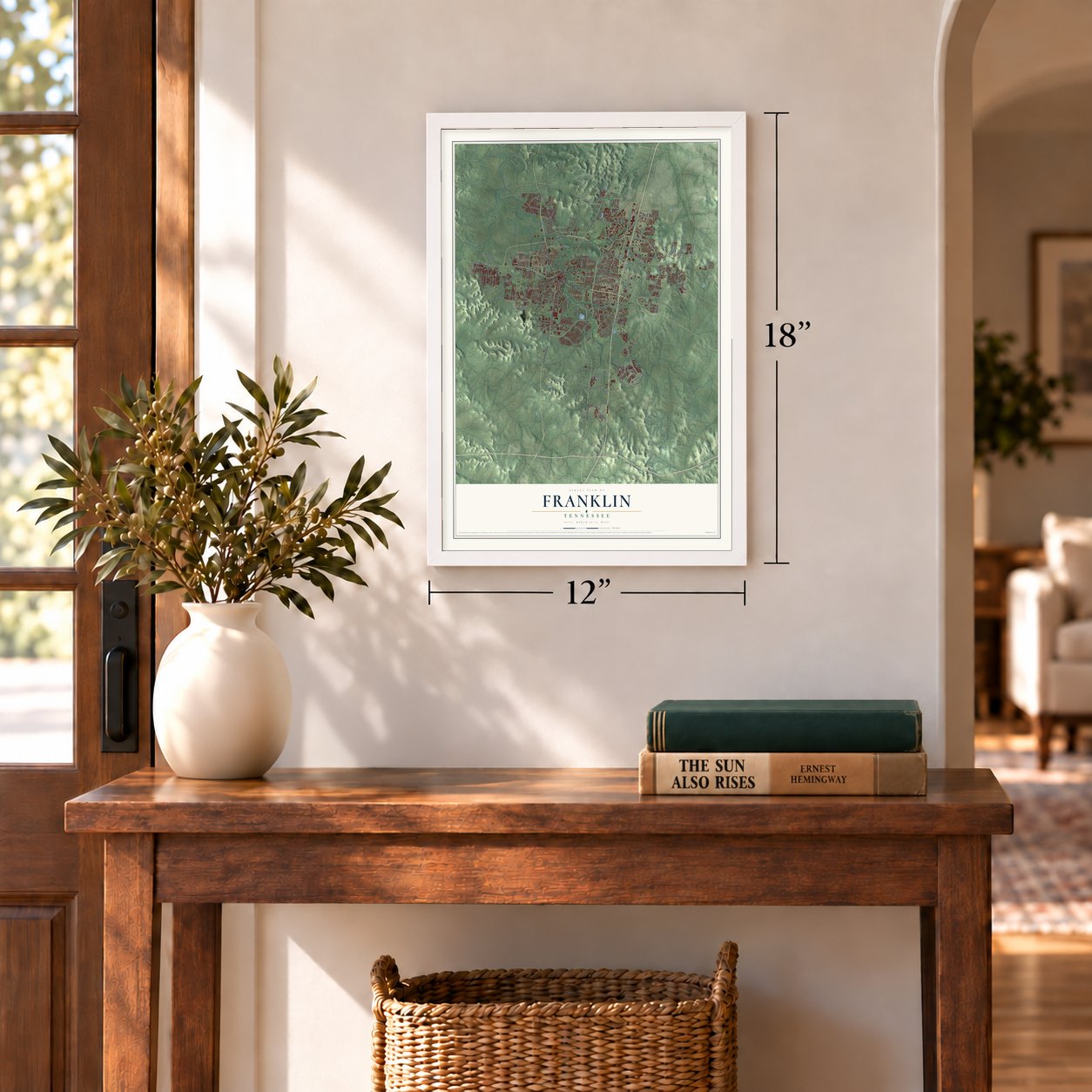
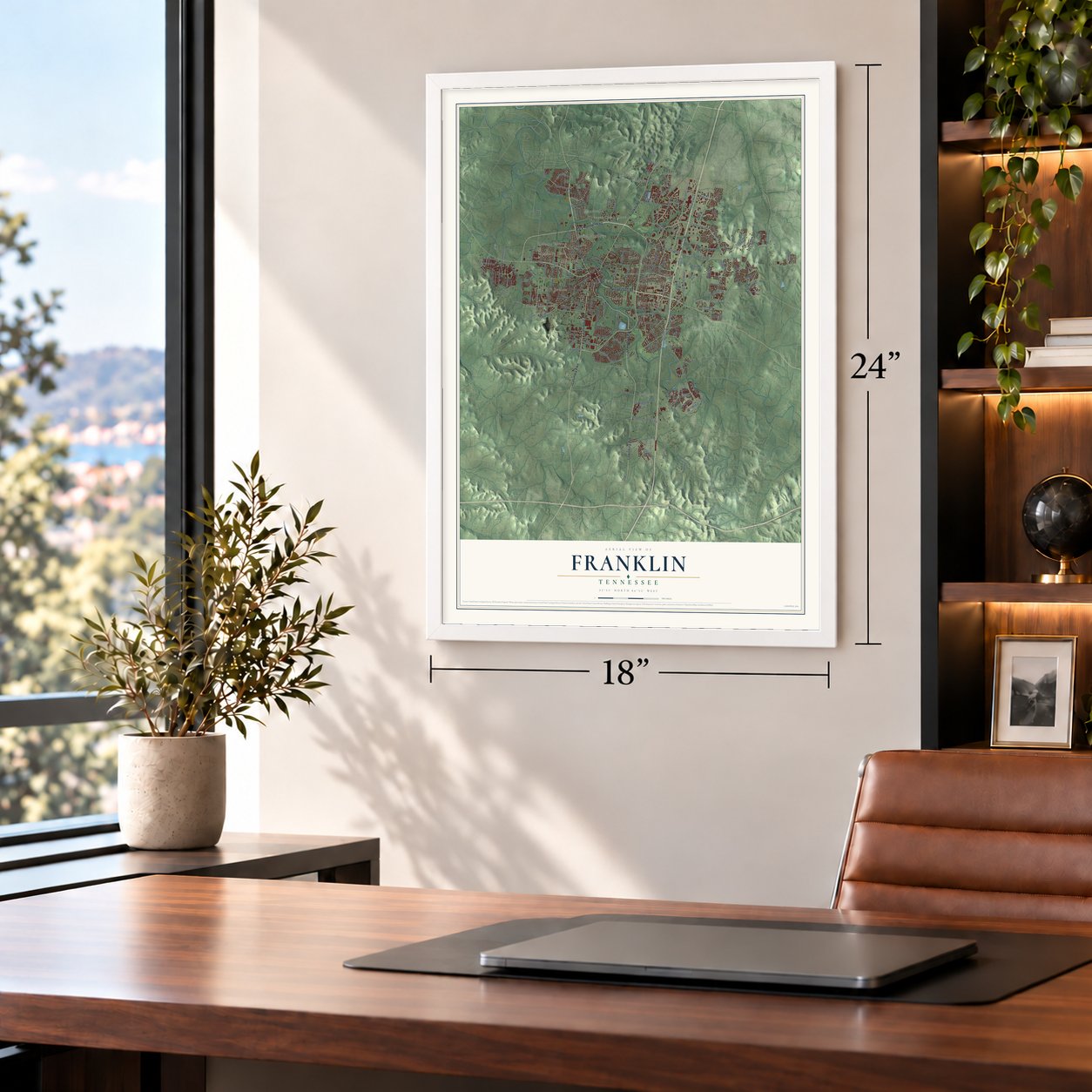
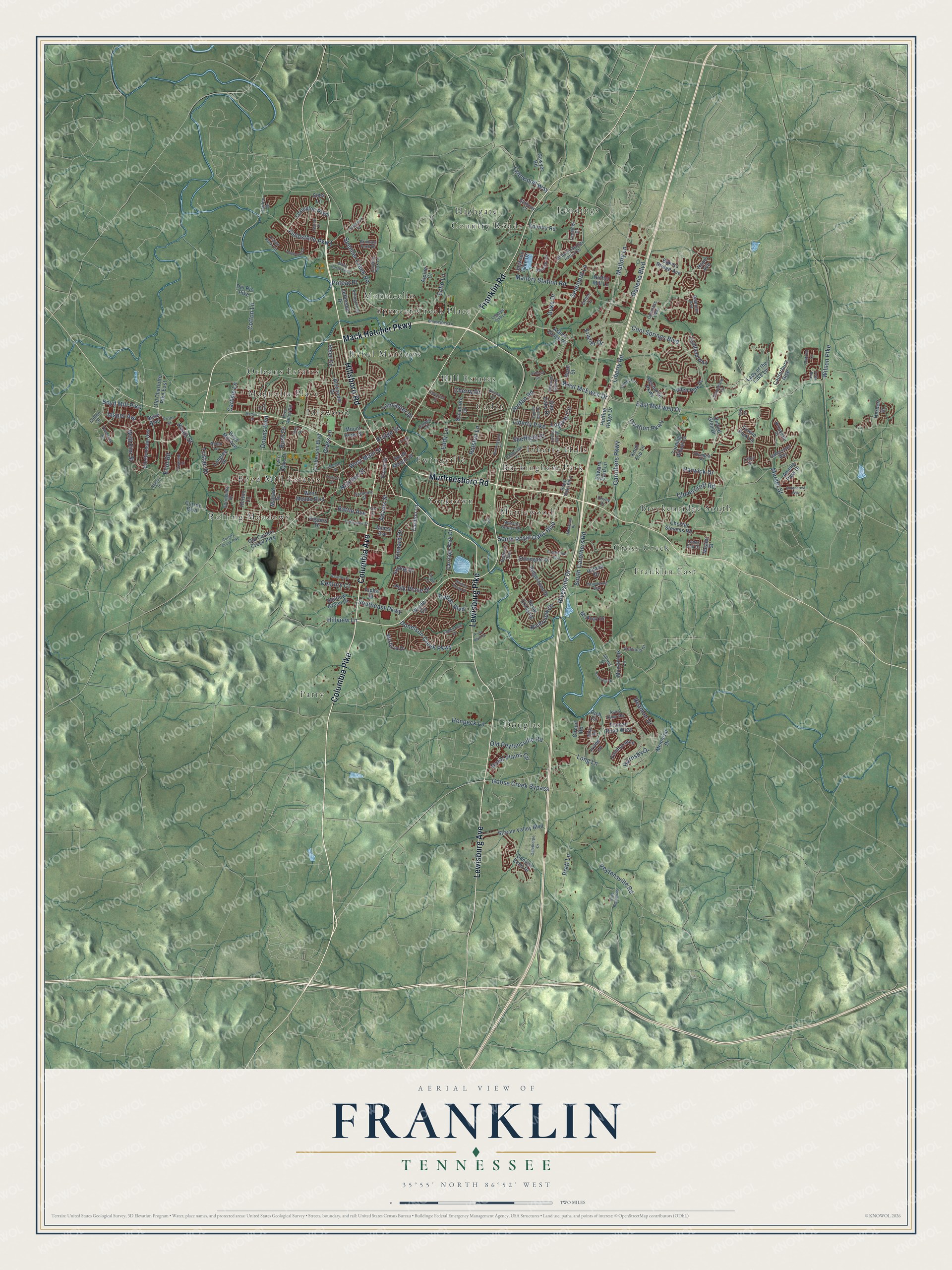
A new map of Franklin, Tennessee, made in 2026 and printed to order on thick archival matte paper.
12" x 18" Archival Matte Print
A Map of Home. A Work of Art.
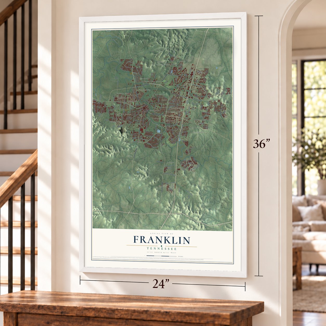
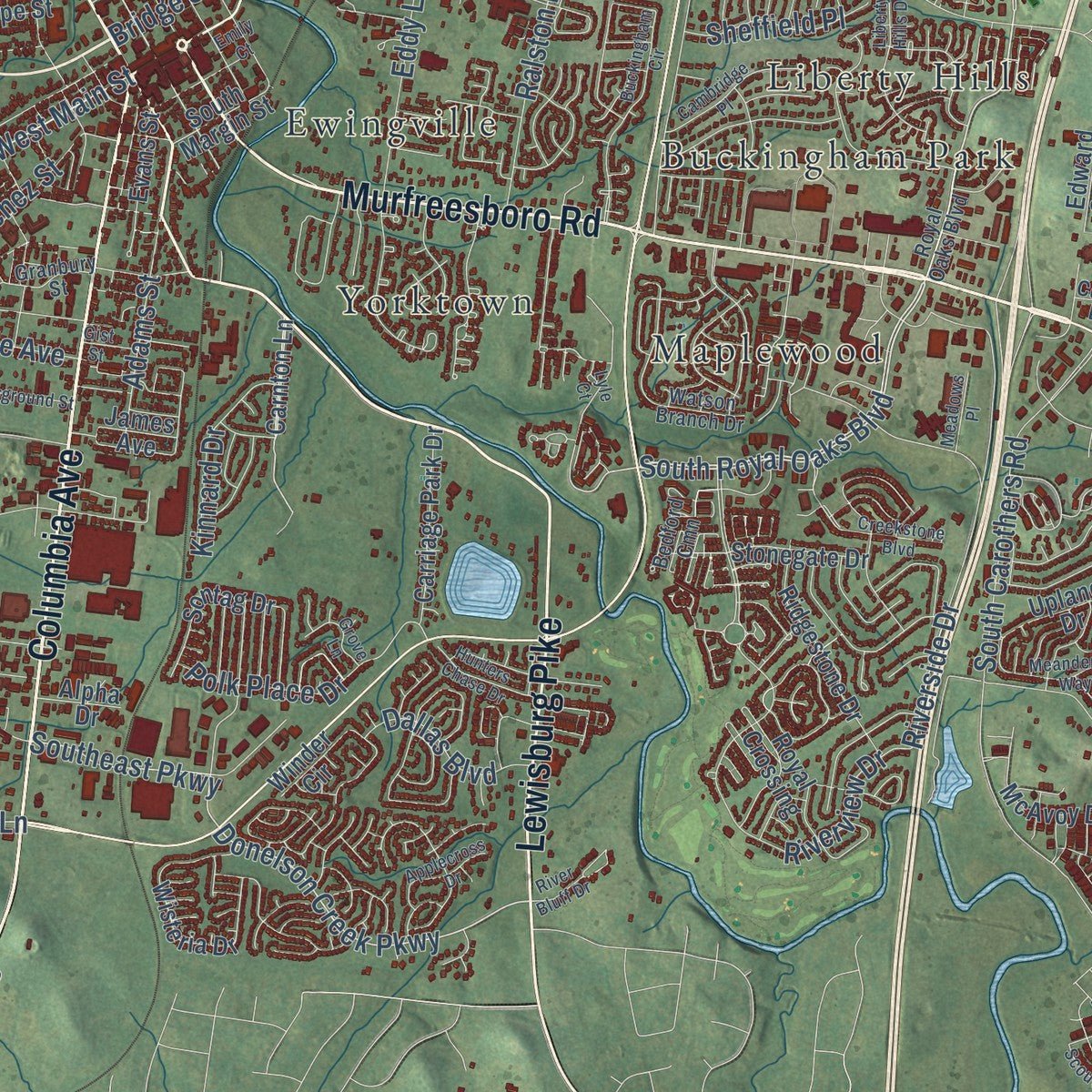
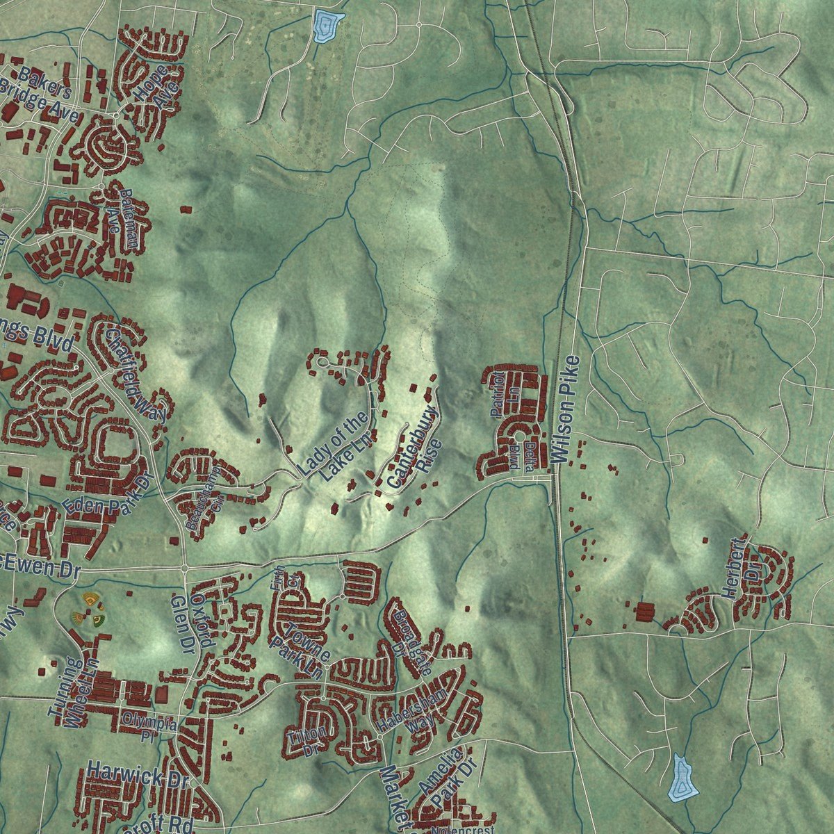
Explore Franklin, Tennessee from a whole new perspective. Created using aerial imagery and detailed geographic data, this map captures Franklin building by building, with labeled streets, familiar landmarks, and shaded topographical relief that highlights the natural contours of the landscape.
Combining modern data with the timeless character of a vintage atlas, this map is just as interesting up close as it is beautiful on the wall. Whether you grew up in Franklin, spent memorable years there, or call it home today, this unique map is a great way to celebrate a place that means something to you. Zoom in on the preview to look for your street, and then order a print to put your memories on the wall.
Three ways to hang it
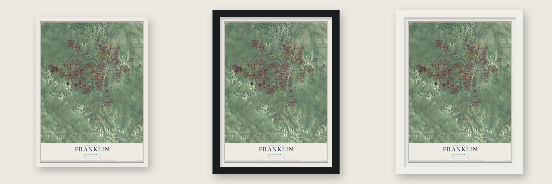
Unframed archival matte, a black wood frame or a white wood frame.
Up close
Geography Worth Displaying
This map was created using accurate cartographic data and authoritative geographic sources, including the U.S. Geological Survey and the Census Bureau. The map brings together terrain, waterways, roads, and building detail. The majority of the streets are labeled, houses are accurately depicted, and the topography is derived from government sources. Combining local data with carefully composed color and shading leads to this beautifully detailed Franklin artwork for your wall.
Rather than simply showing street outlines, we’ve included as many of the street names as we could reasonably fit on the map while keeping their names legible. Zoom in on the high resolution preview to see exactly what’s on the map. We truly set out to create a statement piece for anyone who loves Franklin. So whether it’s for you, or a gift for someone you love, we hope this map of Franklin brings back fond memories.
Read the story behind this map of Franklin, Tennessee from 2026.

About Franklin, Tennessee
Franklin is a city of 83,454 people and the county seat of Williamson County. It grew up along both banks of the Harpeth River. Ewen Cameron, a Scottish settler, put up the first log house in 1798. A year later Abram Maury, who later became a state senator, bought 640 acres from the large military grant of Major Anthony Sharp. Maury laid out the county seat on 109 acres of that land in 1800 and named it for Benjamin Franklin.
Before the Civil War, farmers here did well raising tobacco, hemp and livestock. Union troops held Tennessee from 1862. On November 30, 1864, the Second Battle of Franklin left almost 10,000 men killed, wounded, captured or missing, and forty-four buildings in town were turned into field hospitals for a time. Franklin stayed a quiet trading and court town for a rural county well into the twentieth century. Then it grew fast as a suburb of Nashville, from 12,407 people in 1980 to 62,487 in 2010.
- The first house, 1798Ewen Cameron was born in Scotland on February 23, 1768. He moved to Virginia in 1785 and came to Tennessee soon after it joined the Union. He built Franklin's first log house and lived in it for 48 years, until he died on February 28, 1846. He and his second wife, Mary, are buried in the old City Cemetery, which joined the National Register in 2012.
- Carnton and the Lotz HouseThe Carter, Carnton and Lotz houses all stood through the 1864 battle, and they still stand today. Carnton joined the National Register in 1973 and the Lotz House in 1976. Near Carnton, the McGavock Confederate Cemetery holds 1,481 Confederate soldiers who died at Franklin. No private Confederate cemetery in America is larger.
- From stoves to shopsIn 1928 the Dortch Stove Works built a factory in Franklin, one of the first big manufacturers in the county. Magic Chef later took over the plant and built gas and electric ranges there. After the factory closed, the empty buildings were restored in the late 1990s for offices, restaurants, stores and event spaces.
- A Buffalo Soldier's honorGeorge Jordan was born into slavery. He later fought in the Indian Wars in New Mexico as a Buffalo Soldier. No other Williamson County man has received the Congressional Medal of Honor. At the armed forces memorial on the grounds of the county archives, the largest of the engraved bricks around the city seal bears his name.
- The Fuller StoryPreservation and church leaders started the Fuller Story to honor the lives of African Americans in Franklin. The Board of Mayor and Aldermen approved it. Its first plaques, on slavery, Reconstruction, Jim Crow and civil rights, went up in 2018. In October 2021 a statue of a United States Colored Troops soldier was unveiled in front of the old courthouse on Franklin Square, once the site of a slave market.
Find your street
Names on the Franklin map
Every name below is printed on this map. Look for your street, your school, the park where you played, or the pond down the road.
Places and landmarks23
- Boyd Mill Estates
- Breckenridge South
- Buckingham Park
- Cadet
- Country Roads
- Cross Creek
- Douglas
- Ewingville
- Franklin East
- Highgate
- Hill Estates
- Idlewood
Show all 23 places
- Landings
- Liberty Hills
- Magnolia Place
- Maplewood
- Monticello
- Orleans Estates
- Parry
- Rebel Meadows
- Rolling Meadows
- Spencer Creek Place
- Yorktown
Streets and roads219
- Mack Hatcher Parkway
- Murfreesboro Road
- Hillsboro Road
- Lewisburg Pike
- Lewisburg Avenue
- Columbia Avenue
- Columbia Pike
- Franklin Road
- South Royal Oaks Boulevard
- West Main Street
- Mallory Lane
- Galleria Boulevard
- Cotton Lane
- Donelson Creek Parkway
- Cool Springs Boulevard
- Hillview Lane
- Southeast Parkway
- Carlisle Lane
- Bush Drive
- Carothers Parkway
- Liberty Pike
- East McEwen Drive
- South Carothers Road
- Downs Boulevard
- Jordan Road
- Clovercroft Road
- Peytonsville Road
- Fieldstone Parkway
- Long Lane
- Spencer Creek Road
Show all 219 streets
- Riverside Drive
- Mallory Station Road
- Pratt Lane
- Riverview Drive
- Old Peytonsville Road
- Seaboard Lane
- Beamon Drive
- Boyd Mill Pike
- West McEwen Drive
- Wilson Pike
- Battle Avenue
- Rural Plains Circle
- Polk Place Drive
- Liberty Road
- Logans Circle
- Goose Creek Bypass
- Harwick Drive
- Ralston Lane
- Eliot Road
- Echo Lane
- Eddy Lane
- Poteat Place
- Adams Street
- Henpeck Lane
- Jasper Avenue
- Keats Street
- Market Street
- Kinnard Drive
- Ovation Parkway
- Lynnwood Way
- Dallas Boulevard
- Lancaster Drive
- Sheffield Place
- Hornsby Drive
- Natchez Street
- Tristan Drive
- Century Court
- Duke Drive
- Wild Elm Street
- Glass Lane
- Frazier Drive
- Cherry Drive
- Bridge Street
- Carnton Lane
- Truman Road West
- Oxford Glen Drive
- Twin Oaks Drive
- Aspen Grove Drive
- Chester Stevens Road
- Del Rio Pike
- Boyd Mill Avenue
- Old Charlotte Pike East
- Lexington Parkway
- Bakers Bridge Avenue
- Stream Valley Boulevard
- Currey Boulevard
- Horton Lane
- Towne Park Lane
- Cheltenham Avenue
- State Boulevard
- Wisteria Drive
- Lady of the Lake Lane
- Turning Wheel Lane
- Sontag Drive
- Ridgestone Drive
- Alexander Drive
- Irvine Lane
- Finnhorse Lane
- Edward Curd Lane
- Royal Crossing
- Eden Park Drive
- Figuers Drive
- Mealer Street
- Carriage Park Drive
- Canterbury Rise
- Chatfield Way
- Herbert Drive
- Glen Oaks Drive
- Rebel Circle
- Circuit Road
- Culberson Boulevard
- Upland Drive
- McAvoy Drive
- Sawyer Road
- South Margin Street
- West Meade Boulevard
- Nichol Mill Lane
- Sycamore Drive
- Huffine Ridge Drive
- Shadow Green Drive
- Resource Parkway
- Rich Circle
- Alpine Court
- Knoll Top Lane
- Jefferson Drive
- Stonegate Drive
- Old Carters Creek Pike
- Maysbrook Lane
- Langley Drive
- Country Road
- Memorial Drive
- Canyon Echo Drive
- Amelia Park Drive
- Mount Hope Street
- Hope Avenue
- James Avenue
- Jackson Lake Drive
- Mallard Drive
- Winder Circle
- Rush Street
- Evans Street
- Alpha Drive
- Sims Lane
- Sunrise Circle
- Royal Oaks Boulevard
- Tower Circle
- Vera Valley Road
- Habersham Way
- General George Patton Drive
- Watson Branch Drive
- Springlake Drive
- Essex Park Circle
- Landings Drive
- Crofton Park Lane
- Granbury Street
- Wise Road
- Tilton Drive
- Gracious Drive
- Nolen Lane
- Avon River Road
- Daniels Drive
- Brixham Park Drive
- Arlington Place
- Broadgate Drive
- Bedford Cmn
- Front Street
- Compass Way
- Bateman Avenue
- Gateway Court
- Olympia Place
- Clifton Street
- Carden Drive
- Inland Drive
- Lanes End Drive
- Patriot Lane
- Gothic Court
- Covey Drive
- Fitzgerald Street
- Buckingham Circle
- Liberty Hills Drive
- Black Horse Parkway
- Penbrook Drive
- Creekstone Boulevard
- Beauchamp Circle
- Halberton Drive
- Ernest Rice Lane
- Cambridge Place
- Legends Club Lane
- Tyne Drive
- Meandering Way
- Citation Drive
- River Bluff Drive
- Richards Glen Drive
- Dyke Bennett Road
- Eagles Glen Drive
- Artessa Circle
- Beasley Drive
- Delta Boulevard
- Arsenal Drive
- Fairground Street
- Hunters Chase Drive
- Scouting Drive
- Nolencrest Way
- Applecross Drive
- Carters Creek Pike
- Roberts Street
- Oglethorpe Drive
- Grove Lane
- Fleetwood Road
- Meadows Place
- Industrial Court
- Madeira Street
- Nelson Drive
- Forrest Street
- Gist Street
- Kelly Road
- Lyle Court
- Emily Court
- Firth Court
Names are listed as they appear on the printed map. Zoom into the product photos to find them.
The art of mapping a place
How This Map Was Made
Real places. Remarkable detail. Discover the layers that turn geographic data into a map of home.

The view from above
Aerial imagery reveals the character of the land: woodland, open fields, and the patterns of a place.

The shape of the land
Elevation data brings hills, valleys, and subtle changes in the landscape into view.

The details of home
Roads, waterways, and building footprints come together to make the map feel unmistakably local.

Geography becomes art
Considered color, shading, and typography bring the layers together in a map made for your wall.


Process illustrated with Mendon, Massachusetts. Aerial imagery: USDA NAIP. Terrain: USGS 3D Elevation Program. Map details and finished artwork: KNOWOL.
The Details
About This Print
Choose an archival matte print, or a black or white Ayous wood frame. The archival matte print is unframed.
Select your size and finish above to see the matching product image and price.
Materials & Craftsmanship
A contemporary map with the character of a classic atlas, printed on archival matte paper. Optional frames are made from Ayous wood.
Your printed map does not include the watermark shown in the full-map preview.
Shipping & Delivery
Free shipping within the United States. Every print is made to order in the USA.
Buying a gift? Add a note in your cart and we'll include it. We never put prices in the package.
Prints ship within 2 to 3 business days. Allow 7 to 10 days total from ordering for delivery. Timing may vary during holidays or periods of high order volume.
Read our shipping policy.
Returns and damaged prints
Each print is made to order. Change-of-mind refunds are not available after production.
If your print arrives damaged, misprinted or incorrect, contact support@knowol.com within 30 days of receiving it. Include your order number, photos and a description of the issue.
Read our full refund and replacement policy. For questions about your order, email support@knowol.com.
Find your town
Looking for another city?
Find a map of home in our Tennessee collection, or any town in the country.
Nearby
Maps of towns near Franklin
Know someone from one of these towns? Their map makes a great gift.
 Brentwood
, Tennessee
From $39.99See the map
 Thompson's Station
, Tennessee
From $39.99See the map
 Nolensville
, Tennessee
From $39.99See the map
More maps nearby: Forest Hills, Oak Hill, Spring Hill, Belle Meade and Berry Hill.