
Search for another town





Free U.S. delivery 7 to 10 days after you order
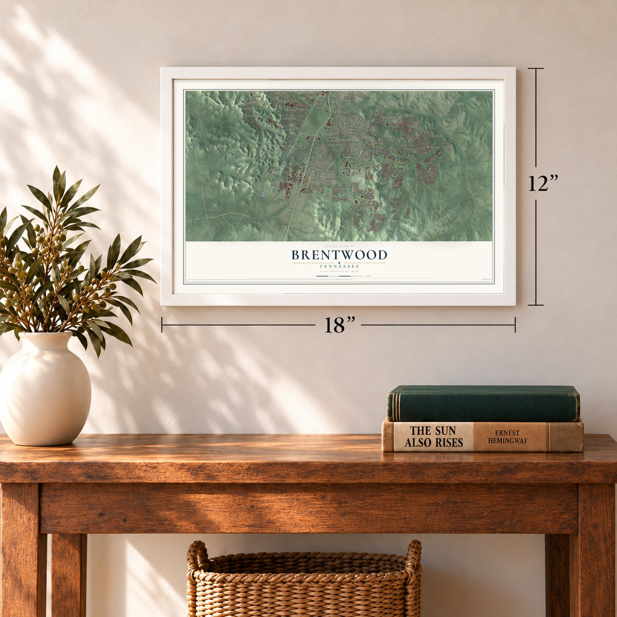
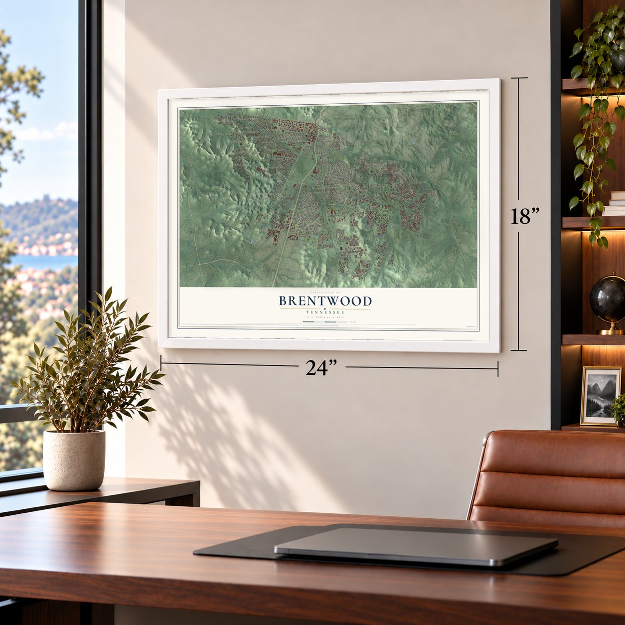
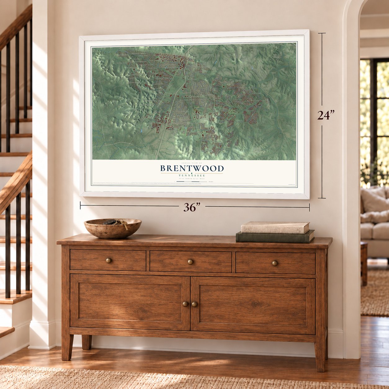
Brentwood, Tennessee Map Art
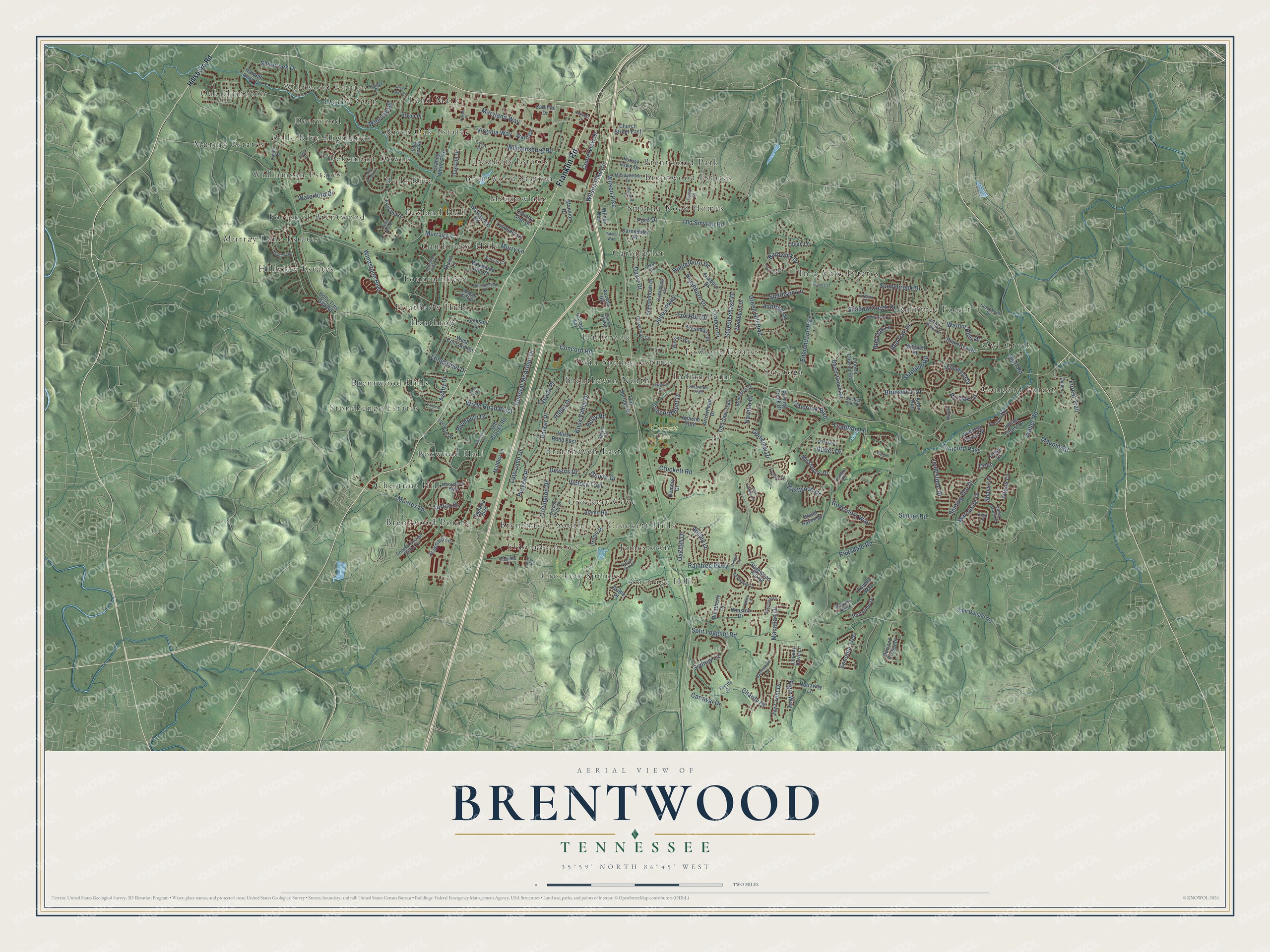
A new map of Brentwood, Tennessee, made in 2026 and printed to order on thick archival matte paper.
12" x 18" Archival Matte Print
A Map of Home. A Work of Art.
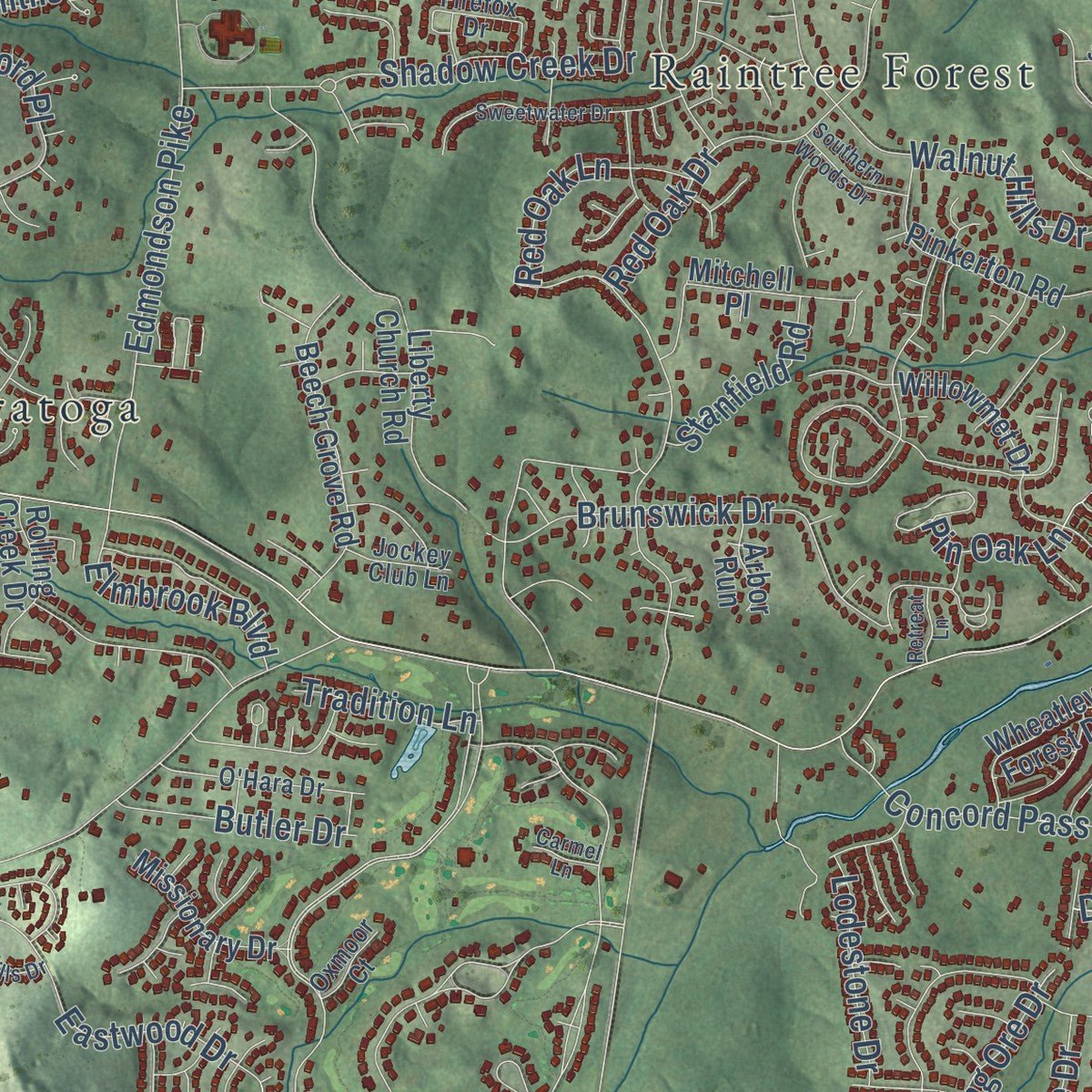
Explore Brentwood, Tennessee from a whole new perspective. Created using aerial imagery and detailed geographic data, this map captures Brentwood building by building, with labeled streets, familiar landmarks, and shaded topographical relief that highlights the natural contours of the landscape.
Combining modern data with the timeless character of a vintage atlas, this map is just as interesting up close as it is beautiful on the wall. Whether you grew up in Brentwood, spent memorable years there, or call it home today, this unique map is a great way to celebrate a place that means something to you. Zoom in on the preview to look for your street, and then order a print to put your memories on the wall.
Three ways to hang it
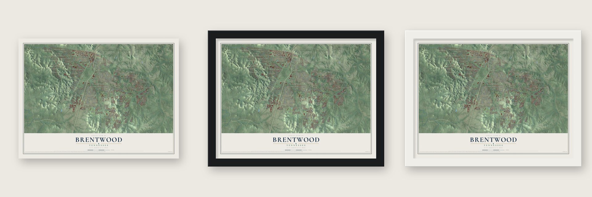
Unframed archival matte, a black wood frame or a white wood frame.
Up close
Geography Worth Displaying
This map was created using accurate cartographic data and authoritative geographic sources, including the U.S. Geological Survey and the Census Bureau. The map brings together terrain, waterways, roads, and building detail. The majority of the streets are labeled, houses are accurately depicted, and the topography is derived from government sources. Combining local data with carefully composed color and shading leads to this beautifully detailed Brentwood artwork for your wall.
Rather than simply showing street outlines, we’ve included as many of the street names as we could reasonably fit on the map while keeping their names legible. Zoom in on the high resolution preview to see exactly what’s on the map. We truly set out to create a statement piece for anyone who loves Brentwood. So whether it’s for you, or a gift for someone you love, we hope this map of Brentwood brings back fond memories.
Read the story behind this map of Brentwood, Tennessee from 2026.

About Brentwood, Tennessee
Brentwood is a city of 45,373 people in Williamson County, a suburb of Nashville. Its first European-American families, among them the Sneeds, Crocketts, Hardemans and Edmondsons, came over the Appalachian Mountains before 1800. Many of the men had served in the Virginia or North Carolina militia in the Revolutionary War and were given land grants here. The Frost place on Old Smyrna Road grew into a frontier trading spot with a general store, a grist mill and a post office. Later the railroad built a depot, the village shifted toward it, and Brentwood prospered as cotton plantations spread over the land.
Union troops held Brentwood until March 25, 1863, when the Confederate general Nathan Bedford Forrest raided the town without warning, aiming to retake this stretch of the Nashville & Decatur Railroad. He cut the telegraph wires first, and Union Lt. Col. Edward Bloodgood, left without help, gave up the town that same day. The fighting caused 305 Union and 6 Confederate casualties and wrecked much of Brentwood. Tenant farms and tobacco replaced the big plantations, and the population barely changed for almost 100 years, until the city incorporated on April 15, 1969, the year the interstate arrived.
- Mounds from before 1300Mississippian people, whom locals named the Mound Indians or Stone Box Indians, raised earthwork mounds here with ceremonial buildings on top, and they had mostly left by 1300. Primm Park on Moores Lane keeps the Fewkes Group, five mounds set around a central plaza, along with Boiling Spring Academy, a schoolhouse from 1832 that was restored in 2003.
- The Mayfield fort raid, 1786In 1786 Creek or Cherokee warriors attacked the Mayfield family's fort, where Wilson Pike now meets Old Smyrna Road. They killed Southerland Mayfield and two other men and carried off young George Mayfield. A Creek family adopted the boy, as tribes often did with captives, and he came back to settler society ten years later.
- A house moved in 1974Dr. Robert Carothers and his wife, Martha Crockett, built what is now called the Cool Springs House where Mallory Lane meets Cool Springs Boulevard. It changed hands many times, and when fast growth around it put the old house at risk, the city moved it to Crockett Park in 1974.
- Fox hunts and the Brentwood DerbyStarting in the 1930s, despite the Great Depression, Nashville businessmen and merchants bought up the old plantation houses, bringing back fox hunting and raising fine horses. One American Saddle Horse farm and race track later became the Maryland Farms office complex, and horses raced in the Brentwood Derby there until the mid 1970s.
Find your street
Names on the Brentwood map
Every name below is printed on this map. Look for your street, your school, the park where you played, or the pond down the road.
Places and landmarks50
- Oak Hampton
- Wildwood Estates
- Crockett Park
- Belle Rive
- Belle Rive Highlands
- Boxwood Hall
- Brenthaven East
- Brenthaven North
- Brenthaven South
- Brentwood Estates
- Brentwood Hills
- Brentwood Park
Show all 50 places
- Brentwood Pointe
- Brentwood Station
- Cambridge Hills
- Carondelet
- Carriage Hills
- Chestnut Hill
- Concord Forest
- Crockett Cove
- Crockett Hills
- Crockett Springs
- Deerwood
- Dekemont Downs
- Derby Glen
- Eldorado Acres
- Forest of Brentwood
- Fountainhead
- Foxboro Estates
- Foxland Hall
- Hallbrook
- Heathrow
- Heathrow Hills
- Hillview Estates
- In-a-Vale-Estates
- Indian Point
- Iroquois Estates
- Jamestown
- Land Mark
- Meadowlake
- Murray Estates
- Murray Lane Estates
- Owl Creek
- Raintree Forest
- River Oak Estates
- Saratoga
- Smyrna Road Homes
- Stonehenge Estates
- Twin Springs Estates
- Williamson Estates
Streets and roads211
- Franklin Road
- Wilson Pike
- Maryland Way
- Raintree Parkway
- Old Smyrna Road
- Jones Parkway
- Concord Road
- Murray Lane
- Moores Lane
- Governors Way
- Sunset Road
- Split Logging Road
- Green Hill Boulevard
- Crockett Road
- Waller Road
- Charity Drive
- Ragsdale Road
- Lipscomb Drive
- Devens Drive
- Knox Valley Drive
- Williamsburg Road
- Edmondson Pike
- Concord Pass
- Wilson Pike Circle
- Ansley Lane
- Virginia Way
- Parker Place
- Eastwood Drive
- Walnut Hills Drive
- Davis Drive
Show all 211 streets
- Hunterboro Drive
- Ivy Crest Drive
- Red Oak Drive
- Pin Oak Lane
- Brunswick Drive
- General McArthur Drive
- Navaho Drive
- Brushboro Drive
- Stanfield Road
- Forest Trail
- Wikle Road West
- Steeplechase Drive
- Windstone Boulevard
- Concord Hunt Drive
- Shadow Creek Drive
- Plymouth Drive
- Murry Lane
- Ashford Place
- Shamrock Drive
- Covington Drive
- Sunnybrook Drive
- Victory Trail
- Elgin Way
- Haber Drive
- Ashby Drive
- Smithson Lane
- Sydney Lane
- Maupin Road
- Milbrook Road
- Bluff Road
- Holly Road
- Bathwick Drive
- Elmbrook Boulevard
- Fox Run Drive
- Sonoma Trce
- Puryear Place
- Macallan Drive
- Red Oak Lane
- Titans Lane
- Shining Ore Drive
- Butler Drive
- Lodestone Drive
- Waterford Drive
- Oakhall Drive
- Tartan Drive
- Centerview Drive
- Marcasite Drive
- Longstreet Drive
- Carnival Drive
- Glenview Drive
- Tradition Lane
- Shays Lane
- Glover Drive
- Lavada Place
- Ford Drive
- Deer
- Hillsboro Road
- Church Street East
- Galleria Boulevard
- Holly Tree Gap Road
- Granny White Pike
- Liberty Church Road
- Arrowhead Drive
- McGavock Road
- Coxboro Drive
- Mallory Lane
- Country Club Drive
- Alamo Road
- Shenandoah Drive
- Harpeth River Drive
- Wikle Road East
- Pinkerton Road
- Burland Crescent
- Stuart Lane
- Beech Grove Road
- Twin Springs Drive
- Old Brooks Road
- Foxboro Drive
- Sam Donald Road
- Foxland Drive
- Jupiter Forest Drive
- Woodland Hills Drive
- West Concord Road
- Highwood Hill Road
- Forest Lawn Drive
- Access Road
- Legacy Cove Lane
- Choctaw Trail
- Lysander Lane
- Jackson Lane
- Demery Court
- Wilson Run
- Ward Circle
- Missionary Drive
- Woodburn Drive
- Wheatley Forest Drive
- Portofino Drive
- Prestmoor Place
- Seaboard Lane
- Willowmet Drive
- Mansion Drive
- Weatherly Drive
- Cadillac Drive
- Rolling Creek Drive
- Mitchell Place
- Nottaway Lane
- Carondelet Place
- Oakvale Drive
- Apache Trail
- Grand Haven Drive
- Primm Drive
- Winston Drive
- Lillian Lane
- Bryan Place
- Arbor Run
- Ravello Way
- Bridle Place
- Timey Place
- Barnstaple Lane
- Heritage Way
- Mooreland Boulevard
- Devins Drive
- High Lea Road
- Dahlia Drive
- Sinclair Circle
- Meadowlawn Drive
- Saddlebow Drive
- General George Patton Drive
- Gordon Petty Drive
- Valley Brook Drive
- Brookview Drive
- Sunny Hill Road
- O'Hara Drive
- Parade Drive
- Oden Court
- Gasserway Circle
- Ellendale Road
- Quiet Lane
- Firefox Drive
- Shawnee Trail
- Exton Lane
- Northfork Drive
- Wilshire Way
- Walnut Park Drive
- Tupper Place
- Stonebluff Drive
- Jockey Club Lane
- Romano Way
- Isabella Lane
- Oxmoor Court
- Onyx Lane
- Powell Place
- Highland Road
- Princeton Hills Drive
- Turtle Creek Drive
- Fountainhead Drive
- Foothills Drive
- Plantation Drive
- Haverhill Drive
- Thurrock Circle
- Mayfield Place
- Sweetwater Drive
- Midlothian Drive
- Victoria Cv
- Lost Hollow Drive
- Split Rail Drive
- Forsyth Park Drive
- Liberty Road
- Gentlewind Drive
- Stow Trail
- Southern Woods Drive
- Ethan Lane
- Harpeth Drive
- Arthur Court
- River Oaks Court
- Retreat Lane
- Arden Court
- Palmer Way
- Carmel Lane
- Kindra Court
- Lenox Road
Names are listed as they appear on the printed map. Zoom into the product photos to find them.
The art of mapping a place
How This Map Was Made
Real places. Remarkable detail. Discover the layers that turn geographic data into a map of home.

The view from above
Aerial imagery reveals the character of the land: woodland, open fields, and the patterns of a place.

The shape of the land
Elevation data brings hills, valleys, and subtle changes in the landscape into view.

The details of home
Roads, waterways, and building footprints come together to make the map feel unmistakably local.

Geography becomes art
Considered color, shading, and typography bring the layers together in a map made for your wall.


Process illustrated with Mendon, Massachusetts. Aerial imagery: USDA NAIP. Terrain: USGS 3D Elevation Program. Map details and finished artwork: KNOWOL.
The Details
About This Print
Choose an archival matte print, or a black or white Ayous wood frame. The archival matte print is unframed.
Select your size and finish above to see the matching product image and price.
Materials & Craftsmanship
A contemporary map with the character of a classic atlas, printed on archival matte paper. Optional frames are made from Ayous wood.
Your printed map does not include the watermark shown in the full-map preview.
Shipping & Delivery
Free shipping within the United States. Every print is made to order in the USA.
Buying a gift? Add a note in your cart and we'll include it. We never put prices in the package.
Prints ship within 2 to 3 business days. Allow 7 to 10 days total from ordering for delivery. Timing may vary during holidays or periods of high order volume.
Read our shipping policy.
Returns and damaged prints
Each print is made to order. Change-of-mind refunds are not available after production.
If your print arrives damaged, misprinted or incorrect, contact support@knowol.com within 30 days of receiving it. Include your order number, photos and a description of the issue.
Read our full refund and replacement policy. For questions about your order, email support@knowol.com.
Find your town
Looking for another city?
Find a map of home in our Tennessee collection, or any town in the country.
Nearby
Maps of towns near Brentwood
Know someone from one of these towns? Their map makes a great gift.
 Oak Hill
, Tennessee
From $39.99See the map
 Nolensville
, Tennessee
From $39.99See the map
 Forest Hills
, Tennessee
From $39.99See the map
More maps nearby: Franklin, Berry Hill, Belle Meade, La Vergne and Nashville.