
Search for another town





Free U.S. delivery 7 to 10 days after you order
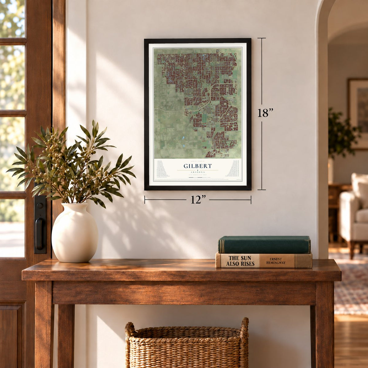
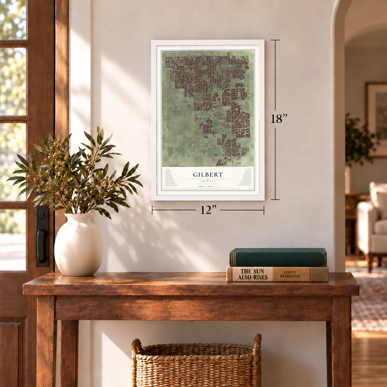
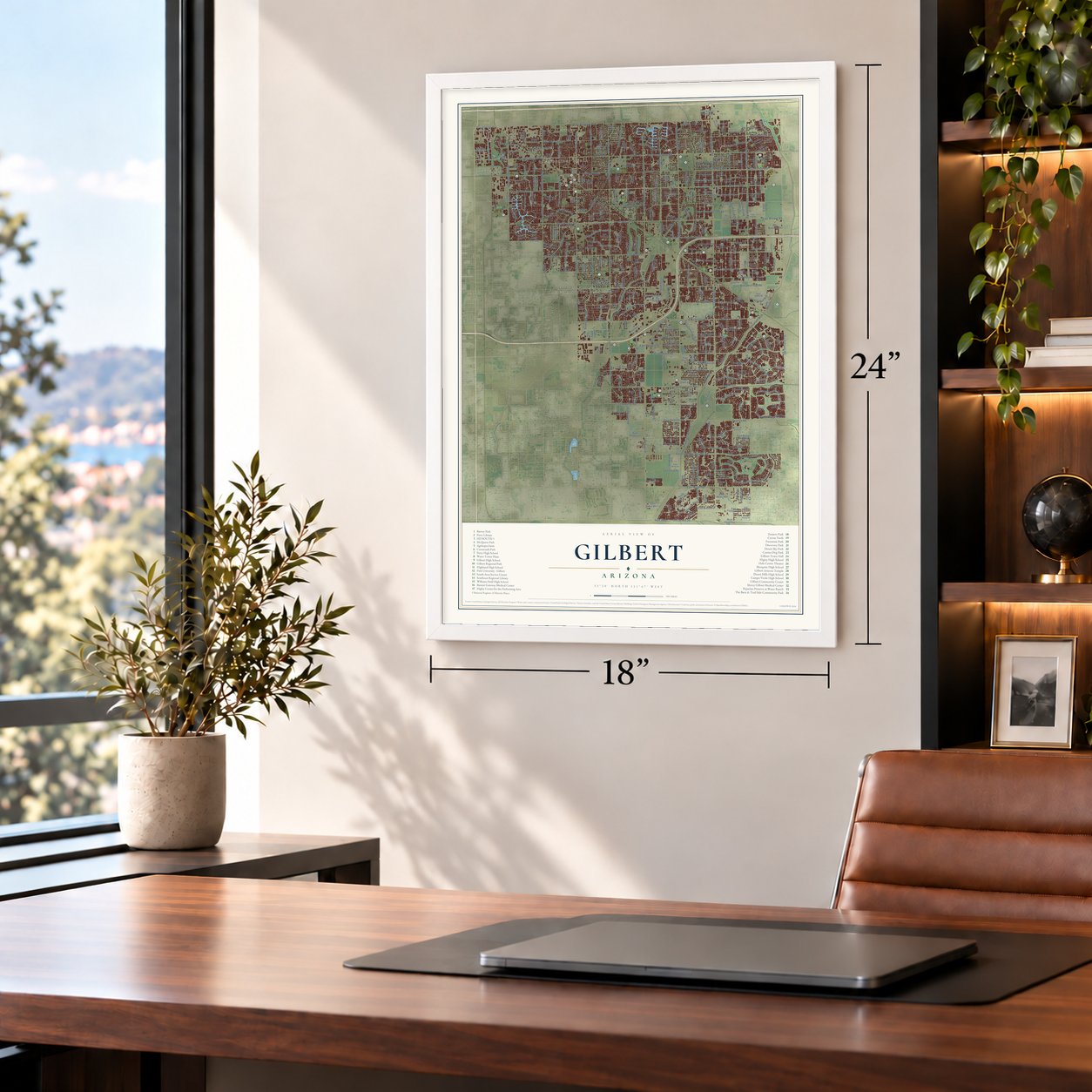
Gilbert, Arizona Map Art
Building by building, with labeled streets and shaded relief.
12" x 18" Archival Matte Print
A Map of Home. A Work of Art.
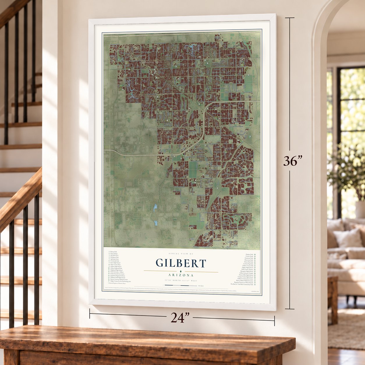
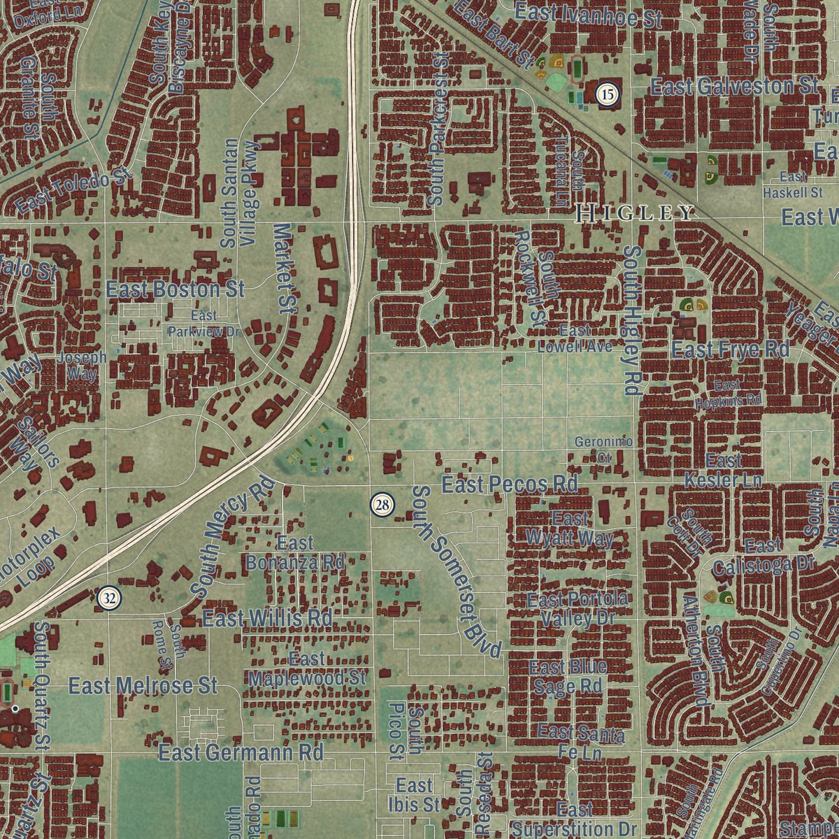
Explore Gilbert, Arizona from a whole new perspective. Created using aerial imagery and detailed geographic data, this map captures Gilbert building by building, with labeled streets, familiar landmarks, and shaded topographical relief that highlights the natural contours of the landscape.
Combining modern data with the timeless character of a vintage atlas, this map is just as interesting up close as it is beautiful on the wall. Whether you grew up in Gilbert, spent memorable years there, or call it home today, this unique map is a great way to celebrate a place that means something to you. Zoom in on the preview to look for your street, and then order a print to put your memories on the wall.

Three ways to hang it
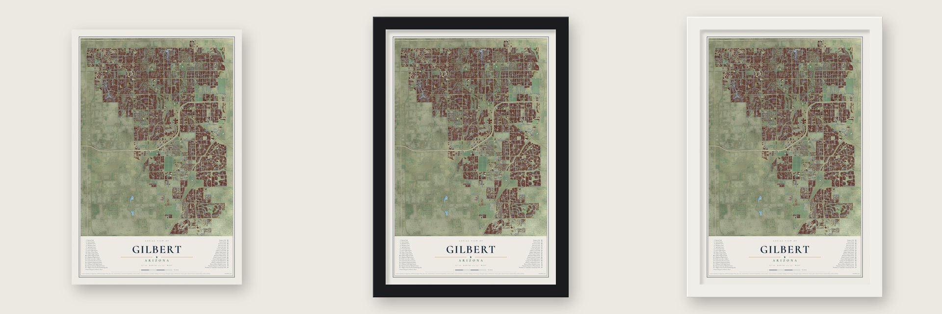
Unframed archival matte, a black wood frame or a white wood frame.
Up close
Geography Worth Displaying
This map was created using accurate cartographic data and authoritative geographic sources, including the U.S. Geological Survey (USGS) and FEMA. The map brings together terrain, waterways, roads, and building detail. The majority of the streets are labeled, houses are accurately depicted, and the topography is derived from government sources. Combining local data with carefully composed color and shading leads to this beautifully detailed Gilbert artwork for your wall.
Rather than simply showing street outlines, we’ve included as many of the street names as we could reasonably fit on the map while keeping their names legible. Zoom in on the high resolution preview to see exactly what’s on the map. We truly set out to create a statement piece for anyone who loves Gilbert. So whether it’s for you, or a gift for someone you love, we hope this map of Gilbert brings back fond memories.
Explore the full map of Gilbert, Arizona and read about the local places it shows.

Find your street
Names on the Gilbert map
Every name below is printed on this map. Look for your street, your school, the park where you played, or the pond down the road.
Places and landmarks10
- Gilbert Civic Center
- Vista Alegre
- Sunview
- Hacienda Solano Park
- Higley
- Falfa
- Breckenridge Manor
- Tremaine
- Sonora Town
- Nortons Corner
Streets and roads405
- South Higley Road
- Roosevelt Wcd
- South Greenfield Road
- South Val Vista Drive
- East Baseline Road
- South Recker Road
- South Power Road
- South Lindsay Road
- East Pecos Road
- East Ray Road
- East Germann Road
- East Warner Road
- East Elliot Road
- East Guadalupe Road
- East Williams Field Road
- East Queen Creek Road
- Roosevelt Wcd Csr
- East Mesquite Street
- East Chandler Heights Road
- East Galveston Street
- South Gilbert Road
- East Houston Avenue
- East Park Avenue
- East Riggs Road
- 800 South
- Twelve Oaks
- West Guadalupe Road
- East Willis Road
- 0 N-S
- South 148th Street
Show all 405 streets
- East Melrose Street
- East Frye Road
- 800 North
- Western Canal
- East Olney Avenue
- East Tremaine Avenue
- East Boston Street
- West Elliot Road
- East Ivanhoe Street
- North Gilbert Road
- East San Angelo Avenue
- East Arrowhead Trail
- South 164th Street
- East Knox Road
- West Warner Road
- North Val Vista Drive
- West Houston Avenue
- North McQueen Road
- North Cooper Road
- North Burk Street
- North Greenfield Road
- North Recker Road
- East Ocotillo Road
- East Ficus Way
- East Pony Lane
- East Appleby Road
- South Seville Boulevard East
- East Ryan Road
- North Cole Drive
- East Coldwater Boulevard
- North Lindsay Road
- North Neely Street
- South Mustang Drive
- South Catalina Street
- East Bloomfield Parkway
- East Village Parkway
- South Cole Drive
- Consolidated Csr
- West Encinas Street
- South Cooper Road
- East Vest Avenue
- Indian Route 56
- South Allen Avenue
- Morrison Ranch Parkway
- South Ranch House Parkway
- Market Street
- 0 E-W
- West San Pedro Street
- North Fiesta Boulevard
- East Settlers Point Drive
- Bluejay Drive
- Ocotillo Road
- East Palmer Street
- West Ray Road
- East Campbell Road
- East Morgan Drive
- North Higley Road
- South Mercy Road
- East Raleigh Bay Drive
- South 163rd Place
- Spectrum Way
- Hunt Highway
- 400 West
- East Lakeside Drive
- South Somerset Boulevard
- East Bridges Boulevard
- East Cypress Street
- Quartz Street
- West Lago Boulevard
- 800 East
- Val Vista Drive
- Granite Street
- South 29th Place
- 164th Street
- Page Avenue
- Seville Boulevard
- Beach Boulevard
- Tatum Lane
- North Ski Court
- Jasper Drive
- Buffalo Street
- Clark Drive
- South Parkcrest Street
- South 172nd Street
- East Linda Lane
- South Portland Avenue
- East Palo Verde Street
- South Granite Street
- East Page Avenue
- East Orchid Lane
- East Sierra Madre Avenue
- East Desert Lane
- South Wade Drive
- East Pinto Drive
- East Encinas Avenue
- East Sagebrush Street
- South Reseda Street
- South Coronado Road
- South Key Biscayne Drive
- East Maplewood Street
- South Sandstone Street
- South Santan Village Parkway
- South 156th Street
- East Meadowview Drive
- South Quinn Avenue
- East Mia Lane
- East Bruce Avenue
- East Juniper Avenue
- East Tulsa Street
- South Rockwell Street
- South Concord Street
- East Jasper Drive
- East Carob Drive
- South Islands Drive West
- West San Angelo Street
- South Soboba Street
- East Flintlock Drive
- East Strawberry Drive
- South Riata Street
- East Wyatt Way
- North Riata Street
- East Blue Sage Road
- South Porter Street
- East Bart Street
- East Joseph Way
- East Bonanza Road
- South 180th Street
- East Powell Way
- East Toledo Street
- East Erie Street
- North Oak Street
- West Palo Verde Street
- East Jude Lane
- East Portola Valley Drive
- South Banning Drive
- East Santa Fe Lane
- North Voyager Drive
- South 142nd Street
- Motorplex Loop
- North Nielson Street
- West Hunt Highway
- South Western Skies Drive
- East Sherri Drive
- East Cloud Road
- South 140th Street
- East Aris Drive
- East Fruitvale Avenue
- East Douglas Avenue
- Ranch House Parkway
- North Palm Street
- West Sherri Drive
- South Highland Glen Lane
- South Quartz Street
- East Baylor Lane
- East Thornton Avenue
- South 154th Street
- East Brooks Farm Road
- South 144th Street
- East Nunneley Road
- East Julian Drive
- East Eleana Lane
- East Everglade Lane
- East Spur Avenue
- Garden Circle
- East Robin Lane
- South 157th Street
- South 158th Street
- North Horne Street
- North El Dorado Drive
- West Iris Drive
- East Mews Road
- East Mead Drive
- North Mondel Drive
- East Somerton Boulevard
- East Kesler Lane
- South McQueen Road
- East Sports Drive
- East Reins Road
- East Calistoga Drive
- South Ironwood Street
- East Superstition Drive
- East Cotton Lane
- East Spur Road
- South 131st Street
- East Millbrae Lane
- East Agritopia Loop
- South Pico Street
- South Jeffry Street
- South Falcon Drive
- 1600 East
- Banning Street
- West Leah Lane
- South Neely Street
- East Watford Court
- East Vallejo Court
- Star Drive
- East Clark Drive
- West Baseline Road
- East Ibis Street
- South Adora Boulevard
- South Ocean Drive
- East Dubois Avenue
- North Tucana Lane
- South Atherton Boulevard
- Marbella Boulevard
- Shamrock Estates Road
- Colonial Street
- Highlnad Hawks Drive
- South Poinciana Road
- East Boxelder Street
- South 178th Street
- South Napa Lane
- South 163rd Street
- South Velvendo Drive
- East Elona Drive
- East Turnbull Street
- Mia Lane
- East Yeager Drive
- West Country Estates Avenue
- East Turley Street
- Mead Drive
- Frye Road
- Cambridge Street
- Key Biscayne Drive
- Marlene Drive
- East Banner Gateway Drive
- South Wanda Drive
- Rachael Way
- South Canal Drive
- Stampede Drive
- Joslyn Lane
- East Allen Avenue
- South 138th Street
- 1500 North
- Partridge Drive
- Sailors Way
- Harvard Street
- Merlot Street
- Gary Way
- Quin Avenue
- South Roanoke Street
- East Appaloosa Road
- East Redfield Road
- East Barbarita Avenue
- East Vermont Drive
- West Juniper Avenue
- South Tucana Lane
- East San Remo Avenue
- South Colt Drive
- East Lowell Avenue
- East Betsy Lane
- South Balboa Drive
- East Blue Spruce Lane
- South Heritage Drive
- South Nielson Street
- East Cathy Drive
- South Tatum Lane
- Village Parkway
- East Melody Drive
- South 162nd Street
- East Oxford Lane
- East Flower Street
- East Silo Drive
- South Ash Street
- South Elm Street
- West Laurel Avenue
- West Scott Avenue
- West Candlewood Lane
- North Meadows Drive
- South Lakeview Drive
- East Haven Crest Drive
- South Saddle Street
- Park Avenue
- North Tech Boulevard
- South Star Canyon Drive
- East Andre Avenue
- East Jones Street
- South Burk Street
- Olive Avenue
- South Ranchos Legante Drive
- North Shore Lane
- North Rock Street
- East Kelly Drive
- South Autumn Drive
- North Beebe Street
- East Kent Avenue
- North Falcon Drive
- Joseph Way
- South Roles Drive
- North Saddle Street
- Nielson Street
- East Daniel Drive
- Walnut Road
- Harwell Road
- East Water Tank Road
- West Loma Vista Street
- Virginia Street
- South 165th Place
- Orleans Drive
- South 147th Place
- Carob Drive
- Andre Avenue
- South Martingale Road
- East Dublin Street
- East Cullumber Street
- East Del Rio Street
- East Rawhide Street
- East Parkview Drive
- South Rome Street
- East Elgin Street
- East Marlene Drive
- East Hopkins Road
- East Olive Avenue
- North Ash Street
- East Gail Drive
- South Ashland Ranch Road
- East Commerce Avenue
- East Ford Avenue
- South Cupertino Drive
- East Stacey Road
- East Rivulon Boulevard
- South Layton Lakes Boulevard East
- East Spring Wheat Lane
- Marble Street
- North Colorado Street
- East Muirfield Street
- South Freeman Drive
- West Straford Avenue
- South Posse Trail
- South Crestview Drive
- East Apricot Lane
- South 159th Street
- South Sorrell Lane
- East Terrace Avenue
- East Libra Street
- South Regional Park Drive
- South Beebe Street
- North Concord Street
- Geronimo Court
- North San Benito Drive
- South Follett Way
- East Buffalo Street
- West Gail Drive
- East Azalea Court
- North Bluejay Drive
- Bautista Road
- East Haskell Street
- South De Anza Boulevard
- North Lake Park Drive
- East Mesquite Avenue
- North Park Village Drive
- East Stone Crest Drive
- South Bluejay Drive
- Wilson Way
- East Carriage Court
- East Susan Drive
- East Holland Park Drive
- Freestone Parkway
- East Country Plaza South
- Lark Drive
- South Griswold Street
- Runaway Bay Place
- South Delmar Court
- Country Lane
- Richard Lane
- East Watford Drive
- East Sipapu Drive
- Bosal Drive
- Hamilton Court
- East Brisa Drive
- West Coast Drive
- East Lines Lane
- 450 North
- Willet Street
- Wren Drive
Names are listed as they appear on the printed map. Zoom into the product photos to find them.
About Gilbert, Arizona
Gilbert is a town of 267,918 people in Maricopa County, southeast of Phoenix, and no other incorporated town in the United States has as many residents. It began in 1902, when William "Bobby" Gilbert gave land to the Arizona Eastern Railway so it could build a rail line from Phoenix to Florence. Ayer's Grocery Store became the first store in 1910, and two years later the first post office opened inside it.
Also in 1912, Mormon families who had escaped Pancho Villa's forces in the church's colonies in Mexico made new homes here, and in 1918 the church organized them as a congregation called the Gilbert Ward. The town incorporated on July 6, 1920. The railroad, together with Roosevelt Dam and two canals, the Eastern and the Consolidated, turned the land into farms, and from 1911 until the late 1920s Gilbert was called the "Hay Capital of the World."
- A schoolhouse from 1913Gilbert Elementary School went up in 1913. By 1915 the Mormon families who had come from Mexico were holding their church meetings in it. Today the building is home to the Gilbert Historical Museum, and it is listed on the National Register of Historic Places.
- A beam from the North TowerFormer Fire Chief Collin DeWitt spent three years raising money for a 9/11 memorial, then drove to New York with Assistant Fire Chief Jim Jobusch to bring back an eight-foot steel beam that had supported the North Tower. At Town Hall the beam is tilted so anyone can touch it, on a pentagon-shaped foundation, with the names of the dead on four granite walls. It was unveiled on September 11, 2011.
- Fastest growing, 2000 to 2010In those ten years Gilbert grew by 90%, faster than any other incorporated place in the country with 100,000 or more people. It has kept its status as a town, so it has fewer powers over utilities and construction than Mesa and Chandler, which are cities.
- A 195-foot temple in 2014Latter-day Saints dedicated Gilbert's temple on March 2, 2014. It stands on 15.4 acres where Greenfield Road meets Pecos Road, and its design links agave leaves together as a sign of the eternal family. Before the dedication, twelve thousand members of the church gathered at Discovery Park for a cultural celebration.
Keep exploring Arizona
Gilbert is one of 519 Arizona towns we've mapped. Every dot on the map is a print of its own.
The search covers every state, Arizona first.
Near Gilbert
Order 2 or more town maps and save 10%. Shown in the size and finish you picked above, so they hang as a set.
- Mesa 12" x 18" / Archival Matte Print $39.99
- Chandler 12" x 18" / Archival Matte Print $39.99
- East Mesa 12" x 18" / Archival Matte Print $39.99

More maps nearby: Queen Creek, Santan, Sun Lakes, Goodyear Village and Lehi.
The art of mapping a place
How This Map Was Made
Real places. Remarkable detail. Discover the layers that turn geographic data into a map of home.

The view from above
Aerial imagery reveals the character of the land: woodland, open fields, and the patterns of a place.

The shape of the land
Elevation data brings hills, valleys, and subtle changes in the landscape into view.

The details of home
Roads, waterways, and building footprints come together to make the map feel unmistakably local.

Geography becomes art
Considered color, shading, and typography bring the layers together in a map made for your wall.


Process illustrated with Mendon, Massachusetts. Aerial imagery: USDA NAIP. Terrain: USGS 3D Elevation Program. Map details and finished artwork: KNOWOL.
The Details
About This Print
Choose an archival matte print, or a black or white Ayous wood frame. The archival matte print is unframed.
Select your size and finish above to see the matching product image and price.
Materials & Craftsmanship
A contemporary map with the character of a classic atlas, printed on archival matte paper. Optional frames are made from Ayous wood.
Your printed map does not include the watermark shown in the full-map preview.
Shipping & Delivery
Free shipping within the United States. Every print is made to order in the USA.
Buying a gift? Add a note in your cart and we'll include it. We never put prices in the package.
Prints ship within 2 to 3 business days. Allow 7 to 10 days total from ordering for delivery. Timing may vary during holidays or periods of high order volume.
Read our shipping policy.
Returns and damaged prints
Each print is made to order. Change-of-mind refunds are not available after production.
If your print arrives damaged, misprinted or incorrect, contact support@knowol.com within 30 days of receiving it. Include your order number, photos and a description of the issue.
Read our full refund and replacement policy. For questions about your order, email support@knowol.com.