


Search for another town





Free U.S. delivery 7 to 10 days after you order
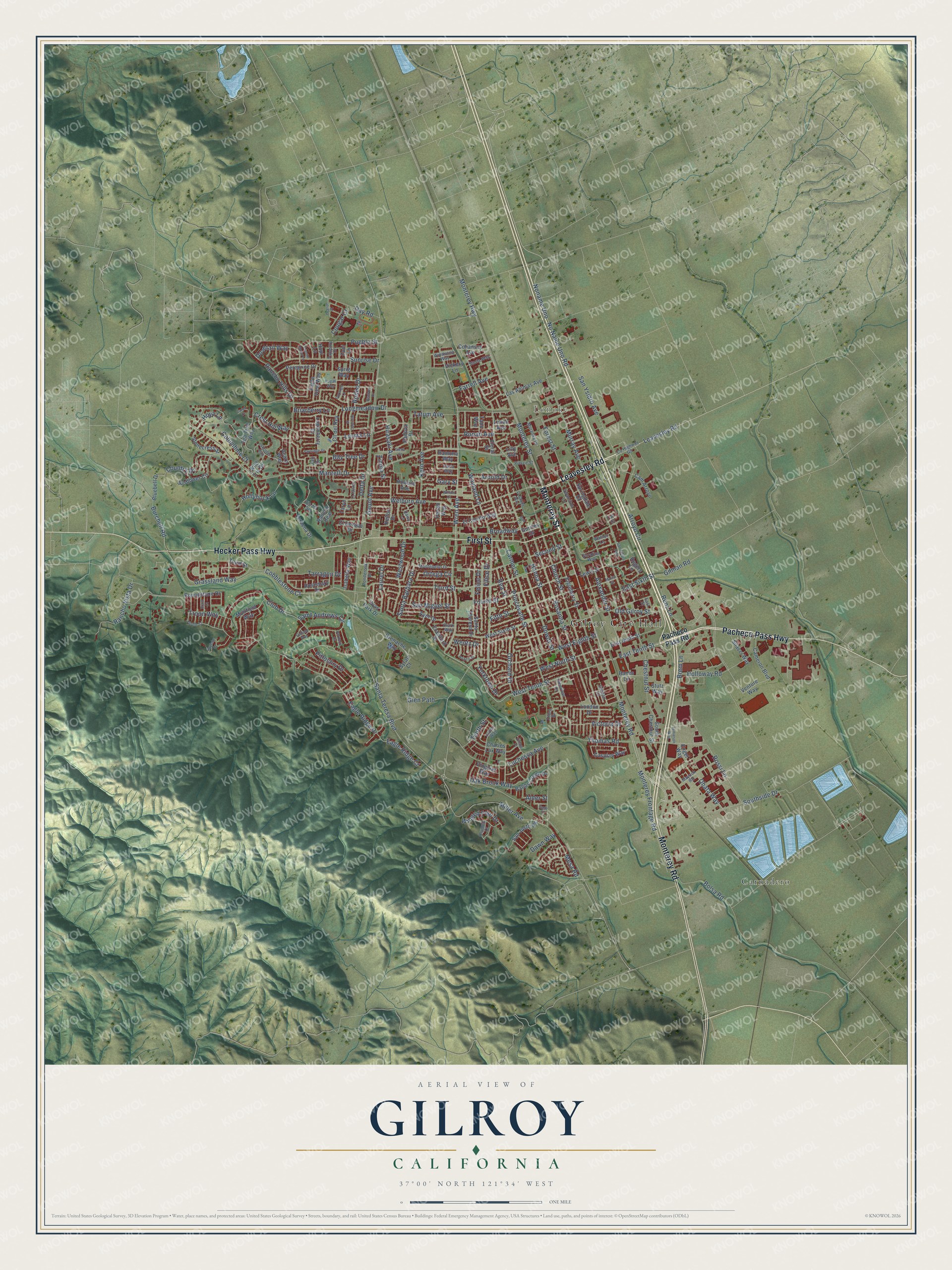
Gilroy, California Map Art
Building by building, with labeled streets and shaded relief.
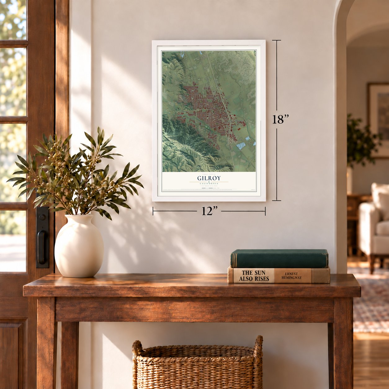
12" x 18" Archival Matte Print
A Map of Home. A Work of Art.
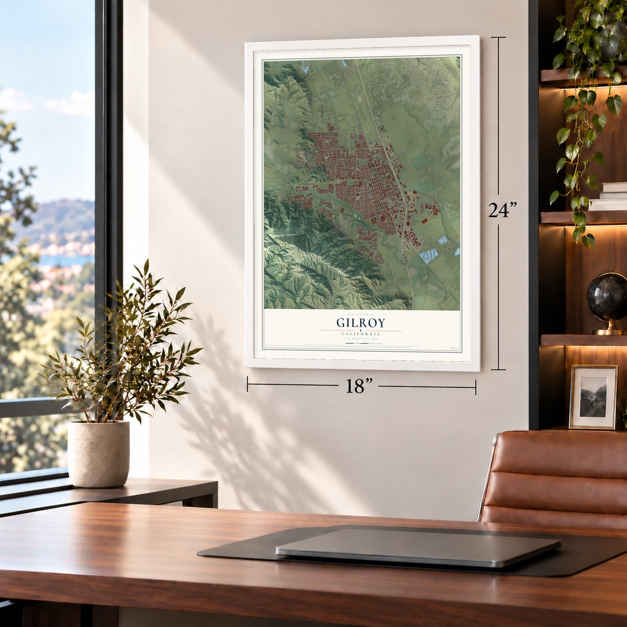
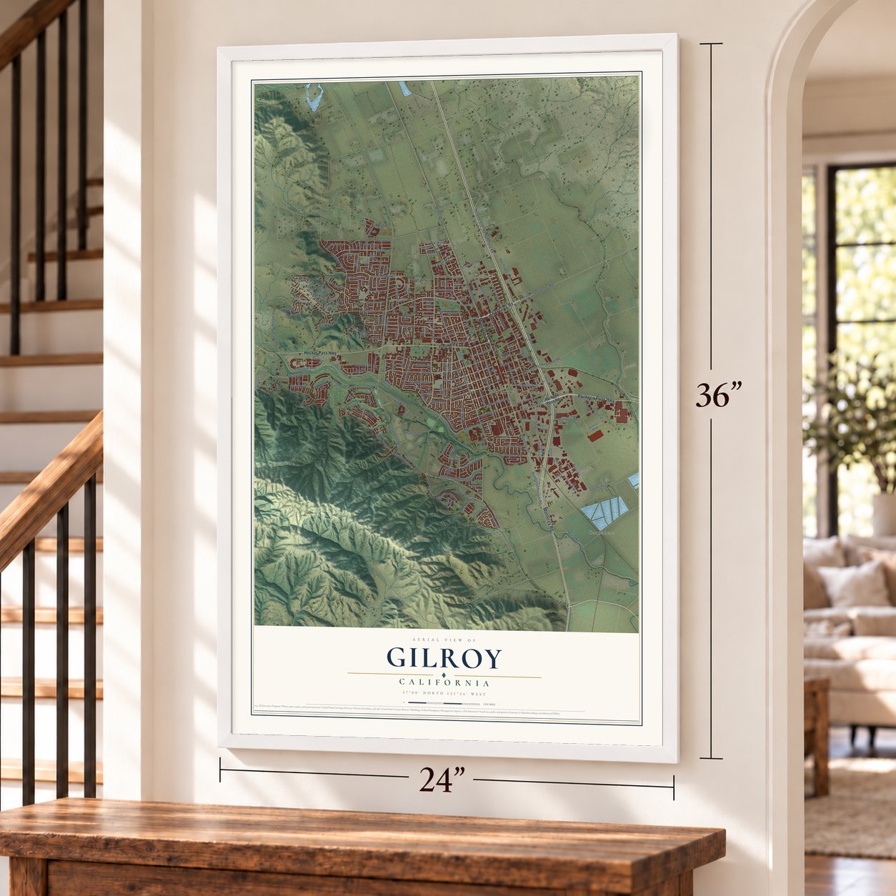
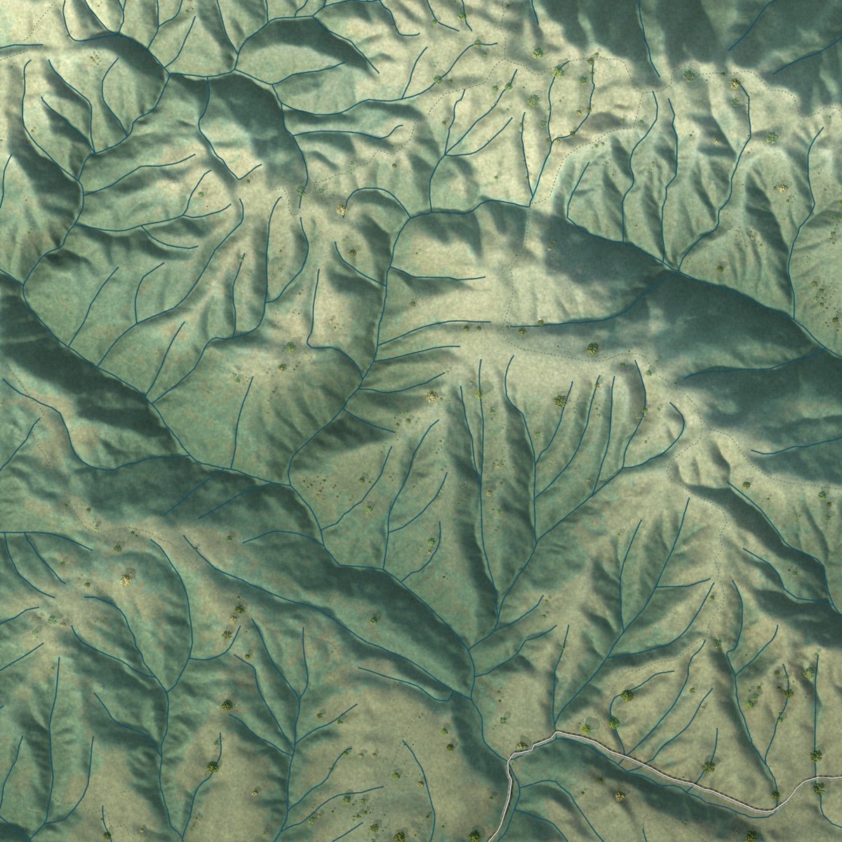
Explore Gilroy, California from a whole new perspective. Created using aerial imagery and detailed geographic data, this map captures Gilroy building by building, with labeled streets, familiar landmarks, and shaded topographical relief that highlights the natural contours of the landscape.
Combining modern data with the timeless character of a vintage atlas, this map is just as interesting up close as it is beautiful on the wall. Whether you grew up in Gilroy, spent memorable years there, or call it home today, this unique map is a great way to celebrate a place that means something to you. Zoom in on the preview to look for your street, and then order a print to put your memories on the wall.
Three ways to hang it
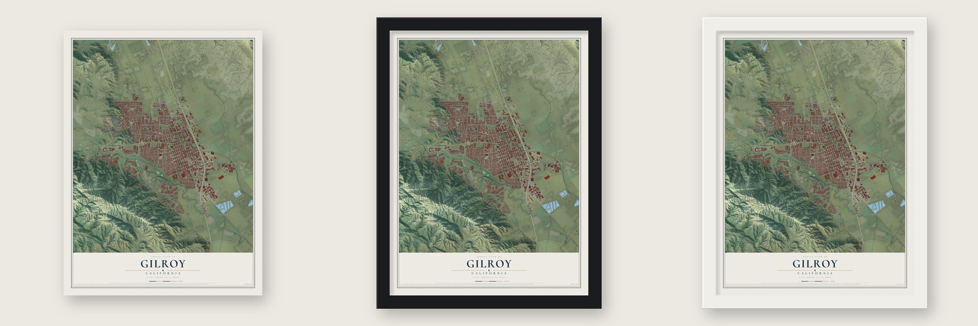
Unframed archival matte, a black wood frame or a white wood frame.
Up close
Geography Worth Displaying
This map was created using accurate cartographic data and authoritative geographic sources, including the U.S. Geological Survey and the Census Bureau. The map brings together terrain, waterways, roads, and building detail. The majority of the streets are labeled, houses are accurately depicted, and the topography is derived from government sources. Combining local data with carefully composed color and shading leads to this beautifully detailed Gilroy artwork for your wall.
Rather than simply showing street outlines, we’ve included as many of the street names as we could reasonably fit on the map while keeping their names legible. Zoom in on the high resolution preview to see exactly what’s on the map. We truly set out to create a statement piece for anyone who loves Gilroy. So whether it’s for you, or a gift for someone you love, we hope this map of Gilroy brings back fond memories.
Read the story behind this map of Gilroy, California from 2026.

Find your street
Names on the Gilroy map
Every name below is printed on this map. Look for your street, your school, the park where you played, or the pond down the road.
Places and landmarks4
- Gilroy City Hall
- Lonoke
- Carnadero
- San Ysidro Park
Streets and roads215
- Pacheco Pass Highway
- Monterey Road
- Leavesley Road
- Monterey Street
- Hecker Pass Highway
- First Street
- Wren Avenue
- East Tenth Street
- West Tenth Street
- Welburn Avenue
- Miller Avenue
- Cobblestone Court
- Forest Street
- Thomas Road
- Eagle Ridge Drive
- Glen Path
- Club Drive
- Santa Barbara Drive
- Luchessa Avenue
- West Eighth Street
- Grassland Way
- Santa Teresa Boulevard
- Church Street
- Mantelli Drive
- Monterey Highway
- Third Street
- Princevalle Street
- Hanna Street
- Murray Avenue
- Rosanna Street
Show all 215 streets
- Carmel Street
- Chestnut Street
- Rancho Hills Drive
- Bolsa Road
- Southside Drive
- Arroyo Circle
- Kern Avenue
- Westwood Drive
- Alexander Street
- Sunrise Drive
- Fourth Street
- West Ninth Street
- Felice Drive
- San Ysidro Avenue
- Longmeadow Drive
- Fifth Street
- Renz Lane
- No Name Uno Road
- Noname Uno
- Saint Andrews Circle
- Brem Lane
- Oak Brook Way
- Mesa Road
- Second Street
- Filice Drive
- Dowdy Street
- Day Road
- Country Drive
- Burchell Road
- East Sixth Street
- Hirasaki Avenue
- Wayland Lane
- Monterey Frontage Road
- Rancho Vista Drive
- Holloway Road
- Ronan Avenue
- Rossi Lane
- Dawn Way
- Orchard Drive
- Hollyhock Lane
- Columbine Court
- Winged Foot Drive
- Eagle Ridge Court
- Delta Drive
- Old Gilroy Street
- Tarragon Drive
- San Miguel Street
- Victoria Drive
- Pitlochry Drive
- Laurel Drive
- Farrell Avenue
- Tatum Avenue
- Obata Way
- Gilman Road
- Crest Hill Way
- Briarberry Lane
- Tenth Street
- Yorktown Drive
- Dovetail Way
- Troon Way
- Rodeo Drive
- Bay Tree Drive
- Arnold Drive
- Ortega Circle
- Cougar Court
- Lerma Lane
- Gaunt Avenue
- Pueblo Street
- Broadway
- Wentz Drive
- Rea Street
- Alder Street
- Gary Street
- Zinnia Street
- Hoya Lane
- Pacheco Pass Road
- Uvas Park Drive
- Grenache Way
- Venture Way
- Eigleberry Street
- West Sixth Street
- Cohansey Avenue
- El Cerrito Way
- Las Animas Avenue
- Sunflower Circle
- Santa Theresa Drive
- Kelton Drive
- Cll del Rey
- East Ninth Street
- Rosemary Drive
- Cam Arroyo
- Isabella Way
- Stonecress Street
- Lewis Street
- Cameron Boulevard
- Babbs Creek Drive
- Padova Drive
- Tea Tree Way
- Ayer Drive
- Peregrine Drive
- Verbena Drive
- South Chestnut Street
- Silacci Way
- Roundstone Drive
- Loganberry Drive
- Ramona Way
- Sprig Way
- Eagle View Way
- Charles Lux Way
- Caspian Way
- Bluebell Drive
- Rogers Lane
- San Justo Road
- Rancho Real
- Lilly Avenue
- Springdale Court
- Acorn Way
- Banes Lane
- Crawford Drive
- Muirfield Way
- Viognier Way
- El Dorado Drive
- Floral Street
- Wild Iris Drive
- Howard Avenue
- Liman Avenue
- London Drive
- Taos Way
- Vickery Lane
- Stutz Way
- Gurries Drive
- Hopi Lane
- Zuni Lane
- Parish Way
- Taryn Lane
- Engel Way
- Jan Drive
- Syrah Court
- County Highway G9
- Muraoka Drive
- Filbro Drive
- Mayock Road
- Walnut Lane
- Montebello Drive
- Lopez Way
- Swanston Lane
- Ponderosa Drive
- Vis del Sur
- Sturla Way
- Clark Way
- Windsong Way
- Sarafina Way
- Glenview Drive
- Pierce Street
- Olympic Court
- Carla Way
- Tapestry Drive
- Garden Court
- East Street
- Daisy Lane
- Taft Court
- Hoylake Court
- Martin Street
- Lavender Way
- Coyote Moon Lane
- El Caminito
- Ousley Drive
- Carob Court
- Fernie Court
- Partridge Drive
- Dornoch Court
- Durango Lane
- Village Place
- Hoxett Street
- La Coche Way
- Braid Court
- Jamieson Way
- Siena Court
- Benbow Drive
- Gullane Way
- Hogan Way
- Willard Court
- Oak Court
- Ocelot Place
- Gage Court
Names are listed as they appear on the printed map. Zoom into the product photos to find them.
About Gilroy, California
Gilroy is a city of 59,520 people in Santa Clara County. In 1809 Ygnacio Ortega received the 13,066-acre Spanish land grant called Rancho San Ysidro, and a village of the same name grew up at the foot of Pacheco Pass. In January 1814 a Scottish sailor named John Gilroy came ashore at Monterey from the British ship Isaac Todd. Some accounts say he deserted, and others say his crew left him to recover from scurvy. He worked as a barrel maker and became a Catholic. He married Ortega's daughter Maria Clara in 1821, and the couple inherited part of the rancho when Ortega died in 1833.
A settlement now called Old Gilroy grew up around his ranch buildings, and after the Mexican-American War ended in 1848, Gilroy became the village alcalde. The gold rush then brought a flood of newcomers. Many Californio families sold their land or lost it, and the area came to be called Pleasant Valley. John Gilroy died in 1869, and on March 12, 1870, the state legislature incorporated the town under his name. By then the center of town had shifted west of El Camino Real onto land from the old Rancho Las Animas.
- Garlic Capital of the WorldIn the 1920s Kiyoshi "Jimmy" Hirasaki began raising garlic as a commercial crop around Gilroy. He kept farming it into the 1950s and became known as the "Garlic King." The Gilroy Garlic Festival started in 1979, and garlic gave the city its nickname.
- A church from 1857The Christian Church at 160 Fifth Street went up in 1857, and it is the oldest wood-frame church in Santa Clara County that has never stopped holding services. It joined the National Register in 1982. Down the street, the blacksmith George Eustice, a Civil War veteran who fought at Gettysburg, built his house in 1869.
- Old City Hall, 1905Gilroy built its Old City Hall downtown in 1905, when farming, cattle and timber from the Santa Cruz Mountains carried the local economy. The building was added to the National Register in 1975.
- A weekly paper since 1868The Gilroy Dispatch was founded in 1868, two years before the town was incorporated. It is still Gilroy's local weekly newspaper.
Keep exploring California
Gilroy is one of 1,990 California towns we've mapped. Every dot on the map is a print of its own.
The search covers every state, California first.
Near Gilroy
Order 2 or more town maps and save 10%. Shown in the size and finish you picked above, so they hang as a set.
- Rucker 12" x 18" / Archival Matte Print $39.99
- San Martin 12" x 18" / Archival Matte Print $39.99
- Interlaken 12" x 18" / Archival Matte Print $39.99
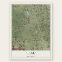

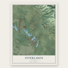
More maps nearby: Morgan Hill, Aromas, Pajaro, Amesti and Corralitos.
The art of mapping a place
How This Map Was Made
Real places. Remarkable detail. Discover the layers that turn geographic data into a map of home.

The view from above
Aerial imagery reveals the character of the land: woodland, open fields, and the patterns of a place.

The shape of the land
Elevation data brings hills, valleys, and subtle changes in the landscape into view.

The details of home
Roads, waterways, and building footprints come together to make the map feel unmistakably local.

Geography becomes art
Considered color, shading, and typography bring the layers together in a map made for your wall.


Process illustrated with Mendon, Massachusetts. Aerial imagery: USDA NAIP. Terrain: USGS 3D Elevation Program. Map details and finished artwork: KNOWOL.
The Details
About This Print
Choose an archival matte print, or a black or white Ayous wood frame. The archival matte print is unframed.
Select your size and finish above to see the matching product image and price.
Materials & Craftsmanship
A contemporary map with the character of a classic atlas, printed on archival matte paper. Optional frames are made from Ayous wood.
Your printed map does not include the watermark shown in the full-map preview.
Shipping & Delivery
Free shipping within the United States. Every print is made to order in the USA.
Buying a gift? Add a note in your cart and we'll include it. We never put prices in the package.
Prints ship within 2 to 3 business days. Allow 7 to 10 days total from ordering for delivery. Timing may vary during holidays or periods of high order volume.
Read our shipping policy.
Returns and damaged prints
Each print is made to order. Change-of-mind refunds are not available after production.
If your print arrives damaged, misprinted or incorrect, contact support@knowol.com within 30 days of receiving it. Include your order number, photos and a description of the issue.
Read our full refund and replacement policy. For questions about your order, email support@knowol.com.