
Search for another town




Free U.S. delivery 7 to 10 days after you order
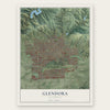
Glendora, California Map Art
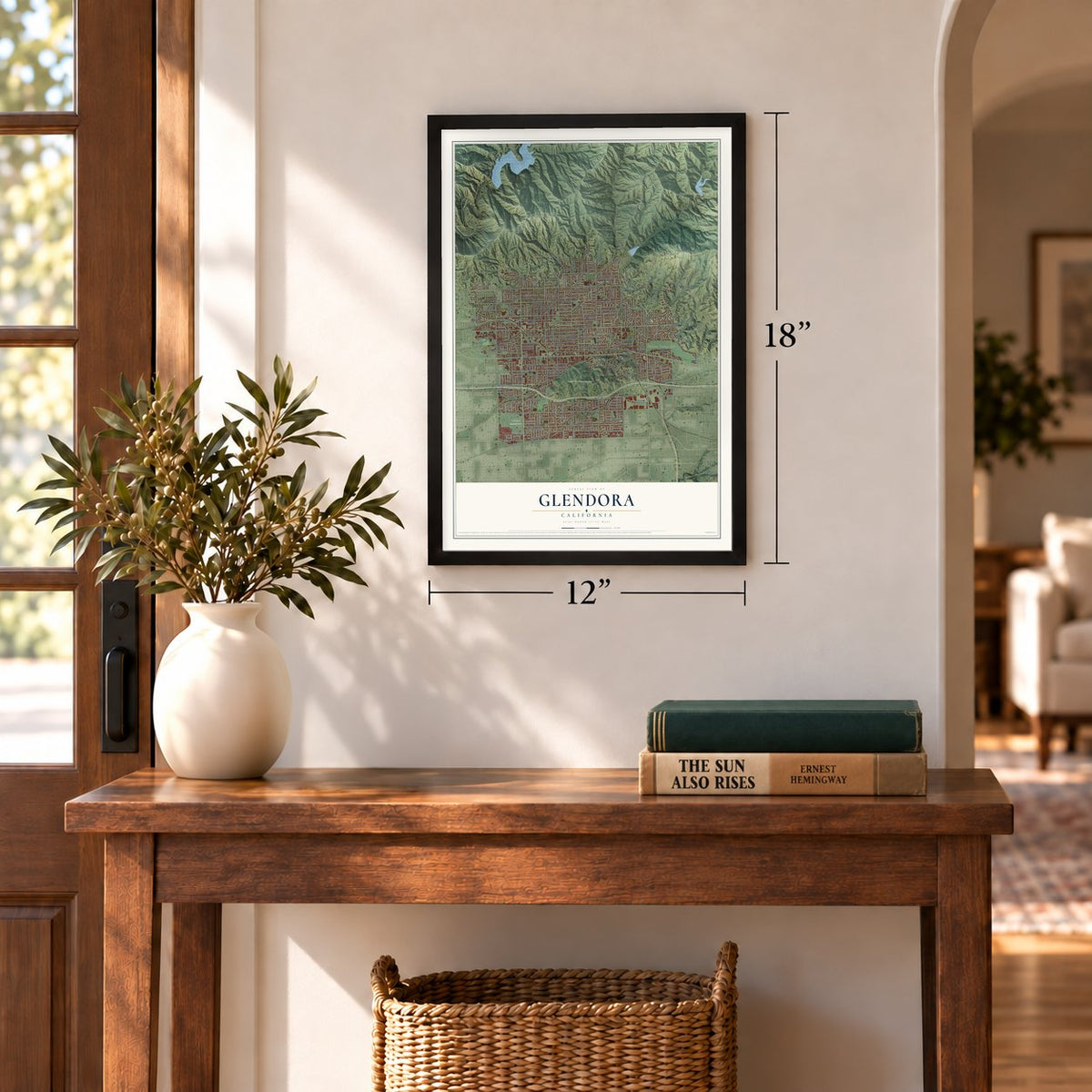
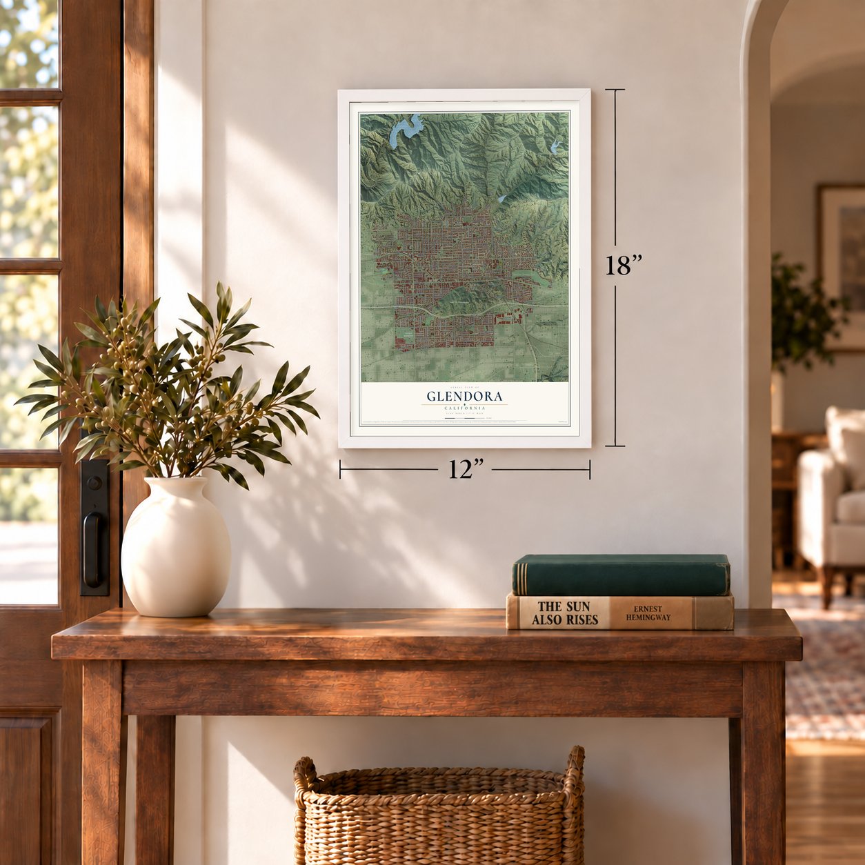
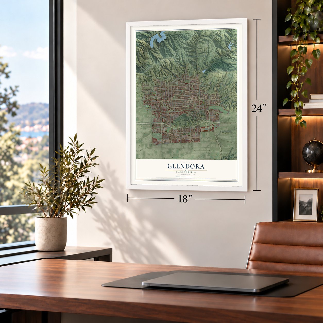
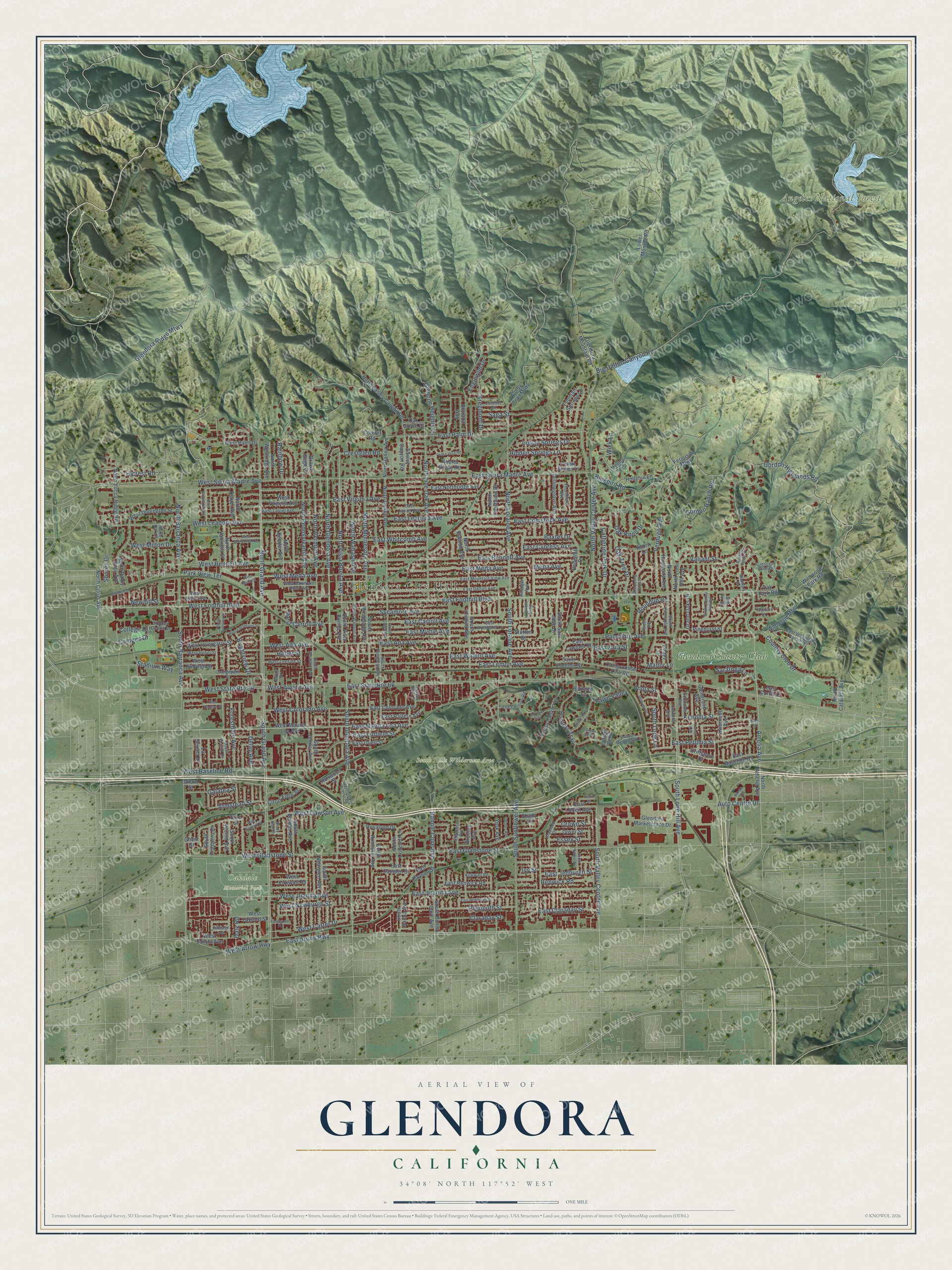
A new map of Glendora, California, made in 2026 and printed to order on thick archival matte paper.
12" x 18" Archival Matte Print
A Map of Home. A Work of Art.
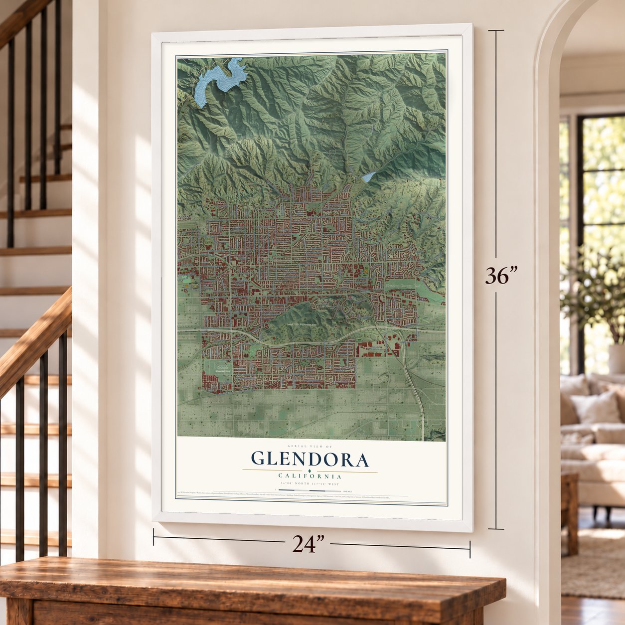
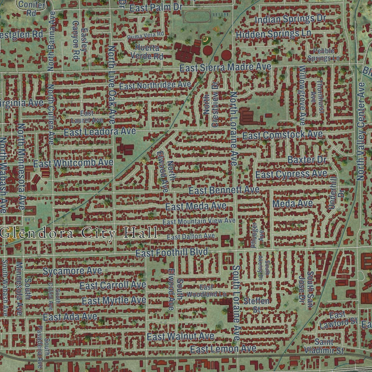
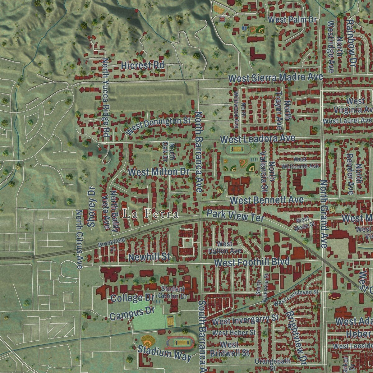
Explore Glendora, California from a whole new perspective. Created using aerial imagery and detailed geographic data, this map captures Glendora building by building, with labeled streets, familiar landmarks, and shaded topographical relief that highlights the natural contours of the landscape.
Combining modern data with the timeless character of a vintage atlas, this map is just as interesting up close as it is beautiful on the wall. Whether you grew up in Glendora, spent memorable years there, or call it home today, this unique map is a great way to celebrate a place that means something to you. Zoom in on the preview to look for your street, and then order a print to put your memories on the wall.
Three ways to hang it
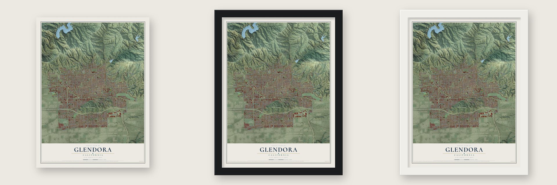
Unframed archival matte, a black wood frame or a white wood frame.
Up close
Geography Worth Displaying
This map was created using accurate cartographic data and authoritative geographic sources, including the U.S. Geological Survey and the Census Bureau. The map brings together terrain, waterways, roads, and building detail. The majority of the streets are labeled, houses are accurately depicted, and the topography is derived from government sources. Combining local data with carefully composed color and shading leads to this beautifully detailed Glendora artwork for your wall.
Rather than simply showing street outlines, we’ve included as many of the street names as we could reasonably fit on the map while keeping their names legible. Zoom in on the high resolution preview to see exactly what’s on the map. We truly set out to create a statement piece for anyone who loves Glendora. So whether it’s for you, or a gift for someone you love, we hope this map of Glendora brings back fond memories.
Read the story behind this map of Glendora, California from 2026.
About Glendora, California
Glendora is a city of 52,558 people in Los Angeles County, in the San Gabriel Valley about 25 miles northeast of Downtown Los Angeles. People have lived on this ground since around 6000 BCE, and when Europeans arrived, the Tongva were the leading people of the region. Their closest villages stood along the San Gabriel River and at a place of many springs in today's San Dimas, while the Glendora foothills served as seasonal camps and hunting grounds near Dalton Canyon.
After Mission San Gabriel Arcángel was founded in 1771, this land came under its rule, and many Tongva were forced to work for it. Mexico won its independence in 1821, and in 1837 Governor Juan Bautista Alvarado gave Ygnacio Palomares and Ricardo Vejar a grant of about 22,000 acres called Rancho San José. That grant took in the southern part of present Glendora. The town itself got its start in the 1880s, when a land boom swept across Southern California.
“In the contest between the two rival towns for the depot building Glendora won; the projectors of Alosta were non-residents, while Glendora had an able and energetic managing head in the person of Mr. Whitcomb; the one was a real-estate speculation, the other was founded for a permanent and prosperous settlement.”
- Acorns from the foothillsThe oak woods of the San Gabriel foothills fed the Tongva who camped here. They shelled the acorns, ground them on stone mortars and rinsed out the bitterness to cook a mush, and they hunted deer, rabbits and birds. Their dome-shaped homes were framed with willow branches and covered with tule or grass.
- The mission herds vanishMission San Gabriel once held about 1.5 million acres and was among the richest missions in California. Between 1829 and 1833, rustling and corrupt officials cut its cattle from roughly 13,000 head to fewer than 75. In August 1833 Mexico ordered the missions secularized, and although the lands were meant for Indigenous people, very few received any. Large ranchos owned by a few powerful families took their place.
- The Pride of the FoothillsGlendora sits against the San Gabriel Mountains and calls itself The Pride of the Foothills. Route 66 passes through the city, and the downtown along Glendora Avenue, known locally as the Glendora Village, fills with restaurants, cafes and shops. Its streets hold Queen Annes, Folk Victorians and early 20th-century bungalows alongside ranch houses and newer estates.
Find your street
Names on the Glendora map
Every name below is printed on this map. Look for your street, your school, the park where you played, or the pond down the road.
Places and landmarks6
- Glendora City Hall
- La Fetra
- Angeles National Forest
- Oakdale Memorial Park
- South Hills Wilderness Area
- Glendora Country Club
Streets and roads273
- South Grand Avenue
- East Foothill Boulevard
- South Glendora Avenue
- North Grand Avenue
- North Glendora Avenue
- West Foothill Boulevard
- Amelia Avenue
- East Meda Avenue
- East Mauna Loa Avenue
- East Arrow Highway
- West Meda Avenue
- North Vista Bonita Avenue
- North Valley Center Avenue
- Gordon Highlands Road
- Auto Centre Drive
- West Juanita Avenue
- East Juanita Avenue
- East Linfield Street
- West Colorado Avenue
- West Ada Avenue
- South Lope Lane
- Bonnie Cove Avenue
- East State Route 66
- Glendora Ridge Mtwy
- Big Dalton Canyon Road
- Bluebird Road
- South Lone Hill Avenue
- West State Route 66
- East Sierra Madre Avenue
- East Bennett Avenue
Show all 273 streets
- West Gladstone Street
- East Gladstone Street
- South Barranca Avenue
- East Leadora Avenue
- West Leadora Avenue
- South Sunflower Avenue
- Country Club Drive
- East Ada Avenue
- East Walnut Avenue
- East Carroll Avenue
- North Loraine Avenue
- West Sierra Madre Avenue
- East Lemon Avenue
- East Palm Drive
- North Live Oak Avenue
- West Baseline Road
- North Barranca Avenue
- East Comstock Avenue
- East Cypress Avenue
- West Bennett Avenue
- East Virginia Avenue
- Forestdale Avenue
- East Whitcomb Avenue
- West Alosta Avenue
- Hunters Trail
- Essex Street
- North Pennsylvania Avenue
- North Vermont Avenue
- North Wabash Avenue
- West Carroll Avenue
- Plymouth Street
- East Myrtle Avenue
- North Minnesota Avenue
- West Carter Drive
- West Arrow Highway
- Delay Avenue
- Glencoe Heights Drive
- Brightview Drive
- East Claraday Street
- South Loraine Avenue
- Palopinto Avenue
- Rainbow Drive
- Sycamore Avenue
- South Valley Center Avenue
- West Dawson Avenue
- Verdugo Avenue
- East Petunia Street
- Claraday Street
- Catherine Park Drive
- Crown Street
- Campus Drive
- Hidden Springs Lane
- Oak Tree Drive
- Stadium Way
- Englewild Drive
- Kregmont Drive
- Gordon Ranch Road
- West Milton Drive
- Indian Springs Drive
- Saga Street
- Armstead Street
- Oak Knoll Drive
- Park View Terrace
- East Jedburgh Street
- Roundup Road
- Crestglen Road
- Kenoma Street
- Hicrest Road
- West Newburgh Street
- Galatea Street
- Valiant Street
- Meda Avenue
- Baxter Drive
- Renwick Road
- Manor Lane
- Ivy Street
- Fawn Valley
- Wick Lane
- Inola Street
- Saratoga Lane
- Heber Street
- East Zara Street
- Newhill Street
- College Drive
- Shorey Drive
- Dale Road
- West Mauna Loa Avenue
- North Amelia Avenue
- East Colorado Avenue
- South Bonnie Cove Avenue
- North Yucca Ridge Road
- North Citrus Avenue
- Lower Monroe Road
- Ferguson Mtwy
- Glendora Mountain Road
- East Northridge Avenue
- South Elwood Avenue
- North Cullen Avenue
- East Renwick Road
- South Bender Avenue
- South Minnesota Avenue
- South Prospero Drive
- Fountain Springs Lane
- South Jenifer Avenue
- South Vecino Avenue
- South Rimhurst Avenue
- North Easley Canyon Road
- Colby Trail Mtwy
- North Baldy Vista Avenue
- East Duell Street
- North Elwood Avenue
- North Westridge Avenue
- Underhill Drive
- East Haltern Avenue
- South Concord Lane
- West Virginia Avenue
- West Laxford Street
- North Valencia Street
- Glengrove Avenue
- West Invergarry Street
- Entrada Way
- Puma Canyon Lane
- South Vista Bonita Avenue
- Bruning Avenue
- West Donington Street
- Citrus Edge Street
- East Payson Street
- Dover Street
- Willowgrove Avenue
- West Bridwell Street
- Wildwood Mtwy
- Shady Lane
- Glendora Marketplace Drive
- Hollyhill Lane
- North Hacienda Avenue
- North Lone Hill Avenue
- Compromise Line Road
- Rosalynn Drive
- Inverness Avenue
- Ghent Street
- West Palm Drive
- Wildwood Park Road
- La Serena Drive
- Huerta Verde Road
- East Lawford Street
- Alford Street
- Conifer Road
- West Kirkwall Road
- Easley Canyon Road
- East Baseline Road
- South Nearglen Avenue
- South San Jose Drive
- North Banna Avenue
- North Bender Avenue
- Grand Oaks Drive
- Acorn Lane
- North Cataract Avenue
- East Camden Street
- West Bonita Avenue
- Saint Vladimir Street
- North Trayer Avenue
- Pinehurst Street
- North Crestview Drive
- East Allen Avenue
- South Banna Avenue
- Driftstone Drive
- Oak Park Road
- East Curtis Court
- Poppy Lane
- Ronwood Street
- Brown Sage Drive
- Steffen Street
- York Avenue
- Oak Grove Drive
- Indian Bend
- Elkhorn Lane
- Big Fir Lane
- Dike Street
- South Vecino Drive
- Crescent Glen Drive
- Lemar Park Drive
- East Dalton Avenue
- East Mountain View Avenue
- Los Cerritos Road
- South Vermont Avenue
- South Wabash Avenue
- East Laurel Avenue
- East Wildwood Canyon Drive
- South Pasadena Avenue
- Mountain Lane
- Bradford Drive
- East Woodland Lane
- Orangepath Street
- West Heber Street
- West Leeside Street
- West Laurel Avenue
- South Hacienda Avenue
- Canyon Meadows Lane
- Thornhurst Avenue
- Rodeo Road
- Pebble Springs Lane
- West Mountain View Avenue
- Stephora Avenue
- West Dalton Avenue
- Cordelia Avenue
- Scottdale Avenue
- Kirkwall Road
- Coronet Street
- Student Center Drive
- North Oak Drive
- Parker Drive
- Valcourt Lane
- Pflueger Avenue
- Oakhart Drive
- West Meda Street
- Morgan Ranch Road
- Glendora Ava Access Road
- West Bagnall Street
- Whispering Oaks Drive
- West Whitcomb Avenue
- South Country Club Road
- North Wildwood Avenue
- South Cullen Avenue
- East Newburgh Street
- Tressy Avenue
- Remuda Drive
- South Valencia Street
- West Lochleven Street
- South Willow Avenue
- Duell Street
- Buffalo Trail
- Beaverbrook Lane
- West Gaillard Street
- Prima Vera Road
- Sierra Sky Drive
- Wales Avenue
- Fleetwood Place
- Swain Street
- Brookfield Place
- South Akeley Drive
- Nicole Court
- Millburgh Avenue
- Shady Glen Drive
Names are listed as they appear on the printed map. Zoom into the product photos to find them.
The art of mapping a place
How This Map Was Made
Real places. Remarkable detail. Discover the layers that turn geographic data into a map of home.

The view from above
Aerial imagery reveals the character of the land: woodland, open fields, and the patterns of a place.

The shape of the land
Elevation data brings hills, valleys, and subtle changes in the landscape into view.

The details of home
Roads, waterways, and building footprints come together to make the map feel unmistakably local.

Geography becomes art
Considered color, shading, and typography bring the layers together in a map made for your wall.


Process illustrated with Mendon, Massachusetts. Aerial imagery: USDA NAIP. Terrain: USGS 3D Elevation Program. Map details and finished artwork: KNOWOL.
The Details
About This Print
Choose an archival matte print, or a black or white Ayous wood frame. The archival matte print is unframed.
Select your size and finish above to see the matching product image and price.
Materials & Craftsmanship
A contemporary map with the character of a classic atlas, printed on archival matte paper. Optional frames are made from Ayous wood.
Your printed map does not include the watermark shown in the full-map preview.
Shipping & Delivery
Free shipping within the United States. Every print is made to order in the USA.
Buying a gift? Add a note in your cart and we'll include it. We never put prices in the package.
Prints ship within 2 to 3 business days. Allow 7 to 10 days total from ordering for delivery. Timing may vary during holidays or periods of high order volume.
Read our shipping policy.
Returns and damaged prints
Each print is made to order. Change-of-mind refunds are not available after production.
If your print arrives damaged, misprinted or incorrect, contact support@knowol.com within 30 days of receiving it. Include your order number, photos and a description of the issue.
Read our full refund and replacement policy. For questions about your order, email support@knowol.com.
Find your town
Looking for another city?
Find a map of home in our California collection, or any town in the country.
Nearby
Maps of towns near Glendora
Know someone from one of these towns? Their map makes a great gift.
 Charter Oak
, California
From $39.99See the map
 Citrus
, California
From $39.99See the map
 San Dimas
, California
From $39.99See the map
More maps nearby: Azusa, Covina, La Verne, Vincent and Duarte.