


Search for another town





Free U.S. delivery 7 to 10 days after you order
Groveland, Massachusetts Map Art
Building by building, with labeled streets and shaded relief.
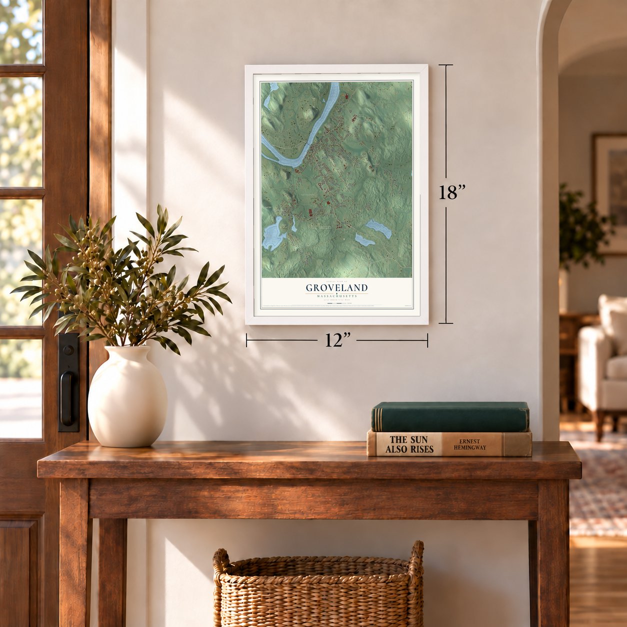
12" x 18" Archival Matte Print
A Map of Home. A Work of Art.
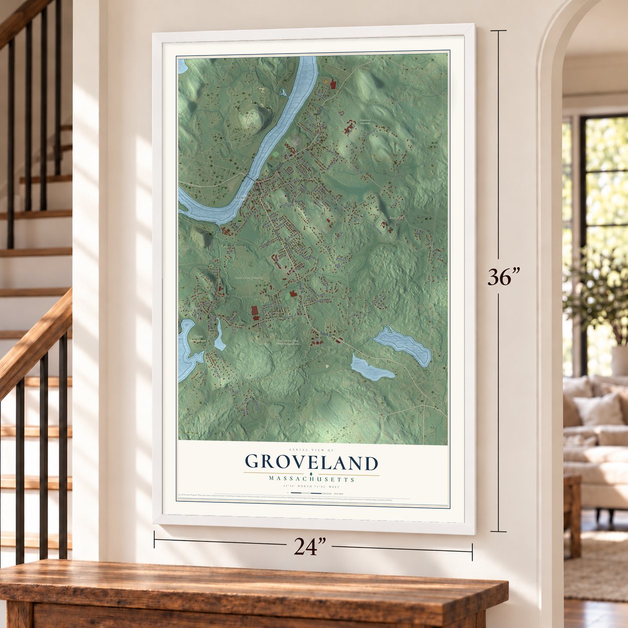
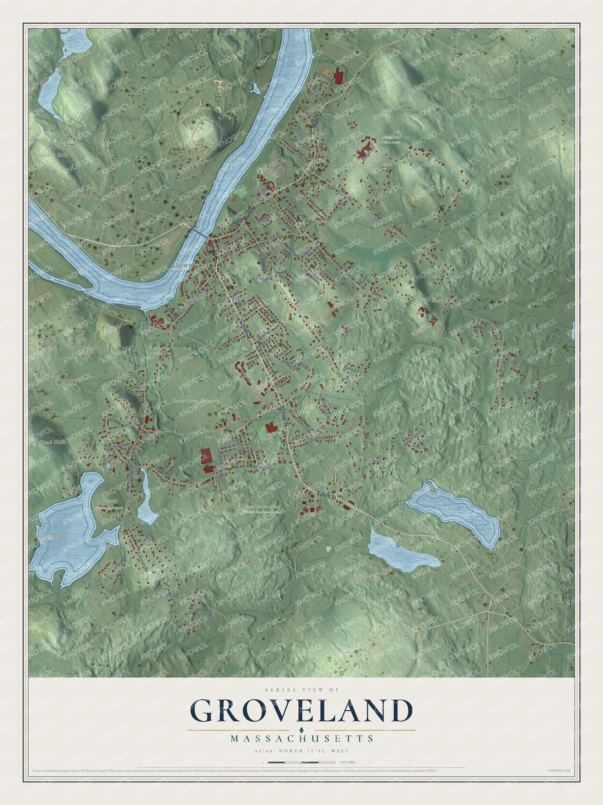
Explore Groveland, Massachusetts from a whole new perspective. Created using aerial imagery and detailed geographic data, this map captures Groveland building by building, with labeled streets, familiar landmarks, and shaded topographical relief that highlights the natural contours of the landscape.
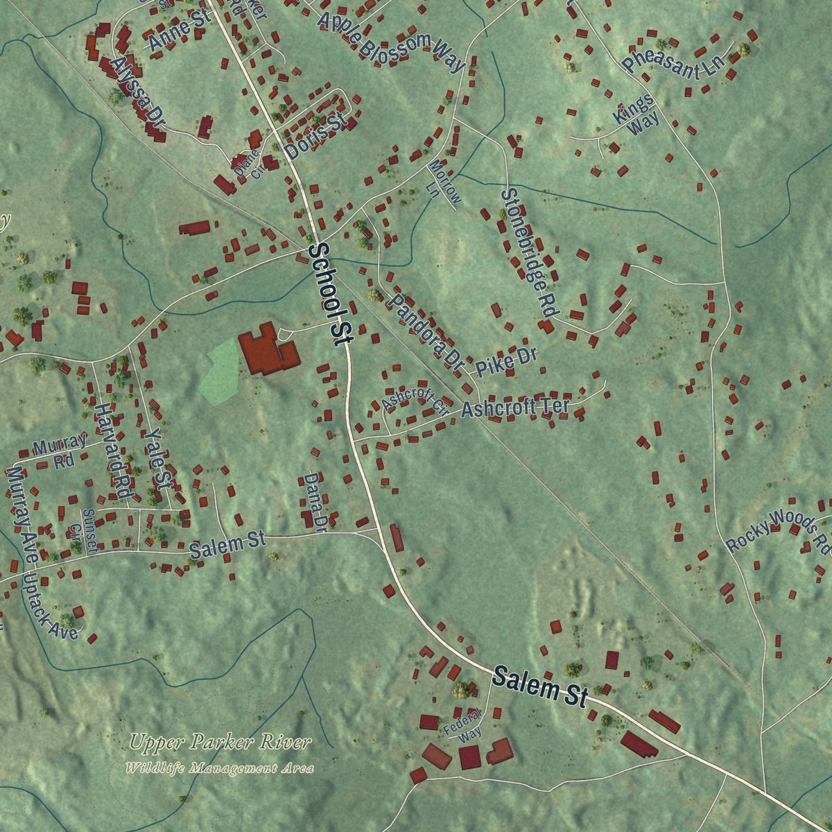
Combining modern data with the timeless character of a vintage atlas, this map is just as interesting up close as it is beautiful on the wall. Whether you grew up in Groveland, spent memorable years there, or call it home today, this unique map is a great way to celebrate a place that means something to you. Zoom in on the preview to look for your street, and then order a print to put your memories on the wall.
Three ways to hang it
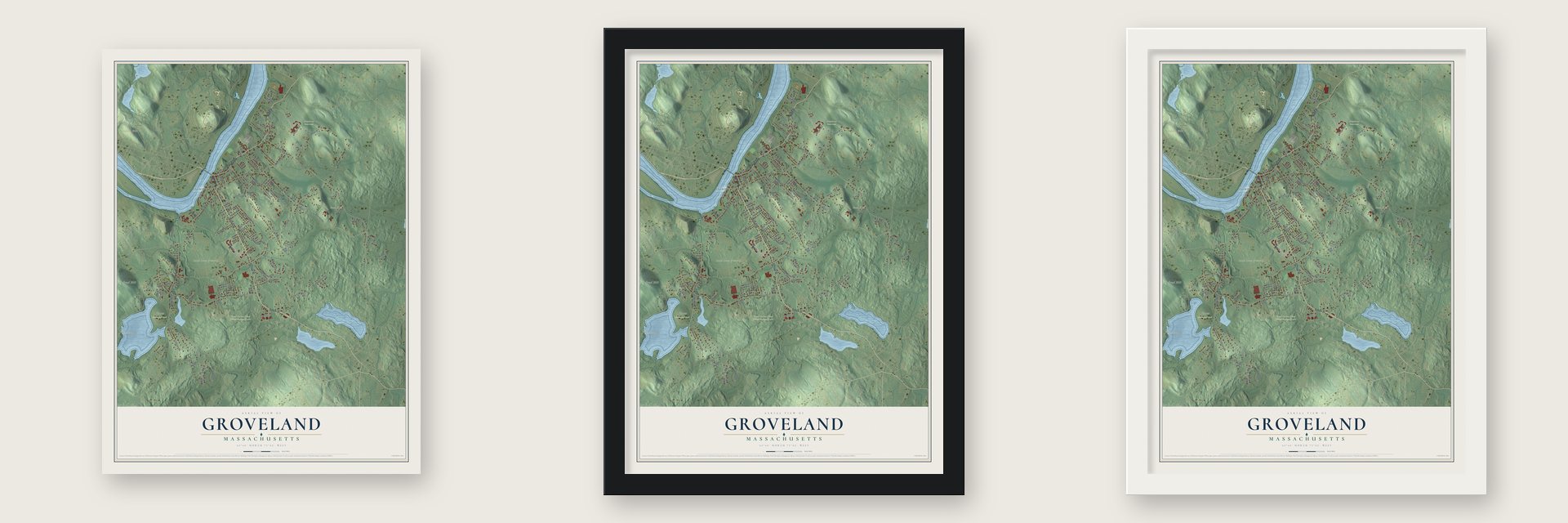
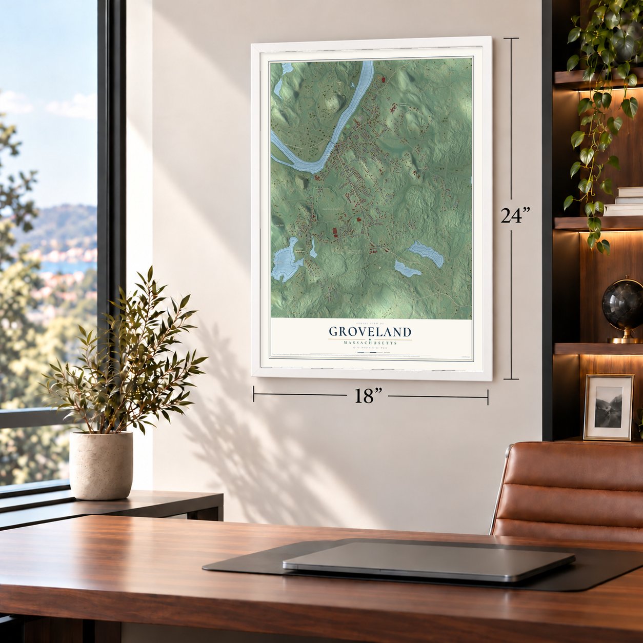
Unframed archival matte, a black wood frame or a white wood frame.
Up close
Geography Worth Displaying
This map was created using accurate cartographic data and authoritative geographic sources, including the U.S. Geological Survey (USGS) and FEMA. The map brings together terrain, waterways, roads, and building detail. The majority of the streets are labeled, houses are accurately depicted, and the topography is derived from government sources. Combining local data with carefully composed color and shading leads to this beautifully detailed Groveland artwork for your wall.
Rather than simply showing street outlines, we’ve included as many of the street names as we could reasonably fit on the map while keeping their names legible. Zoom in on the high resolution preview to see exactly what’s on the map. We truly set out to create a statement piece for anyone who loves Groveland. So whether it’s for you, or a gift for someone you love, we hope this map of Groveland brings back fond memories.
Explore the full map of Groveland, Massachusetts and read about the local places it shows.

Find your street
Names on the Groveland map
Every name below is printed on this map. Look for your street, your school, the park where you played, or the pond down the road.
Places and landmarks11
- Downtown
- South Groveland
- Bear Hill
- Dead Hill
- Golden Hill
- Johnsons Pond
- Center Street Greenway
- Groveland Town Forest
- Upper Parker River Wildlife Management Area
- Veasey Memorial Park
- Elm Park
Streets and roads107
- School Street
- Salem Street
- Main Street
- Gardner Street
- Garrison Street
- Bare Hill Road
- Rollins Street
- 7 Star Road
- Seven Star Road
- Byfield Road
- Alyssa Drive
- Center Street
- King Street
- Washington Street
- Uptack Road
- Wood Street
- Stonebridge Road
- Coleman Road
- Evergreen Lane
- Fairview Circle
- Governors Road
- Ashcroft Terrace
- Balch Avenue
- Pandora Drive
- Pinewood Lane
- Manor Drive
- Carlida Road
- Apple Blossom Way
- Cranton Avenue
- Baldwin Terrace
Show all 107 streets
- Briscoe Road
- Marjorie Street
- Yale Street
- Yemma Road
- Abbott Street
- Broad Street
- Harvard Road
- Berrywood Lane
- Esty Way
- Union Street
- Dwinnell Street
- Pheasant Lane
- Omega Road
- Off King Way
- Merrit Avenue
- Chestnut Street
- Murray Avenue
- Savory Lane
- Anne Street
- Doris Street
- Wharf Drive
- Pike Drive
- Nora Lane
- Nichols Way
- Rocky Woods Road
- Merrimack River Road
- Pond Street
- Parker Road
- Cannon Hill Avenue
- Birchwood Terrace
- Alpha Road
- Pineau Avenue
- River Pines Road
- Kings Way
- Lanen Avenue
- Clark Road
- Murray Road
- Pecker Lane
- Sylvan Street
- Uptack Avenue
- Graeme Way
- Highland Avenue
- Mulberry Street
- Tallyshire Road
- Stocker Avenue
- Outlook Drive
- Dana Drive
- Amber Lane
- Clara Court
- Dion Drive
- Wyka Lane
- Mill Street
- Cannon Hill Road Extended
- Benjamin Street
- Ashcroft Circle
- Burke Street
- Francis Avenue
- Madison Avenue
- Morrow Lane
- Sunset Circle
- Sewall Street
- Diane Circle
- Hemlock Lane
- Holly Lane
- View Hill Road
- Federal Way
- Muriel Road
- Zachery Lane
- Homestead Lane
- Stevenson Way
- Georgia Street
- Philbrick Street
- Lindsay's Way
- Rivers Edge
- Hillview Drive
- Marion Avenue
- Hales Court
Names are listed as they appear on the printed map. Zoom into the product photos to find them.
About Groveland, Massachusetts
Groveland is a town of 6,752 people in Essex County, on the south bank of the Merrimack River. Its land first belonged to Rowley, a town settled in 1639 by the Reverend Ezekiel Rogers, who had lost his Yorkshire parish because he would not read the Book of Sports aloud. Rogers crossed the ocean with twenty families, spent the winter at Salem and paid £800 for land that Ipswich and Newbury had already claimed.
Bradford broke away from Rowley in 1672, and the future Groveland grew up as Bradford's East Parish. The parish became a town of its own on September 9, 1850, and residents still mark that anniversary every year as Groveland Day. Bradford itself was taken into the city of Haverhill in 1897.
- A Paul Revere bellThe bell of Groveland's Congregational church came from Paul Revere's company, which cast 900 bells in all. Only two of them are still rung in active service, this one and another in Lowell.
- Veto, the 1798 fire engineTown hall keeps an engine that the town believes is the nation's oldest surviving hand pumper. Its makers finished it in 1798 and named it the Torrent of Roxbury, and it came to Bradford in 1828 to serve as Engine 2. In 1850, the year Groveland became a town, it was renamed Veto.
- Elm Park since 1832The common was laid out in 1832 as Constitution Park, ringed with house lots whose owners shared a well at its south end. Elms were planted in 1857 and gave the park its name. Dutch elm disease killed most of them by the 1950s, and the last tree fell in the early 1960s. About thirty years later, state grants paid to restore the park with new lampposts, a fountain, a gazebo and disease-resistant elms.
- The first post office, 1810Groveland's first post office opened in 1810, while the town was still part of Bradford, in Squire Greenough's store on Main Street. Greenough served as postmaster until 1825, when Capt. Benjamin Parker took over and moved the office into his own store and then into a blacksmith shop near the Haverhill Bridge.
- Medal of Honor at FredericksburgJohn G. B. Adams was a Groveland native, born in 1841. He joined the Civil War as a private and rose to captain by its end. His part in the Battle of Fredericksburg earned him the Medal of Honor.
Keep exploring Massachusetts
Groveland is one of 470 Massachusetts towns we've mapped. Every dot on the map is a print of its own.
The search covers every state, Massachusetts first.
Near Groveland
Order 2 or more town maps and save 10%. Shown in the size and finish you picked above, so they hang as a set.
- Georgetown 12" x 18" / Archival Matte Print $39.99
- West Newbury 12" x 18" / Archival Matte Print $39.99
- Haverhill 12" x 18" / Archival Matte Print $39.99

More maps nearby: Boxford, Merrimac, North Andover, Rowley and Newbury.
The art of mapping a place
How This Map Was Made
Real places. Remarkable detail. Discover the layers that turn geographic data into a map of home.

The view from above
Aerial imagery reveals the character of the land: woodland, open fields, and the patterns of a place.

The shape of the land
Elevation data brings hills, valleys, and subtle changes in the landscape into view.

The details of home
Roads, waterways, and building footprints come together to make the map feel unmistakably local.

Geography becomes art
Considered color, shading, and typography bring the layers together in a map made for your wall.


Process illustrated with Mendon, Massachusetts. Aerial imagery: USDA NAIP. Terrain: USGS 3D Elevation Program. Map details and finished artwork: KNOWOL.
The Details
About This Print
Choose an archival matte print, or a black or white Ayous wood frame. The archival matte print is unframed.
Select your size and finish above to see the matching product image and price.
Materials & Craftsmanship
A contemporary map with the character of a classic atlas, printed on archival matte paper. Optional frames are made from Ayous wood.
Your printed map does not include the watermark shown in the full-map preview.
Shipping & Delivery
Free shipping within the United States. Every print is made to order in the USA.
Buying a gift? Add a note in your cart and we'll include it. We never put prices in the package.
Prints ship within 2 to 3 business days. Allow 7 to 10 days total from ordering for delivery. Timing may vary during holidays or periods of high order volume.
Read our shipping policy.
Returns and damaged prints
Each print is made to order. Change-of-mind refunds are not available after production.
If your print arrives damaged, misprinted or incorrect, contact support@knowol.com within 30 days of receiving it. Include your order number, photos and a description of the issue.
Read our full refund and replacement policy. For questions about your order, email support@knowol.com.