
Search for another town

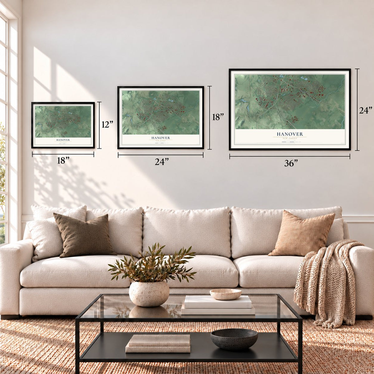
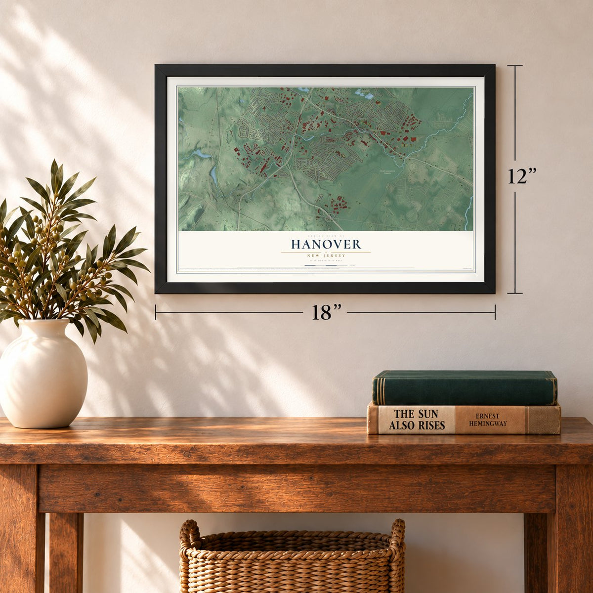
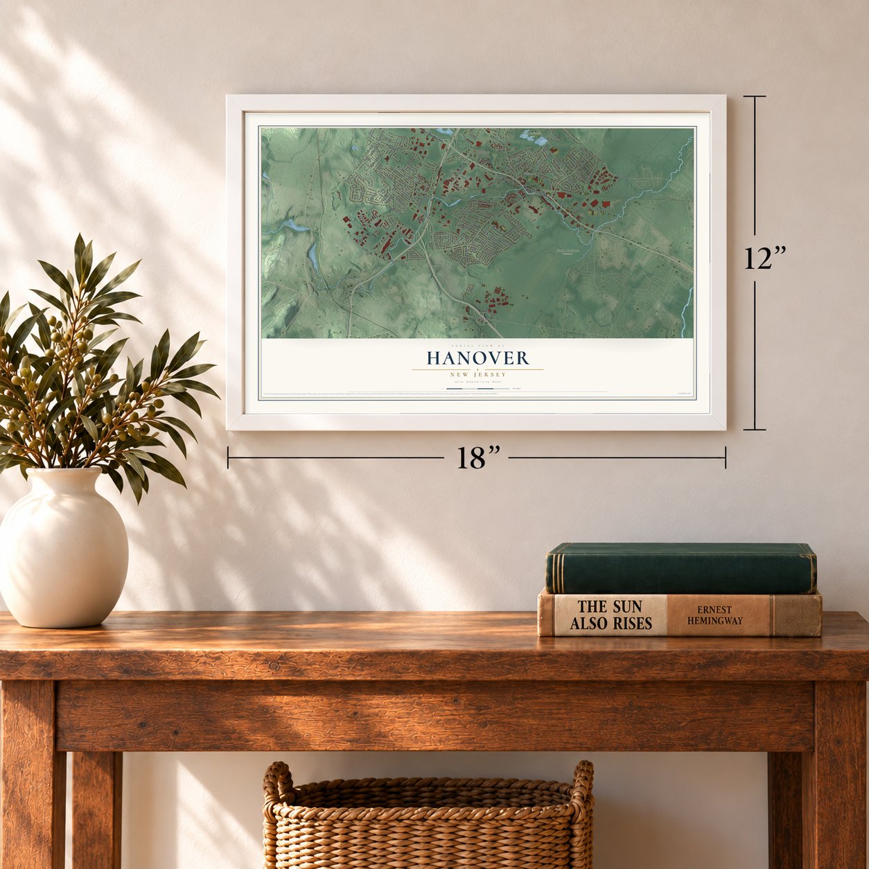

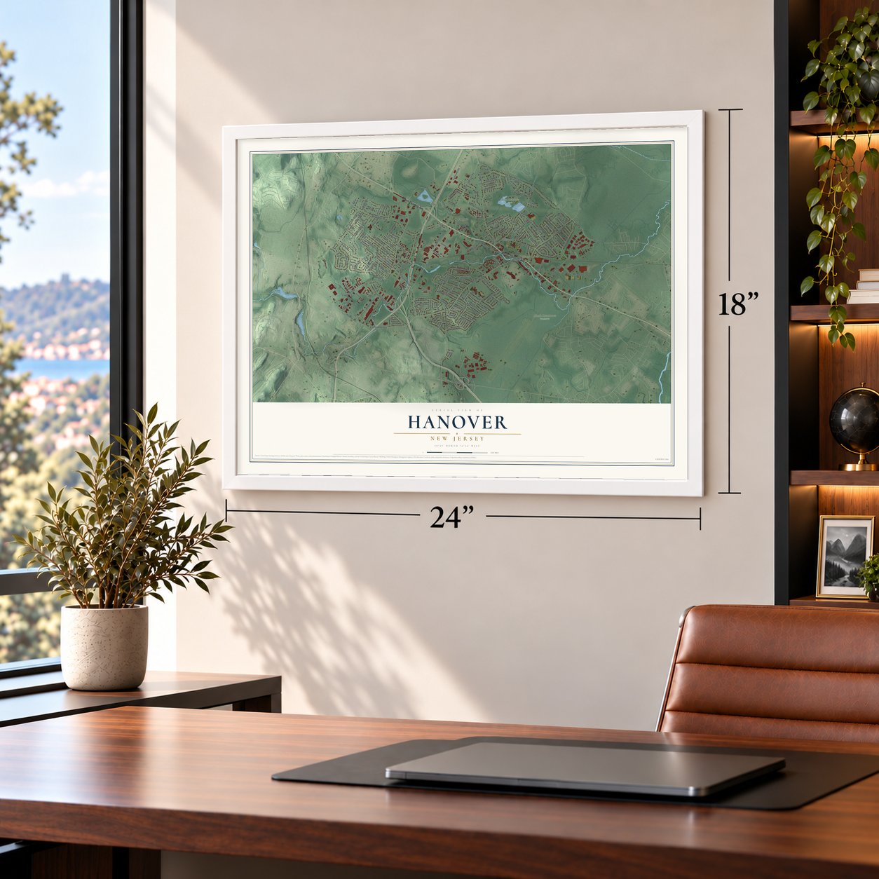
Free U.S. delivery 7 to 10 days after you order
Hanover, New Jersey Map Art
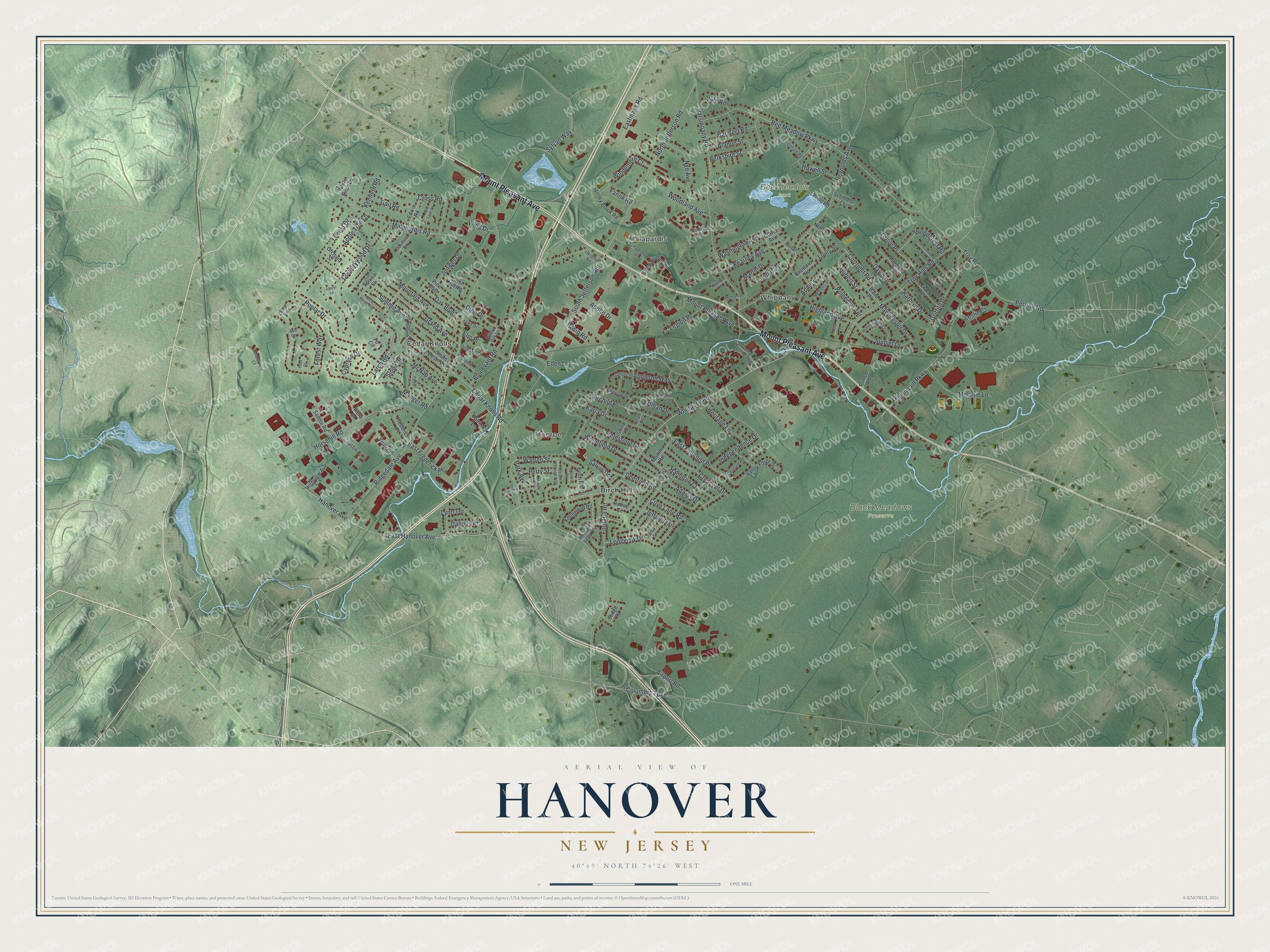
Building by building, with labeled streets and shaded relief.
12" x 18" Archival Matte Print
A Map of Home. A Work of Art.
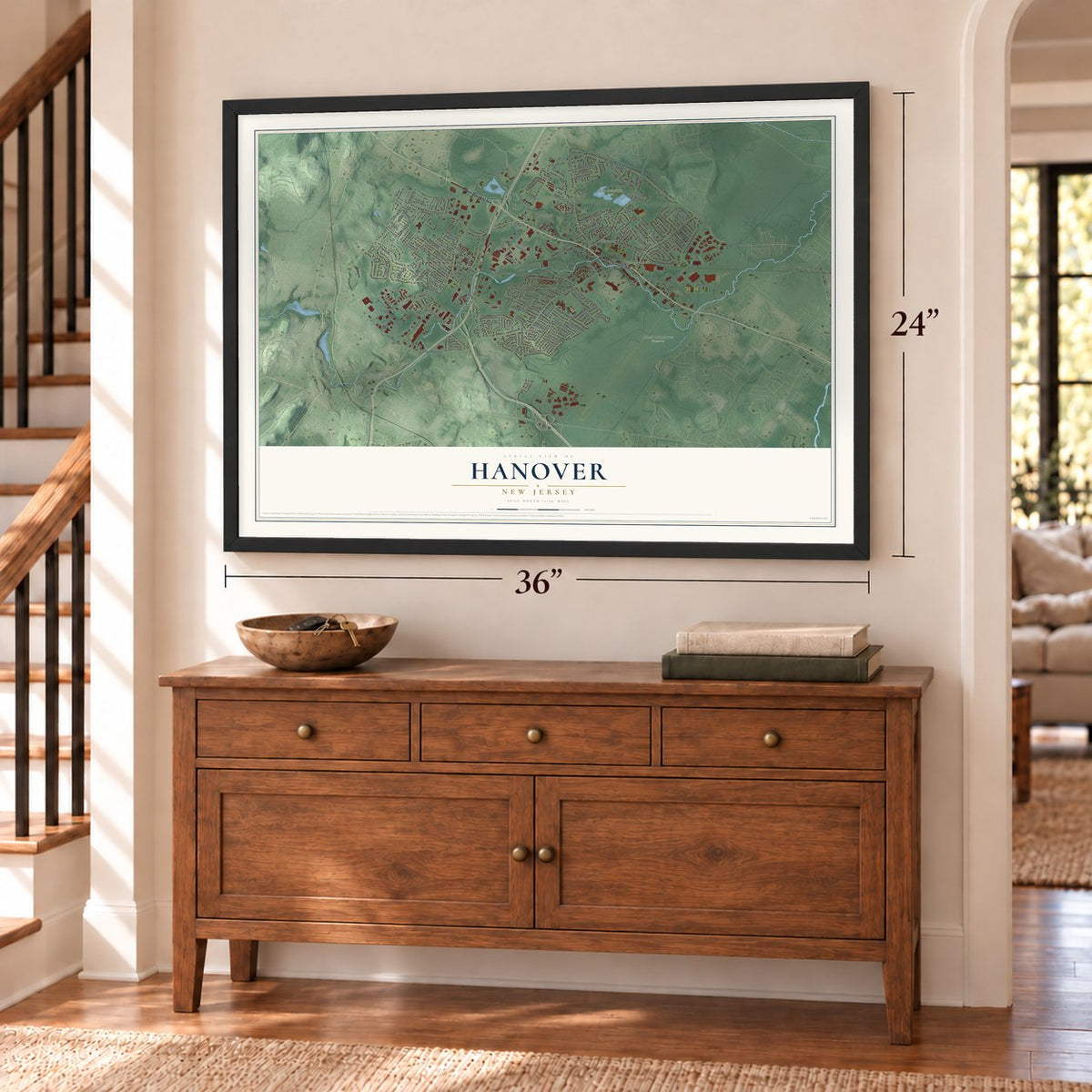
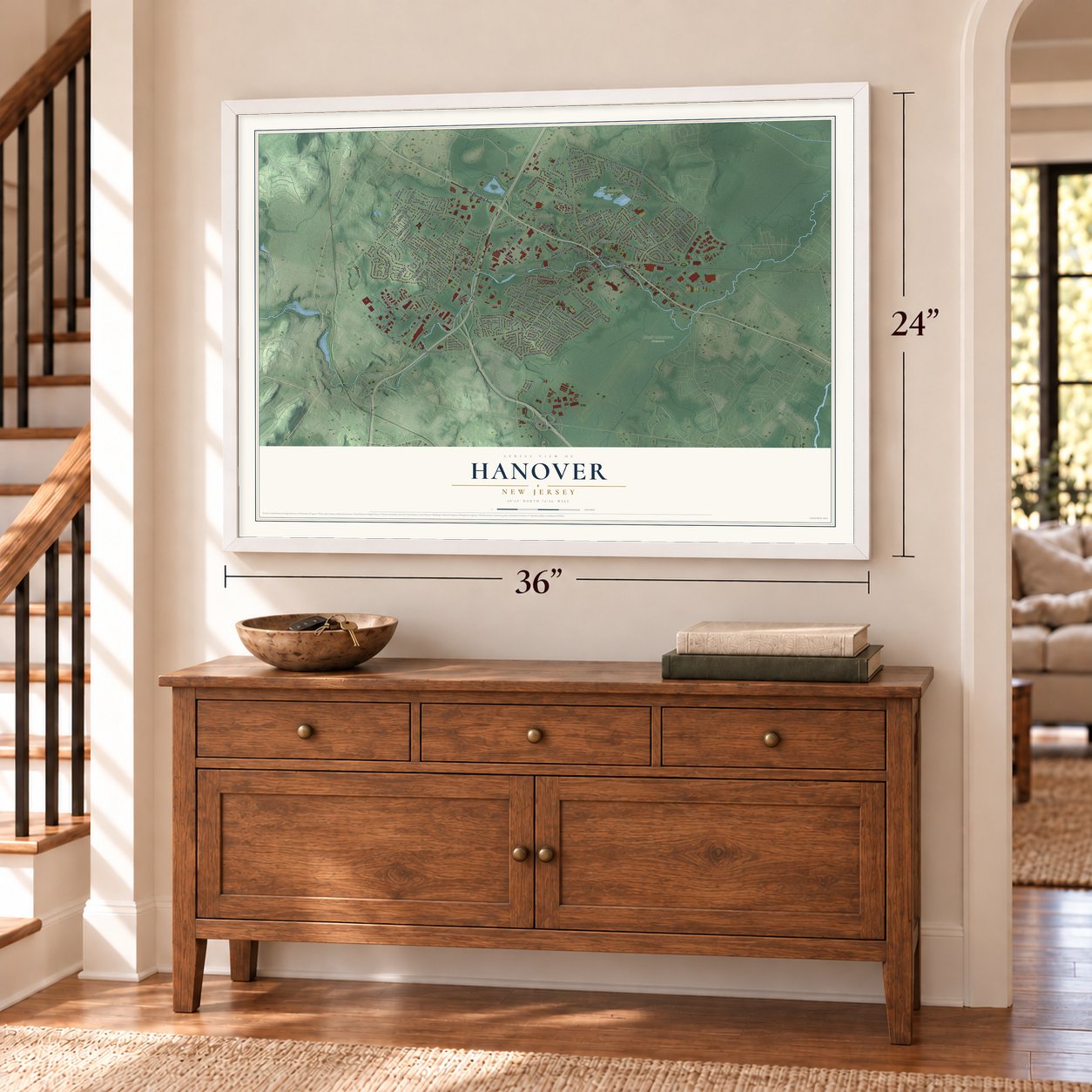
Explore Hanover, New Jersey from a whole new perspective. Created using aerial imagery and detailed geographic data, this map captures Hanover building by building, with labeled streets, familiar landmarks, and shaded topographical relief that highlights the natural contours of the landscape.
Combining modern data with the timeless character of a vintage atlas, this map is just as interesting up close as it is beautiful on the wall. Whether you grew up in Hanover, spent memorable years there, or call it home today, this unique map is a great way to celebrate a place that means something to you. Zoom in on the preview to look for your street, and then order a print to put your memories on the wall.
Three ways to hang it
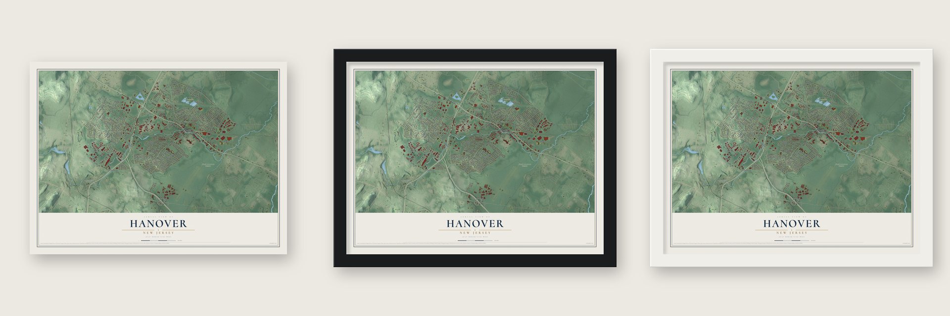
Unframed archival matte, a black wood frame or a white wood frame.
Up close
Geography Worth Displaying
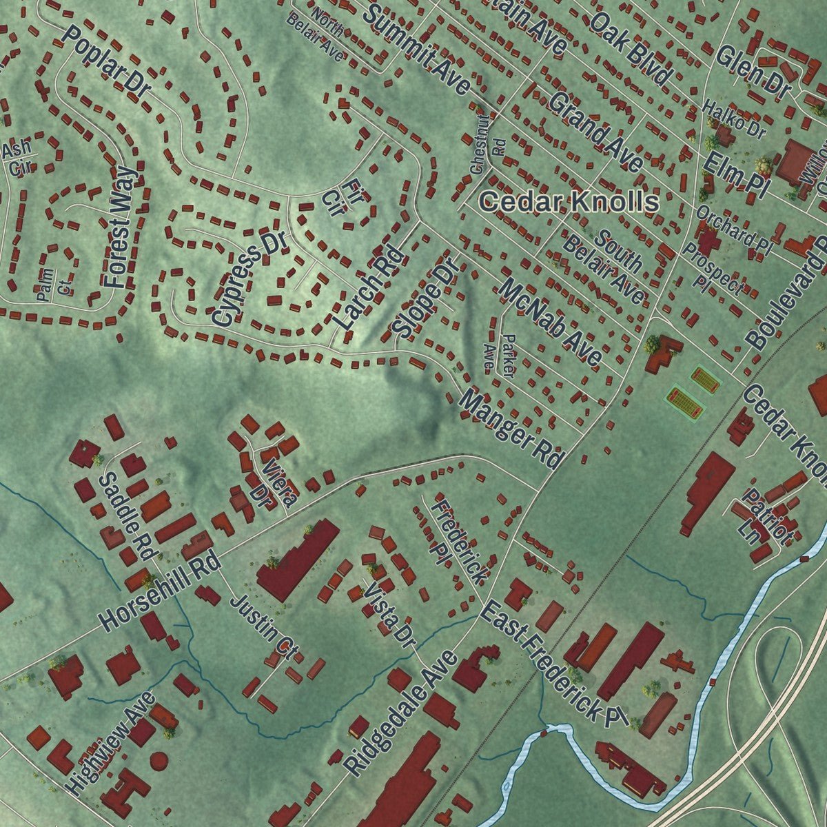
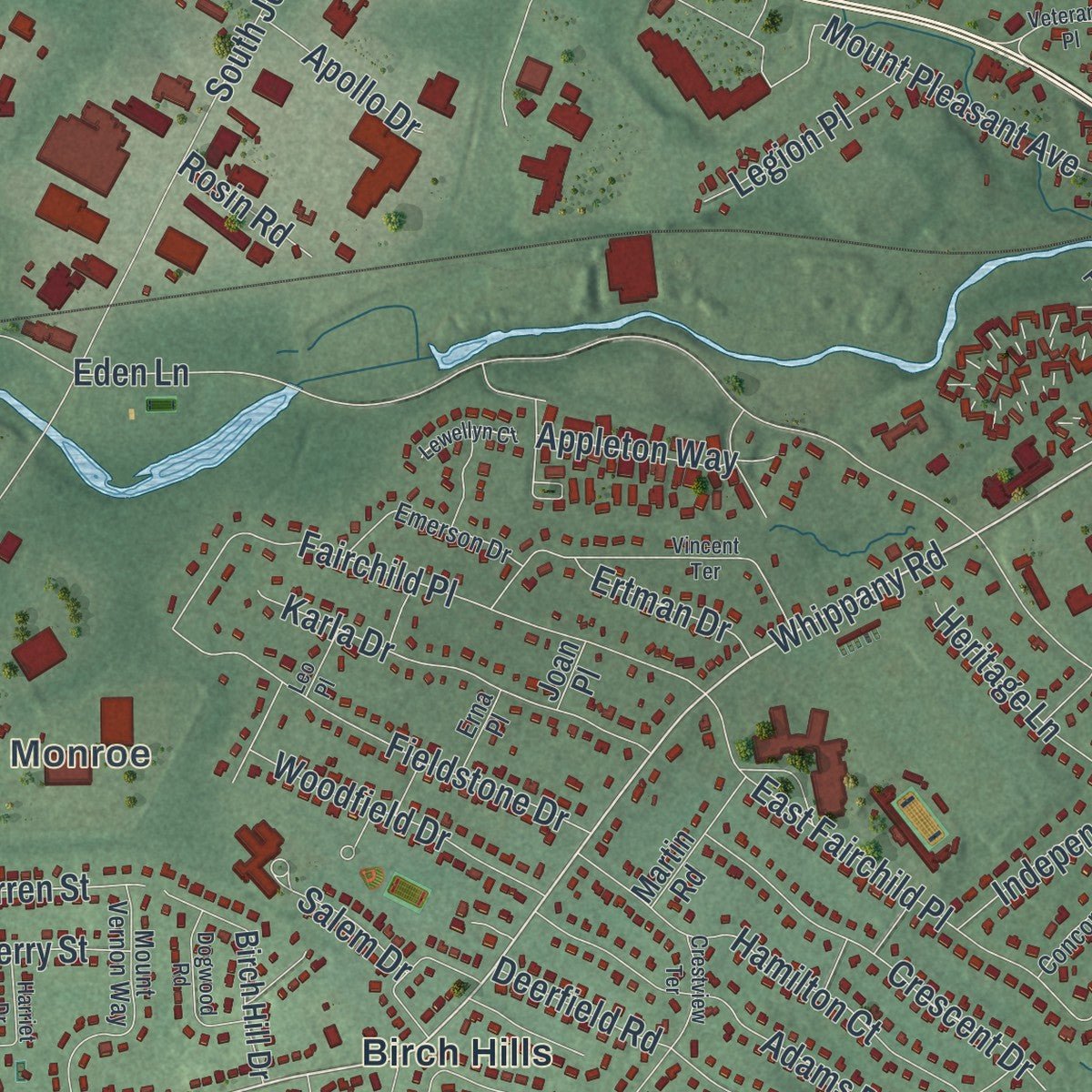
This map was created using accurate cartographic data and authoritative geographic sources, including the U.S. Geological Survey (USGS) and FEMA. The map brings together terrain, waterways, roads, and building detail. The majority of the streets are labeled, houses are accurately depicted, and the topography is derived from government sources. Combining local data with carefully composed color and shading leads to this beautifully detailed Hanover artwork for your wall.
Rather than simply showing street outlines, we’ve included as many of the street names as we could reasonably fit on the map while keeping their names legible. Zoom in on the high resolution preview to see exactly what’s on the map. We truly set out to create a statement piece for anyone who loves Hanover. So whether it’s for you, or a gift for someone you love, we hope this map of Hanover brings back fond memories.
Explore the full map of Hanover, New Jersey and read about the local places it shows.

Find your street
Names on the Hanover map
Every name below is printed on this map. Look for your street, your school, the park where you played, or the pond down the road.
Places and landmarks7
- Cedar Knolls
- Whippany
- Malapardis
- Monroe
- Bee Meadow Park
- Black Meadows Preserve
- Birch Hills
Streets and roads172
- Mount Pleasant Avenue
- Whippany Road
- North Jefferson Road
- East Hanover Avenue
- Hanover Avenue
- Ridgedale Avenue
- Eden Lane
- Parsippany Road
- Bee Meadow Parkway
- Park Avenue
- Malapardis Road
- Reynolds Avenue
- South Jefferson Road
- Algonquin Parkway
- Cedar Knolls Road
- Troy Hills Road
- Forest Way
- Horsehill Road
- Poplar Drive
- Cross Road
- Countrywood Drive
- Boulevard Road
- Perrine Road
- Troy Road
- Locust Drive
- Fairchild Place
- Summit Avenue
- Manger Road
- Grand Avenue
- McNab Avenue
Show all 172 streets
- Columbia Turnpike
- Sylvan Way
- Mountain Avenue
- Airport Road
- Highland Avenue
- Longview Drive
- Adams Drive
- Fieldstone Drive
- Berkshire Street
- Deerfield Road
- East Fairchild Place
- Griffith Drive
- Nye Avenue
- Crescent Drive
- Karla Drive
- Kearney Avenue
- Melanie Lane
- Ford Hill Road
- Wing Drive
- Sunset Drive
- Woodcrest Road
- Hamilton Court
- Woodfield Drive
- Ertman Drive
- Lefke Lane
- Polhemus Terrace
- Glen Drive
- Independence Drive
- Heritage Lane
- Grove Place
- Manchester Drive
- Juniper Drive
- Apple Tree Lane
- Hubert Street
- Oak Boulevard
- Alanon Street
- Washington Avenue
- Handzel Road
- Marlin Drive
- Cortright Road
- Eastmans Road
- Woodland Avenue
- Gail Road
- Howell Street
- Windemere Court
- Addie Lane
- Jeffrie Trail
- East Frederick Place
- Appleton Way
- Salem Drive
- Legion Place
- Warren Street
- Kathryn Drive
- David Drive
- Cove Lane Road
- Elm Place
- Larch Road
- Apollo Drive
- Perry Street
- Kenneth Road
- Daniel Terrace
- Leslie Court
- Cypress Drive
- Vale Road
- Rosin Road
- Slope Drive
- Fanok Road
- Louis Street
- Lynn Terrace
- Sunrise Drive
- Hilltop Circle
- Pond Road
- Knollwood Road
- Brook Hollow Drive
- South Belair Avenue
- Pine Boulevard
- Birch Hill Drive
- Justin Court
- Saddle Road
- Stoney Brook Road
- Magnolia Drive
- Valley Forge Drive
- Frank Terrace
- Branford Road
- Grist Mill Road
- Highview Avenue
- Edwin Road
- Frederick Place
- Patriot Lane
- Martin Road
- Vista Drive
- Orchard Street
- Baird Place
- Schindler Court
- White Birch Drive
- Nemic Lane
- Spruce Street
- Ridge Road
- Viera Drive
- Prince Road
- Gloria Avenue
- Joan Place
- Fir Circle
- Mount Vernon Way
- Pleasant Valley Road
- Runnymede Court
- Emerson Drive
- Old Parsippany Road
- Buckingham Road
- Orchard Place
- Oakview Road
- Prospect Place
- Behrens Drive
- Waterview Court
- Concord Road
- Jacque Terrace
- Ukraine Road
- Erna Place
- Halko Drive
- Joseph Street
- Kitchell Place
- Willow Oak Lane
- Cedar Run
- Ash Circle
- Crestview Terrace
- Chestnut Road
- Vincent Terrace
- Parker Avenue
- Papermill Drive
- North Belair Avenue
- Dogwood Road
- Veterans Place
- Old Farm Road
- Beaumont Place
- Leamoor Drive
- Anna Terrace
- Lewellyn Court
- Harriet Drive
- Leo Place
- Slattery Lane
- Laurel Lane
- Palm Court
Names are listed as they appear on the printed map. Zoom into the product photos to find them.
About Hanover, New Jersey
Hanover is a township of 14,677 people in Morris County, made up of Whippany and Cedar Knolls. New Englanders settled beside the Whippany River in 1685, close to where the old Whippany Cemetery now stands on Route 10, and theirs was the first European settlement in northwest New Jersey. The name Whippany comes from Whippanong, a Native American word meaning "place of the arrow wood."
On December 7, 1720, the township was named Hanover to honor George I of Great Britain, a king from the German House of Hanover. At first its borders covered the whole of what is now Morris County, along with pieces of Sussex and Warren, which was too much land for one local government to run. New townships were carved from it, starting with Mendham in 1749, and the last split came on May 9, 1928, when East Hanover and Parsippany-Troy Hills left together.
- Mills on the Whippany RiverBefore the suburbs arrived, Hanover was a thinly settled industrial town. The Whippany River powered its iron works and paper mills. After World War II, as suburbs spread across New Jersey, the township filled with homes over the second half of the twentieth century.
- Television in 1927In 1927 Whippany helped stage the first long distance television demonstration in the United States. One signal ran over telephone wire to New York from Washington, D.C., while a second crossed to New York by radio from Whippany. Lucent Technologies later kept a large facility in Whippany.
- The Seeing Eye, 1931 to 1966The Seeing Eye, the country's first school to train guide dogs for the blind, was based in Whippany from 1931 until 1966. It then moved to its present campus in nearby Morris Township.
- A railway museum since 1985Whippany's railway depot opened in 1905. In 1965 a museum started in part of its freight house, alongside the Morris County Central excursion railroad, but both later moved to Newfoundland. Volunteers came back in the 1980s, repaired the freight house foundation, set up exhibits and opened the Whippany Railway Museum there in 1985.
- Whippany at 350In 2026 the township marked the 350th anniversary of Whippany. The count starts with a 1676 deed that named the area "a Place Called Whippano," the community's first written record.
Keep exploring New Jersey
Hanover is one of 990 New Jersey towns we've mapped. Every dot on the map is a print of its own.
The search covers every state, New Jersey first.
Near Hanover
Order 2 or more town maps and save 10%. Shown in the size and finish you picked above, so they hang as a set.
- Whippany 12" x 18" / Archival Matte Print $39.99
- Cedar Knolls 12" x 18" / Archival Matte Print $39.99
- Troy Hills 12" x 18" / Archival Matte Print $39.99


More maps nearby: Morris Plains, Parsippany-Troy Hills, Morristown, Littleton and Parsippany.
The art of mapping a place
How This Map Was Made
Real places. Remarkable detail. Discover the layers that turn geographic data into a map of home.

The view from above
Aerial imagery reveals the character of the land: woodland, open fields, and the patterns of a place.

The shape of the land
Elevation data brings hills, valleys, and subtle changes in the landscape into view.

The details of home
Roads, waterways, and building footprints come together to make the map feel unmistakably local.

Geography becomes art
Considered color, shading, and typography bring the layers together in a map made for your wall.


Process illustrated with Mendon, Massachusetts. Aerial imagery: USDA NAIP. Terrain: USGS 3D Elevation Program. Map details and finished artwork: KNOWOL.
The Details
About This Print
Choose an archival matte print, or a black or white Ayous wood frame. The archival matte print is unframed.
Select your size and finish above to see the matching product image and price.
Materials & Craftsmanship
A contemporary map with the character of a classic atlas, printed on archival matte paper. Optional frames are made from Ayous wood.
Your printed map does not include the watermark shown in the full-map preview.
Shipping & Delivery
Free shipping within the United States. Every print is made to order in the USA.
Buying a gift? Add a note in your cart and we'll include it. We never put prices in the package.
Prints ship within 2 to 3 business days. Allow 7 to 10 days total from ordering for delivery. Timing may vary during holidays or periods of high order volume.
Read our shipping policy.
Returns and damaged prints
Each print is made to order. Change-of-mind refunds are not available after production.
If your print arrives damaged, misprinted or incorrect, contact support@knowol.com within 30 days of receiving it. Include your order number, photos and a description of the issue.
Read our full refund and replacement policy. For questions about your order, email support@knowol.com.