
Search for another town





Free U.S. delivery 7 to 10 days after you order
Hobe Sound, Florida Map Art
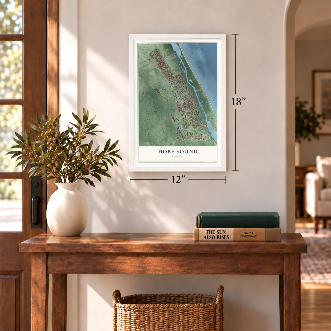
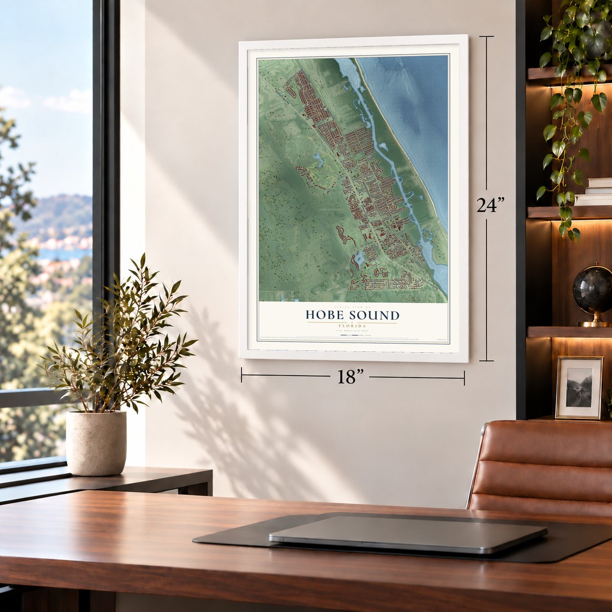
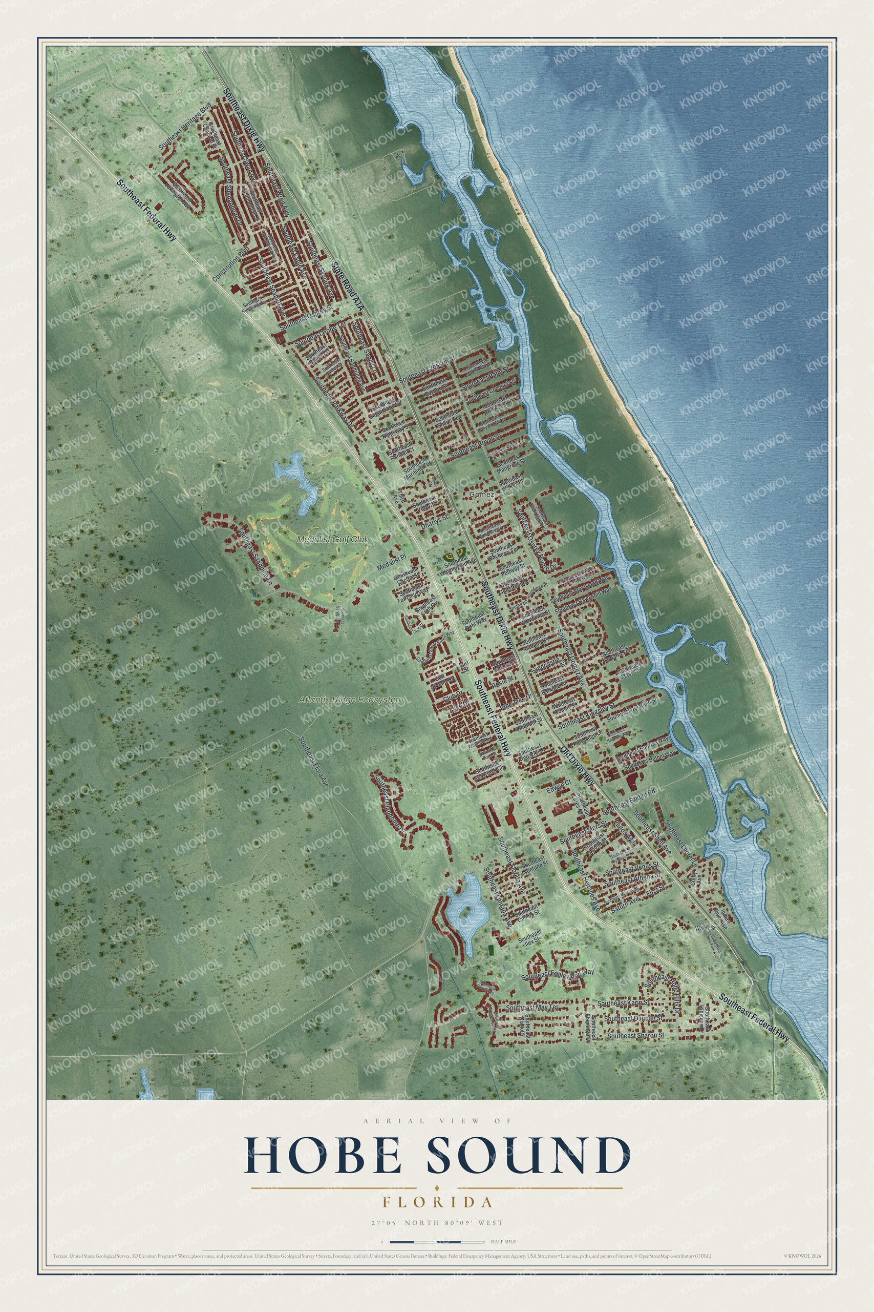
A new map of Hobe Sound, Florida, made in 2026 and printed to order on thick archival matte paper.
12" x 18" Archival Matte Print
A Map of Home. A Work of Art.
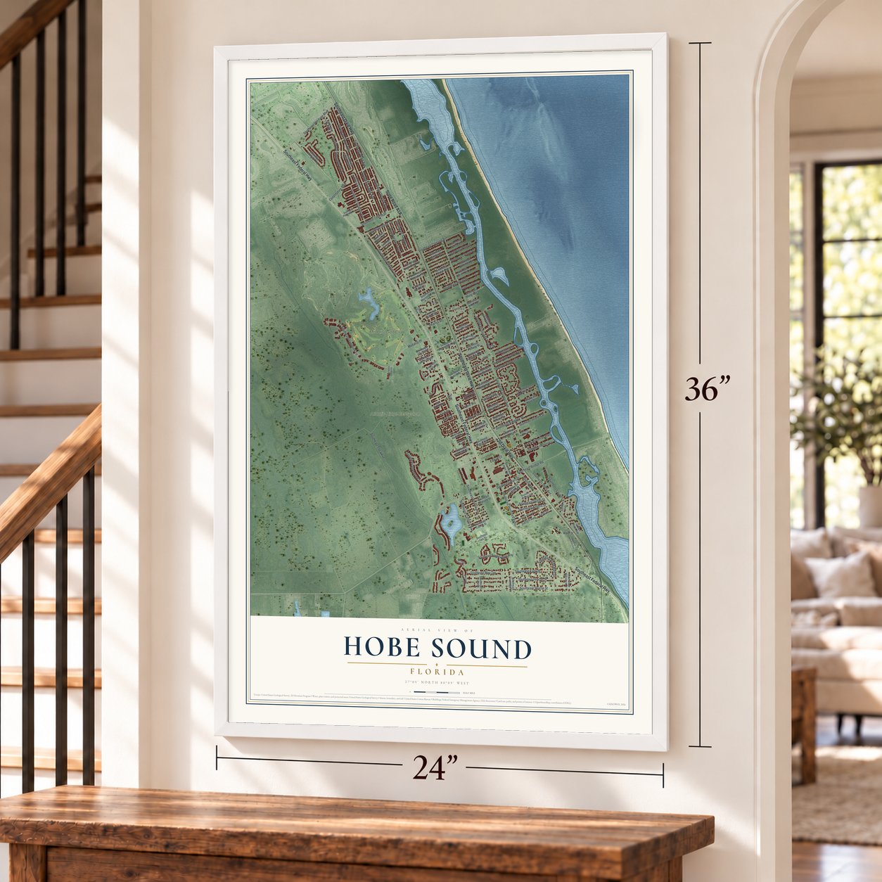
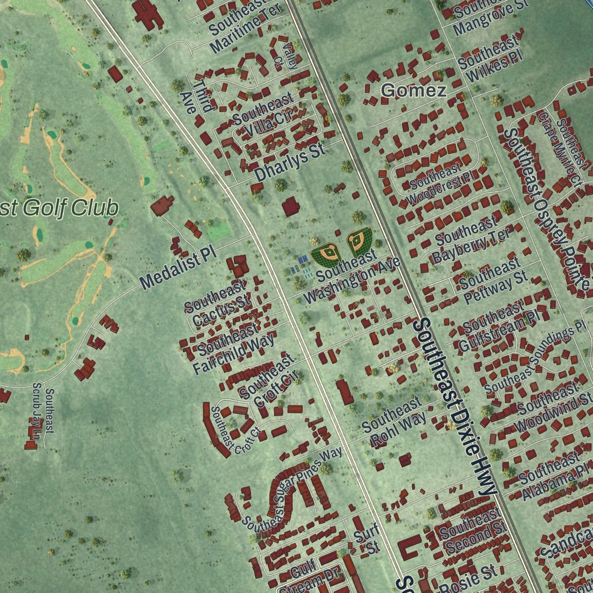
Explore Hobe Sound, Florida from a whole new perspective. Created using aerial imagery and detailed geographic data, this map captures Hobe Sound building by building, with labeled streets, familiar landmarks, and shaded topographical relief that highlights the natural contours of the landscape.
Combining modern data with the timeless character of a vintage atlas, this map is just as interesting up close as it is beautiful on the wall. Whether you grew up in Hobe Sound, spent memorable years there, or call it home today, this unique map is a great way to celebrate a place that means something to you. Zoom in on the preview to look for your street, and then order a print to put your memories on the wall.
Three ways to hang it
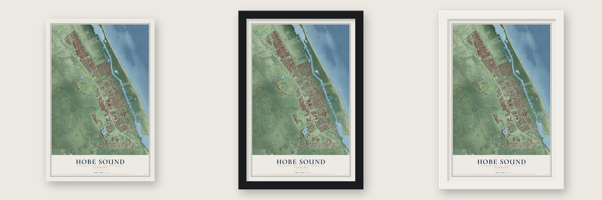
Unframed archival matte, a black wood frame or a white wood frame.
Up close
Geography Worth Displaying
This map was created using accurate cartographic data and authoritative geographic sources, including the U.S. Geological Survey (USGS) and FEMA. The map brings together terrain, waterways, roads, and building detail. The majority of the streets are labeled, houses are accurately depicted, and the topography is derived from government sources. Combining local data with carefully composed color and shading leads to this beautifully detailed Hobe Sound artwork for your wall.
Rather than simply showing street outlines, we’ve included as many of the street names as we could reasonably fit on the map while keeping their names legible. Zoom in on the high resolution preview to see exactly what’s on the map. We truly set out to create a statement piece for anyone who loves Hobe Sound. So whether it’s for you, or a gift for someone you love, we hope this map of Hobe Sound brings back fond memories.
Explore the full map of Hobe Sound, Florida and read about the local places it shows.

About Hobe Sound, Florida
Hobe Sound is a community of 13,163 people in Martin County, on Florida's Treasure Coast. Its name comes from a Jaega village that stood here before Europeans arrived. Spanish records wrote that name as Jove or Jobe. In 1696 a Quaker merchant named Jonathan Dickinson was shipwrecked nearby, and in the journal of his trip north to St. Augustine he spelled it Hoe-bey.
In 1815 Spain gave Don Eusebio a grant of 12,000 acres that took in part of the area, and in 1821 Gomez sold 8,000 acres, Jupiter Island among them, to Joseph Delespine at a dollar an acre. Hobe Sound got its post office in 1891. Early in the 20th century Henry Flagler's railroad reached the community, and over the years it brought work, the first tourists and new businesses.
- Picture City in the 1920sDuring Florida's land boom of the 1920s, New Yorkers Lewis J. Selznick and Joseph Schenck picked Hobe Sound for Picture City, a planned moviemaking center. Its townsite, Olympia, was laid out for 585 Greek-style buildings on streets named Athena, Venus, Mars, Zeus, Pluto, Saturn, Olympus and Mercury. The 1928 Okeechobee hurricane ended the boom, and the town took back its old name. The street names survive, and so do the cement streetlights on Dixie Highway.
- The Olympia School of 1925The two-room schoolhouse at 9141 Southeast Apollo Street went up in 1924. The Martin County Board of Public Instruction got the use of it from the Picture City Corporation and opened it as the Olympia School in October 1925. Children studied there until 1962. The Mission Revival building, which later went by Picture City School and then Apollo Street School, joined the National Register in 2002.
- Trains until 1963Hobe Sound was a stop for long-distance trains until 1963, among them the South Wind, the Havana Special, the City of Miami and the East Coast Champion, and local trains running between Jacksonville and Miami kept stopping until 1968. The old station was restored and moved west of town, where it now holds an office for Becker Groves.
- A turtle refuge in 1969In 1969 the Hobe Sound National Wildlife Refuge was set aside on Jupiter Island and part of the mainland to protect loggerhead and green sea turtles. Since 2019 its official name has honored Nathaniel P. Reed.
Find your street
Names on the Hobe Sound map
Every name below is printed on this map. Look for your street, your school, the park where you played, or the pond down the road.
Places and landmarks3
- Gomez
- Atlantic Ridge Ecosystem
- Medalist Golf Club
Streets and roads126
- Southeast Federal Highway
- Southeast Dixie Highway
- Old Dixie Highway
- First Street
- Saturn Avenue
- Constitution Boulevard
- Southeast Gomez Avenue
- Southeast Eagle Avenue
- Southeast Flora Avenue
- Southeast Bridge Road
- Southeast Eaglewood Way
- Southeast Plandome Drive
- Southeast Swan Avenue
- Southeast Sharon Street
- Southeast Duncan Street
- Medalist Place
- Southeast Florida Avenue
- Southeast Wren Avenue
- Southeast Heritage Boulevard
- Southeast Hobe Hills Drive
- Southeast Sandy Lane
- Southeast Kingsley Street
- Southeast Mars Street
- Southeast Parkway Drive
- Southeast Shenandoah Drive
- Southeast Osprey Pointe Drive
- Southeast Sandpine Lane
- Southeast Palm Street
- Southeast Crossrip Street
- Southeast Osprey Street
Show all 126 streets
- Southeast Skylark Avenue
- Southeast Hercules Avenue
- Southeast Shell Avenue
- Southeast Hobe Terrace
- Southeast Lantana Avenue
- Southeast Laurel Lane
- Southeast Karin Street
- Southeast Royal Street
- Southeast May Terrace
- Southeast Athena Street
- Southeast Seabird Avenue
- Plutos Avenue
- Southeast Venus Street
- Dharlys Street
- Sandcastle Circle
- Edwyn Court
- Pine Tree Drive
- Rosie Street
- Club Drive
- Lake Drive
- Colby Avenue
- Southeast Sea Pines Circle
- Gulf Stream Drive
- Southeast Croft Circle
- Southeast Colony Street
- Southeast Lexington Avenue
- Southeast Lares Avenue
- Southeast Coconut Street
- Southeast Sugar Sand Circle
- Southeast Pettway Street
- Southeast Bahama Circle
- Southeast Villa Circle
- Southeast Bayberry Terrace
- Southeast Sandridge Avenue
- Southeast Maritime Terrace
- Southeast Apollo Street
- Southeast Star Island Way
- Southeast Hawksbill Way
- Southeast Delafield Street
- Southeast Bethel Way
- Southeast Continental Drive
- Southeast Sunrise Way
- Southeast Algozzini Place
- Southeast Alabama Place
- Southeast Driftwood Street
- Southeast Mast Terrace
- Southeast Washington Avenue
- Southeast Carlton Street
- Southeast Oleander Street
- Southeast Yardarm Terrace
- Southeast Comus Street
- Southeast Rohl Way
- Southeast Flamingo Drive
- Southeast Kingsway Street
- Southeast Hibiscus Drive
- Southeast Woodwind Street
- Southeast Shiloh Terrace
- Southeast Mangrove Street
- Southeast Gulfstream Place
- Southeast Fairchild Way
- Southeast Cactus Street
- Southeast Randall Court
- Southeast Pine Cone Lane
- Southeast Neptune Street
- Indian River Avenue
- Southeast Bruce Terrace
- Southeast Concord Place
- Surf Street
- Southeast Ilex Street
- Southeast Clark Drive
- Southeast Second Street
- Southeast Wilkes Place
- Water Street
- Third Avenue
- Southeast Homestead Avenue
- Southeast Marina Bay Drive
- Southeast Woodcrest Place
- Southeast Sugar Pines Way
- Southeast Ridgeway Terrace
- Southeast Harbor Island Way
- Southeast James Street
- Southeast Soundings Place
- Southeast Banyan Tree Street
- Southeast Sabal Street
- Southeast Crape Myrtle Court
- Southeast Windham Lane
- Southeast Mercury Street
- Southeast Croft Court
- Southeast Olympus Street
- Southeast Crooked Stick Lane
- Southeast New York Avenue
- Southeast Diane Street
- Southeast Scrub Jay Lane
- Southeast Harmony Way
- Southeast Berwick Court
- Valley Court
Names are listed as they appear on the printed map. Zoom into the product photos to find them.
The art of mapping a place
How This Map Was Made
Real places. Remarkable detail. Discover the layers that turn geographic data into a map of home.

The view from above
Aerial imagery reveals the character of the land: woodland, open fields, and the patterns of a place.

The shape of the land
Elevation data brings hills, valleys, and subtle changes in the landscape into view.

The details of home
Roads, waterways, and building footprints come together to make the map feel unmistakably local.

Geography becomes art
Considered color, shading, and typography bring the layers together in a map made for your wall.


Process illustrated with Mendon, Massachusetts. Aerial imagery: USDA NAIP. Terrain: USGS 3D Elevation Program. Map details and finished artwork: KNOWOL.
The Details
About This Print
Choose an archival matte print, or a black or white Ayous wood frame. The archival matte print is unframed.
Select your size and finish above to see the matching product image and price.
Materials & Craftsmanship
A contemporary map with the character of a classic atlas, printed on archival matte paper. Optional frames are made from Ayous wood.
Your printed map does not include the watermark shown in the full-map preview.
Shipping & Delivery
Free shipping within the United States. Every print is made to order in the USA.
Buying a gift? Add a note in your cart and we'll include it. We never put prices in the package.
Prints ship within 2 to 3 business days. Allow 7 to 10 days total from ordering for delivery. Timing may vary during holidays or periods of high order volume.
Read our shipping policy.
Returns and damaged prints
Each print is made to order. Change-of-mind refunds are not available after production.
If your print arrives damaged, misprinted or incorrect, contact support@knowol.com within 30 days of receiving it. Include your order number, photos and a description of the issue.
Read our full refund and replacement policy. For questions about your order, email support@knowol.com.
Find your town
Looking for another city?
Find a map of home in our Florida collection, or any town in the country.
Nearby
Maps of towns near Hobe Sound
Know someone from one of these towns? Their map makes a great gift.
 Jupiter Island
, Florida
From $39.99See the map
 Port Salerno
, Florida
From $39.99See the map
 Tequesta
, Florida
From $39.99See the map
More maps nearby: Limestone Creek, Sewall's Point, Jupiter Inlet Colony, Stuart and Jupiter.