
Search for another town





Free U.S. delivery 7 to 10 days after you order
Inglewood, California Map Art
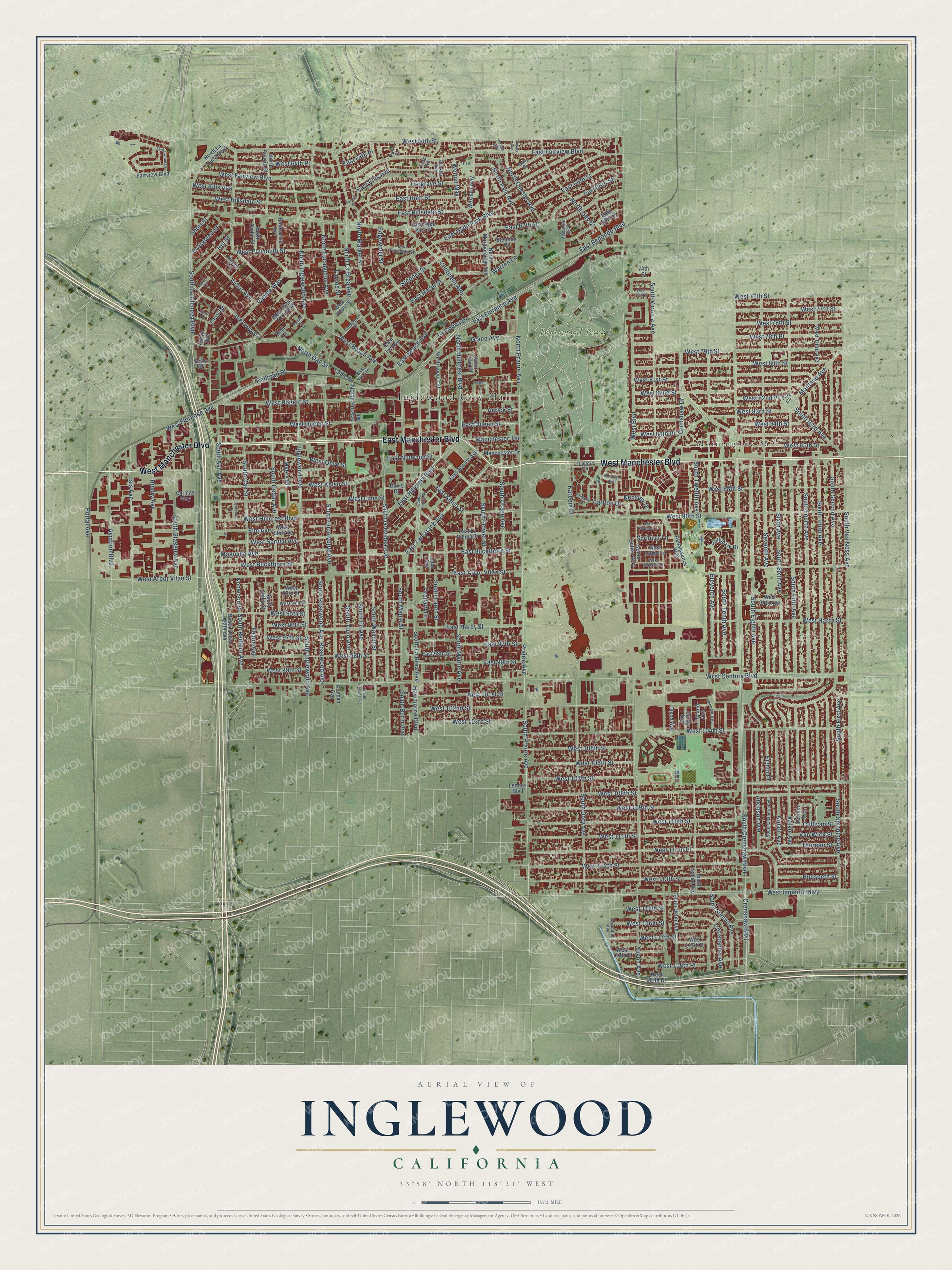
A new map of Inglewood, California, made in 2026 and printed to order on thick archival matte paper.
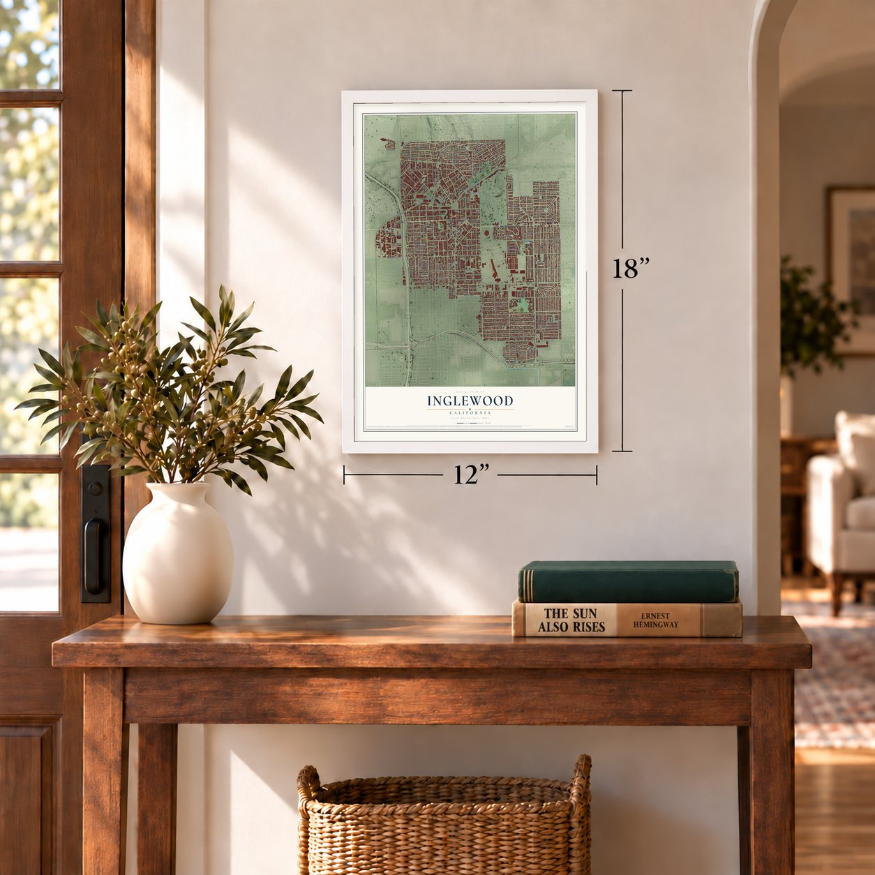
12" x 18" Archival Matte Print
A Map of Home. A Work of Art.
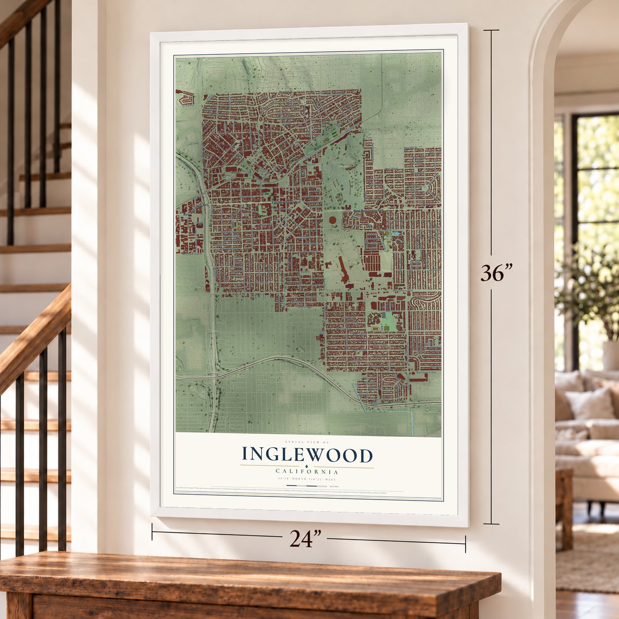
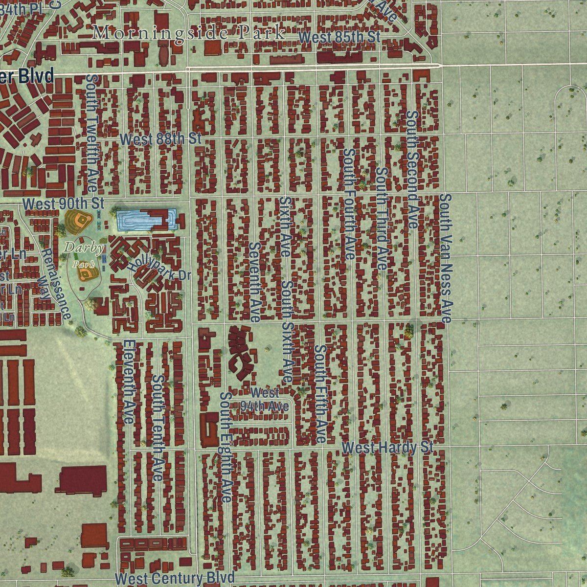
Explore Inglewood, California from a whole new perspective. Created using aerial imagery and detailed geographic data, this map captures Inglewood building by building, with labeled streets, familiar landmarks, and shaded topographical relief that highlights the natural contours of the landscape.
Combining modern data with the timeless character of a vintage atlas, this map is just as interesting up close as it is beautiful on the wall. Whether you grew up in Inglewood, spent memorable years there, or call it home today, this unique map is a great way to celebrate a place that means something to you. Zoom in on the preview to look for your street, and then order a print to put your memories on the wall.
Three ways to hang it
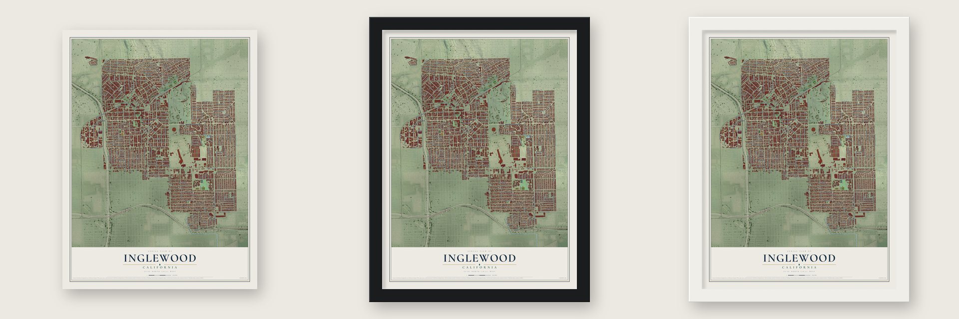
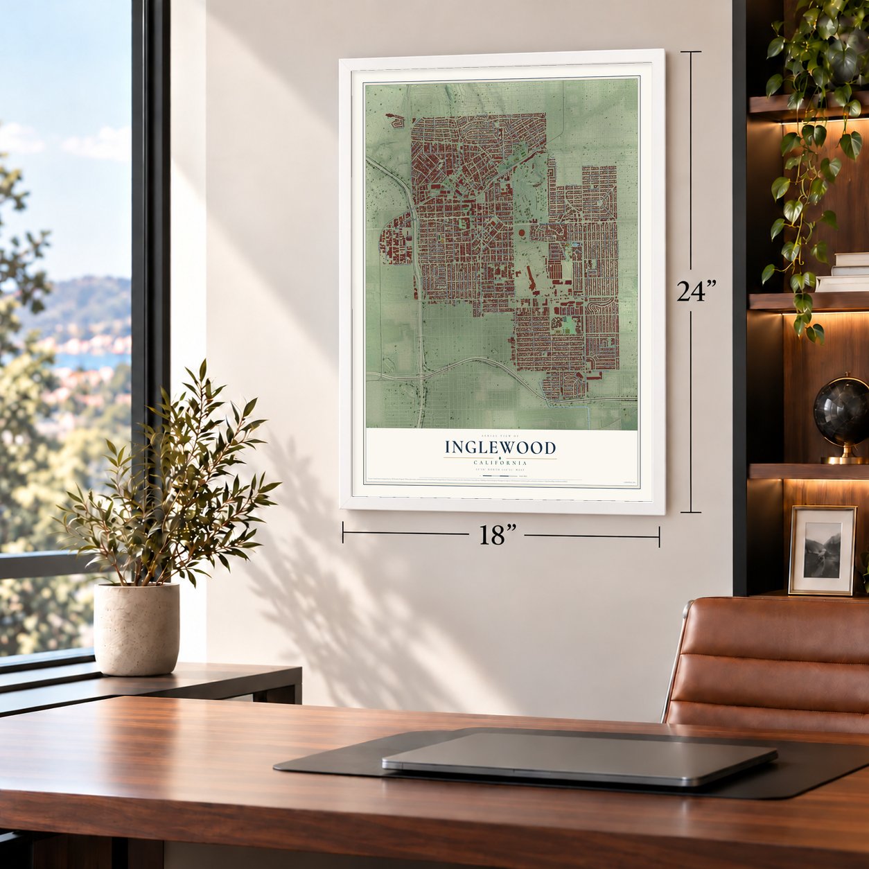
Unframed archival matte, a black wood frame or a white wood frame.
Up close
Geography Worth Displaying
This map was created using accurate cartographic data and authoritative geographic sources, including the U.S. Geological Survey and the Census Bureau. The map brings together terrain, waterways, roads, and building detail. The majority of the streets are labeled, houses are accurately depicted, and the topography is derived from government sources. Combining local data with carefully composed color and shading leads to this beautifully detailed Inglewood artwork for your wall.
Rather than simply showing street outlines, we’ve included as many of the street names as we could reasonably fit on the map while keeping their names legible. Zoom in on the high resolution preview to see exactly what’s on the map. We truly set out to create a statement piece for anyone who loves Inglewood. So whether it’s for you, or a gift for someone you love, we hope this map of Inglewood brings back fond memories.
Read the story behind this map of Inglewood, California from 2026.

About Inglewood, California
Inglewood is a city of 107,762 people in Los Angeles County, about 4.15 miles from Los Angeles International Airport. Native Americans first used the Centinela springs here, which took their name from the surrounding hills, where ranchers could keep watch over their herds like sentinels. In 1822 Bruno Ygnacio Ávila got a permit to put up a corral and a hut for his herders near the springs. In 1834 Ygnacio Machado, son of one of the first settlers of Los Angeles, built the Centinela Adobe nearby, and two years later he was granted the 2,220-acre Rancho Aguaje de la Centinela.
Daniel Freeman later acquired the rancho. In 1887, the year the Venice to Inglewood railway opened, he helped found the Centinela-Inglewood Land Company to develop the land. Inglewood became the first settlement carved from the 25,000-acre Centinela Ranch in 1888, and on February 14, 1908, it was incorporated as a city.
“The Centinela-Inglewood Company has put on a four-horse coach between their office and Inglewood, leaving at 9:30 am and returning at 2 pm to carry passengers desiring to see the property.”
- Church in a hotel, 1888On April 22, 1888, Inglewood held its first church service at the Inglewood House, a hotel on Commercial Street, now La Brea Avenue. The town then had 300 residents and 112 registered voters. Presbyterians founded the first permanent church on Market Street on January 19, 1890. In 1910 they moved the sanctuary and manse to Grevillea and Nutwood, away from the noisy Market Street streetcars that blew dust and sand fleas through the windows.
- The 1941 aircraft strikeIn 1941 the United Auto Workers won the right to represent all workers at the North American Aviation plant in Inglewood, which built a fourth of the nation's fighter planes. Despite the union's no-strike pledge, a wildcat strike shut the plant on June 4. When the union could not get its members back to work, President Franklin Roosevelt ordered California's National Guard troops to the plant to reopen it.
- A changing city after 1960The 1960 census counted 29 Black residents among Inglewood's 63,390 people. After 19 parents sued, Judge Max F. Deutz ordered the schools desegregated on July 22, 1970. Loyd Sterling Webb, elected to the school board in 1971, was the city's first Black officeholder, and Curtis Tucker Sr. joined the council in 1972. Edward Vincent Jr. became the first Black mayor in 1983, and Inglewood was the first California city to make Dr. King's birthday a holiday.
- From racetrack to stadiumHollywood Park ran horse races here from 1938 to 2013. The Forum opened in 1967 and was home to the Lakers, Kings and Sparks until Staples Center opened in 1999. SoFi Stadium rose on the old racetrack site and opened in 2020 for the Rams and Chargers, and the Clippers began playing at Intuit Dome in 2024.
- Fosters Freeze, 1946George Foster opened Fosters Freeze in Inglewood in 1946, and it became California's first chain of soft serve ice cream.
Find your street
Names on the Inglewood map
Every name below is printed on this map. Look for your street, your school, the park where you played, or the pond down the road.
Places and landmarks4
- Inglewood City Hall
- Morningside Park
- Darby Park
- Inglewood Park Cemetery
Streets and roads264
- West Manchester Boulevard
- East Manchester Boulevard
- South Grevillea Avenue
- East Arbor Vitae Street
- North Hillcrest Boulevard
- South La Brea Avenue
- West Arbor Vitae Street
- Crenshaw Drive
- East Queen Street
- Portal Avenue
- North Market Street
- North Prairie Avenue
- West Imperial Highway
- South Prairie Avenue
- East Hillcrest Boulevard
- West 108th Street
- West 95th Street
- East Hardy Street
- West Century Boulevard
- West 98th Street
- East Buckthorn Street
- West 115th Street
- West 116th Street
- West 64th Street
- West 102nd Street
- Crenshaw Boulevard
- South La Cienega Boulevard
- South Van Ness Avenue
- South Crenshaw Boulevard
- Prairie Avenue
Show all 264 streets
- South Eighth Avenue
- South Fifth Avenue
- Seventh Avenue
- South Second Avenue
- South Third Avenue
- West 90th Street
- West 104th Street
- Centinela Avenue
- South Fourth Avenue
- North La Brea Avenue
- West 111th Street
- West 109th Street
- East Hyde Park Boulevard
- West Florence Avenue
- Yukon Avenue
- West Beach Avenue
- Sixth Avenue
- West 112th Street
- North Eucalyptus Avenue
- West Hillcrest Boulevard
- South Tenth Avenue
- Inglewood Avenue
- South Inglewood Avenue
- East Fairview Boulevard
- South Eucalyptus Avenue
- West Boulevard
- West 113th Street
- East Florence Avenue
- South Fir Avenue
- West 110th Street
- West 111th Place
- South Doty Avenue
- West Hardy Street
- West 79th Street
- South Sixth Avenue
- West 85th Street
- East Brett Street
- West 83rd Street
- West 80th Street
- South Flower Street
- West 81st Street
- East 67th Street
- North Inglewood Avenue
- South Cedar Avenue
- South Oak Street
- South Osage Avenue
- West 101st Street
- South Ash Avenue
- Eleventh Avenue
- West 82nd Street
- West Olive Street
- West Buckthorn Street
- North Oak Street
- West Queen Street
- South Walnut Street
- South Myrtle Avenue
- West Kelso Street
- West 84th Place
- South Victoria Avenue
- West Regent Street
- West 64th Place
- West Hillsdale Street
- West Spruce Avenue
- West 88th Street
- West Fairview Boulevard
- Stepney Street
- West Ellis Avenue
- South Glasgow Avenue
- East 65th Street
- East Kelso Street
- East Nutwood Street
- Hindry Avenue
- Hargrave Street
- West Lime Street
- East Hazel Street
- Isis Avenue
- West 78th Place
- Edgewood Street
- West 78th Street
- West 84th Street
- West 118th Place
- Warren Lane
- East Tamarack Avenue
- West 107th Street
- West 105th Street
- Venice Way
- West 106th Street
- East Ellis Avenue
- North Park Avenue
- Magnolia Avenue
- West Plymouth Street
- South Spinning Avenue
- Hawthorne Boulevard
- Aviation Boulevard
- West 77th Street
- Rosewood Avenue
- South Rosewood Avenue
- South Maple Street
- South Truro Avenue
- East 97th Street
- Welton Way
- East 99th Street
- West 103rd Street
- South Larch Street
- North Gay Street
- West 99th Street
- West 76th Street
- East Hillsdale Street
- West 117th Street
- West 82nd Place
- Thoreau Street
- Elm Avenue
- North Chester Avenue
- Carlton Drive
- East Beach Avenue
- Ardath Avenue
- South First Avenue
- East 66th Street
- Glenway Drive
- Grace Avenue
- South Simms Avenue
- Maitland Avenue
- South Byrd Avenue
- Victor Avenue
- Hudspeth Street
- Wilkie Avenue
- Cullivan Street
- Hill Street
- South Redfern Avenue
- Manchester Terrace
- East Redondo Boulevard
- Atkinson Avenue
- Eighth Place
- Orchard Drive
- South Burin Avenue
- Kareem Court
- South Twelfth Avenue
- Evergreen Street
- Van Wick Street
- La Colina Drive
- Christopher Avenue
- Felton Avenue
- Railroad Place
- Cory Drive
- West 97th Street
- West 96th Street
- North Fir Avenue
- Aerick Street
- Kensley Drive
- Scribner Lane
- East 64th Place
- Kenwood Street
- Lamos Street
- Myers Place
- Short Street
- North Locust Street
- South Ocean Gate Avenue
- Condon Avenue
- Wexham Way
- West Hyde Park Boulevard
- South Lemoli Avenue
- East Spruce Avenue
- North Acacia Street
- North Marlborough Avenue
- West Elm Avenue
- East La Palma Drive
- West 118th Street
- South Dehn Avenue
- East 68th Street
- Hollypark Drive
- East Hyde Park Place
- East 98th Street
- Renaissance Way
- North La Tijera Boulevard
- South Cullen Way
- Saint John Place
- Manchester Drive
- West Third Avenue
- East Ivy Avenue
- West Luther Lane
- South Holly Street
- England Avenue
- North Cedar Street
- Fairview Boulevard
- Enterprise Avenue
- West 117th Place
- Cable Place
- West 119th Court
- Stepney Place
- West 94th Avenue
- Casimir Avenue
- West 93rd Street
- Darby Avenue
- Dixon Avenue
- Austin Avenue
- Carmax Way
- Java Avenue
- Davis Drive
- Lennox Boulevard
- Fair Place
- Pine Court
- Vesta Street
- 74th Street
- West 94th Street
- East Plymouth Street
- Field Avenue
- South Chanera Avenue
- West Ivy Avenue
- Park Circle
- Buckler Avenue
- Alpha Street
- West Medici Lane
- Grosvenor Street
- Kincaid Avenue
- West Juniper Street
- Flora Drive
- East Park Way
- Kornblum Avenue
- Dunford Lane
- South Market Street
- Woodworth Avenue
- Regent Circle
- Forest Street
- Laurelwood Drive
- West Chapman Lane
- Armitage Avenue
- South Firmona Avenue
- West 75th Place
- Sycamore Place
- Hardin Drive
- Amberly Drive
- Pepper Court
- Verdun Avenue
- Alviso Avenue
Names are listed as they appear on the printed map. Zoom into the product photos to find them.
The art of mapping a place
How This Map Was Made
Real places. Remarkable detail. Discover the layers that turn geographic data into a map of home.

The view from above
Aerial imagery reveals the character of the land: woodland, open fields, and the patterns of a place.

The shape of the land
Elevation data brings hills, valleys, and subtle changes in the landscape into view.

The details of home
Roads, waterways, and building footprints come together to make the map feel unmistakably local.

Geography becomes art
Considered color, shading, and typography bring the layers together in a map made for your wall.


Process illustrated with Mendon, Massachusetts. Aerial imagery: USDA NAIP. Terrain: USGS 3D Elevation Program. Map details and finished artwork: KNOWOL.
The Details
About This Print
Choose an archival matte print, or a black or white Ayous wood frame. The archival matte print is unframed.
Select your size and finish above to see the matching product image and price.
Materials & Craftsmanship
A contemporary map with the character of a classic atlas, printed on archival matte paper. Optional frames are made from Ayous wood.
Your printed map does not include the watermark shown in the full-map preview.
Shipping & Delivery
Free shipping within the United States. Every print is made to order in the USA.
Buying a gift? Add a note in your cart and we'll include it. We never put prices in the package.
Prints ship within 2 to 3 business days. Allow 7 to 10 days total from ordering for delivery. Timing may vary during holidays or periods of high order volume.
Read our shipping policy.
Returns and damaged prints
Each print is made to order. Change-of-mind refunds are not available after production.
If your print arrives damaged, misprinted or incorrect, contact support@knowol.com within 30 days of receiving it. Include your order number, photos and a description of the issue.
Read our full refund and replacement policy. For questions about your order, email support@knowol.com.
Find your town
Looking for another city?
Find a map of home in our California collection, or any town in the country.
Nearby
Maps of towns near Inglewood
Know someone from one of these towns? Their map makes a great gift.
 Lennox
, California
From $39.99See the map
 Westmont
, California
From $39.99See the map
 View Park-Windsor Hills
, California
From $39.99See the map
More maps nearby: Hawthorne, Del Aire, Ladera Heights, West Athens and Culver City.