
Search for another town

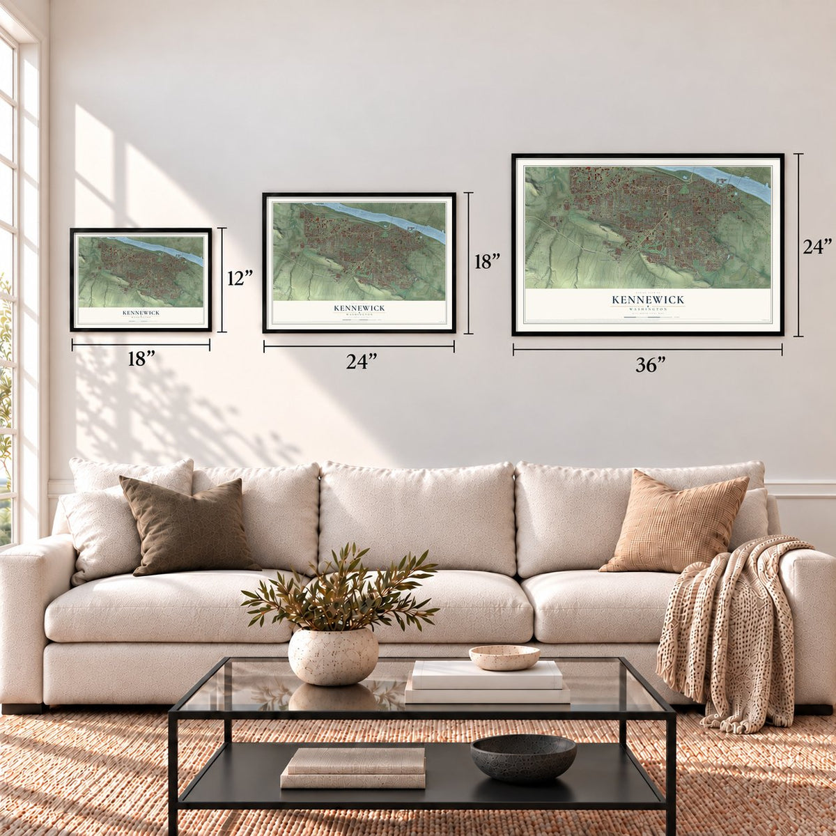

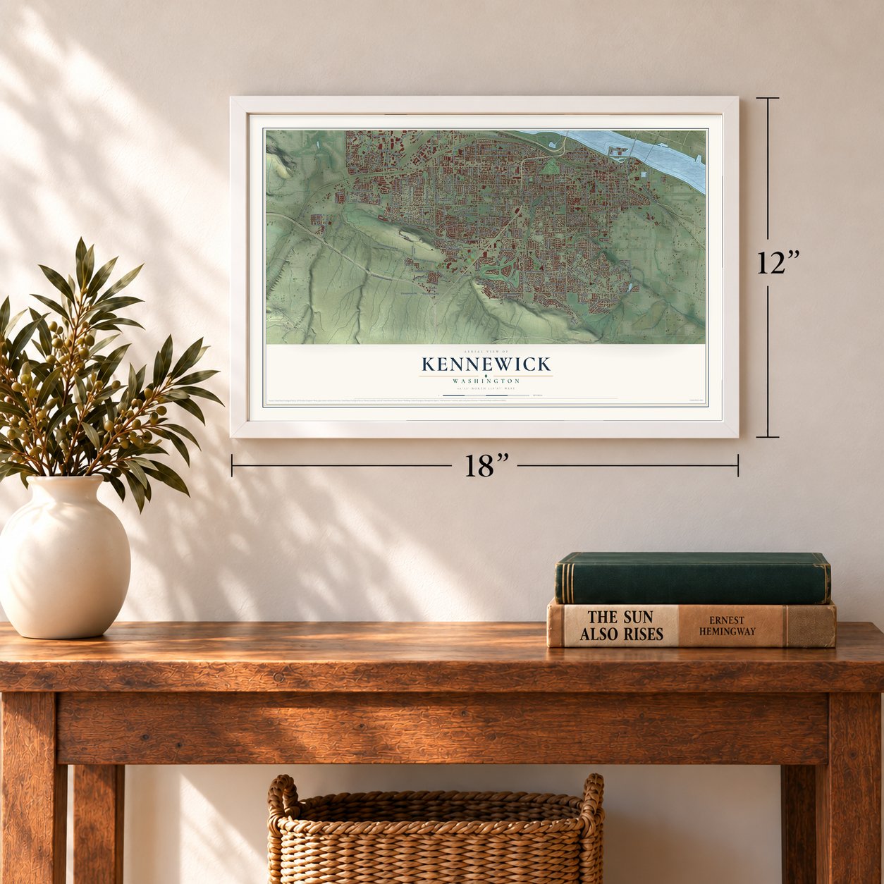
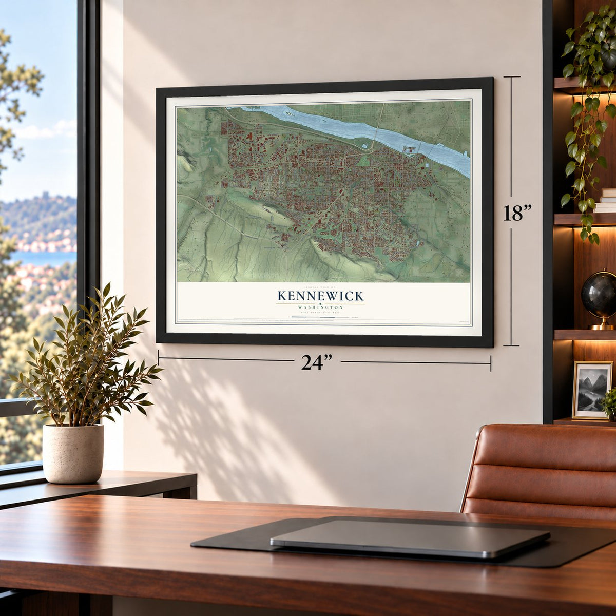
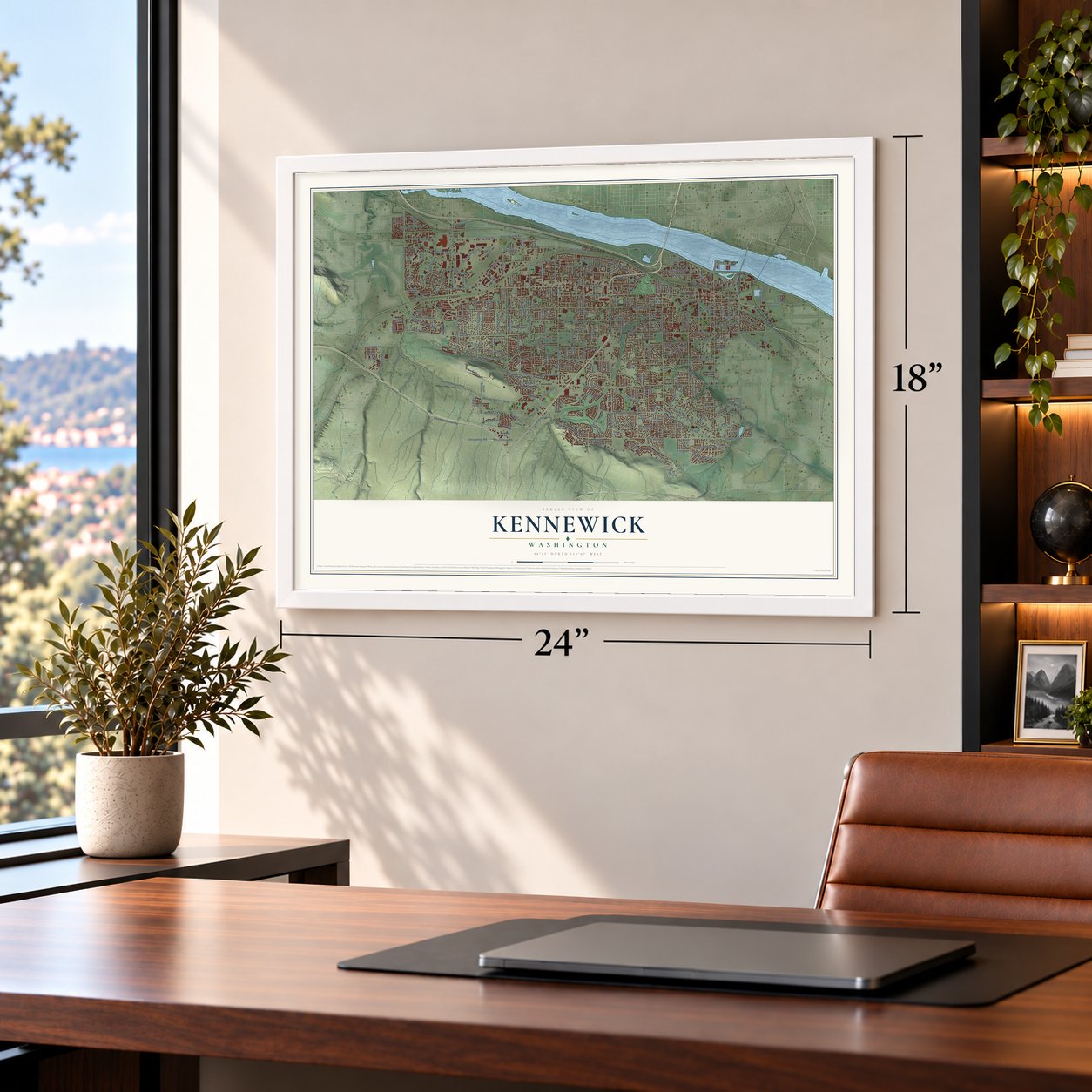
Free U.S. delivery 7 to 10 days after you order
Kennewick, Washington Map Art
A new map of Kennewick, Washington, made in 2026 and printed to order on thick archival matte paper.
12" x 18" Archival Matte Print
A Map of Home. A Work of Art.
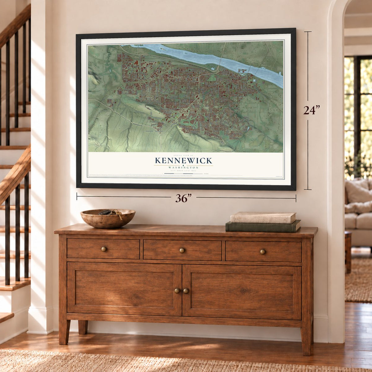
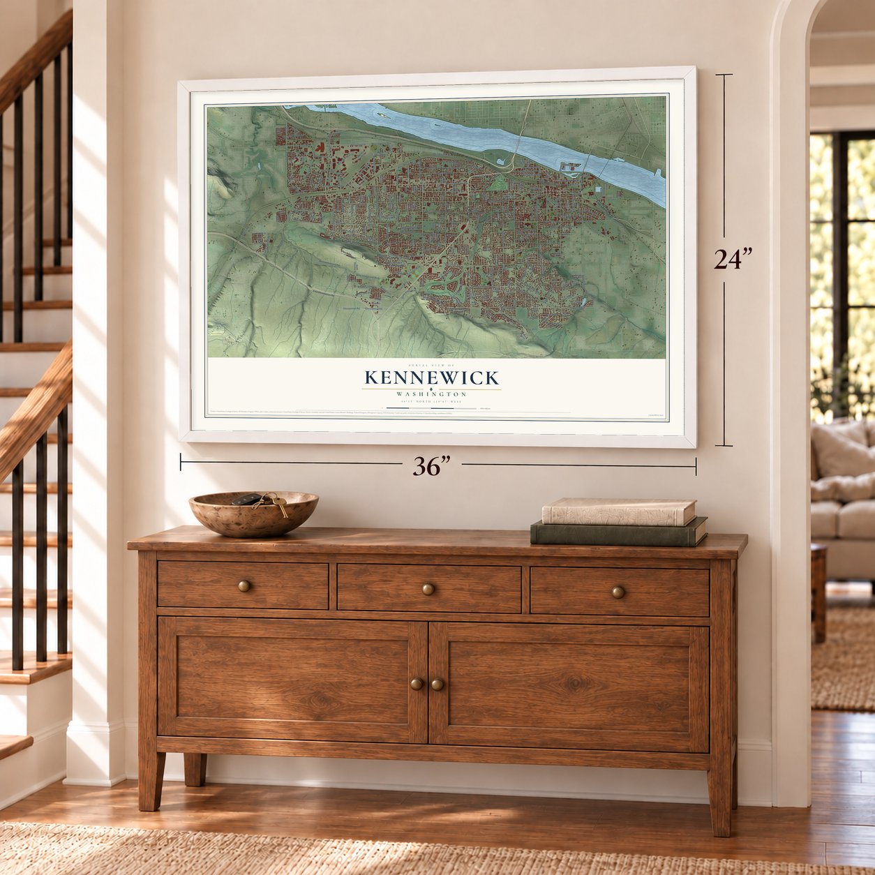
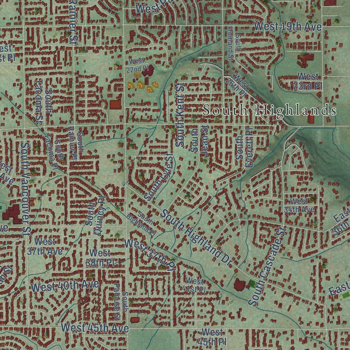
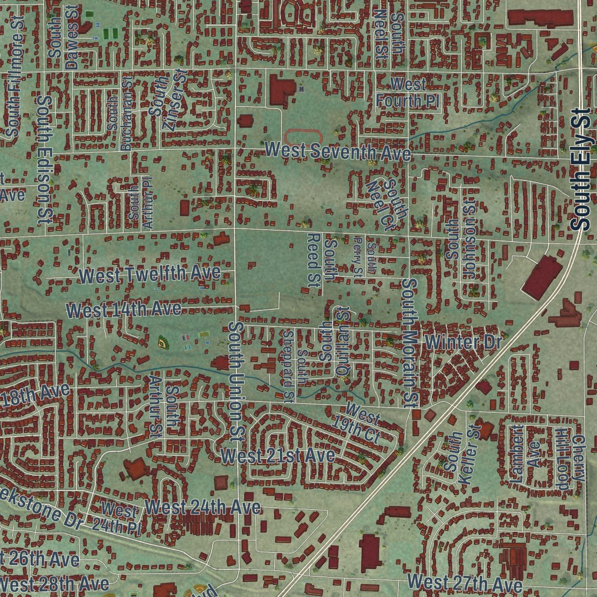
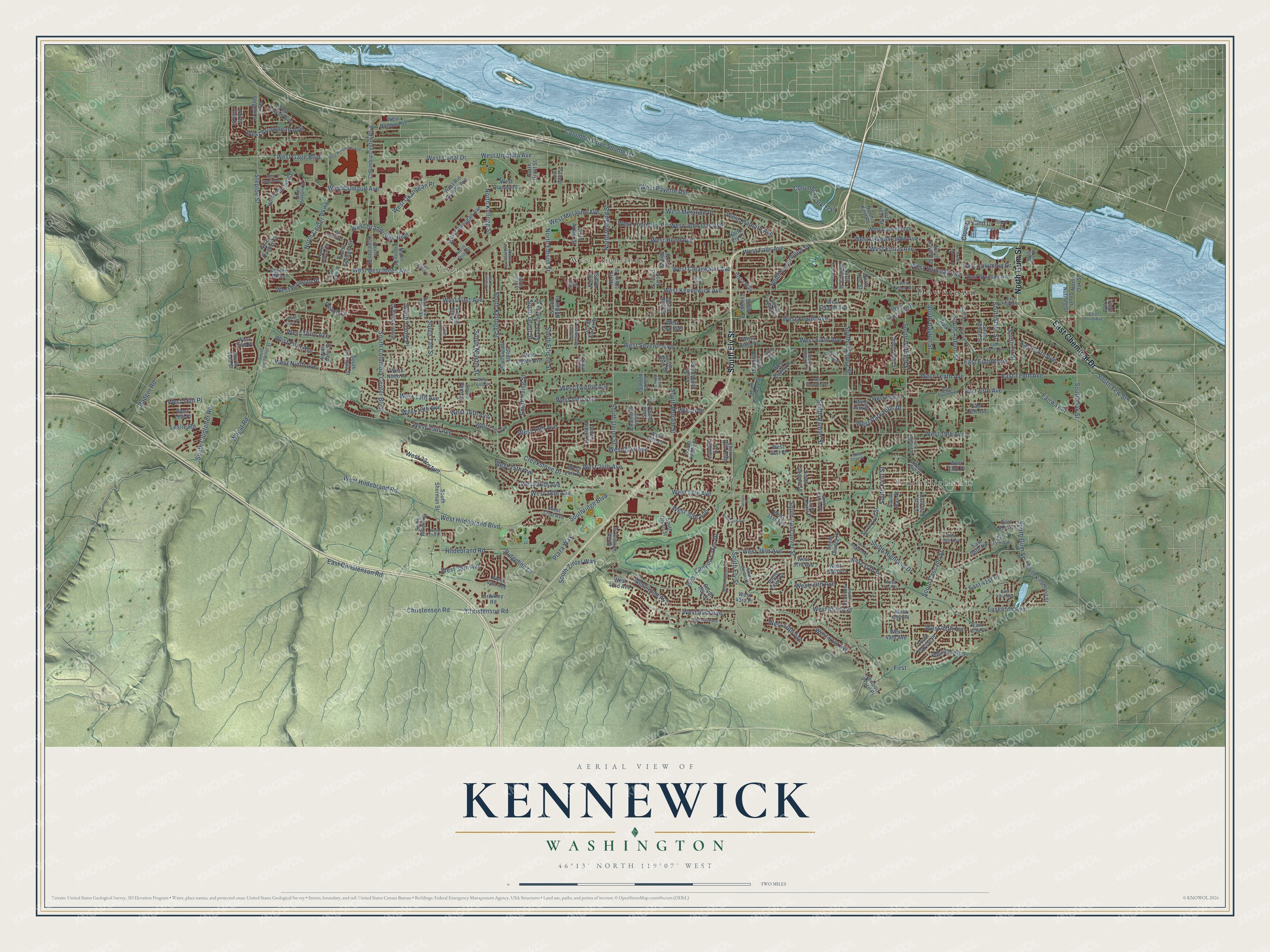
Explore Kennewick, Washington from a whole new perspective. Created using aerial imagery and detailed geographic data, this map captures Kennewick building by building, with labeled streets, familiar landmarks, and shaded topographical relief that highlights the natural contours of the landscape.
Combining modern data with the timeless character of a vintage atlas, this map is just as interesting up close as it is beautiful on the wall. Whether you grew up in Kennewick, spent memorable years there, or call it home today, this unique map is a great way to celebrate a place that means something to you. Zoom in on the preview to look for your street, and then order a print to put your memories on the wall.
Three ways to hang it
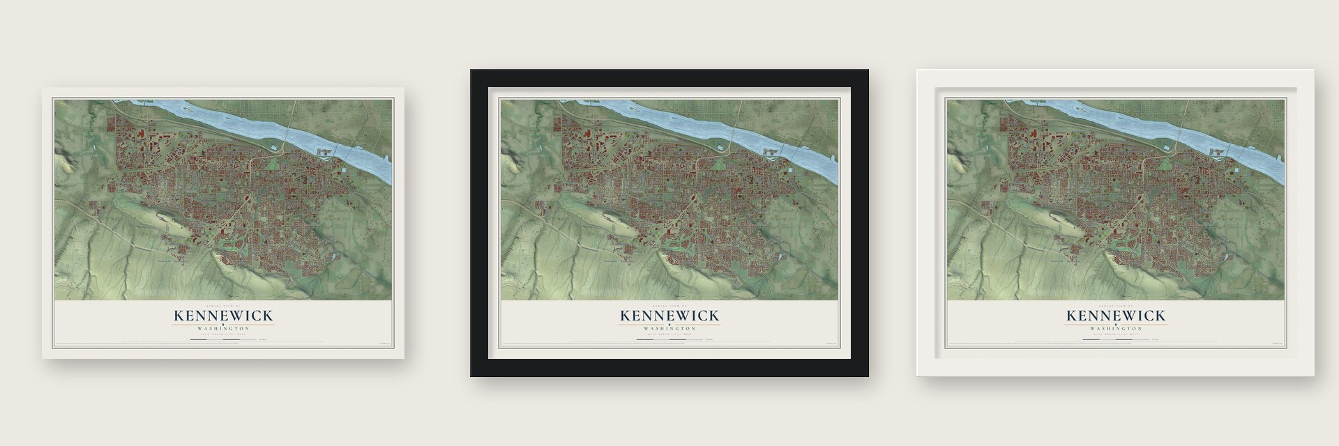
Unframed archival matte, a black wood frame or a white wood frame.
Up close
Geography Worth Displaying
This map was created using accurate cartographic data and authoritative geographic sources, including the U.S. Geological Survey and the Census Bureau. The map brings together terrain, waterways, roads, and building detail. The majority of the streets are labeled, houses are accurately depicted, and the topography is derived from government sources. Combining local data with carefully composed color and shading leads to this beautifully detailed Kennewick artwork for your wall.
Rather than simply showing street outlines, we’ve included as many of the street names as we could reasonably fit on the map while keeping their names legible. Zoom in on the high resolution preview to see exactly what’s on the map. We truly set out to create a statement piece for anyone who loves Kennewick. So whether it’s for you, or a gift for someone you love, we hope this map of Kennewick brings back fond memories.
Read the story behind this map of Kennewick, Washington from 2026.
About Kennewick, Washington
Kennewick is a city of 83,921 people in Benton County. It sits on the Columbia River, along the stretch where the Yakima and the Snake flow in. In 1884 Daisy Beach Emigh's father heard that the Northern Pacific would lay a line up the Yakima Valley on this side of the river. He bought land at the family's old picnic grounds, and that May he moved them over from Ainsworth. Railroad workers followed, and by autumn the busy construction camp was called Kennewick.
The camp nearly vanished in 1887. Once the track and a railroad bridge over the Columbia were finished, Pasco across the river became the division point, and most people left, some hauling their buildings away. In 1892 an irrigation company platted a new townsite farther from the river, and about 400 people came, with a three-story hotel, a newspaper and a school. The company failed in the panic of 1893. Irrigation finally made farming possible by 1902, orchards, vineyards and strawberry fields spread, and Kennewick was incorporated on February 5, 1904.
“It was not a very dependable craft, for it sometimes, yea often, decided in the middle of the river to stop work and float a bit instead of following the simple path of duty.”
- Kennewick Man, 9,200 years oldIn 1996 two young fans of hydroplane racing found human bones in the riverbank at Columbia Park. Dated to 9,200 years ago, Kennewick Man ranks as North America's oldest nearly complete skeleton. The find set off years of dispute between scientists and tribes.
- A grassy placeNorthern Pacific engineer H. S. Huson said the local Indian name sounded like Kin-ne-wack, meaning grassy place, and his spelling, Kennewick, stuck. Emigh told another version: settlers meant to honor the trapper Chenoweth, and the name came from how Indians said it. The camp had also briefly gone by Te He and Cottonwood Landing.
- From 1,918 to 10,085The Hanford site opened in and north of Richland in 1943, and thousands of workers arrived to help build an atomic bomb, many of them living in Kennewick. Hanford's plutonium went into the Fat Man bomb dropped on Nagasaki in 1945. Kennewick grew from 1,918 people in 1940 to 10,085 in 1950, and by 1980 it was the largest of the Tri-Cities, with 34,397.
- The Green Bridge of 1922The Pasco-Kennewick Bridge, known locally as the Green Bridge, first joined the two cities by car in 1922. With 10,000 cars a day crowding it, the four-lane Blue Bridge opened upstream in 1954. The Cable Bridge replaced the Green Bridge in 1978, and after preservationists stalled its demolition, the old span came down in 1990.
Find your street
Names on the Kennewick map
Every name below is printed on this map. Look for your street, your school, the park where you played, or the pond down the road.
Places and landmarks4
- Downtown
- South Highlands
- Vista
- West Highlands
Streets and roads278
- South Ely Street
- East Chemical Drive
- North Gum Street
- West Kennewick Avenue
- West Twelfth Avenue
- South Kellogg Street
- South Union Street
- Christensen Road
- Christenson Road
- North Kellogg Street
- Creekstone Drive
- North Center Parkway
- West Gage Boulevard
- East 41st Place
- South Kent Street
- Southridge Boulevard
- South Date Street
- West Tenth Avenue
- West Clearwater Avenue
- West Fourth Avenue
- West Canal Drive
- West 19th Avenue
- South Olympia Street
- West 27th Avenue
- Columbia Drive Southeast
- West Sixth Avenue
- West Seventh Avenue
- West Deschutes Avenue
- West Fifth Avenue
- West 36th Avenue
Show all 278 streets
- South Vancouver Street
- West First Avenue
- West Canyon Lakes Drive
- South Garfield Street
- West 15th Avenue
- West 20th Avenue
- East Christenson Road
- West 21st Avenue
- West 24th Avenue
- West Hood Avenue
- West Hildebrand Road
- West Grand Ronde Avenue
- West Ninth Avenue
- South Rainier Street
- West Metaline Avenue
- West Grandridge Boulevard
- West Third Avenue
- West 45th Avenue
- West 14th Avenue
- West Hildebrand Boulevard
- South Dayton Street
- West Quinault Avenue
- West Klamath Avenue
- West John Day Avenue
- West Entiat Avenue
- West 16th Avenue
- South Cascade Street
- South Morain Street
- South Gum Street
- North Edison Street
- West Umatilla Avenue
- South Auburn Street
- West Arrowhead Avenue
- West 26th Avenue
- South Irving Street
- West 42nd Avenue
- South Edison Street
- West 18th Avenue
- Steptoe Street
- West 25th Avenue
- South Highland Drive
- East Tenth Avenue
- West 46th Avenue
- West 13th Avenue
- South Columbia Center Boulevard
- West 23rd Avenue
- West 28th Avenue
- West 30th Avenue
- South Grant Street
- West 40th Avenue
- South Taft Street
- West 51st Avenue
- West 48th Avenue
- East Sixth Avenue
- West Payette Avenue
- South Oak Street
- West Falls Avenue
- East Eighth Avenue
- North Volland Street
- Hildebrand Road
- West 37th Place
- West Okanogan Place
- East Columbia Drive
- South Clodfelter Road
- Columbia Park Trail
- West 38th Avenue
- East 45th Avenue
- West Metaline Place
- Clover Island Drive
- South Young Place
- West 16th Place
- Leslie Road
- South Nelson Street
- Plaza Way
- Fairway Street
- West 50th Avenue
- West Railroad Avenue
- West Bruneau Place
- Wheat Road
- South Fir Street
- South Zintel Way
- West Park Hills Drive
- North Underwood Street
- South Yew Street
- East 13th Avenue
- Ridgeline Drive
- West John Day Place
- Badger Road
- Winter Drive
- First
- Peach Lane
- West Okanogan Avenue
- South Zillah Street
- South Tacoma Street
- South Jefferson Street
- South Buntin Street
- Center Parkway
- West 17th Avenue
- West Second Avenue
- West Fourth Place
- West Quinault Street
- Columbia Center Boulevard
- South Quincy Place
- West Eighth Avenue
- South Olson Street
- South Dawes Street
- West 32nd Avenue
- West Columbia Drive
- South Irby Street
- South Ione Street
- South Beech Street
- West Rio Grande Avenue
- West 37th Avenue
- South Jean Street
- South Conway Street
- South Johnson Street
- South Sherman Street
- South Lyle Street
- West 31st Avenue
- West Ninth Place
- South Penn Street
- South Keller Street
- South Young Street
- South Quillan Street
- South Dayton Place
- West 43rd Avenue
- North Quebec Street
- South Yelm Street
- West 21st Place
- North Pittsburg Street
- West 49th Avenue
- North Colorado Street
- South Everett Place
- Cherry Hill Loop
- West Eighth Place
- East Bruneau Avenue
- West Bonnie Avenue
- South Fillmore Street
- North Neel Street
- West Fifth Place
- North Young Street
- North Steptoe Street
- South Reed Street
- West 52nd Avenue
- West 41st Avenue
- South Kingwood Street
- South Volland Street
- North Arthur Street
- South Conway Place
- West Sixth Place
- West 15th Place
- West 23rd Place
- South Wilson Street
- West Canyon Avenue
- South Zinser Street
- North Grant Street
- West 24th Place
- North Kent Place
- North Jean Street
- West 43rd Place
- South Neel Street
- South Quay Street
- North Lyle Street
- North Perry Street
- South Arthur Street
- South Georgia Street
- East 36th Avenue
- North Dayton Street
- North Union Street
- West 45th Place
- South Idaho Street
- South Nutmeg Street
- North Olympia Street
- North Ely Place
- Park Drive
- North Georgia Street
- West 14th Place
- Vista Way
- South Neel Court
- West Vineyard Drive
- West 18th Place
- South Yolo Street
- East 15th Avenue
- West 19th Court
- West 38th Place
- North Yost Street
- Newport Place Pr
- East 31st Court
- Brinkley Road
- North Utah Street
- Lambert Avenue
- East 47th Place
- East Street
- North Oak Street
- Sage Loop
- North Montana Street
- South Palouse Street
- South Dennis Street
- South Sharron Street
- West 34th Avenue
- East Third Avenue
- South Green Street
- West First Place
- South Clodfelter Street
- South Sheppard Street
- North Quay Street
- East First Avenue
- South Buchanan Street
- North Irving Place
- South Rainier Place
- South Tacoma Place
- West 26th Place
- West Tenth Place
- North Jefferson Street
- West Twelfth Place
- South Arthur Place
- South Van Buren Street
- East 35th Avenue
- North Kansas Street
- East 43rd Avenue
- North Ivey Street
- West 41st Place
- West Albany Avenue
- South Washington Street
- West Eleventh Avenue
- South Fruitland Street
- East Seventh Avenue
- West 47th Avenue
- West Imnaha Avenue
- West Seventh Place
- West Skagit Avenue
- West 33rd Avenue
- South Roosevelt Street
- West Willamette Avenue
- West 33rd Place
- North Lincoln Street
- Clover Is
- North Irby Street
- South Perry Street
- South Yelm Place
- North Quincy Street
- West 22nd Place
- North Auburn Street
- North Hawaii Street
- South Highland Place
- North Dawes Street
- Van Buren Place
- Dennis Place
Names are listed as they appear on the printed map. Zoom into the product photos to find them.
The art of mapping a place
How This Map Was Made
Real places. Remarkable detail. Discover the layers that turn geographic data into a map of home.

The view from above
Aerial imagery reveals the character of the land: woodland, open fields, and the patterns of a place.

The shape of the land
Elevation data brings hills, valleys, and subtle changes in the landscape into view.

The details of home
Roads, waterways, and building footprints come together to make the map feel unmistakably local.

Geography becomes art
Considered color, shading, and typography bring the layers together in a map made for your wall.


Process illustrated with Mendon, Massachusetts. Aerial imagery: USDA NAIP. Terrain: USGS 3D Elevation Program. Map details and finished artwork: KNOWOL.
The Details
About This Print
Choose an archival matte print, or a black or white Ayous wood frame. The archival matte print is unframed.
Select your size and finish above to see the matching product image and price.
Materials & Craftsmanship
A contemporary map with the character of a classic atlas, printed on archival matte paper. Optional frames are made from Ayous wood.
Your printed map does not include the watermark shown in the full-map preview.
Shipping & Delivery
Free shipping within the United States. Every print is made to order in the USA.
Buying a gift? Add a note in your cart and we'll include it. We never put prices in the package.
Prints ship within 2 to 3 business days. Allow 7 to 10 days total from ordering for delivery. Timing may vary during holidays or periods of high order volume.
Read our shipping policy.
Returns and damaged prints
Each print is made to order. Change-of-mind refunds are not available after production.
If your print arrives damaged, misprinted or incorrect, contact support@knowol.com within 30 days of receiving it. Include your order number, photos and a description of the issue.
Read our full refund and replacement policy. For questions about your order, email support@knowol.com.
Find your town
Looking for another city?
Find a map of home in our Washington collection, or any town in the country.
Nearby
Maps of towns near Kennewick
Know someone from one of these towns? Their map makes a great gift.
 West Pasco
, Washington
From $39.99See the map
 Pasco
Pasco, Washington
From $39.99See the map
 Finley
, Washington
From $39.99See the map
More maps nearby: Richland, Burbank, West Richland, Wallula and Benton City.