
Search for another town





Free U.S. delivery 7 to 10 days after you order
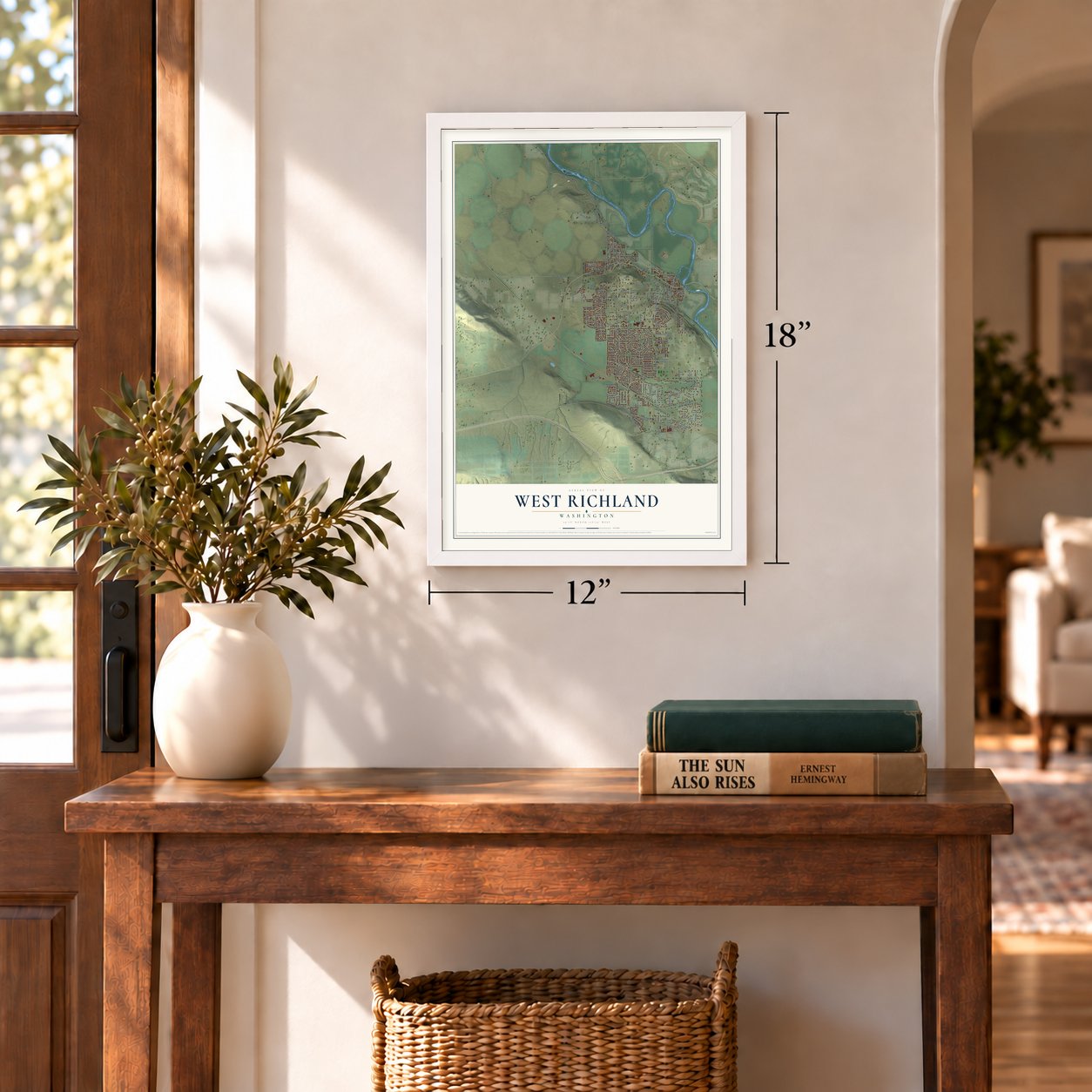
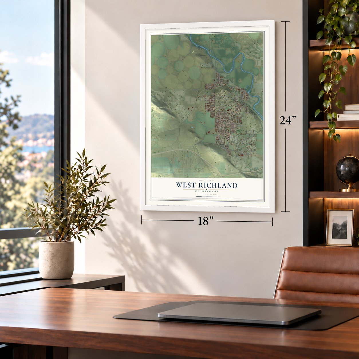
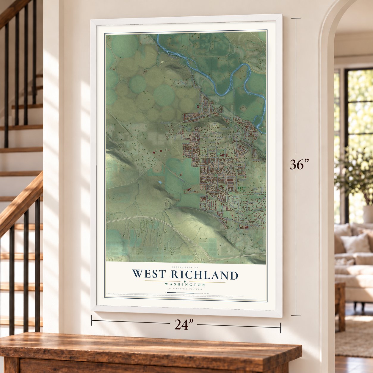
West Richland, Washington Map Art
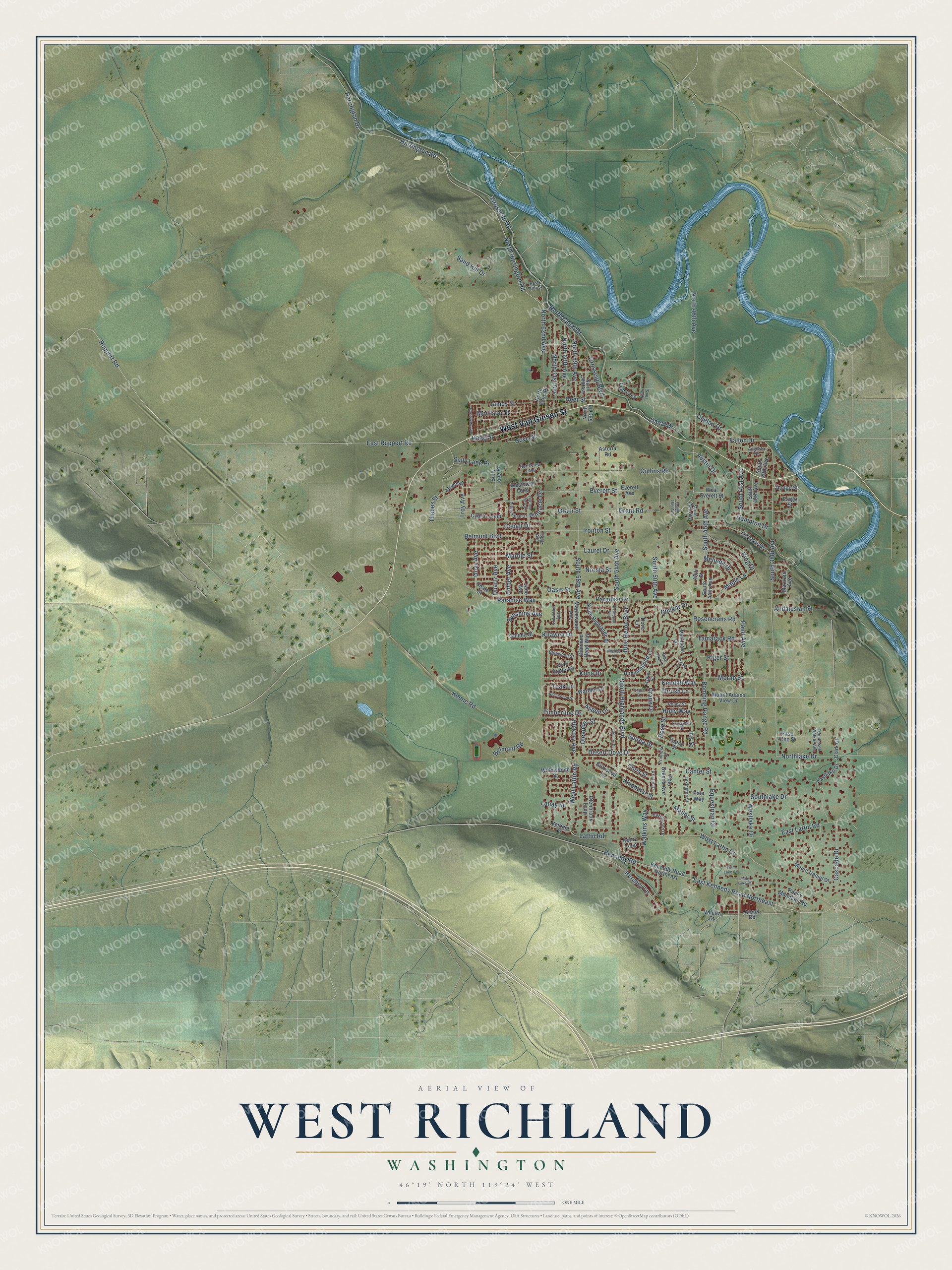
A new map of West Richland, Washington, made in 2026 and printed to order on thick archival matte paper.
12" x 18" Archival Matte Print
A Map of Home. A Work of Art.
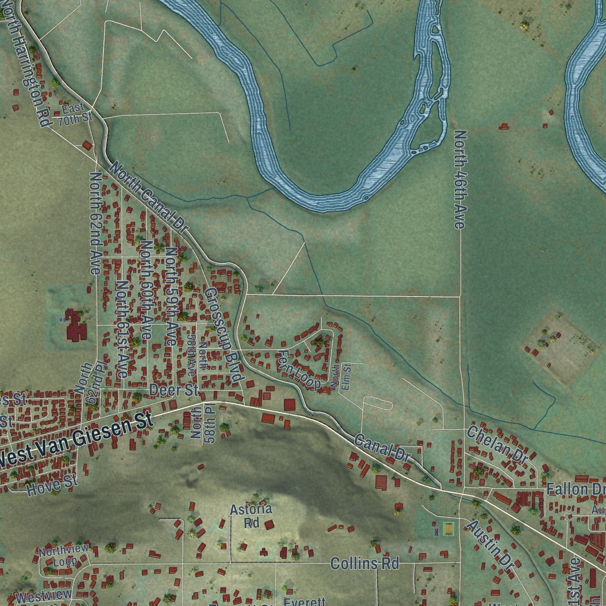
Explore West Richland, Washington from a whole new perspective. Created using aerial imagery and detailed geographic data, this map captures West Richland building by building, with labeled streets, familiar landmarks, and shaded topographical relief that highlights the natural contours of the landscape.
Combining modern data with the timeless character of a vintage atlas, this map is just as interesting up close as it is beautiful on the wall. Whether you grew up in West Richland, spent memorable years there, or call it home today, this unique map is a great way to celebrate a place that means something to you. Zoom in on the preview to look for your street, and then order a print to put your memories on the wall.
Three ways to hang it
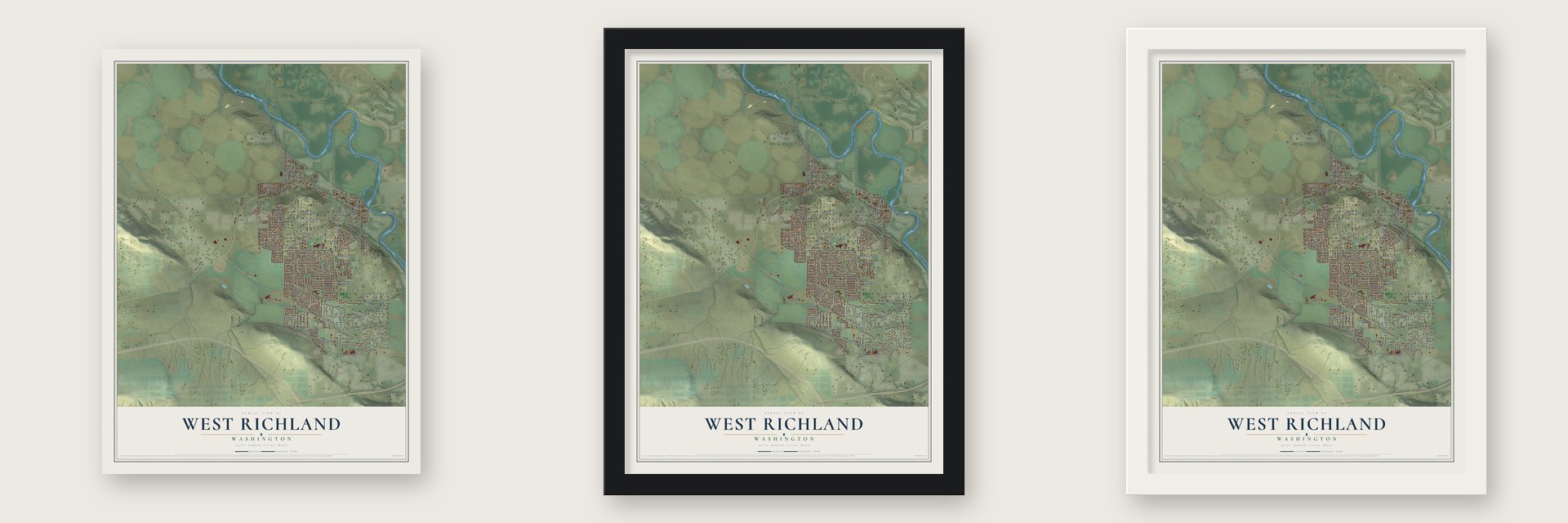
Unframed archival matte, a black wood frame or a white wood frame.
Up close
Geography Worth Displaying
This map was created using accurate cartographic data and authoritative geographic sources, including the U.S. Geological Survey and the Census Bureau. The map brings together terrain, waterways, roads, and building detail. The majority of the streets are labeled, houses are accurately depicted, and the topography is derived from government sources. Combining local data with carefully composed color and shading leads to this beautifully detailed West Richland artwork for your wall.
Rather than simply showing street outlines, we’ve included as many of the street names as we could reasonably fit on the map while keeping their names legible. Zoom in on the high resolution preview to see exactly what’s on the map. We truly set out to create a statement piece for anyone who loves West Richland. So whether it’s for you, or a gift for someone you love, we hope this map of West Richland brings back fond memories.
Read the story behind this map of West Richland, Washington from 2026.

About West Richland, Washington
West Richland is a city of 16,295 people in Benton County, across the Yakima River from Richland. The Chemnapum and Yakama people caught salmon in the river near Horn Rapids and kept a longhouse here until the early twentieth century. Settlers came in the 1870s, and private irrigation began in 1879, when farmers drew river water to turn the dry shrub-steppe into cattle pasture.
For most of its history the area had no name of its own. Carl and Vera Heminger arrived in 1948 and bought 80 acres, planning a model city called Heminger City, but in February 1949 the residents picked Enterprise instead. Heminger then started his own Heminger City about a mile away. In 1953 voters chose, 99 to 39, to join the two towns under the name West Richland. The town voted to incorporate on June 7, 1955, with only 600 residents, and that August it annexed the rest of Heminger's land.
“I'm leaving. I feel this was an attack on me personally. I don't know where I'll go, but there are 47 other states with no Heminger City, so I have a big field”
- Lena Fallon's bridgeA school district was formed by November 1889. Hannah Van Horn taught its first classes in her own home for a dollar a day until a schoolhouse went up in 1896. To reach it, children rowed across the Yakima River in a flimsy boat. Lena Fallon collected signatures and asked the Yakima County Commissioners for a bridge. When it was built, north of today's Van Giesen Street, it was named Fallon Bridge for her.
- On the Yellowstone TrailIn 1912 a few businessmen from South Dakota set out to create a highway across the country for drivers. Their Yellowstone Trail ran from Albany, New York, to Seattle, and it came through the Yakima Valley in 1917 and 1918. Early road trippers crossed the Fallon Bridge into the area and headed west to Kiona. Travelers drifted away from the route once federal highways were built and the Depression set in.
- A town without a mayorBy 1959 West Richland had around 1,000 people. That September Mayor Robert Marlow moved to Sitka, Alaska, but he never formally resigned. Without a resignation, the City Council had no power to appoint someone in his place. Councilman H. J. Barott ended the standoff by stepping in as mayor pro-tem.
- A parade since 1999The city has held a Veterans Day Parade every year since 1999. It holds a regional site designation from the U.S. Department of Veterans Affairs, which only three Washington cities have, and it is the only one of them east of the Cascades. By 2023 the parade drew more than 3,000 spectators, with over 1,000 participants and more than 100 entries.
- Over 250 mph in 2008West Richland is home to SSC North America, the carmaker behind the SSC Aero. In 2008 the car was tested here at more than 250 mph. That run made it, for a time, the world's fastest production car.
Find your street
Names on the West Richland map
Every name below is printed on this map. Look for your street, your school, the park where you played, or the pond down the road.
Streets and roads175
- West Van Giesen Street
- Grosscup Road
- South 38th Avenue
- Northlake Drive
- Keene Road
- Fallon Drive
- Sully Lane Pr
- Desert Dove Drive
- Kiger Street
- North Canal Drive
- Harrington Road
- North Harrington Road
- North 62nd Avenue
- Thrush Lane
- Bombing Range Road
- East Ruppert Road
- Ruppert Road
- Harrington Drive
- Kennedy Road
- East Kennedy Road Northeast
- Collins Road
- Belmont Boulevard
- South Highlands Boulevard
- Paradise Way
- Canal Drive
- Holly Way
- Paradise Drive
- Laurel Drive
- Everett Street
- South 58th Avenue
Show all 175 streets
- North 46th Avenue
- Grant Street
- Grosscup Boulevard
- East Lattin Road
- Blue Heron Boulevard
- Lattin Road
- South 54th Avenue
- West Lattin Court
- Norma Street
- Hershey Lane
- Sand Hill Drive
- Austin Drive
- South 45th Avenue
- North 61st Avenue
- Chukar Drive
- Ironton Street
- Canter Street
- South 50th Avenue
- Hickory Avenue
- Kilawea Drive
- Marble Street
- Equestrian Drive
- Quartz Avenue
- Oasis Street
- North 60th Avenue
- Ironton Drive
- King Drive
- Southlake Drive
- Hampton Drive
- James Street
- Paint Avenue
- Deer Street
- West Lattin Road
- Haag Street
- North 59th Avenue
- Kona Drive
- Cascade Drive
- Amber Avenue
- Watkins Way
- Maple Lane
- Westlake Drive
- Rose Street
- Iris Street
- Sunshine Avenue
- Pinehurst Street
- Onyx Avenue
- Crane Drive
- Teak Lane
- Mallet Street
- Andalusian Street
- Rosencrans Road
- Tamarack Road
- South 41st Avenue
- Timberline Drive
- Lanay Street
- Cobalt Drive
- Morrison Street
- Belmont Road
- Kendall Way
- Pinnacle Drive
- Chelan Drive
- Melinda Drive
- Aspen Drive
- Morab Street
- Grant Road
- Oleander Street
- Thebes Street
- Troy Avenue
- Chris Street
- Spirea Drive
- Hove Street
- Arena Road
- Athens Drive
- South 44th Avenue
- 45th Court
- Kennedy Road Northeast
- South Highlands Bl
- Crab Apple Circle
- Fern Loop
- Mount Adams View Drive
- Eastlake Drive
- Glenbrook Loop
- Hummingbird Lane
- Shale Street
- Polo Greens Avenue
- Diamond Head Way
- South 39th Avenue
- Kenra Loop
- Cyprus Loop
- Warbler Lane
- Mount Daniel Drive
- Polo Way
- Dove Lane
- Pheasant Lane
- Velonia Drive
- Everett Avenue
- Peony Street
- Jade Avenue
- Astoria Road
- Paso Fino Street
- Westview Loop
- South 40th Avenue
- North 62nd Place
- Maplewood Avenue
- Rocky Mountain Road
- Willowbend Street
- Kirkwood Lane
- West Everett Street
- Galena Street
- Dodge Street
- Mazzard Avenue
- Clark Court
- North 58th Place
- Fargo Street
- Valdez Court
- Ironwood Avenue
- Topaz Avenue
- Blue Jay Lane
- Northview Loop
- Lexington Street
- Hazelwood Drive
- Forsythia Street
- North 58th Avenue
- Kristin Drive
- Tennessee Walker Avenue
- Pikes Peak Drive
- Poppy Street
- Primrose Street
- Bluewood Street
- South 46th Avenue
- Augusta Street
- East 70th Street
- Osprey Lane
- Chicory Drive
- North 69th Avenue
- Towhee Lane
- Hill Top View Street
- South 48th Avenue
- Beechwood Street
- Ala Moana Way
- Thrush Court
- Pheobe Lane
- Jenny Lake Court
- Twin Lake Court
- North Elm Street
Names are listed as they appear on the printed map. Zoom into the product photos to find them.
The art of mapping a place
How This Map Was Made
Real places. Remarkable detail. Discover the layers that turn geographic data into a map of home.

The view from above
Aerial imagery reveals the character of the land: woodland, open fields, and the patterns of a place.

The shape of the land
Elevation data brings hills, valleys, and subtle changes in the landscape into view.

The details of home
Roads, waterways, and building footprints come together to make the map feel unmistakably local.

Geography becomes art
Considered color, shading, and typography bring the layers together in a map made for your wall.


Process illustrated with Mendon, Massachusetts. Aerial imagery: USDA NAIP. Terrain: USGS 3D Elevation Program. Map details and finished artwork: KNOWOL.
The Details
About This Print
Choose an archival matte print, or a black or white Ayous wood frame. The archival matte print is unframed.
Select your size and finish above to see the matching product image and price.
Materials & Craftsmanship
A contemporary map with the character of a classic atlas, printed on archival matte paper. Optional frames are made from Ayous wood.
Your printed map does not include the watermark shown in the full-map preview.
Shipping & Delivery
Free shipping within the United States. Every print is made to order in the USA.
Buying a gift? Add a note in your cart and we'll include it. We never put prices in the package.
Prints ship within 2 to 3 business days. Allow 7 to 10 days total from ordering for delivery. Timing may vary during holidays or periods of high order volume.
Read our shipping policy.
Returns and damaged prints
Each print is made to order. Change-of-mind refunds are not available after production.
If your print arrives damaged, misprinted or incorrect, contact support@knowol.com within 30 days of receiving it. Include your order number, photos and a description of the issue.
Read our full refund and replacement policy. For questions about your order, email support@knowol.com.
Find your town
Looking for another city?
Find a map of home in our Washington collection, or any town in the country.
Nearby
Maps of towns near West Richland
Know someone from one of these towns? Their map makes a great gift.
 Richland
, Washington
From $39.99See the map
 Benton City
, Washington
From $39.99See the map
 West Pasco
, Washington
From $39.99See the map
More maps nearby: Kennewick, Pasco, Finley, Prosser and Burbank.