
Search for another town




Free U.S. delivery 7 to 10 days after you order
Longview, Washington Map Art
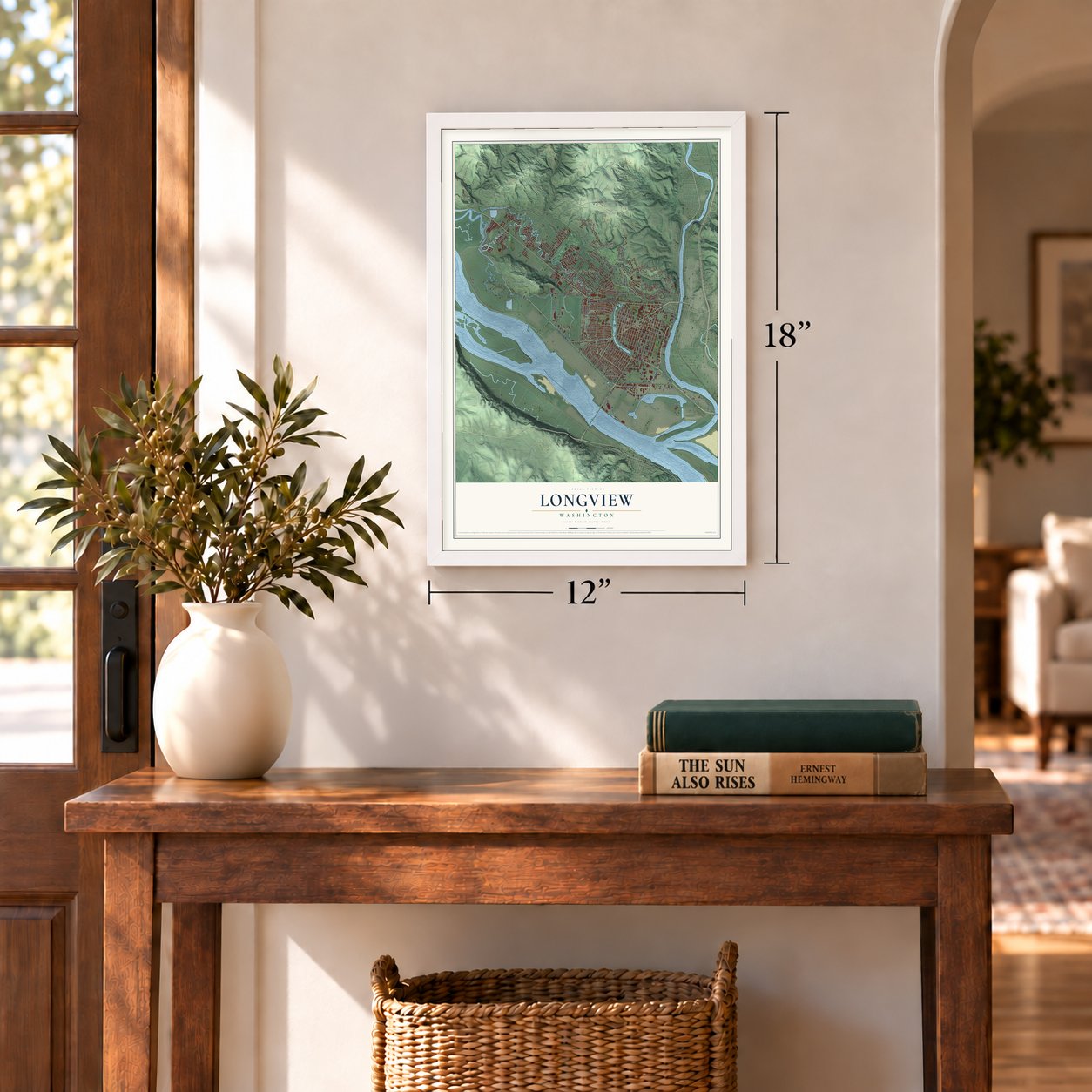
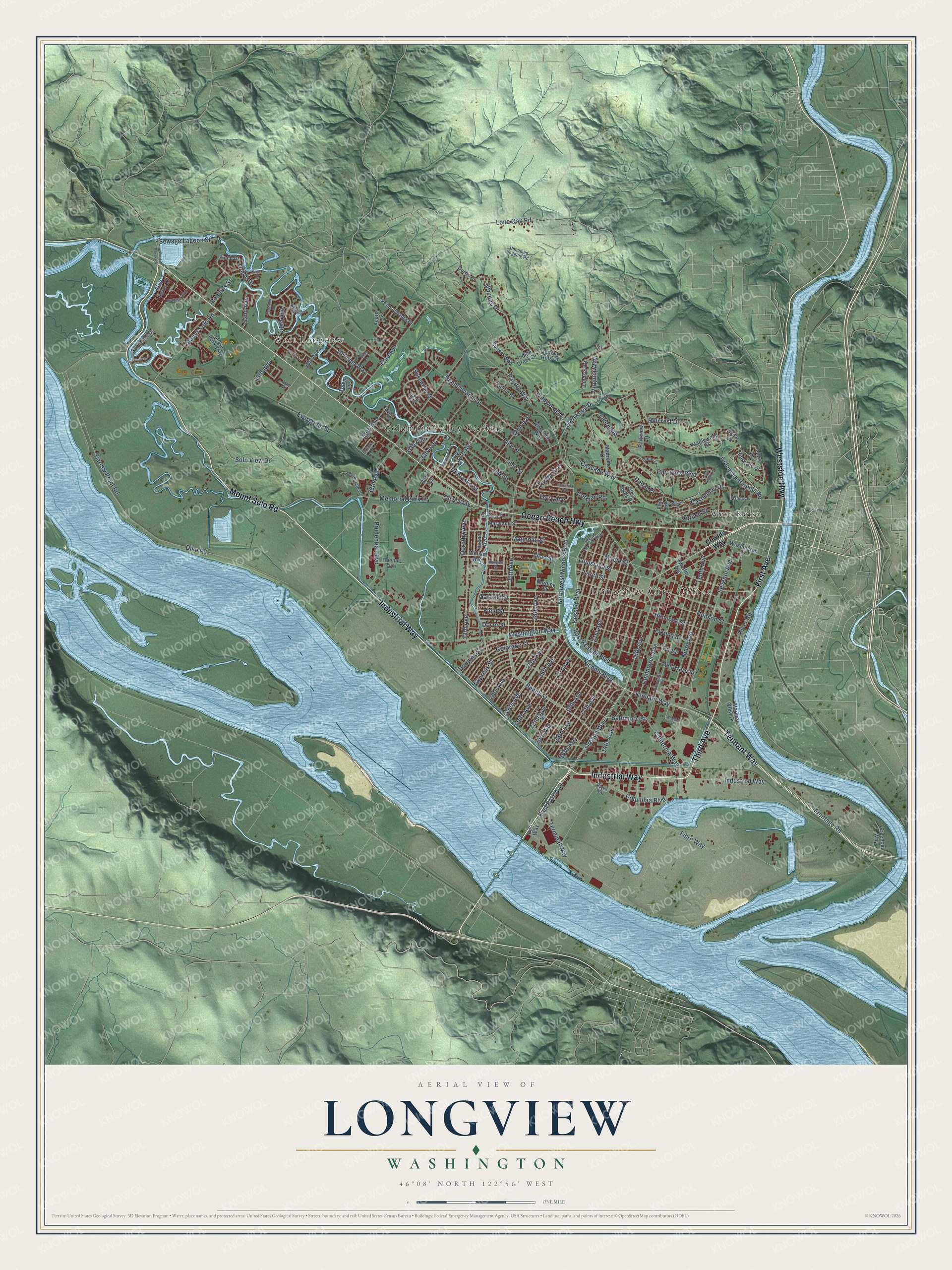
A new map of Longview, Washington, made in 2026 and printed to order on thick archival matte paper.
12" x 18" Archival Matte Print
A Map of Home. A Work of Art.
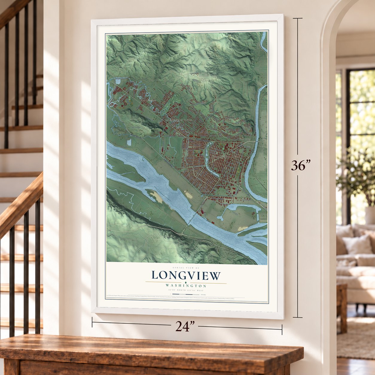
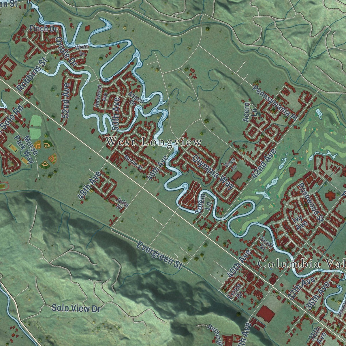
Explore Longview, Washington from a whole new perspective. Created using aerial imagery and detailed geographic data, this map captures Longview building by building, with labeled streets, familiar landmarks, and shaded topographical relief that highlights the natural contours of the landscape.
Combining modern data with the timeless character of a vintage atlas, this map is just as interesting up close as it is beautiful on the wall. Whether you grew up in Longview, spent memorable years there, or call it home today, this unique map is a great way to celebrate a place that means something to you. Zoom in on the preview to look for your street, and then order a print to put your memories on the wall.
Three ways to hang it
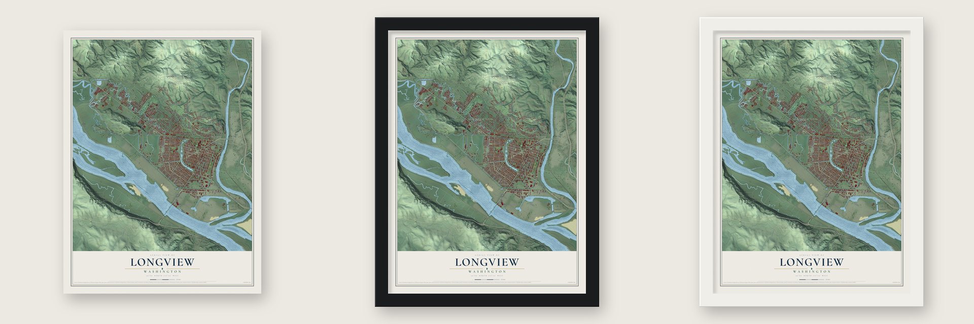
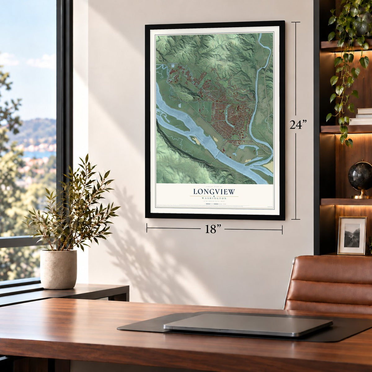
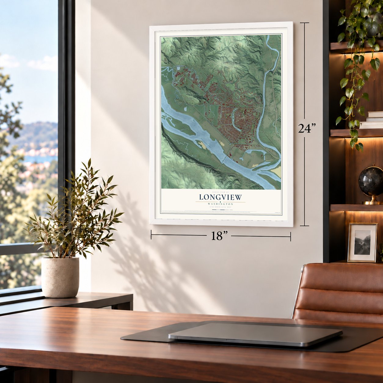
Unframed archival matte, a black wood frame or a white wood frame.
Up close
Geography Worth Displaying
This map was created using accurate cartographic data and authoritative geographic sources, including the U.S. Geological Survey and the Census Bureau. The map brings together terrain, waterways, roads, and building detail. The majority of the streets are labeled, houses are accurately depicted, and the topography is derived from government sources. Combining local data with carefully composed color and shading leads to this beautifully detailed Longview artwork for your wall.
Rather than simply showing street outlines, we’ve included as many of the street names as we could reasonably fit on the map while keeping their names legible. Zoom in on the high resolution preview to see exactly what’s on the map. We truly set out to create a statement piece for anyone who loves Longview. So whether it’s for you, or a gift for someone you love, we hope this map of Longview brings back fond memories.
Read the story behind this map of Longview, Washington from 2026.
About Longview, Washington
Longview is a city of 37,818 people in Cowlitz County, where the Cowlitz River meets the Columbia. After World War I, the Long-Bell Lumber Company of Kansas City was running out of good timber in the South. It bought forest in the Northwest, including the right to log 70,000 acres in Cowlitz and Lewis counties. In early 1921 Robert A. Long picked this flat, swampy farmland for the company's mill and paid $2,611,103 for 14,000 acres.
Nearby Kelso had fewer than 2,000 people, far too few to house the mill's workers. Long would not let a rough mill town spring up on its own. In 1922 he hired Jesse C. Nichols, George B. Kessler and Sidney Herbert Hare to plan a city for 50,000, with wide boulevards running out from a six-acre civic center. Some 10,000 people came to the dedication on July 12, 1923. The city was incorporated on February 14, 1924, and four months later the new mill, called the largest in the world, began cutting lumber.
- A name bought for $25Longview takes its name from the horse farm that Long owned in Lees Summit, Missouri, which covered 1,600 acres. When Long-Bell asked for a post office, the government refused, because Washington already had a Long View: a railroad flag stop in Benton County used by three farm families. They agreed to give up the name if the company built them a covered mail platform, which cost $25.
- Monticello and statehoodHarry and Rebecca Jane Huntington led the first Euro-American settlers here in 1849, and the place was called Monticello after Jefferson's home. In 1852 settlers met at the Monticello Convention and asked Congress for a new state named Columbia. Congress agreed but chose the name Washington. Monticello was the county seat from 1854 to 1865, and a Cowlitz River flood in December 1867 destroyed it. A monument to the convention stands near the Civic Center.
- A dike 15 miles longThe river delta sat on a high water table and flooded from time to time, so the land could not be built on until it was protected. Long-Bell sold bonds to pay for a dike 15 miles long, standing 30 feet above the river, along with drainage canals. The work cost $3.25 million.
- Hotel Monticello, 1923The first permanent building in the new city was the six-story Hotel Monticello, in the Georgian Revival style, facing Jefferson Square, now R. A. Long Park. It opened for business on July 23, 1923, with 200 rooms, each with its own bathroom. Buyers and business visitors stayed there while they looked over land for sale, and it became the place for the city's big events.
Find your street
Names on the Longview map
Every name below is printed on this map. Look for your street, your school, the park where you played, or the pond down the road.
Places and landmarks4
- Longview City Office
- Columbia Valley Gardens
- West Kelso
- West Longview
Streets and roads168
- Mount Solo Road
- Industrial Way
- Westside Highway
- Third Avenue
- Tennant Way
- Ocean Beach Highway
- First Avenue
- Washington Way
- Oregon Way
- Nichols Boulevard
- Louisiana Street
- 17th Avenue
- 27th Avenue
- Northwest Nichols Boulevard
- Larch Street
- East Kessler Boulevard
- 30th Avenue
- 32nd Avenue
- 15th Avenue
- Beech Street
- Maple Street
- 38th Avenue
- Pacific Way
- Hudson Street
- 20th Avenue
- Columbia Heights Road
- 23rd Avenue
- Seventh Avenue
- Olympia Way
- 21st Avenue
Show all 168 streets
- 22nd Avenue
- Hemlock Street
- 18th Avenue
- Pennsylvania Street
- Oak Street
- 19th Avenue
- Douglas Street
- Florida Street
- Baltimore Street
- 14th Avenue
- 28th Avenue
- 16th Avenue
- Fir Street
- Cypress Street
- 24th Avenue
- Cascade Way
- Dike Road
- Laurel Road
- Ninth Avenue
- Commerce Avenue
- Memorial Park Drive
- 25th Avenue
- 26th Avenue
- City View Boulevard
- 42nd Avenue
- Fibre Way
- 33rd Avenue
- Delaware Street
- Frontage Road
- Ohio Street
- Terminal Way
- 36th Avenue
- Kessler Boulevard
- California Way
- Pine Street
- 34th Avenue
- Colorado Street
- Tenth Avenue
- Ammons Drive
- Prudential Boulevard
- Terry Avenue
- Columbia Boulevard
- Garfield Street
- Field Street
- Solo View Drive
- Glenwood Drive
- Oriole Drive
- Hillcrest Drive
- 40th Avenue
- Taylor Avenue
- East Port Way
- Olive Way
- Evergreen Street
- Dover Street
- Nebraska Street
- Sewage Lagoon Street
- 48th Avenue
- 50th Avenue
- Virginia Way
- 52nd Avenue
- Magnolia Street
- Castleman Drive
- Barlow Point Road
- 29th Avenue
- Lilac Street
- Robbins Street
- River Road
- Lone Oak Road
- Dorothy Avenue
- Cedar Place
- Wildwood Drive
- Corman Road
- 37th Avenue
- Spruce Street
- Cowlitz Way
- Blue Heron Drive
- Twelfth Avenue
- Maryland Street
- Maplewood Drive
- Port Way
- 46th Avenue
- Rosewood Street
- Curtis Drive
- Sunset Way
- Pacific Place
- Madrona Drive
- Morse Park Way
- Totem Lane
- Pershing Way
- West Hills Drive
- Washington Street
- Schneiter Drive
- Marine View Drive
- Pennsylvania Place
- Finch Drive
- Parkview Drive
- Lindsey Drive
- Acorn Lane
- Indian Creek Drive
- Indian Hills Drive
- Park Hill Drive
- Freedom Way
- Cedar Lane
- Hoehne Avenue
- Susan Avenue
- Harding Street
- Peters Drive
- William Avenue
- Ivy Avenue
- 35th Avenue
- Elm Street
- Eleventh Avenue
- West Kessler Boulevard
- Michigan Street
- Fishers Lane
- Paper Way
- Aspen Drive
- Estate Drive
- Unnamed Logging Road
- Rutherglen Drive
- Gibbs Lane
- Scott Street
- Julie Place
- Lynn Place
- Heritage Boulevard
- Northlake Avenue
- View Ridge Circle
- Merlin Street
- Island Drive
- Redwood Avenue
- Jennifer Place
- Sires Lane
- Marigold Street
- Wren Drive
- Coal Creek Road
- Wheeler Street
- Willow Place
- Selix Lane
Names are listed as they appear on the printed map. Zoom into the product photos to find them.
The art of mapping a place
How This Map Was Made
Real places. Remarkable detail. Discover the layers that turn geographic data into a map of home.

The view from above
Aerial imagery reveals the character of the land: woodland, open fields, and the patterns of a place.

The shape of the land
Elevation data brings hills, valleys, and subtle changes in the landscape into view.

The details of home
Roads, waterways, and building footprints come together to make the map feel unmistakably local.

Geography becomes art
Considered color, shading, and typography bring the layers together in a map made for your wall.


Process illustrated with Mendon, Massachusetts. Aerial imagery: USDA NAIP. Terrain: USGS 3D Elevation Program. Map details and finished artwork: KNOWOL.
The Details
About This Print
Choose an archival matte print, or a black or white Ayous wood frame. The archival matte print is unframed.
Select your size and finish above to see the matching product image and price.
Materials & Craftsmanship
A contemporary map with the character of a classic atlas, printed on archival matte paper. Optional frames are made from Ayous wood.
Your printed map does not include the watermark shown in the full-map preview.
Shipping & Delivery
Free shipping within the United States. Every print is made to order in the USA.
Buying a gift? Add a note in your cart and we'll include it. We never put prices in the package.
Prints ship within 2 to 3 business days. Allow 7 to 10 days total from ordering for delivery. Timing may vary during holidays or periods of high order volume.
Read our shipping policy.
Returns and damaged prints
Each print is made to order. Change-of-mind refunds are not available after production.
If your print arrives damaged, misprinted or incorrect, contact support@knowol.com within 30 days of receiving it. Include your order number, photos and a description of the issue.
Read our full refund and replacement policy. For questions about your order, email support@knowol.com.
Find your town
Looking for another city?
Find a map of home in our Washington collection, or any town in the country.
Nearby
Maps of towns near Longview
Know someone from one of these towns? Their map makes a great gift.
 Longview Heights
, Washington
From $39.99See the map
 Beacon Hill
, Washington
From $39.99See the map
 Lexington
, Washington
From $39.99See the map
More maps nearby: Kelso, Castle Rock, Kalama, Ryderwood and Vader.