
Search for another town



Free U.S. delivery 7 to 10 days after you order
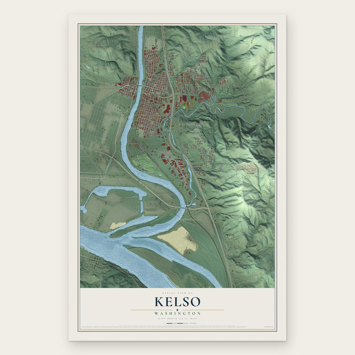
Kelso, Washington Map Art
A new map of Kelso, Washington, made in 2026 and printed to order on thick archival matte paper.
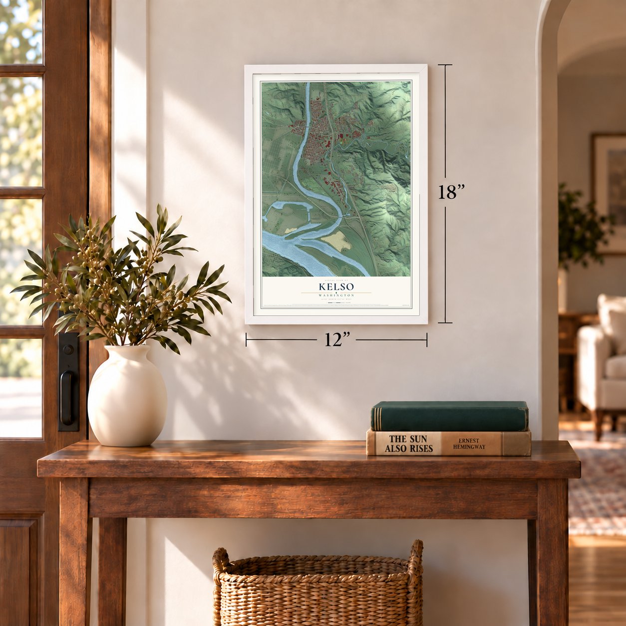
12" x 18" Archival Matte Print
A Map of Home. A Work of Art.
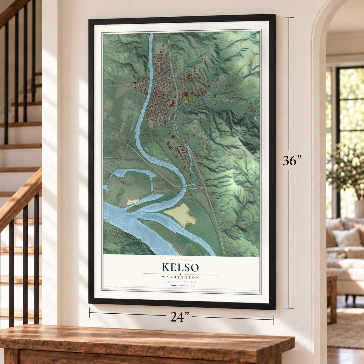
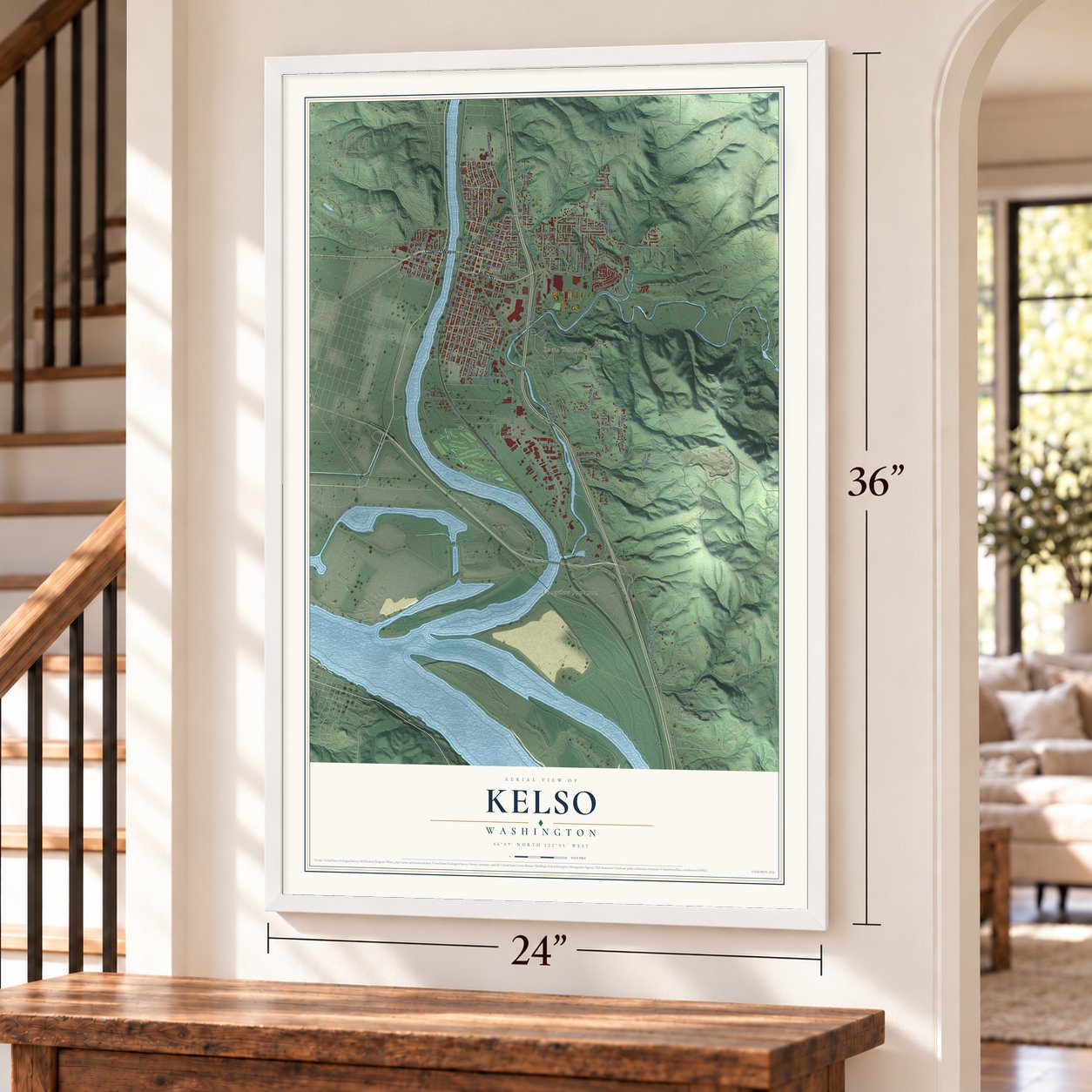
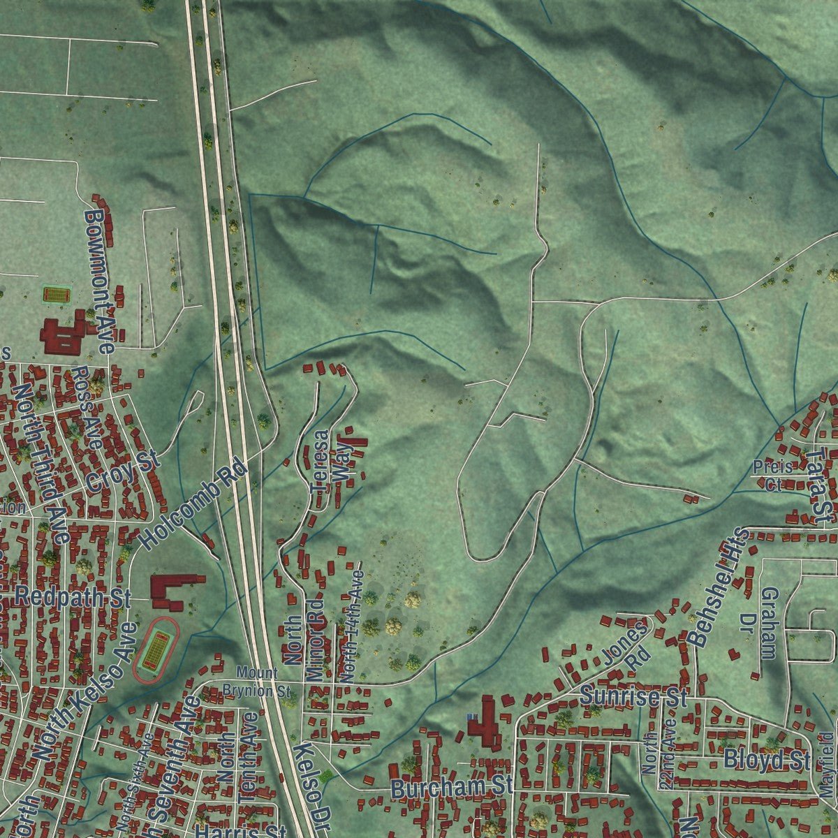
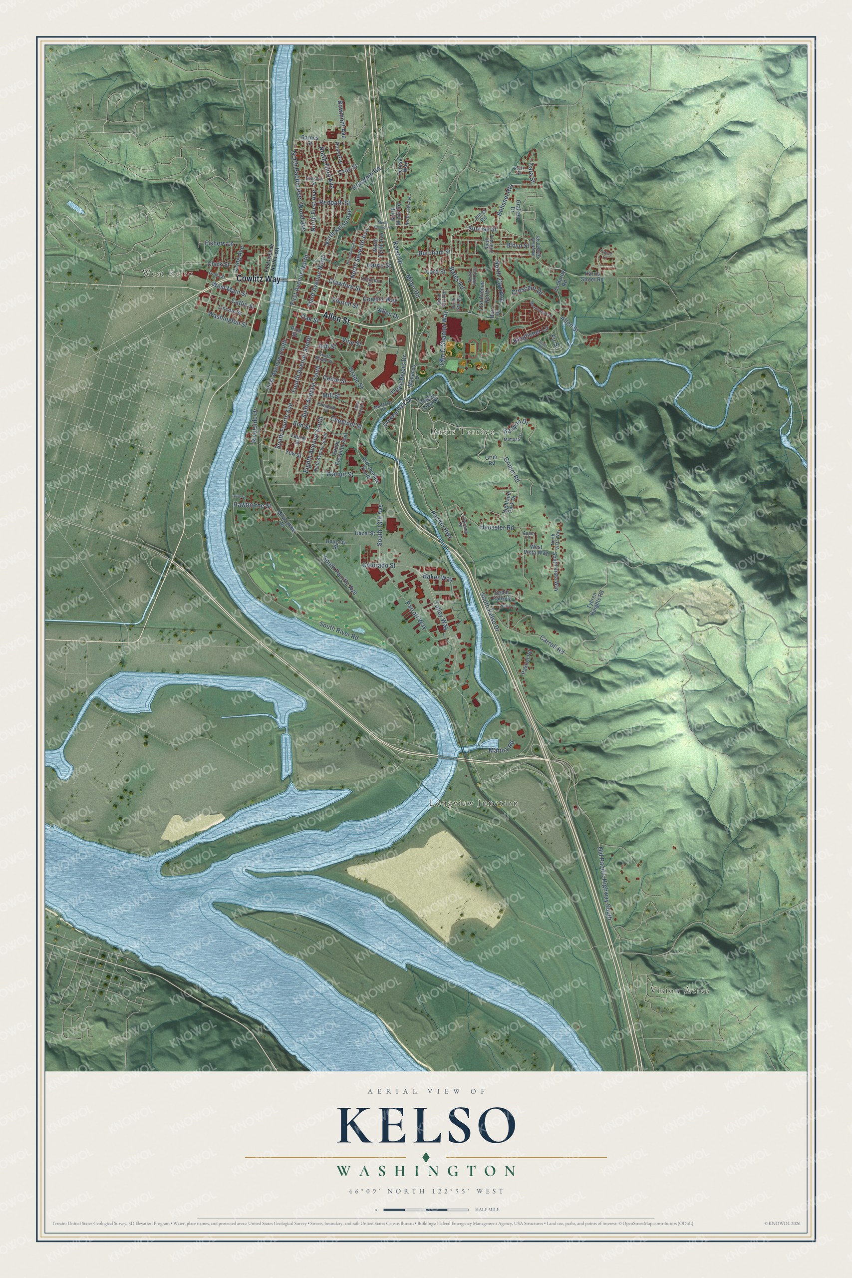
Explore Kelso, Washington from a whole new perspective. Created using aerial imagery and detailed geographic data, this map captures Kelso building by building, with labeled streets, familiar landmarks, and shaded topographical relief that highlights the natural contours of the landscape.
Combining modern data with the timeless character of a vintage atlas, this map is just as interesting up close as it is beautiful on the wall. Whether you grew up in Kelso, spent memorable years there, or call it home today, this unique map is a great way to celebrate a place that means something to you. Zoom in on the preview to look for your street, and then order a print to put your memories on the wall.
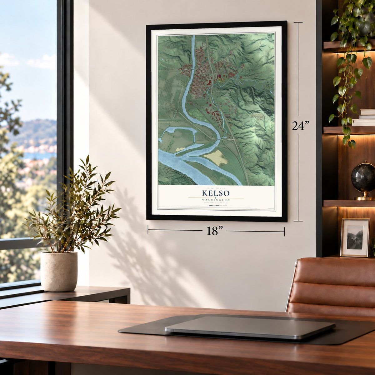
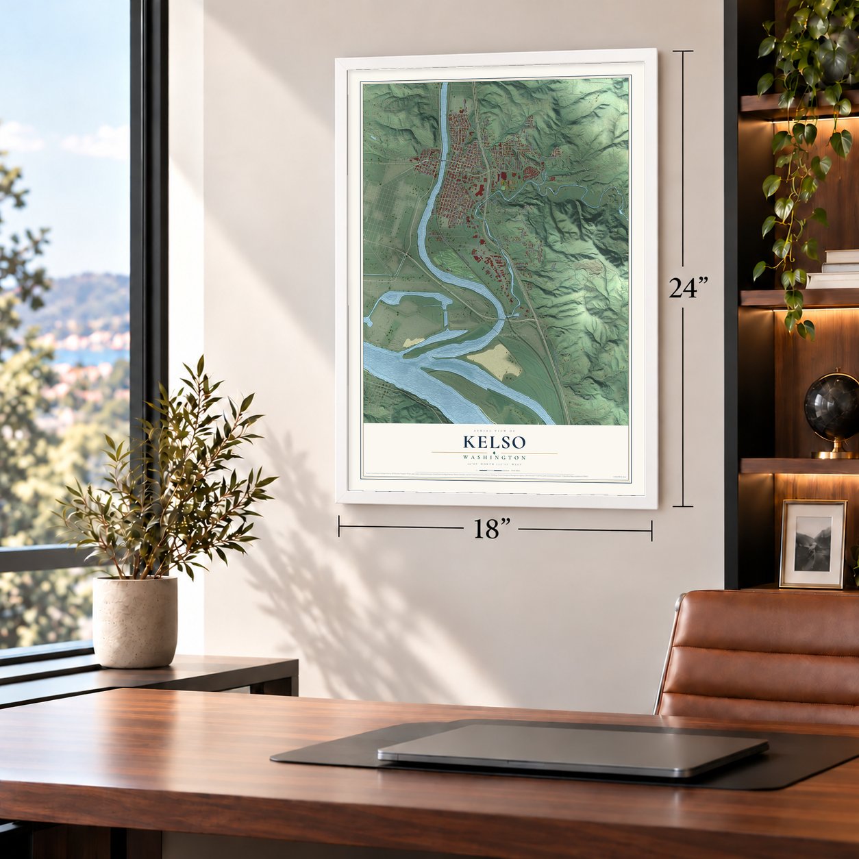
Three ways to hang it
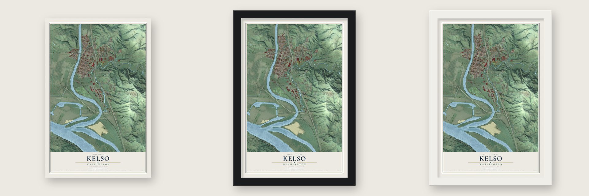
Unframed archival matte, a black wood frame or a white wood frame.
Up close
Geography Worth Displaying
This map was created using accurate cartographic data and authoritative geographic sources, including the U.S. Geological Survey and the Census Bureau. The map brings together terrain, waterways, roads, and building detail. The majority of the streets are labeled, houses are accurately depicted, and the topography is derived from government sources. Combining local data with carefully composed color and shading leads to this beautifully detailed Kelso artwork for your wall.
Rather than simply showing street outlines, we’ve included as many of the street names as we could reasonably fit on the map while keeping their names legible. Zoom in on the high resolution preview to see exactly what’s on the map. We truly set out to create a statement piece for anyone who loves Kelso. So whether it’s for you, or a gift for someone you love, we hope this map of Kelso brings back fond memories.
Read the story behind this map of Kelso, Washington from 2026.

About Kelso, Washington
Kelso is a city of 12,720 people and the seat of Cowlitz County, on the east bank of the Cowlitz River. Its founder, the surveyor Peter W. Crawford, was born near Kelso, Scotland. He traveled west by wagon train and rowed up the Cowlitz with a few other bachelors. On December 25, 1847, he went to Oregon City and filed for his land, the earliest legal claim in the future Cowlitz County.
In 1884 Crawford cut his farm into 500 lots and named the new town for his Scottish home. A. E. Edlin paid $25 for the first lot and opened a general store with a post office, and Crawford gave land for a Presbyterian church, a courthouse and a school that opened in 1887 with 20 pupils. Crawford died on June 10, 1889, and the next spring residents voted 50 to 1 to incorporate. In 1922 voters took the county seat away from Kalama and gave it to Kelso.
“I find them best when cooked Indian stile, which is by roasting a number of them together on a wooden spit without any previous preparing whatever”
- Smelt Capital of the WorldFishermen on the Cowlitz scooped smelt from boats with long-handled dip nets, sometimes landing more than they could easily empty. Salted and boxed, the fish went by rail across the country and to Asia. A smelt-eating contest and a yearly Queen of the Eulachon began in 1952. The catch dropped from up to 6 million pounds a year to 43,000 pounds by 2006, and in 2010, at the Cowlitz tribe's request, the smelt was listed as threatened.
- Known as Little ChicagoLoggers from the hills poured into town on weekends, and West Kelso filled with saloons, card rooms and brothels. Police raided them now and then, but the houses kept running until the FBI made the mayor close them in the 1950s. The Strand Hotel held out until the mid-1960s because its madam paid off the police.
- West Kelso began as CatlinSeth Catlin, born in Massachusetts, reached the Cowlitz with his family two years after Crawford and claimed land that later became West Kelso and most of downtown Longview. Called the Sage of Monticello, he led the upper house of the first territorial legislature. His settlement, known as Catlin, joined Kelso in 1908, once a bridge spanned the river.
- The Allen Street Bridge, 1923The wooden drawbridge that had linked the two sides of the river since 1906 gave way on January 3, 1923, as the Cowlitz ran high against a log jam. It fell at the end of the workday, and 17 people were listed as dead, still the state's deadliest bridge disaster.
- The first skateboard parkVern Salsbury opened the country's first skateboard park in West Kelso in 1966, a wooden track 600 feet long. Ticket sales never paid its costs, and it closed two years later.
Find your street
Names on the Kelso map
Every name below is printed on this map. Look for your street, your school, the park where you played, or the pond down the road.
Places and landmarks4
- West Kelso
- Longview Junction
- Davis Terrace
- Vision Acres
Streets and roads127
- Cowlitz Way
- Allen Street
- Bates Road
- Sunrise Street
- Harris Street
- Talley Way
- Colorado Street
- Coweeman Drive
- West Main Street
- North Pacific Avenue
- Long Avenue
- Grimm Road
- Fir Street
- South Kelso Drive
- South Pacific Avenue
- South River Road
- South 13th Avenue
- Holcomb Road
- Grade Street
- Burcham Street
- Old Pacific Highway South
- Three Rivers Drive
- Minor Road
- First Avenue North
- North First Avenue
- North Third Avenue
- Third Avenue North
- Haussler Road
- Bloyd Street
- Fourth Avenue South
Show all 127 streets
- South Fourth Avenue
- Eighth Avenue South
- Kelso Drive
- North Kelso Avenue
- Sixth Avenue South
- Parrott Way
- Mill Street
- Crawford Street
- Carroll Road
- Cedar Street
- First Avenue South
- Chestnut Street
- Bowmont Avenue
- Tam O'Shanter Way
- Elm Street
- North Seventh Avenue
- Lord Street
- North 23rd Avenue
- Behshel Heights
- Ash Street
- Walnut Street
- Croy Street
- Fishers Lane
- Baker Way
- Banyon Drive
- Church Street
- Oak Street
- Vine Street
- Catlin Street
- Washington Street
- Allen Drive
- Redpath Street
- Crescent Drive
- Wood Avenue
- Riverside Drive
- Kingfisher Lane
- Marina Road
- Hawthorne Street
- Pacific Highway
- Clark Street
- Tara Street
- 13th Avenue South
- Tybren Heights Road
- Grim Road
- South Eleventh Avenue
- North Minor Road
- Manacso Drive
- Ross Avenue
- Laurel Street
- Yew Street
- Lincoln Street
- Highland Park Drive
- Barnes Street
- North Tenth Avenue
- Teresa Way
- Corduroy Road
- 21st Avenue North
- Jones Road
- Cedar Falls Drive
- South Vista Way
- Paxton Road
- Milwaukee Place
- Barr Drive
- Valley View Drive
- West Vista Way
- Pine Street
- Harris Street Road
- Douglas Street
- Graham Drive
- Hazel Street
- Ninth Avenue South
- Columbia Street
- Division Street
- Manasco Drive
- Grant Street
- South Maple Street
- North 19th Avenue
- North 20th Avenue
- Mimosa Drive
- Elizabeth Street
- North 14th Avenue
- Apple Lane
- North 22nd Avenue
- Mayfield Garden Road
- North Vista Way
- Lowraine Drive
- North 17th Avenue
- Preis Court
- First Avenue Northwest
- North Sixth Avenue
- River Road
- Mount Brynion Street
- South Twelfth Avenue
- Meadowlark Lane
- Roley Court
- Olive Street
- Tweed Court
Names are listed as they appear on the printed map. Zoom into the product photos to find them.
The art of mapping a place
How This Map Was Made
Real places. Remarkable detail. Discover the layers that turn geographic data into a map of home.

The view from above
Aerial imagery reveals the character of the land: woodland, open fields, and the patterns of a place.

The shape of the land
Elevation data brings hills, valleys, and subtle changes in the landscape into view.

The details of home
Roads, waterways, and building footprints come together to make the map feel unmistakably local.

Geography becomes art
Considered color, shading, and typography bring the layers together in a map made for your wall.


Process illustrated with Mendon, Massachusetts. Aerial imagery: USDA NAIP. Terrain: USGS 3D Elevation Program. Map details and finished artwork: KNOWOL.
The Details
About This Print
Choose an archival matte print, or a black or white Ayous wood frame. The archival matte print is unframed.
Select your size and finish above to see the matching product image and price.
Materials & Craftsmanship
A contemporary map with the character of a classic atlas, printed on archival matte paper. Optional frames are made from Ayous wood.
Your printed map does not include the watermark shown in the full-map preview.
Shipping & Delivery
Free shipping within the United States. Every print is made to order in the USA.
Buying a gift? Add a note in your cart and we'll include it. We never put prices in the package.
Prints ship within 2 to 3 business days. Allow 7 to 10 days total from ordering for delivery. Timing may vary during holidays or periods of high order volume.
Read our shipping policy.
Returns and damaged prints
Each print is made to order. Change-of-mind refunds are not available after production.
If your print arrives damaged, misprinted or incorrect, contact support@knowol.com within 30 days of receiving it. Include your order number, photos and a description of the issue.
Read our full refund and replacement policy. For questions about your order, email support@knowol.com.
Find your town
Looking for another city?
Find a map of home in our Washington collection, or any town in the country.
Nearby
Maps of towns near Kelso
Know someone from one of these towns? Their map makes a great gift.
 Beacon Hill
, Washington
From $39.99See the map
 Longview
, Washington
From $39.99See the map
 Lexington
, Washington
From $39.99See the map
More maps nearby: Longview Heights, Kalama, Castle Rock, Woodland and Ryderwood.