
Search for another town



Free U.S. delivery 7 to 10 days after you order
Malden, Massachusetts Map Art
Building by building, with labeled streets and shaded relief.
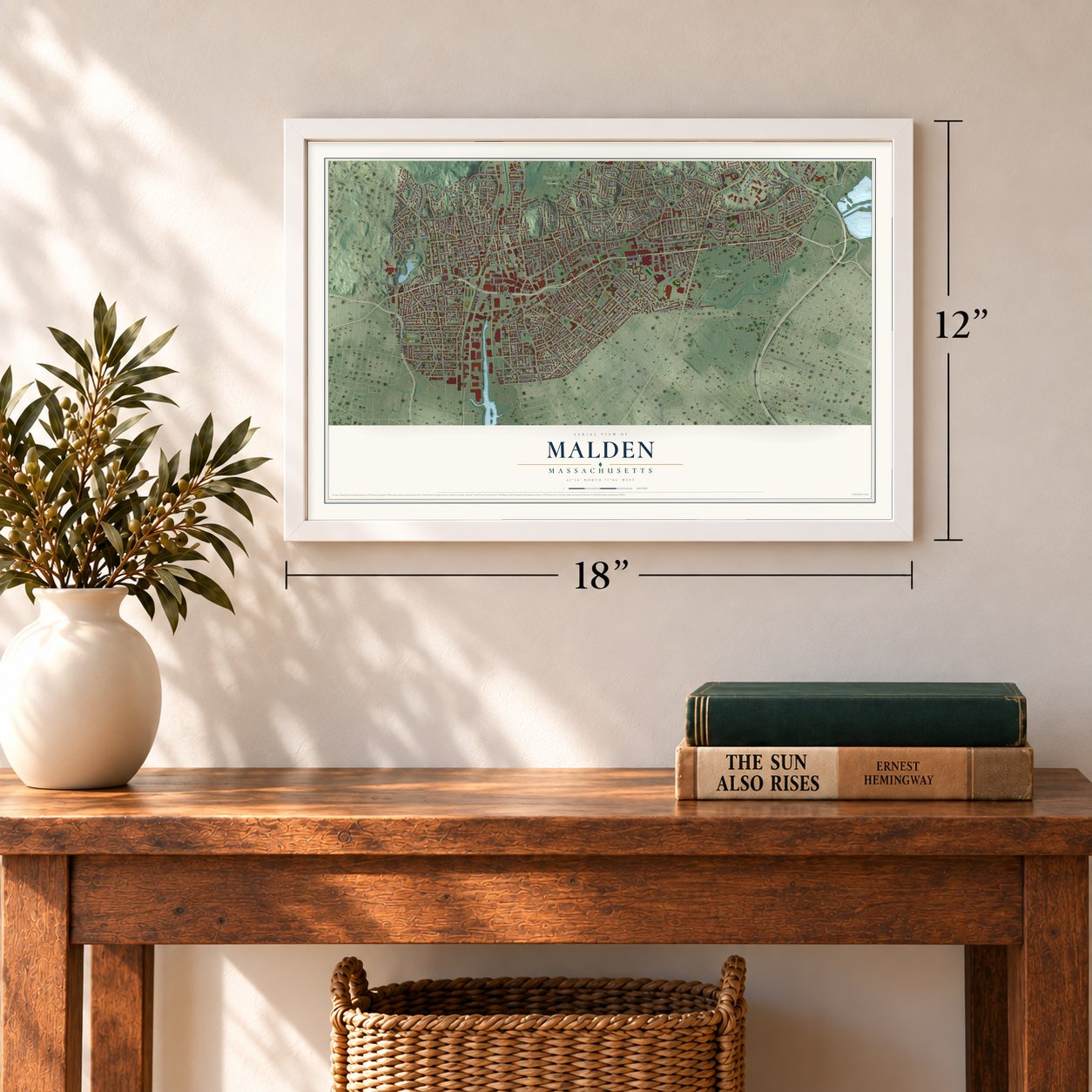
12" x 18" Archival Matte Print
A Map of Home. A Work of Art.
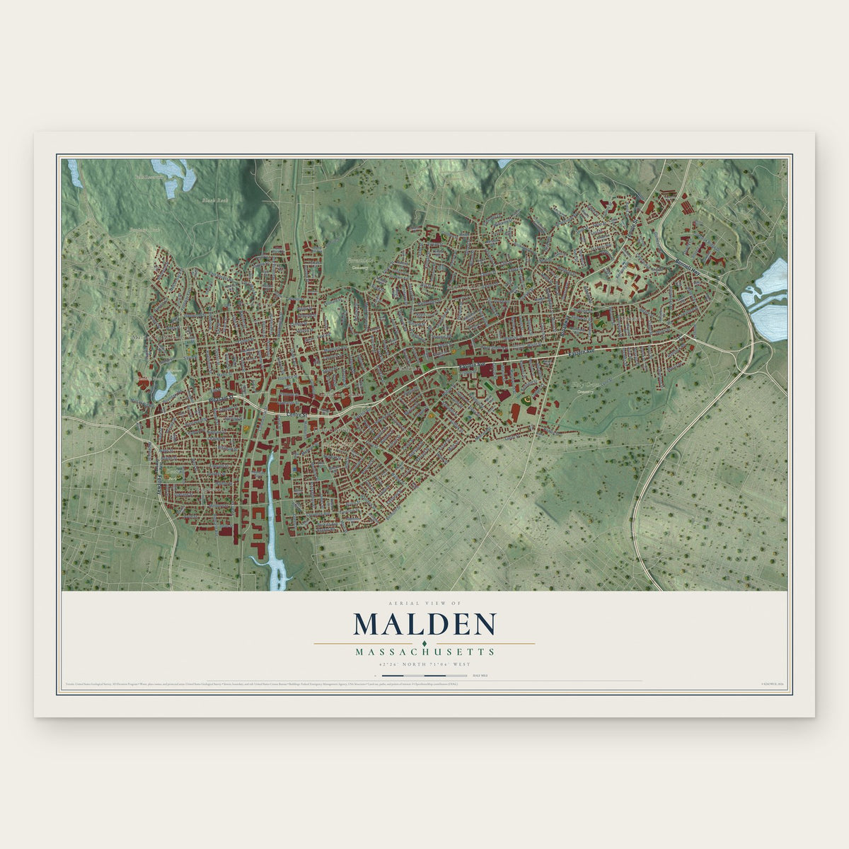
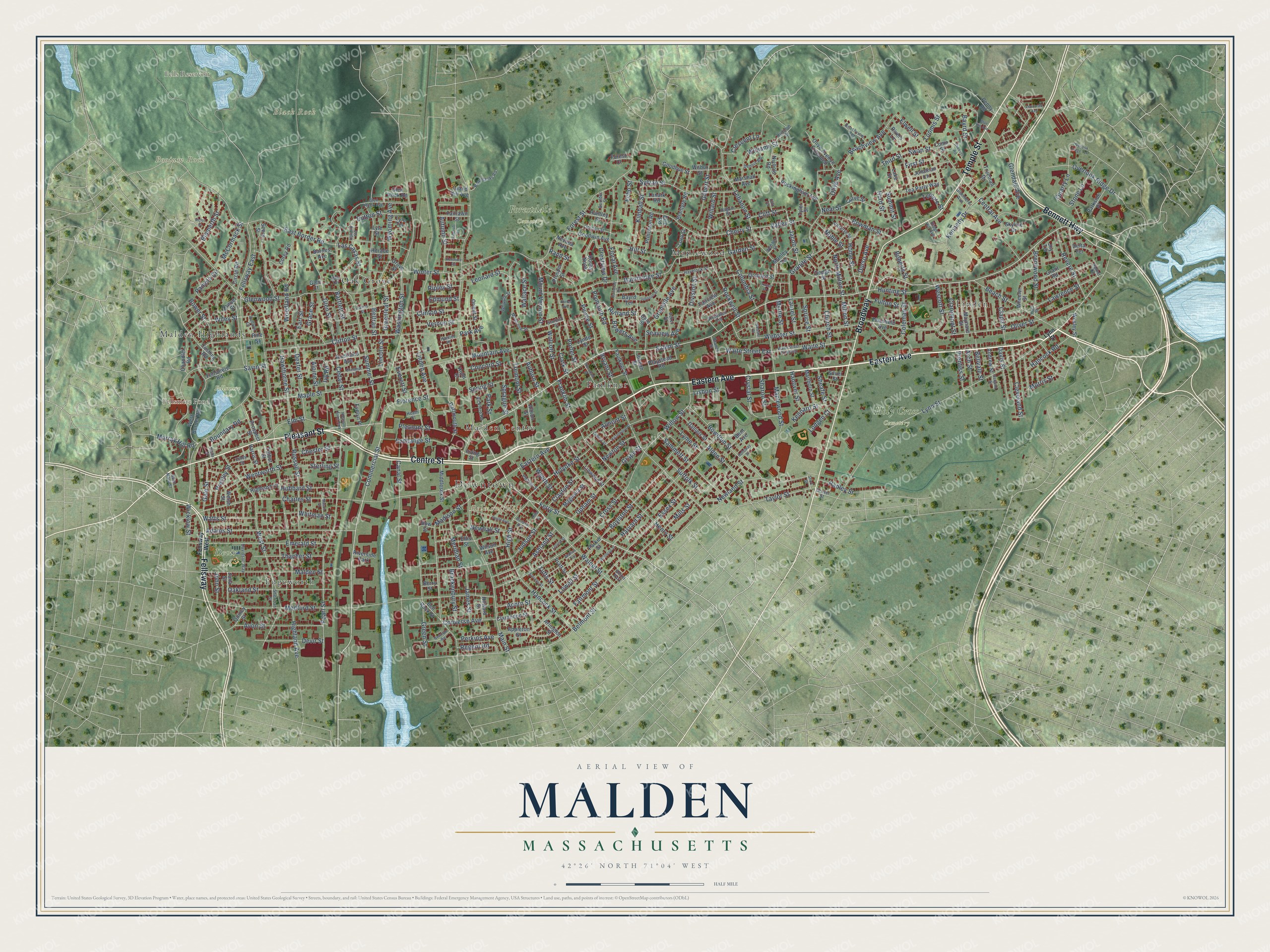
Explore Malden, Massachusetts from a whole new perspective. Created using aerial imagery and detailed geographic data, this map captures Malden building by building, with labeled streets, familiar landmarks, and shaded topographical relief that highlights the natural contours of the landscape.
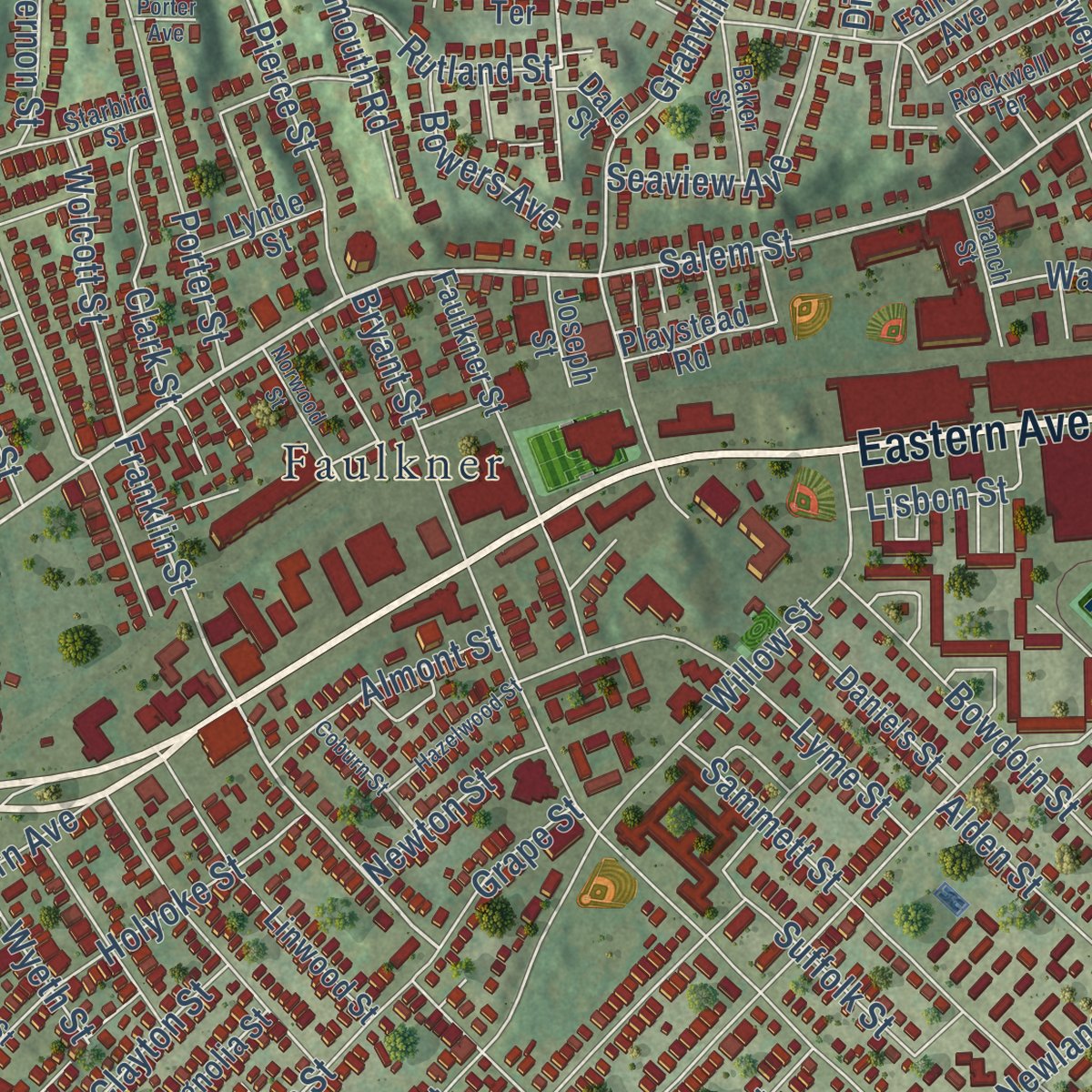
Combining modern data with the timeless character of a vintage atlas, this map is just as interesting up close as it is beautiful on the wall. Whether you grew up in Malden, spent memorable years there, or call it home today, this unique map is a great way to celebrate a place that means something to you. Zoom in on the preview to look for your street, and then order a print to put your memories on the wall.
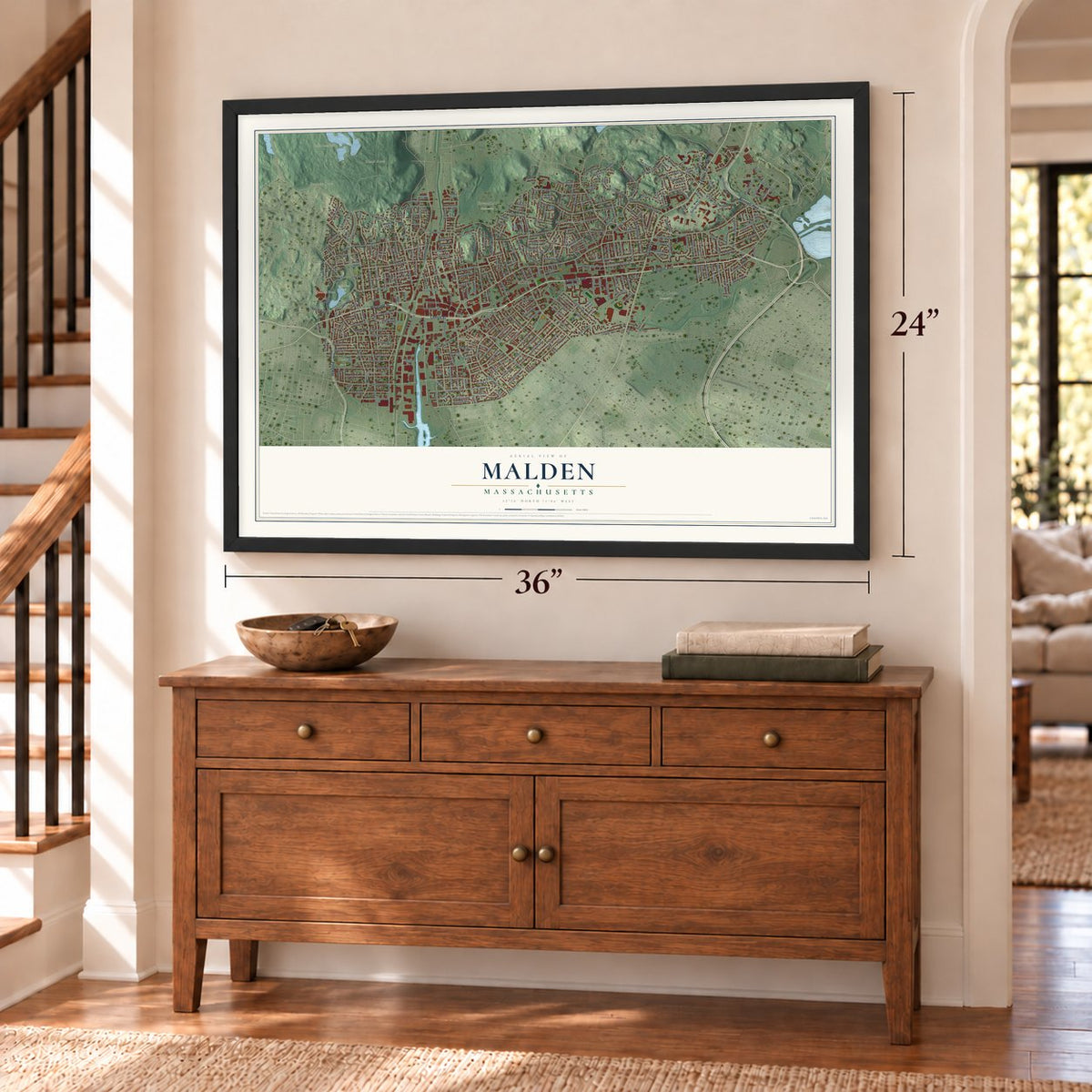
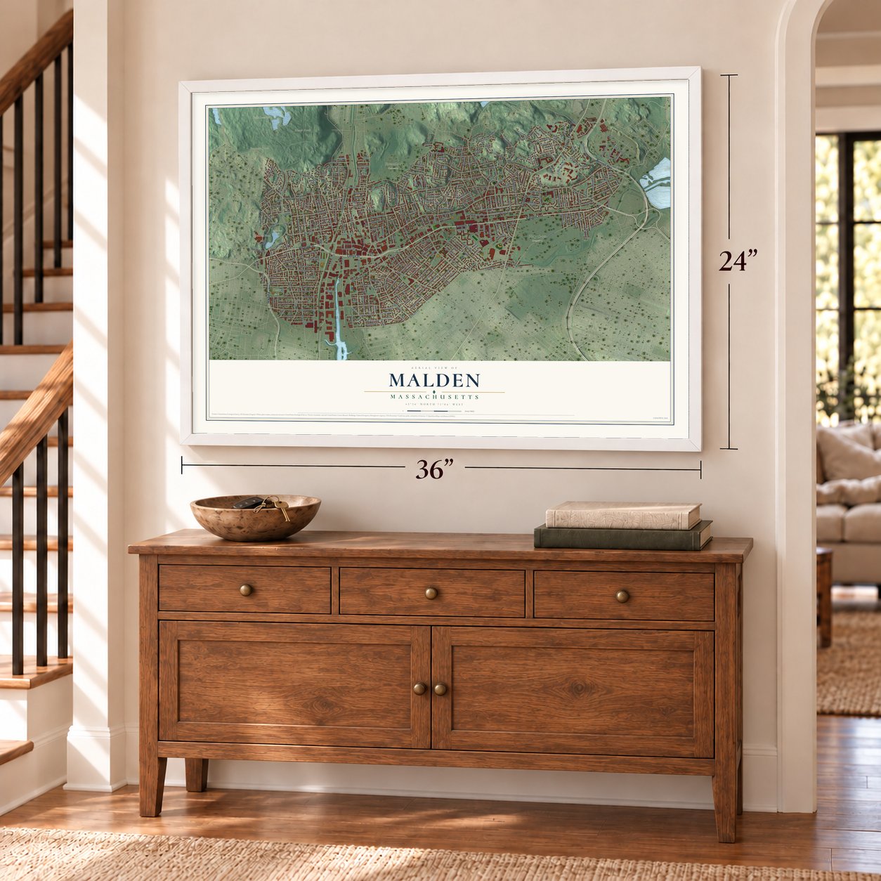
Three ways to hang it
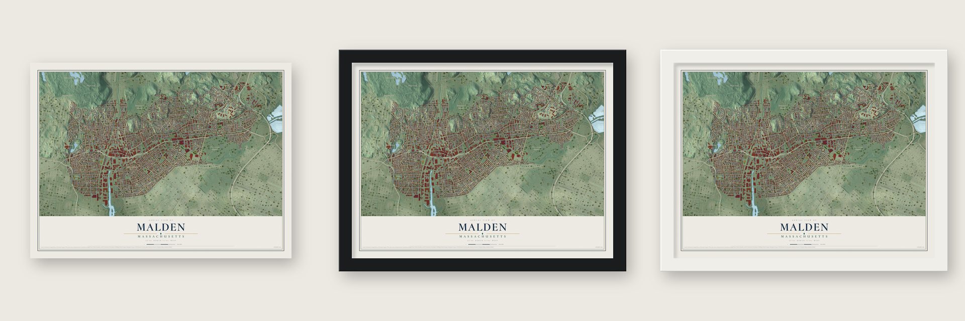
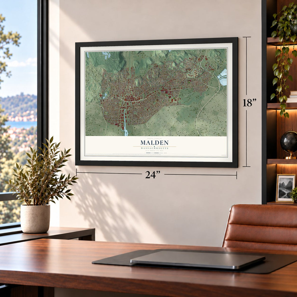
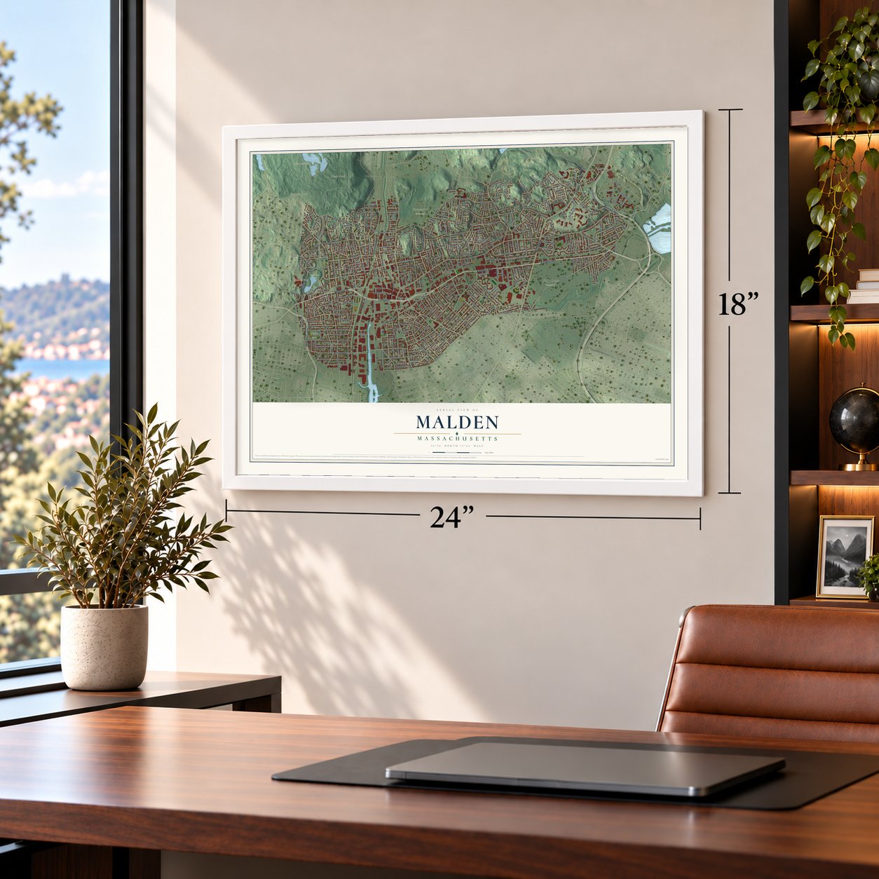
Unframed archival matte, a black wood frame or a white wood frame.
Up close
Geography Worth Displaying
This map was created using accurate cartographic data and authoritative geographic sources, including the U.S. Geological Survey (USGS) and FEMA. The map brings together terrain, waterways, roads, and building detail. The majority of the streets are labeled, houses are accurately depicted, and the topography is derived from government sources. Combining local data with carefully composed color and shading leads to this beautifully detailed Malden artwork for your wall.
Rather than simply showing street outlines, we’ve included as many of the street names as we could reasonably fit on the map while keeping their names legible. Zoom in on the high resolution preview to see exactly what’s on the map. We truly set out to create a statement piece for anyone who loves Malden. So whether it’s for you, or a gift for someone you love, we hope this map of Malden brings back fond memories.
Explore the full map of Malden, Massachusetts and read about the local places it shows.
Find your street
Names on the Malden map
Every name below is printed on this map. Look for your street, your school, the park where you played, or the pond down the road.
Places and landmarks20
- Downtown
- Belmont Hill
- Black Rock
- Boojum Rock
- Fells Reservoir
- Fellsmere Pond
- Fellsmere Park
- Forestdale Cemetery
- Holy Cross Cemetery
- Devir Park
- Linden
- Faulkner
Show all 20 places
- Maplewood
- Oak Grove
- Malden Highlands
- Malden Centre
- Edgeworth
- Riverside Park
- Alcott Park
- Pleasant Saint Park
Streets and roads383
- Eastern Avenue
- Pleasant Street
- Broadway
- Bennett Highway
- Temple Street
- Fellsway
- Centre Street
- Salem Street
- Commercial Street
- Ferry Street
- Lynn Street
- Home Street
- Mount Vernon Street
- Franklin Street
- Jacob Street
- Main Street
- Fellsway East
- Highland Avenue
- Medford Street
- Charles Street
- Cross Street
- Washington Street
- Pearl Street
- Forest Street
- Summer Street
- Kennedy Drive
- Clifton Street
- Lebanon Street
- Bryant Street
- Hawthorne Street
Show all 383 streets
- Bainbridge Street
- Belmont Street
- West Street
- Mountain Avenue
- Glenwood Street
- East Border Road
- Oliver Street
- Harvard Street
- Adams Street
- Tremont Street
- Emerald Street
- Webster Street
- Canal Street
- Madison Street
- Green Street
- Beltran Street
- Cherry Street
- Maplewood Street
- Malden Street
- Newland Street
- Walnut Street
- Maple Street
- Columbia Street
- Central Avenue
- Pierce Street
- Sylvan Street
- Linden Avenue
- Granite Street
- Lawrence Street
- Savin Street
- Oakland Street
- Dexter Street
- Bowdoin Street
- Boylston Street
- Florence Street
- Glen Street
- Glendale Avenue
- Bellvale Street
- Beach Street
- Woodland Road
- Sammett Street
- Floral Avenue
- Russell Street
- Elwell Street
- Avon Street
- Kimball Street
- Granville Avenue
- Suffolk Street
- Converse Avenue
- Rockwell Street
- Wyoming Avenue
- Willow Street
- High Street
- Lyme Street
- Henry Street
- Cedar Street
- Exchange Street
- Waite Street
- Ashland Street
- Coleman Street
- Holyoke Street
- Essex Street
- Beachview Avenue
- Fairmont Street
- Elm Street
- Whitman Street
- Mills Street
- Judson Street
- Overlook Ridge Drive
- Porter Street
- Bowman Street
- Revere Street
- Hancock Street
- Williams Street
- Alden Street
- Neal Street
- Cleveland Street
- Pamela Circle
- Thacher Street
- Devir Street
- Crystal Street
- North Milton Street
- Bower Street
- Stone Lane
- Upham Street
- Valley Street
- Lowell Street
- Dutton Street
- Brentwood Street
- Blomerth Street
- Laurel Street
- Hunting Street
- Taylor Street
- Newhall Street
- Wentworth Street
- Seaview Avenue
- Loomis Street
- Gilbert Street
- Hubbard Street
- Waite Street Extension
- Autumn Street
- Las Casas Street
- Wolcott Street
- Davis Street
- Hancock Road
- Quarry Lane
- Hill Street
- Meridian Street
- McCormack Street
- Clark Street
- Bayrd Street
- James Street
- Watts Street
- Brackenbury Street
- Garden Street
- Plymouth Road
- Sprague Street
- Sheafe Street
- Claremont Street
- Gale Street
- Leonard Street
- Wiley Street
- Cliff Street
- Greenleaf Street
- Crestview Drive
- Clapp Street
- Spring Street
- Durso Avenue
- First Street
- Bartlett Street
- Hadley Street
- Almont Street
- Winter Street
- Church Street
- Wescott Street
- Boundary Road
- Chester Street
- Acorn Street
- Presley Street
- Wallace Street
- Clinton Street
- Perkins Avenue
- Willard Street
- Regent Road
- Vernon Street
- Lincoln Street
- Murray Hill Road
- Clayton Street
- Morris Street
- Sharon Street
- Olive Avenue
- Rutland Street
- Sterling Street
- Lisbon Street
- Bowers Avenue
- Noble Street
- Newton Street
- Hanover Street
- Earl Street
- Prentiss Street
- Grace Street
- Kennard Street
- Fulton Street
- Edmund Street
- Division Street
- Wyeth Street
- Park Street
- Summit Street
- Grape Street
- Concord Street
- Arch Street
- Echo Street
- Crescent Lane
- Spruce Street
- Myrtle Street
- Alpine Street
- Wicklow Street
- Roberts Street
- Auburn Street
- Ripley Street
- Tufts Street
- Ivy Road
- Milton Street
- Swan Street
- John Street
- Everett Street
- Park Avenue
- Lodgen Court
- Hurd Street
- Third Street
- Rand Street
- Dartmouth Street
- Rockland Avenue
- Plainfield Avenue
- West Border Road
- Middlesex Street
- Fairview Avenue
- Bell Rock Street
- Faulkner Street
- Pine Street
- Appleton Street
- Linwood Street
- Fellsmere Road
- Orchard Street
- Trueman Drive
- Daniels Street
- Cushing Road
- Rockingham Avenue
- Maynard Street
- Clarendon Street
- Rocky Nook
- Olive Avenue Extended
- Goodwin Avenue
- Nichols Road
- Corey Road
- Prospect Street
- Chandler Road
- Princeton Road
- Tea Party Way
- Magnolia Street
- Marlboro Street
- Wheeler Street
- Orient Street
- Parkside Place
- Grant Road
- Wilbur Street
- Lyle Street
- Island Hill Avenue
- Welsh Street
- Glen Rock Road
- Fairlawn Street
- Julia Street
- Highland Court
- Blantyre Road
- Talbot Street
- Lanark Road
- Goodhue Street
- Huntley Street
- Jonathan Lane
- Playstead Road
- Pratt Street
- Wilson Avenue
- Circle Road
- Marshall Avenue
- Albion Street
- Prosper Street
- Dodge Street
- Andrew Street
- Barnes Avenue
- Manley Terrace
- Lyle Terrace
- Arlington Street
- Parker Street
- Bayrd Terrace
- Lynde Street
- Wesley Street
- Howard Street
- Skyline Drive
- Bent Avenue
- Sawyer Street
- Harris Street
- Lora Street
- Curve Street
- Evelyn Place
- Lake Street
- Rivers Lane
- Seery Street
- Forest Court
- Ellis Street
- Penny Road
- Joseph Street
- Quincy Street
- Nevada Avenue
- Delta Terrace
- Horace Street
- Holm Court
- Como Street
- Silver Street
- Tyler Street
- Bow Street
- Joy Terrace
- Berry Street
- Grove Street
- Irving Street
- Dale Street
- Glen Court
- Eric Road
- Fellsway West
- Glen Rock Avenue
- Baker Street
- Pine Banks Road
- Gordon Street
- Havelock Street
- Starbird Street
- Pagum Street
- Glenmere Avenue
- Barker Road
- Webber Street
- Reserve Street
- Dennis Road
- Beachview Terrace
- Bickford Road
- Sheridan Street
- Phillips Street
- Davidson Way
- Rockwell Terrace
- Montrose Street
- Boulder Street
- Rudolph Street
- Auburn Court
- Whipple Street
- Estey Street
- Upland Road
- Vista Street
- Hamlet Place
- Ridge Hill Avenue
- Saint Mary Street
- Branch Street
- Grover Street
- Heath Court
- Oak Terrace
- Hall Street
- Johnson Street
- Waite Street Extended
- Francis Street
- Gould Avenue
- Newman Road
- Blue Hill Avenue
- Stevens Street
- Hazelwood Street
- Chestnut Street
- Winthrop Street
- Norwood Street
- Coburn Street
- Cheever Road
- Leland Street
- Garland Avenue
- Hillcroft Road
- Baincroft Road
- Overlook Ridge Terrace
- Leonardo Avenue
- Kenmore Road
- Victor Street
- Mason Street
- Holloway Street
- Louise Court
- Webster Place
- Sargent Street
- Walnut Terrace
- Cliff Terrace
- Short Street
- Porter Avenue
- Hills Court
Names are listed as they appear on the printed map. Zoom into the product photos to find them.
About Malden, Massachusetts
Malden is a city of 66,263 people in Middlesex County, on hilly ground north of the Mystic River. Puritans settled here in 1640 on land that the Mystic people, part of the Pawtucket Confederation, had sold in 1629, and the place was first called the Mistick Side of Charlestown. It became a town of its own in 1649, spelled Mauldon, after early landholder Joseph Hills borrowed the name of Maldon in England.
When the Revolution came, about 1,000 people lived here, and in 1770 they gave up tea to protest the Revenue Act. The town of 3,030 people in 1840 later lost its north end, which became Melrose in 1850, and its south end, which became Everett in 1870. Malden became a city in 1881, and by its 250th birthday in 1899 the three places held about 70,000 people.
“From Cambridge, the Star made his Remove, till he comes to dispense his Sweet Influences, upon thee, O Maldon! And he was thy Faithful One, for about a Jubilee of years together.”
- The bell on the rockMalden's first meetinghouse sat beside a rocky ledge on Bailey's Hill. In November 1658 the selectmen engaged Job Lane for a new one, thirty-three feet square, with a bell turret that was never built. The bell hung in a frame on the ledge instead, named Bell Rock ever since. Thomas Dunnell, the first bellman on record, was chosen in 1690 at one pound fifteen shillings yearly to ring it and sweep the meetinghouse.
- The Day of DoomMichael Wigglesworth, young and sickly, left Cambridge in 1656 to become Malden's minister and served nearly fifty years. His long poem on the Last Judgment, The Day of Doom, came out in 1662, and its first 1,800 copies sold within a year, about one for every thirty-fifth New Englander. After he died on June 10, 1705, Cotton Mather preached his memorial sermon by Bell Rock.
- Rubber and a first mayorElisha S. Converse opened the Boston Rubber Shoe Company at Edgeworth in 1853. With 3,500 workers at its peak, it ranked among the nation's biggest rubber makers, and in 1881 Converse was elected the new city's first mayor. With his wife Mary he gave a library in memory of their son Frank, built of brown Longmeadow sandstone to Henry Hobson Richardson's design. It opened in 1885, the last library Richardson designed.
- Birthplace of the All-StarIn 1908 a second Converse, Marquis Mills Converse, set up his own firm in Malden, the Converse Rubber Shoe Company. Its factory stood at the foot of Pearl Street in Edgeworth, and the company's All-Star basketball shoe was first made there, arriving in 1917.
- A Bible in BurmeseAdoniram Judson, son of a Congregational minister, was born in Malden on August 9, 1788. At 25 he went to Burma as a Baptist missionary and stayed almost 40 years, spending 24 of them translating the whole Bible into Burmese, a task he completed in 1834.
Keep exploring Massachusetts
Malden is one of 470 Massachusetts towns we've mapped. Every dot on the map is a print of its own.
The search covers every state, Massachusetts first.
Near Malden
Order 2 or more town maps and save 10%. Shown in the size and finish you picked above, so they hang as a set.
- Everett 12" x 18" / Archival Matte Print $39.99
- Melrose 12" x 18" / Archival Matte Print $39.99
- Medford 12" x 18" / Archival Matte Print $39.99


More maps nearby: Chelsea, Ten Hills, Winter Hill, East Somerville and Charlestown.
The art of mapping a place
How This Map Was Made
Real places. Remarkable detail. Discover the layers that turn geographic data into a map of home.

The view from above
Aerial imagery reveals the character of the land: woodland, open fields, and the patterns of a place.

The shape of the land
Elevation data brings hills, valleys, and subtle changes in the landscape into view.

The details of home
Roads, waterways, and building footprints come together to make the map feel unmistakably local.

Geography becomes art
Considered color, shading, and typography bring the layers together in a map made for your wall.


Process illustrated with Mendon, Massachusetts. Aerial imagery: USDA NAIP. Terrain: USGS 3D Elevation Program. Map details and finished artwork: KNOWOL.
The Details
About This Print
Choose an archival matte print, or a black or white Ayous wood frame. The archival matte print is unframed.
Select your size and finish above to see the matching product image and price.
Materials & Craftsmanship
A contemporary map with the character of a classic atlas, printed on archival matte paper. Optional frames are made from Ayous wood.
Your printed map does not include the watermark shown in the full-map preview.
Shipping & Delivery
Free shipping within the United States. Every print is made to order in the USA.
Buying a gift? Add a note in your cart and we'll include it. We never put prices in the package.
Prints ship within 2 to 3 business days. Allow 7 to 10 days total from ordering for delivery. Timing may vary during holidays or periods of high order volume.
Read our shipping policy.
Returns and damaged prints
Each print is made to order. Change-of-mind refunds are not available after production.
If your print arrives damaged, misprinted or incorrect, contact support@knowol.com within 30 days of receiving it. Include your order number, photos and a description of the issue.
Read our full refund and replacement policy. For questions about your order, email support@knowol.com.