
Search for another town


Free U.S. delivery 7 to 10 days after you order
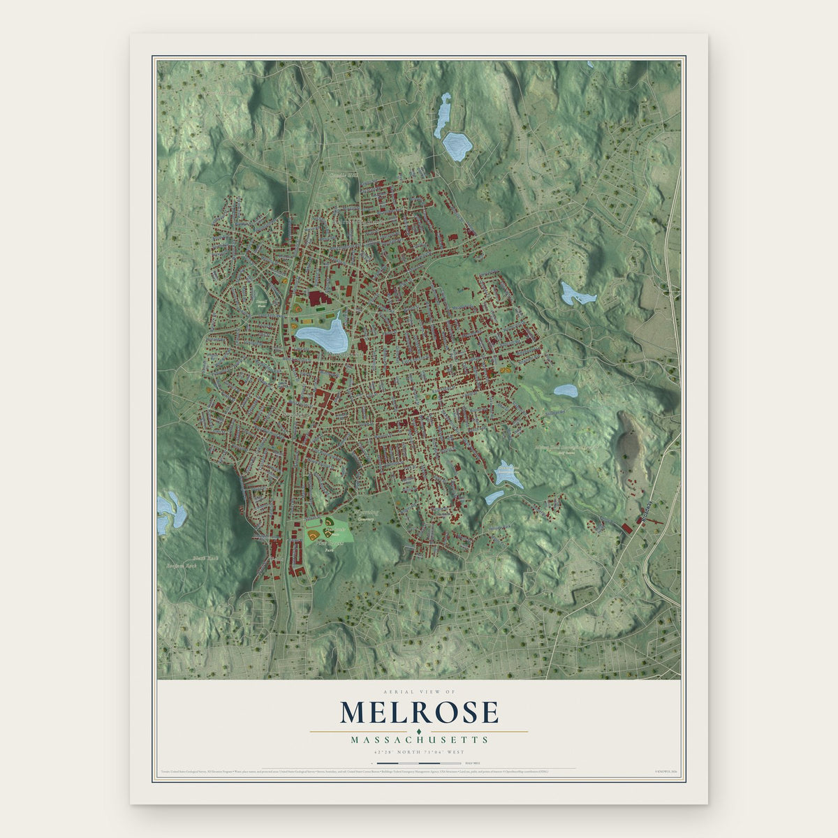
Melrose, Massachusetts Map Art
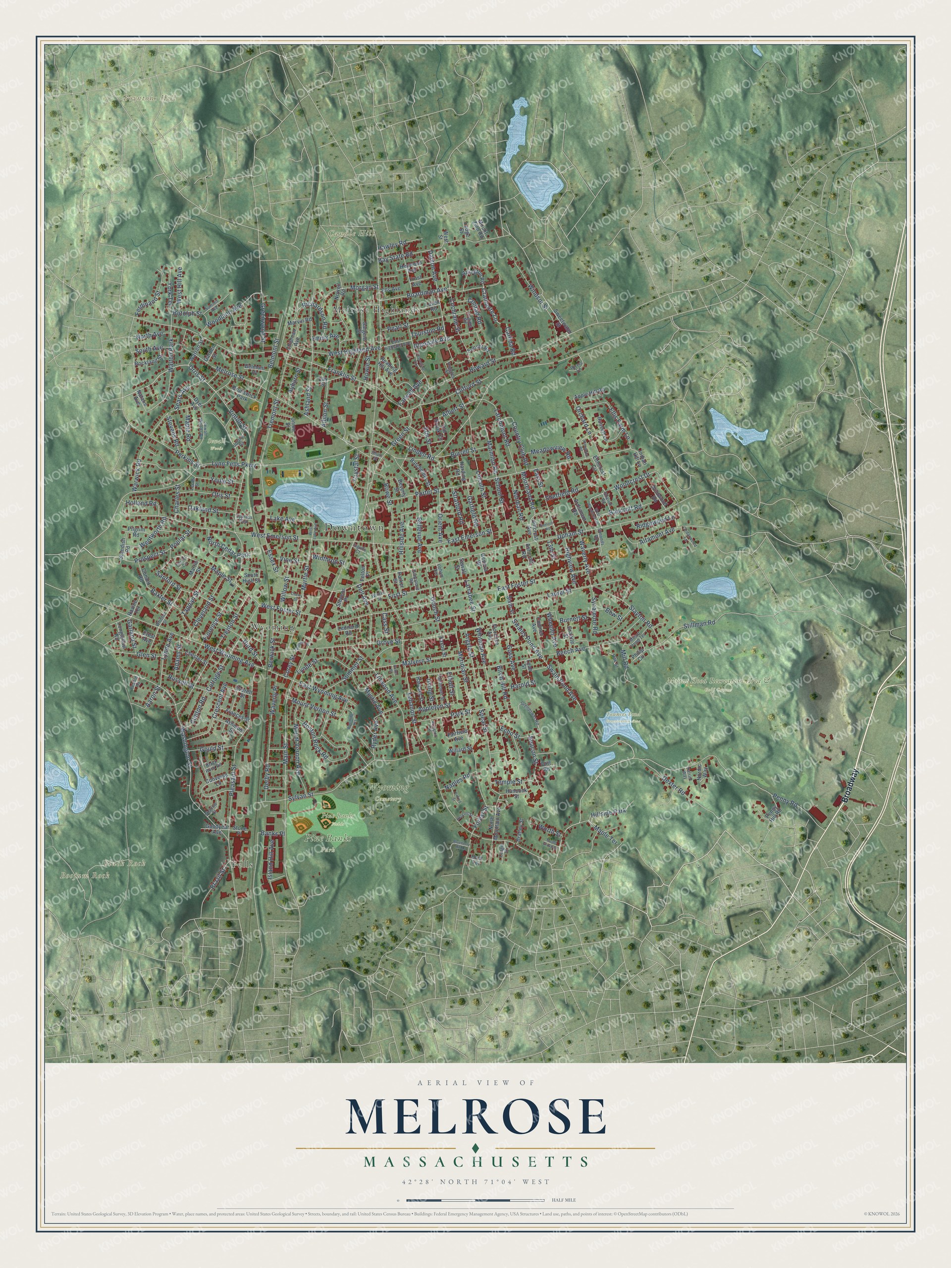
Building by building, with labeled streets and shaded relief.
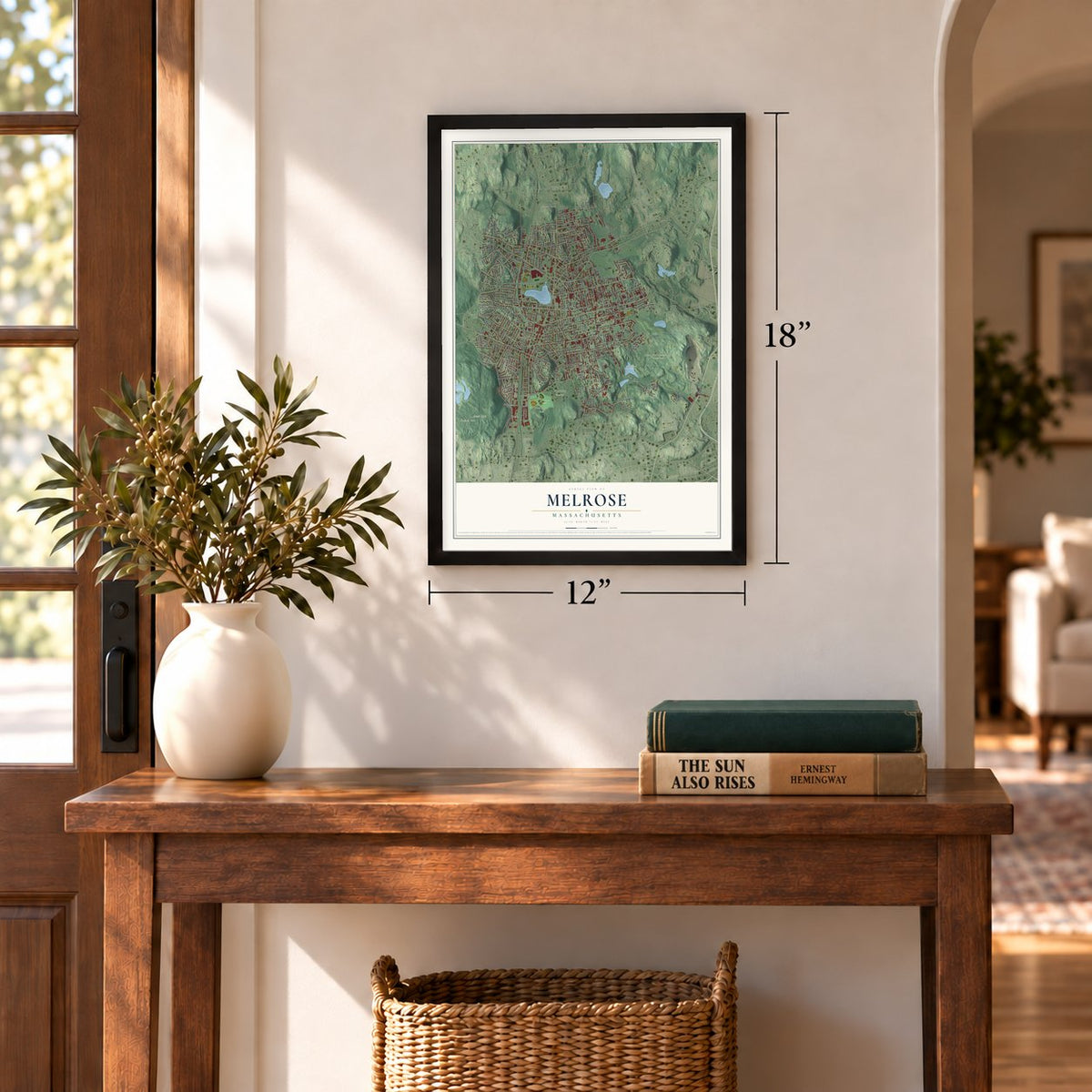
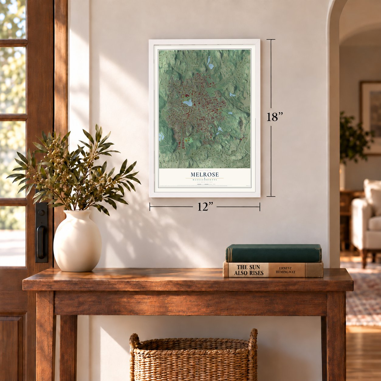
12" x 18" Archival Matte Print
A Map of Home. A Work of Art.
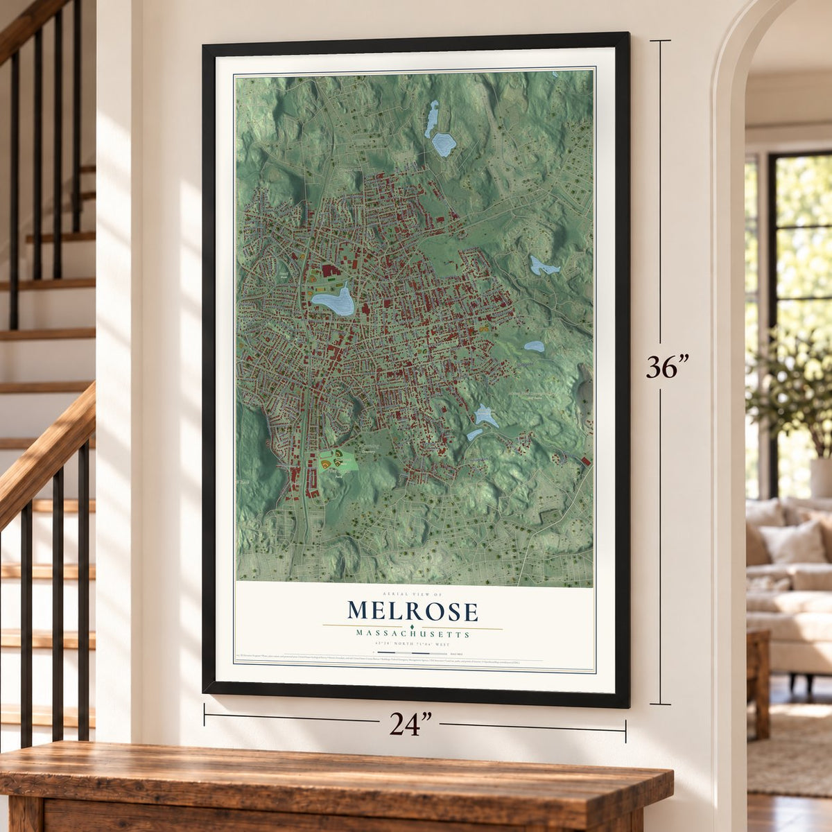
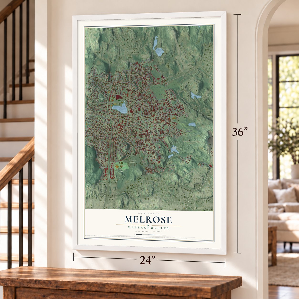
Explore Melrose, Massachusetts from a whole new perspective. Created using aerial imagery and detailed geographic data, this map captures Melrose building by building, with labeled streets, familiar landmarks, and shaded topographical relief that highlights the natural contours of the landscape.
Combining modern data with the timeless character of a vintage atlas, this map is just as interesting up close as it is beautiful on the wall. Whether you grew up in Melrose, spent memorable years there, or call it home today, this unique map is a great way to celebrate a place that means something to you. Zoom in on the preview to look for your street, and then order a print to put your memories on the wall.
Three ways to hang it
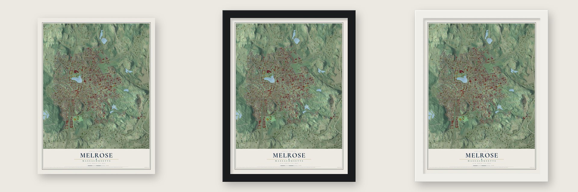
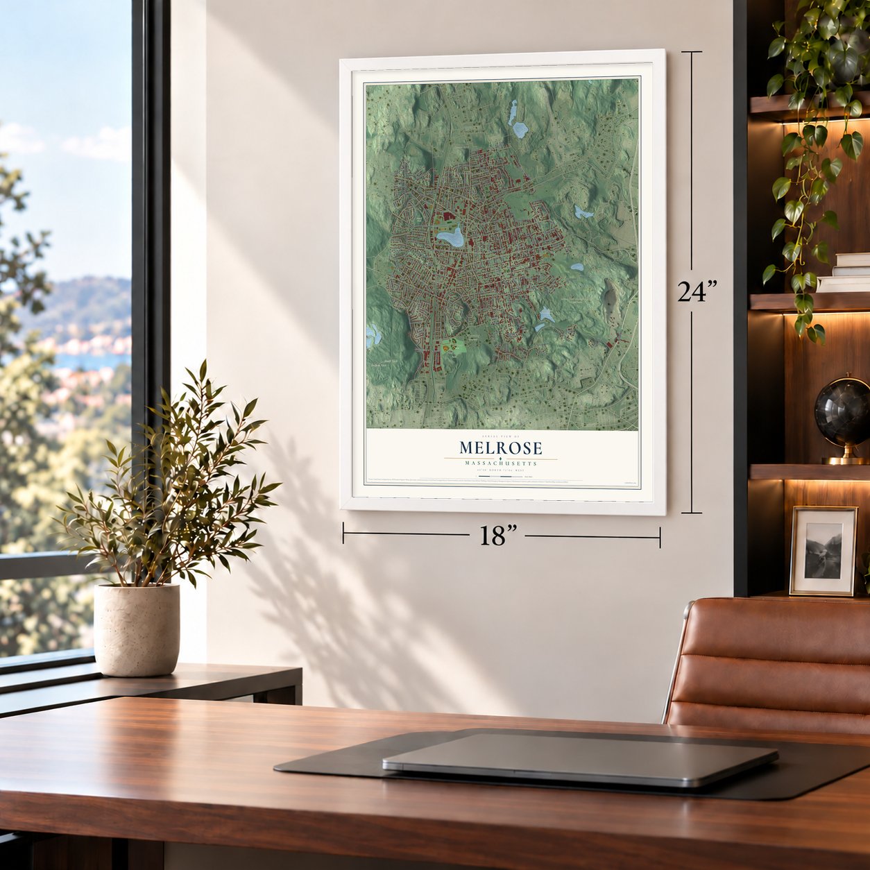
Unframed archival matte, a black wood frame or a white wood frame.
Up close
Geography Worth Displaying
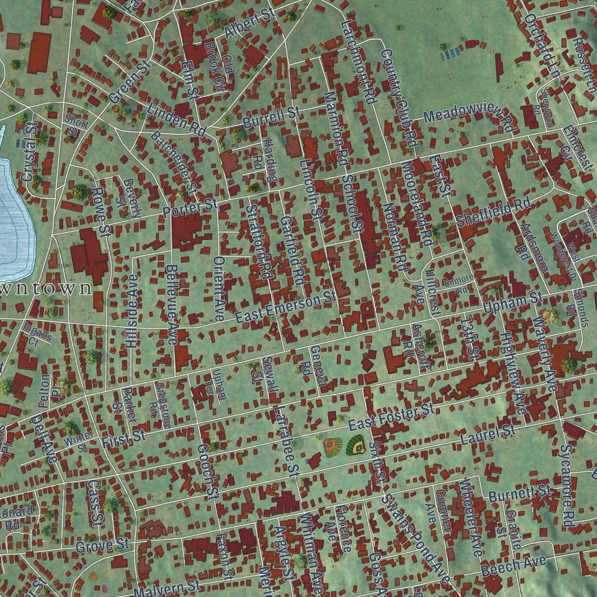
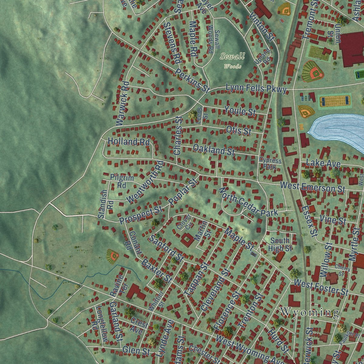
This map was created using accurate cartographic data and authoritative geographic sources, including the U.S. Geological Survey (USGS) and FEMA. The map brings together terrain, waterways, roads, and building detail. The majority of the streets are labeled, houses are accurately depicted, and the topography is derived from government sources. Combining local data with carefully composed color and shading leads to this beautifully detailed Melrose artwork for your wall.
Rather than simply showing street outlines, we’ve included as many of the street names as we could reasonably fit on the map while keeping their names legible. Zoom in on the high resolution preview to see exactly what’s on the map. We truly set out to create a statement piece for anyone who loves Melrose. So whether it’s for you, or a gift for someone you love, we hope this map of Melrose brings back fond memories.
Explore the full map of Melrose, Massachusetts and read about the local places it shows.

Find your street
Names on the Melrose map
Every name below is printed on this map. Look for your street, your school, the park where you played, or the pond down the road.
Places and landmarks19
- Downtown
- Black Rock
- Boojum Rock
- Boyntons Hill
- Candle Hill
- Mount Hood Recreation Area & Golf Course
- Pine Banks Park
- Pine Banks Fields
- Towners Pond Conservation Area
- Wyoming Cemetery
- Sewall Woods
- Wyoming
Show all 19 places
- Fells
- Melrose Highlands
- Walton Park
- North Cedar Park
- Hillside Park
- Brunswick Park
- Cypress Park
Streets and roads287
- Broadway
- Park Street
- Orris Street
- Cranmore Lane
- Main Street
- Lynn Fells Parkway
- Lebanon Street
- Upham Street
- Swain Pond Avenue
- Swains Pond Avenue
- East Foster Street
- Grove Street
- Washington Street
- Porter Street
- Vinton Street
- Franklin Street
- Laurel Street
- West Emerson Street
- Beech Avenue
- Melrose Street
- First Street
- Penny Road
- West Wyoming Avenue
- Tremont Street
- Howard Street
- Sylvan Street
- Pleasant Street
- Whitman Avenue
- Warwick Road
- Bellevue Avenue
Show all 287 streets
- East Emerson Street
- Trenton Street
- Green Street
- Boston Rock Road
- Stillman Road
- Lincoln Street
- Linwood Avenue
- Boardman Avenue
- Damon Avenue
- Bay State Road
- Ashland Street
- Lynde Street
- Forest Street
- Dexter Road
- Woodcrest Drive
- Myrtle Street
- Florence Street
- Rowe Street
- Youle Street
- Cottage Street
- Cochrane Street
- Essex Street
- Linden Road
- Country Club Road
- Windsor Street
- Mount Vernon Avenue
- Maple Street
- Sycamore Road
- Slayton Road
- West Foster Street
- Sheffield Road
- Pearl Street
- Spear Street
- West Highland Avenue
- Altamont Avenue
- Malvern Street
- Larchmont Road
- Derby Road
- Meridian Street
- Ellis Farm Lane
- Perkins Street
- Crescent Avenue
- Sanford Street
- Glendale Avenue
- Hillside Avenue
- Cleveland Street
- Banks Place
- East Street
- Clifford Street
- Stratford Road
- School Street
- Gooch Street
- Morgan Street
- Richardson Road
- Hurd Street
- Woodland Avenue
- Wheeler Avenue
- East Wyoming Avenue
- Goss Avenue
- Albion Street
- Elm Street
- Bancroft Road
- Orchard Lane
- Berwick Street
- Russell Street
- Ferdinand Street
- Dell Avenue
- Otis Street
- Island Hill Avenue
- Oakland Street
- Baxter Street
- Ridgewood Lane
- Argyle Street
- Norman Road
- Beacon Street
- Mystic Avenue
- Botolph Street
- Belmont Street
- Lynde Avenue
- Greenwood Street
- Mount Vernon Street
- Tappan Street
- Burrell Street
- Meadowview Road
- Highview Avenue
- Waverly Avenue
- Prospect Street
- Wentworth Road
- Marmion Road
- Glen Street
- Summer Street
- Orient Avenue
- Birch Hill Road
- Mill Road
- Garfield Road
- Brazil Street
- Gould Street
- Willow Street
- Larrabee Street
- Crystal Street
- Burnett Street
- Clinton Road
- Albert Street
- York Terrace
- Hawley Road
- West Hill Avenue
- Maple Road
- Mooreland Road
- Lake Avenue
- Conrad Road
- Temple Street
- Henry Avenue
- Holland Road
- Sears Avenue
- Waverly Place
- Adams Street
- Ryder Avenue
- Echo Street
- Naples Road
- Poplar Street
- Appleton Street
- Harold Street
- Aaron Street
- Stevens Road
- Farwell Avenue
- Garland Street
- Auburn Street
- Winthrop Street
- South Avenue
- Maple Terrace
- Vine Street
- North Avenue
- Charles Street
- Worth Street
- Elliott Street
- Thurston Road
- Carlida Road
- Howie Street
- Irving Street
- Cass Street
- Bow Street
- Corey Street
- 13th Street
- Heywood Avenue
- Sargent Street
- Ardsmoor Road
- Converse Lane
- Lovell Road
- Nowell Road
- Marvin Road
- Old Brook Circle
- Granite Street
- Sweetwater Street
- Sixth Street
- Russett Lane
- Penny Hill Road
- Arlington Road
- Hillcrest Avenue
- Leonard Road
- Reading Hill Avenue
- Cumner Avenue
- Wildwood Road
- Batchelder Street
- Rockland Street
- Chipman Avenue
- Frances Street
- Sunset Road
- North Mountain Avenue
- Ashmont Street
- Union Street
- Conant Road
- Harvard Street
- Fairfield Avenue
- Warren Street
- Harding Road
- Apple Hill Road
- Chester Street
- Beverly Street
- Philip Circle
- South High Street
- Longfellow Road
- Dyer Avenue
- Everett Street
- Standish Road
- Goodyear Avenue
- Bratley Street
- Hancock Street
- Frost Avenue
- Willard Street
- Belmont Place
- Pilgrim Road
- Crest Avenue
- Leah Street
- Ashcroft Road
- Nordic Way
- Geneva Road
- Sewall Street
- Faxon Street
- Mount Zion Road
- Parker Street
- Elmcrest Circle
- Ravine Terrace
- Natalie Avenue
- Ells Avenue
- Florence Avenue
- Stone Place
- Garden Street
- Stevens Place
- Indian Hill Lane
- Martin Street
- Cliff Road
- Day Street
- Ledge Street
- Felton Place
- Hunt Terrace
- West Street
- Sewall Woods Road
- Glendower Road
- Mount Hood Terrace
- Whittier Street
- Upland Road
- Simonds Road
- Fairmount Street
- East Highland Avenue
- Black Rock Road
- Summit Avenue
- Rivers Lane
- Shadow Street
- Cedarwood Lane
- Ruggles Street
- Winter Street
- Greystone Road
- Oak Street
- Sharon Road
- Virginia Road
- Cargill Street
- Upham Terrace
- Ingalls Court
- Pebble Road
- Leeds Street
- Patriot Way
- Clover Circle
- Short Street
- Hesseltine Avenue
- Sherwood Road
- Blueberry Hill Lane
- West Woodcrest Drive
- Wyoming Heights
- Hopkins Street
- Enmore Road
- Faulkner Place
- Cherry Street
- West Lake Avenue
- Oxford Street
- Arlington Street
- Maple Grove Street
- Potter Street
Names are listed as they appear on the printed map. Zoom into the product photos to find them.
About Melrose, Massachusetts
Melrose is a city of 29,817 people in Middlesex County, about seven miles north of Boston. In 1628 Richard and Ralph Sprague explored the valley above the Mystic River, and its first name, Ponde Fielde, came from its many ponds and streams. The land joined Charlestown in 1633, and when Malden became a separate town in 1649, most of it went along as North Malden, a quiet district of farms.
That changed once the Boston and Maine Railroad opened three stops here by 1845, because Boston workers who wanted country air could now live here and ride the train into the city. North Malden grew, broke away from Malden and became the town of Melrose on May 3, 1850. Melrose took the Highlands from Stoneham in 1853 and became the 33rd city in Massachusetts in 1899. Its first mayor, Levi S. Gould, began his term on January 1, 1900.
“Thus early known and named let us reverence and continue the old name and not try to change it for something a little more mellifluous, possibly.”
- A name from ScotlandWilliam Bogle, a Glasgow native, took the stagecoach to his Boston business before the railroad arrived. He championed the name Melrose, for the Scottish burgh whose Eildon hills looked like this valley, and as one no other American town used. Bogle and three others settled the question at John Shelton's home on Lake Avenue. The name was in use by May 1849, when the Trustees of the Melrose Town Clock signed for a steeple clock, a year before incorporation.
- Ell Pond since 1638Charlestown records mention Ell Pond, so called for its L shape, by 1638. By 1663 Samuel Howard had built a dam at its outlet to run a sawmill. Shad and alewives once swam up the brooks into the pond, and when mill owners resisted fish ladders, people reportedly carried the fish in tubs of water. The Crystal Lake Boat Club began racing there in 1874, and some tried to rename the pond, but the old name won.
- Bear Hill becomes Mount HoodMount Hood was once Bear Hill. Around 1887 Wendell P. Hood put a small house on the summit with a well and fruit trees, but it burned and the hill went wild. In the 1930s Works Progress Administration crews built nine holes of golf, a toboggan run and a ski jump. Lookouts in Slayton Tower scanned the sea for U-boats during World War II. Today the course has 18 holes, and sledders fill it in winter.
- A merchant's summer houseBoston merchant William Foster built the Beebe Estate in 1828 as a Greek Revival summer house. Its cupola was modeled on an ancient monument in Athens, the Choragic Monument of Lysicrates. In 1963 the Beebe family handed the house over to the city, which now uses it for local art and events. It joined the National Register in 1981.
- The Phineas Upham HouseThis First Period house on Upham Street dates from the early 1700s. Local historians long credited Phineas Upham with building it around 1703, but its construction suggests he put it up in the late 1730s for his son Amos. The Melrose Historical Society purchased and restored the house in 1913, and since 1940 it has belonged to an Upham family association. It joined the National Register in 1990.
Keep exploring Massachusetts
Melrose is one of 461 Massachusetts towns we've mapped. Every dot on the map is a print of its own.
The search covers every state, Massachusetts first.
Near Melrose
Order 2 or more town maps and save 10%. Shown in the size and finish you picked above, so they hang as a set.
- Malden 12" x 18" / Archival Matte Print $39.99
- Stoneham 12" x 18" / Archival Matte Print $39.99
- Saugus 12" x 18" / Archival Matte Print $39.99


More maps nearby: Wakefield, Medford, Everett, Revere and Chelsea.
The art of mapping a place
How This Map Was Made
Real places. Remarkable detail. Discover the layers that turn geographic data into a map of home.

The view from above
Aerial imagery reveals the character of the land: woodland, open fields, and the patterns of a place.

The shape of the land
Elevation data brings hills, valleys, and subtle changes in the landscape into view.

The details of home
Roads, waterways, and building footprints come together to make the map feel unmistakably local.

Geography becomes art
Considered color, shading, and typography bring the layers together in a map made for your wall.


Process illustrated with Mendon, Massachusetts. Aerial imagery: USDA NAIP. Terrain: USGS 3D Elevation Program. Map details and finished artwork: KNOWOL.
The Details
About This Print
Choose an archival matte print, or a black or white Ayous wood frame. The archival matte print is unframed.
Select your size and finish above to see the matching product image and price.
Materials & Craftsmanship
A contemporary map with the character of a classic atlas, printed on archival matte paper. Optional frames are made from Ayous wood.
Your printed map does not include the watermark shown in the full-map preview.
Shipping & Delivery
Free shipping within the United States. Every print is made to order in the USA.
Buying a gift? Add a note in your cart and we'll include it. We never put prices in the package.
Prints ship within 2 to 3 business days. Allow 7 to 10 days total from ordering for delivery. Timing may vary during holidays or periods of high order volume.
Read our shipping policy.
Returns and damaged prints
Each print is made to order. Change-of-mind refunds are not available after production.
If your print arrives damaged, misprinted or incorrect, contact support@knowol.com within 30 days of receiving it. Include your order number, photos and a description of the issue.
Read our full refund and replacement policy. For questions about your order, email support@knowol.com.