
Search for another town




Free U.S. delivery 7 to 10 days after you order
Marshfield, Massachusetts Map Art
Building by building, with labeled streets and shaded relief.
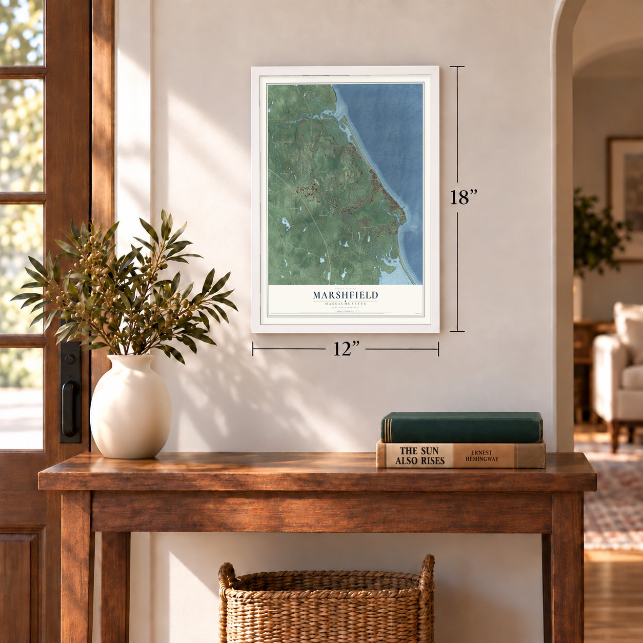
12" x 18" Archival Matte Print
A Map of Home. A Work of Art.
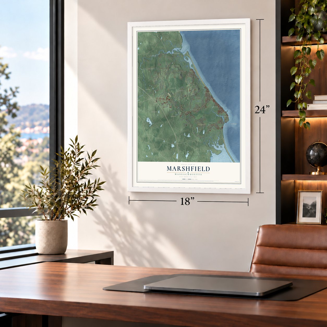
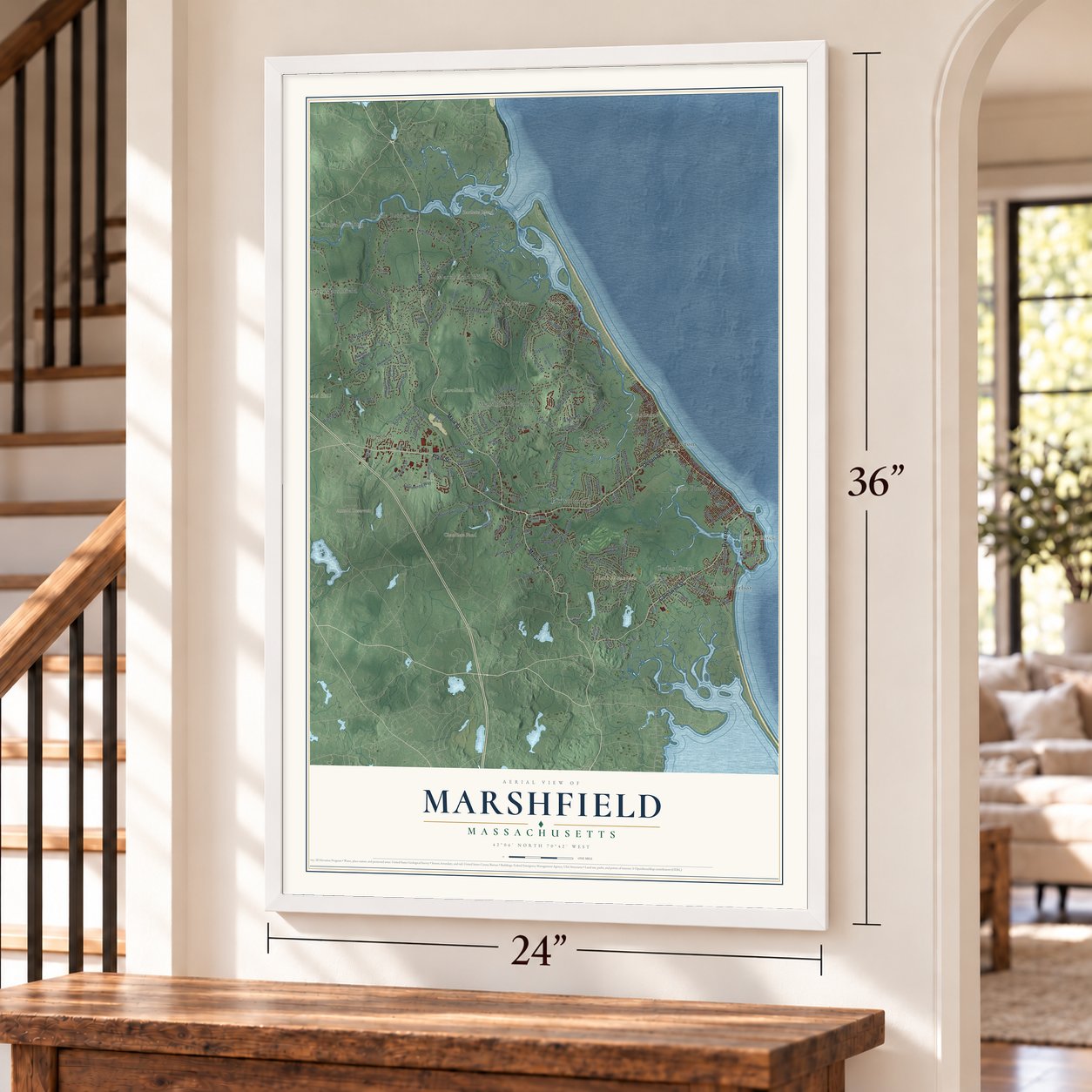
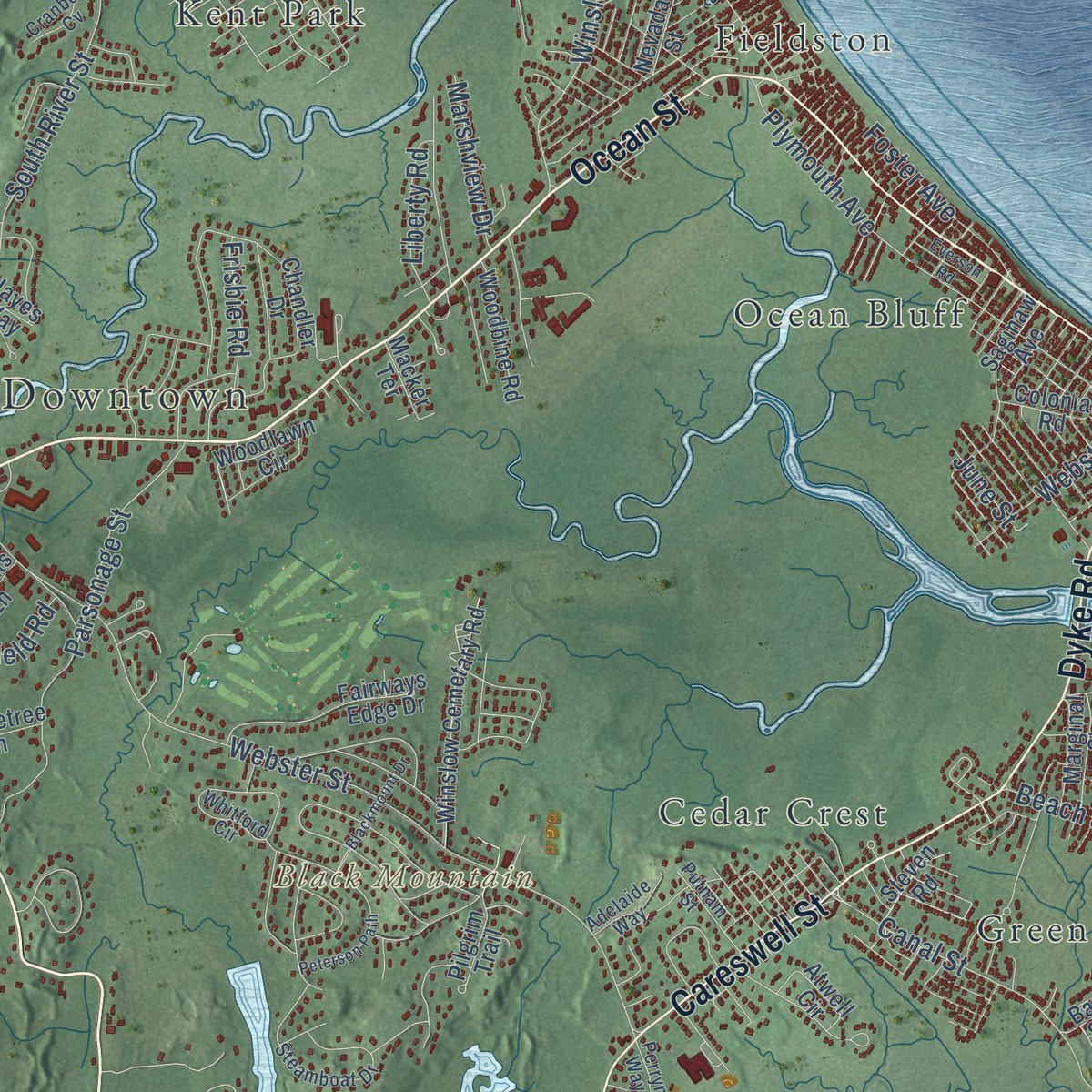
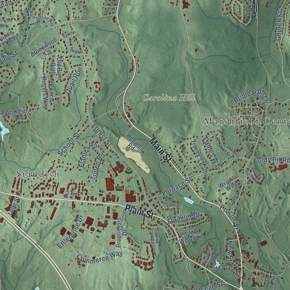
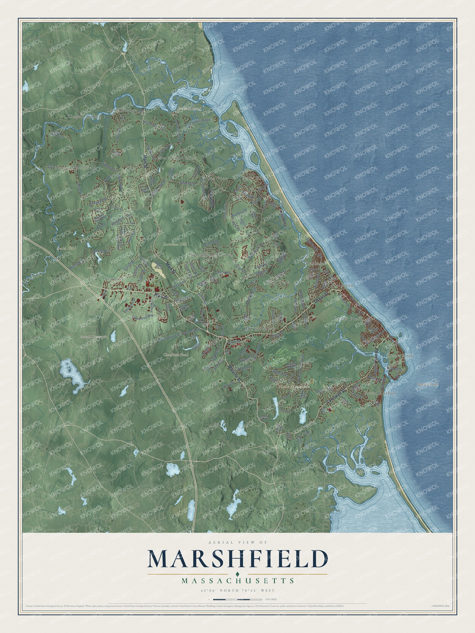
Explore Marshfield, Massachusetts from a whole new perspective. Created using aerial imagery and detailed geographic data, this map captures Marshfield building by building, with labeled streets, familiar landmarks, and shaded topographical relief that highlights the natural contours of the landscape.
Combining modern data with the timeless character of a vintage atlas, this map is just as interesting up close as it is beautiful on the wall. Whether you grew up in Marshfield, spent memorable years there, or call it home today, this unique map is a great way to celebrate a place that means something to you. Zoom in on the preview to look for your street, and then order a print to put your memories on the wall.
Three ways to hang it
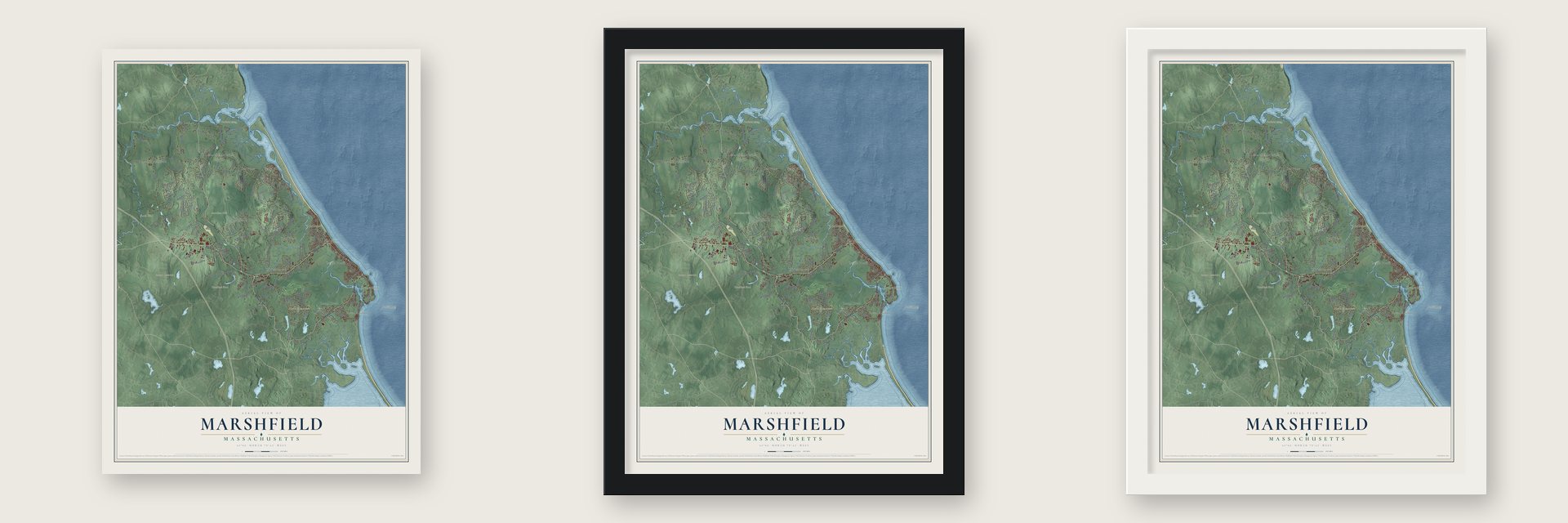
Unframed archival matte, a black wood frame or a white wood frame.
Up close
Geography Worth Displaying
This map was created using accurate cartographic data and authoritative geographic sources, including the U.S. Geological Survey (USGS) and FEMA. The map brings together terrain, waterways, roads, and building detail. The majority of the streets are labeled, houses are accurately depicted, and the topography is derived from government sources. Combining local data with carefully composed color and shading leads to this beautifully detailed Marshfield artwork for your wall.
Rather than simply showing street outlines, we’ve included as many of the street names as we could reasonably fit on the map while keeping their names legible. Zoom in on the high resolution preview to see exactly what’s on the map. We truly set out to create a statement piece for anyone who loves Marshfield. So whether it’s for you, or a gift for someone you love, we hope this map of Marshfield brings back fond memories.
Explore the full map of Marshfield, Massachusetts and read about the local places it shows.
Find your street
Names on the Marshfield map
Every name below is printed on this map. Look for your street, your school, the park where you played, or the pond down the road.
Places and landmarks23
- Downtown
- Brant Rock
- Bald Hill
- Bartlett Rock
- Bartletts Island
- Black Mountain
- Arnold Reservoir
- Chandlers Pond
- Carolina Hill
- Kings Landing
- Kent Park
- North Marshfield
Show all 23 places
- Sea View
- Fieldston
- Marshfield Hills
- Standish
- Green Harbor
- Cedar Crest
- Little Bridge
- Ferry Hill
- Ocean Bluff
- Marshfield Center
- Rexhame
Streets and roads159
- Ocean Street
- Plain Street
- Moraine Street
- Main Street
- Careswell Street
- Dyke Road
- Pinehurst Road
- Union Street
- Ferry Street
- South River Street
- Forest Street
- Summer Street
- Webster Street
- Eames Way
- Highland Street
- Holly Road
- Pine Street
- Plymouth Avenue
- School Street
- Pleasant Street
- Spring Street
- Furnace Street
- Parsonage Street
- Church Street
- Arrow Head Road
- Grove Street
- Elm Street
- Macombers Ridge
- Old Main Street
- Old Ocean Street
Show all 159 streets
- Stonybrook Road
- Oak Street
- Standish Street
- Mill Pond Lane
- Winslow Street
- Damons Point Road
- Canal Street
- Flaggler Drive
- Ridge Road
- Foster Avenue
- Tea Rock Lane
- Acorn Street
- Commerce Way
- Valley Path
- Bay Avenue
- Webster Avenue
- Clay Pit Road
- Enterprise Drive
- Quail Run
- Mount Skirgo Street
- Texas Street
- Deerhill Lane
- Boles Road
- Maryland Street
- Marshview Drive
- Liberty Road
- Canoe Tree Street
- Dwight Road
- Bridle Path Lane
- Forge Road
- New Street
- Frisbie Road
- Beach Street
- Flames Road
- Bayberry Drive
- Tilden Road
- Eagle Road
- Rayfield Road
- Central Street
- Snow Road
- Proctor Street
- June Street
- Sea Street
- Old Barn Path
- Bay Street
- Chandler Drive
- Prince Rogers Way
- Winslow Cemetary Road
- Woodlawn Circle
- Atwell Circle
- Fairways Edge Drive
- Saginaw Avenue
- Canoe Tree Way
- Prospect Street
- Whiffletree Lane
- Proprietors Drive
- Peregrine White Drive
- Ruggles Road
- Stonewood Lane
- Walnut Street
- Colonial Road
- Woodbine Road
- Old Plain Street
- Mounce Farm Way
- Bayberry Road
- Tracey's Path
- Rugani Avenue
- Surf Avenue
- Cohasset Avenue
- Prince Circle
- Duck Hill Lane
- Wrights Way
- Rocky Reach Farm
- Marginal Street
- Mariner's Drive
- Pilgrim Trail
- Pioneer Trail
- Bakers Lane
- Willow Street
- Nevada Street
- Steven Road
- Puddle Wharf Lane
- Sinnotts Lane
- Dog Lane
- Lone Street
- Macker Terrace
- Brook Road
- Cove Street
- Hayes Way
- Carolina Trail
- Corn Hill Lane
- Pilgrim Road
- Whitford Circle
- Steamboat Drive
- Pudding Hill Lane
- Helena Road
- Silverbirch Road
- Putnam Street
- Adelaide Way
- Fox Run
- Cranberry Cv
- Littles Lane
- Oakman Way
- Bunny Lane
- Perryn Way
- Minot Street
- Kent Avenue
- Maple Lane
- Hampstead Way
- Colby Hewitt Lane
- Peterson Path
- Partridge Brook Circle
- Blackmount Drive
- Planting Field Road
- Cross Street
- North River Drive
- Earldor Circle
- Sheridan Drive
- Strawberry Farm Road
- Canonchet Trail
- Parsons Walk
- Horseshoe Farm Lane
- Brunswick Street
- Edmund Road
- Everson Road
- Page's Lane
- Hatch Street
- Birch Road
- River Street
Names are listed as they appear on the printed map. Zoom into the product photos to find them.
About Marshfield, Massachusetts
Marshfield is a town of 25,825 people in Plymouth County, on the South Shore. Before the Pilgrims came, the land was called Missaucatucket. In 1632 Plymouth granted farms at Green's Harbor, and Edward Winslow, a Mayflower passenger, started a settlement there. In 1640 Green's Harbor became a town called Rexhame, and it soon took the name Marshfield for the salt marshes along its North, South and Green Harbor rivers.
Winslow named his estate Careswell, after a family seat in England. In 1645 he and his neighbors promised yearly sums to pay a schoolteacher. In 1665 Josias Wampatuck, son of the sachem Chickatabut, signed over his rights in the township to Josiah Winslow, but he kept the right to hunt, fish and cut trees for canoes. In 1673 Josiah Winslow became governor of Plymouth Colony, the first governor born in New England.
- The Queen's Guards escapeMarshfield sided with the king in 1775; an 1884 history counted three hundred loyalists. At their call, Captain Balfour's company of Queen's Guards arrived in January and took over Nathaniel Ray Thomas's house. After Lexington, Captain William Thomas signaled from a hill with three guns, and by noon about five hundred militiamen from Plymouth, Kingston and Duxbury had arrived. On April 20 the guards escaped by sloop from Brant Rock. Nine months later the town voted for independence.
- Webster's last addressDaniel Webster moved to Marshfield in 1837, building his estate on a Thomas family farm. On July 24, 1852, he gave his last public address to neighbors on Cherry Hill; he died here October 24. He lies in the Winslow Cemetery, the town's oldest, begun about 1651 on William Thomas's land. His 1832 law office, the sole survivor from his years, was saved from demolition by the historical society in 1966 and returned to the estate in 2015.
- Radio from Brant RockIn January 1906, Reginald Fessenden traded Morse code across the Atlantic between his Brant Rock station and one at Machrihanish, Scotland, the first two-way radiotelegraph exchange over the ocean. A 1932 letter of his says that on Christmas Eve 1906 he also broadcast music to vessels offshore: he played "O Holy Night" on the violin and read from the Bible.
- Digging at Green HarborIn 1633 the colony court had a channel cut from Green's Harbor to the bay, putting Plymouth seven miles away by water, not fifteen by land. In 1810 sportsmen dug through the beach at high tide, and the current carved a new river mouth. To farm the salt marsh, its owners spent about $30,000 on a dike near Turkey Point, finished in 1872. Silt filled the river, and an 1893 guide described a thread of water at low tide.
- The Winslow house of 1700Judge Isaac Winslow built his home about 1700 on land once granted to Edward Winslow, and it has seen little modernizing since. Winslows owned it until 1822, and it became a museum in 1920. On its grounds are a blacksmith shop that still works and the one-horse phaeton that belonged to Daniel Webster.
Keep exploring Massachusetts
Marshfield is one of 461 Massachusetts towns we've mapped. Every dot on the map is a print of its own.
The search covers every state, Massachusetts first.
Near Marshfield
Order 2 or more town maps and save 10%. Shown in the size and finish you picked above, so they hang as a set.
- Marshfield Hills 12" x 18" / Archival Matte Print $39.99
- Ocean Bluff-Brant Rock 12" x 18" / Archival Matte Print $39.99
- Cedar Crest 12" x 18" / Archival Matte Print $39.99
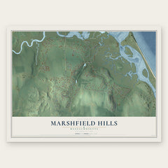
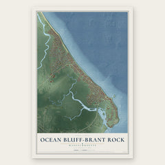

More maps nearby: North Pembroke, Green Harbor, Duxbury, Pembroke and Scituate.
The art of mapping a place
How This Map Was Made
Real places. Remarkable detail. Discover the layers that turn geographic data into a map of home.

The view from above
Aerial imagery reveals the character of the land: woodland, open fields, and the patterns of a place.

The shape of the land
Elevation data brings hills, valleys, and subtle changes in the landscape into view.

The details of home
Roads, waterways, and building footprints come together to make the map feel unmistakably local.

Geography becomes art
Considered color, shading, and typography bring the layers together in a map made for your wall.


Process illustrated with Mendon, Massachusetts. Aerial imagery: USDA NAIP. Terrain: USGS 3D Elevation Program. Map details and finished artwork: KNOWOL.
The Details
About This Print
Choose an archival matte print, or a black or white Ayous wood frame. The archival matte print is unframed.
Select your size and finish above to see the matching product image and price.
Materials & Craftsmanship
A contemporary map with the character of a classic atlas, printed on archival matte paper. Optional frames are made from Ayous wood.
Your printed map does not include the watermark shown in the full-map preview.
Shipping & Delivery
Free shipping within the United States. Every print is made to order in the USA.
Buying a gift? Add a note in your cart and we'll include it. We never put prices in the package.
Prints ship within 2 to 3 business days. Allow 7 to 10 days total from ordering for delivery. Timing may vary during holidays or periods of high order volume.
Read our shipping policy.
Returns and damaged prints
Each print is made to order. Change-of-mind refunds are not available after production.
If your print arrives damaged, misprinted or incorrect, contact support@knowol.com within 30 days of receiving it. Include your order number, photos and a description of the issue.
Read our full refund and replacement policy. For questions about your order, email support@knowol.com.