
Search for another town





Free U.S. delivery 7 to 10 days after you order
Mechanicsville, Virginia Map Art
A new map of Mechanicsville, Virginia, made in 2026 and printed to order on thick archival matte paper.
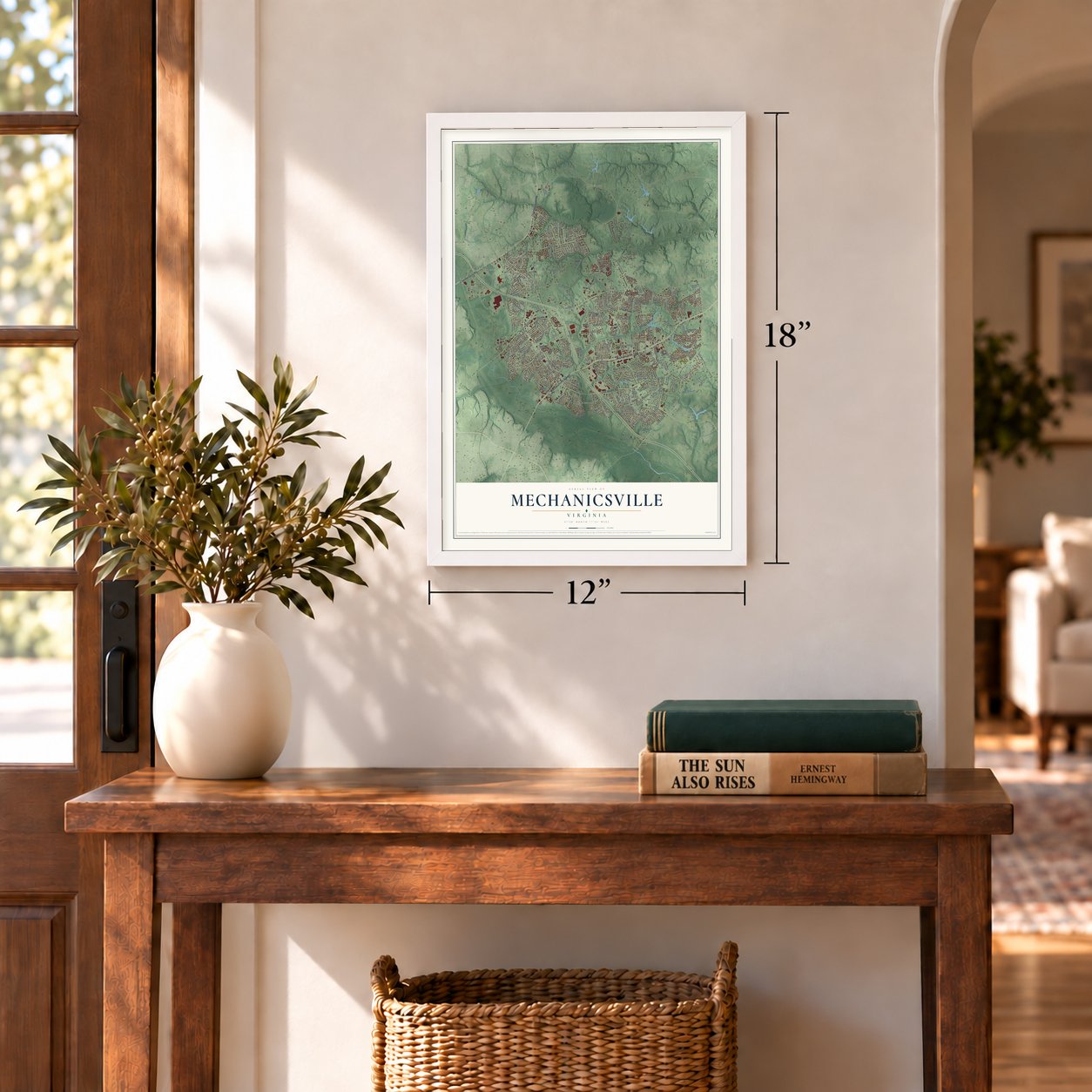
12" x 18" Archival Matte Print
A Map of Home. A Work of Art.
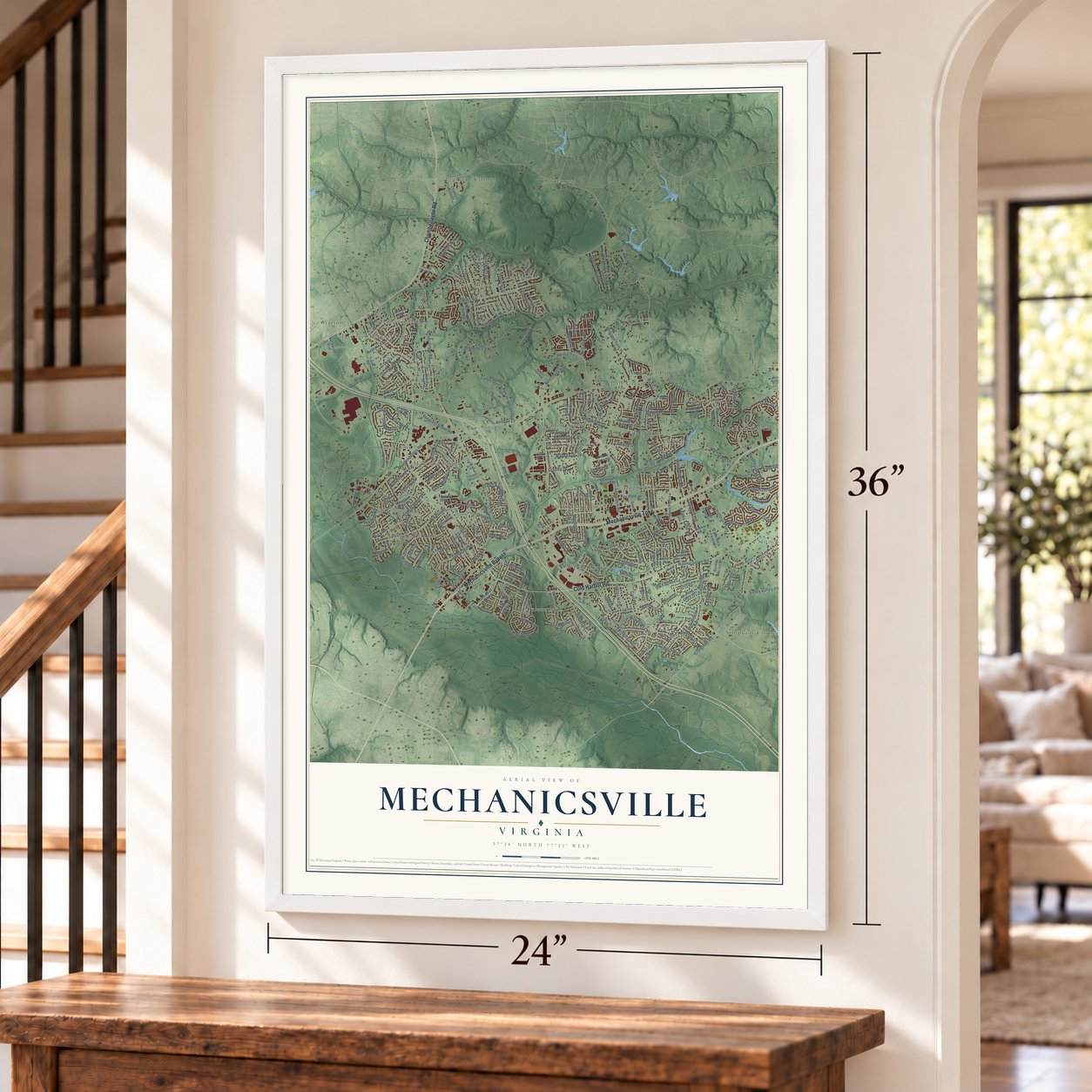
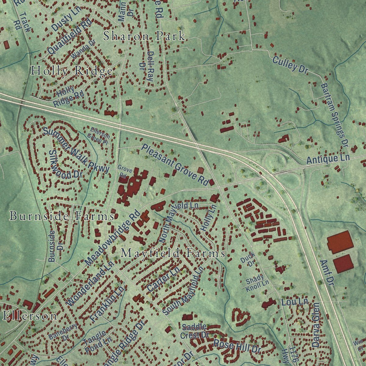
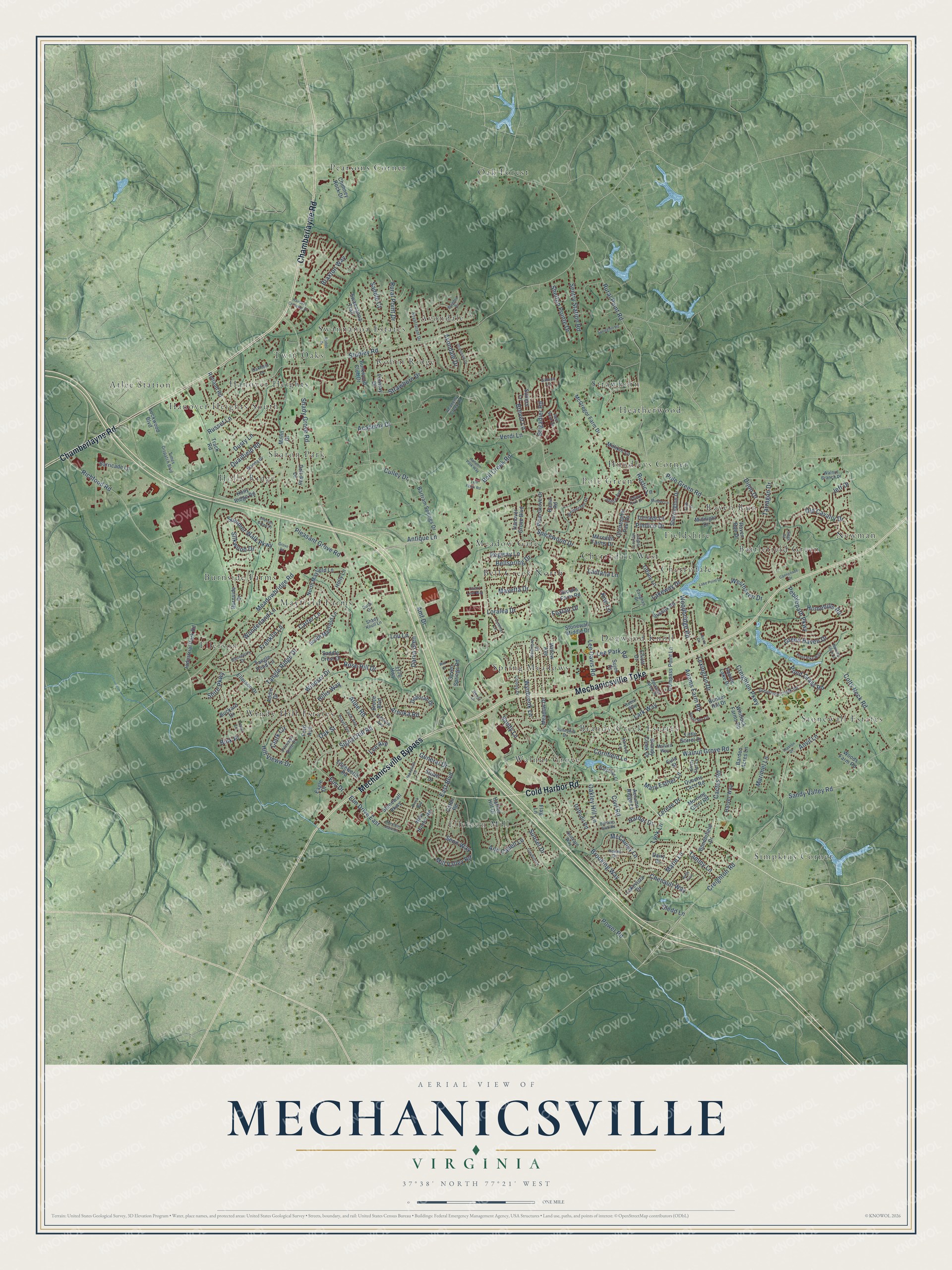
Explore Mechanicsville, Virginia from a whole new perspective. Created using aerial imagery and detailed geographic data, this map captures Mechanicsville building by building, with labeled streets, familiar landmarks, and shaded topographical relief that highlights the natural contours of the landscape.
Combining modern data with the timeless character of a vintage atlas, this map is just as interesting up close as it is beautiful on the wall. Whether you grew up in Mechanicsville, spent memorable years there, or call it home today, this unique map is a great way to celebrate a place that means something to you. Zoom in on the preview to look for your street, and then order a print to put your memories on the wall.
Three ways to hang it
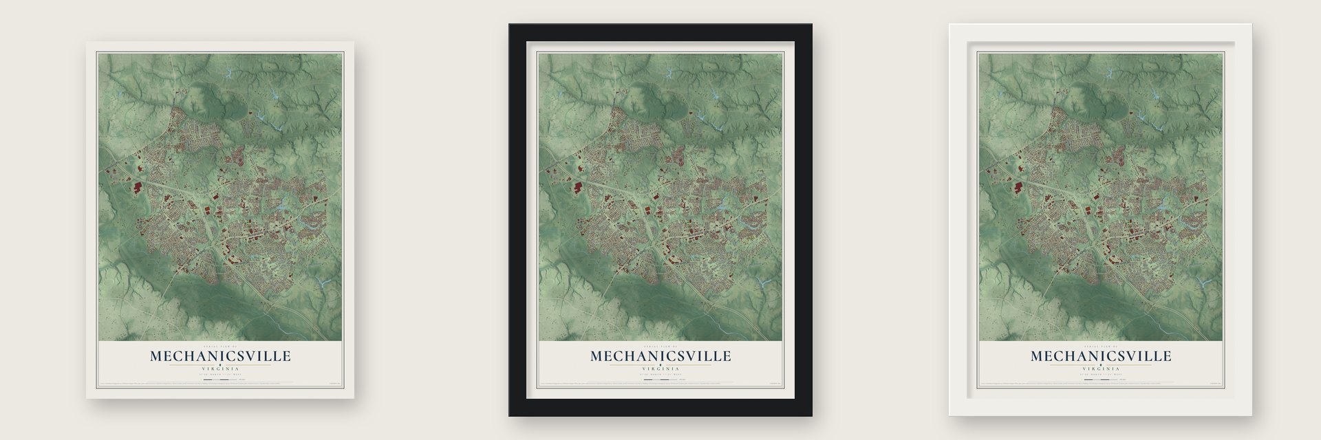
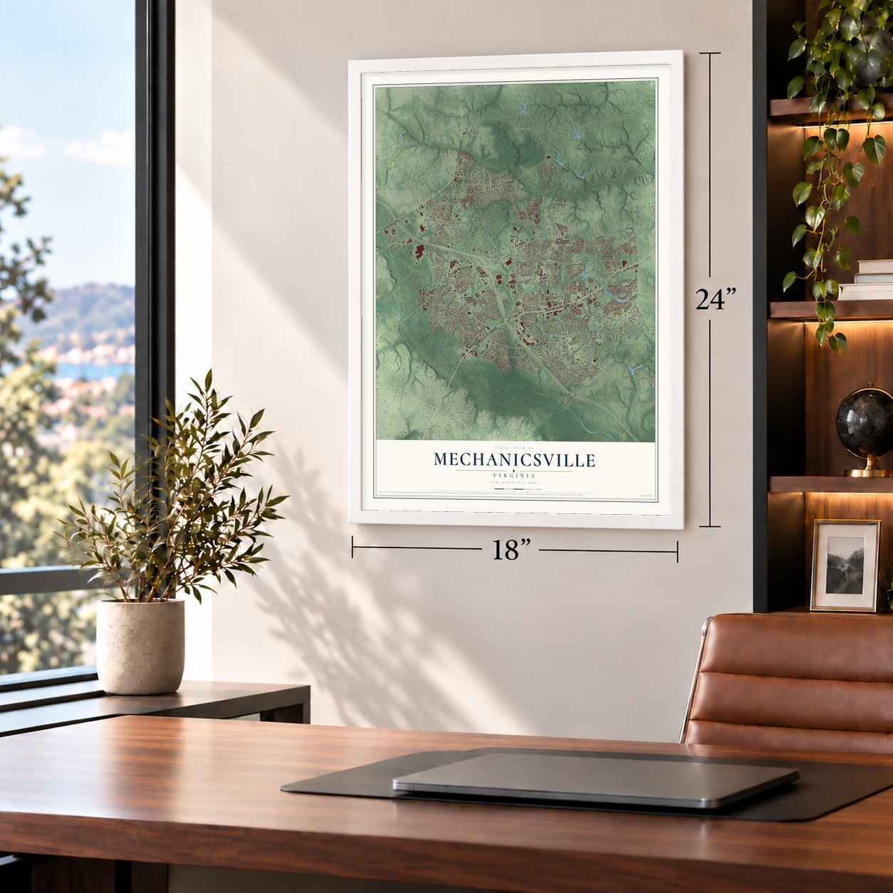
Unframed archival matte, a black wood frame or a white wood frame.
Up close
Geography Worth Displaying
This map was created using accurate cartographic data and authoritative geographic sources, including the U.S. Geological Survey and the Census Bureau. The map brings together terrain, waterways, roads, and building detail. The majority of the streets are labeled, houses are accurately depicted, and the topography is derived from government sources. Combining local data with carefully composed color and shading leads to this beautifully detailed Mechanicsville artwork for your wall.
Rather than simply showing street outlines, we’ve included as many of the street names as we could reasonably fit on the map while keeping their names legible. Zoom in on the high resolution preview to see exactly what’s on the map. We truly set out to create a statement piece for anyone who loves Mechanicsville. So whether it’s for you, or a gift for someone you love, we hope this map of Mechanicsville brings back fond memories.
Read the story behind this map of Mechanicsville, Virginia from 2026.

About Mechanicsville, Virginia
Mechanicsville is a community of 39,482 people in Hanover County, on the north side of the Chickahominy River and less than two miles from Richmond at its closest point. English colonists began settling the area in the 17th century. Rural Plains, also called Shelton House, was built in 1670, and Shelton men lived in it until 2006. Today the National Park Service runs the house as part of Richmond National Battlefield Park.
The Civil War reached the village on June 26, 1862. That day Confederate General A.P. Hill sent wave after wave of attacks against Union Major General Fitz John Porter's troops, who held a line along Beaver Dam Creek just east of town. The Union soldiers threw back every attack and then pulled back to Boatswain Creek near Gaines' Mill. The fight was the second of the Seven Days Battles, and part of that ground is now protected inside the battlefield park.
- Cold Harbor in 1864Two years after the Seven Days, war returned to the fields east of Mechanicsville. The Battle of Cold Harbor was the last major battle of Ulysses S. Grant's 1864 Overland Campaign, and it was fought over the same ground as Gaines' Mill. Part of the field where the losses were heaviest is preserved, along with a national cemetery built after the war.
- A windmill built as a bankThe stone windmill in downtown Mechanicsville went up in the 1970s as a branch office of Heritage Bank. It became a local landmark, and a new bank restored and enlarged it in 2007 and 2008. The windmill is only for show, and an electric motor turns it.
- Grew to 39,482 by 2020The 2020 census counted 39,482 people in Mechanicsville, up from 36,348 in 2010.
Find your street
Names on the Mechanicsville map
Every name below is printed on this map. Look for your street, your school, the park where you played, or the pond down the road.
Places and landmarks34
- Atlee Station
- Avondale
- Battlefield Green
- Bell Creek North
- Brandy Creek Estates
- Burnside Farms
- Cherrydale
- Cherrydale West
- Dogwood Knoll
- Ellerson
- Ellerson Mill
- Fieldshire
Show all 34 places
- Hanover Heights
- Hanover Heights South
- Heatherwood
- Holly Ridge
- Hundleys Corner
- Mayfield Farms
- Meadow Gate
- Newman
- Oak Forest
- Pearsons Corner
- Pole Green
- Raven Run
- Robin Ridge
- Sharon Park
- Simpkins Corner
- Spring Meadows
- Stonewall Estates
- Strawhorn
- Swannanoa Estates
- Twin Oaks
- Walnut Grove
- Windy Hill Estates
Streets and roads241
- Mechanicsville Turnpike
- Chamberlayne Road
- Cold Harbor Road
- Mechanicsville Bypass
- Bell Creek Road
- Pole Green Road
- Shady Grove Road
- Rural Point Road
- Studley Road
- Atlee Road
- Walnut Grove Road
- Lee Davis Road
- Meadowbridge Road
- Creighton Road
- Old Cavalry Drive
- Amf Drive
- Verdi Lane
- Richfood Road
- Creighton Parkway
- Tammy Lane
- Brooking Way
- Sandy Valley Road
- Windsor Drive
- Summer Walk Parkway
- Woodbridge Road
- Culley Drive
- Cactus Road
- Anvil Lane
- Pond Grass Road
- Sentry Station Road
Show all 241 streets
- Wynbrook Lane
- Colts Neck Road
- Academy Drive
- McCauley Lane
- Power Road
- Hill Vieww Drive
- Westhaven Drive
- Pimlico Drive
- Tarragon Drive
- Mill Valley Road
- Antique Lane
- Rural Point Drive
- Lexington Drive
- Sandy Lane
- Pleasant Grove Road
- Signal Hill Road
- Elm Drive East
- Green Haven Drive
- Strawhorn Drive
- Civil Road
- Lakeway Drive
- Elm Drive
- Pebblepath Parkway
- Cornfield Lane
- Shelton Pointe Drive
- Mary Esther Lane
- Brigadier Road
- East Boulevard
- Marie Lane
- Homehills Road
- Rose Hill Drive
- Spicewood Drive
- Chenault Way
- Lantana Lane
- Silkwood Drive
- Quailfield Road
- Darva Glen
- Adams Farm Road
- Sunset Drive
- Arnoka Road
- Lee Park Road
- Tangle Ridge Drive
- Lark Way
- Marimel Lane
- General Drive
- Bellspring Drive
- Kiwi Lane
- Ann Cabell Lane
- Wonderland Lane
- Oak Street
- Loralea Drive
- Russet Lane
- Jeff Drive
- Braxton Way
- Oakley Hill Lane
- Dijon Drive
- Avondale Drive
- Franklin Lane
- Dusty Lane
- Lynk Lane
- Shire Parkway
- Lereve Drive
- Clark Circle
- Pegway Lane
- Foxlair Drive
- Brevet Lane
- Carter Lane
- Senn Way
- Mayetta Drive
- Harbor Drive
- Sledd Lane
- Saddle Court
- Hillis Way
- Lou Lane
- Rustic Lane
- Bink Place
- Lee Avenue
- Meadow Drive
- South Mayfield Lane
- McGregor Farm Drive
- Ellerson Drive
- Brandy Creek Drive
- Burnside Drive
- Stonewall Middle Drive
- North Mayfield Lane
- Edgeworth Road
- Bonniefield Drive
- Holly Ridge Road
- Midnight Drive
- Pebble Lake Drive
- Rutland Road
- Morning Glory Road
- Little Sorrel Drive
- Dell-Ray Drive
- Swannanoa Trail
- Ford Avenue
- Bartram Springs Drive
- Compass Point Lane
- New Hunter Road
- Raven Run Drive
- Hanover Grove Boulevard
- Elliott Drive
- Stonewall Parkway
- Turnage Lane
- Industrial Park Road
- Queens Lace Road
- Harbor Hill Drive
- Sussex Road
- Dairy Drive
- Sherrington Drive
- Daffodil Road
- Christopher Paul Drive
- Deborah Drive
- Whitlock Farms Road
- Chimney Rock Drive
- Fenway Drive
- Catlin Road
- Bunker Hill Drive
- Mann Drive
- Plum Grove Drive
- Willow Avenue
- Track Road
- Autumn Ridge Lane
- Barden Acres Lane
- Tiffany Lane
- Meredith Farms Drive
- Barricade Lane
- Flag Lane
- Burkwood Club Drive
- Sutlers Lane
- Lakevista Drive
- Harver Way
- Addie Drive
- Stuart Drive
- Holly Lane
- Tangle Pond Lane
- Millikin Lane
- Seven Springs Road
- Woods Farm Road
- Brooks Farm Road
- Lockwood Boulevard
- Saddle Crest Drive
- Buckard Drive
- Eagle Drive
- Bruce Boulevard
- Sujen Court
- 1176 Highway
- Bama Road
- Eula Street
- Vaughan Drive
- Times Dispatch Boulevard
- Kenmore Drive
- Colony Drive
- Greystone Creek Road
- Sunnyhill Drive
- Fullview Avenue
- Princess Anne Drive
- Kristy Star Lane
- Hanna Drive
- Wetherden Drive
- Academy Creek Lane
- Jackson Arch Drive
- Janice Avenue
- Harvest Lane
- Wanda Drive
- Baneberry Drive
- Royal Grant Drive
- Walnut Branch Drive
- Luck Avenue
- Lynmar Lane
- Walgrove Court
- Mallard Way
- Troub Lane
- Robin Way
- Red Sash Drive
- Shady Knoll Lane
- Drinkard Way
- Oakfield Lane
- Gabion Lane
- Duck Drive
- Hanover Crossing Drive
- Midday Lane
- Ellerson Green Place
- Angela Nicole Lane
- Claybird Lane
- Liberty Circle
- Grantham Drive
- Rodeo Drive
- Pond Pike Way
- Brook Way
- Bartletts Bluff Road
- Pickett Avenue
- Springhill Road
- Lake Point Drive
- Stonewall Drive
- Broad Sky Circle
- Autumn Park Way
- Legacy Park Drive
- Thaxton Drive
- Dominion Park Drive
- Blagdon Drive
- Woody Lane
- Cannonade Drive
- Cherry Leaf Way
- Walking Stick Lane
- Left Flank Road
- Grove Road
- Win Court
- Siege Road
- Nells Trce
- Trudi Place
Names are listed as they appear on the printed map. Zoom into the product photos to find them.
The art of mapping a place
How This Map Was Made
Real places. Remarkable detail. Discover the layers that turn geographic data into a map of home.

The view from above
Aerial imagery reveals the character of the land: woodland, open fields, and the patterns of a place.

The shape of the land
Elevation data brings hills, valleys, and subtle changes in the landscape into view.

The details of home
Roads, waterways, and building footprints come together to make the map feel unmistakably local.

Geography becomes art
Considered color, shading, and typography bring the layers together in a map made for your wall.


Process illustrated with Mendon, Massachusetts. Aerial imagery: USDA NAIP. Terrain: USGS 3D Elevation Program. Map details and finished artwork: KNOWOL.
The Details
About This Print
Choose an archival matte print, or a black or white Ayous wood frame. The archival matte print is unframed.
Select your size and finish above to see the matching product image and price.
Materials & Craftsmanship
A contemporary map with the character of a classic atlas, printed on archival matte paper. Optional frames are made from Ayous wood.
Your printed map does not include the watermark shown in the full-map preview.
Shipping & Delivery
Free shipping within the United States. Every print is made to order in the USA.
Buying a gift? Add a note in your cart and we'll include it. We never put prices in the package.
Prints ship within 2 to 3 business days. Allow 7 to 10 days total from ordering for delivery. Timing may vary during holidays or periods of high order volume.
Read our shipping policy.
Returns and damaged prints
Each print is made to order. Change-of-mind refunds are not available after production.
If your print arrives damaged, misprinted or incorrect, contact support@knowol.com within 30 days of receiving it. Include your order number, photos and a description of the issue.
Read our full refund and replacement policy. For questions about your order, email support@knowol.com.
Find your town
Looking for another city?
Find a map of home in our Virginia collection, or any town in the country.
Nearby
Maps of towns near Mechanicsville
Know someone from one of these towns? Their map makes a great gift.
 East Highland Park
, Virginia
From $39.99See the map
 Chamberlayne
, Virginia
From $39.99See the map
 Highland Springs
, Virginia
From $39.99See the map
More maps nearby: Lakeside, Montrose, Glen Allen, Laurel and Dumbarton.