
Search for another town


Free U.S. delivery 7 to 10 days after you order
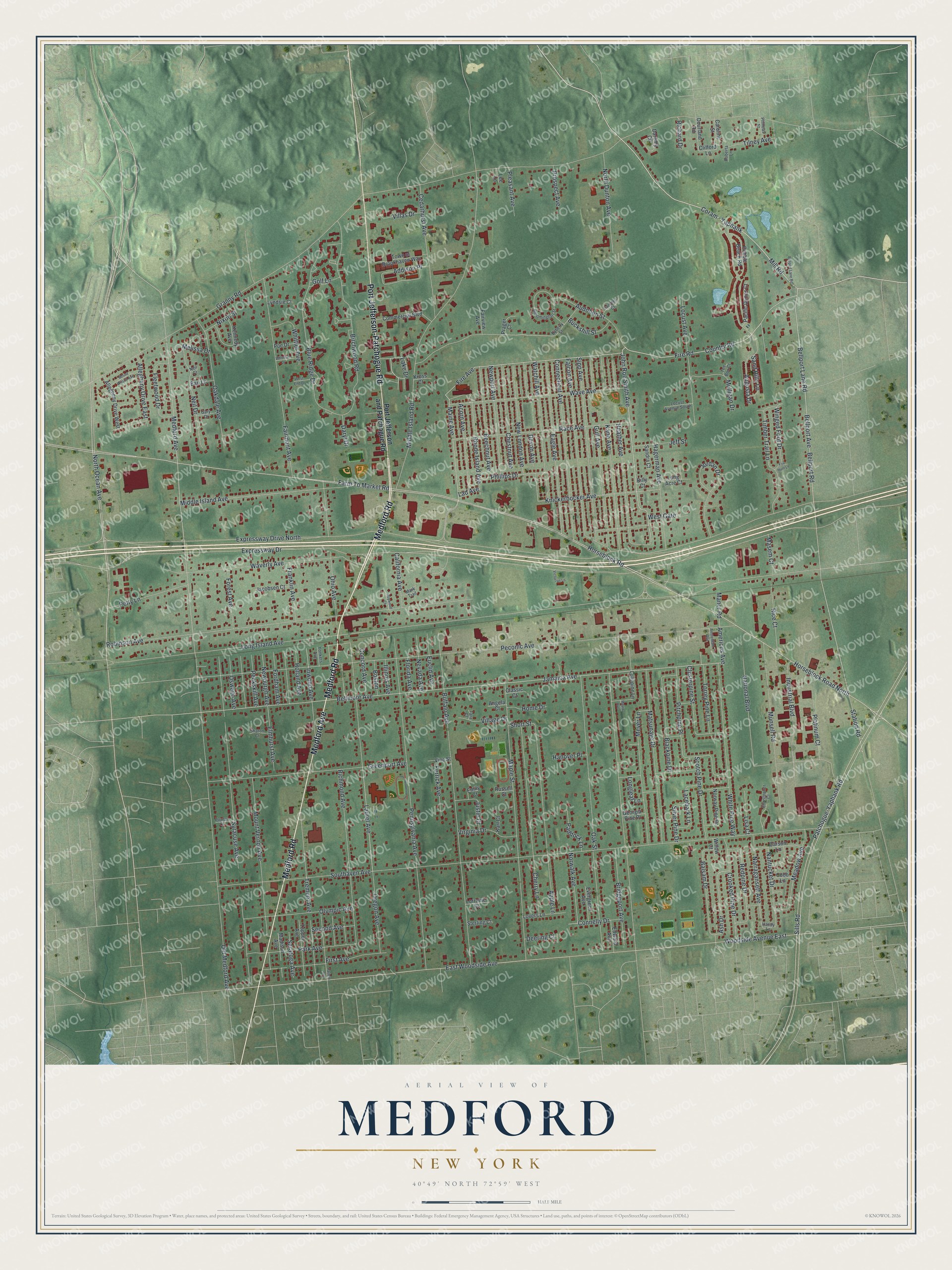
Medford, New York Map Art
Building by building, with labeled streets and shaded relief.
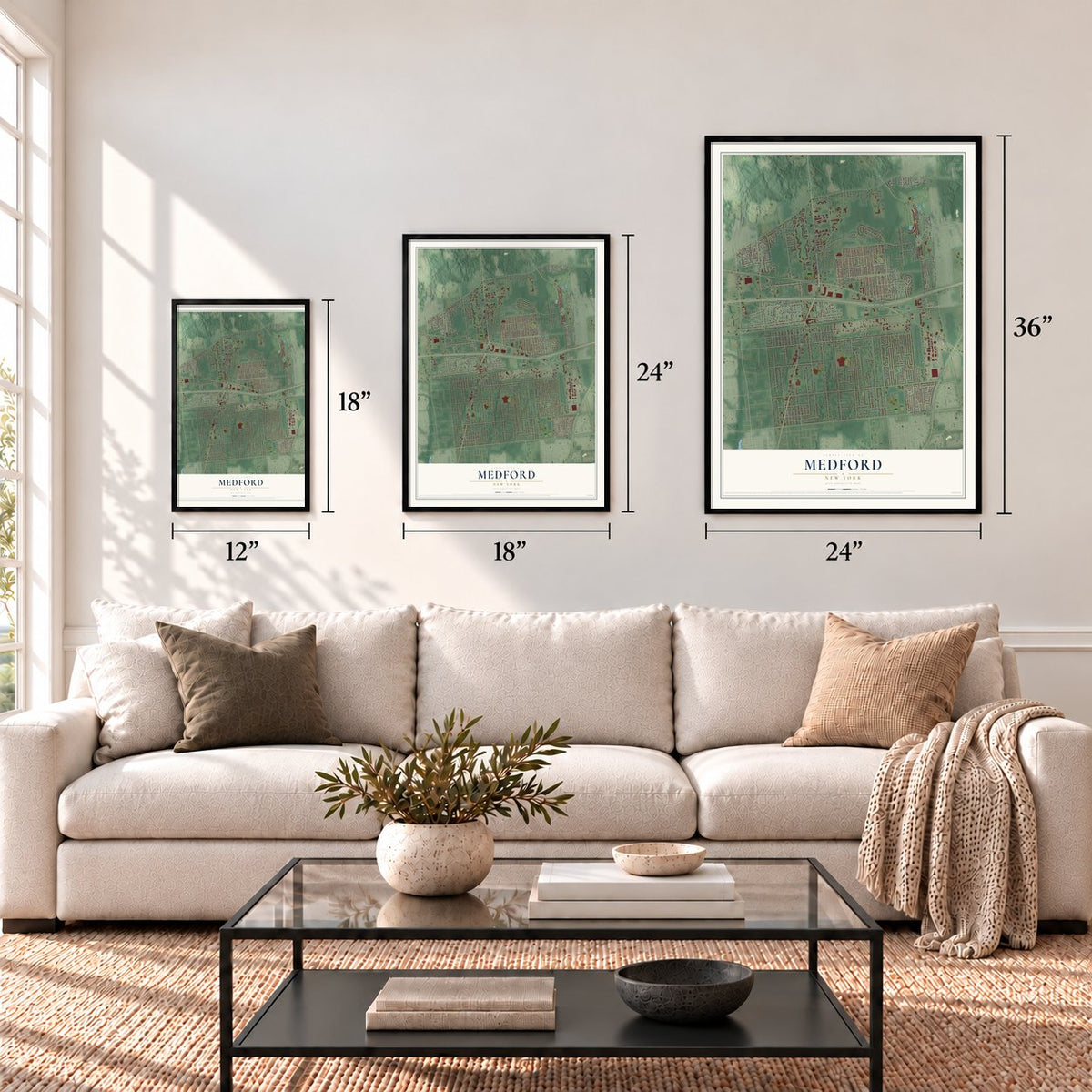
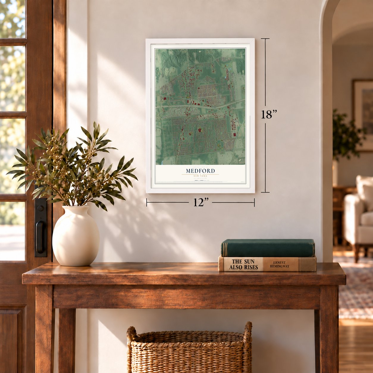
12" x 18" Archival Matte Print
A Map of Home. A Work of Art.
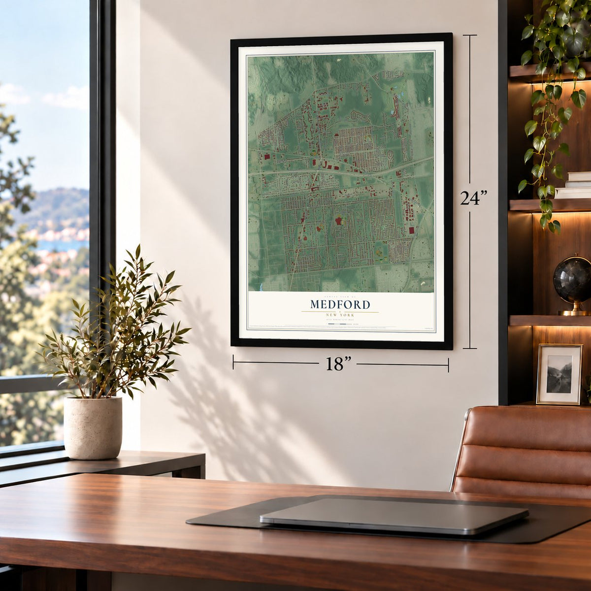
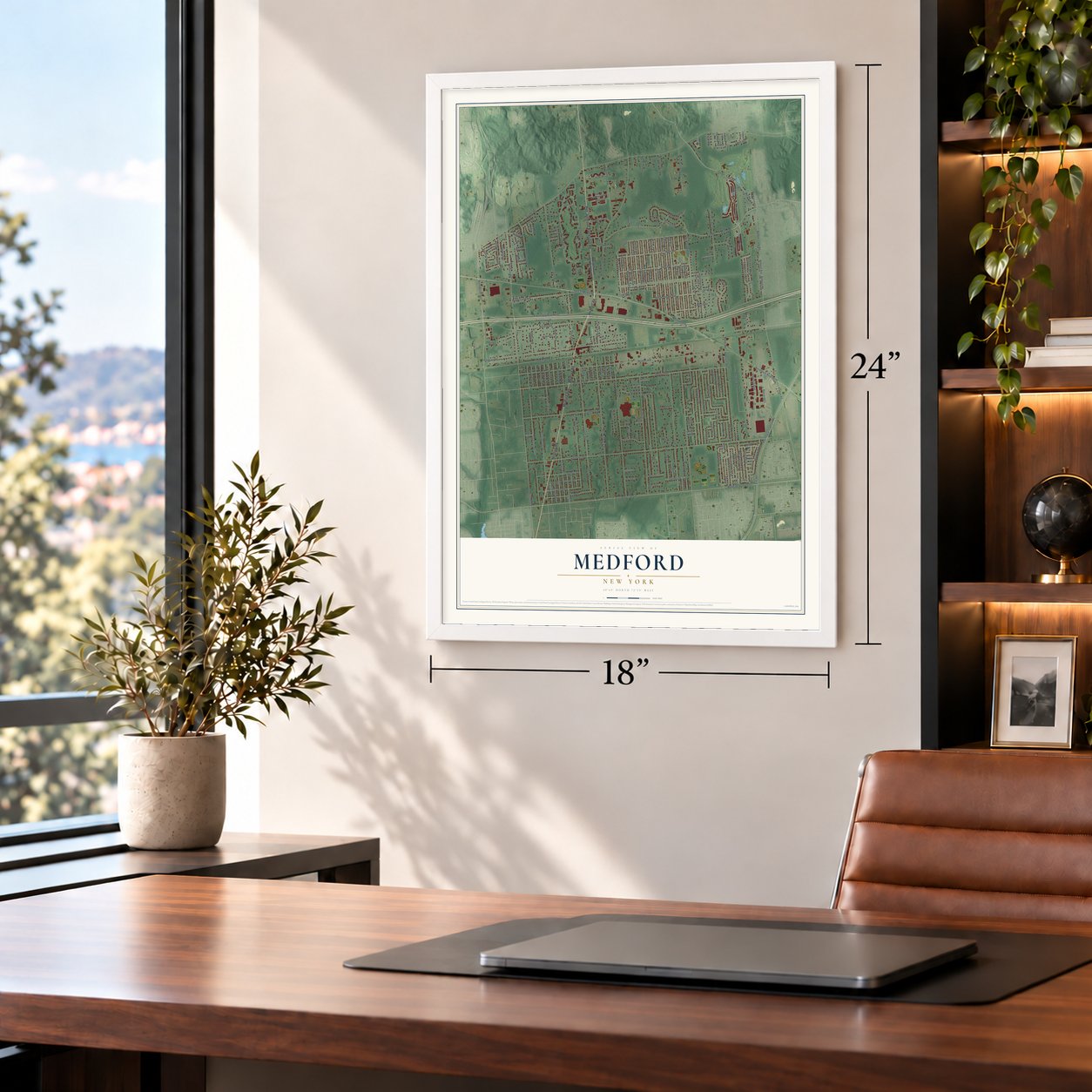
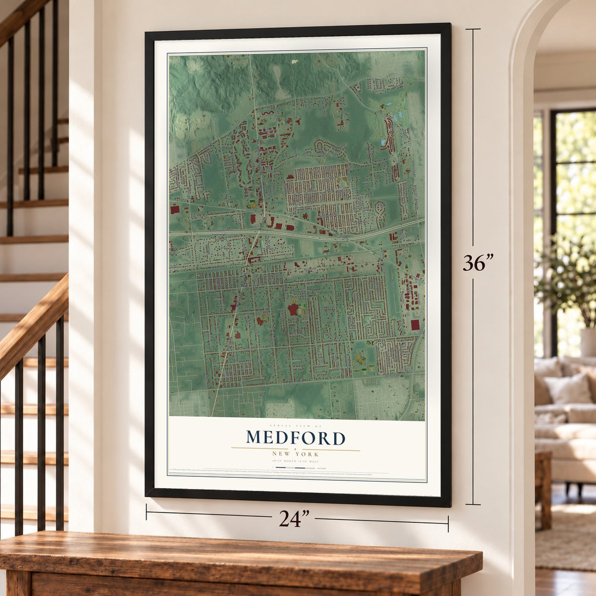
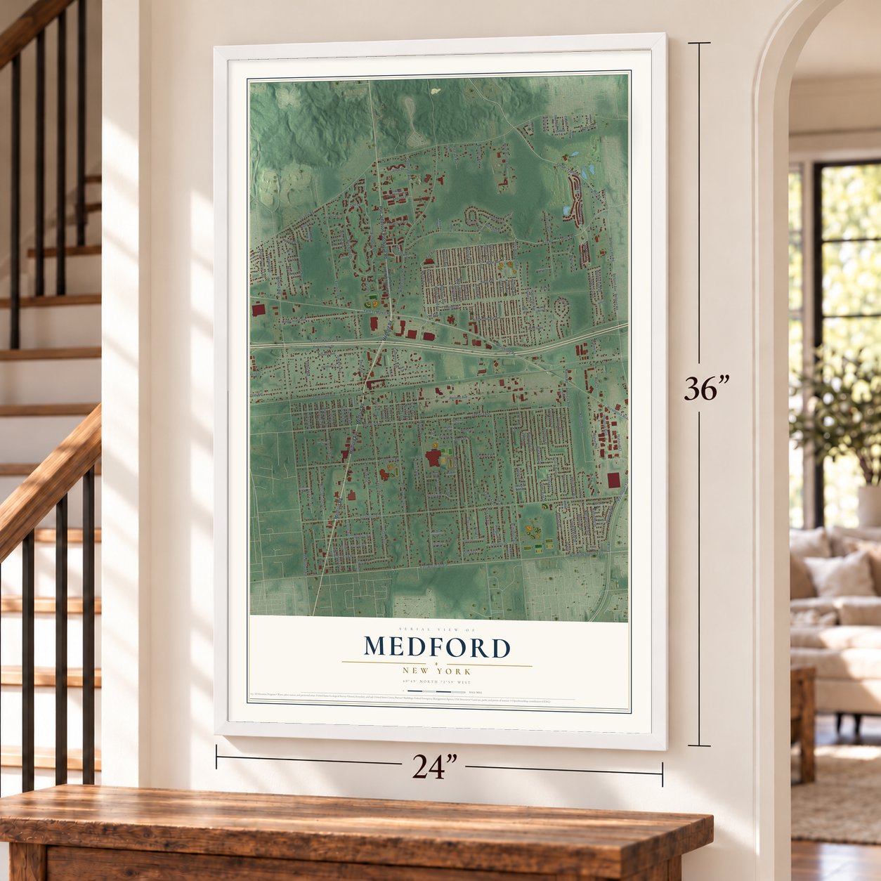
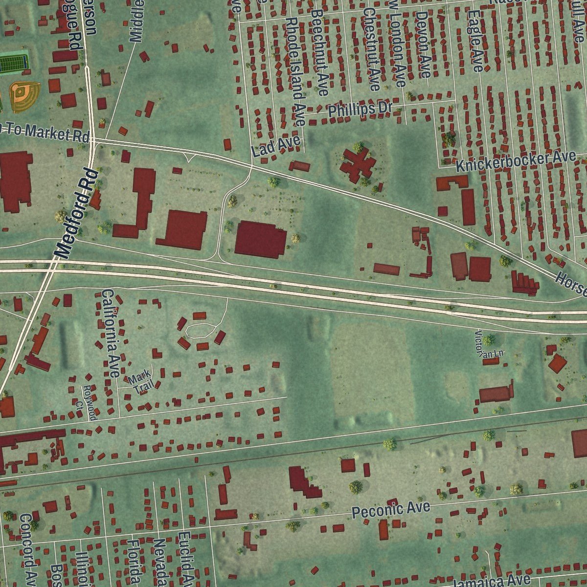
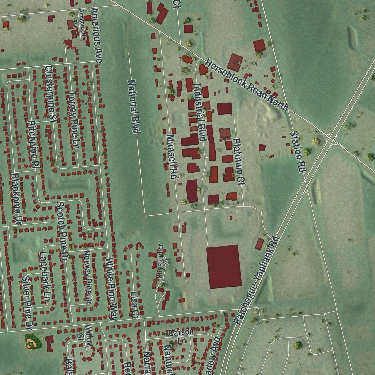
Explore Medford, New York from a whole new perspective. Created using aerial imagery and detailed geographic data, this map captures Medford building by building, with labeled streets, familiar landmarks, and shaded topographical relief that highlights the natural contours of the landscape.
Combining modern data with the timeless character of a vintage atlas, this map is just as interesting up close as it is beautiful on the wall. Whether you grew up in Medford, spent memorable years there, or call it home today, this unique map is a great way to celebrate a place that means something to you. Zoom in on the preview to look for your street, and then order a print to put your memories on the wall.
Three ways to hang it
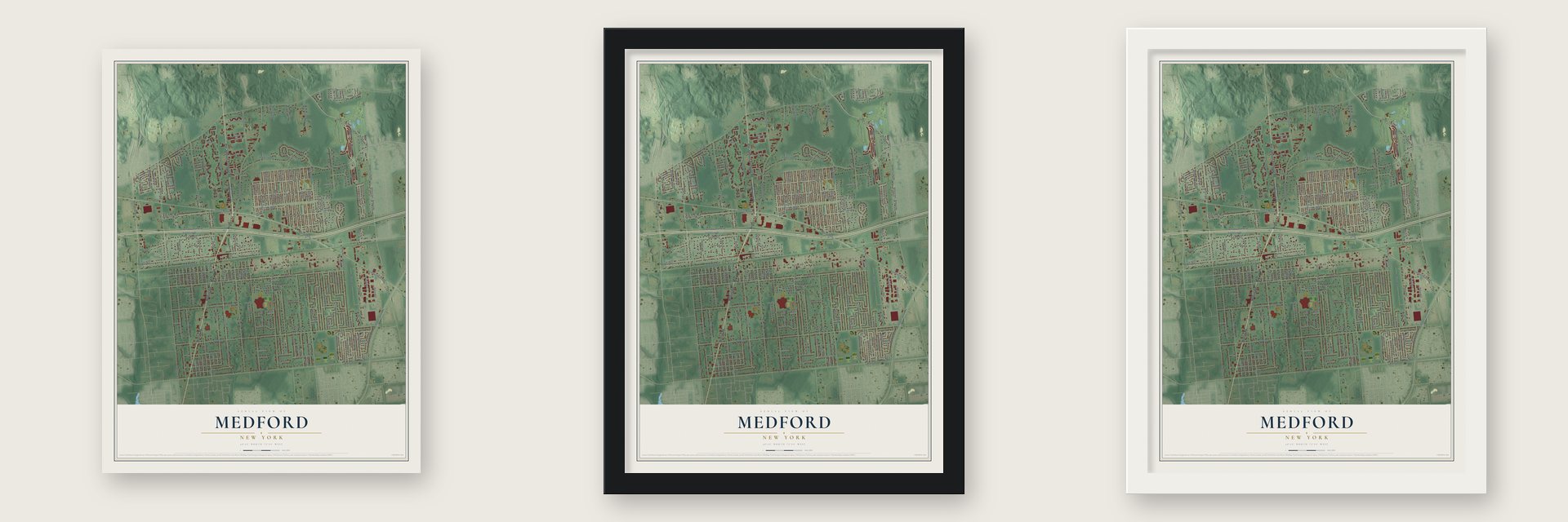
Unframed archival matte, a black wood frame or a white wood frame.
Up close
Geography Worth Displaying
This map was created using accurate cartographic data and authoritative geographic sources, including the U.S. Geological Survey (USGS) and FEMA. The map brings together terrain, waterways, roads, and building detail. The majority of the streets are labeled, houses are accurately depicted, and the topography is derived from government sources. Combining local data with carefully composed color and shading leads to this beautifully detailed Medford artwork for your wall.
Rather than simply showing street outlines, we’ve included as many of the street names as we could reasonably fit on the map while keeping their names legible. Zoom in on the high resolution preview to see exactly what’s on the map. We truly set out to create a statement piece for anyone who loves Medford. So whether it’s for you, or a gift for someone you love, we hope this map of Medford brings back fond memories.
Explore the full map of Medford, New York and read about the local places it shows.
Find your street
Names on the Medford map
Every name below is printed on this map. Look for your street, your school, the park where you played, or the pond down the road.
Streets and roads229
- Medford Road
- Medford Avenue
- Port Jefferson-Patchogue Road
- North Ocean Avenue
- Mill Road
- John Roe Smith Avenue
- Lake Drive
- Hagerman Avenue
- Bellport Lane Road
- Fire Road
- Coram - Yaphank
- Fire Avenue
- Maine Avenue
- East Woodside Avenue
- Bellport Road
- Woodside Avenue East
- Middle Island Road
- Rhode Island Avenue
- Farm To Market Road
- Horseblock Road North
- Middle Island Avenue
- Horseblock Road
- Granny Road
- Long Island Avenue
- Expressway Drive North
- Expressway Drive
- Old Medford Avenue
- Southaven Avenue
- Peconic Avenue
- Jamaica Avenue
Show all 229 streets
- Bellmore Avenue
- Sipp Avenue
- Patchogue-Yaphank Road
- Sills Road
- Robinson Avenue
- Country Road
- Buffalo Avenue
- Pennsylvania Avenue
- Bellport Avenue
- Oregon Avenue
- Syracuse Avenue
- Maple Street
- Oak Street
- Waverly Avenue
- Mount Vernon Avenue
- Falcon Avenue
- Tremont Avenue
- Birchwood Road
- National Boulevard
- Fairmont Avenue
- Greenport Avenue
- Augusta Drive
- Blue Ridge Drive
- Kane Avenue
- Richmond Avenue
- Cherry Lane
- Apple Lane
- Connecticut Avenue
- Race Avenue
- Wave Avenue
- Heather Avenue
- Matsunaye Drive
- Eagle Avenue
- White Pine Way
- Munsell Road
- Ohio Avenue
- Gull Avenue
- Pitchpine Place
- Meyer Lane
- Watchill Avenue
- Cedarhurst Avenue
- Oakdale Avenue
- Locust Avenue
- Industrial Boulevard
- New London Avenue
- Knickerbocker Avenue
- Jordan Drive
- Olympic Avenue
- Park Avenue
- Timber Trail Lane
- First Avenue
- Newport Avenue
- Blackpine Drive
- Addison Place
- Neil Drive
- Laurel Avenue
- Beechnut Avenue
- Chestnut Avenue
- Crooked Pine Drive
- North Dunton Avenue
- Balsam Drive
- Devon Avenue
- Bridgeport Avenue
- Redpine Drive
- Clusterpine Street
- Meadow Avenue
- Audobon Street
- Narragansett Avenue
- Acorn Avenue
- Petty Lane
- Scotch Pine Drive
- Nantucket Drive
- Ash Drive
- Fleetwood Drive
- Mulligan Drive
- Allegheny Drive East
- Norwalk Avenue
- Torrey Pine Lane
- Rice Court
- Lacebark Lane
- Phillips Drive
- Elmhurst Avenue
- Whittier Avenue
- Villas Drive
- Peekskill Avenue
- Virginia Drive
- Forest Avenue
- Platinum Court
- Franklin Avenue
- Ferrick Avenue
- Winged Foot Drive
- Euclid Avenue
- Nevada Avenue
- California Avenue
- Jeff Street
- Justin Drive
- Inwood Avenue
- Station Road
- Fordham Avenue
- Newburgh Avenue
- Oswego Avenue
- Buckshill Street
- Village Drive
- Silver Pine Drive
- Pleasant Avenue
- Paddock Lane
- Concord Avenue
- Sand Hills Lane
- Saratoga Avenue
- Holland Avenue
- Lisa Court
- Connelly Drive
- Second Avenue
- Prospect Avenue
- Tilney Avenue
- Masem Court
- West Gate
- Home Drive
- Americus Avenue
- Nixon Street
- Boston
- Hanover Place
- Florida Avenue
- Illinois Avenue
- Longleaf Lane
- Manor Road
- Melissa Drive
- Richard Drive
- Deering Court
- Daryl Drive
- Golf Lane
- Short Street
- Lad Avenue
- Port Jefferson and Patchogue Road
- Clifford Lane
- Caroline Street
- Commercial Boulevard
- Allegheny Drive West
- Tupper Avenue
- Pebble Beach Road
- Town of Brookhaven Way
- Daremy Circle
- Fairview Avenue
- Lollypine Lane
- Norway Pine Drive
- Carson Lane
- Pacific Dunes Court
- Lovers Lane
- Jacobsen Court
- Evergreen Avenue
- Kennedy Avenue
- Edward Avenue
- Long Acre Court
- Dourland Road
- Madison Avenue
- Lyndsie Court
- Sterling Court
- Prager Court
- Lorraine Court
- Bari Lane
- Sandra Court
- Georgia Pine Place
- Vine Street
- Poe Drive
- Cobb Lane
- Classic Court
- Emily Court
- Angela Court
- Willow Court
- Russell Court
- Kross Court
- Karl Court
- Lee Lane
- Billy Court
- Bloomington Street
- Christopher Court
- Dyberry Street
- Yonkers Avenue
- Locust Avenue South
- Camden Court
- Phineas Street
- Gary Drive
- Mark Trail
- Sharon Court
- Roberta Lane
- Poplar Lane
- Tee Box Court
- Handy Lane
- Tara Court
- Neil Court
- Harlem Avenue
- Victorian Lane
- Mount Wilson Avenue
- Whitman Drive
- Amsterdam Avenue
- West End Drive
- Roywood Court
- Fox Hunt Lane
- Maure Avenue
Names are listed as they appear on the printed map. Zoom into the product photos to find them.
About Medford, New York
Medford began in 1843, when the Long Island Rail Road built a station in flat, empty pine barrens. A post office soon followed. In 1907 the railroad set up the Medford Prosperity Farm on 80 acres. It proved that crops could grow in the sandy pine barrens.
Keep exploring New York
Medford is one of 2,112 New York towns we've mapped. Every dot on the map is a print of its own.
The search covers every state, New York first.
Near Medford
Order 2 or more town maps and save 10%. Shown in the size and finish you picked above, so they hang as a set.
- Brookhaven 12" x 18" / Archival Matte Print $39.99
- Yaphank 12" x 18" / Archival Matte Print $39.99
- Farmingville 12" x 18" / Archival Matte Print $39.99

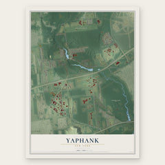

More maps nearby: Gordon Heights, Holtsville, North Bellport, North Patchogue and East Patchogue.
The art of mapping a place
How This Map Was Made
Real places. Remarkable detail. Discover the layers that turn geographic data into a map of home.

The view from above
Aerial imagery reveals the character of the land: woodland, open fields, and the patterns of a place.

The shape of the land
Elevation data brings hills, valleys, and subtle changes in the landscape into view.

The details of home
Roads, waterways, and building footprints come together to make the map feel unmistakably local.

Geography becomes art
Considered color, shading, and typography bring the layers together in a map made for your wall.


Process illustrated with Mendon, Massachusetts. Aerial imagery: USDA NAIP. Terrain: USGS 3D Elevation Program. Map details and finished artwork: KNOWOL.
The Details
About This Print
Choose an archival matte print, or a black or white Ayous wood frame. The archival matte print is unframed.
Select your size and finish above to see the matching product image and price.
Materials & Craftsmanship
A contemporary map with the character of a classic atlas, printed on archival matte paper. Optional frames are made from Ayous wood.
Your printed map does not include the watermark shown in the full-map preview.
Shipping & Delivery
Free shipping within the United States. Every print is made to order in the USA.
Buying a gift? Add a note in your cart and we'll include it. We never put prices in the package.
Prints ship within 2 to 3 business days. Allow 7 to 10 days total from ordering for delivery. Timing may vary during holidays or periods of high order volume.
Read our shipping policy.
Returns and damaged prints
Each print is made to order. Change-of-mind refunds are not available after production.
If your print arrives damaged, misprinted or incorrect, contact support@knowol.com within 30 days of receiving it. Include your order number, photos and a description of the issue.
Read our full refund and replacement policy. For questions about your order, email support@knowol.com.