
Search for another town




Free U.S. delivery 7 to 10 days after you order
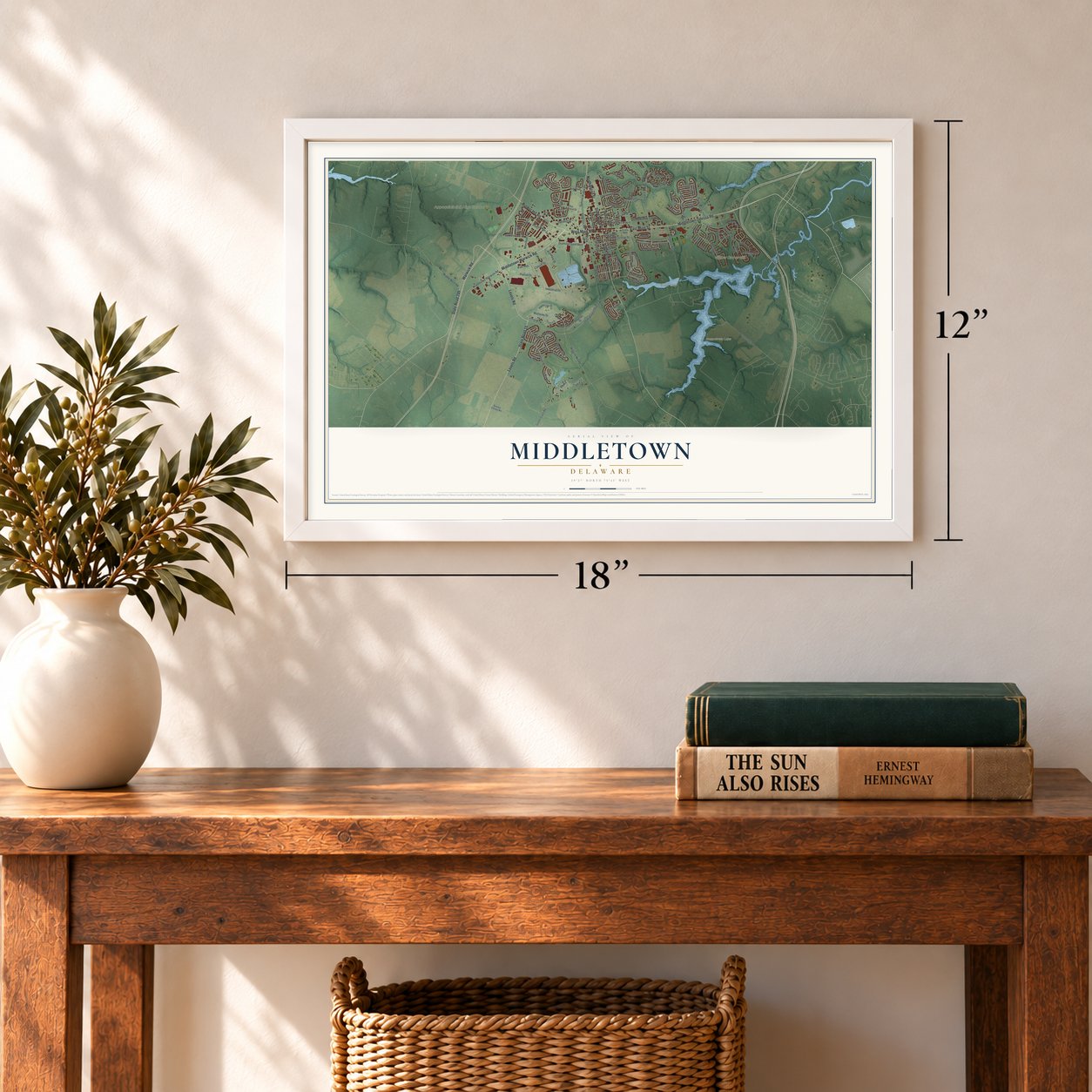
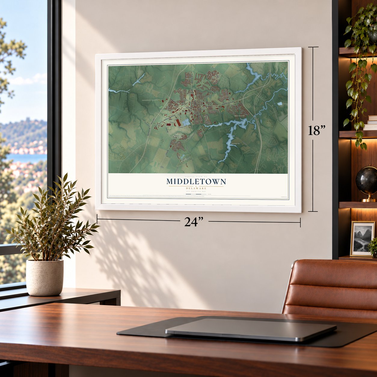
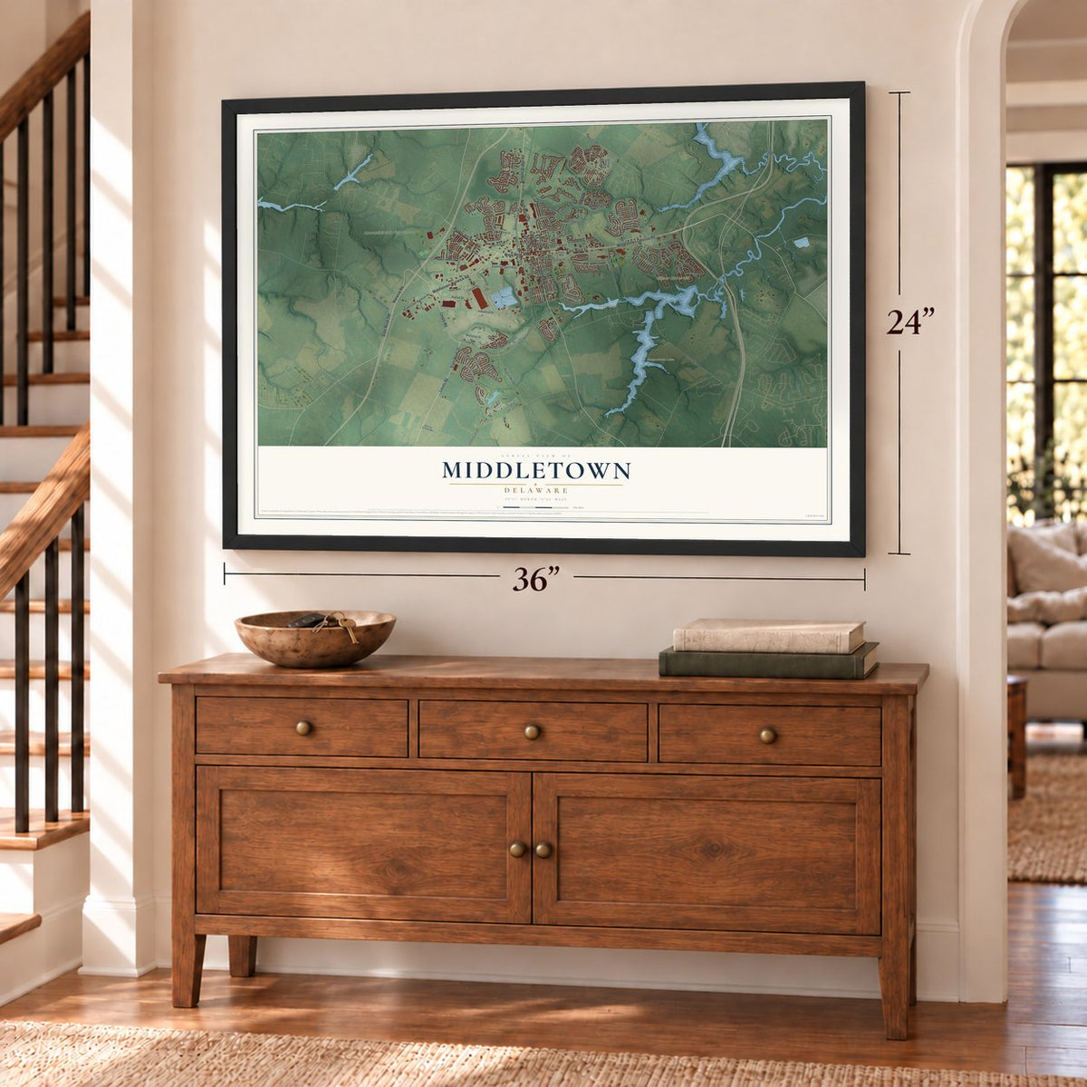
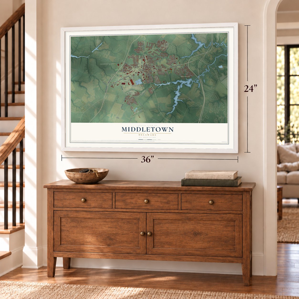
Middletown, Delaware Map Art
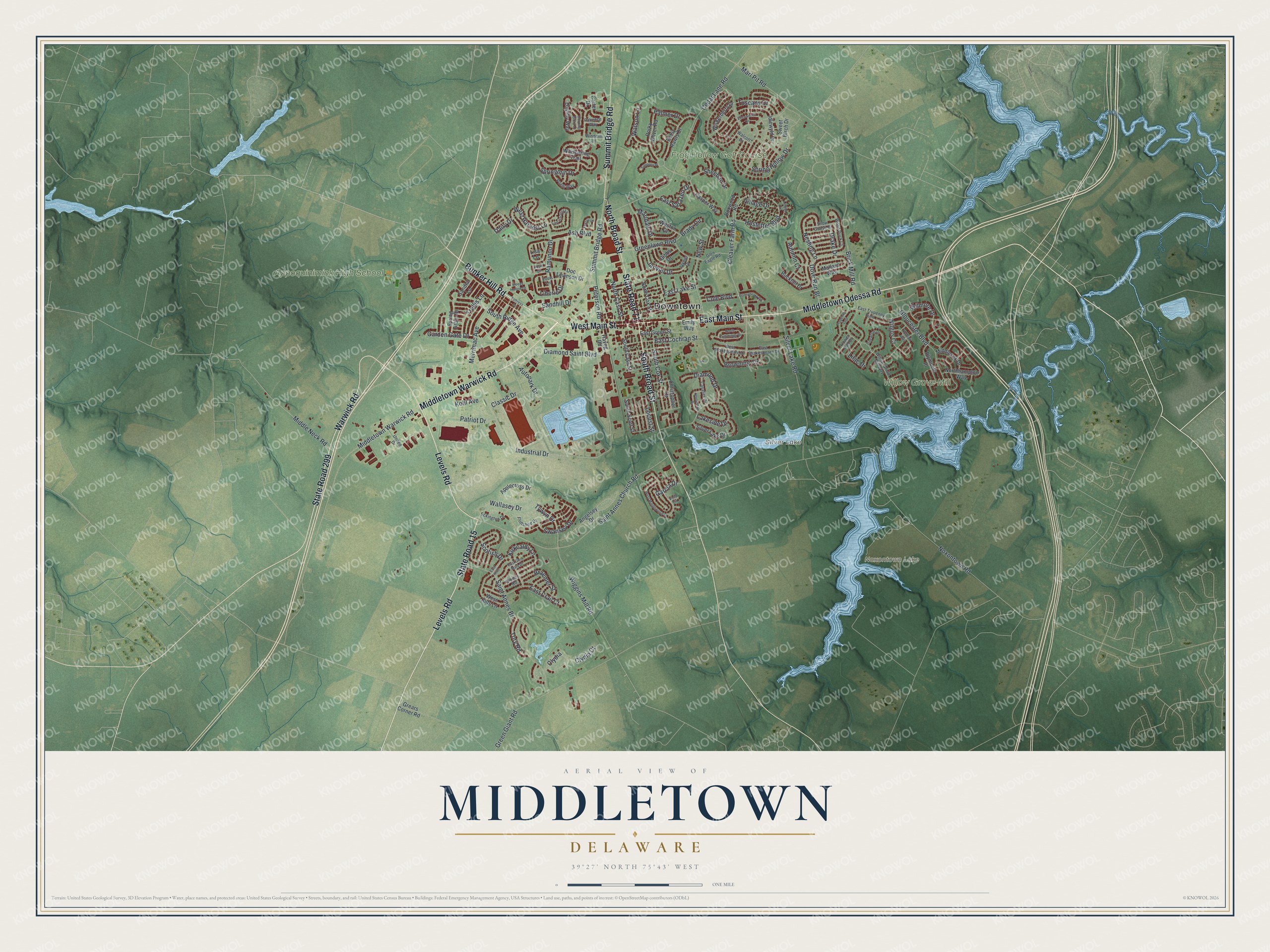
A new map of Middletown, Delaware, made in 2026 and printed to order on thick archival matte paper.
12" x 18" Archival Matte Print
A Map of Home. A Work of Art.
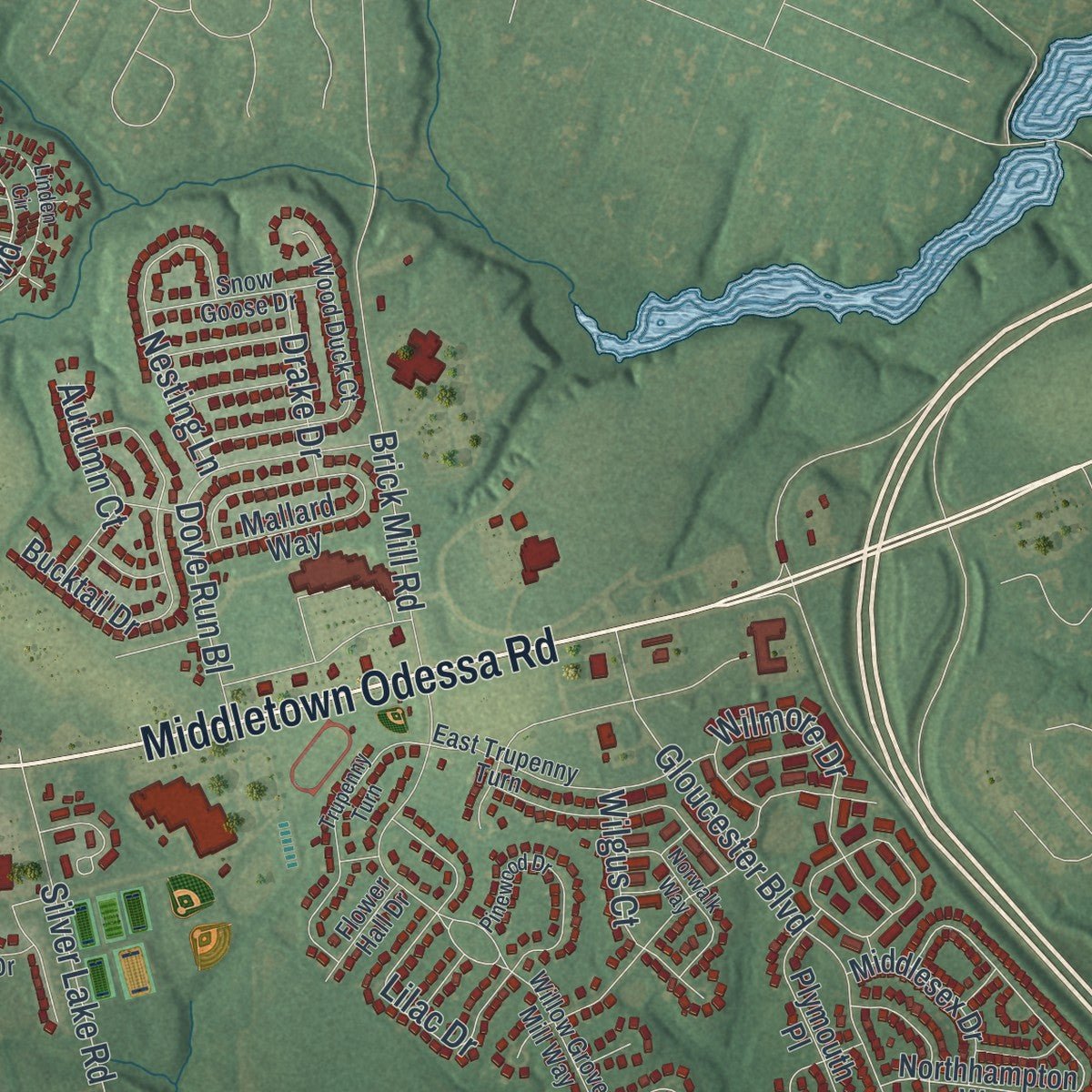
Explore Middletown, Delaware from a whole new perspective. Created using aerial imagery and detailed geographic data, this map captures Middletown building by building, with labeled streets, familiar landmarks, and shaded topographical relief that highlights the natural contours of the landscape.
Combining modern data with the timeless character of a vintage atlas, this map is just as interesting up close as it is beautiful on the wall. Whether you grew up in Middletown, spent memorable years there, or call it home today, this unique map is a great way to celebrate a place that means something to you. Zoom in on the preview to look for your street, and then order a print to put your memories on the wall.
Three ways to hang it
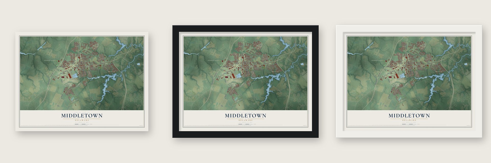
Unframed archival matte, a black wood frame or a white wood frame.
Up close
Geography Worth Displaying
This map was created using accurate cartographic data and authoritative geographic sources, including the U.S. Geological Survey and the Census Bureau. The map brings together terrain, waterways, roads, and building detail. The majority of the streets are labeled, houses are accurately depicted, and the topography is derived from government sources. Combining local data with carefully composed color and shading leads to this beautifully detailed Middletown artwork for your wall.
Rather than simply showing street outlines, we’ve included as many of the street names as we could reasonably fit on the map while keeping their names legible. Zoom in on the high resolution preview to see exactly what’s on the map. We truly set out to create a statement piece for anyone who loves Middletown. So whether it’s for you, or a gift for someone you love, we hope this map of Middletown brings back fond memories.
Read the story behind this map of Middletown, Delaware from 2026.

About Middletown, Delaware
Middletown is a town of 23,192 people in New Castle County. In 1675 Adam Peterson took out warrants for the ground where the town would later rise, and surveyors first measured it in 1678. Middletown was incorporated in 1861, and its weekly paper, the Middletown Transcript, printed its first edition on January 4, 1868.
In recent years the town has annexed new land, and it is now called the fastest growing area in Delaware. Its population grew 206.3% between 2000 and 2010, as new neighborhoods to the north drew commuters from Wilmington and Philadelphia. To keep up, the town formed its own police department, which went on duty on October 3, 2007, with 20 officers.
“Queen Anne of England, for whom the Church was named is said to have been a patron.”
- Dead Poets Society, 1989Peter Weir shot nearly all of Dead Poets Society, starring Robin Williams and Ethan Hawke, on the grounds of St. Andrew's School, a coed Episcopal boarding school in town. For the play scene, the crew moved to The Everett Theatre on Main Street. Part of the West Wing episode "Two Cathedrals" was also shot at St. Andrew's.
- The Olde Tyme Peach FestivalEvery August, Main Street closes to cars for the Olde Tyme Peach Festival, which opens with a parade and draws tens of thousands of visitors. There is music, local art, history exhibits and peach treats sold only for the day, plus a 5k whose proceeds go to local sports boosters. The town also holds the Hummers parade, a send-up of Philadelphia's Mummers that pokes fun at the year's news.
- Redding High SchoolBefore desegregation, Black students went to Louis L. Redding Comprehensive High School, run by Middletown School District 120 from 1953 to 1966. Schools desegregated after 1966, and on July 1, 1969, the Middletown and Odessa districts merged into the Appoquinimink School District.
Find your street
Names on the Middletown map
Every name below is printed on this map. Look for your street, your school, the park where you played, or the pond down the road.
Places and landmarks6
- Downtown
- Frog Hollow Golf Course
- Appoquinimink High School
- Noxontown Lake
- Willow Grove Mill
- Silver Lake
Streets and roads154
- State Road 299
- State Road 15
- Middletown Warwick Road
- Middletown Odessa Road
- East Main Street
- Bunker Hill Road
- West Main Street
- Warwick Road
- Levels Road
- North Broad Street
- South Broad Street
- State Road 71
- Summit Bridge Road
- Cleaver Farm Road
- Hostetter Boulevard
- Diamond Saint Boulevard
- South Ridge Avenue
- Springmill Drive
- New Street
- Tywyn Drive
- Lilac Drive
- Scotish Drive
- Clydia
- Spring Hollow Drive
- Industrial Drive
- Saint Annes Church Road
- Cedar Lane Road
- Gloucester Boulevard
- Green Giant Road
- Saint Annes Bl
Show all 154 streets
- Patriot Drive
- Autopark Drive
- Wiggins Mill Road
- Lakeside Drive
- Silver Lake Road
- Merrimac Avenue
- Middle Neck Road
- Kirkcaldy Lane
- Brick Mill Road
- Marl Pit Road
- Wilmore Drive
- West Harvest Lane
- Greenlawn Boulevard
- South Cox Street
- Dove Run Bl
- Liborio Drive
- Noxontown Road
- Swansea Drive
- East Cochran Street
- Tuscany Drive
- Ramunno Drive
- Janvier Drive
- Wallasey Drive
- Browning Circle
- East Lake Street
- Nesting Lane
- East Crail Court
- Marldale Drive
- Diamond Drive
- East Sarazen Drive
- Braemer Street
- Garden Gate Drive
- Trellis Lane
- Sheehan Drive
- Watson Lane
- Ash Boulevard
- Peterson Road
- North Cass Street
- Wilgus Court
- Sandhill Drive
- Tory Road
- Autumn Court
- Village Drive
- Clydia Court
- Cole Boulevard
- Locust Street
- Classic Drive
- Drake Drive
- Palmer Drive
- Kohl Avenue
- Garcia Drive
- Brady Circle
- Dairy Drive
- Boxwood Road
- Northhampton Way
- Idlewyld Drive
- Sweet Birch Drive
- Whispering Trail
- Bucktail Drive
- Mallard Way
- South Scott Street
- Spring Arbor Drive
- South Cass Street
- Angelsey Drive
- Wickerberry Drive
- East Green Street
- Doc Levinson Drive
- Silver Lake Drive
- Betsy Rawls Drive
- West Kilts Lane
- Daylilly Way
- Plymouth Place
- Porky Oliver Road
- Casper Way
- Applecross Drive
- North Cox Street
- Middlesex Drive
- Grears Corner Road
- Carter Drive
- Weston Drive
- Haveg Road
- Christopher Drive
- Gibbs Drive
- Sandial Lane
- Lisa Lane
- Emily Way
- Willow Grove Mill Way
- Jaynier Drive
- Wood Duck Court
- East Trupenny Turn
- East Shakespeare Drive
- Patience Way
- Eckington Drive
- Snow Goose Drive
- West Shakespeare Drive
- Cavalier Drive
- Glen Eagle Road
- Poets Way
- Flintshire Drive
- Windmill Lane
- Flower Hall Drive
- United Drive
- Louis Lane
- Orkney Road
- Walcott Drive
- North Cummings Drive
- East Kilts
- Ellenwood Drive
- East Harvest Lane
- Sleepy Hollow Drive
- Trupenny Turn
- West Minglewood Drive
- Linden Circle
- Toftress Drive
- Pinewood Drive
- East Glen Mare Drive
- Norwalk Way
- Horseshoe Drive
- Bonnybrook Road
- Morning Glory Lane
- Simpson Place
- Foxtail Lane
- Rosie Drive
- Viola Circle
Names are listed as they appear on the printed map. Zoom into the product photos to find them.
The art of mapping a place
How This Map Was Made
Real places. Remarkable detail. Discover the layers that turn geographic data into a map of home.

The view from above
Aerial imagery reveals the character of the land: woodland, open fields, and the patterns of a place.

The shape of the land
Elevation data brings hills, valleys, and subtle changes in the landscape into view.

The details of home
Roads, waterways, and building footprints come together to make the map feel unmistakably local.

Geography becomes art
Considered color, shading, and typography bring the layers together in a map made for your wall.


Process illustrated with Mendon, Massachusetts. Aerial imagery: USDA NAIP. Terrain: USGS 3D Elevation Program. Map details and finished artwork: KNOWOL.
The Details
About This Print
Choose an archival matte print, or a black or white Ayous wood frame. The archival matte print is unframed.
Select your size and finish above to see the matching product image and price.
Materials & Craftsmanship
A contemporary map with the character of a classic atlas, printed on archival matte paper. Optional frames are made from Ayous wood.
Your printed map does not include the watermark shown in the full-map preview.
Shipping & Delivery
Free shipping within the United States. Every print is made to order in the USA.
Buying a gift? Add a note in your cart and we'll include it. We never put prices in the package.
Prints ship within 2 to 3 business days. Allow 7 to 10 days total from ordering for delivery. Timing may vary during holidays or periods of high order volume.
Read our shipping policy.
Returns and damaged prints
Each print is made to order. Change-of-mind refunds are not available after production.
If your print arrives damaged, misprinted or incorrect, contact support@knowol.com within 30 days of receiving it. Include your order number, photos and a description of the issue.
Read our full refund and replacement policy. For questions about your order, email support@knowol.com.
Find your town
Looking for another city?
Find a map of home in our Delaware collection, or any town in the country.
Nearby
Maps of towns near Middletown
Know someone from one of these towns? Their map makes a great gift.
 Townsend
, Delaware
From $39.99See the map
 Odessa
, Delaware
From $39.99See the map
 Port Penn
, Delaware
From $39.99See the map
More maps nearby: St. Georges, Glasgow, Delaware City, Smyrna and Bear.