
Search for another town




Free U.S. delivery 7 to 10 days after you order
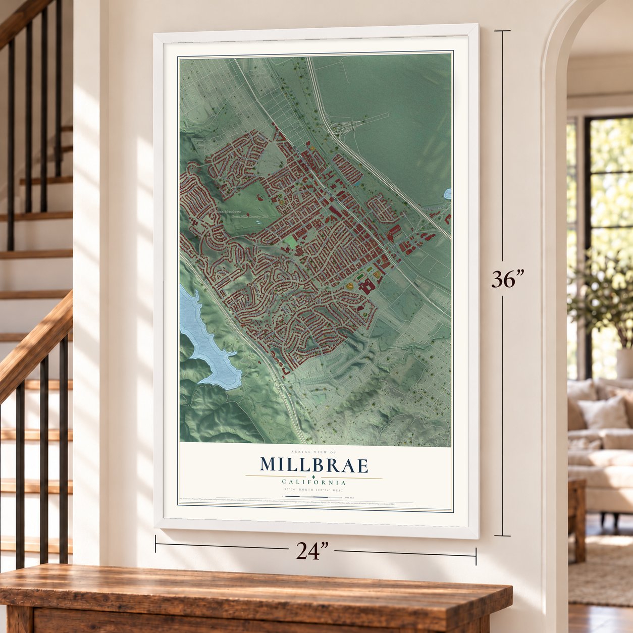
Millbrae, California Map Art
A new map of Millbrae, California, made in 2026 and printed to order on thick archival matte paper.
12" x 18" Archival Matte Print
A Map of Home. A Work of Art.
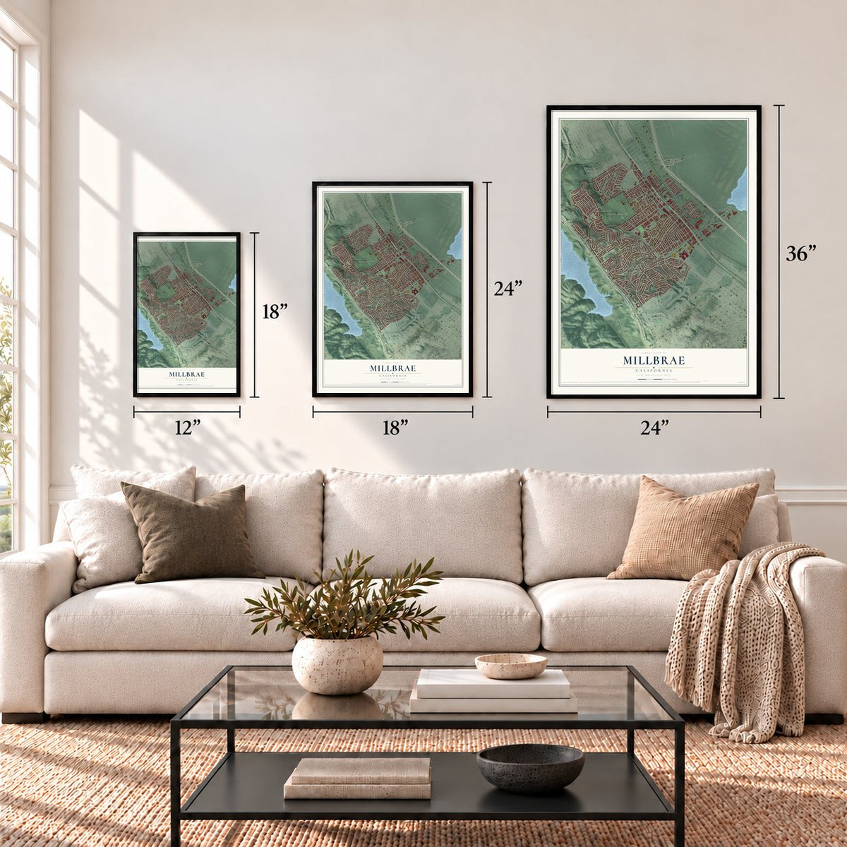
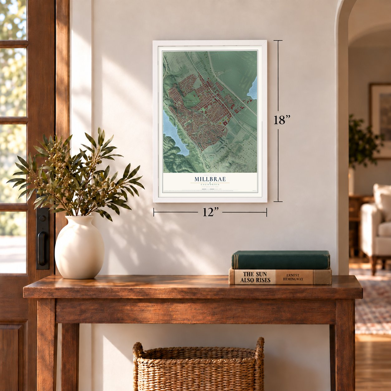
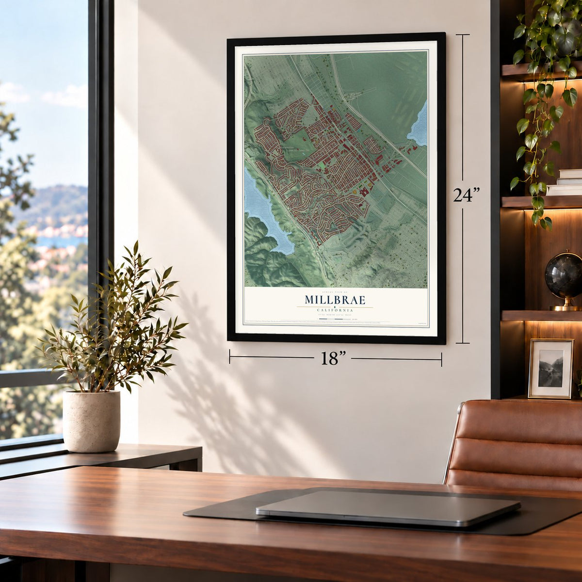
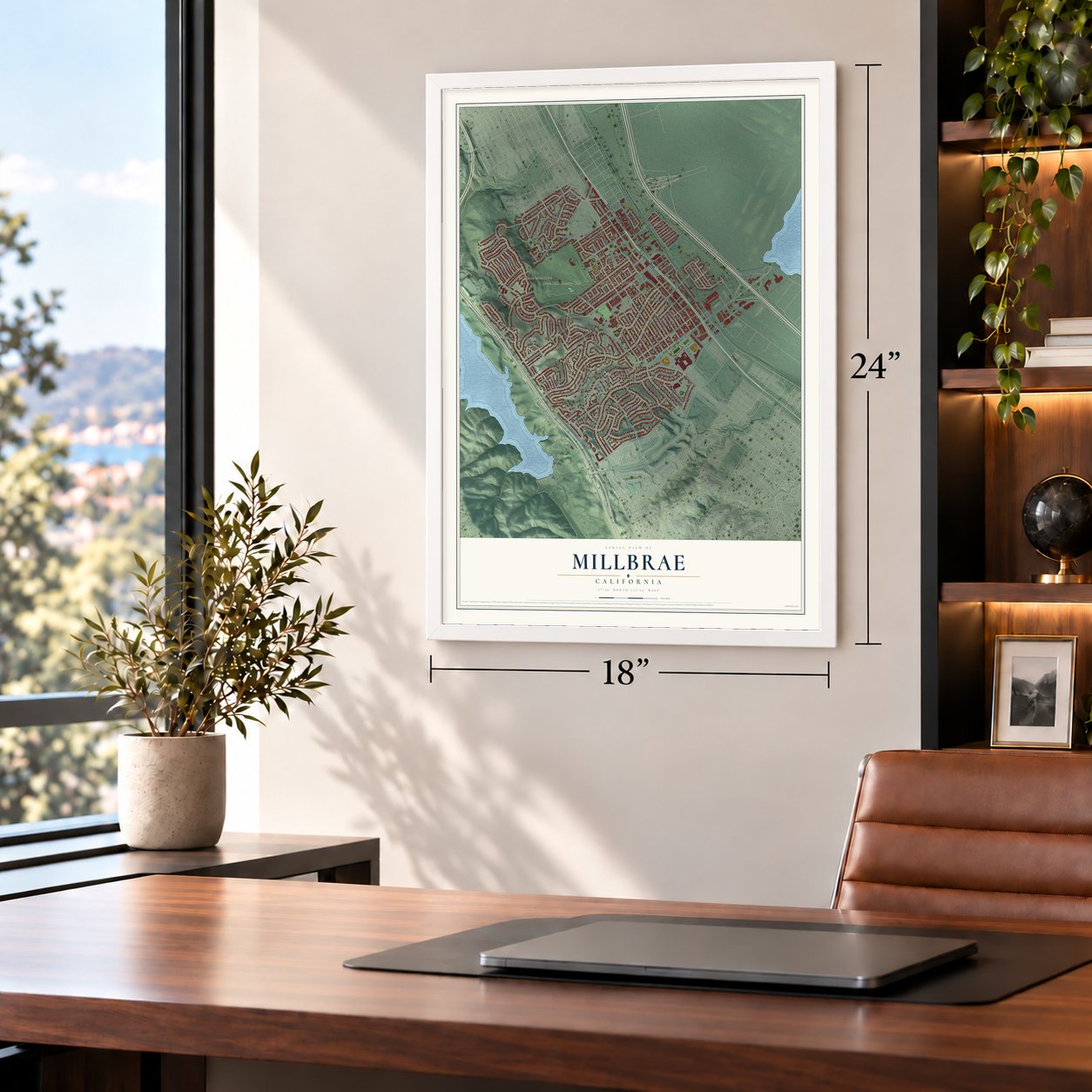
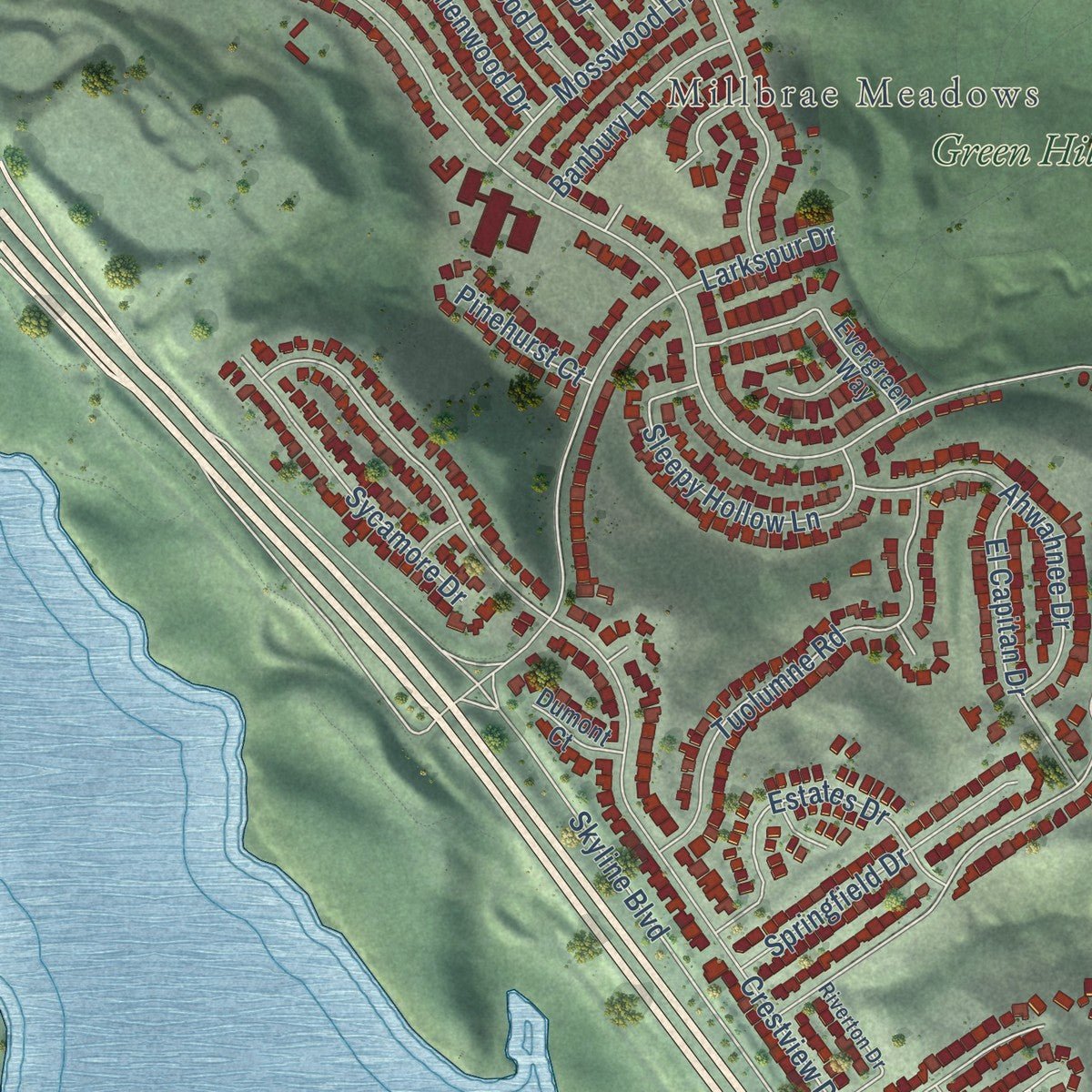
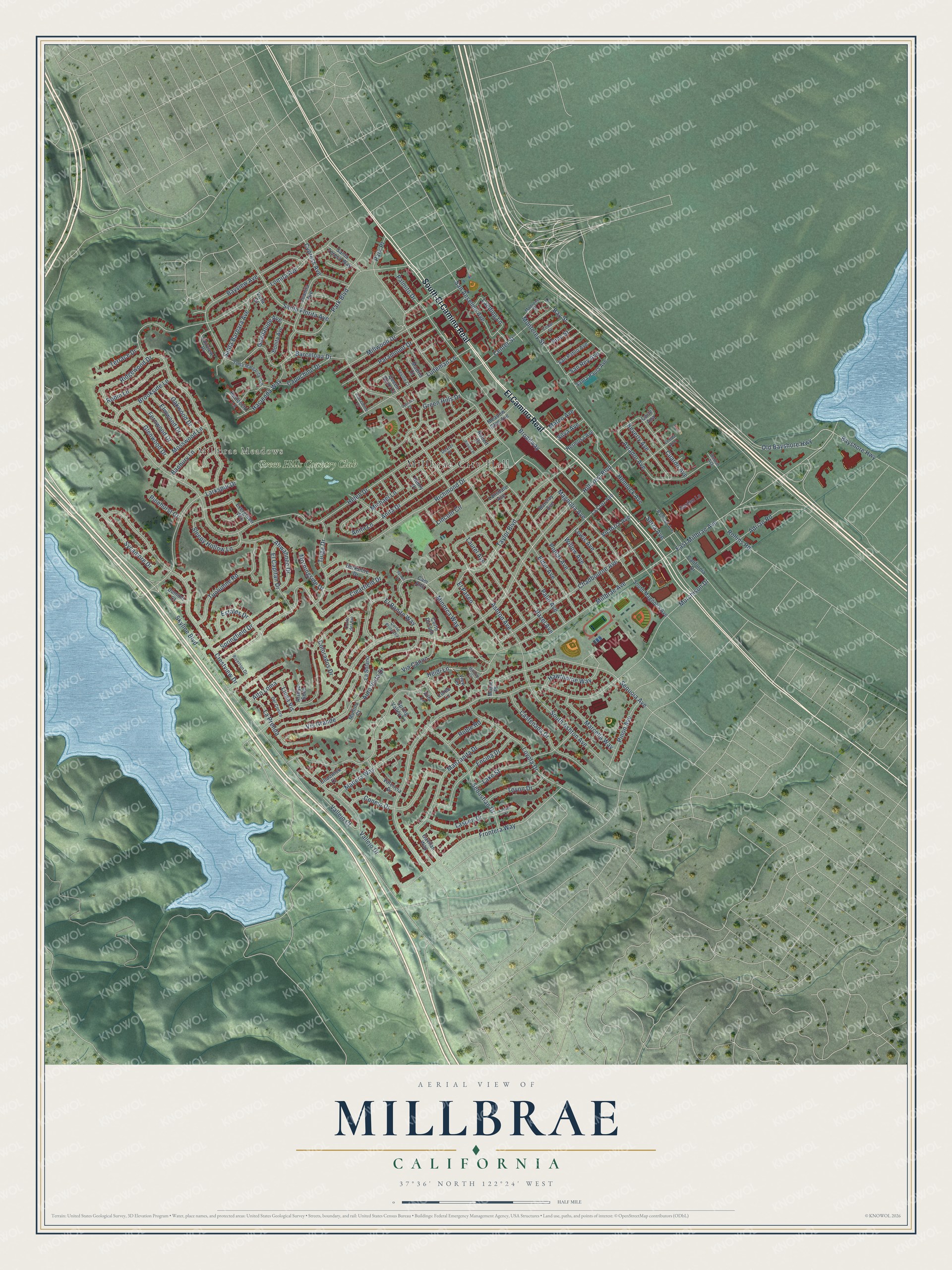
Explore Millbrae, California from a whole new perspective. Created using aerial imagery and detailed geographic data, this map captures Millbrae building by building, with labeled streets, familiar landmarks, and shaded topographical relief that highlights the natural contours of the landscape.
Combining modern data with the timeless character of a vintage atlas, this map is just as interesting up close as it is beautiful on the wall. Whether you grew up in Millbrae, spent memorable years there, or call it home today, this unique map is a great way to celebrate a place that means something to you. Zoom in on the preview to look for your street, and then order a print to put your memories on the wall.
Three ways to hang it
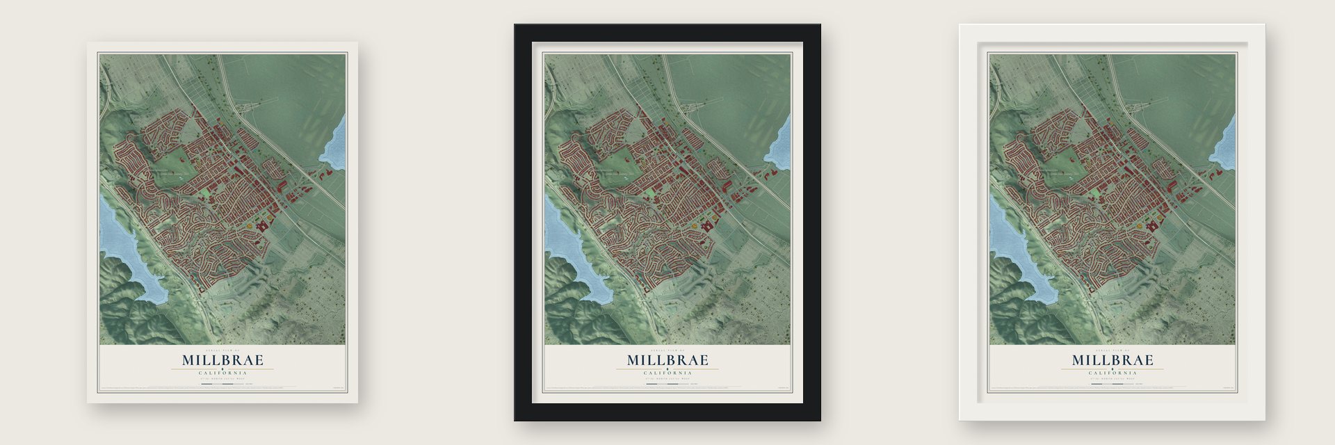
Unframed archival matte, a black wood frame or a white wood frame.
Up close
Geography Worth Displaying
This map was created using accurate cartographic data and authoritative geographic sources, including the U.S. Geological Survey and the Census Bureau. The map brings together terrain, waterways, roads, and building detail. The majority of the streets are labeled, houses are accurately depicted, and the topography is derived from government sources. Combining local data with carefully composed color and shading leads to this beautifully detailed Millbrae artwork for your wall.
Rather than simply showing street outlines, we’ve included as many of the street names as we could reasonably fit on the map while keeping their names legible. Zoom in on the high resolution preview to see exactly what’s on the map. We truly set out to create a statement piece for anyone who loves Millbrae. So whether it’s for you, or a gift for someone you love, we hope this map of Millbrae brings back fond memories.
Read the story behind this map of Millbrae, California from 2026.

About Millbrae, California
Millbrae is a city of 23,216 people in San Mateo County, between San Francisco International Airport and San Andreas Lake. On November 4, 1769, the Portolà expedition came down from Sweeney Ridge and camped for the night near the lake, on what is now the city's western edge. In 1827 the governor of Alta California let José Antonio Sánchez use Rancho Buri Buri, which took in part of present-day Millbrae, for grazing and farming.
In the 1860s Darius Ogden Mills bought part of the rancho from José de la Cruz Sánchez and built a country estate. People called it Millbrae, joining his name to brae, the Scottish word for a hill slope. Trains from San Francisco arrived in 1863, but the town grew slowly, and the 1890 census found only 243 residents. After more than a decade of debate, pushed along by the weekly Millbrae Sun, residents took their city charter to Sacramento on January 14, 1948, and elected W.F. Leutenegger mayor of nearly 8,000 people.
- A MacKenzie course from 1929Green Hills Country Club was built in 1929 on a course designed by Dr. Alister MacKenzie, the architect of Augusta National and Cypress Point. It was the Union League Golf Club of San Francisco from 1930 to 1933 and Millbrae Country Club from 1933 to 1945. Today it is a green belt in the middle of the city, and it may be the only place in town where creeks still run in the open.
- A depot on the 1863 lineThe San Francisco and San Jose Railroad, which later became Caltrain, began running through Millbrae in 1863. Southern Pacific laid a second track in 1904, and by the 1940s 26 trains a day ran between San Francisco and San Jose. The Southern Pacific Depot joined the National Register in 1978.
- Sixteen Mile House, 1872In 1872 some of the Sánchez family opened the first Sixteen Mile House near the Mills estate, where travelers could stop to rest and eat. The county history names a merchant called Garnot as Millbrae's pioneer, the man who first set up in business here.
- A hilltop for the airportIn the 1940s a Millbrae hilltop was cut away and used as fill for the growing San Francisco Airport next door. The airport was named an international airport in 1954, when its Central Terminal was finished.
- Volunteers and a private patrolResidents formed a volunteer fire department in 1931, and it stayed all volunteer until 1938. For police, merchants and residents paid for a private patrol. That ended in 1941, the year the county's Board of Supervisors set up the Millbrae Police District.
Find your street
Names on the Millbrae map
Every name below is printed on this map. Look for your street, your school, the park where you played, or the pond down the road.
Places and landmarks3
- Millbrae City Hall
- Millbrae Meadows
- Green Hills Country Club
Streets and roads168
- South El Camino Real
- El Camino Real
- East Millbrae Avenue
- Millbrae Avenue
- Skyline Boulevard
- Bay Street
- Broadway
- Ashton Avenue
- Murchison Drive
- Hillcrest Boulevard
- Helen Drive
- Magnolia Avenue
- Vis Grande
- Lomita Avenue
- Laurel Avenue
- Crestview Drive
- Clearfield Drive
- Ridgewood Drive
- Richmond Drive
- Taylor Boulevard
- Barcelona Drive
- Chadbourne Avenue
- Frontera Way
- Poplar Avenue
- Palm Avenue
- Vallejo Drive
- Sequoia Avenue
- Aviador Avenue
- Bayview Avenue
- Larkspur Drive
Show all 168 streets
- El Bonito Way
- Hazel Avenue
- Park Boulevard
- La Prenda
- Anita Drive
- Capuchino Drive
- Manzanita Drive
- South Ashton Avenue
- Elder Avenue
- Ludeman Lane
- Hemlock Avenue
- Millwood Drive
- Loyola Drive
- Sebastian Drive
- Conejo Drive
- Tuolumne Road
- Lake Street
- Green Hills Drive
- Encina Drive
- Paramount Drive
- Castenada Drive
- Minorca Way
- Tioga Drive
- Morningside Drive
- Old Bayshore Highway
- Ahwahnee Drive
- San Anselmo Avenue
- Adrian Road
- Monterey Street
- Santa Florita Avenue
- Madera Way
- Santa Barbara Avenue
- Anita Lane
- El Paseo
- Sleepy Hollow Lane
- Springfield Drive
- Center Street
- Cuardo Avenue
- Sycamore Drive
- Hacienda Way
- Marcella Way
- Brookside Lane
- Aura Vista Drive
- Estates Drive
- Rollins Road
- Lewis Avenue
- El Capitan Drive
- Lasuen Drive
- Cypress Avenue
- Lincoln Circle
- Willow Avenue
- Robin Lane
- Beverly Avenue
- Hawthorne Way
- Pinon Avenue
- Toyon Drive
- Glenwood Drive
- Mosswood Lane
- Fernwood Drive
- Oakwood Drive
- Elmwood Drive
- Banbury Lane
- Guadalupe Avenue
- Landing Lane
- Michael Lane
- Colorados Drive
- Via Canon
- Terrace Drive
- Victoria Avenue
- Vallejo Court
- Bayshore Highway
- Alto Loma
- Serra Avenue
- Palmito Drive
- Roble Road
- San Rey Avenue
- Mateo Avenue
- Linda Vis
- Pinehurst Court
- Silva Avenue
- Park Place
- Pine Street
- Heidi Lane
- Gavilan Way
- Juanita Avenue
- La Cruz Avenue
- Evergreen Way
- California Drive
- Cam Alto
- Berkshire Drive
- South Magnolia Avenue
- Henry Place
- Robert Drive
- Valencia Drive
- Santa Paula Avenue
- Santa Teresa Way
- Bonita Avenue
- San Pablo Avenue
- Barclay Avenue
- Meadow Glen Avenue
- Hermosa Avenue
- Fairview Place
- Loree Lane
- Mullins Court
- Queen Anne Court
- La Solano
- Lansdale Avenue
- Arroyo Seco
- Bertocchi Lane
- Garden Lane
- Chadwick Court
- Spring Valley Lane
- View Terrace
- Dumont Court
- Corte Dorado
- Madrid Court
- Corte Ana
- Maple Place
- Villa Lane
- Vista Court
- Madrone Street
- Santa Margarita Avenue
- Dexter Place
- Riverton Drive
- Del Centro
- Lerida Avenue
- Cozzolino Court
- Cedar Street
- Railroad Avenue
- Seville Court
- Corte Princesa
- Roblar Avenue
- Corte del Sol
- Robert Place
- Millbrae Circle
- Lasuen Court
- Cypress Court
- Sylvan Court
Names are listed as they appear on the printed map. Zoom into the product photos to find them.
The art of mapping a place
How This Map Was Made
Real places. Remarkable detail. Discover the layers that turn geographic data into a map of home.

The view from above
Aerial imagery reveals the character of the land: woodland, open fields, and the patterns of a place.

The shape of the land
Elevation data brings hills, valleys, and subtle changes in the landscape into view.

The details of home
Roads, waterways, and building footprints come together to make the map feel unmistakably local.

Geography becomes art
Considered color, shading, and typography bring the layers together in a map made for your wall.


Process illustrated with Mendon, Massachusetts. Aerial imagery: USDA NAIP. Terrain: USGS 3D Elevation Program. Map details and finished artwork: KNOWOL.
The Details
About This Print
Choose an archival matte print, or a black or white Ayous wood frame. The archival matte print is unframed.
Select your size and finish above to see the matching product image and price.
Materials & Craftsmanship
A contemporary map with the character of a classic atlas, printed on archival matte paper. Optional frames are made from Ayous wood.
Your printed map does not include the watermark shown in the full-map preview.
Shipping & Delivery
Free shipping within the United States. Every print is made to order in the USA.
Buying a gift? Add a note in your cart and we'll include it. We never put prices in the package.
Prints ship within 2 to 3 business days. Allow 7 to 10 days total from ordering for delivery. Timing may vary during holidays or periods of high order volume.
Read our shipping policy.
Returns and damaged prints
Each print is made to order. Change-of-mind refunds are not available after production.
If your print arrives damaged, misprinted or incorrect, contact support@knowol.com within 30 days of receiving it. Include your order number, photos and a description of the issue.
Read our full refund and replacement policy. For questions about your order, email support@knowol.com.
Find your town
Looking for another city?
Find a map of home in our California collection, or any town in the country.
Nearby
Maps of towns near Millbrae
Know someone from one of these towns? Their map makes a great gift.
 Burlingame
, California
From $39.99See the map
 San Bruno
, California
From $39.99See the map
 Hillsborough
, California
From $39.99See the map
More maps nearby: South San Francisco, Pacifica, Brisbane, San Mateo and Baywood Park.