


Search for another town





Free U.S. delivery 7 to 10 days after you order
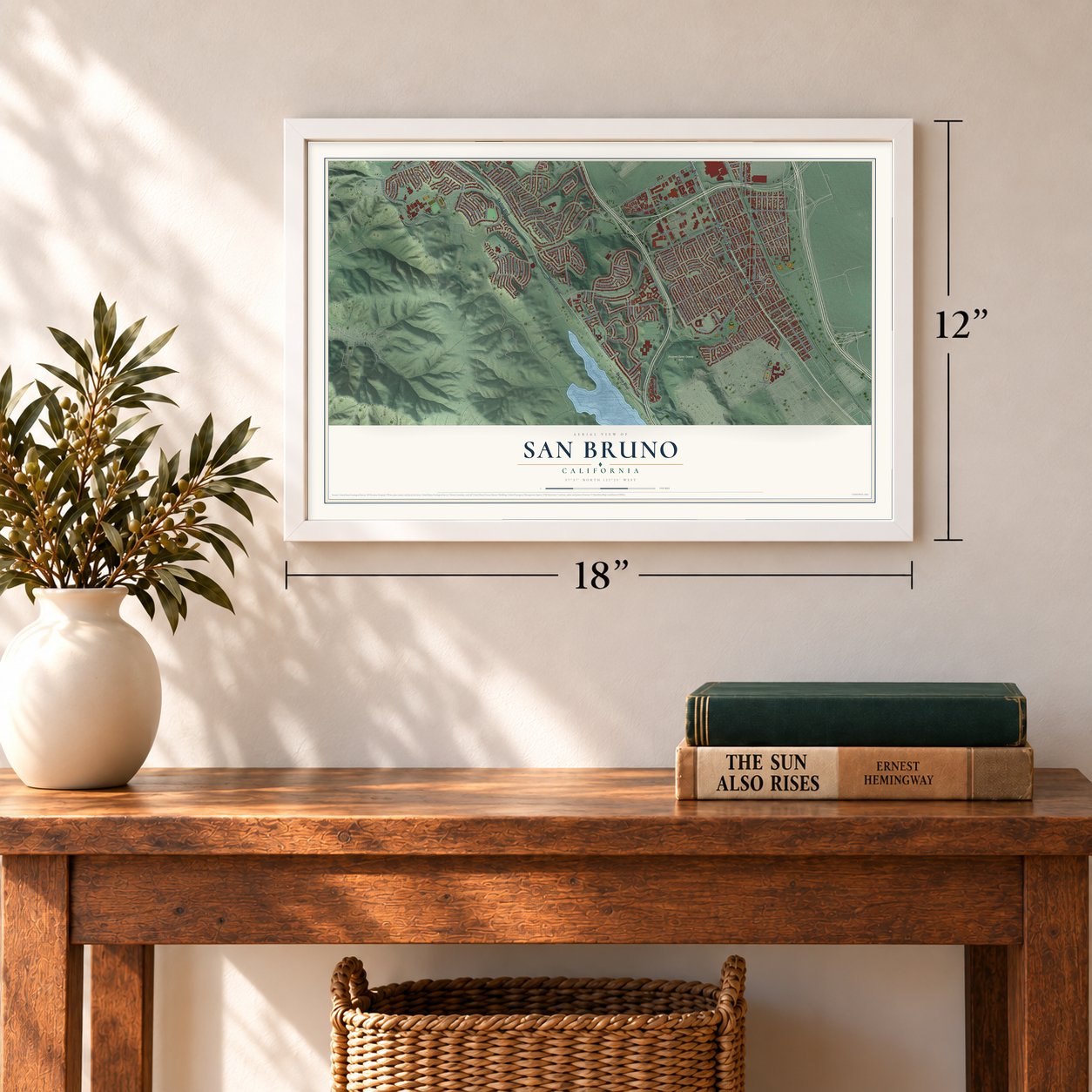
San Bruno, California Map Art
Building by building, with labeled streets and shaded relief.
12" x 18" Archival Matte Print
A Map of Home. A Work of Art.
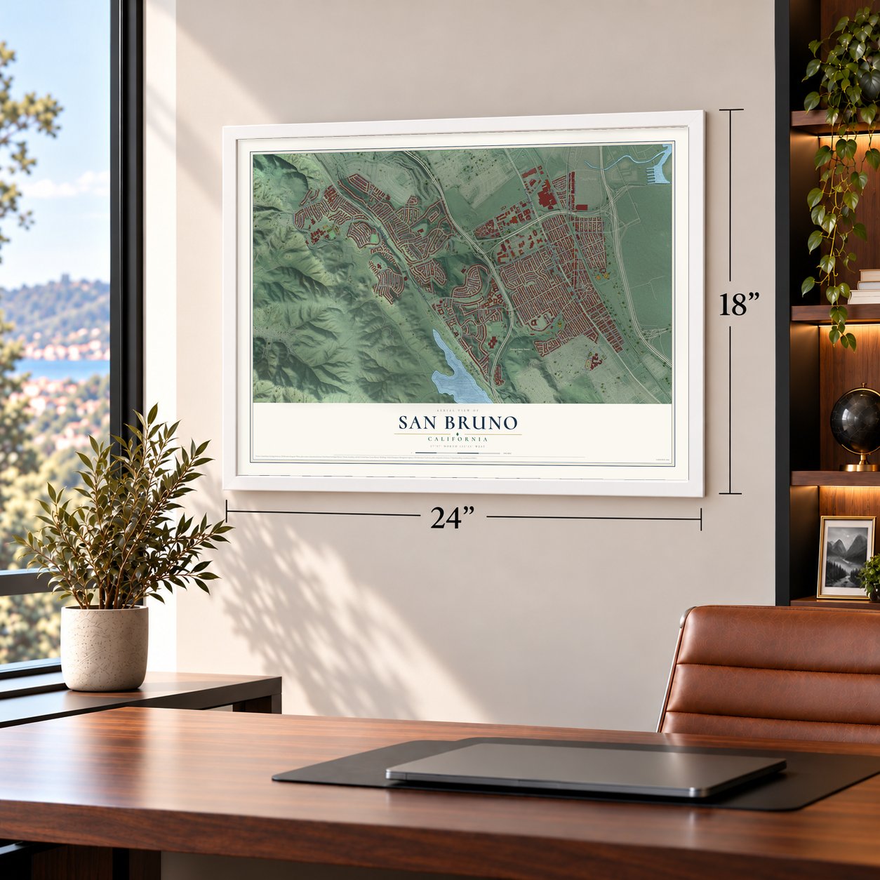
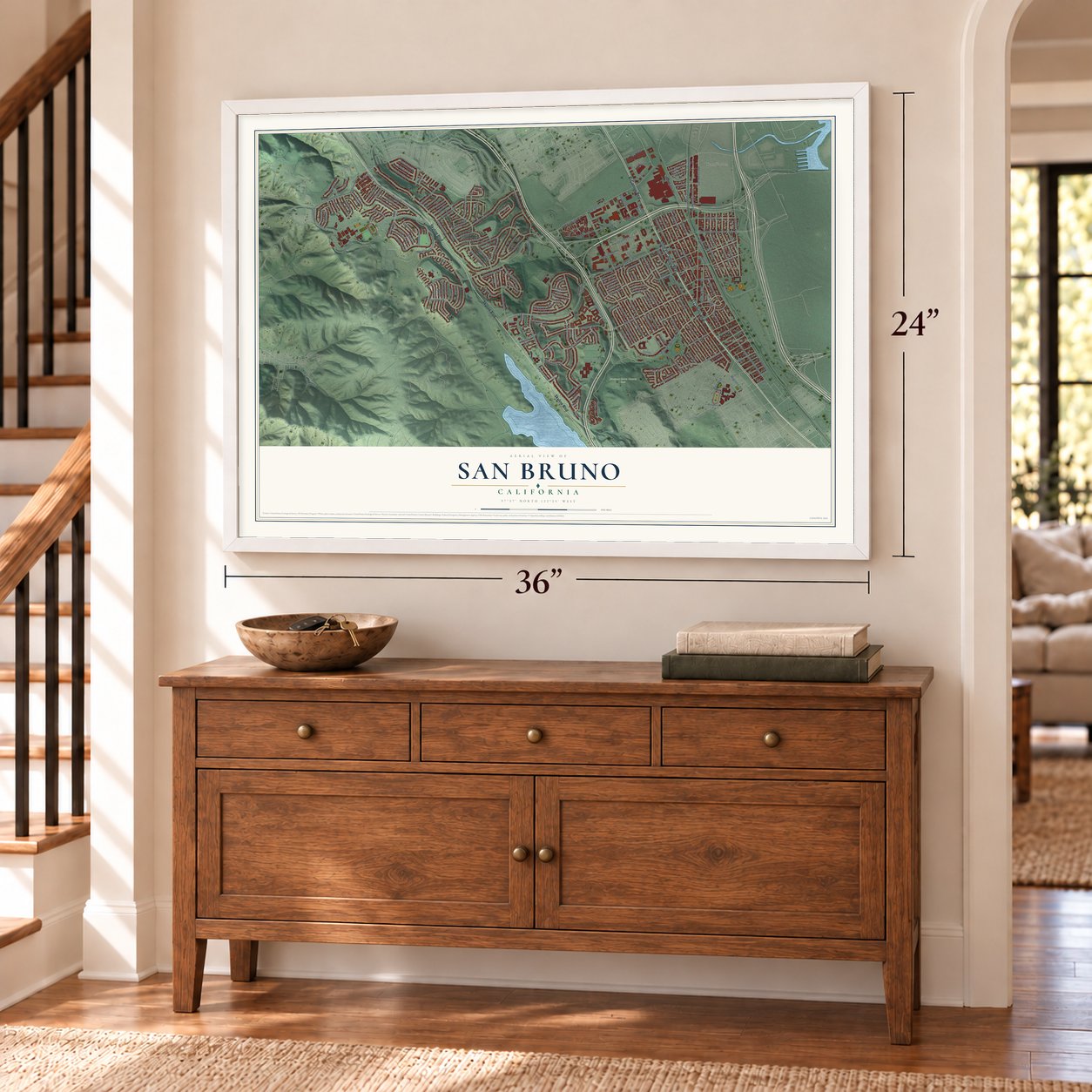
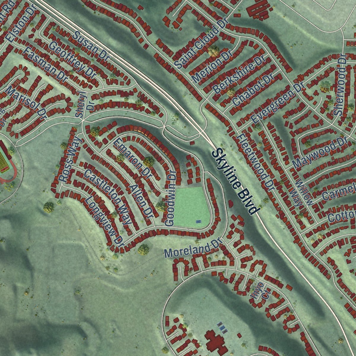
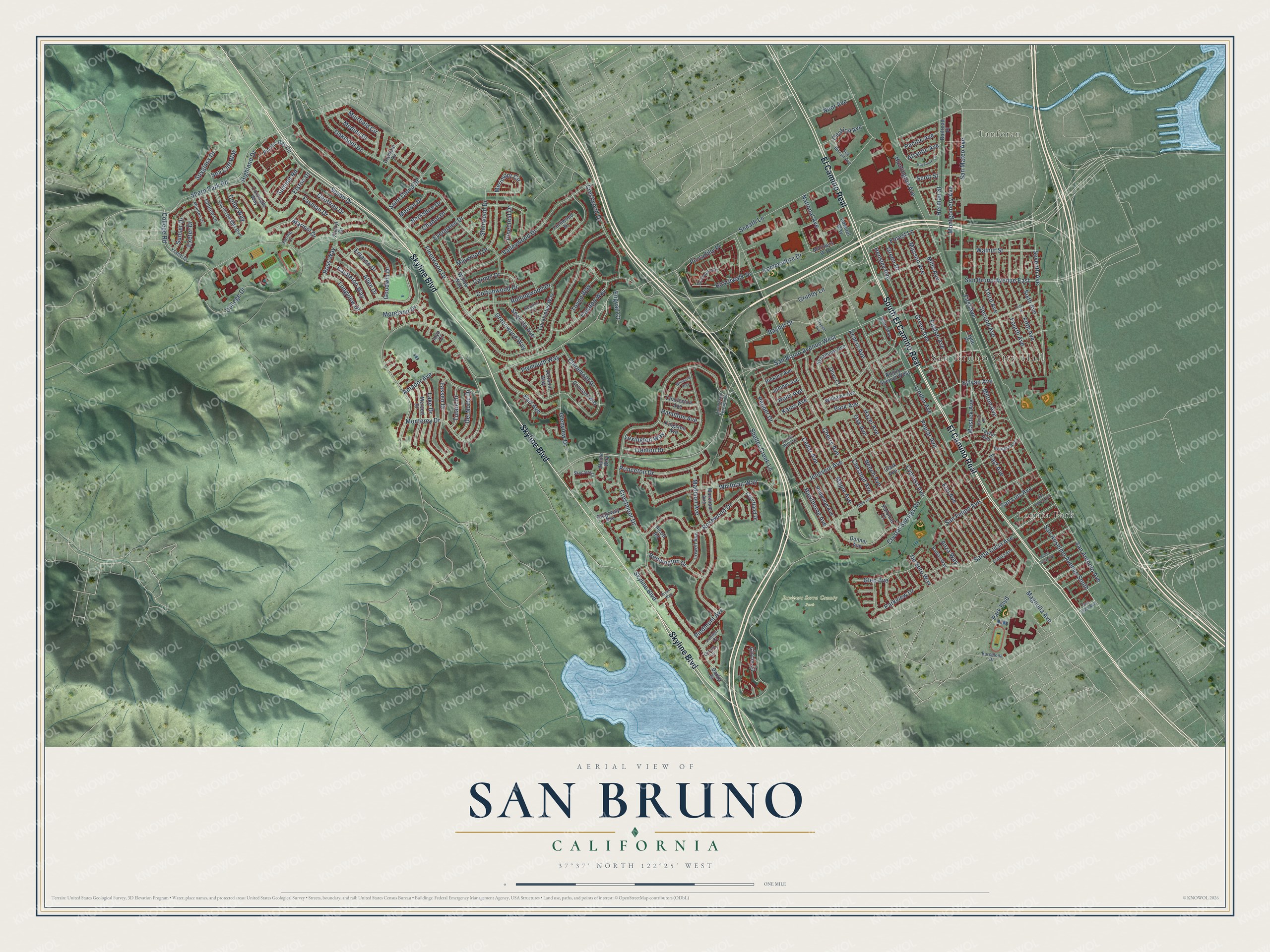
Explore San Bruno, California from a whole new perspective. Created using aerial imagery and detailed geographic data, this map captures San Bruno building by building, with labeled streets, familiar landmarks, and shaded topographical relief that highlights the natural contours of the landscape.
Combining modern data with the timeless character of a vintage atlas, this map is just as interesting up close as it is beautiful on the wall. Whether you grew up in San Bruno, spent memorable years there, or call it home today, this unique map is a great way to celebrate a place that means something to you. Zoom in on the preview to look for your street, and then order a print to put your memories on the wall.
Three ways to hang it
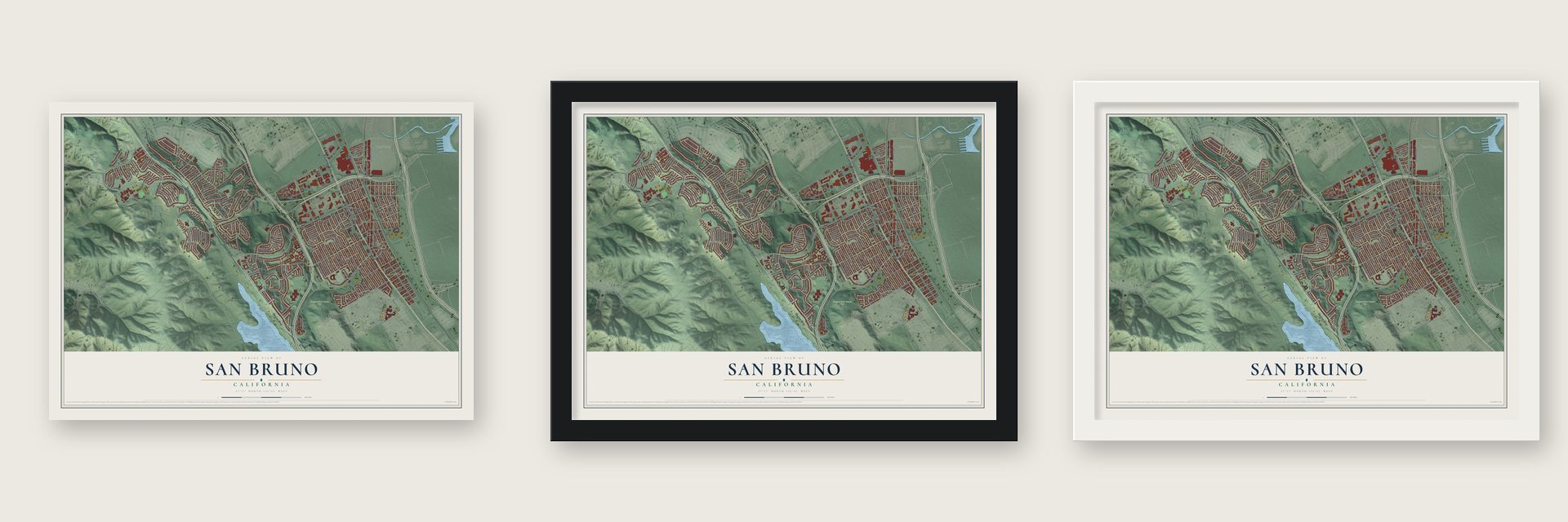
Unframed archival matte, a black wood frame or a white wood frame.
Up close
Geography Worth Displaying
This map was created using accurate cartographic data and authoritative geographic sources, including the U.S. Geological Survey and the Census Bureau. The map brings together terrain, waterways, roads, and building detail. The majority of the streets are labeled, houses are accurately depicted, and the topography is derived from government sources. Combining local data with carefully composed color and shading leads to this beautifully detailed San Bruno artwork for your wall.
Rather than simply showing street outlines, we’ve included as many of the street names as we could reasonably fit on the map while keeping their names legible. Zoom in on the high resolution preview to see exactly what’s on the map. We truly set out to create a statement piece for anyone who loves San Bruno. So whether it’s for you, or a gift for someone you love, we hope this map of San Bruno brings back fond memories.
Read the story behind this map of San Bruno, California from 2026.

Find your street
Names on the San Bruno map
Every name below is printed on this map. Look for your street, your school, the park where you played, or the pond down the road.
Places and landmarks4
- San Bruno City Hall
- Tanforan
- Junipero Serra County Park
- Lomita Park
Streets and roads200
- Skyline Boulevard
- South El Camino Real
- El Camino Real
- College Road
- College Drive
- Longview Drive
- Piccadilly Place
- Ross Way
- Green Avenue
- San Antonio Avenue
- Pepper Drive
- Sylvan Avenue
- Sneath Lane
- San Bruno Avenue West
- Fleetwood Drive
- Crestmoor Drive
- Huntington Avenue
- Crystal Springs Road
- San Mateo Avenue
- Elm Avenue
- Linden Avenue
- Cherry Avenue
- Acacia Avenue
- Cypress Avenue
- Oakmont Drive
- Kains Avenue
- Santa Lucia Avenue
- Rollingwood Drive
- Claremont Drive
- Jenevein Avenue
Show all 200 streets
- Whitman Way
- Poplar Avenue
- Cedar Avenue
- Glenview Drive
- Valleywood Drive
- Seventh Avenue
- Bayhill Drive
- Madison Avenue
- Hensley Avenue
- Susan Drive
- Easton Avenue
- Chestnut Avenue
- Sharp Park Road
- Second Avenue
- Trenton Drive
- Third Avenue
- San Anselmo Avenue South
- Mastick Avenue
- Fourth Avenue
- Monterey Drive
- Evergreen Drive
- Fifth Avenue
- Commodore Drive
- Montgomery Avenue
- Rosewood Drive
- Masson Avenue
- Green Drive
- Highland Drive
- Oak Avenue
- Hazel Avenue
- San Felipe Avenue
- Herman Street
- Shelter Creek Lane
- Hawthorne Avenue
- Crestwood Drive
- Mills Avenue
- First Avenue
- Lake Drive
- Princeton Drive
- Elston Drive
- Parkview Drive
- Maple Avenue
- Walnut Street
- San Bruno Avenue East
- Sixth Avenue
- Lassen Drive
- Magnolia Avenue
- Amador Avenue
- Cottonwood Drive
- Goodwin Drive
- Muirfield Circle
- Maywood Drive
- Fasman Drive
- Grundy Lane
- Earl Avenue
- Beech Avenue
- Moreland Drive
- Catalpa Way
- Allen Drive
- Sherwood Drive
- Milton Avenue
- Merimont Circle
- Park Boulevard
- Greenwood Way
- Berkshire Drive
- Forest Lane
- Park Avenue
- Bennington Drive
- Sequoia Avenue
- Carmel Drive
- Geoffrey Drive
- Saint Cloud Drive
- Castleton Way
- Atlantic Avenue
- National Avenue
- Boardwalk Drive
- Citation Avenue
- Colby Way
- Sunset Drive
- Plymouth Way
- Toyon Way
- San Luis Avenue
- Noor Avenue
- Del Norte Drive
- Medina Drive
- Scott Street
- Lexington Way
- Spyglass Drive
- Circle Court
- Emaron Drive
- Exeter Drive
- Summit Road
- Tulare Drive
- Pinecrest Drive
- Chabot Drive
- Pacific Avenue
- Hamilton Avenue
- Piedmont Avenue
- Merion Drive
- De Soto Way
- Sea Cliff Way
- East Avenue
- Glen Avenue
- Engvall Court
- Holly Avenue
- Marisol Drive
- Anza Way
- Angus Avenue West
- Fernwood Drive
- Pacific Bay Circle
- Redwood Avenue
- Donner Avenue
- Willow Way
- Merced Drive
- Sycamore Avenue
- Eucalyptus Way
- Coronado Way
- Concord Way
- Clark Avenue
- Courtland Drive
- Taylor Avenue
- Railroad Place
- Lowell Avenue
- Kingston Avenue
- Charleston Avenue
- Vermont Way
- Alcott Road
- Williams Avenue
- Markham Avenue
- Ridgeway Avenue
- Hickory Avenue
- Juniper Avenue
- Chilton Lane
- Mariners Way
- Admiral Way
- Olympic Drive
- Layne Place
- Palomar Court
- Alpine Way
- Olive Court
- Darby Place
- Sheryl Drive
- Inyo Court
- Oxford Lane
- Pacific Heights Boulevard
- White Way
- Ysabel Drive
- Sea Biscuit Avenue
- Skycrest Drive
- Heather Lane
- Georgia Avenue
- Moulton Drive
- Balboa Way
- Bering Drive
- Lomita Avenue
- Livingston Terrace Drive
- Cedar Mills Lane
- London Court
- Barcelona Drive
- San Juan Avenue
- Boardwalk Way
- Niles Avenue
- Pine Street
- San Marco Avenue
- Santa Inez Avenue
- Bayshore Circle
- Whitecliff Way
- Traeger Avenue
- Martin Place
- Bryant Way
Names are listed as they appear on the printed map. Zoom into the product photos to find them.
About San Bruno, California
San Bruno is a city of 43,908 people in San Mateo County, about 12 miles south of Downtown San Francisco. The Ohlone village of Urebure stood here when Gaspar de Portolà led a Spanish expedition through in November 1769. Bruno de Heceta later named San Bruno Creek for St. Bruno of Cologne, who started a monastic order in the Middle Ages, and the town most likely took its name from the creek.
After the missions declined, the land became part of Rancho Buri Buri, and dairy farms later spread across it. The town began as Clark's Station, a Butterfield Overland Mail stop at an inn built in 1849, and the railroad from San Francisco to San Jose added a station in the 1860s. Real growth came only after the 1906 earthquake and fire. The San Bruno Herald campaigned for a city government, mostly to get the streets paved, and San Bruno was incorporated in 1914. It passed 1,500 people by 1920 and had 3,610 in 1930.
- Uncle Tom's CabinThe 1849 inn at the heart of the early town was first called Thorp's Place, then Uncle Tom's Cabin or 14 Mile House. In 1912, crews started paving El Camino Real, California's first state highway, right in front of it. The inn was torn down in 1949. Its corner at El Camino Real and Crystal Springs Avenue became a Lucky's supermarket and is now a Walgreens.
- Eugene Ely's flight, 1911On January 18, 1911, Eugene Ely took off from Tanforan Racetrack and flew out over San Francisco Bay. He landed on the armored cruiser USS Pennsylvania, which was anchored there. It was the first time anyone had landed an airplane on a ship, and it made naval aviation history.
- A cemetery and a campIn 1939 the War Department opened Golden Gate National Cemetery in San Bruno, because the Presidio of San Francisco was running out of room to bury veterans. In 1942, during World War II, the Tanforan racetrack became the Tanforan Assembly Center. It held Japanese Americans who had been forced from the West Coast under Executive Order 9066.
- Lomita Park joins, Pacifica refusesIn 1953 San Bruno annexed Lomita Park, a neighboring community that had its own Southern Pacific station until then. In the mid-1950s the city looked at pushing its limits west to the Pacific Ocean. The communities out there opposed the plan, so they joined together and became the city of Pacifica in 1957.
- Rochester and Suzanne SomersThe actor Eddie "Rochester" Anderson was one of the first students at North Brae Elementary School, which opened in 1912. Suzanne Somers, an actress who also built a business career, was born here in 1946. She went through the city's schools and earned her diploma from Capuchino High School in June 1964.
Keep exploring California
San Bruno is one of 1,990 California towns we've mapped. Every dot on the map is a print of its own.
The search covers every state, California first.
Near San Bruno
Order 2 or more town maps and save 10%. Shown in the size and finish you picked above, so they hang as a set.
- Millbrae 12" x 18" / Archival Matte Print $39.99
- Pacifica 12" x 18" / Archival Matte Print $39.99
- South San Francisco 12" x 18" / Archival Matte Print $39.99


More maps nearby: Colma, Brisbane, Burlingame, Broadmoor and Daly City.
The art of mapping a place
How This Map Was Made
Real places. Remarkable detail. Discover the layers that turn geographic data into a map of home.

The view from above
Aerial imagery reveals the character of the land: woodland, open fields, and the patterns of a place.

The shape of the land
Elevation data brings hills, valleys, and subtle changes in the landscape into view.

The details of home
Roads, waterways, and building footprints come together to make the map feel unmistakably local.

Geography becomes art
Considered color, shading, and typography bring the layers together in a map made for your wall.


Process illustrated with Mendon, Massachusetts. Aerial imagery: USDA NAIP. Terrain: USGS 3D Elevation Program. Map details and finished artwork: KNOWOL.
The Details
About This Print
Choose an archival matte print, or a black or white Ayous wood frame. The archival matte print is unframed.
Select your size and finish above to see the matching product image and price.
Materials & Craftsmanship
A contemporary map with the character of a classic atlas, printed on archival matte paper. Optional frames are made from Ayous wood.
Your printed map does not include the watermark shown in the full-map preview.
Shipping & Delivery
Free shipping within the United States. Every print is made to order in the USA.
Buying a gift? Add a note in your cart and we'll include it. We never put prices in the package.
Prints ship within 2 to 3 business days. Allow 7 to 10 days total from ordering for delivery. Timing may vary during holidays or periods of high order volume.
Read our shipping policy.
Returns and damaged prints
Each print is made to order. Change-of-mind refunds are not available after production.
If your print arrives damaged, misprinted or incorrect, contact support@knowol.com within 30 days of receiving it. Include your order number, photos and a description of the issue.
Read our full refund and replacement policy. For questions about your order, email support@knowol.com.