


Search for another town


Free U.S. delivery 7 to 10 days after you order
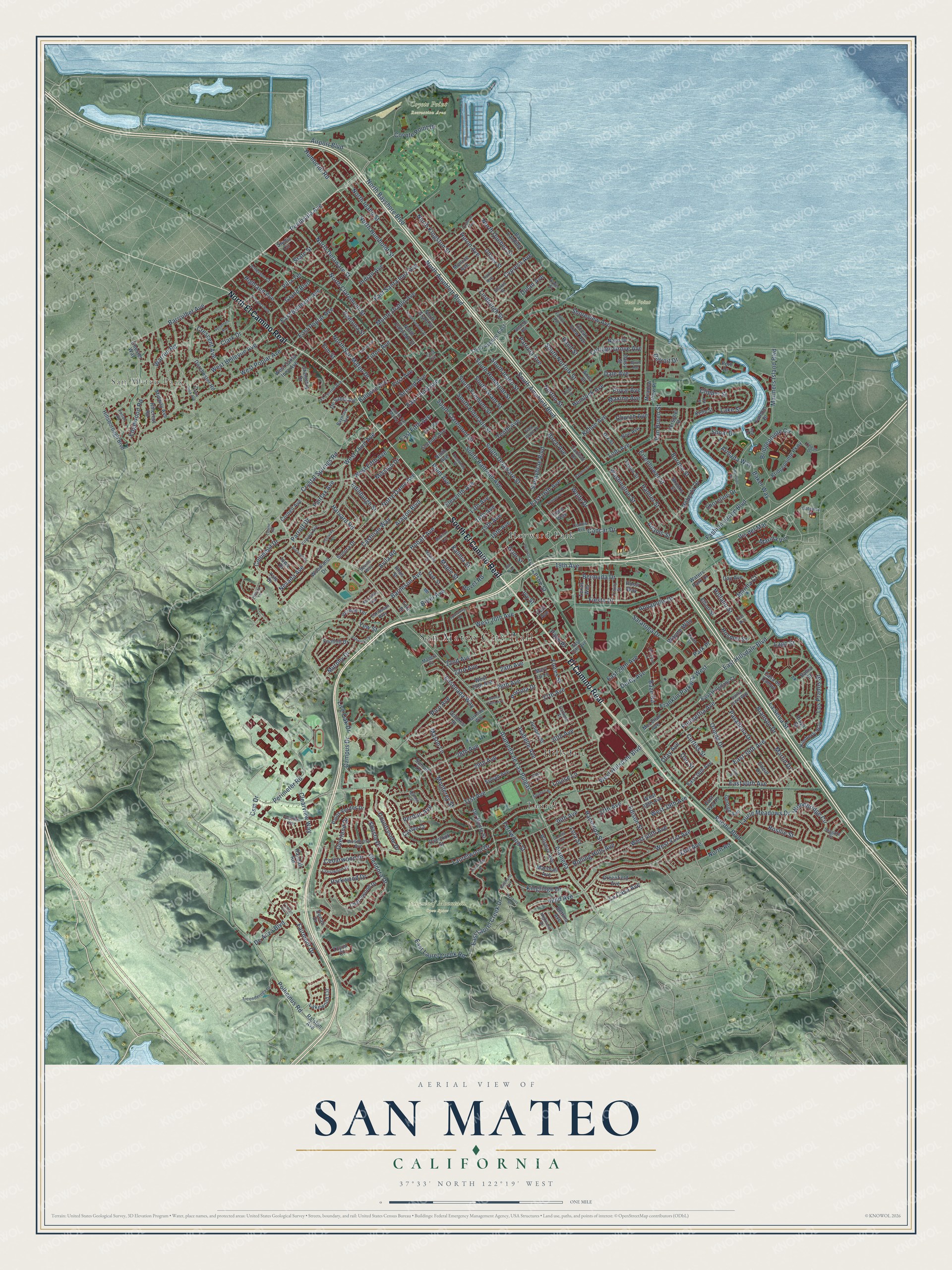
San Mateo, California Map Art
Building by building, with labeled streets and shaded relief.
12" x 18" Archival Matte Print
A Map of Home. A Work of Art.
Explore San Mateo, California from a whole new perspective. Created using aerial imagery and detailed geographic data, this map captures San Mateo building by building, with labeled streets, familiar landmarks, and shaded topographical relief that highlights the natural contours of the landscape.
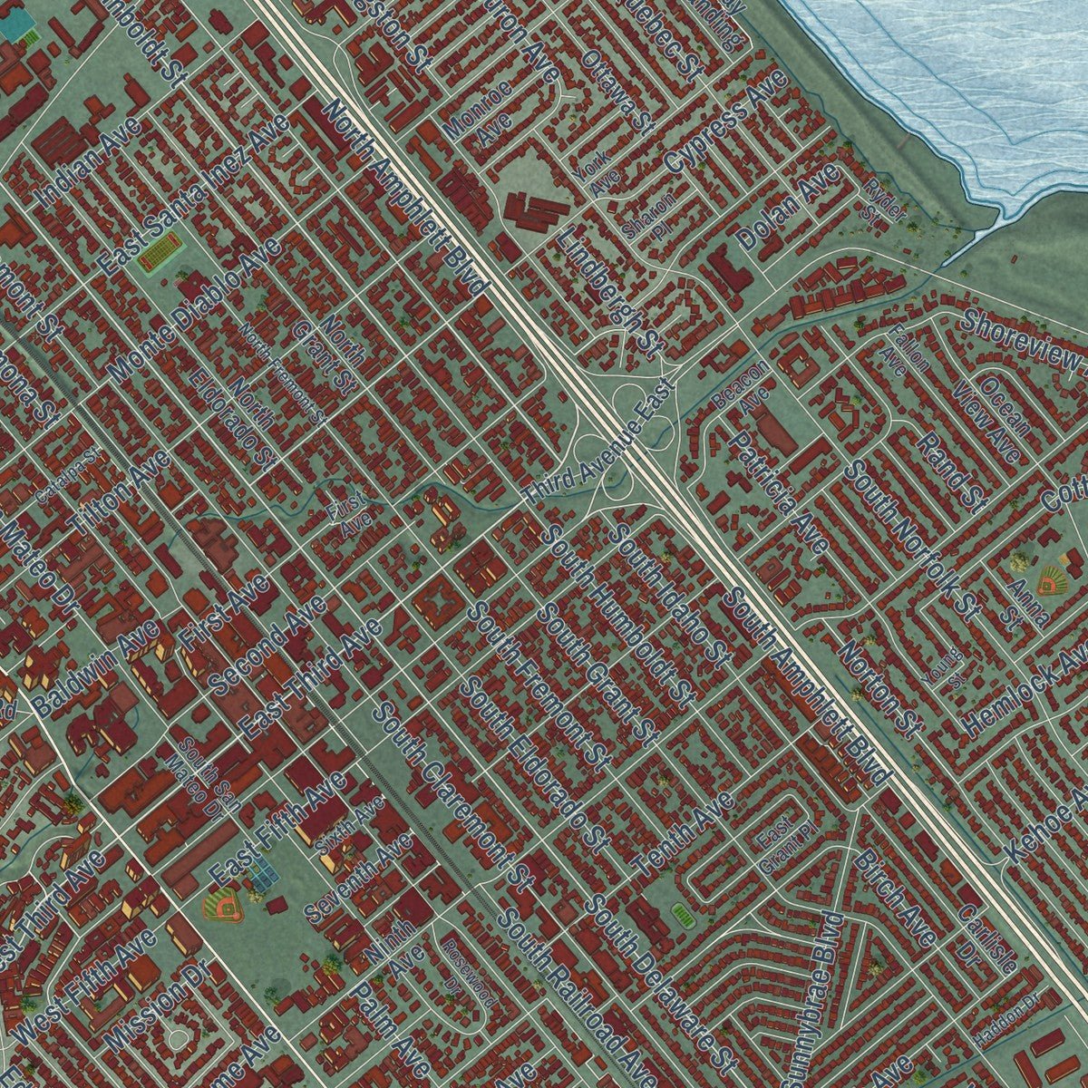
Combining modern data with the timeless character of a vintage atlas, this map is just as interesting up close as it is beautiful on the wall. Whether you grew up in San Mateo, spent memorable years there, or call it home today, this unique map is a great way to celebrate a place that means something to you. Zoom in on the preview to look for your street, and then order a print to put your memories on the wall.
Three ways to hang it
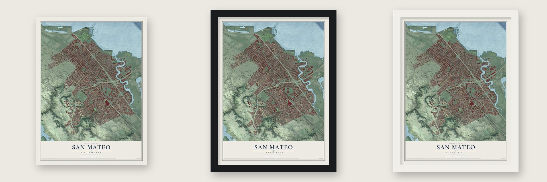
Unframed archival matte, a black wood frame or a white wood frame.
Up close
Geography Worth Displaying
This map was created using accurate cartographic data and authoritative geographic sources, including the U.S. Geological Survey and the Census Bureau. The map brings together terrain, waterways, roads, and building detail. The majority of the streets are labeled, houses are accurately depicted, and the topography is derived from government sources. Combining local data with carefully composed color and shading leads to this beautifully detailed San Mateo artwork for your wall.
Rather than simply showing street outlines, we’ve included as many of the street names as we could reasonably fit on the map while keeping their names legible. Zoom in on the high resolution preview to see exactly what’s on the map. We truly set out to create a statement piece for anyone who loves San Mateo. So whether it’s for you, or a gift for someone you love, we hope this map of San Mateo brings back fond memories.
Read the story behind this map of San Mateo, California from 2026.

Find your street
Names on the San Mateo map
Every name below is printed on this map. Look for your street, your school, the park where you played, or the pond down the road.
Places and landmarks8
- San Mateo City Hall
- San Mateo Park
- Coyote Point Recreation Area
- Seal Point Park
- Sugarloaf Mountain Open Space
- Hayward Park
- Hillsdale
- Laurel
Streets and roads357
- South El Camino Real
- El Camino Real
- North El Camino Real
- East Third Avenue
- Peninsula Avenue
- North Humboldt Street
- South Idaho Street
- North Delaware Street
- Airport Boulevard
- West Third Avenue
- Perimeter Road
- South Delaware Street
- East Hillsdale Boulevard
- Pacific Boulevard
- Coyote Point Drive
- Cypress Avenue
- West Hillsdale Boulevard
- Maple Street
- North Amphlett Boulevard
- South Amphlett Boulevard
- North Idaho Street
- North San Mateo Drive
- East Laurel Creek Drive
- Humboldt Road
- Bovet Road
- Warren Road
- Alameda
- Alameda de Las Pulgas
- South Norfolk Street
- South Grant Street
Show all 357 streets
- 31st Avenue
- East Laurel Creek Road
- Hacienda Street
- Parrott Drive
- Palm Avenue
- South Railroad Avenue
- Mariners Island Boulevard
- Monte Diablo Avenue
- 42nd Avenue
- Second Avenue
- Edison Street
- 28th Avenue
- East Poplar Avenue
- South Claremont Street
- Barneson Avenue
- Shoreview Avenue
- Fashion Island Boulevard
- Parkwood Drive
- West 39th Avenue
- West Poplar Avenue
- Kehoe Avenue
- Crystal Springs Road
- De Anza Boulevard
- North Bayshore Boulevard
- North Claremont Street
- Saratoga Drive
- 29th Avenue
- 26th Avenue
- 36th Avenue
- Isabelle Avenue
- Edinburgh Street
- West 41st Avenue
- 30th Avenue
- East Santa Inez Avenue
- Fernwood Street
- Tilton Avenue
- East Fifth Avenue
- 27th Avenue
- Tenth Avenue
- Clark Drive
- Roberta Drive
- Bermuda Drive
- 37th Avenue
- Branson Drive
- Hobart Avenue
- 19th Avenue
- Edgewood Road
- South Humboldt Street
- South Fremont Street
- Los Prados Street
- Flores Street
- South Eldorado Street
- Martin Drive
- 24th Avenue
- Harvard Road
- Notre Dame Avenue
- East 40th Avenue
- Barroilhet Avenue
- Campus Drive
- Kingridge Drive
- Vis del Mar
- Birch Avenue
- West 20th Avenue
- Highland Avenue
- Monterey Street
- Aragon Boulevard
- La Selva Street
- Poinsettia Avenue
- East 39th Avenue
- 22nd Avenue
- Norton Street
- Avila Road
- 23rd Avenue
- North Kingston Street
- Concar Drive
- Borel Avenue
- Glendora Drive
- Pasadena Drive
- Nevada Avenue
- West Bellevue Avenue
- Castilian Way
- Curtiss Street
- East Bellevue Avenue
- Shoreline Drive
- State Street
- Woodbridge Circle
- Patricia Avenue
- Cottage Grove Avenue
- Franklin Parkway West
- Shoal Drive
- Polhemus Road
- Grand Boulevard
- Sunnybrae Boulevard
- Rosilie Street
- East 16th Avenue
- West 40th Avenue
- Mason Lane
- Laurelwood Drive
- Bridgepointe Circle
- Royal Avenue
- Crescent Avenue
- La Casa Avenue
- Lodi Avenue
- Hemlock Avenue
- Ensenada Way
- Fiesta Drive
- Eisenhower Street
- Laurie Meadows Drive
- Indian Avenue
- Orinda Drive
- Fairfax Avenue
- East 28th Avenue
- Dale Avenue
- Wayne Way
- 43rd Avenue
- Countryside Drive
- North Quebec Street
- Leslie Street
- Clearview Way
- Pico Avenue
- Lake Street
- Hamlet Street
- Yew Street
- Elm Street
- Park Place
- Louise Lane
- Villa Terrace
- Overland Drive
- Holland Street
- Huron Avenue
- Rand Street
- Baze Road
- Portola Drive
- Washington Street
- Otay Avenue
- Van Buren Street
- Fairmont Drive
- Borden Street
- Eleventh Avenue
- Annapolis Drive
- Columbia Drive
- Rolling Hills Avenue
- 14th Avenue
- West Fifth Avenue
- Palm Place
- Derby Avenue
- Murphy Drive
- 16th Avenue
- Live Oak Drive
- Shasta Drive
- Cedarwood Drive
- Maxine Avenue
- Lago Street
- Marina Court
- Armada Way
- First Avenue
- 15th Avenue
- 13th Avenue
- Marina Vis
- Lindbergh Street
- Detroit Drive
- Wolfe Drive
- Csm Drive
- Ramona Street
- North Road
- Baldwin Avenue
- Church Avenue
- Ivy Street
- Hosmer Street
- Mission Drive
- Baker Way
- Verdun Avenue
- Clipper Street
- Gum Street
- Dolan Avenue
- Adams Street
- Kalmia Street
- Oso Street
- Lola Street
- Ninth Avenue
- Sylvan Avenue
- Seventh Avenue
- West 25th Avenue
- North Eldorado Street
- Lakewood Circle
- Fathom Drive
- North Grant Street
- Sonora Drive
- Cherrywood Drive
- George Avenue
- Ocean View Avenue
- West 38th Avenue
- Waters Park Drive
- Sunset Terrace
- McLellan Avenue
- Gramercy Drive
- Del Monte Street
- Dix Street
- Woodland Drive
- Meadow View Place
- Foothill Drive
- Oak Street
- Wilshire Avenue
- Dorchester Road
- Palos Verdes Drive
- Ottawa Street
- Carlisle Drive
- Third Avenue East
- Greenfield Avenue
- Bridgepointe Parkway
- Hillsborough Boulevard
- Tilia Street
- East Hillsdale Court
- Nash Drive
- Casa de Campo
- Kimberly Way
- Oneill Drive
- Studio Circle
- East 38th Avenue
- Yale Drive
- Edna Way
- De Sabla Road
- Dolores Street
- Bahia Street
- West Santa Inez Avenue
- Kelly Street
- Brooks Street
- Midway Avenue
- Playa Street
- Ralston Avenue
- Vernon Terrace
- East 41st Place
- Cornell Avenue
- Monroe Avenue
- Iowa Drive
- Bettina Avenue
- Day Avenue
- Hillcrest Road
- Juniper Street
- Noe Avenue
- Bay Landing
- Herschel Street
- Port Drive
- Caxton Court
- Rossi Way
- Daisy Street
- Mary Lu Lane
- Texas Way
- Anna Street
- Taylor Street
- Overlook Street
- Marshall Avenue
- Chester Way
- Elliott Street
- Rhus Street
- Randall Road
- Denali Drive
- Toyon Court
- 21st Avenue
- Virginia Avenue
- Seville Way
- South San Mateo Drive
- Nadina Street
- Garfield Street
- York Avenue
- Santa Clara Way
- Fallon Avenue
- Ticonderoga Drive
- East Grant Place
- Woodberry Avenue
- Beacon Avenue
- David Street
- Baywood Avenue
- El Cerrito Avenue
- Parkside Way
- Crestwood Drive
- Connie Avenue
- Seagate Drive
- Trinity Street
- Jefferson Court
- East 25th Avenue
- Chess Drive
- Caribbean Way
- Sixth Avenue
- Highview Drive
- Sharon Place
- Ryder Street
- Gateway Drive
- Fulton Road
- Madera Drive
- Crio Avenue
- Railroad Avenue
- Costa Rica Avenue
- North Fremont Street
- Viewridge Drive
- Trollman Avenue
- Prospect Row
- Spuraway Drive
- Bucknell Drive
- Madison Avenue
- Rosewood Drive
- Joanne Drive
- Ashwood Drive
- Chapman Lane
- Wharfside Road
- Sycamore Avenue
- Catalpa Street
- Bayridge Way
- Young Street
- Canyon Oak Court
- Gillis Drive
- Stephen Road
- Haddon Drive
- La Jolla Avenue
- Dalehurst Avenue
- Kentucky Avenue
- Tulane Road
- Buena Vista Avenue
- Byron Avenue
- Macarthur Avenue
- Haskins Drive
- Alder Lane
- Treetop Lane
- Alanhill Lane
- Ark Street
- 18th Avenue
- Spar Drive
Names are listed as they appear on the printed map. Zoom into the product photos to find them.
About San Mateo, California
San Mateo is a city of 105,661 people in San Mateo County, about 20 miles south of San Francisco. In 1789 Spanish missionaries named a Native village on Laurel Creek Los Laureles, and the land belonged to Mission Dolores. In May 1846 Pío Pico granted Rancho San Mateo to his secretary, Cayetano Arenas. Arenas sold it that same year to William Davis Merry Howard for $25,000, and Howard spent as much again to fence it.
After the American conquest, many San Franciscans built summer homes on the mid-Peninsula in the 1850s because its weather was milder. In the 1860s the San Francisco and San Jose Railroad was being built, and one of its directors, Charles Polhemus, bought the land south of San Mateo Creek. He laid out the first town plat there in 1862, on the ground where downtown stands today. San Mateo became a city on September 4, 1894, and its first mayor was Captain A.H. Payson, the son-in-law of landowner John Parrott.
“It strongly resembled a nobleman's park: herds of cattle and horses were grazing upon the rich pasture”
- A stage stop in 1858In 1858 the Butterfield Overland Mail opened Sun Water Station in San Mateo. Stagecoaches stopped here midway between two other stations, each 9 miles away: Clarks Station to the north, in present-day San Bruno, and Redwood City to the south.
- A Japanese tea garden from 1894Eugene J. De Sabla's Japanese teahouse and garden, at 70 De Sabla Road, date from 1894. Makoto Hagiwara, who designed the Japanese garden in Golden Gate Park, planned it and brought Japanese artisans over to build the teahouse. Achille and Joan Paladini bought the property in 1988 and restored it, and it joined the National Register in 1992.
- The city that adopted Alpha CompanyIn December 1967 Sgt. Joe Artavia wrote from Vietnam to his sister, Linda Giese, who worked in San Mateo, asking whether a city would adopt his unit, Alpha Company of the 327th Infantry. San Mateo voted to adopt it on March 4, 1968, and residents sent letters and gifts. Artavia was killed on March 24, 1968. In January 1972 the city held a parade for the returning men, thought to be the only Vietnam War parade honoring the military.
Keep exploring California
San Mateo is one of 1,990 California towns we've mapped. Every dot on the map is a print of its own.
The search covers every state, California first.
Near San Mateo
Order 2 or more town maps and save 10%. Shown in the size and finish you picked above, so they hang as a set.
- Hillsborough 12" x 18" / Archival Matte Print $39.99
- Baywood Park 12" x 18" / Archival Matte Print $39.99
- Foster City 12" x 18" / Archival Matte Print $39.99
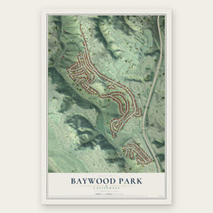

More maps nearby: Belmont, Highlands, Burlingame, San Carlos and Millbrae.
The art of mapping a place
How This Map Was Made
Real places. Remarkable detail. Discover the layers that turn geographic data into a map of home.

The view from above
Aerial imagery reveals the character of the land: woodland, open fields, and the patterns of a place.

The shape of the land
Elevation data brings hills, valleys, and subtle changes in the landscape into view.

The details of home
Roads, waterways, and building footprints come together to make the map feel unmistakably local.

Geography becomes art
Considered color, shading, and typography bring the layers together in a map made for your wall.


Process illustrated with Mendon, Massachusetts. Aerial imagery: USDA NAIP. Terrain: USGS 3D Elevation Program. Map details and finished artwork: KNOWOL.
The Details
About This Print
Choose an archival matte print, or a black or white Ayous wood frame. The archival matte print is unframed.
Select your size and finish above to see the matching product image and price.
Materials & Craftsmanship
A contemporary map with the character of a classic atlas, printed on archival matte paper. Optional frames are made from Ayous wood.
Your printed map does not include the watermark shown in the full-map preview.
Shipping & Delivery
Free shipping within the United States. Every print is made to order in the USA.
Buying a gift? Add a note in your cart and we'll include it. We never put prices in the package.
Prints ship within 2 to 3 business days. Allow 7 to 10 days total from ordering for delivery. Timing may vary during holidays or periods of high order volume.
Read our shipping policy.
Returns and damaged prints
Each print is made to order. Change-of-mind refunds are not available after production.
If your print arrives damaged, misprinted or incorrect, contact support@knowol.com within 30 days of receiving it. Include your order number, photos and a description of the issue.
Read our full refund and replacement policy. For questions about your order, email support@knowol.com.