
Search for another town





Free U.S. delivery 7 to 10 days after you order
San Carlos, California Map Art
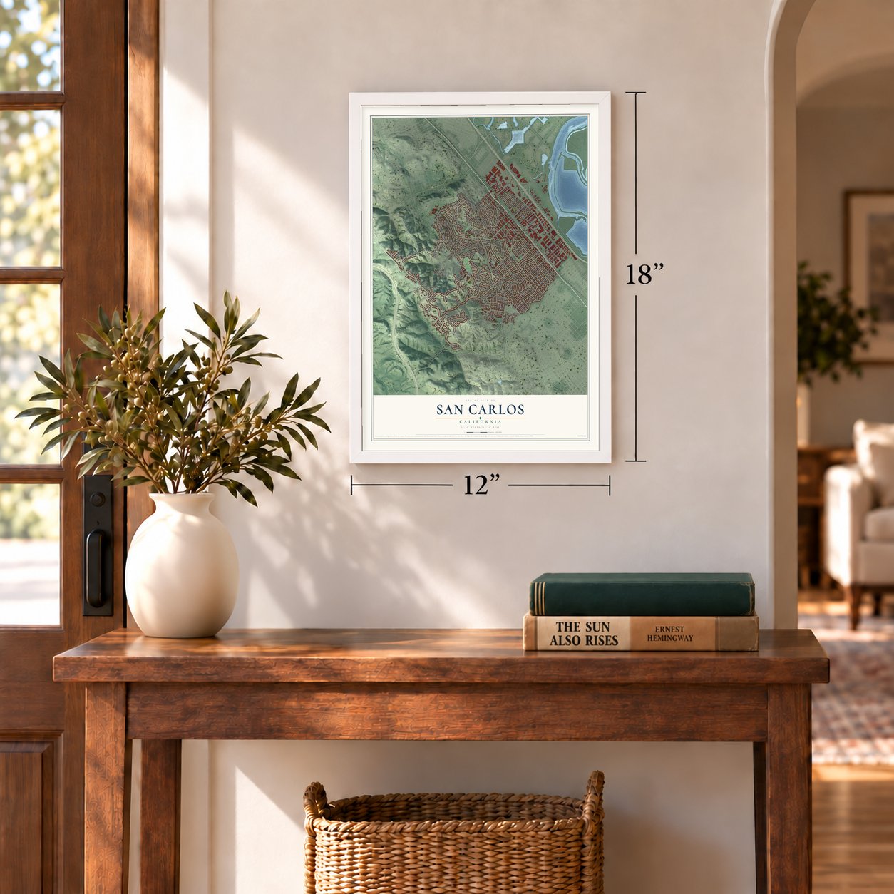
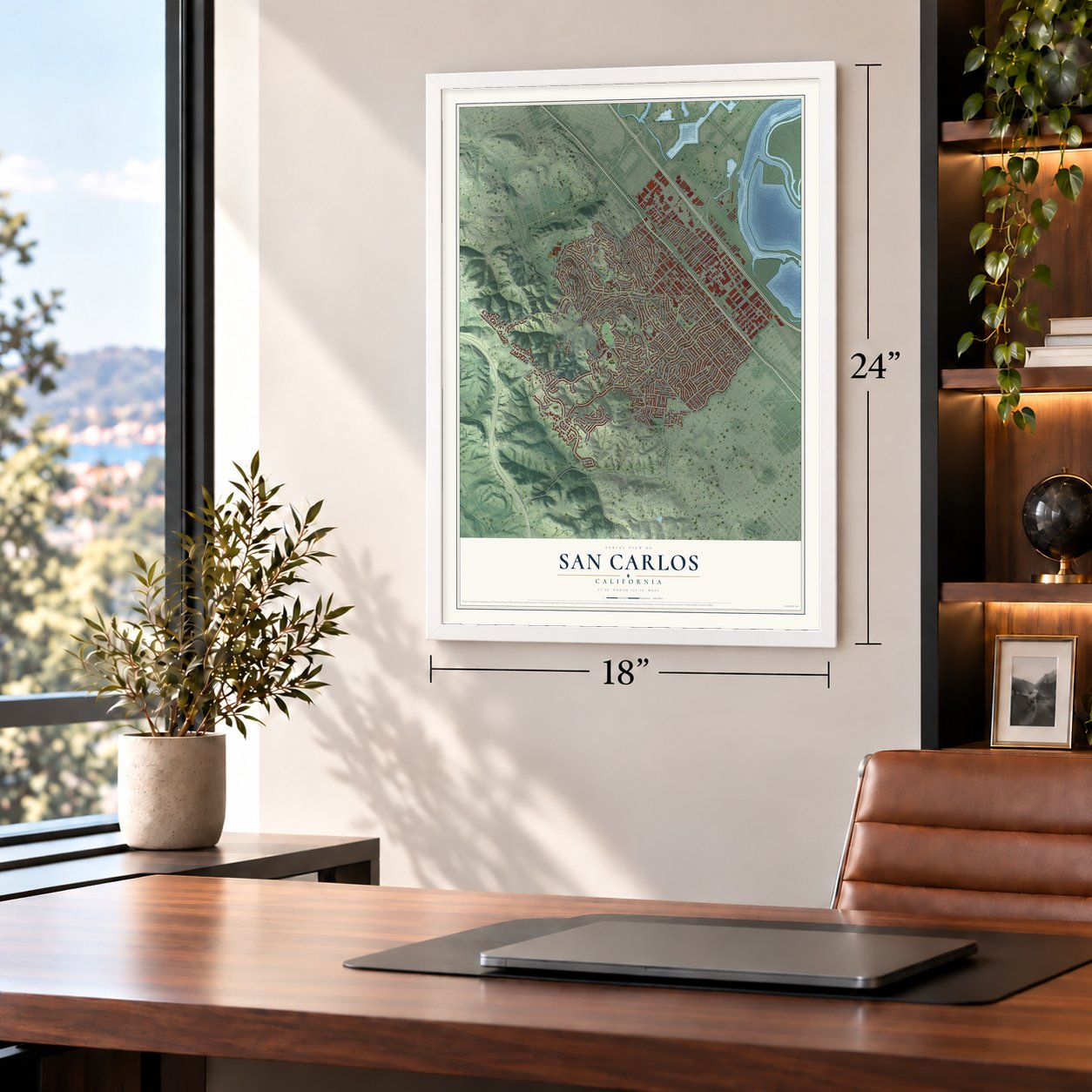
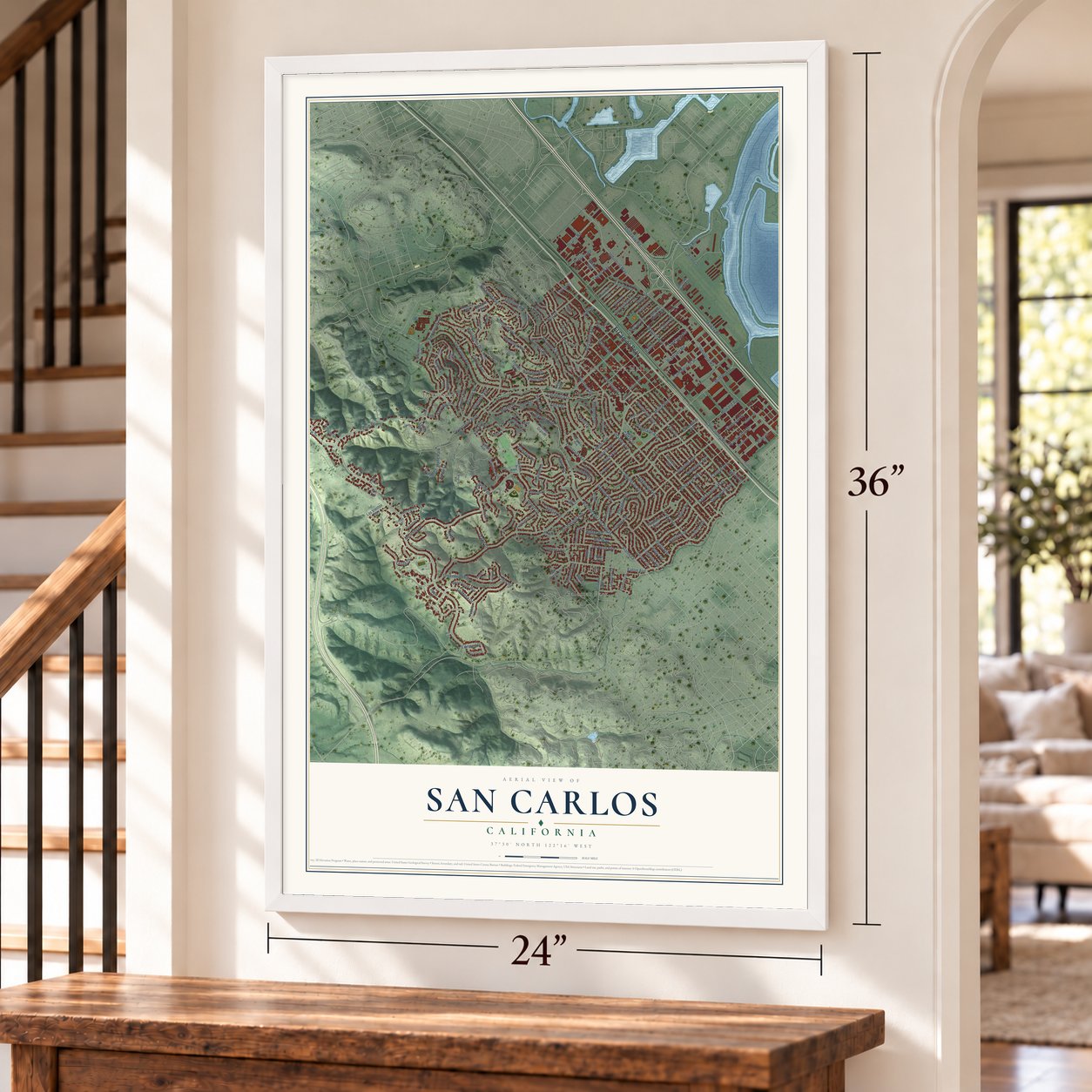
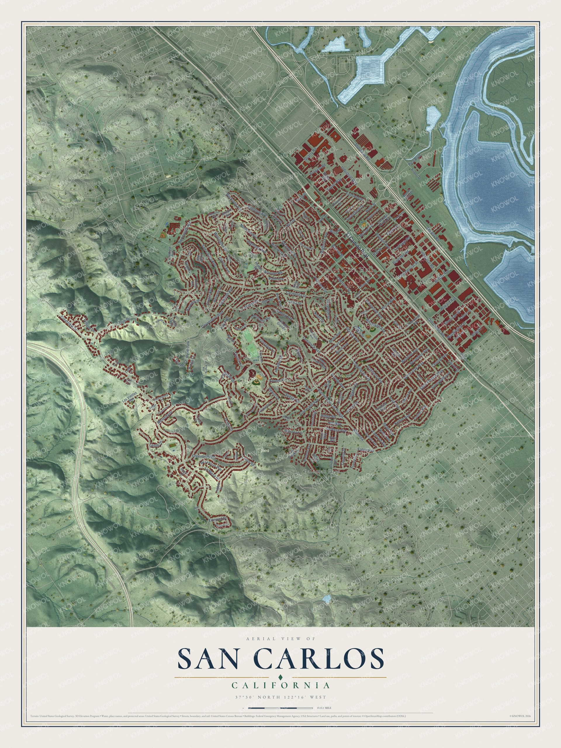
A new map of San Carlos, California, made in 2026 and printed to order on thick archival matte paper.
12" x 18" Archival Matte Print
A Map of Home. A Work of Art.
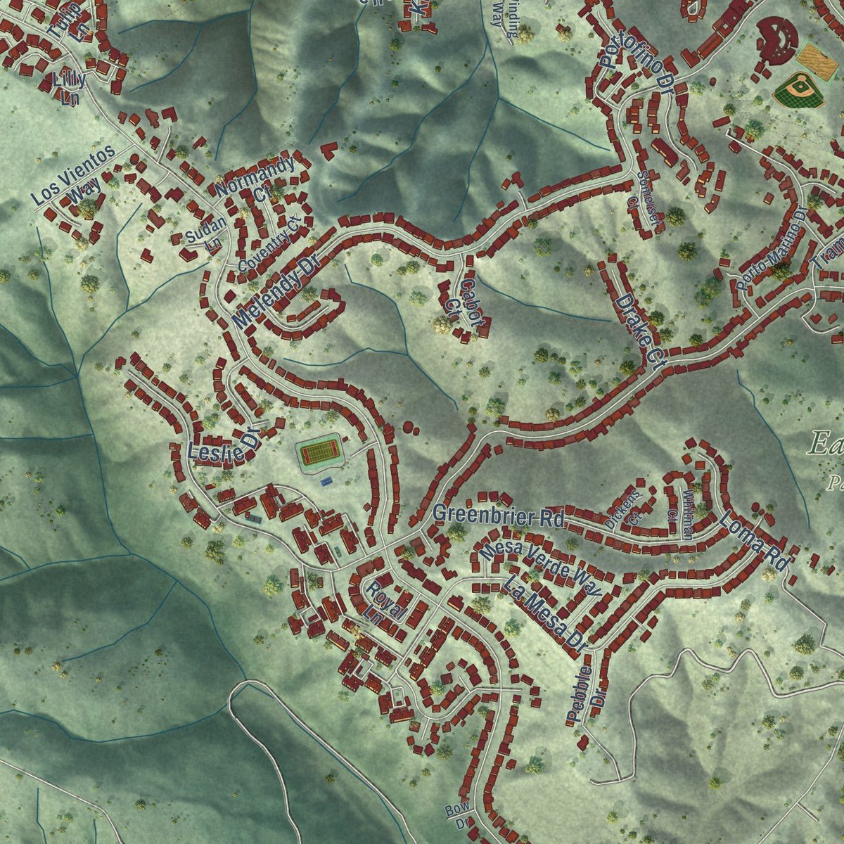
Explore San Carlos, California from a whole new perspective. Created using aerial imagery and detailed geographic data, this map captures San Carlos building by building, with labeled streets, familiar landmarks, and shaded topographical relief that highlights the natural contours of the landscape.
Combining modern data with the timeless character of a vintage atlas, this map is just as interesting up close as it is beautiful on the wall. Whether you grew up in San Carlos, spent memorable years there, or call it home today, this unique map is a great way to celebrate a place that means something to you. Zoom in on the preview to look for your street, and then order a print to put your memories on the wall.
Three ways to hang it
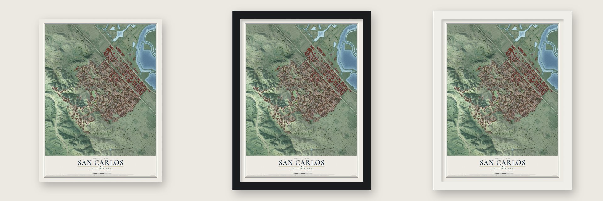
Unframed archival matte, a black wood frame or a white wood frame.
Up close
Geography Worth Displaying
This map was created using accurate cartographic data and authoritative geographic sources, including the U.S. Geological Survey and the Census Bureau. The map brings together terrain, waterways, roads, and building detail. The majority of the streets are labeled, houses are accurately depicted, and the topography is derived from government sources. Combining local data with carefully composed color and shading leads to this beautifully detailed San Carlos artwork for your wall.
Rather than simply showing street outlines, we’ve included as many of the street names as we could reasonably fit on the map while keeping their names legible. Zoom in on the high resolution preview to see exactly what’s on the map. We truly set out to create a statement piece for anyone who loves San Carlos. So whether it’s for you, or a gift for someone you love, we hope this map of San Carlos brings back fond memories.
Read the story behind this map of San Carlos, California from 2026.
About San Carlos, California
San Carlos is a city of 30,722 people in San Mateo County, on the San Francisco Peninsula. Before the Spanish came in 1769, the Lamchin people lived here, and their name for the place became Las Pulgas, "the fleas" in Spanish. The land later became one rancho granted to Don José Darío Argüello, and after his son Luis, the first California-born governor, died in 1830, the family moved onto it.
In the 1850s the Argüellos began selling off parcels. Timothy Guy Phelps graded streets, laid sewer lines and tried to sell lots in what he called "The Town of Phelps," but buyers stayed away, and much of his land passed to the San Carlos Land Development Company of Nicholas T. Smith. Its developers dropped his name and chose San Carlos, because they believed Portolá had first seen the bay from these hills on November 4, the feast of St. Charles. A railroad station opened in 1888, yet the town still had fewer than one hundred houses when the century ended.
- The Father of San CarlosFrederick Drake bought 130 acres here in foreclosure, a year before the town opened its school at 600 Elm Street in 1918, and began selling lots. Growth came fast. In the early 1920s Drake built an office at Cypress and El Camino Real, where Drake's Restaurant now honors him, and Cypress was widened and renamed San Carlos Avenue. Residents voted to incorporate on July 8, 1925, when about 600 people lived here, and by 1941 there were 5,000.
- War dogs in 1942In October 1942 the Army turned the 178-acre H and H Ranch into its War Dog Reception and Training Center, on the hilltop where Club Drive and Crestview Drive run today. Each handler trained four dogs for sentry, attack, scout or messenger work, then shipped out with the best one. The 25th Quartermaster Corps War Dog Platoon, the first sent to the Pacific, left on May 11, 1944. The center closed that October after about 4,500 dogs.
- Litton's glass-blowing latheCharles Litton Sr. opened Litton Engineering Laboratories in San Carlos in 1932, and his glass-blowing lathe changed how vacuum tubes were made. Dalmo Victor built the city's first large electronics plant in 1944, and Eitel McCullough, Varian Associates and Lenkurt Electric followed. By 1950 the city had 14,371 people and 89 industries.
- An airport the county boughtIn the late 1940s, when Bayshore was still a two-lane road, the San Carlos Airport moved from its old spot between Brittan and San Carlos Avenues to the site it holds today. In 1964 San Mateo County paid Cal West Yacht Harbor $990,000 and took it over.
Find your street
Names on the San Carlos map
Every name below is printed on this map. Look for your street, your school, the park where you played, or the pond down the road.
Places and landmarks6
- San Carlos City Hall
- Devonshire
- Arguello Park
- Eaton Park
- Palomar Park
- Hyde Park
Streets and roads199
- El Camino Real
- Hillcrest Road
- Shelford Avenue
- Shoreway Road
- Carmelita Drive
- La Mesa Drive
- Edmond Drive
- Devonshire Boulevard
- Fay Avenue
- Brittan Avenue
- Crestview Drive
- Old County Road
- Cedar Street
- Elm Street
- San Carlos Avenue
- Laurel Street
- Chestnut Street
- Eaton Avenue
- Alameda de Las Pulgas
- Alameda
- Howard Avenue
- Industrial Road
- Melendy Drive
- Walnut Street
- Club Drive
- Cordilleras Avenue
- Saint Francis Way
- Dartmouth Avenue
- Skyway Road
- Holly Street
Show all 199 streets
- Bayport Avenue
- Arroyo Avenue
- Orange Avenue
- Bayview Drive
- White Oak Way
- Wellington Drive
- Exeter Avenue
- Sunset Drive
- Cherry Street
- Tamarack Avenue
- Belmont Avenue
- Coronado Avenue
- Industrial Way
- Clifton Avenue
- Woodland Avenue
- Highland Avenue
- Beverly Drive
- Rosewood Avenue
- Hewitt Drive
- Knoll Drive
- Emerald Avenue
- Buckland Avenue
- Northam Avenue
- Elizabeth Street
- Park Avenue
- Arundel Road
- De Anza Avenue
- American Street
- Hull Drive
- Sycamore Street
- Madera Avenue
- Greenbrier Road
- Pico Boulevard
- Bransten Road
- Graceland Avenue
- Bauer Drive
- Portofino Drive
- Edgehill Drive
- Kelton Avenue
- Morse Boulevard
- Oakhurst Avenue
- Magnolia Avenue
- Vine Street
- Quarry Road
- Pearl Avenue
- Ruby Avenue
- Belle Avenue
- Glasgow Lane
- McCue Avenue
- Hall Street
- Washington Street
- Bing Street
- Commercial Street
- Prospect Street
- Taylor Way
- Plymouth Avenue
- Birch Avenue
- Sunnydale Avenue
- Belvedere Avenue
- Loma Road
- Hill Way
- Fairfield Drive
- Leslie Drive
- Springfield Drive
- Olive Street
- Torino Drive
- Manor Drive
- Central Avenue
- Bragato Road
- Tanklage Road
- Pine Avenue
- Ridge Road
- Heather Drive
- Colton Avenue
- Palm Avenue
- Timothy Drive
- Roland Avenue
- Dayton Avenue
- Trillium Lane
- Queens Court
- Drake Court
- Bush Street
- Alma Street
- Kings Court
- Oak Street
- Fir Street
- Clifford Avenue
- Lynton Avenue
- Greenwood Avenue
- Oakview Drive
- East San Carlos Avenue
- Upper Lupin Way
- Alberta Avenue
- Fairmont Avenue
- Center Street
- Mesa Verde Way
- Garnet Avenue
- Tramanto Drive
- Phelps Road
- Vista Avenue
- Vis del Grande
- Roslyn Avenue
- Riverton Drive
- Royal Lane
- Glenn Way
- Geneva Avenue
- Dale Avenue
- Chilton Avenue
- Debbie Lane
- Los Vientos Way
- Thornhill Drive
- Frances Lane
- Sherwood Drive
- Cranfield Avenue
- Brook Street
- Airport Drive
- Oak Creek Lane
- Sequoia Court
- Pebble Drive
- Robin Way
- Bayport Court
- Normandy Court
- Nanette Drive
- Tulip Lane
- Elston Court
- Spring Street
- Cabot Court
- Barford Avenue
- Monte Vista Drive
- Exeter Way
- Iris Lane
- Lilly Lane
- Sheldon Avenue
- Porto Marino Drive
- Wildwood Avenue
- Exbourne Avenue
- Sylvan Drive
- Maple Way
- Aberdeen Drive
- Hemlock Street
- Oakley Avenue
- Gover Lane
- Varian Street
- Rutherdale Avenue
- Coventry Court
- Glenwood Street
- Walton Street
- Stafford Street
- School Street
- Cottage Lane
- Acacia Court
- Rogers Avenue
- Pepper Lane
- Tasker Lane
- Sudan Lane
- Curry Court
- Deer Lane
- Eucalyptus Avenue
- Wessex Way
- Ensenada Road
- Baytree Road
- Fleetwood Drive
- Montgomery Lane
- Somerset Court
- Winding Way
- Whitman Court
- Dickens Court
- Susie Lane
- Bow Drive
Names are listed as they appear on the printed map. Zoom into the product photos to find them.
The art of mapping a place
How This Map Was Made
Real places. Remarkable detail. Discover the layers that turn geographic data into a map of home.

The view from above
Aerial imagery reveals the character of the land: woodland, open fields, and the patterns of a place.

The shape of the land
Elevation data brings hills, valleys, and subtle changes in the landscape into view.

The details of home
Roads, waterways, and building footprints come together to make the map feel unmistakably local.

Geography becomes art
Considered color, shading, and typography bring the layers together in a map made for your wall.


Process illustrated with Mendon, Massachusetts. Aerial imagery: USDA NAIP. Terrain: USGS 3D Elevation Program. Map details and finished artwork: KNOWOL.
The Details
About This Print
Choose an archival matte print, or a black or white Ayous wood frame. The archival matte print is unframed.
Select your size and finish above to see the matching product image and price.
Materials & Craftsmanship
A contemporary map with the character of a classic atlas, printed on archival matte paper. Optional frames are made from Ayous wood.
Your printed map does not include the watermark shown in the full-map preview.
Shipping & Delivery
Free shipping within the United States. Every print is made to order in the USA.
Buying a gift? Add a note in your cart and we'll include it. We never put prices in the package.
Prints ship within 2 to 3 business days. Allow 7 to 10 days total from ordering for delivery. Timing may vary during holidays or periods of high order volume.
Read our shipping policy.
Returns and damaged prints
Each print is made to order. Change-of-mind refunds are not available after production.
If your print arrives damaged, misprinted or incorrect, contact support@knowol.com within 30 days of receiving it. Include your order number, photos and a description of the issue.
Read our full refund and replacement policy. For questions about your order, email support@knowol.com.
Find your town
Looking for another city?
Find a map of home in our California collection, or any town in the country.
Nearby
Maps of towns near San Carlos
Know someone from one of these towns? Their map makes a great gift.
 Belmont
, California
From $39.99See the map
 Emerald Lake Hills
, California
From $39.99See the map
 Redwood City
, California
From $39.99See the map
More maps nearby: North Fair Oaks, Highlands, Baywood Park, Foster City and Atherton.