
Search for another town



Free U.S. delivery 7 to 10 days after you order
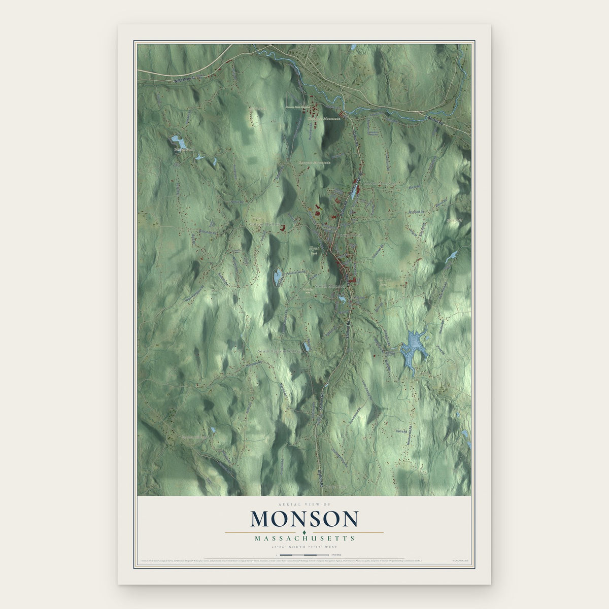
Monson, Massachusetts Map Art
Building by building, with labeled streets and shaded relief.
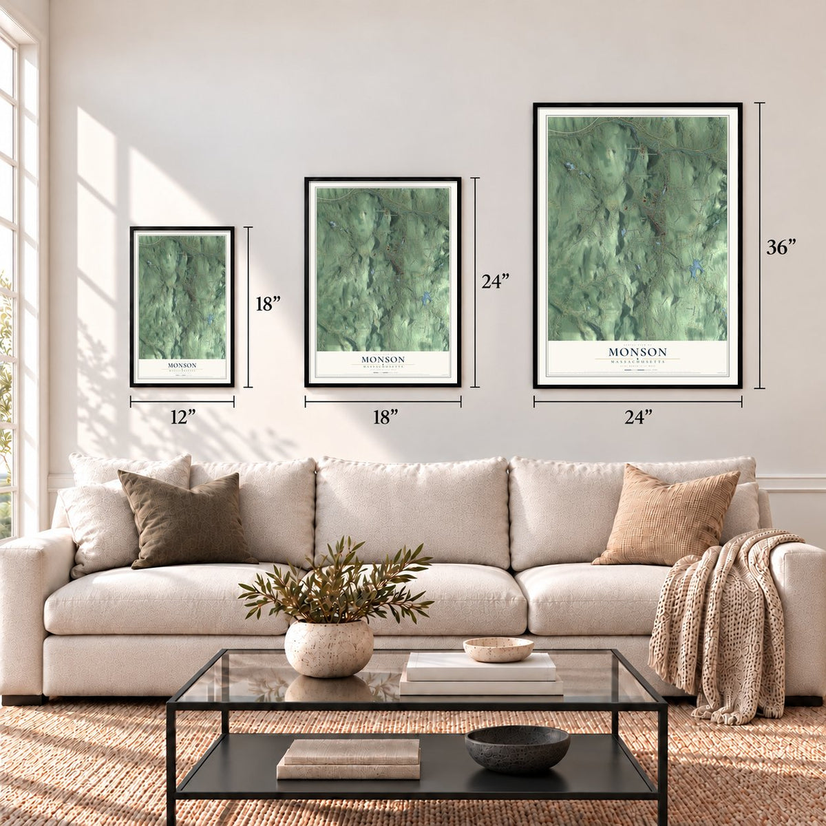
12" x 18" Archival Matte Print
A Map of Home. A Work of Art.
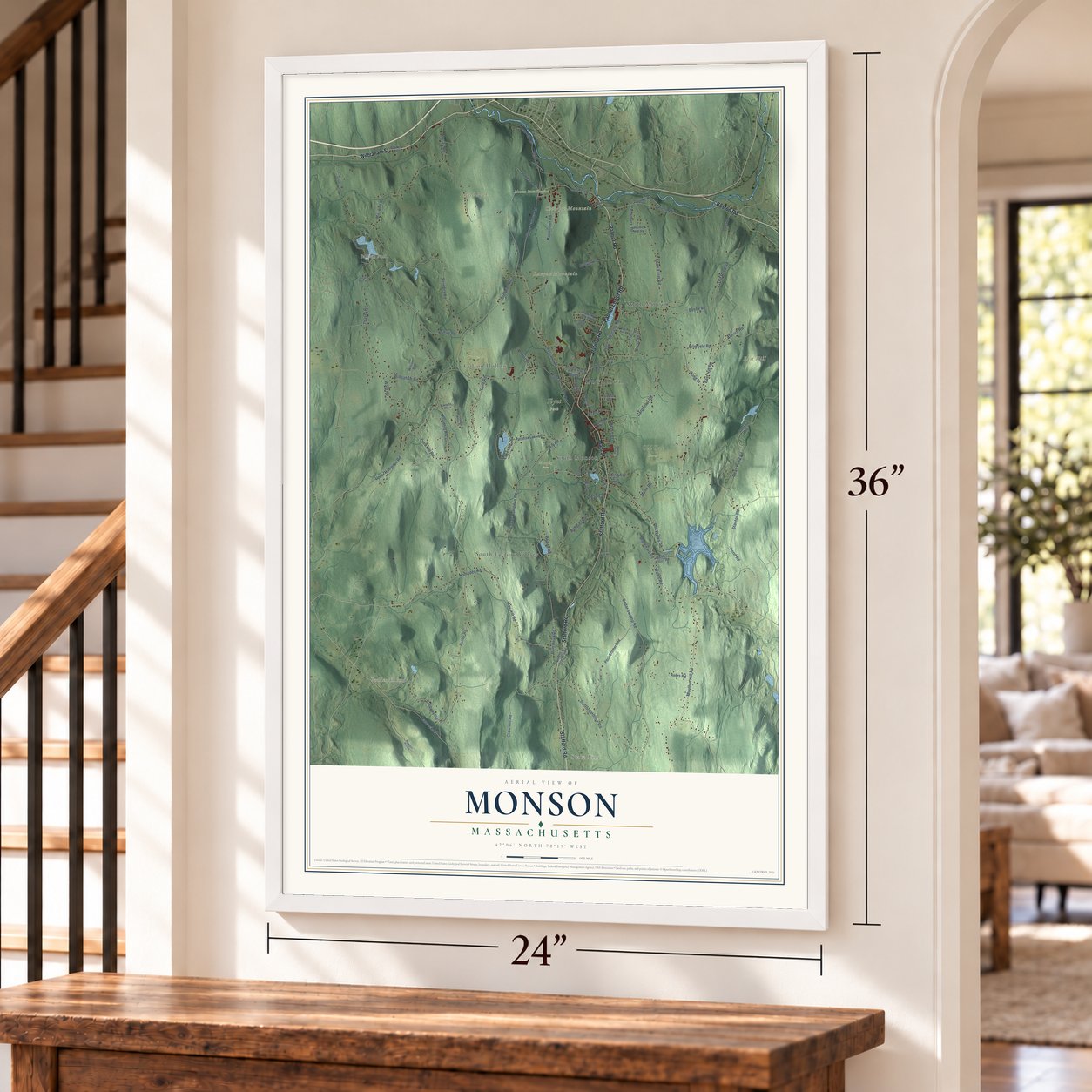
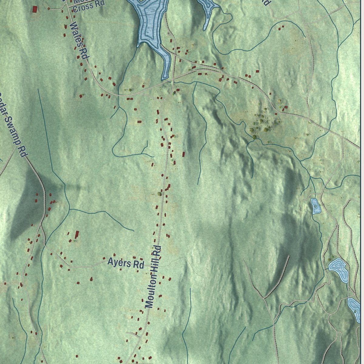
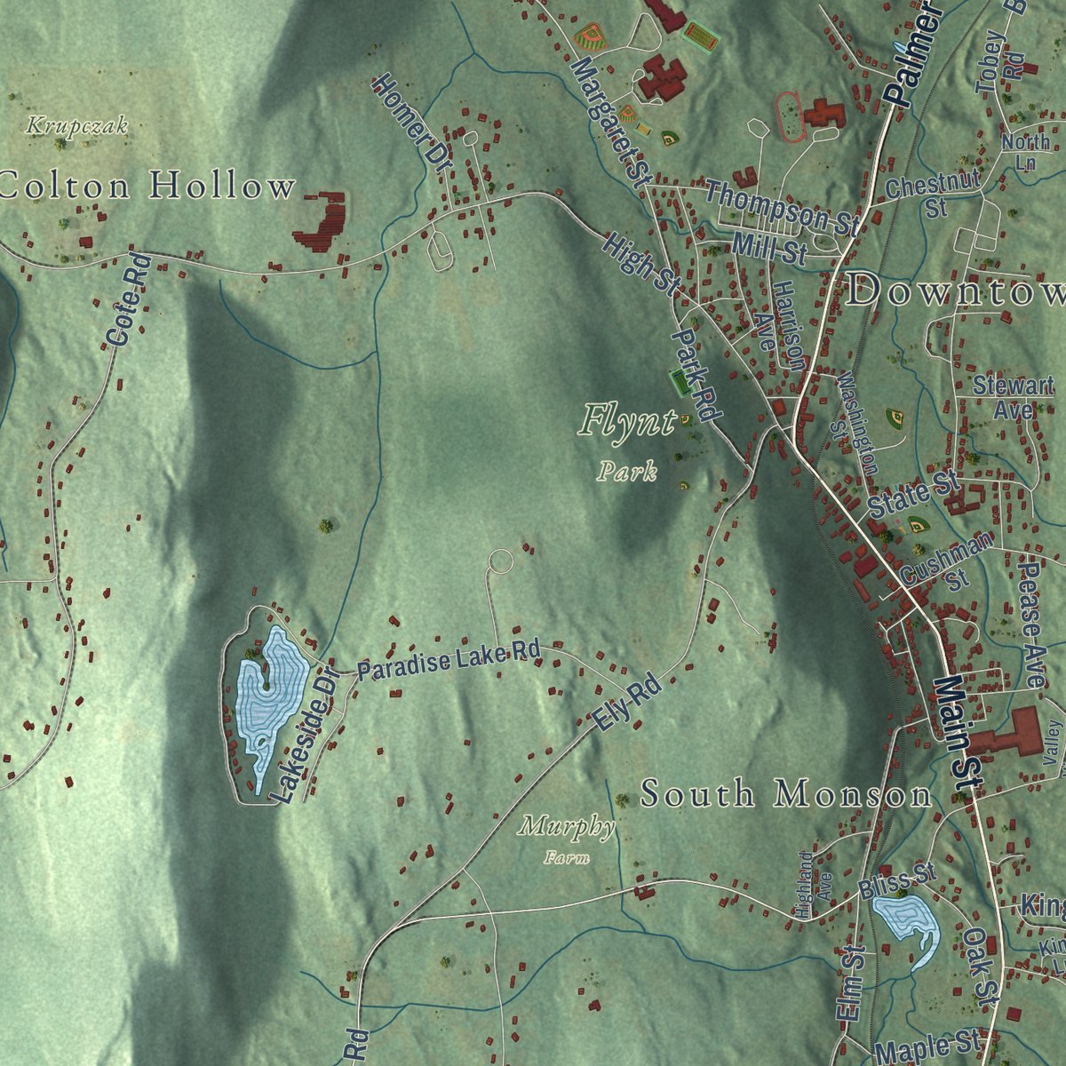
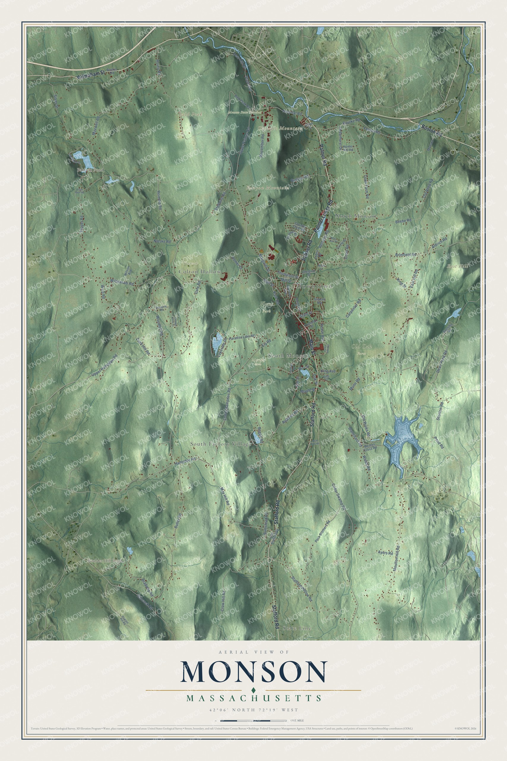
Explore Monson, Massachusetts from a whole new perspective. Created using aerial imagery and detailed geographic data, this map captures Monson building by building, with labeled streets, familiar landmarks, and shaded topographical relief that highlights the natural contours of the landscape.
Combining modern data with the timeless character of a vintage atlas, this map is just as interesting up close as it is beautiful on the wall. Whether you grew up in Monson, spent memorable years there, or call it home today, this unique map is a great way to celebrate a place that means something to you. Zoom in on the preview to look for your street, and then order a print to put your memories on the wall.
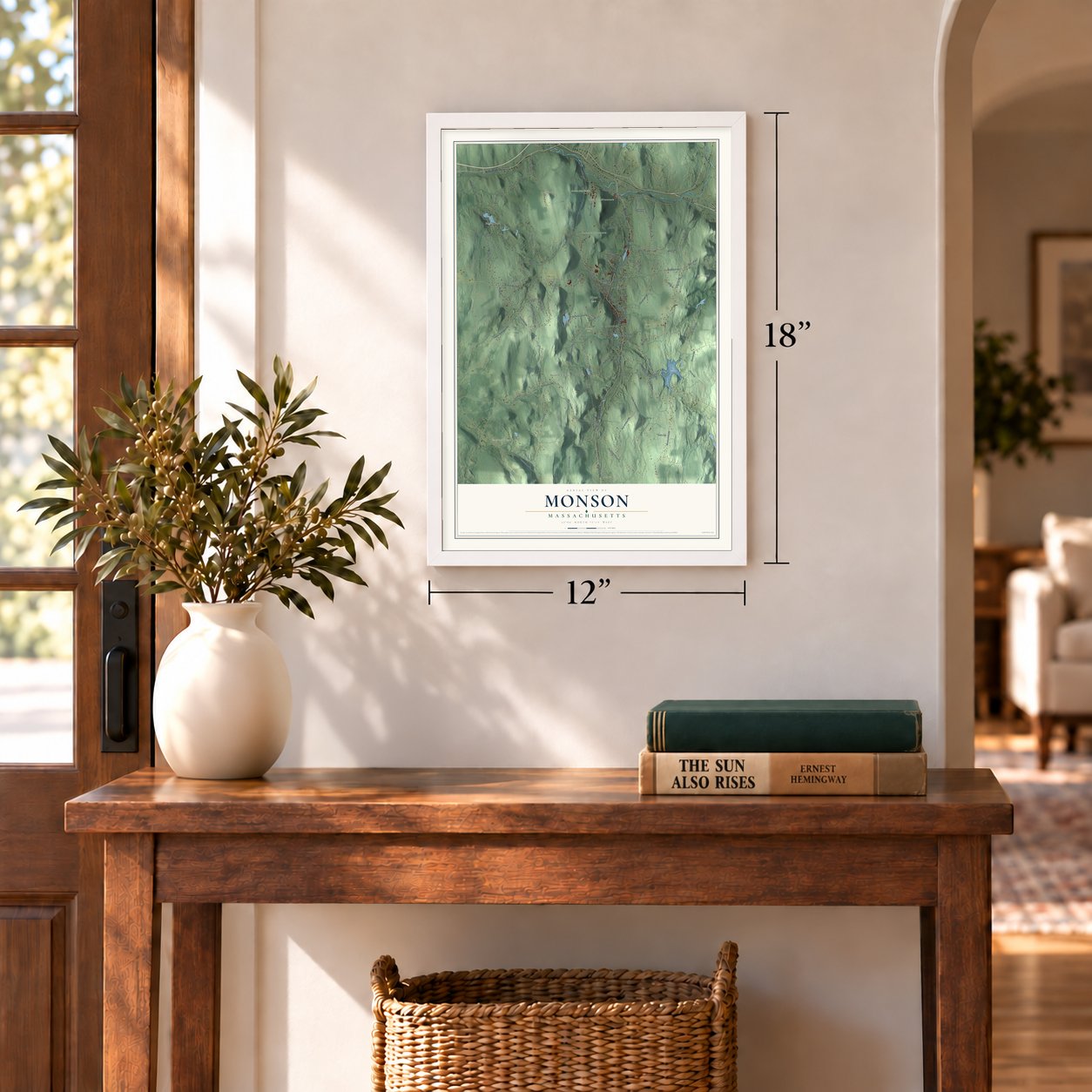
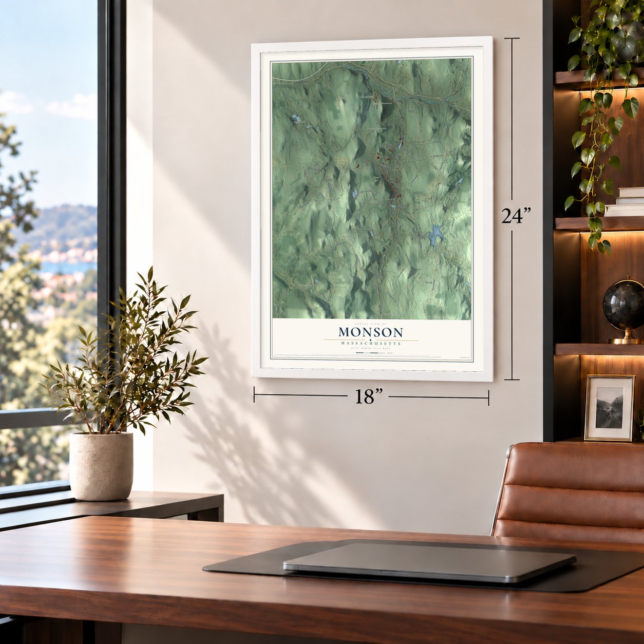
Three ways to hang it
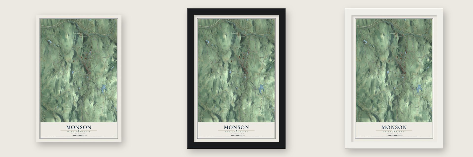
Unframed archival matte, a black wood frame or a white wood frame.
Up close
Geography Worth Displaying
This map was created using accurate cartographic data and authoritative geographic sources, including the U.S. Geological Survey (USGS) and FEMA. The map brings together terrain, waterways, roads, and building detail. The majority of the streets are labeled, houses are accurately depicted, and the topography is derived from government sources. Combining local data with carefully composed color and shading leads to this beautifully detailed Monson artwork for your wall.
Rather than simply showing street outlines, we’ve included as many of the street names as we could reasonably fit on the map while keeping their names legible. Zoom in on the high resolution preview to see exactly what’s on the map. We truly set out to create a statement piece for anyone who loves Monson. So whether it’s for you, or a gift for someone you love, we hope this map of Monson brings back fond memories.
Explore the full map of Monson, Massachusetts and read about the local places it shows.

Find your street
Names on the Monson map
Every name below is printed on this map. Look for your street, your school, the park where you played, or the pond down the road.
Places and landmarks17
- Downtown
- State Line
- Bald Peak
- Bunyan Mountain
- Chicopee Mountain
- East Hill
- Baldwin Pond
- Boulder Hill Pond
- Flynt Park
- Krupczak
- Monson State Hospital
- Murphy Farm
Show all 17 places
- Old Oak Farm
- South Factory Village
- South Monson
- North Monson
- Colton Hollow
Streets and roads104
- Wilbraham Street
- Palmer Road
- Boston Road
- Main Street
- Stafford Road
- Palmer Lower Road
- Hospital Road
- Upper Palmer Road
- Margaret Street
- Elm Street
- Hampden Road
- State Avenue
- Cedar Swamp Road
- Lower Hampden Road
- Hancock Road
- Silver Street
- Wales Road
- Hovey Road
- Moulton Hill Road
- Wilbraham Road
- Bumstead Road
- Woodhill Road
- East Hill Road
- Reimers Road
- Butler Road
- Munn Road
- Town Farm Road
- Brimfield Road
- Beebe Road
- Upper Hampden Road
Show all 104 streets
- Blanchard Road
- Thayer Road
- Fenton Road
- Stafford Hollow Road
- Bethany Road
- May Hill Road
- Crow Hill Road
- Maxwell Road
- Carpenter Road
- Cote Road
- Ely Road
- Stebbins Road
- Macomber Road
- Bogan Road
- Dean Pond Road
- Old Wales Road
- Lakeside Drive
- Bradway Road
- Waid Road
- Old Reed Road
- High Street
- Ayers Road
- King Street
- Zuell Hill Road
- Crest Road
- Nieske Road
- Robbins Road
- Bunyan Road
- Pond Road
- Rourke Road
- Stanton Road
- Thompson Street
- Park Road
- State Street
- Cedarhurst Drive
- Fern Hill Road
- Aldrich Road
- Homer Drive
- Oak Street
- Maple Street
- Mill Street
- Pease Avenue
- King Avenue
- Bliss Street
- Peck Brothers Road
- Bald Peak Road
- Sutcliffe Road
- Tobey Road
- Paradise Lake Road
- Moores Cross Road
- Country Club Heights
- Circle Drive
- Old Stafford Road
- Monson
- Harrison Avenue
- Wilson Avenue
- Chestnut Street
- Hunter Hill Road
- Cushman Street
- Stewart Avenue
- Silva Street
- Lakeshore Drive
- Quaboag Heights
- Washington Street
- King Lane
- Pinnacle Road
- Howlett Hill Road
- North Lane
- Highland Avenue
- Betty Jean Drive
- Carriage House Lane
- Pulpit Rock Road
- Valley View Heights
- Peck Bros Road
Names are listed as they appear on the printed map. Zoom into the product photos to find them.
About Monson, Massachusetts
Monson is a town of 8,150 people in eastern Hampden County, where Chicopee Brook flows north toward the Quaboag River. In 1657 the Massachusetts General Court granted a colonist 200 acres here, and he opened a tavern on the Bay Path between Springfield and Boston. It was the first house anywhere between Springfield and Brookfield, but fear of attacks by local Native Americans drove him away within a year or two.
Permanent settlers came in 1715. When Brimfield was incorporated in 1735, this land fell inside its borders, but the western part of Brimfield later broke away and became the town of Monson on August 23, 1775, the same day Ludlow was incorporated. The new town was named for Sir John Monson, who led the British Board of Trade and was a friend of Governor Thomas Pownall.
- Granite since 1809Monson's first granite quarry opened in 1809, east of what is now Margaret Street, and for a short time the federal government took stone from it for the Springfield Armory. Rufus Flynt bought the site and started a commercial quarry in 1825 with five workers. By 1900 the W. N. Flynt Granite Company employed almost 500 people, and the quarry kept working until about 1935.
- Monson Academy, opened 1806Monson Academy was founded in 1804 and opened its doors in 1806. In 1847 it became the first school in America to enroll Chinese students. Lucy Stone, the abolitionist and suffragist, studied there, as did William Strong and Henry Billings Brown, both of them Supreme Court justices. Frances Perkins and Louise Torrey Taft were on its faculty. In 1971 the academy merged with Wilbraham Academy, forming Wilbraham & Monson Academy.
- Emily Dickinson's motherEmily Norcross was born in Monson in 1804, and her father, who believed girls should be educated, sent her to Monson Academy. Edward Dickinson, a law student in Amherst at the time, met her in 1826 when legal business brought him to Monson. They wrote each other ninety-three letters, then married and settled in Amherst, where their daughter Emily Dickinson, the poet, was born.
- A teacher in China and JapanSamuel Robbins Brown grew up in Monson and sailed to China as a missionary in 1838, where he started the Chinese Empire's first Protestant school; Yung Wing was among his pupils. Later, working in Japan, he was one of the translators of the New Testament into Japanese and a founder of the Asiatic Society of Japan. He is buried in Monson.
- The 2011 tornadoOn June 1, 2011, an EF3 tornado tore through the center of town and damaged 238 buildings, 77 of them beyond repair, for $11.9 million in losses. Two churches lost their steeples, the town's Unitarian Universalist Church and the First Church of Monson, and the 1900 Holmes Gymnasium of the old Monson Academy was destroyed. The town office building, built in 1925 as Monson's first high school, could not be saved and came down in 2013.
Keep exploring Massachusetts
Monson is one of 467 Massachusetts towns we've mapped. Every dot on the map is a print of its own.
The search covers every state, Massachusetts first.
Near Monson
Order 2 or more town maps and save 10%. Shown in the size and finish you picked above, so they hang as a set.
- Wales 12" x 18" / Archival Matte Print $39.99
- Hampden 12" x 18" / Archival Matte Print $39.99
- Wilbraham 12" x 18" / Archival Matte Print $39.99


More maps nearby: Brimfield, Palmer, Holland, East Longmeadow and Ludlow.
The art of mapping a place
How This Map Was Made
Real places. Remarkable detail. Discover the layers that turn geographic data into a map of home.

The view from above
Aerial imagery reveals the character of the land: woodland, open fields, and the patterns of a place.

The shape of the land
Elevation data brings hills, valleys, and subtle changes in the landscape into view.

The details of home
Roads, waterways, and building footprints come together to make the map feel unmistakably local.

Geography becomes art
Considered color, shading, and typography bring the layers together in a map made for your wall.


Process illustrated with Mendon, Massachusetts. Aerial imagery: USDA NAIP. Terrain: USGS 3D Elevation Program. Map details and finished artwork: KNOWOL.
The Details
About This Print
Choose an archival matte print, or a black or white Ayous wood frame. The archival matte print is unframed.
Select your size and finish above to see the matching product image and price.
Materials & Craftsmanship
A contemporary map with the character of a classic atlas, printed on archival matte paper. Optional frames are made from Ayous wood.
Your printed map does not include the watermark shown in the full-map preview.
Shipping & Delivery
Free shipping within the United States. Every print is made to order in the USA.
Buying a gift? Add a note in your cart and we'll include it. We never put prices in the package.
Prints ship within 2 to 3 business days. Allow 7 to 10 days total from ordering for delivery. Timing may vary during holidays or periods of high order volume.
Read our shipping policy.
Returns and damaged prints
Each print is made to order. Change-of-mind refunds are not available after production.
If your print arrives damaged, misprinted or incorrect, contact support@knowol.com within 30 days of receiving it. Include your order number, photos and a description of the issue.
Read our full refund and replacement policy. For questions about your order, email support@knowol.com.