
Search for another town





Free U.S. delivery 7 to 10 days after you order
Hampden, Massachusetts Map Art
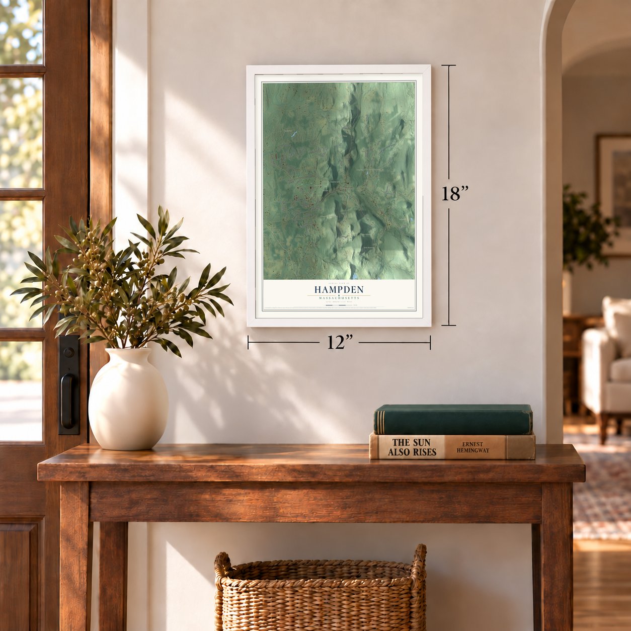
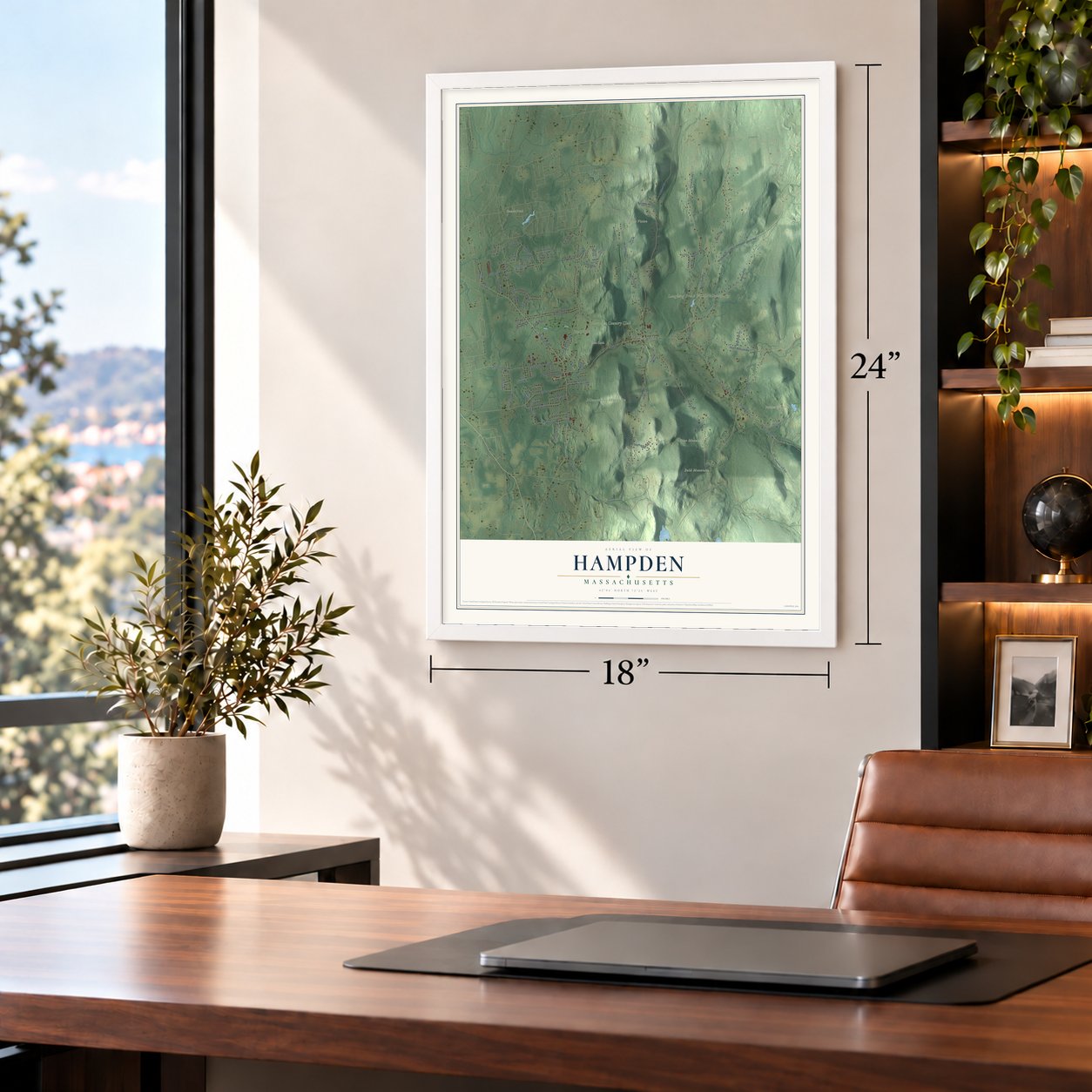
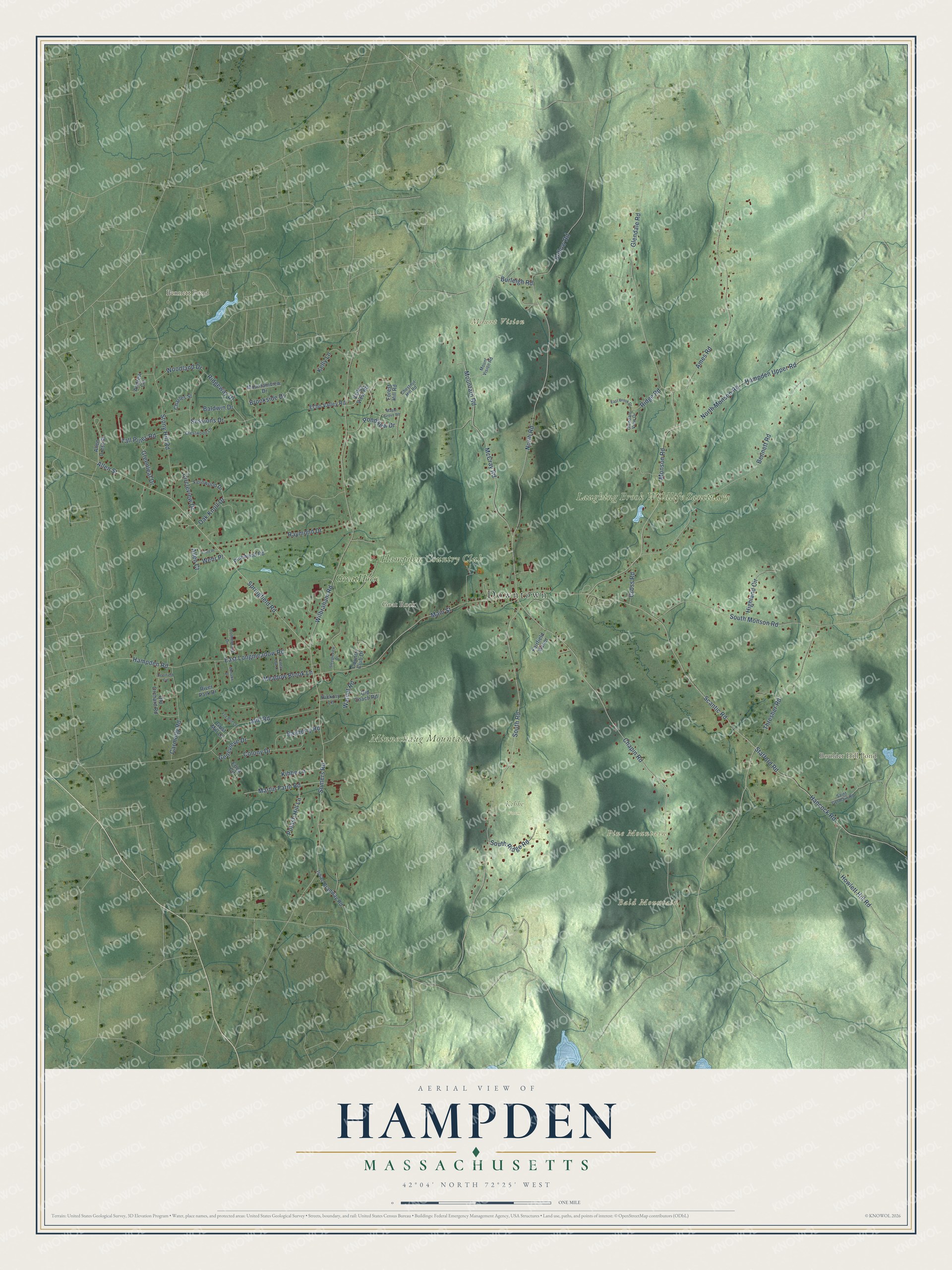
A new map of Hampden, Massachusetts, made in 2026 and printed to order on thick archival matte paper.
12" x 18" Archival Matte Print
A Map of Home. A Work of Art.
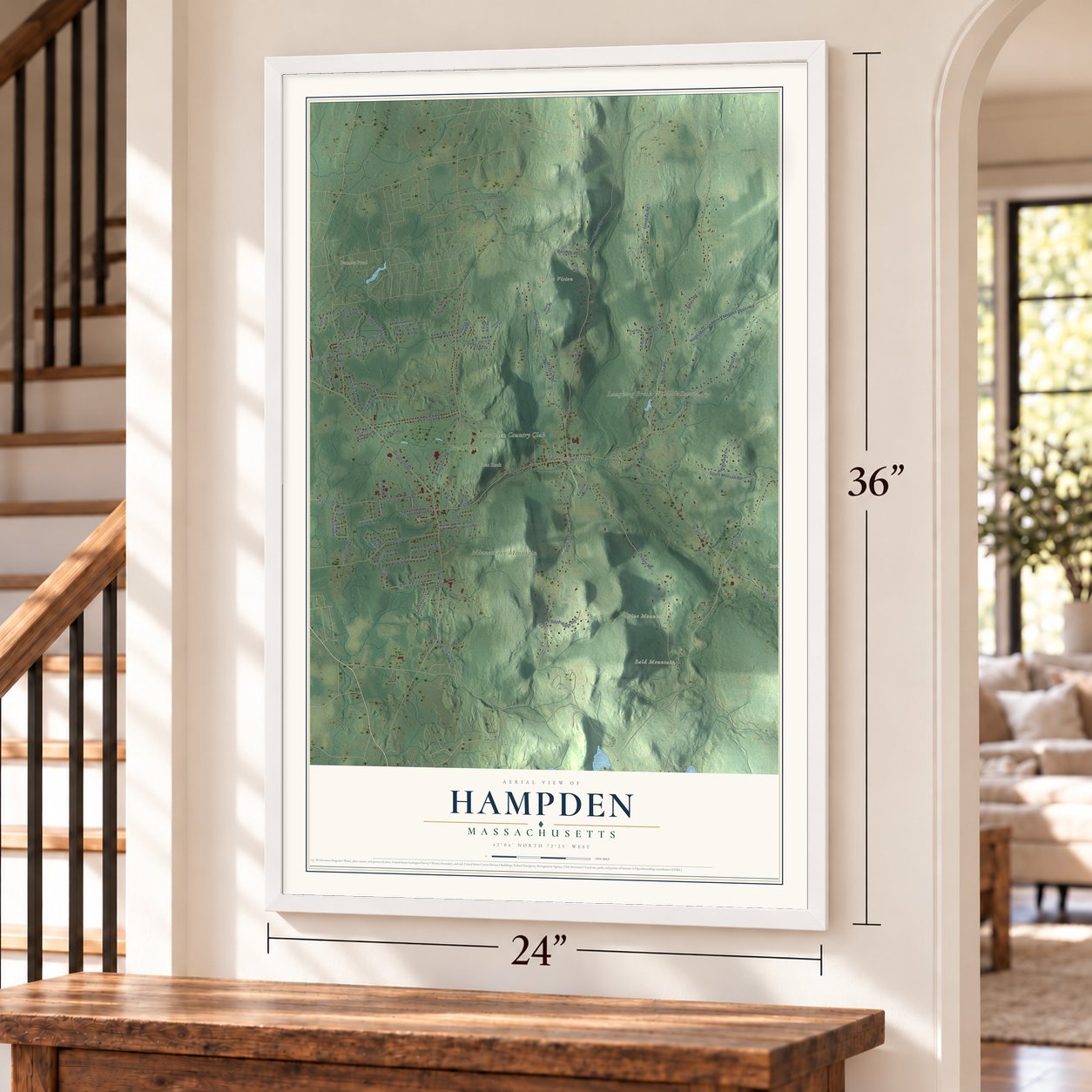
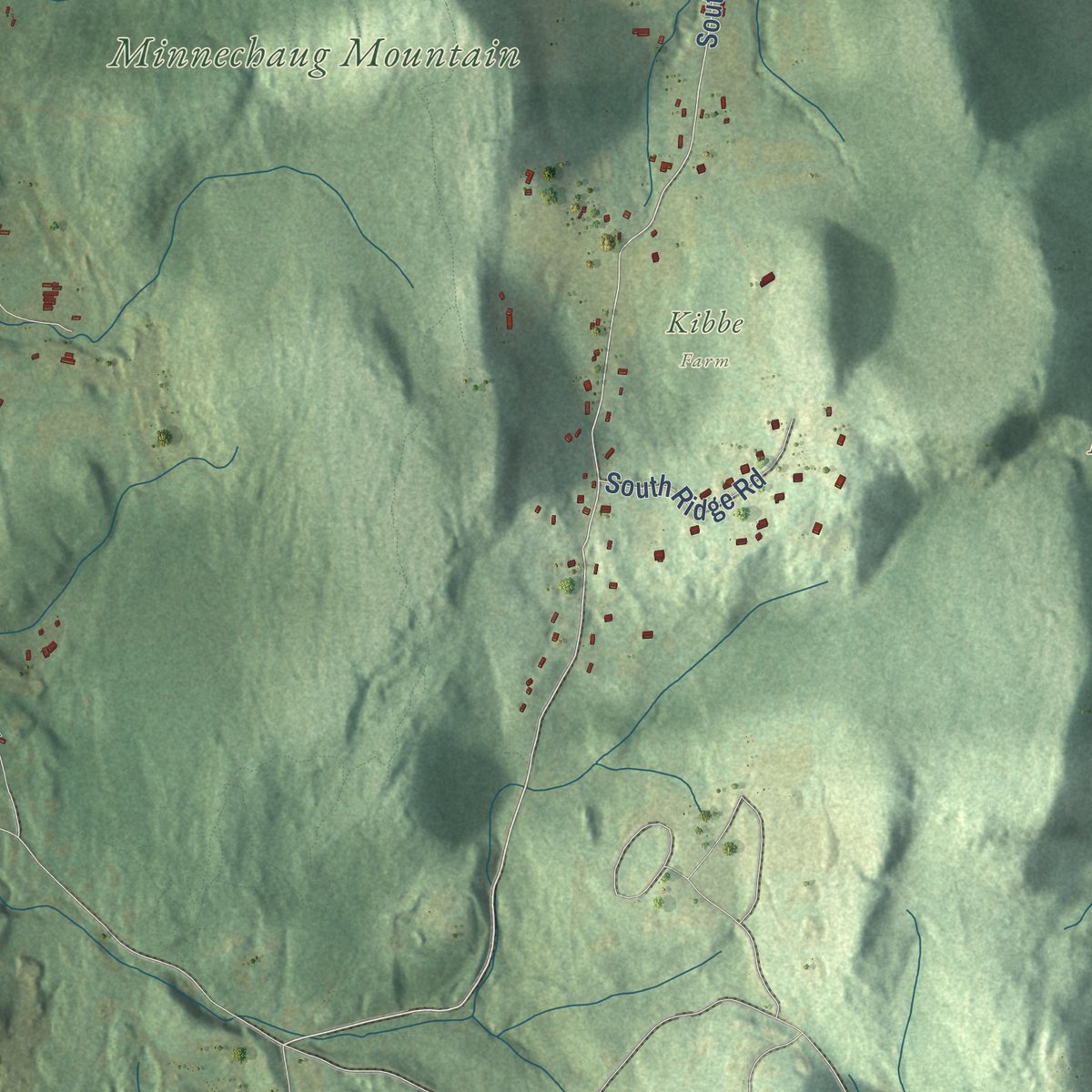
Explore Hampden, Massachusetts from a whole new perspective. Created using aerial imagery and detailed geographic data, this map captures Hampden building by building, with labeled streets, familiar landmarks, and shaded topographical relief that highlights the natural contours of the landscape.
Combining modern data with the timeless character of a vintage atlas, this map is just as interesting up close as it is beautiful on the wall. Whether you grew up in Hampden, spent memorable years there, or call it home today, this unique map is a great way to celebrate a place that means something to you. Zoom in on the preview to look for your street, and then order a print to put your memories on the wall.
Three ways to hang it
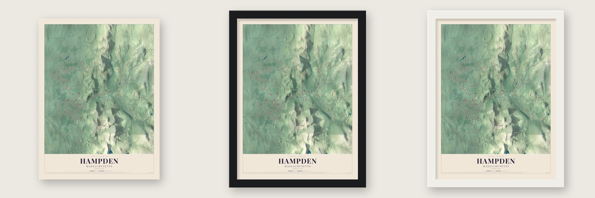
Unframed archival matte, a black wood frame or a white wood frame.
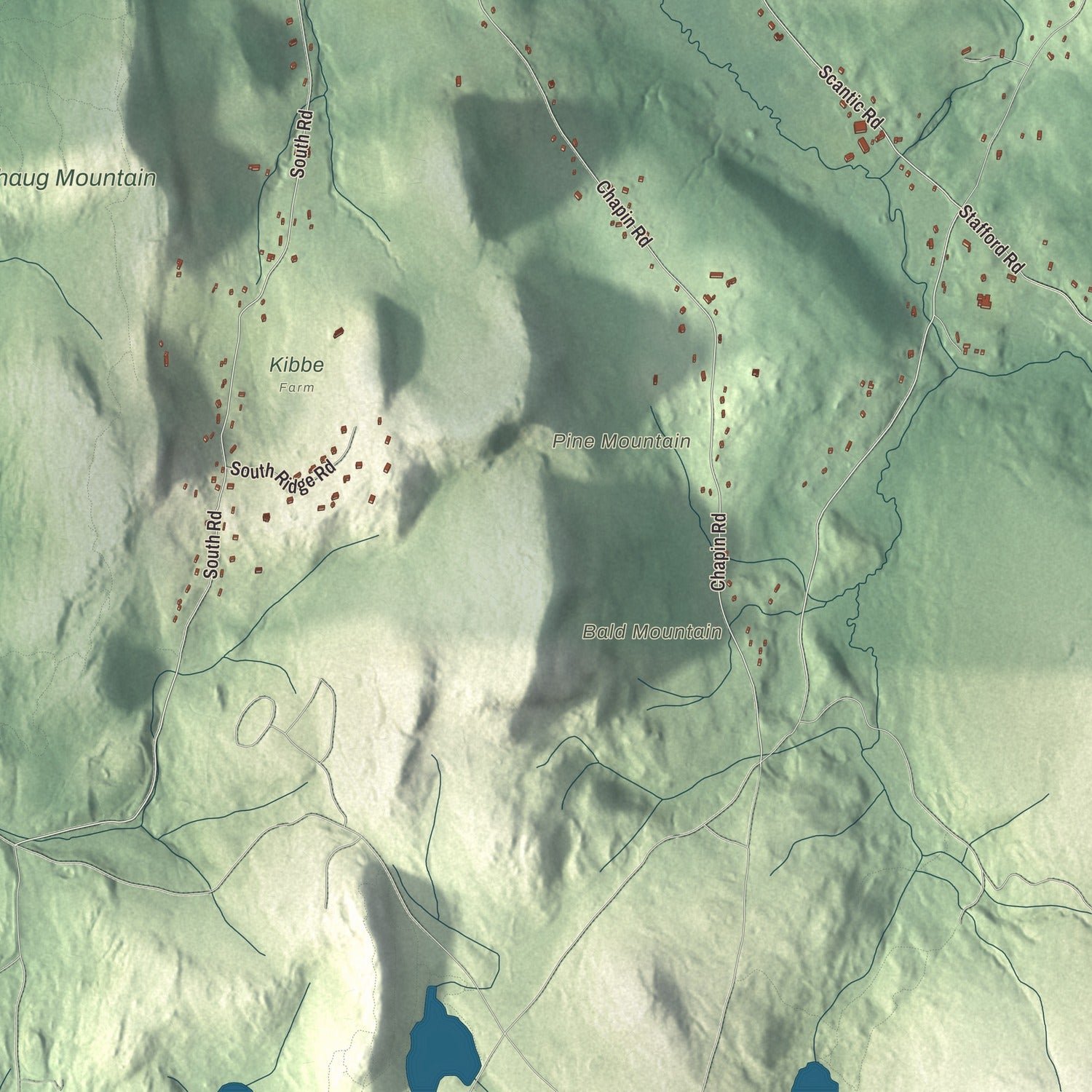
Up close
Geography Worth Displaying
This map was created using accurate cartographic data and authoritative geographic sources, including the U.S. Geological Survey (USGS) and FEMA. The map brings together terrain, waterways, roads, and building detail. The majority of the streets are labeled, houses are accurately depicted, and the topography is derived from government sources. Combining local data with carefully composed color and shading leads to this beautifully detailed Hampden artwork for your wall.
Rather than simply showing street outlines, we’ve included as many of the street names as we could reasonably fit on the map while keeping their names legible. Zoom in on the high resolution preview to see exactly what’s on the map. We truly set out to create a statement piece for anyone who loves Hampden. So whether it’s for you, or a gift for someone you love, we hope this map of Hampden brings back fond memories.
Explore the full map of Hampden, Massachusetts and read about the local places it shows.
About Hampden, Massachusetts
Hampden is a town of 4,966 people in Hampden County, on the Connecticut line. The Nipmuc called this country Minnechaug, meaning "berry land" or "berry hill," and in 1674 they sold it to William Pynchon of Springfield. Settlers did not arrive until about 1741, when the Stebbins and Hitchcock families came. Their grist and saw mills needed the Scantic River for power, so the first houses rose along the river and its brooks.
For about a hundred years the place was South Wilbraham, a farming district of its mother town. It split off in 1878 and took the name of John Hampden, an English patriot. Mills were growing then, but the Lacowsic mill burned in 1892 and the Ravine mill in 1904, other businesses failed, and cars let men find work elsewhere. Farmers turned to orchards, dairy cows and crops, Springfield families built summer homes here, and over time Hampden became a residential town.
- The rattlesnake of 1761On August 7, 1761, Timothy Merrick, 22, was mowing in his father's field when a snake bit him, and he died. The field is believed to lie in today's Hampden. His death became the subject of "On Springfield Mountain," one of the earliest ballads written in North America, and later of the folk song "Rattlesnake Mountain."
- Thornton W. Burgess at homeBurgess, who wrote the Bedtime Stories newspaper column from 1912 to 1960, bought a house in Hampden in 1925 and made it his permanent home in 1957. The house at 789 Main Street was built between 1780 and 1784 and now belongs to the Massachusetts Audubon Society, beside its Laughing Brook Wildlife Sanctuary. In September 2004 an arson fire burned the sanctuary headquarters, which had been dedicated to him, but his house came through untouched.
- A war memorial in 1920In January 1920, only months after the fighting stopped, Hampden put up a World War I monument that was among the earliest in the nation. It still stands on the village green.
- The Dunwich HorrorH. P. Lovecraft traveled through Hampden, and the trip inspired his 1928 horror story "The Dunwich Horror." Its made-up town of Dunwich drew on Hampden and the hills around it.
- Floods of 1955 and 2005Hurricane Diane struck in August 1955, and its floods carried off most of the town's bridges. Fifty years later, a week of rain ended with a downpour on October 9, 2005, which sent many brooks and the Scantic River itself over their banks. The water flooded homes and businesses and washed out the VFW bridge.
Find your street
Names on the Hampden map
Every name below is printed on this map. Look for your street, your school, the park where you played, or the pond down the road.
Places and landmarks13
- Downtown
- Bald Mountain
- Goat Rock
- Mount Vision
- Pine Mountain
- Bennett Pond
- Boulder Hill Pond
- Goodwill Pond
- Laughing Brook Wildlife Sanctuary
- Hampden Country Club
- Minnechaug Mountain
- Kibbe Farm
Show all 13 places
- GreatHorse
Streets and roads82
- Scantic Road
- Chapin Road
- Glendale Road
- South Road
- North Road
- Somers Road
- Wilbraham Road
- North Monson Road
- Hampden Upper Road
- Main Street
- Allen Street
- Springfield Road
- Bennett Road
- Ames Road
- McCray Road
- Mountain Road
- Mill Road
- South Monson Road
- East Longmeadow Road
- Monson Road
- Sessions Drive
- Hancock Road
- Stafford Road
- Raymond Drive
- Thresher Road
- Stony Hill Road
- Woodland Drive
- Carmody Road
- Howlett Hill Road
- Hollow Road
Show all 82 streets
- Colony Drive
- Martin Farm Road
- Baldwin Drive
- Oak Knoll Drive
- Tall Pines Road
- Circleview Drive
- Brookside Drive
- Highland Circle
- South Ridge Road
- Pondview Drive
- Bayberry Road
- Meadow Brook Lane
- Greenleaf Drive
- Potash Hill Lane
- Genevieve Drive
- Kelly Lane
- Ridgeway Drive
- Walnut Road
- Hampden Road
- Allen Court
- Kibbe Lane
- Cross Road
- Ridge Road
- Allen Crest Street
- Valley View Road
- Old Orchard Road
- River Park Drive
- Forest Hill Road
- Fernwood Drive
- Issac Bradway Road
- Old Coach Road
- Erica Circle
- Andrew Circle
- Echo Valley Road
- Burleigh Road
- Pinewood Road
- Country Club Drive
- Chestnut Hill Road
- Fairfield Manor
- Grist Mill Lane
- Hickory Lane
- Saint Germain Road
- Crestwood Lane
- Mount Vision Road
- Mountainview Drive
- Charles Street
- Glendale View Drive
- Commercial Drive
- East Brook Drive
- Mohawk Drive
- Fox Run Lane
- Deerfield Circle
Names are listed as they appear on the printed map. Zoom into the product photos to find them.
The art of mapping a place
How This Map Was Made
Real places. Remarkable detail. Discover the layers that turn geographic data into a map of home.

The view from above
Aerial imagery reveals the character of the land: woodland, open fields, and the patterns of a place.

The shape of the land
Elevation data brings hills, valleys, and subtle changes in the landscape into view.

The details of home
Roads, waterways, and building footprints come together to make the map feel unmistakably local.

Geography becomes art
Considered color, shading, and typography bring the layers together in a map made for your wall.


Process illustrated with Mendon, Massachusetts. Aerial imagery: USDA NAIP. Terrain: USGS 3D Elevation Program. Map details and finished artwork: KNOWOL.
The Details
About This Print
Choose an archival matte print, or a black or white Ayous wood frame. The archival matte print is unframed.
Select your size and finish above to see the matching product image and price.
Materials & Craftsmanship
A contemporary map with the character of a classic atlas, printed on archival matte paper. Optional frames are made from Ayous wood.
Your printed map does not include the watermark shown in the full-map preview.
Shipping & Delivery
Free shipping within the United States. Every print is made to order in the USA.
Buying a gift? Add a note in your cart and we'll include it. We never put prices in the package.
Prints ship within 2 to 3 business days. Allow 7 to 10 days total from ordering for delivery. Timing may vary during holidays or periods of high order volume.
Read our shipping policy.
Returns and damaged prints
Each print is made to order. Change-of-mind refunds are not available after production.
If your print arrives damaged, misprinted or incorrect, contact support@knowol.com within 30 days of receiving it. Include your order number, photos and a description of the issue.
Read our full refund and replacement policy. For questions about your order, email support@knowol.com.
Find your town
Looking for another city?
Find a map of home in our Massachusetts collection, or any town in the country.
Nearby
Maps of towns near Hampden
Know someone from one of these towns? Their map makes a great gift.
 Wilbraham
, Massachusetts
From $39.99See the map
 East Longmeadow
, Massachusetts
From $39.99See the map
 Monson
, Massachusetts
From $39.99See the map
More maps nearby: Springfield, Longmeadow, Ludlow, Wales and Palmer.