
Search for another town





Free U.S. delivery 7 to 10 days after you order
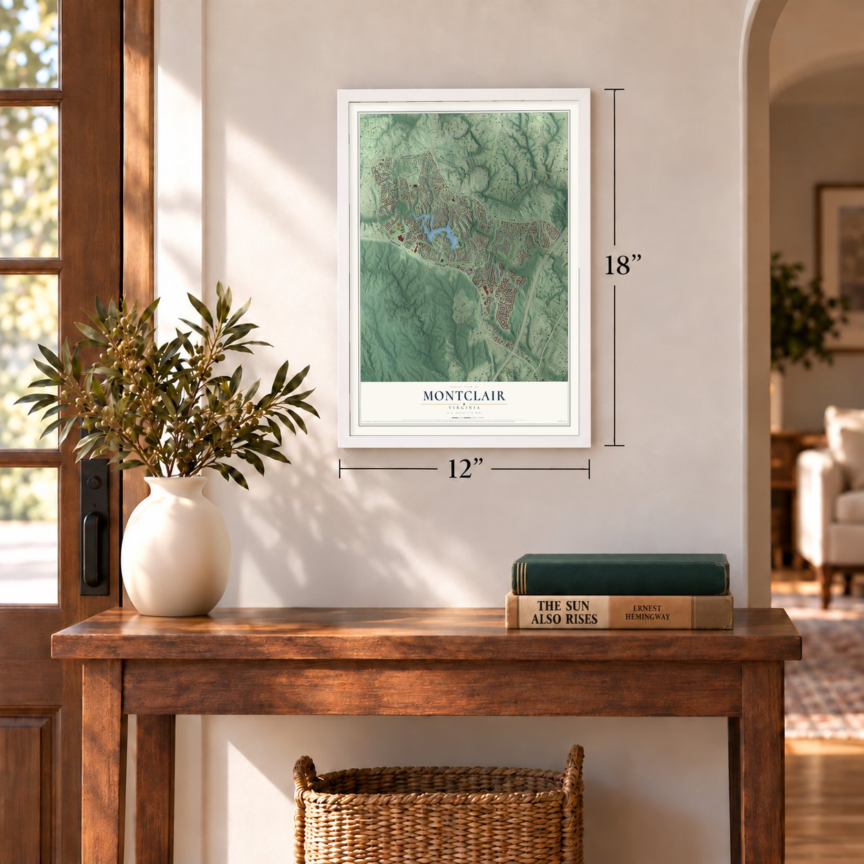
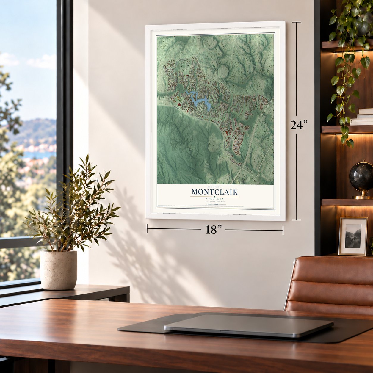
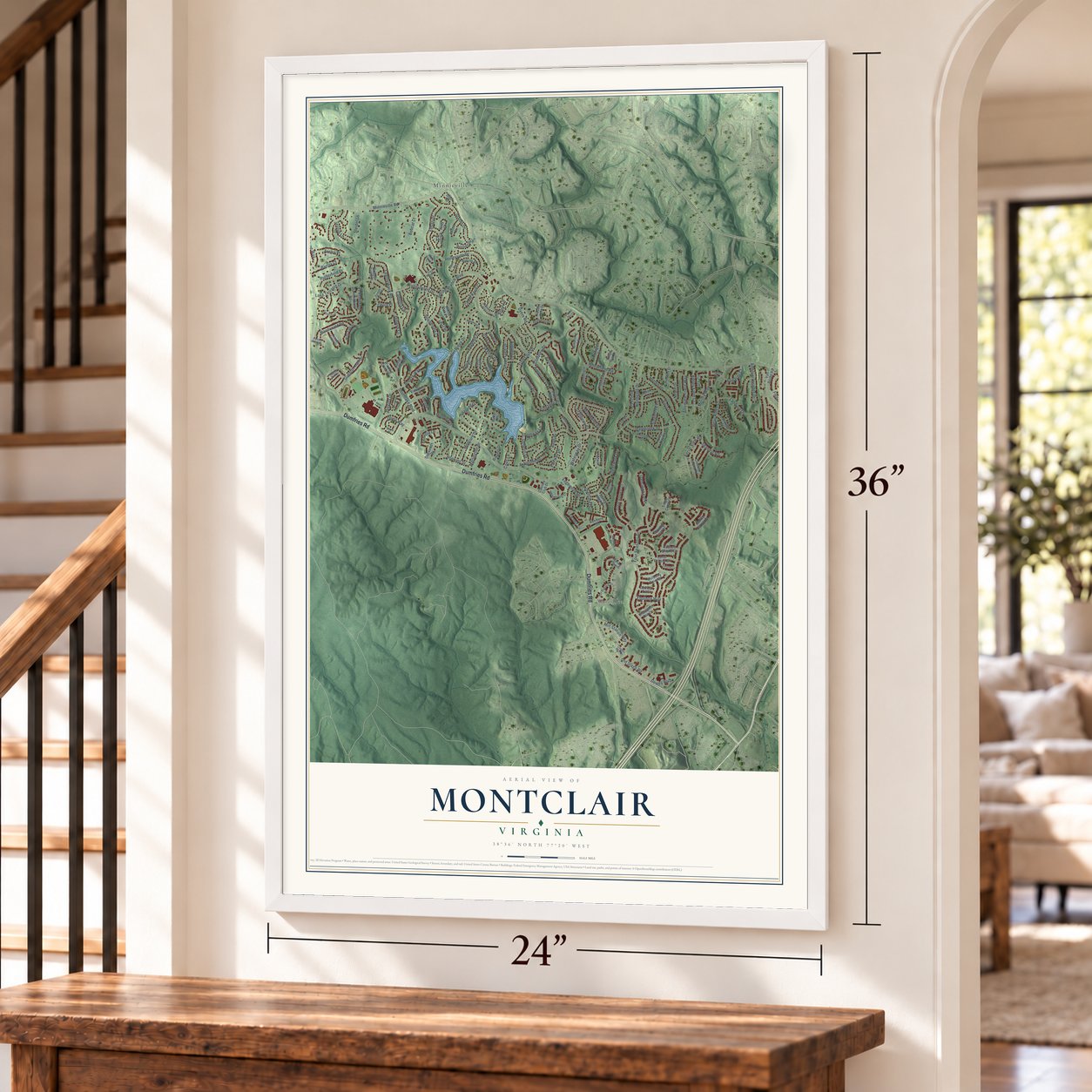
Montclair, Virginia Map Art
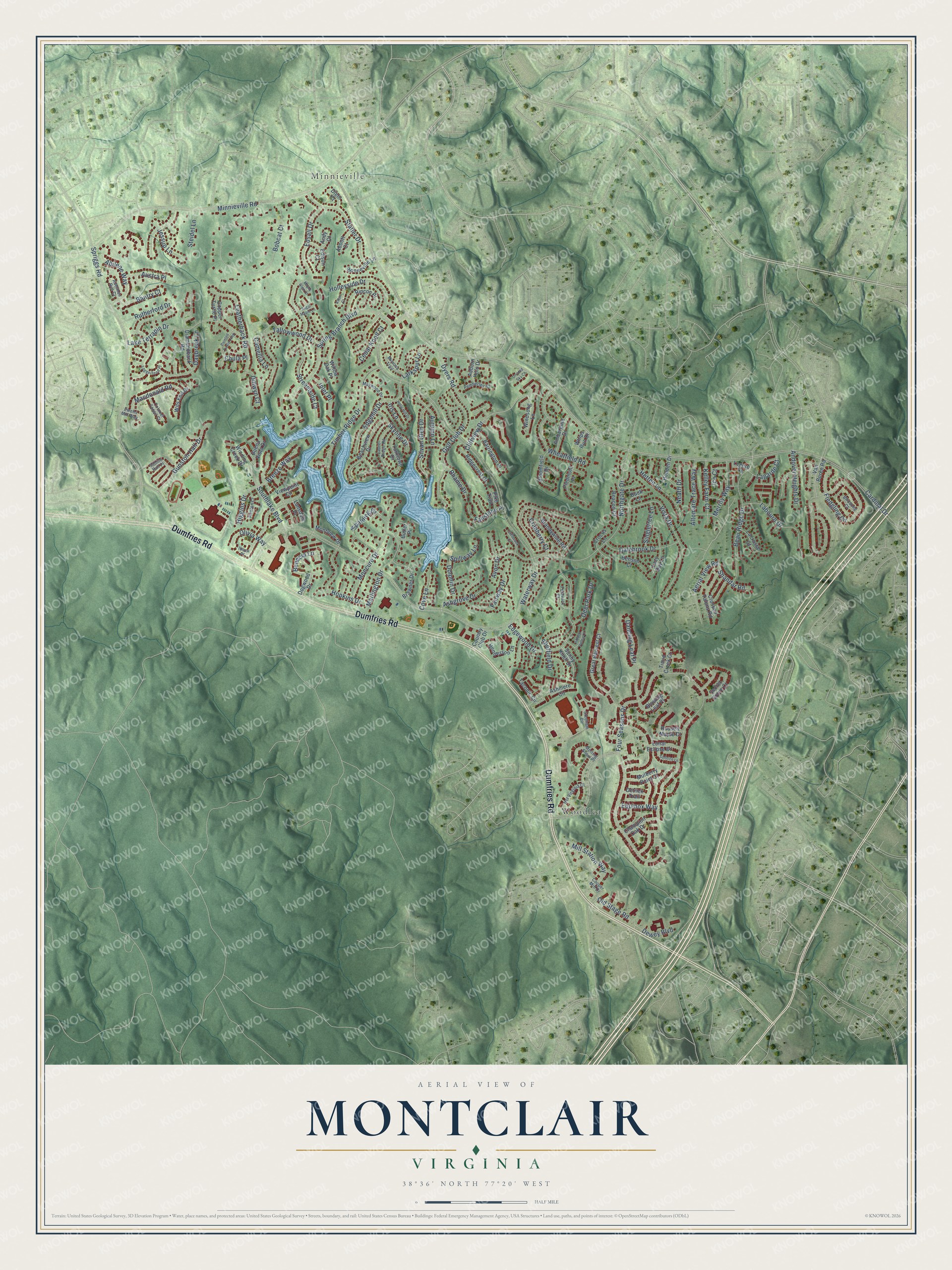
A new map of Montclair, Virginia, made in 2026 and printed to order on thick archival matte paper.
12" x 18" Archival Matte Print
A Map of Home. A Work of Art.
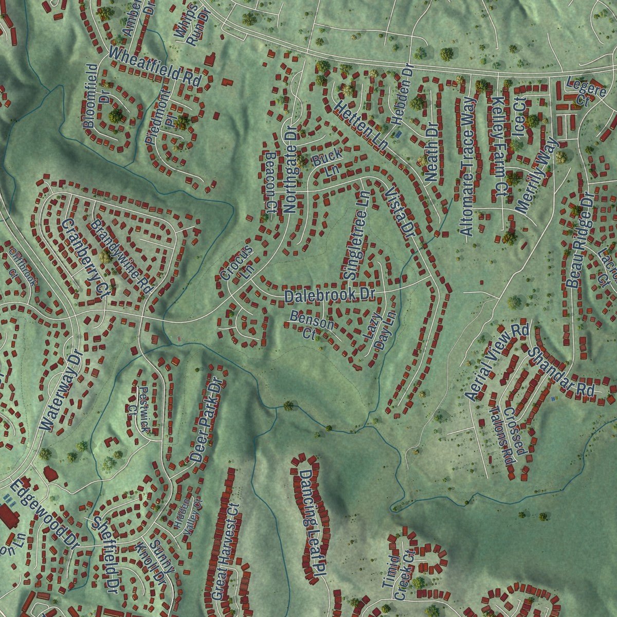
Explore Montclair, Virginia from a whole new perspective. Created using aerial imagery and detailed geographic data, this map captures Montclair building by building, with labeled streets, familiar landmarks, and shaded topographical relief that highlights the natural contours of the landscape.
Combining modern data with the timeless character of a vintage atlas, this map is just as interesting up close as it is beautiful on the wall. Whether you grew up in Montclair, spent memorable years there, or call it home today, this unique map is a great way to celebrate a place that means something to you. Zoom in on the preview to look for your street, and then order a print to put your memories on the wall.
Three ways to hang it
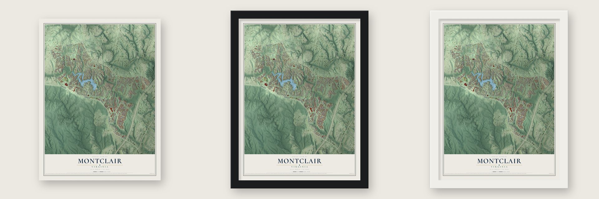
Unframed archival matte, a black wood frame or a white wood frame.
Up close
Geography Worth Displaying
This map was created using accurate cartographic data and authoritative geographic sources, including the U.S. Geological Survey and the Census Bureau. The map brings together terrain, waterways, roads, and building detail. The majority of the streets are labeled, houses are accurately depicted, and the topography is derived from government sources. Combining local data with carefully composed color and shading leads to this beautifully detailed Montclair artwork for your wall.
Rather than simply showing street outlines, we’ve included as many of the street names as we could reasonably fit on the map while keeping their names legible. Zoom in on the high resolution preview to see exactly what’s on the map. We truly set out to create a statement piece for anyone who loves Montclair. So whether it’s for you, or a gift for someone you love, we hope this map of Montclair brings back fond memories.
Read the story behind this map of Montclair, Virginia from 2026.
About Montclair, Virginia
Montclair is a community of 22,279 people in Prince William County, built around a man-made lake and a golf course. Its property owners association dates the community to 1969, and building began in the late 1960s. Houses kept going up until the last new homes were finished in the 1990s.
Today about 3,800 homes stand around the lake, across a community that covers 6.2 square miles, nearly all of it land. The Hammond-Queen House, inside the community, is listed on the National Register of Historic Places.
- A 108-acre lakeThe homes of Montclair circle a lake of 108 acres. A wide central boulevard runs through the community, with flowering trees down the middle and broad sidewalks on each side for walkers, runners and cyclists.
- Run by its homeownersThe Montclair Property Owners Association governs the community. Each year it holds elections and seats the new board at its annual meeting. The board enforces the covenants, takes care of the lake and looks after the needs of residents.
- Forest Park High SchoolForest Park High School, part of Prince William County Public Schools, stands inside Montclair, although its mailing address is in Woodbridge.
Find your street
Names on the Montclair map
Every name below is printed on this map. Look for your street, your school, the park where you played, or the pond down the road.
Places and landmarks2
- Minnieville
- Woodlea
Streets and roads163
- Dumfries Road
- Cardinal Drive
- Waterway Drive
- Four Seasons Drive
- Minnieville Road
- Edgewood Drive
- Spriggs Road
- Holleyside Drive
- Spring Branch Boulevard
- Northgate Drive
- Bobcat Court
- Southlake Boulevard
- Timber Ridge Drive
- Vista Drive
- Beau Ridge Drive
- Lake Terrapin Drive
- Golf Club Drive
- Fledgling Circle
- Fairway Drive
- Leatherback Road
- Statler Drive
- Moncure Drive
- Marlington Drive
- Edgehill Drive
- Labourn Drive
- Streamside Court
- Gunston Hall Drive
- Dancing Leaf Place
- Spalding Drive
- Daybreak Lane
Show all 163 streets
- Silvan Glen Drive
- Dalebrook Drive
- Wheatfield Road
- Hetten Lane
- Aerial View Road
- Edsall Drive
- Tallowwood Drive
- Abilene Way
- Altomare Trace Way
- Benecia Lane
- Macdonald Road
- Old Stage Road
- Dyers Road
- Kelley Farm Court
- Avon Drive
- Cranberry Court
- Rutherford Drive
- Mill Station Way
- Merrily Way
- Andover Heights Drive
- Inlet Place
- Skyline Drive
- Autumn Lane
- Hopkins Drive
- Ashgrove Drive
- Breeze Way
- Cliffview Drive
- Singletree Lane
- Deer Park Drive
- Higgins Drive
- Shandar Road
- Fallstone Place
- Lagarde Court
- Bantry Court
- Olivia Way
- Dolphin Drive
- Austra Place
- Cedar Knoll Court
- Steidel Lane
- Dewey Boulevard
- Neath Drive
- Rhame Drive
- Equinox Way
- Jessup Lane
- Camellia Lane
- Dillwyn Court
- Larkspur Lane
- Cove Lane
- Sheffield Drive
- Spillway Lane
- Chula Place
- Iris Lane
- Ice Court
- Van Buren Road
- Great Harvest Court
- Montview Drive
- Taconic Circle
- Beachview Drive
- Viewpoint Circle
- Piedmont Place
- Rincon Place
- Ashmere Circle
- Brawner Drive
- Russett Maple Court
- Crossed Talons Road
- Brandywine Road
- Barrington Place
- Windsong Lane
- Buck Lane
- Dogwood Drive
- Ridgecrest Drive
- Bloomfield Drive
- Willow Oak Place
- Henderson Lane
- Diamondback Road
- Ambergate Drive
- Yorktown Drive
- Lazy Day Lane
- Lacrosse Court
- Champion Oak Drive
- Mulberry Point Court
- Sunny Knoll Drive
- Lunar Eclipse Drive
- Hebden Drive
- Secret Grove Court
- Blowing Leaf Place
- Crocus Lane
- Bonneville Lane
- Winding Creek Drive
- Edison Court
- Wits End Drive
- Buena Vista Drive
- Beacon Court
- Copper Turtle Place
- Auburn Hills Drive
- Detrick Trail
- Abbott Court
- Timid Creek Court
- Benson Court
- Lansdale Place
- Butler Place
- Whips Run Drive
- Diehl Court
- Country Club Drive
- Legere Court
- Andy Court
- Pike Trail
- Stedham Circle
- Hst Virginia Court
- Laurel Ridge Road
- Melting Snow Place
- Renton Court
- Maywood Drive
- Ibsen Place
- Pemberley Court
- Pestwick Court
- Sabine Hall Place
- Colonel Tansil Court
- Mimosa Trail
- Cooper Mill Drive
- Ewells Mill Way
- Adelman Run Court
- Birdsong Court
- Loggerhead Place
- Painted Turtle Loop
- Solstice Lane
- Cliffbrook Court
- Holly Hill Drive
- Hidden Valley Court
- Afton Court
- Sugar Maple Lane
- Maple Glen Court
- Divided Sky Court
Names are listed as they appear on the printed map. Zoom into the product photos to find them.
The art of mapping a place
How This Map Was Made
Real places. Remarkable detail. Discover the layers that turn geographic data into a map of home.

The view from above
Aerial imagery reveals the character of the land: woodland, open fields, and the patterns of a place.

The shape of the land
Elevation data brings hills, valleys, and subtle changes in the landscape into view.

The details of home
Roads, waterways, and building footprints come together to make the map feel unmistakably local.

Geography becomes art
Considered color, shading, and typography bring the layers together in a map made for your wall.


Process illustrated with Mendon, Massachusetts. Aerial imagery: USDA NAIP. Terrain: USGS 3D Elevation Program. Map details and finished artwork: KNOWOL.
The Details
About This Print
Choose an archival matte print, or a black or white Ayous wood frame. The archival matte print is unframed.
Select your size and finish above to see the matching product image and price.
Materials & Craftsmanship
A contemporary map with the character of a classic atlas, printed on archival matte paper. Optional frames are made from Ayous wood.
Your printed map does not include the watermark shown in the full-map preview.
Shipping & Delivery
Free shipping within the United States. Every print is made to order in the USA.
Buying a gift? Add a note in your cart and we'll include it. We never put prices in the package.
Prints ship within 2 to 3 business days. Allow 7 to 10 days total from ordering for delivery. Timing may vary during holidays or periods of high order volume.
Read our shipping policy.
Returns and damaged prints
Each print is made to order. Change-of-mind refunds are not available after production.
If your print arrives damaged, misprinted or incorrect, contact support@knowol.com within 30 days of receiving it. Include your order number, photos and a description of the issue.
Read our full refund and replacement policy. For questions about your order, email support@knowol.com.
Find your town
Looking for another city?
Find a map of home in our Virginia collection, or any town in the country.
Nearby
Maps of towns near Montclair
Know someone from one of these towns? Their map makes a great gift.
 Dale City
, Virginia
From $39.99See the map
 Dumfries
, Virginia
From $39.99See the map
 Leesylvania
, Virginia
From $39.99See the map
More maps nearby: Potomac Mills, Cherry Hill, Triangle, Independent Hill and Woodbridge.