
Search for another town



Free U.S. delivery 7 to 10 days after you order
Woodbridge, Virginia Map Art
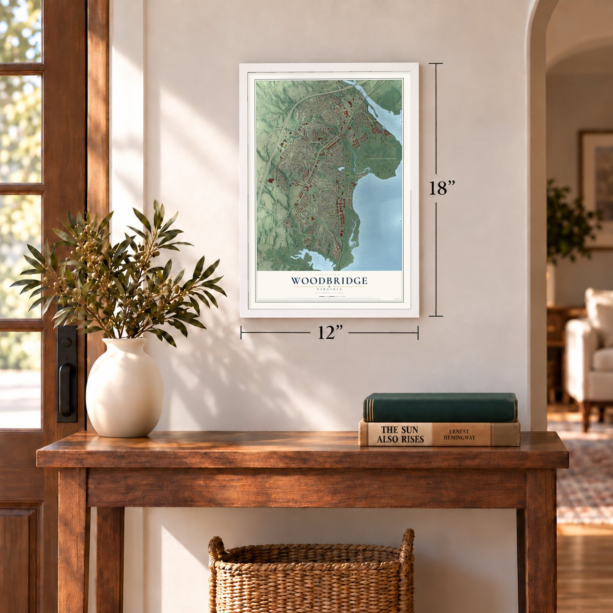
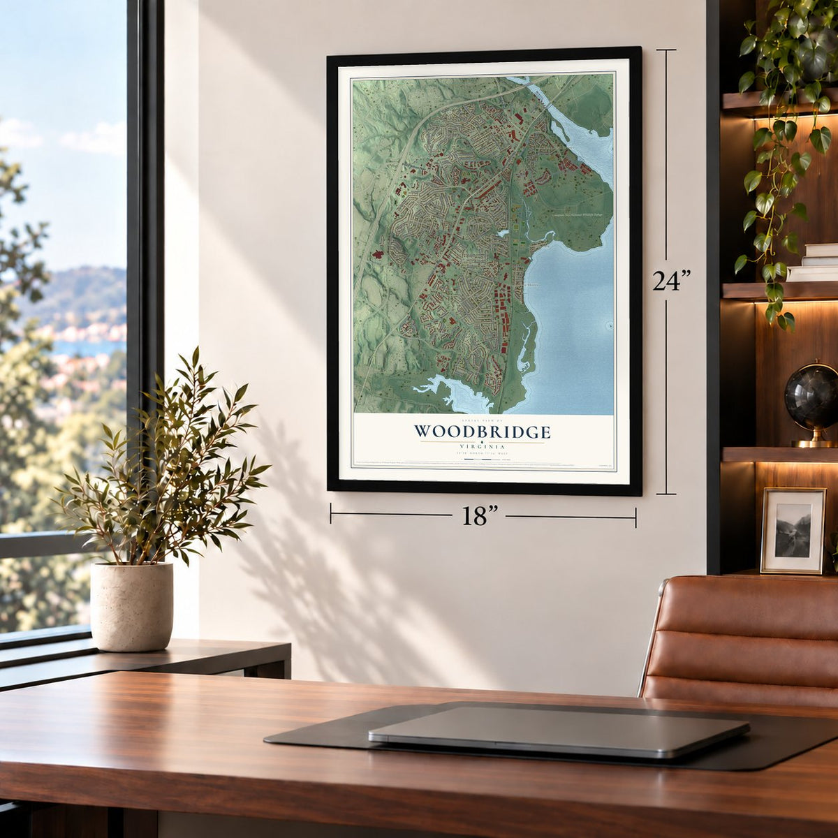
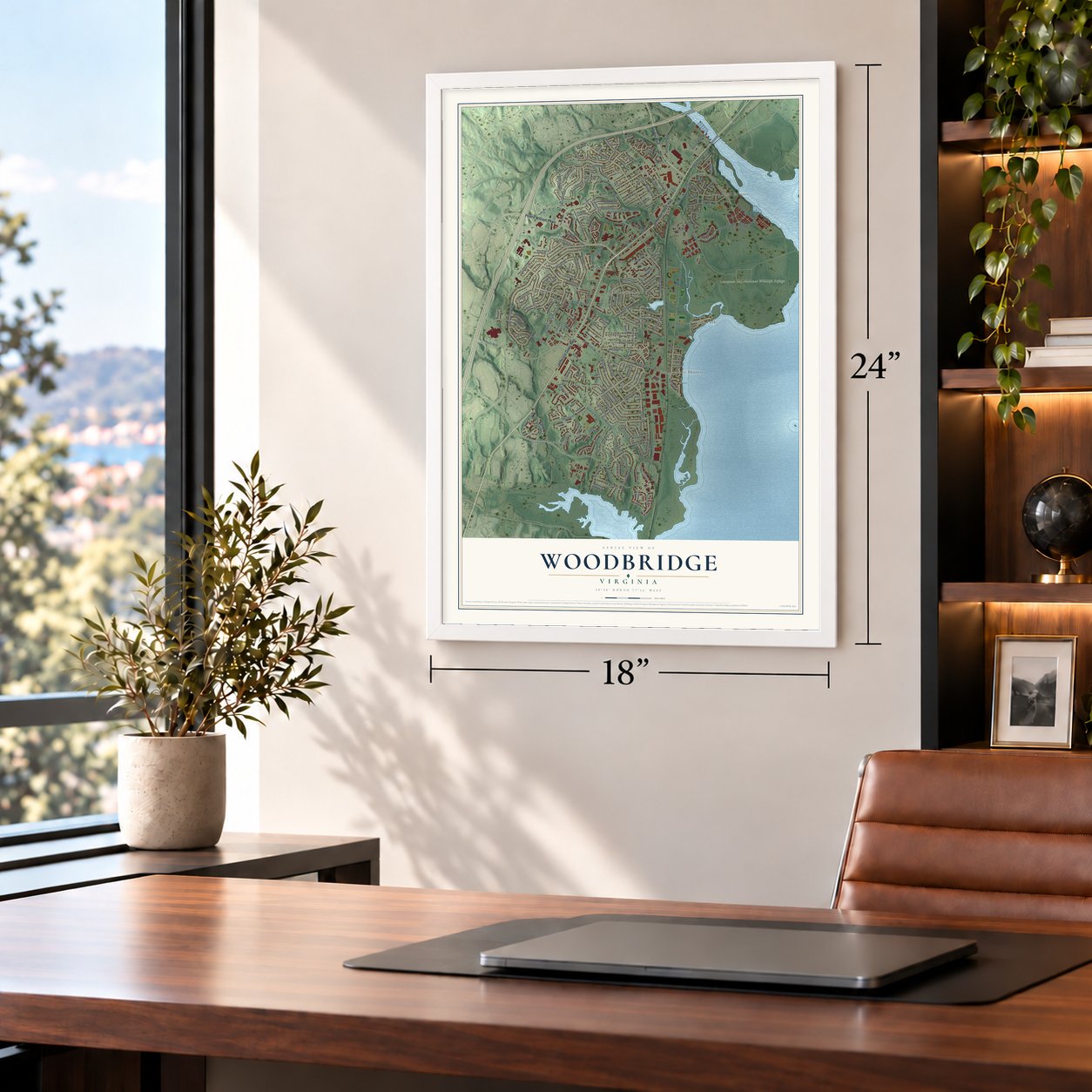
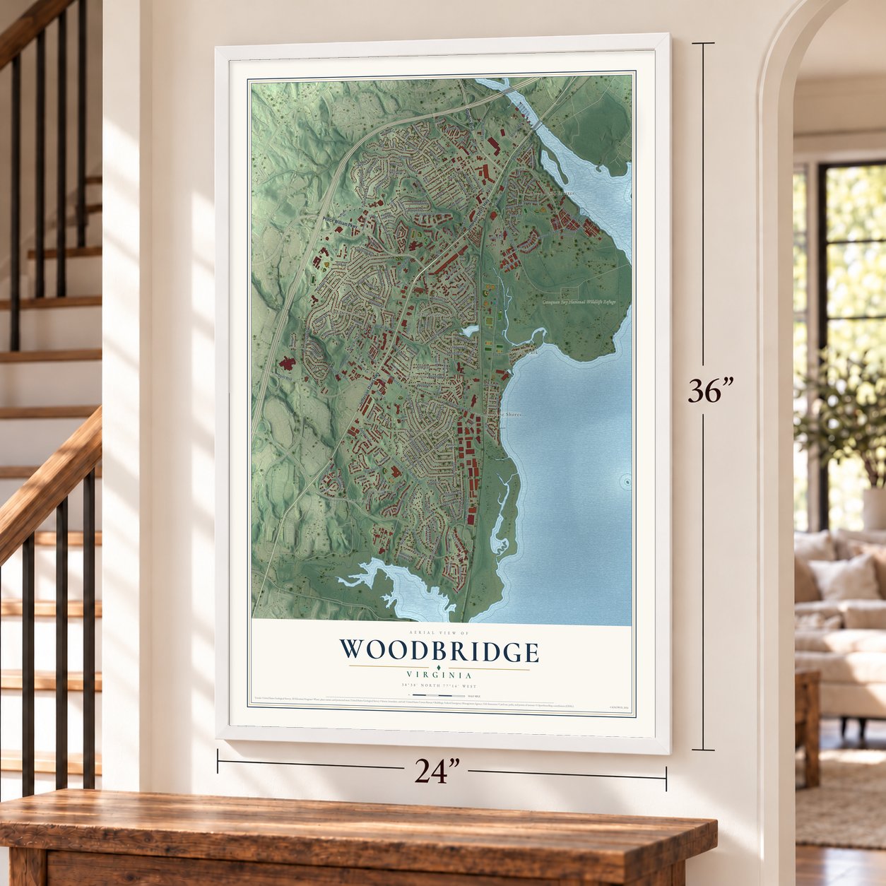
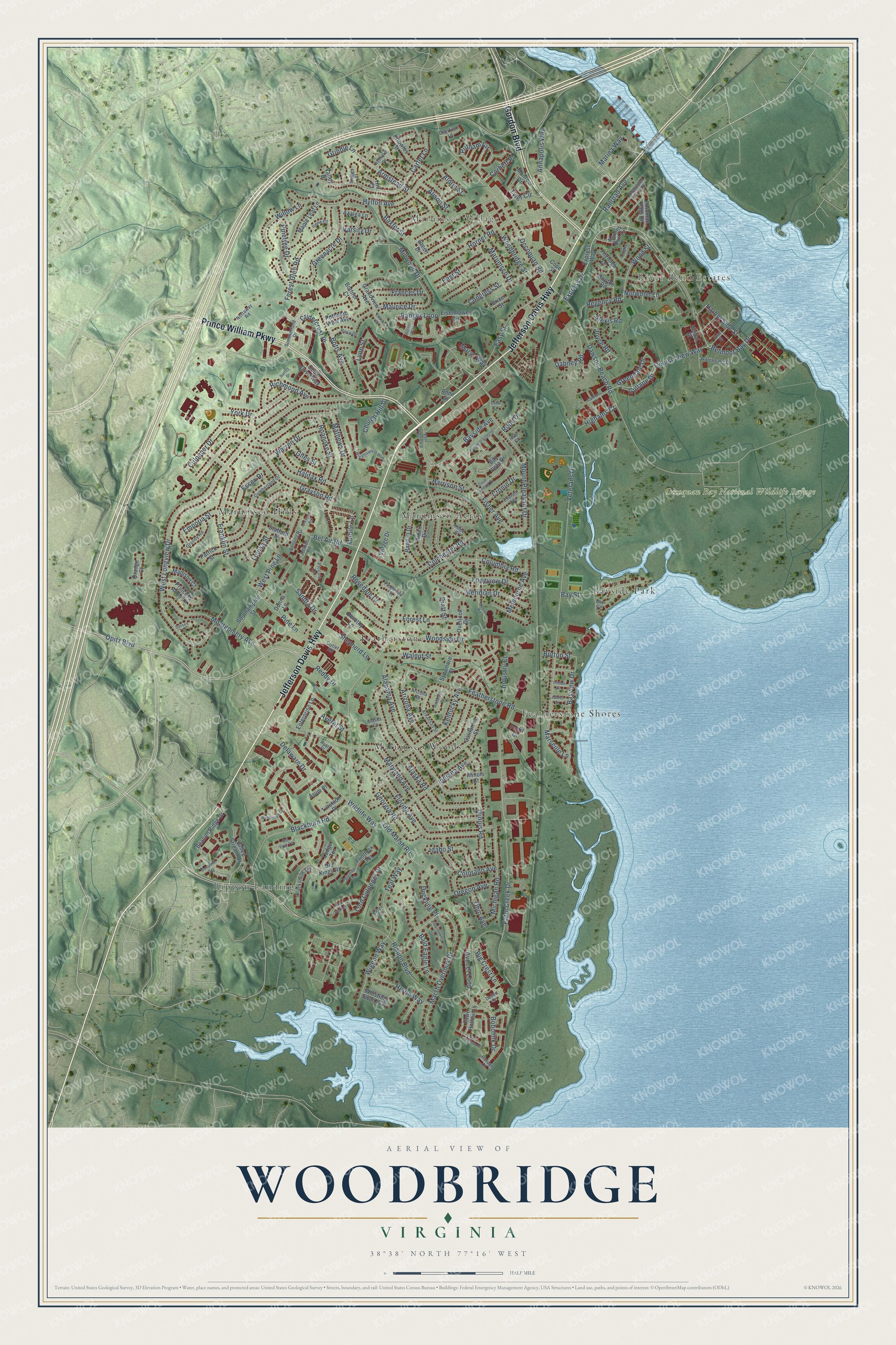
A new map of Woodbridge, Virginia, made in 2026 and printed to order on thick archival matte paper.
12" x 18" Archival Matte Print
A Map of Home. A Work of Art.
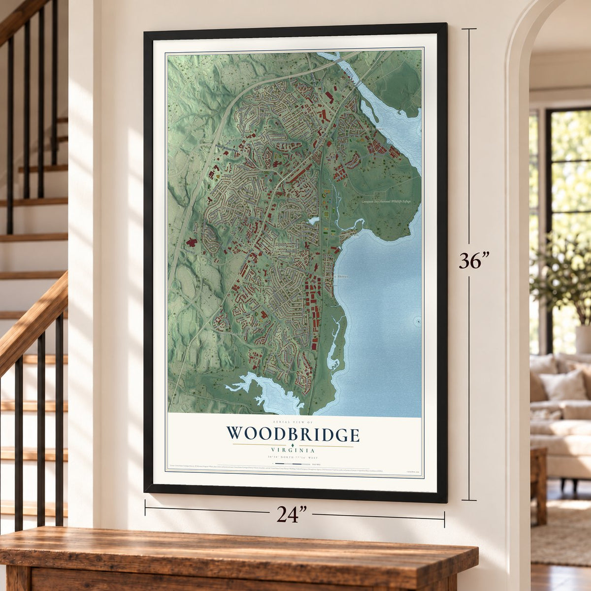
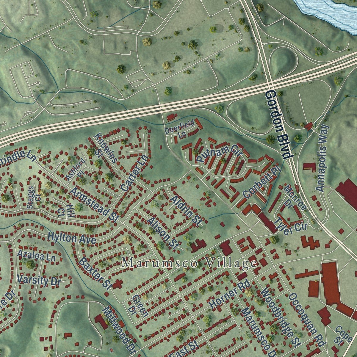
Explore Woodbridge, Virginia from a whole new perspective. Created using aerial imagery and detailed geographic data, this map captures Woodbridge building by building, with labeled streets, familiar landmarks, and shaded topographical relief that highlights the natural contours of the landscape.
Combining modern data with the timeless character of a vintage atlas, this map is just as interesting up close as it is beautiful on the wall. Whether you grew up in Woodbridge, spent memorable years there, or call it home today, this unique map is a great way to celebrate a place that means something to you. Zoom in on the preview to look for your street, and then order a print to put your memories on the wall.
Three ways to hang it
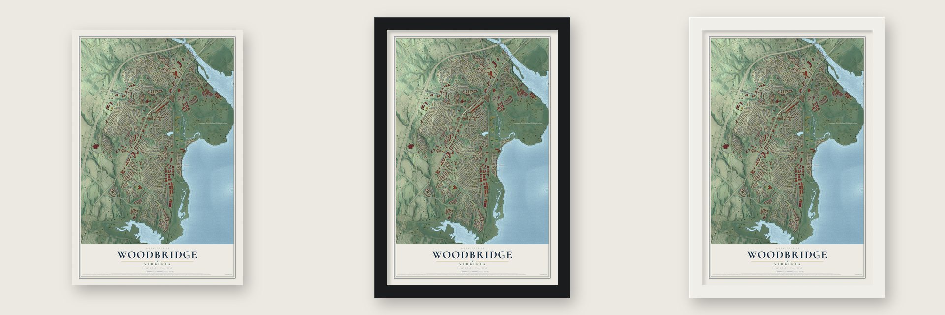
Unframed archival matte, a black wood frame or a white wood frame.
Up close
Geography Worth Displaying
This map was created using accurate cartographic data and authoritative geographic sources, including the U.S. Geological Survey and the Census Bureau. The map brings together terrain, waterways, roads, and building detail. The majority of the streets are labeled, houses are accurately depicted, and the topography is derived from government sources. Combining local data with carefully composed color and shading leads to this beautifully detailed Woodbridge artwork for your wall.
Rather than simply showing street outlines, we’ve included as many of the street names as we could reasonably fit on the map while keeping their names legible. Zoom in on the high resolution preview to see exactly what’s on the map. We truly set out to create a statement piece for anyone who loves Woodbridge. So whether it’s for you, or a gift for someone you love, we hope this map of Woodbridge brings back fond memories.
Read the story behind this map of Woodbridge, Virginia from 2026.

About Woodbridge, Virginia
Woodbridge is a community of 44,668 people in Prince William County, set between the Occoquan and Potomac rivers about 20 miles south of Washington, D.C. Around 1692 the George Mason family bought 534 acres here from Henry Corbin, and that tract is the ground Woodbridge covers today. When Prince William County was formed out of Stafford County in 1731, its first courthouse went up here, halfway between Dumfries and Alexandria, the county's two largest towns.
Once Fairfax County was created, Woodbridge no longer sat at the center of the county, so the courthouse moved west, first to Brentsville and finally to Manassas. The land stayed in plantations and farms for many years after that. After World War II those farms were divided into suburban subdivisions, and the biggest building boom came in the mid-1980s.
- Named for a toll bridgeThomas Mason, a son of George Mason, built a wooden toll bridge across the Occoquan River in the 18th century as part of the King's Highway, the colonial road between the northern and southern settlements. A heavy storm washed it away in 1807, and trade shifted upriver to Occoquan, the next crossing. No bridge stood here again until an iron truss bridge in the 20th century. Hurricane Agnes wrecked that one in 1972, and the present bridge replaced it.
- Two plantations on Marumsco CreekThomas Mason's Woodbridge Plantation lay north of Marumsco Creek and later became known as Deep Hole Plantation. South of the creek stood Belle Aire, owned first by the Linton family and then by the Graysons. In the Civil War, doctors used Belle Aire as a field hospital for the wounded. Most of the Grayson farm later became subdivisions named for the creek.
- From radio station to refugeOn the old Deep Hole Plantation grounds, the Army ran the East Coast Radio Transmitting Station from 1950 to 1994. The U.S. Fish and Wildlife Service took over the land from the Army in 1995 and made it the Occoquan Bay National Wildlife Refuge, home to bald eagles and ospreys.
- Olympic gold in 1984Benita Fitzgerald-Brown of Woodbridge won the gold medal in the 100-meter hurdles at the 1984 Summer Olympics.
Find your street
Names on the Woodbridge map
Every name below is printed on this map. Look for your street, your school, the park where you played, or the pond down the road.
Places and landmarks10
- River Bend Estates
- Marumsco Village
- Occoquan Bay National Wildlife Refuge
- Bayside Park
- Featherstone
- Featherstone Shores
- Marumsco Acres
- Marumsco Hills
- Marumsco Woods
- Rippon Landing
Streets and roads228
- Jefferson Davis Highway
- Prince William Parkway
- Gordon Boulevard
- Rippon Boulevard
- Belmont Bay Drive
- Express Drive
- Marys Way
- Annapolis Way
- Armstead Street
- Dawson Beach Road
- Lynn Street
- Grindle Lane
- Featherstone Road
- Mount Pleasant Drive
- Course View Way
- Marina Way
- Norwood Lane
- Avocet Loop
- West Longview Drive
- Horner Road
- Blackburn Road
- Farm Creek Drive
- York Drive
- Maryland Avenue
- Opitz Boulevard
- Longview Drive
- Occoquan Road
- Mathews Drive
- Florida Avenue
- Hylton Avenue
Show all 228 streets
- Marsh Overlook Drive
- Alaska Road
- Alabama Avenue
- Grayson Road
- Carter Lane
- Colchester Road
- Old Marsh Road
- Walnut Street
- Franklin Street
- Woodside Drive
- Veterans Drive
- Delaware Drive
- Kentucky Avenue
- Indiana Avenue
- Montgomery Avenue
- Fisher Avenue
- Maurice Drive
- Illinois Road
- Bald Eagle Lane
- Forest Glen Road
- Greenacre Drive
- Wildlife Way
- Meridian Drive
- Easy Street
- Woodbridge Street
- Michigan Road
- Millwood Drive
- Ranger Loop
- Botts Avenue
- Bel Air Road
- Harbor Side Street
- Teal Way
- Bobolink Drive
- Culpeper Drive
- Mobile Lane
- Georgia Road
- Essex Drive
- Big Crest Lane
- Bay Street
- Pine Lane
- Colorado Avenue
- Bayside Avenue
- Forest Lane
- Putnam Circle
- Arizona Avenue
- Lord Culpeper Court
- Wigeon Way
- Wood Street
- Heron Way
- Richmond Avenue
- Baxter Street
- Halifax Road
- Roanoke Street
- Willow Lane
- Alison Street
- Pratt Street
- Columbia Road
- Warren Drive
- Shepherd Lane
- Industry Court
- Regency Road
- Bayview Drive
- Joyce Road
- Greendale Drive
- Pinetree Drive
- Frances Drive
- Reddy Drive
- Idaho Street
- Melbourne Avenue
- Emporia Street
- Dabney Road
- East Street
- Cridercrest Place
- Duckling Place
- Oregon Avenue
- Marumsco Drive
- Railroad Avenue
- Sandra Drive
- Cronin Drive
- Harrison Street
- Marseille Lane
- Church Hill Drive
- Gullane Drive
- Tyler Circle
- Rosedale Court
- West Pine Lane
- Corbett Place
- Ohio Avenue
- Highams Court
- Congress Street
- Aldrin Street
- Louisa Street
- Giles Street
- Burton Street
- Averet Street
- Rope Drive
- Varsity Drive
- Alexis Road
- Herons Run Lane
- Express Way
- Anne Street
- Enterprise Lane
- California Street
- Randall Drive
- Eisenhower Circle
- Aiden Drive
- Old Kings Road
- Princess Anne Lane
- Beacon Ridge Drive
- Bay Vista Drive
- Vestal Street
- Maple Leaf Lane
- Knowles Street
- Fitzhugh Lane
- Dorothy Lane
- Overlook Drive
- Monroe Drive
- Potomac Path Drive
- Southampton Street
- Cedar Cove Way
- Village Drive
- Valley Stream Drive
- Madison Court
- Potomac View Avenue
- Fawn Hollow Lane
- Tilletson Place
- Flintlock Terrace
- Stafford Street
- Grandview Avenue
- Lodge Terrace
- Whistling Swan Way
- Patrick Street
- Arum Place
- Azalea Lane
- Sycamore Street
- Orange Court
- Bottner Court
- Donna Lane
- Cope Street
- Hopton Road
- Hill Court
- Brice Street
- Illinois Court
- Profit Court
- Valley Drive
- Green Drive
- Arkansas Street
- Cumberland Drive
- Piccolo Lane
- Outlet Road
- Summerland Drive
- Everett Avenue
- Colchester Ferry Place
- Blacksmith Terrace
- Grundy Road
- Hyatt Place
- Bay Circle
- Watermans Drive
- Hope Street
- Rosa Drive
- Ashford Place
- Bellona Road
- Nottaway Road
- Arizona Court
- Pinewood Court
- Jeffries Road
- Deerfield Lane
- Irene Court
- Staggs Court
- Refuge Court
- Alaska Court
- Ladue Court
- Egret Court
- Hale Court
- Wigglesworth Way
- Lamar Road
- Potomac Vista Drive
- Gunsmith Terrace
- Wentwood Lane
- Cove Landing Drive
- Hornet Way
- Old Post Terrace
- Ann Scarlet Court
- Barn Swallow Place
- East Longview Drive
- Fleet Street
- Eiderdown Court
- Cannons Court
- Stevens Road
- Arkansas Court
- Charles Court
- Postillion Terrace
- Linden Street
- Laurel Street
- Surrey Drive
- Yardley Lane
- Sussex Court
- Cobb Court
Names are listed as they appear on the printed map. Zoom into the product photos to find them.
The art of mapping a place
How This Map Was Made
Real places. Remarkable detail. Discover the layers that turn geographic data into a map of home.

The view from above
Aerial imagery reveals the character of the land: woodland, open fields, and the patterns of a place.

The shape of the land
Elevation data brings hills, valleys, and subtle changes in the landscape into view.

The details of home
Roads, waterways, and building footprints come together to make the map feel unmistakably local.

Geography becomes art
Considered color, shading, and typography bring the layers together in a map made for your wall.


Process illustrated with Mendon, Massachusetts. Aerial imagery: USDA NAIP. Terrain: USGS 3D Elevation Program. Map details and finished artwork: KNOWOL.
The Details
About This Print
Choose an archival matte print, or a black or white Ayous wood frame. The archival matte print is unframed.
Select your size and finish above to see the matching product image and price.
Materials & Craftsmanship
A contemporary map with the character of a classic atlas, printed on archival matte paper. Optional frames are made from Ayous wood.
Your printed map does not include the watermark shown in the full-map preview.
Shipping & Delivery
Free shipping within the United States. Every print is made to order in the USA.
Buying a gift? Add a note in your cart and we'll include it. We never put prices in the package.
Prints ship within 2 to 3 business days. Allow 7 to 10 days total from ordering for delivery. Timing may vary during holidays or periods of high order volume.
Read our shipping policy.
Returns and damaged prints
Each print is made to order. Change-of-mind refunds are not available after production.
If your print arrives damaged, misprinted or incorrect, contact support@knowol.com within 30 days of receiving it. Include your order number, photos and a description of the issue.
Read our full refund and replacement policy. For questions about your order, email support@knowol.com.
Find your town
Looking for another city?
Find a map of home in our Virginia collection, or any town in the country.
Nearby
Maps of towns near Woodbridge
Know someone from one of these towns? Their map makes a great gift.
 Leesylvania
, Virginia
From $39.99See the map
 Potomac Mills
, Virginia
From $39.99See the map
 Occoquan
, Virginia
From $39.99See the map
More maps nearby: Lake Ridge, Laurel Hill, Lorton, Mason Neck and Montclair.