
Search for another town





Free U.S. delivery 7 to 10 days after you order
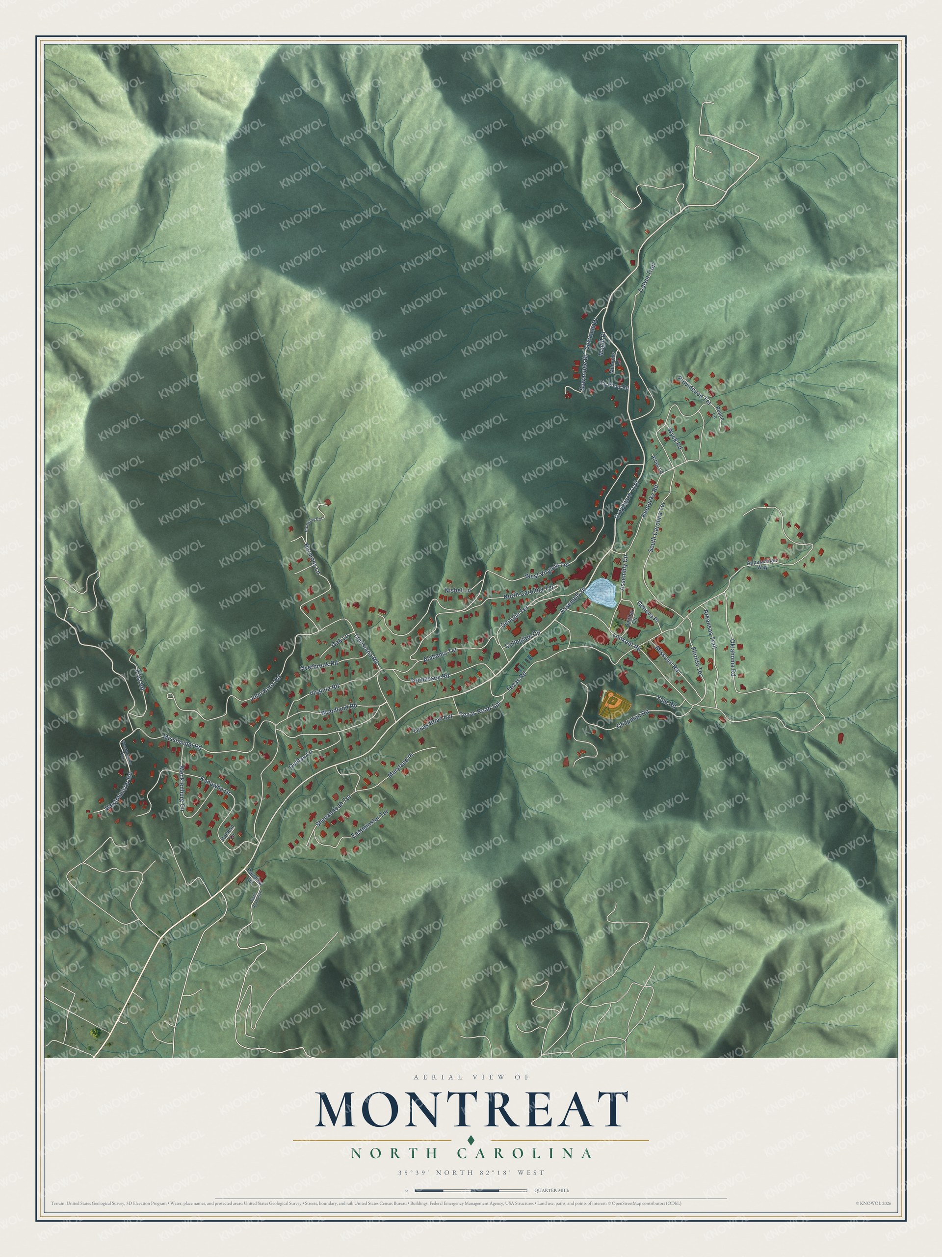
Montreat, North Carolina Map Art
Building by building, with labeled streets and shaded relief.
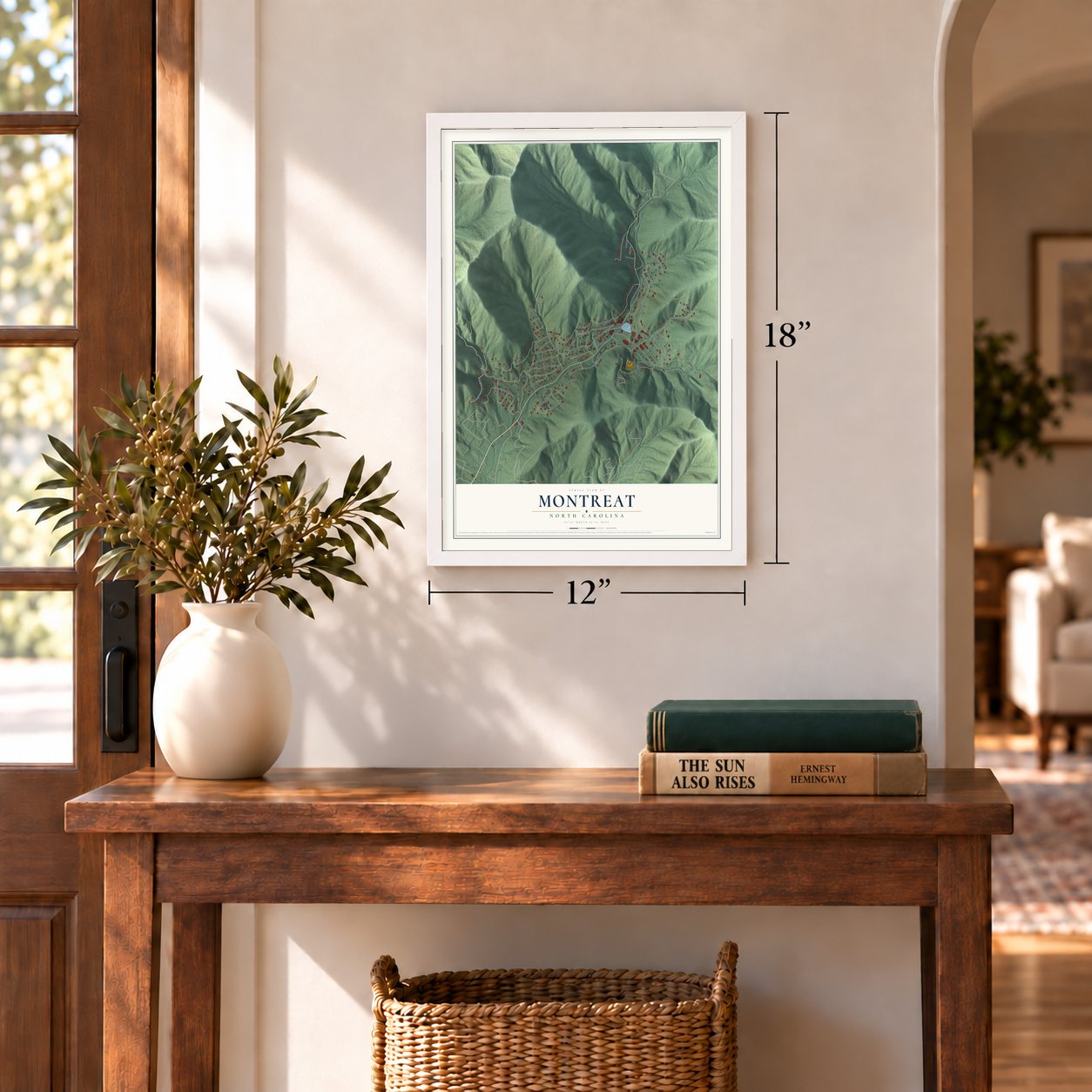
12" x 18" Archival Matte Print
A Map of Home. A Work of Art.
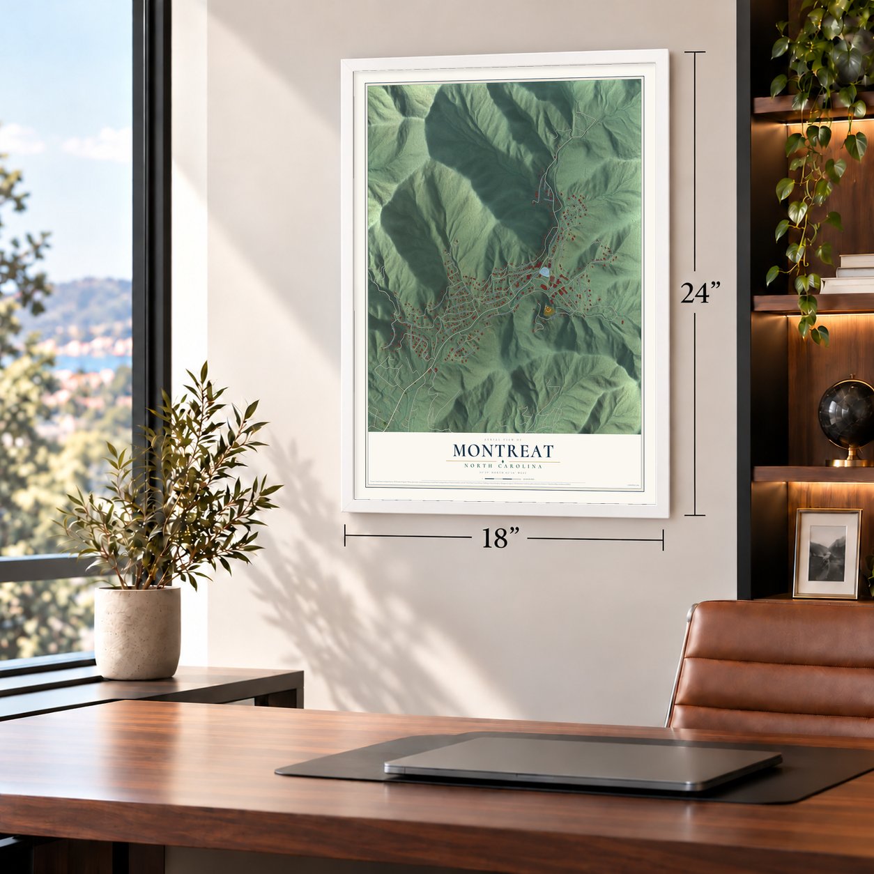
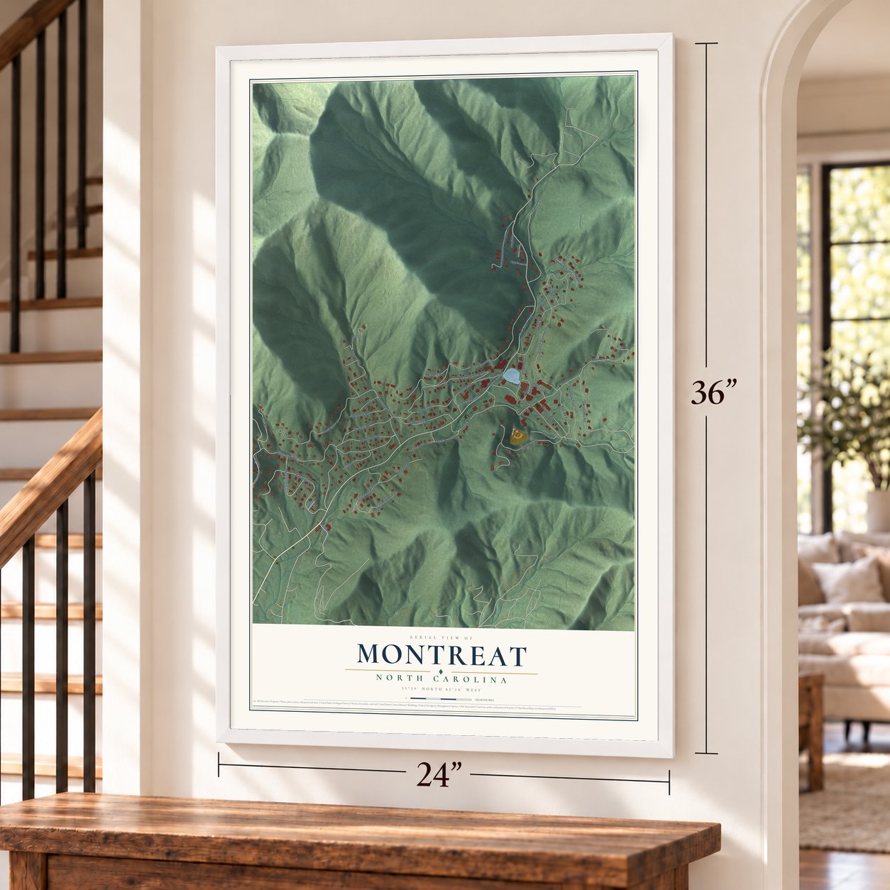
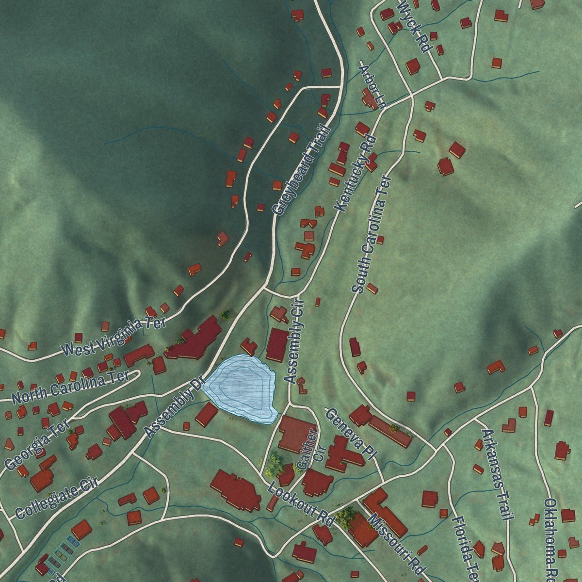
Explore Montreat, North Carolina from a whole new perspective. Created using aerial imagery and detailed geographic data, this map captures Montreat building by building, with labeled streets, familiar landmarks, and shaded topographical relief that highlights the natural contours of the landscape.
Combining modern data with the timeless character of a vintage atlas, this map is just as interesting up close as it is beautiful on the wall. Whether you grew up in Montreat, spent memorable years there, or call it home today, this unique map is a great way to celebrate a place that means something to you. Zoom in on the preview to look for your street, and then order a print to put your memories on the wall.
Three ways to hang it
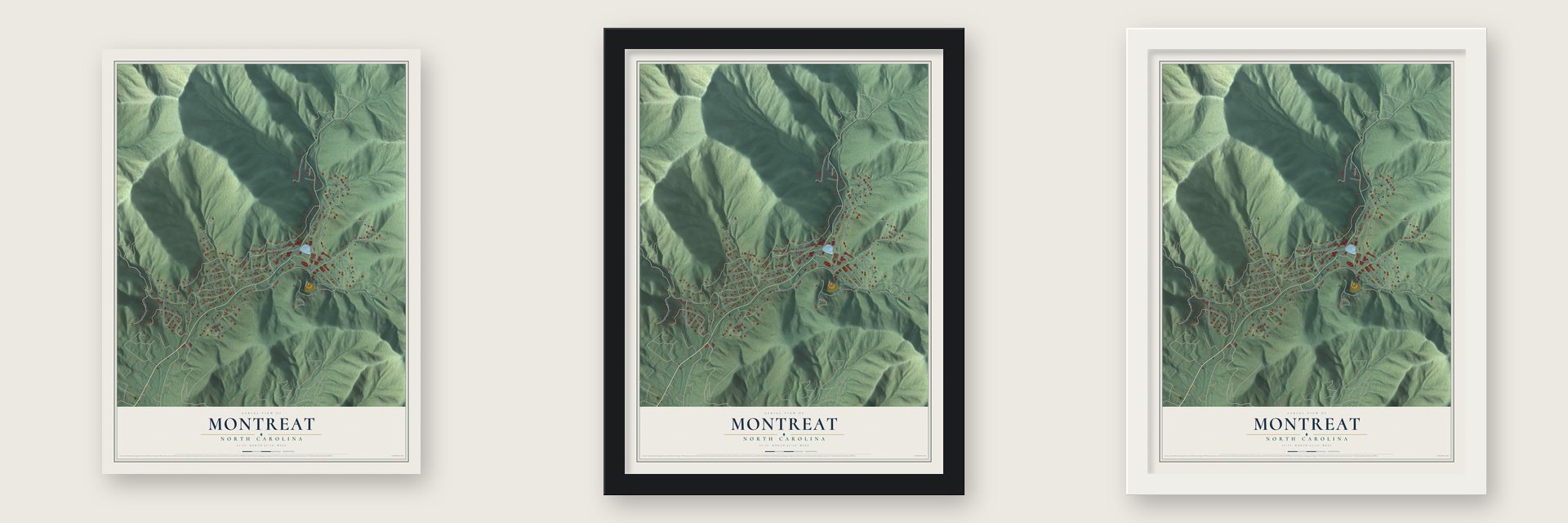
Unframed archival matte, a black wood frame or a white wood frame.
Up close
Geography Worth Displaying
This map was created using accurate cartographic data and authoritative geographic sources, including the U.S. Geological Survey and the Census Bureau. The map brings together terrain, waterways, roads, and building detail. The majority of the streets are labeled, houses are accurately depicted, and the topography is derived from government sources. Combining local data with carefully composed color and shading leads to this beautifully detailed Montreat artwork for your wall.
Rather than simply showing street outlines, we’ve included as many of the street names as we could reasonably fit on the map while keeping their names legible. Zoom in on the high resolution preview to see exactly what’s on the map. We truly set out to create a statement piece for anyone who loves Montreat. So whether it’s for you, or a gift for someone you love, we hope this map of Montreat brings back fond memories.
Read the story behind this map of Montreat, North Carolina from 2026.
Find your street
Names on the Montreat map
Every name below is printed on this map. Look for your street, your school, the park where you played, or the pond down the road.
Streets and roads56
- Assembly Drive
- Greybeard Trail
- Louisiana Road
- Virginia Road
- Mississippi Road
- Lookout Road
- West Virginia Terrace
- John Knox Road
- North Carolina Terrace
- Kentucky Road
- Kanawha Drive
- South Carolina Terrace
- Oklahoma Road
- Texas Road
- Calvin Trail
- Chapman Road
- Georgia Terrace
- Shenandoah Terrace
- Mecklenburg Circle
- Harmony Lane
- Tennessee Road
- Arkansas Trail
- Westminister Road
- Eastminster Terrace
- Florida Terrace
- Woodland Road
- Assembly Circle
- Maryland Place
- Alabama Terrace
- Frist Road
Show all 56 streets
- Missouri Road
- Overbrook Road
- Texas Road Extension
- Quillan Lane
- Suwannee Drive
- Yale Road
- Texas Road Spr
- Suwanee Drive
- Wyck Road
- Providence Terrace
- Oak Lane
- Collegiate Circle
- Nisbet Lane
- Geneva Place
- Magill Drive
- Appalachian Way
- Gaither Circle
- Rainbow Terrace
- Big Piney Road
- Peace Lane
- Memphis Lane
- Arbor Lane
- Holston Lane
- Westminster Terrace
- Harmony Extension
- State Road 2520
Names are listed as they appear on the printed map. Zoom into the product photos to find them.
About Montreat, North Carolina
The Rev. John C. Collins first envisioned Montreat in 1897 as a place set apart for people seeking a closer relationship with their Creator. That purpose endured for more than 120 years.
Montreat grew from the Mountain Retreat Association, formed in 1897 by Connecticut minister John Collins. Candy maker John S. Huyler paid to create the retreat. The town's name joins the words mountain and retreat. Evangelist Billy Graham and his wife, Ruth Bell, later made their home here.
- The conference townIn 1907 the Presbyterian Church in the US took over the Mountain Retreat Association. For many years since, Montreat has hosted religious gatherings, mostly Presbyterian. Montreat College was founded here in 1916.
Keep exploring North Carolina
Montreat is one of 951 North Carolina towns we've mapped. Every dot on the map is a print of its own.
The search covers every state, North Carolina first.
Near Montreat
Order 2 or more town maps and save 10%. Shown in the size and finish you picked above, so they hang as a set.
- Black Mountain 12" x 18" / Archival Matte Print $39.99
- Swannanoa 12" x 18" / Archival Matte Print $39.99
- Old Fort 12" x 18" / Archival Matte Print $39.99


More maps nearby: Pleasant Gardens, Gerton, Barnardsville, Chimney Rock Village and Weaverville.
The art of mapping a place
How This Map Was Made
Real places. Remarkable detail. Discover the layers that turn geographic data into a map of home.

The view from above
Aerial imagery reveals the character of the land: woodland, open fields, and the patterns of a place.

The shape of the land
Elevation data brings hills, valleys, and subtle changes in the landscape into view.

The details of home
Roads, waterways, and building footprints come together to make the map feel unmistakably local.

Geography becomes art
Considered color, shading, and typography bring the layers together in a map made for your wall.


Process illustrated with Mendon, Massachusetts. Aerial imagery: USDA NAIP. Terrain: USGS 3D Elevation Program. Map details and finished artwork: KNOWOL.
The Details
About This Print
Choose an archival matte print, or a black or white Ayous wood frame. The archival matte print is unframed.
Select your size and finish above to see the matching product image and price.
Materials & Craftsmanship
A contemporary map with the character of a classic atlas, printed on archival matte paper. Optional frames are made from Ayous wood.
Your printed map does not include the watermark shown in the full-map preview.
Shipping & Delivery
Free shipping within the United States. Every print is made to order in the USA.
Buying a gift? Add a note in your cart and we'll include it. We never put prices in the package.
Prints ship within 2 to 3 business days. Allow 7 to 10 days total from ordering for delivery. Timing may vary during holidays or periods of high order volume.
Read our shipping policy.
Returns and damaged prints
Each print is made to order. Change-of-mind refunds are not available after production.
If your print arrives damaged, misprinted or incorrect, contact support@knowol.com within 30 days of receiving it. Include your order number, photos and a description of the issue.
Read our full refund and replacement policy. For questions about your order, email support@knowol.com.