
Search for another town





Free U.S. delivery 7 to 10 days after you order
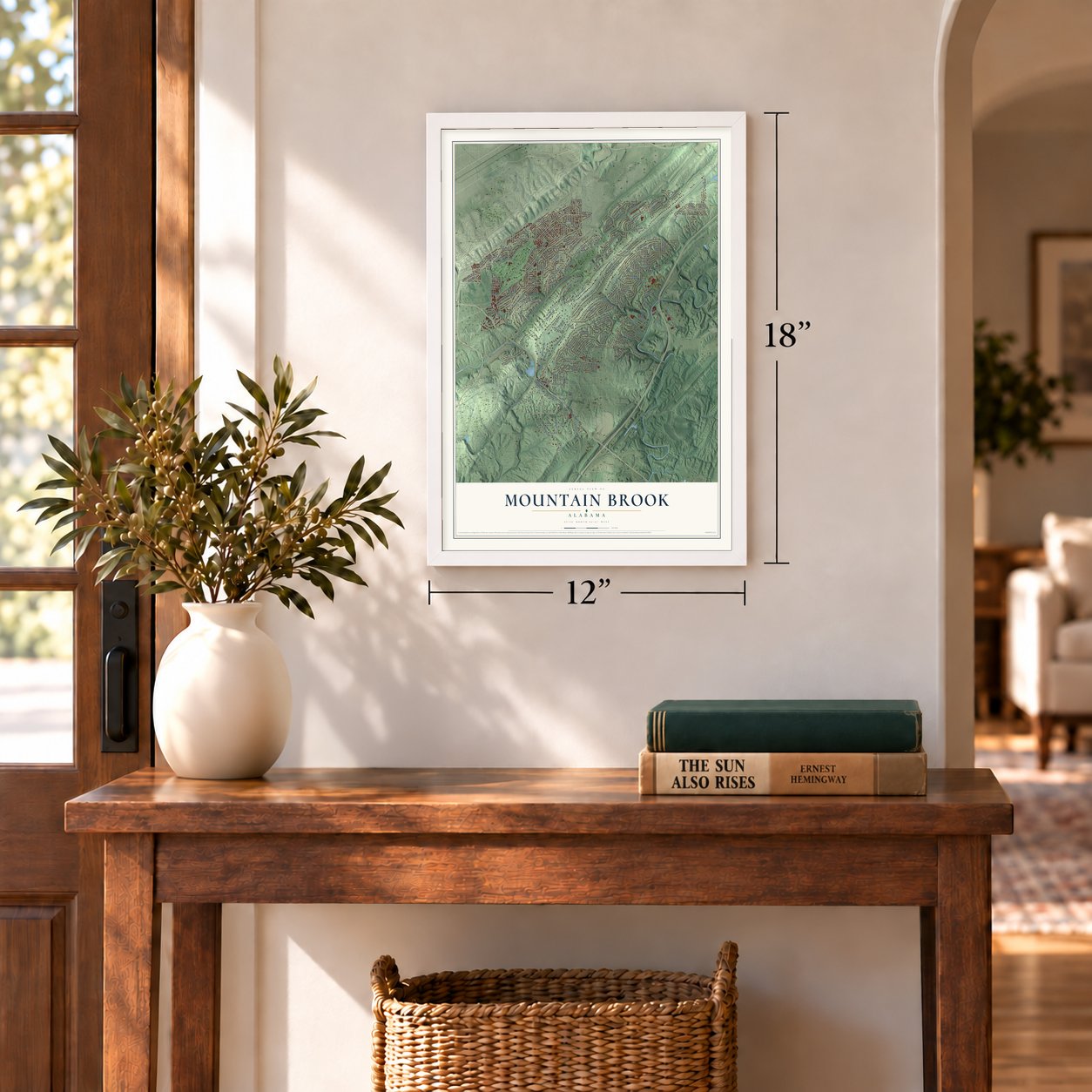
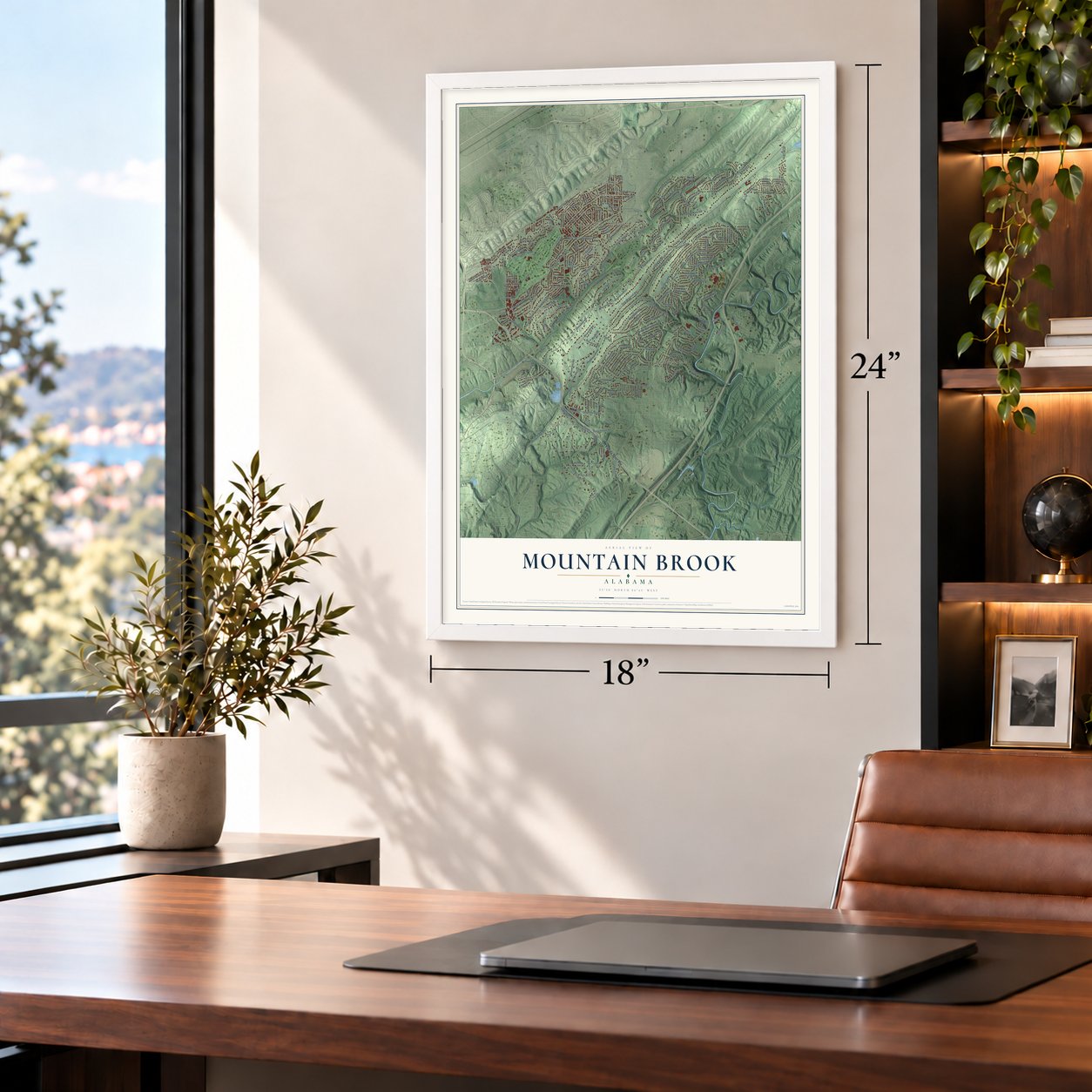
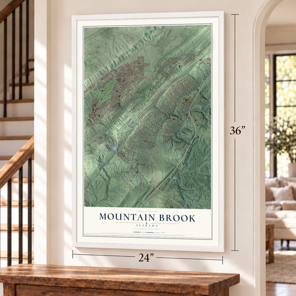
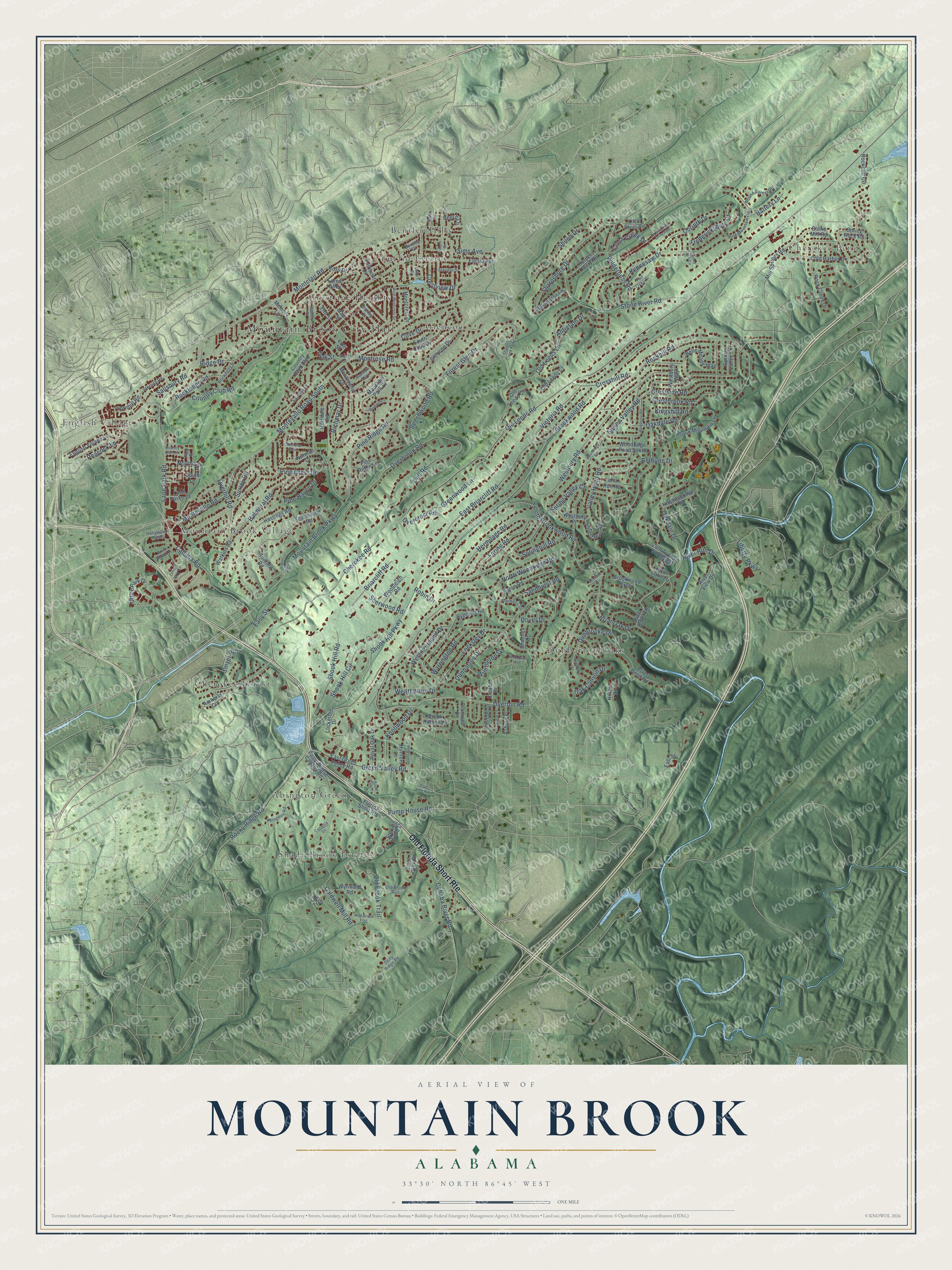
Mountain Brook, Alabama Map Art
Building by building, with labeled streets and shaded relief.
12" x 18" Archival Matte Print
A Map of Home. A Work of Art.
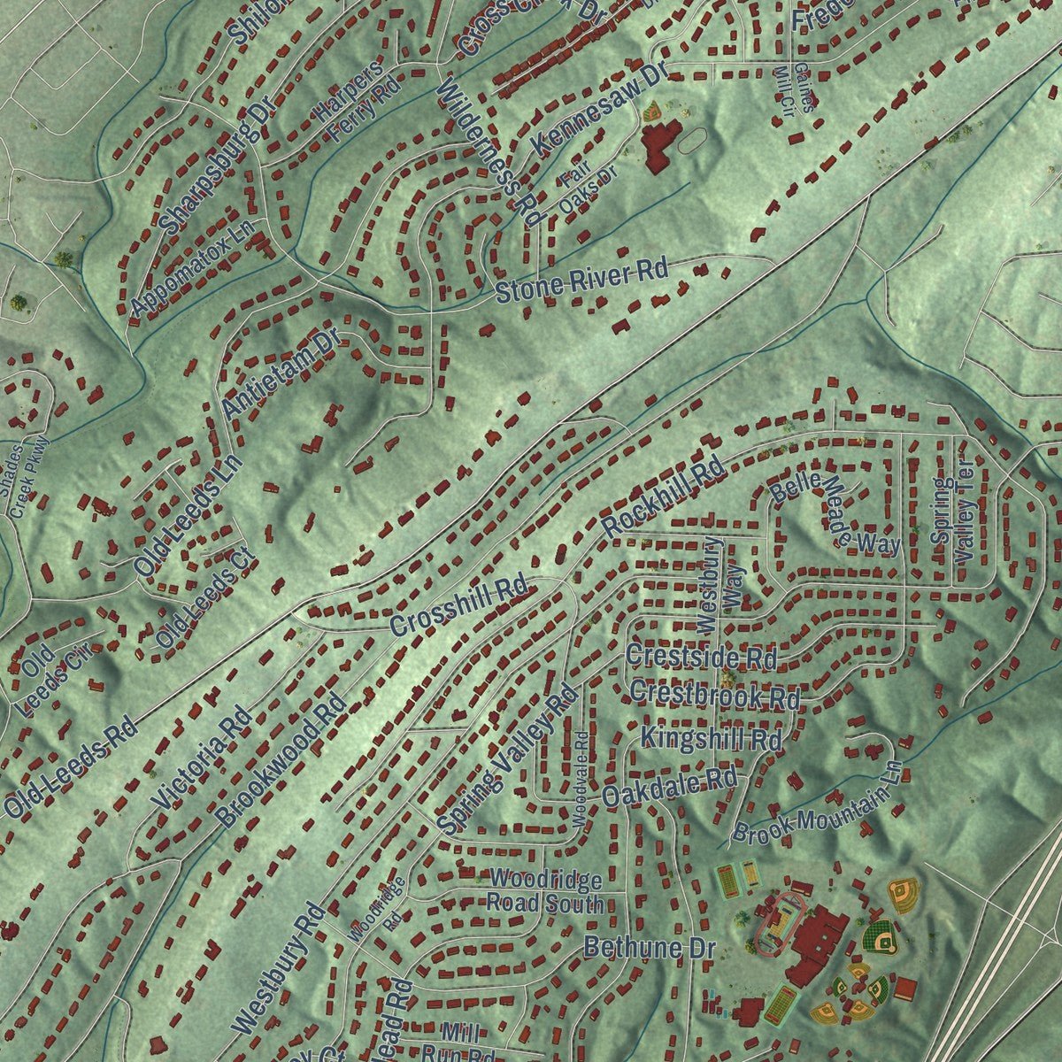
Explore Mountain Brook, Alabama from a whole new perspective. Created using aerial imagery and detailed geographic data, this map captures Mountain Brook building by building, with labeled streets, familiar landmarks, and shaded topographical relief that highlights the natural contours of the landscape.
Combining modern data with the timeless character of a vintage atlas, this map is just as interesting up close as it is beautiful on the wall. Whether you grew up in Mountain Brook, spent memorable years there, or call it home today, this unique map is a great way to celebrate a place that means something to you. Zoom in on the preview to look for your street, and then order a print to put your memories on the wall.
Three ways to hang it
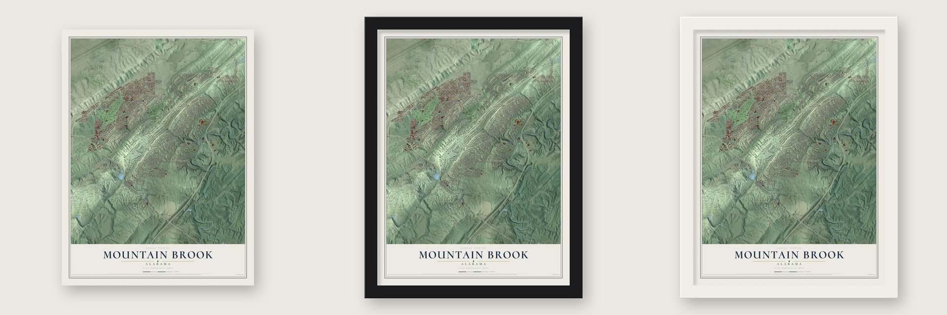
Unframed archival matte, a black wood frame or a white wood frame.
Up close
Geography Worth Displaying
This map was created using accurate cartographic data and authoritative geographic sources, including the U.S. Geological Survey and the Census Bureau. The map brings together terrain, waterways, roads, and building detail. The majority of the streets are labeled, houses are accurately depicted, and the topography is derived from government sources. Combining local data with carefully composed color and shading leads to this beautifully detailed Mountain Brook artwork for your wall.
Rather than simply showing street outlines, we’ve included as many of the street names as we could reasonably fit on the map while keeping their names legible. Zoom in on the high resolution preview to see exactly what’s on the map. We truly set out to create a statement piece for anyone who loves Mountain Brook. So whether it’s for you, or a gift for someone you love, we hope this map of Mountain Brook brings back fond memories.
Read the story behind this map of Mountain Brook, Alabama from 2026.

Find your street
Names on the Mountain Brook map
Every name below is printed on this map. Look for your street, your school, the park where you played, or the pond down the road.
Places and landmarks12
- Mountain Brook City Hall
- Cherokee Bend
- Abington Green
- Bentley Hills
- Cherokee Forest
- Crestline Heights
- Dunbarton Oaks
- English Village
- Euclid Estates
- Glencoe
- Mountain Brook Village
- Shady Brook Estates
Streets and roads210
- Old Florida Short Route
- Cahaba Road
- Country Club Road
- Salisbury Road
- Montevallo Road South
- Mountain Brook Parkway
- Montclair Road
- Overton Road
- Oak Street
- Old Leeds Road
- Montevallo Road
- Cherokee Road
- Brookwood Road
- Overbrook Road
- North Woodridge Road
- Rockhill Road
- Spring Valley Road
- Westbury Road
- Kennesaw Drive
- Dunbarton Drive
- South Brookwood Road
- Caldwell Mill Road
- East Briarcliff Road
- Overhill Road
- Stone River Road
- Old Leeds Lane
- Spring Valley Court
- Old Brook Trail
- Springhill Road
- Pine Ridge Road
Show all 210 streets
- Kingshill Road
- Sharpsburg Drive
- Shook Hill Circle
- Oakdale Drive
- Warrington Road
- Dover Drive
- Crestbrook Road
- Locksley Drive
- Rocky Ridge Road
- Richmar Drive
- Green Valley Road
- Valley Head Road
- Hermitage Road
- Forest Glen Drive
- Bethune Drive
- Shook Hill Road
- Briar Oak Drive
- Crosshill Road
- Smyer Road
- Dell Road
- Shiloh Drive
- Westmoreland Drive
- Wilderness Road
- Pine Crest Drive
- Greenwood Lane
- Lane Park Road
- Liberty Parkway
- Ridge Drive
- Faring Road
- Corinth Drive
- Crestside Road
- Sherwood Road
- Victoria Road
- Sims Avenue
- Montrose Road
- Knollwood Drive
- Overcrest Road
- Beechwood Road
- Oakdale Road
- Balmoral Road
- Rockledge Road
- Briarcliff Road
- Antietam Drive
- Pine Haven Drive
- Wimbleton Drive
- Fredericksburg Drive
- Cahaba River Road
- Dunbrooke Drive
- Sandhurst Road
- River Run Drive
- Crestview Drive
- Cross Creek Drive
- Weatherton Drive
- Oak Canyon Drive
- Pump House Road
- Shook Hill Parkway
- Battery Lane
- Cove Drive
- Peacock Lane
- Surrey Road
- North Lane
- Easy Street
- Robin Drive
- Memory Lane
- Euclid Avenue
- Office Park Drive
- Pump House Cahaba Road
- Spring Rock Road
- River Bend Road
- Country Club Boulevard
- Mountain Park Drive
- Glencoe Drive
- Southwood Road
- Ryecroft Road
- Montevallo Lane
- Florida Short Route
- East Green Valley Road
- Mill Springs Road
- Brook Hollow Lane
- Rock Creek Drive
- Forest Run Road
- Norman Drive
- Belle Meade Way
- Cold Harbor Drive
- Briar Glen Drive
- Brook Mountain Lane
- Guilford Road
- Westbury Way
- Eaton Road
- Main Street
- Hastings Road
- Woodridge Road South
- Elm Street
- Watkins Road
- Lane Parke Court
- Harpers Ferry Road
- 26th Avenue Northwest
- English Village Lane
- Brookwood Trce
- South Cove Drive
- Mill Run Road
- Cromwell Drive
- Old Leeds Court
- Montcrest Drive
- Fairmont Drive
- Hunters Lane
- Royal Oak Drive
- Thornhill Road
- Appomatox Lane
- Arundel Drive
- Woodleigh Road
- Knightsbridge Road
- Stone Mill Road
- South Lane
- Spring Valley Terrace
- Westbury Place
- Asbury Place
- Vine Street
- Rockcliff Circle
- Wynward Road
- River Oaks Lane
- Little River Road
- Lockerbie Drive
- Shamley Drive
- Old Leeds Circle
- Forest Alley
- Beech Lane
- Sterling Wood Drive
- Pine Ridge Lane
- River Oaks Road
- River View Drive
- Amherst Circle
- Crosby Drive
- Old Trce
- Hillsdale Road
- Ross Drive
- Hillard Drive
- East Street
- Hollywood Boulevard
- Fairway Drive
- Abingdon Road
- Pine Mountain Road
- Sterling Road
- Spring Street
- Dolly Ridge Road
- Fair Oaks Drive
- Lake Drive
- Rockdell Lane
- Round Forest Drive
- Old Mill Lane
- Old Brook Run
- Marlboro Drive
- Club Place
- Bentley Drive
- Shades Creek Parkway
- Church Street
- Office Park Circle
- Woodridge Road
- Woodvale Road
- Mountain Alley
- West Montcrest Drive
- Beech Street
- Memory Court
- Wild Brook Trail
- Dunbrook Drive
- Halbrook Lane
- Cross Creek Drive East
- Seven Bark Circle
- Beech Circle
- Winthrop Avenue
- Royal Oak Court
- Brook Manor Drive
- Sheridan Drive
- Michael Lane
- Woodland Avenue
- Camellia Lane
- Briaroak Circle
- Country Club Circle
- Pipe Line Road
- Gaines Mill Circle
Names are listed as they appear on the printed map. Zoom into the product photos to find them.
About Mountain Brook, Alabama
Mountain Brook is a city of 22,461 people in Jefferson County, southeast of Birmingham. In the 1920s the real estate developer Robert Jemison Jr. began laying out Mountain Brook Estates on the Shades Valley side of Red Mountain. He planned it to keep the woods and natural setting intact for buyers he expected to be mostly wealthy Birmingham business families. Jemison sold shares that let buyers pick their own lots, kept the community white only, and banned hospitals, garages, veterinarians and most noisy or smelly businesses.
No streetcar line ran out to the new suburb, so residents drove, and people at the time took note of its paved roads and utilities, though sewers came years later. The Great Depression hit Birmingham hard, and some shareholders had to sell, leaving lots empty and homes boarded up. Mountain Brook came back as Birmingham recovered during World War II, and it was incorporated as a city on May 24, 1942.
“It is said that the dead center of Birmingham society is the southeast corner of the locker room at the Mountain Brook country club.”
- Three villages by Warren ManningBoston landscape architect Warren H. Manning drew the plans, with large estate lots along winding roads and shops grouped in three villages: Crestline Village, English Village and Mountain Brook Village. Builders kept most of the existing trees, and 92.03% of the city is still under tree cover. Overton, Brookwood Forest, Cherokee Bend, Crestline and other neighborhoods sit in the forest, tied together by bridle paths.
- A riding academy with 60 stallsOnce the houses were going up, Jemison turned to recreation centers, fine shops, schools and the Mountain Brook Club. Many buildings went up in the English Tudor style, while larger estates also used Italianate, French Norman farmhouse, Georgian and Federal Revival designs. The Mountain Brook Riding Academy, one of the best-known early amenities, kept a blacksmith shop and 60 stalls.
- The first office park, 1955The country's first office park opened in Mountain Brook in 1955. Its ideas were new at the time: plenty of free parking and low office buildings set among waterspouts and landscaped grounds.
- Alabama's first city managerMountain Brook was the first city in Alabama to run under a council and manager system. The city has a mayor, but a city manager oversees daily operations, and a new city hall with fire and police stations opened in 2013.
Keep exploring Alabama
Mountain Brook is one of 675 Alabama towns we've mapped. Every dot on the map is a print of its own.
The search covers every state, Alabama first.
Near Mountain Brook
Order 2 or more town maps and save 10%. Shown in the size and finish you picked above, so they hang as a set.
- Vestavia Hills 12" x 18" / Archival Matte Print $39.99
- Birmingham 12" x 18" / Archival Matte Print $39.99
- Brook Highland 12" x 18" / Archival Matte Print $39.99

More maps nearby: Homewood, Irondale, Rocky Ridge, Meadowbrook and Eagle Point.
The art of mapping a place
How This Map Was Made
Real places. Remarkable detail. Discover the layers that turn geographic data into a map of home.

The view from above
Aerial imagery reveals the character of the land: woodland, open fields, and the patterns of a place.

The shape of the land
Elevation data brings hills, valleys, and subtle changes in the landscape into view.

The details of home
Roads, waterways, and building footprints come together to make the map feel unmistakably local.

Geography becomes art
Considered color, shading, and typography bring the layers together in a map made for your wall.


Process illustrated with Mendon, Massachusetts. Aerial imagery: USDA NAIP. Terrain: USGS 3D Elevation Program. Map details and finished artwork: KNOWOL.
The Details
About This Print
Choose an archival matte print, or a black or white Ayous wood frame. The archival matte print is unframed.
Select your size and finish above to see the matching product image and price.
Materials & Craftsmanship
A contemporary map with the character of a classic atlas, printed on archival matte paper. Optional frames are made from Ayous wood.
Your printed map does not include the watermark shown in the full-map preview.
Shipping & Delivery
Free shipping within the United States. Every print is made to order in the USA.
Buying a gift? Add a note in your cart and we'll include it. We never put prices in the package.
Prints ship within 2 to 3 business days. Allow 7 to 10 days total from ordering for delivery. Timing may vary during holidays or periods of high order volume.
Read our shipping policy.
Returns and damaged prints
Each print is made to order. Change-of-mind refunds are not available after production.
If your print arrives damaged, misprinted or incorrect, contact support@knowol.com within 30 days of receiving it. Include your order number, photos and a description of the issue.
Read our full refund and replacement policy. For questions about your order, email support@knowol.com.