
Search for another town


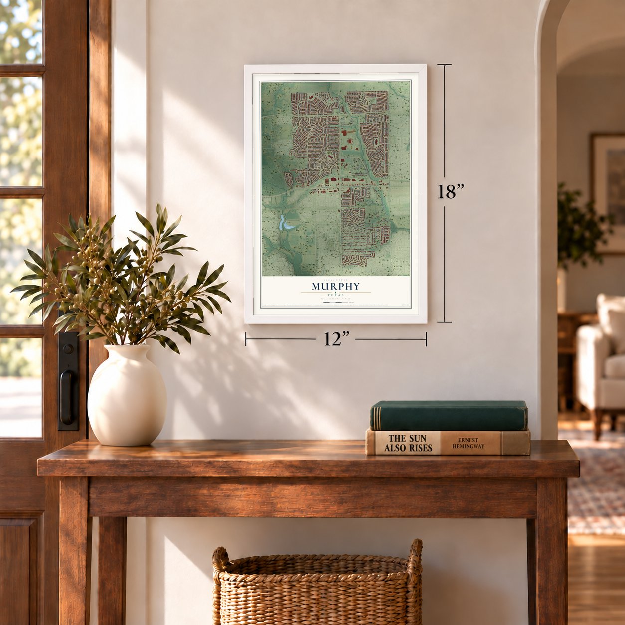

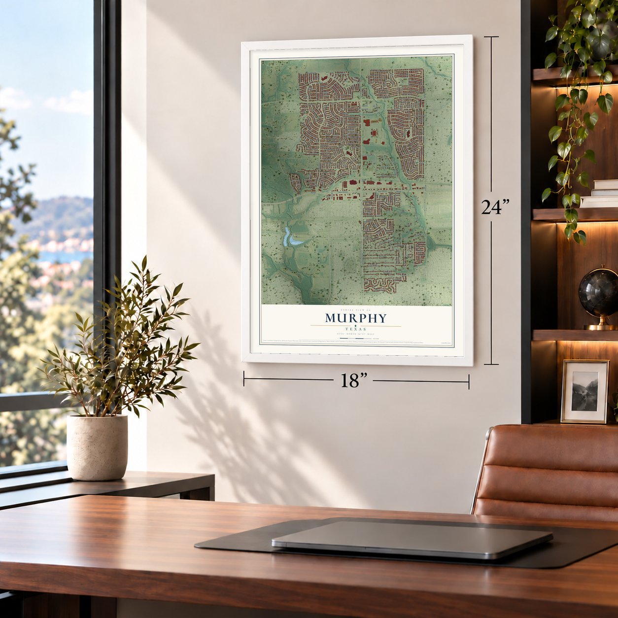

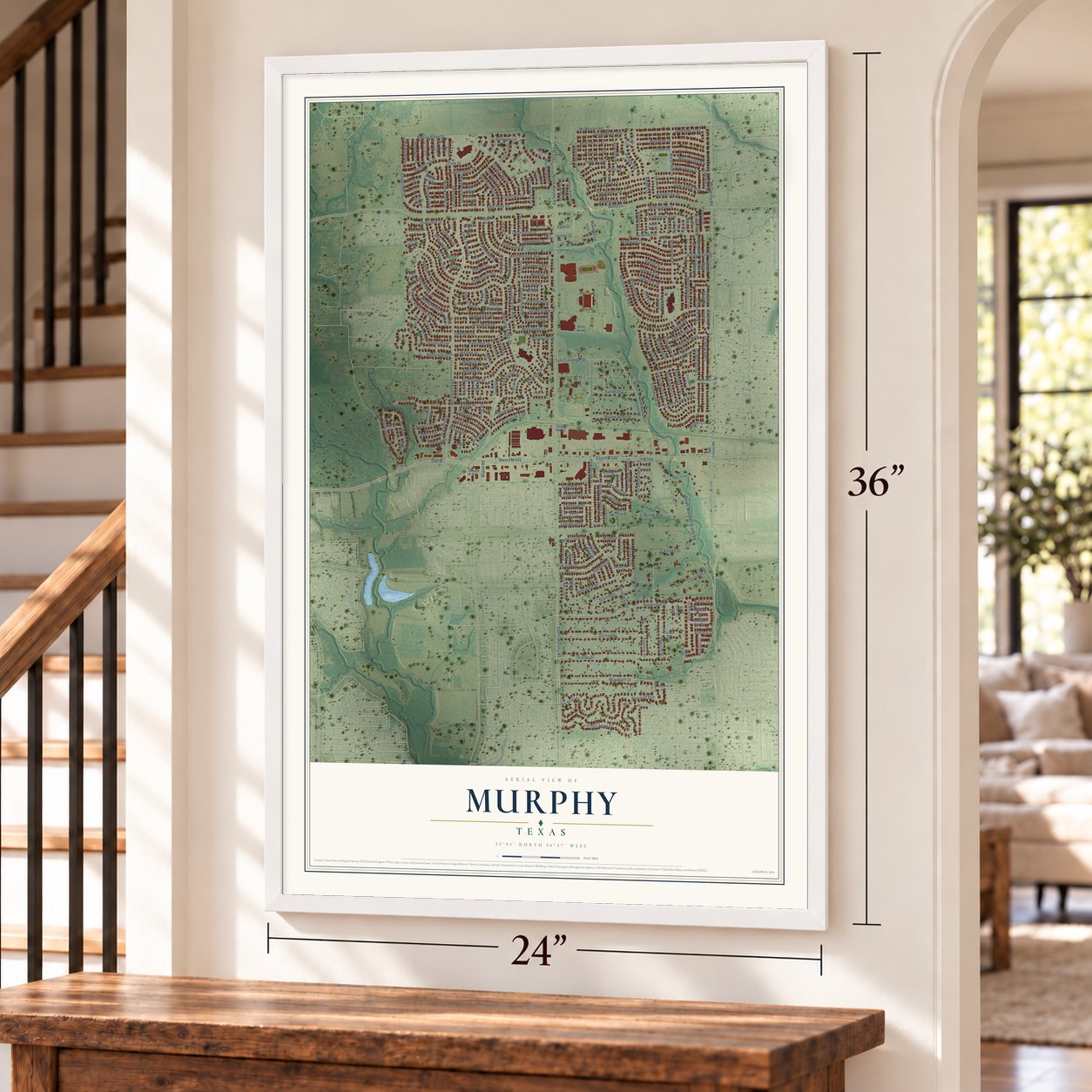

Free U.S. delivery 7 to 10 days after you order
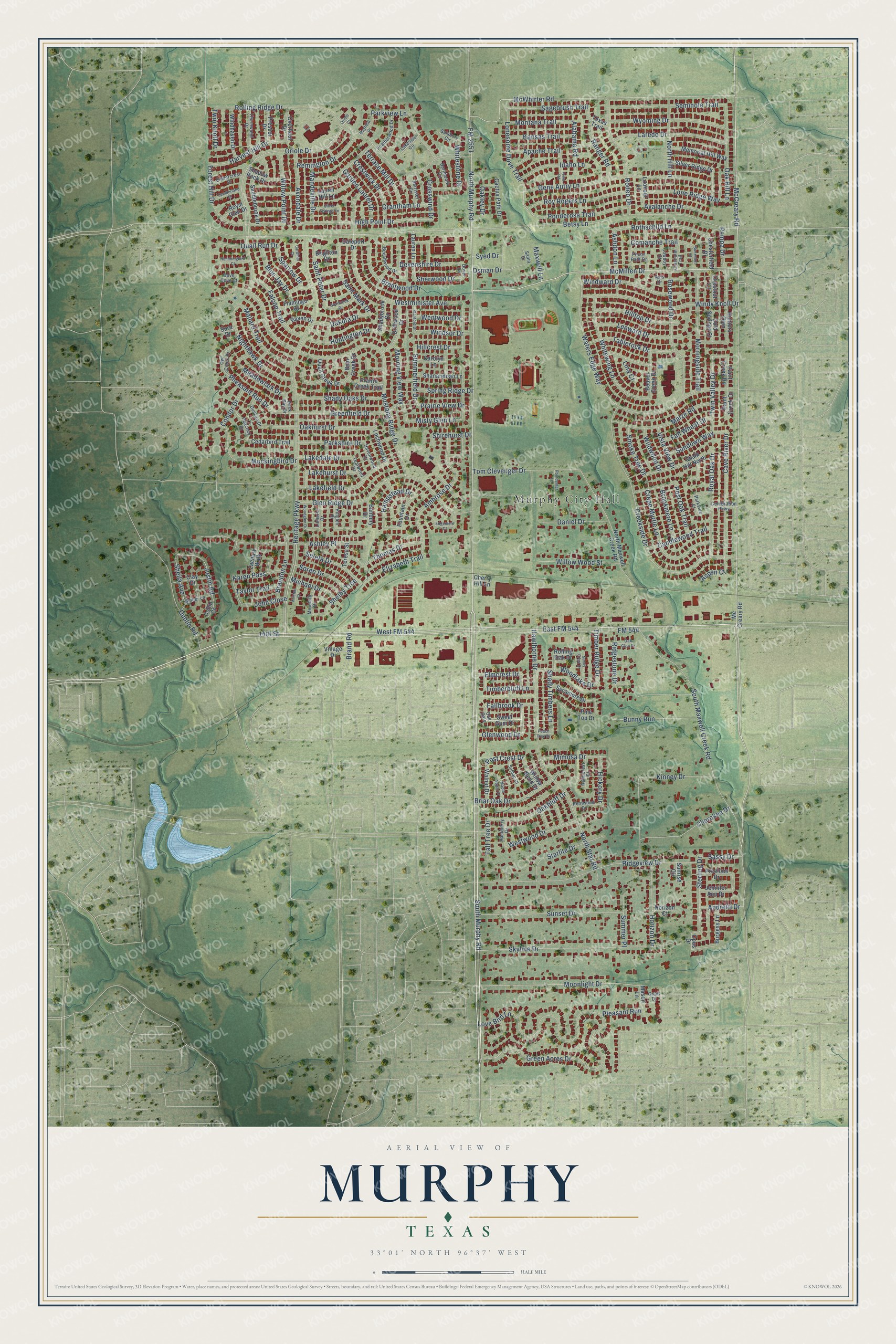
Murphy, Texas Map Art
A new map of Murphy, Texas, made in 2026 and printed to order on thick archival matte paper.
12" x 18" Archival Matte Print
A Map of Home. A Work of Art.
This beautifully detailed map of Murphy, Texas was created in 2026 using aerial imagery combined with modern topographical, census, street and landmark data. It's a modern aerial view of Murphy in Collin County, Texas, that combines modern data with a vintage aesthetic. Zoom in on the preview and look for your block.
Three ways to hang it
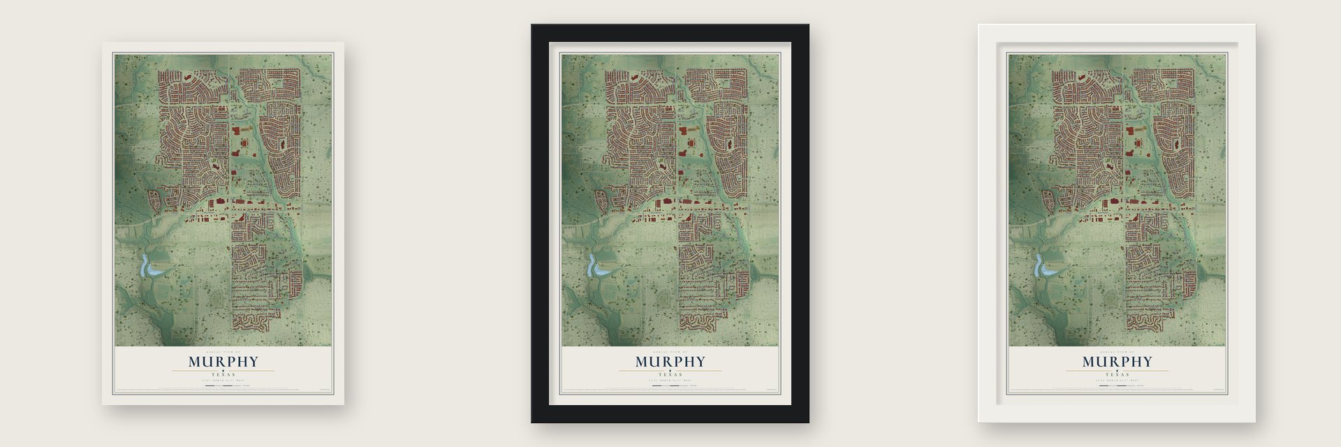
Unframed archival matte, a black wood frame or a white wood frame.
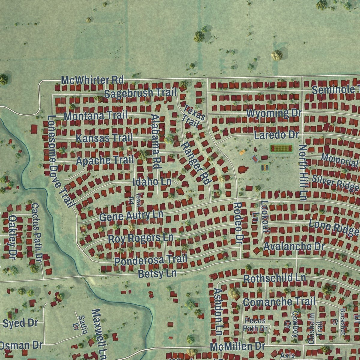
Up close
Real geography. Art worth displaying.
This map was created using accurate cartographic data and authoritative geographic sources, including the U.S. Geological Survey and the Census Bureau. The map brings together terrain, waterways, roads, and building detail. The majority of the streets are labeled, houses are accurately depicted, and the topography is derived from government sources. Combining local data with carefully composed color and shading leads to this beautifully detailed Murphy artwork for your wall.
Rather than simply showing street outlines, we’ve included as many of the street names as we could reasonably fit on the map while keeping their names legible. Zoom in on the high resolution preview to see exactly what’s on the map. We truly set out to create a statement piece for anyone who loves Murphy. So whether it’s for you, or a gift for someone you love, we hope this map of Murphy brings back fond memories.

About Murphy, Texas
Murphy is a city in Collin County, situated on Farm Road 544 between Plano and Wylie. Settlers arrived in 1846, and the community took its present name after the railway reached the area in 1888. Once an agricultural shipping point, Murphy grew from 3,099 residents in 2000 to 21,013 in the 2020 census.
- Earlier Town NamesThe original townsite was first known as Old Decator and later as Maxwell's Branch.
- Railway RenamingResidents chose the name Murphy in 1888 to honor William Murphy, who provided land for railroad tracks and a depot.
- Agricultural Shipping PointFrom the 1880s through the 1950s, Murphy served as a shipping point for nearby farmers and livestock raisers.
- Population RevivalAfter falling to 135 residents in 1961, Murphy reached 1,547 in 1990 and 3,099 in 2000.
- Ten City ParksMurphy maintains 10 parks covering 195.5 acres, including the 60-acre Murphy Central Park.
Find your street
Names on the Murphy map
Every name below is printed on this map. Look for your street, your school, the park where you played, or the pond down the road.
Places and landmarks1
- Murphy City Hall
Streets and roads280
- FM 2551
- South Murphy Road
- FM 544
- McCreary Road
- North Murphy Road
- East FM 544
- West FM 544
- 14th Street
- Heritage Parkway
- Sheila Avenue
- High Point Drive
- Windward Drive
- Pheasant Run Drive
- Justin Road
- Alabama Road
- Oriole Drive
- Moonlight Drive
- Green Acres Drive
- Rothschild Lane
- Misty Glen Lane
- Twin Knoll Drive
- Post Crest Drive
- Betsy Lane
- South Maxwell Creek Road
- Mustang Ridge Drive
- Rolling Ridge Drive
- Love Bird Lane
- McMillen Drive
- McWhirter Road
- Creekside Drive
Show all 280 streets
- Waters Edge Way
- Ridgeview Drive
- Westminister Avenue
- Hawthorne Drive
- Glen Ridge Drive
- Skyline Drive
- Gene Autry Lane
- Kinney Drive
- Ashley Place
- Windy Knoll Drive
- Sunset Drive
- Ambrose Drive
- Cave River Drive
- Rosewood Drive
- Whitewing Lane
- Dublin Road
- Rodeo Drive
- Wyoming Drive
- Crepe Myrtle Lane
- Seminole Trail
- Mockingbird Drive
- Morningside Trail
- Laredo Drive
- Oakhurst Drive
- Greenfield Drive
- Tom Clevenger Drive
- Nighthawk Drive
- Lonesome Dove Trail
- Ponderosa Trail
- Maize Road
- Royal Oak Drive
- Roy Rogers Lane
- Cherokee Drive
- Lakefield Drive
- Oak Hill Lane
- Parkview Lane
- Tablerock Drive
- Starlite Drive
- Bunny Run
- Leeward Drive
- Lone Ridge Way
- Oakbluff Drive
- Briar Oak Drive
- Shady Oaks Drive
- Sterling Drive
- Horizon Drive
- Crestwick Drive
- Harvest Hill Drive
- Thomas Drive
- Mallard Trail
- Brentwood Drive
- Willow Wood Street
- Saint Mark Drive
- Hilltop Drive
- Morning View Way
- Sagebrush Trail
- Falcon Trail
- Forest Hill Drive
- Westwood Drive
- Seleta Drive
- Brand Road
- Huntington Drive
- Idaho Lane
- Meadowlark Drive
- Twin Valley Drive
- Avondale Drive
- North Hill Lane
- Candlewood Trail
- Elizabeth Trail
- Daniel Drive
- Avalanche Drive
- Blue Jay Drive
- Remington Drive
- Willow Point Drive
- Kansas Trail
- Montana Trail
- Ashdon Lane
- Mimosa Drive
- Terrace Mill Drive
- Woodlake Drive
- Saint Peter Drive
- Parkshire Drive
- Sundown Way
- Shady Timbers Lane
- Comanche Trail
- Ranger Road
- Devenshire Drive
- Hampstead Drive
- Garden Laurel Drive
- Shelby Trce
- Spring Ridge Drive
- Summerfield Drive
- Soren Drive
- Dakota Drive
- Quail Run Drive
- Windsor Drive
- Mandeville Drive
- Timber Ridge Drive
- Brookmere Lane
- Fall Wheat Drive
- Brandon Lane
- Osman Drive
- Prairie View Drive
- Lakedale Drive
- Summer Place
- North Star Road
- Smoke Tree Drive
- Crosswind Drive
- Apache Trail
- Post Oak Trail
- Grantham Lane
- Karen Pass
- Lakehurst Drive
- Ridgestone Drive
- Sparrow Drive
- Timberbluff Lane
- Michael Drive
- Fallbrook Drive
- Hickory Drive
- Wentwood Drive
- Whitestone Drive
- Hillcrest Drive
- Vista View Drive
- John Close
- Sherwood Drive
- Elmcrest Drive
- Andretti Drive
- Wildwood Drive
- Aspen Court
- Glenwood Drive
- Taylor Trail
- Sassy Drive
- Condor Drive
- Pleasant Run
- Shirehurst Drive
- Tall Tree Drive
- Pampa Drive
- Maxwell Lane
- Oakley Drive
- Syed Drive
- Lina Court
- Mc Creary Road
- Sweet Gum Drive
- North Maxwell Creek Road
- Hunters Glen
- Memorial Hill Way
- Windhaven Drive
- Driftwood Drive
- Cactus Path Drive
- Saddlebrook Drive
- Lauren Lane
- Sycamore Drive
- Shanandoah Lane
- Pine Top Drive
- Beaver Creek Drive
- Laurel Hill Lane
- Silver Ridge Drive
- Quail Creek Drive
- Cedarbird Trail
- Chalk Hill North
- Shadow Rock Drive
- Burgess Lane
- Clay Drive
- Lochwood Drive
- Prairie Creek Trail
- Walnut Drive
- Prescot Drive
- Fountain Drive
- Flamingo Court
- Shadybrook Drive
- Overhaul Drive
- Chesterfield Drive
- Willow Bend Drive
- Zachary Walk
- Precious Drive
- Jennifer Ann Drive
- Paint Creek Road
- Texas Trail
- Bear Creek Drive
- Raven Drive
- Cold Springs Court
- Chestnut Court
- Carolyn Lane
- Lookout Lane
- Daleport Drive
- Paint Creek Court
- Banbury Drive
- Rolling Oak Drive
- Royal Glen Drive
- Teresa Street
- Village Drive
- Horizon Court
- Mason Lane
- Brighton Drive
- Collin Court
- Sunrise Circle
- Cherry Hill Lane
- Opus Drive
- Sora Drive
- Oak Dale
- Thornwood Drive
- Parkside Court
- Amber Lane
- Featherwood Drive
- Peacock Drive
- Owl Creek Drive
- Beechwood Drive
- Embercrest Drive
- Duncan Drive
- Rainforest Court
- Havenwood Drive
- Dove Cove Court
- Kentwood Drive
- Chisholm Trail
- Axis Drive
- Merideth Drive
- Hackberry Drive
- Sumac Court
- Barrister Circle
- Dartmouth Circle
- Linhurst Drive
- Celebration Parkway
- Tealwood Drive
- Cowboy Court
- Hillglen Drive
- Lakeside Circle
- Salsbury Circle
- Grant Drive
- Duck Bay Drive
- Pecos Path Drive
- Sadiq Drive
- Dover Lane
- Poindexter Lane
- Oak Glen Drive
- Edgemere Court
- Iowa Road
- Maple Sugar Drive
- Glenbrook Drive
- Cumberland Drive
- Stanford Drive
- Hummingbird Court
- Woodglen Drive
- Sunny Crest Drive
- Silver Springs Lane
- Mayfield Drive
- Cardinal Court
- Kristen Court
- Buckshot Court
- Peach Tree Drive
- Oriole Court
Names are listed as they appear on the printed map. Zoom into the product photos to find them.
The art of mapping a place
How This Map Was Made
Real places. Remarkable detail. Discover the layers that turn geographic data into a map of home.

The view from above
Aerial imagery reveals the character of the land: woodland, open fields, and the patterns of a place.

The shape of the land
Elevation data brings hills, valleys, and subtle changes in the landscape into view.

The details of home
Roads, waterways, and building footprints come together to make the map feel unmistakably local.

Geography becomes art
Considered color, shading, and typography bring the layers together in a map made for your wall.


Process illustrated with Mendon, Massachusetts. Aerial imagery: USDA NAIP. Terrain: USGS 3D Elevation Program. Map details and finished artwork: KNOWOL.
The Details
About This Print
Choose an archival matte print, or a black or white Ayous wood frame. The archival matte print is unframed.
Select your size and finish above to see the matching product image and price.
Materials & Craftsmanship
A contemporary map with the character of a classic atlas, printed on archival matte paper. Optional frames are made from Ayous wood.
Your printed map does not include the watermark shown in the full-map preview.
Shipping & Delivery
Free shipping within the United States. Every print is made to order in the USA.
Buying a gift? Add a note in your cart and we'll include it. We never put prices in the package.
Prints ship within 2 to 3 business days. Allow 7 to 10 days total from ordering for delivery. Timing may vary during holidays or periods of high order volume.
Read our shipping policy.
Returns and damaged prints
Each print is made to order. Change-of-mind refunds are not available after production.
If your print arrives damaged, misprinted or incorrect, contact support@knowol.com within 30 days of receiving it. Include your order number, photos and a description of the issue.
Read our full refund and replacement policy. For questions about your order, email support@knowol.com.
Find your town
Looking for another city?
Find a map of home in our Texas collection.
Nearby
Maps of towns near Murphy
Know someone from one of these towns? Their map makes a great gift.
 Parker
, Texas
From $39.99See the map
 Sachse
, Texas
From $39.99See the map
 St. Paul
, Texas
From $39.99See the map
More maps nearby: Seis Lagos, Wylie, Lucas, Richardson and Allen.